Paul Pottinger’s Adventures from the Top of the World

Jump to helpful navigation →

Archives

Tahoma via Kautz Ice Chute: Day 3

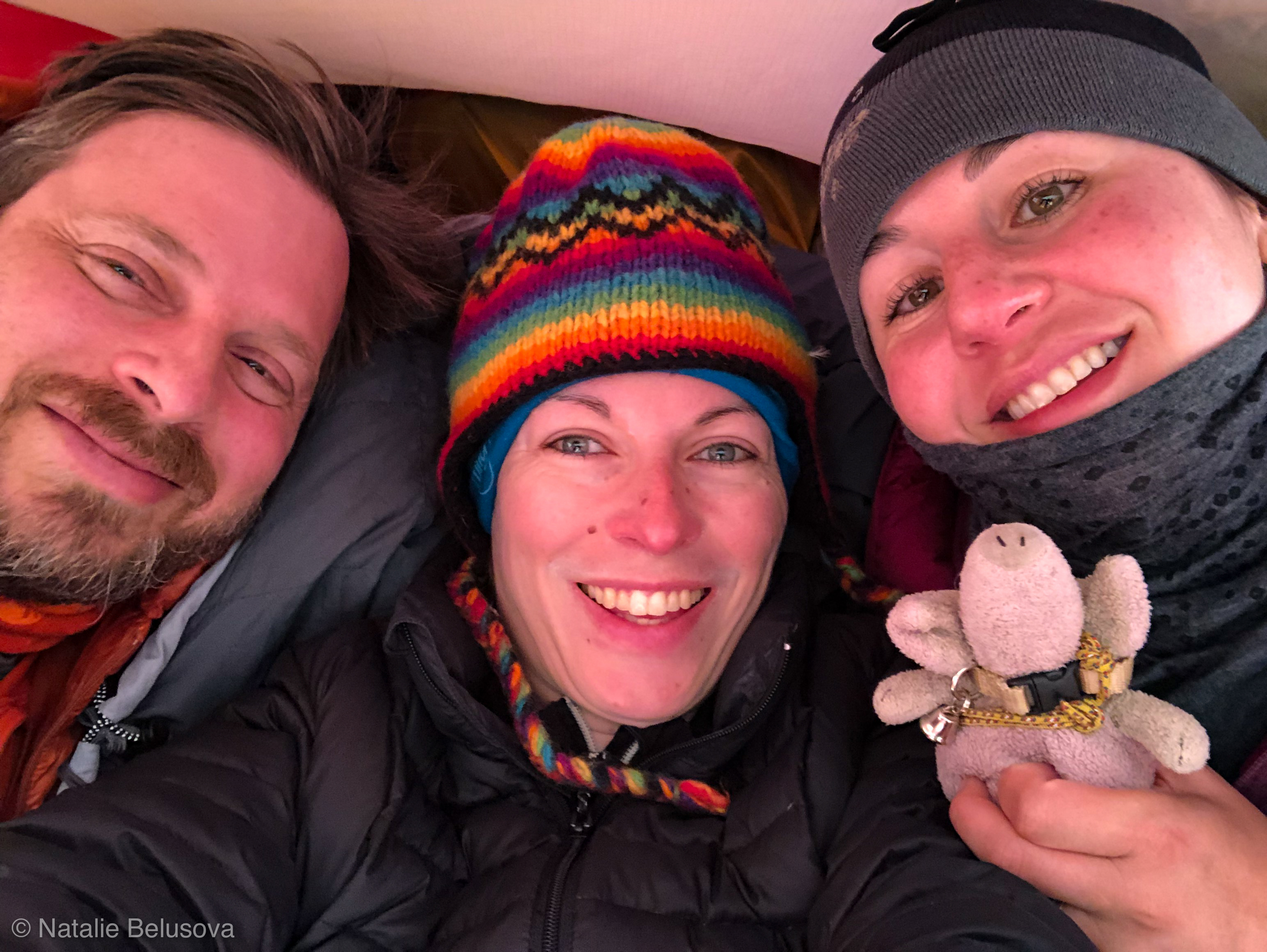
That night I tossed in the sleeping bag, made a bit of urine, dreamed of the route, adjusted my layers when chilled… I slept in total for a few hours. Another party passed by quietly circa 12:30 AM, but otherwise there were no surprises that night, except for the tent getting buffeted by gusts of wind that felt slightly ominous.

The wakeup call came at 2:20 AM, which seemed perfect to me.

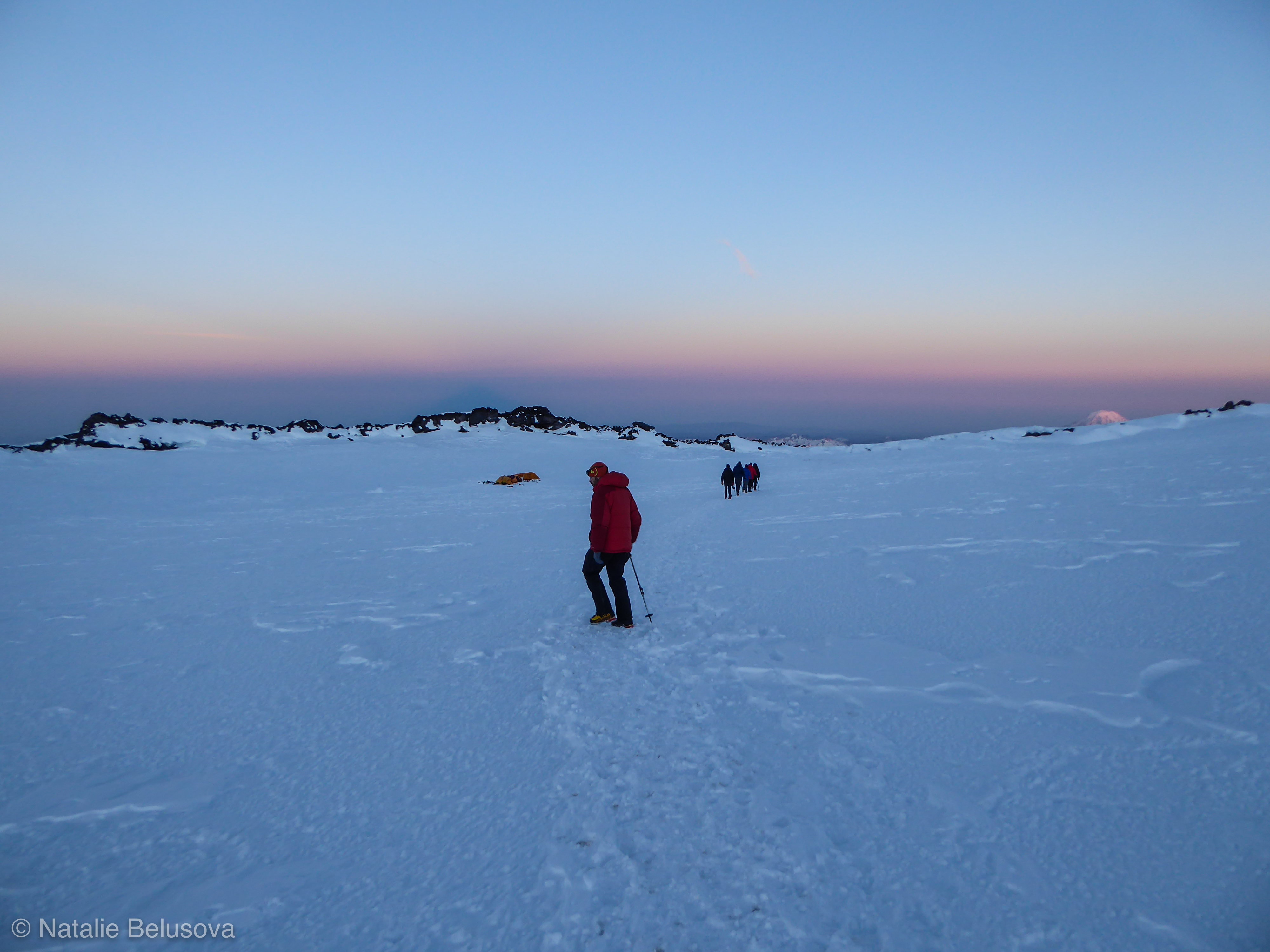
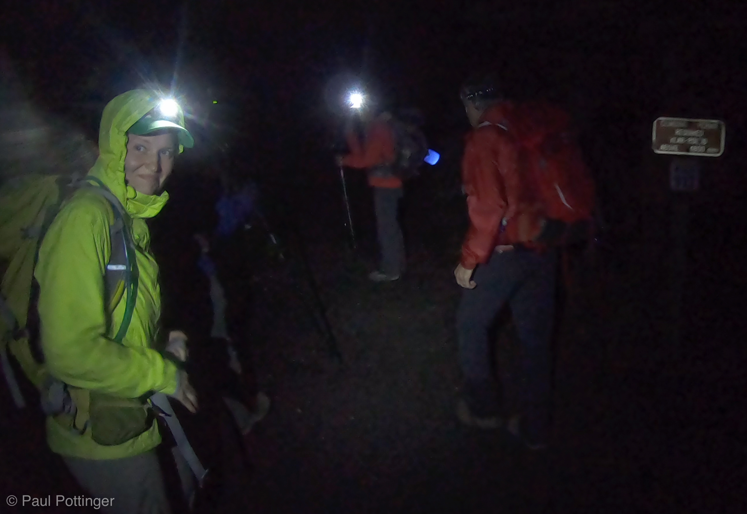
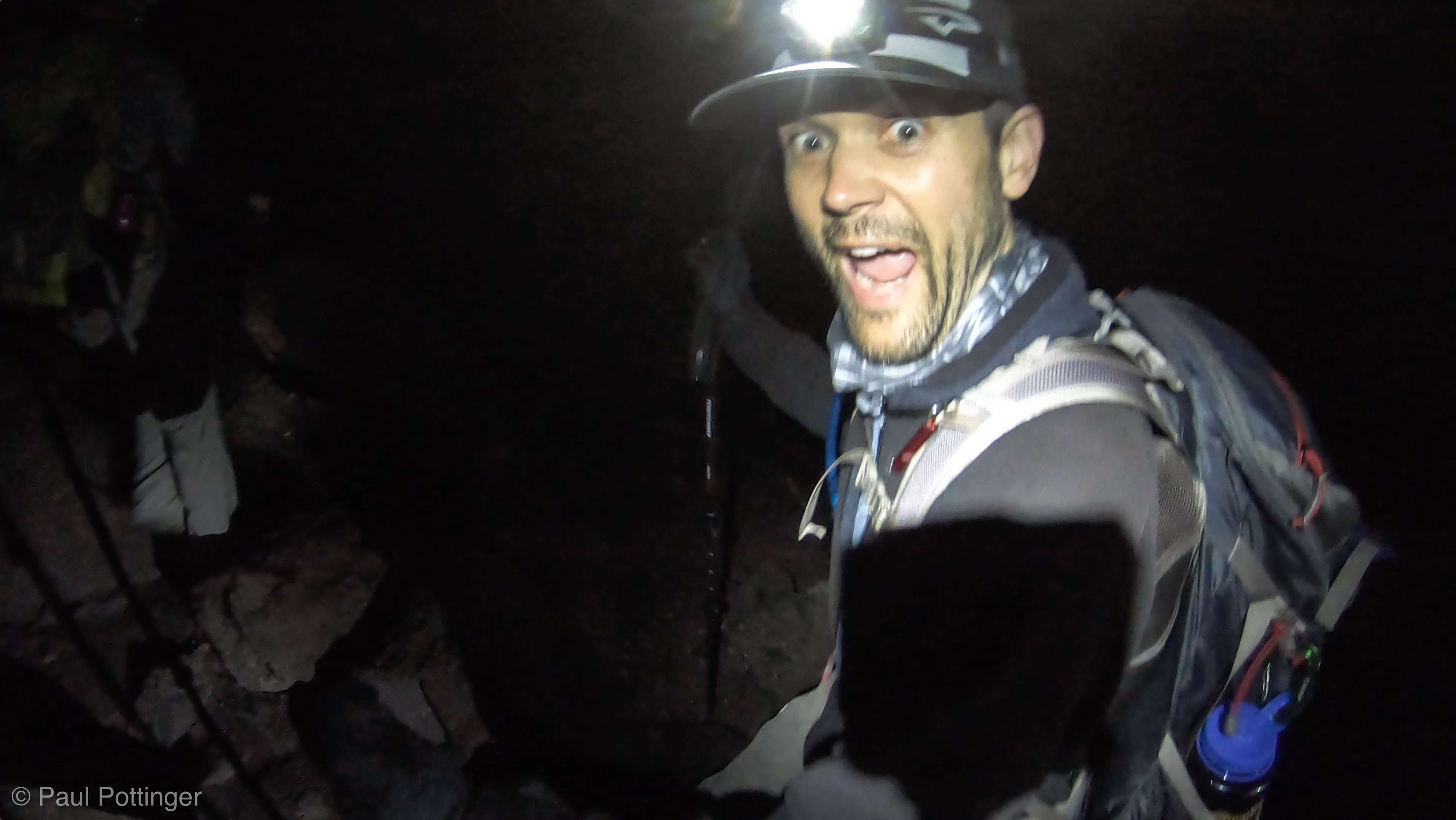
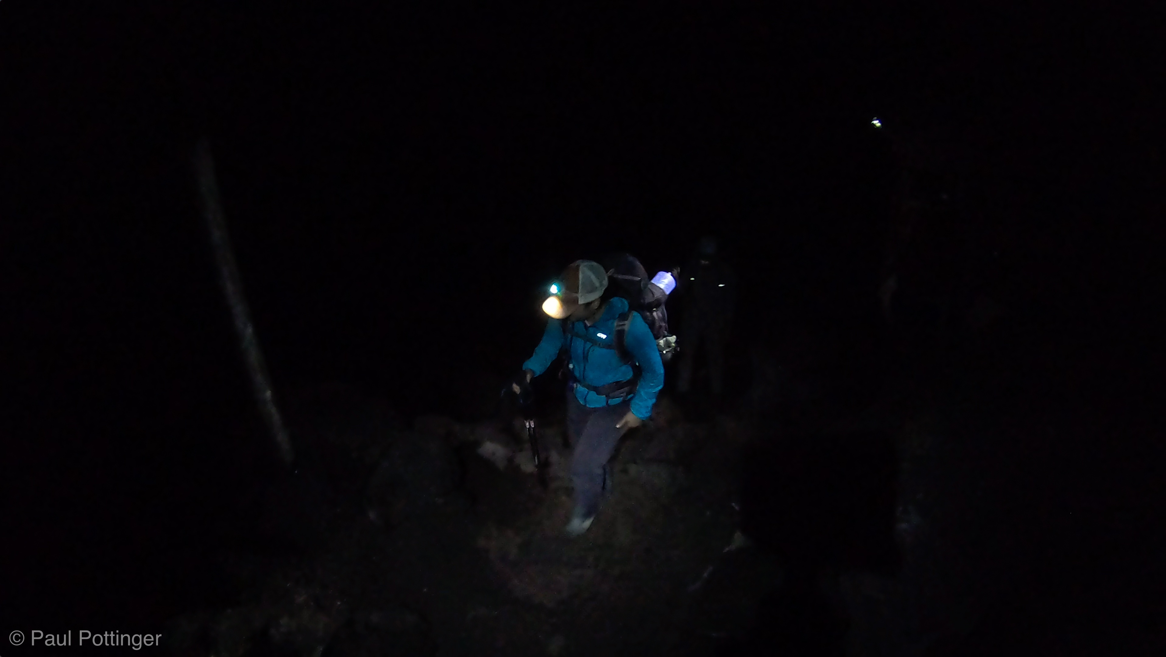
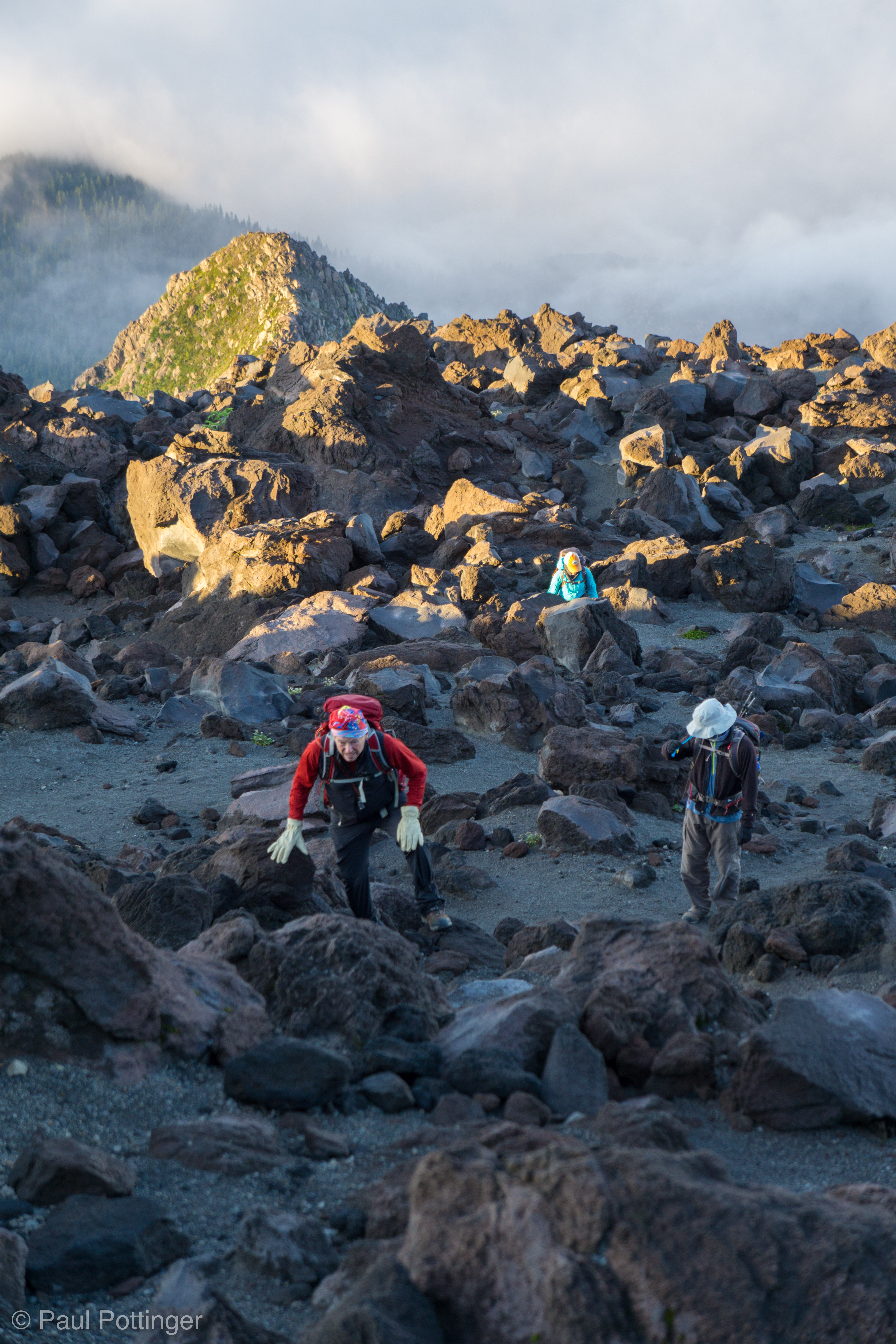
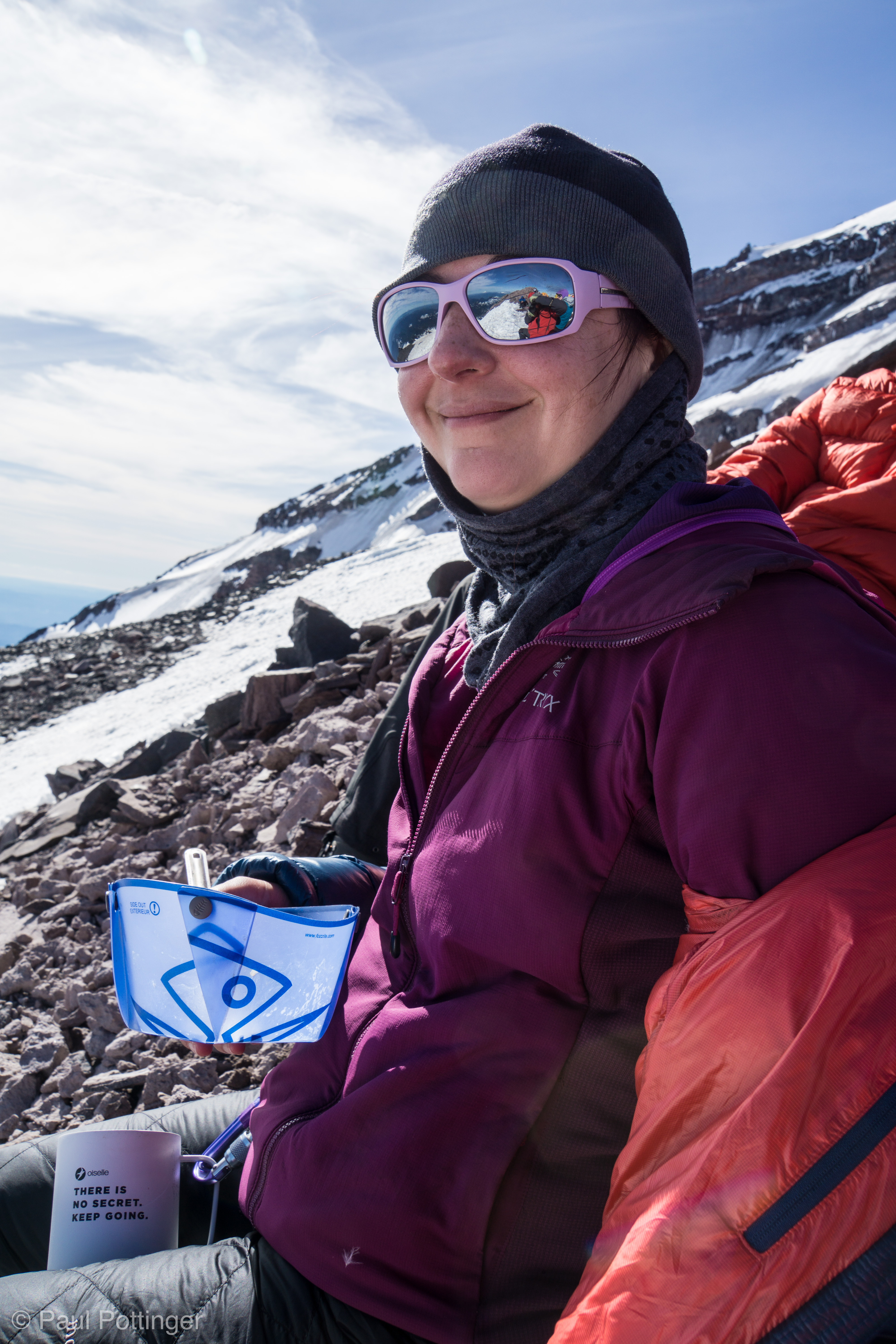
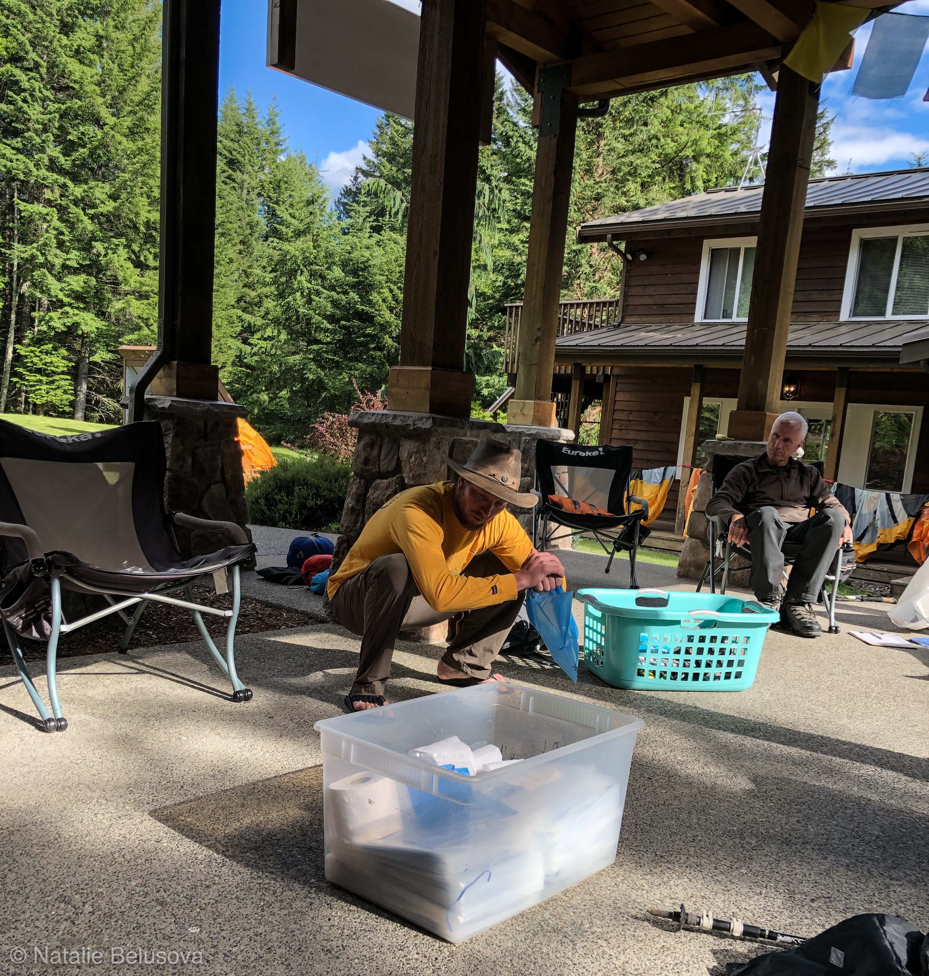
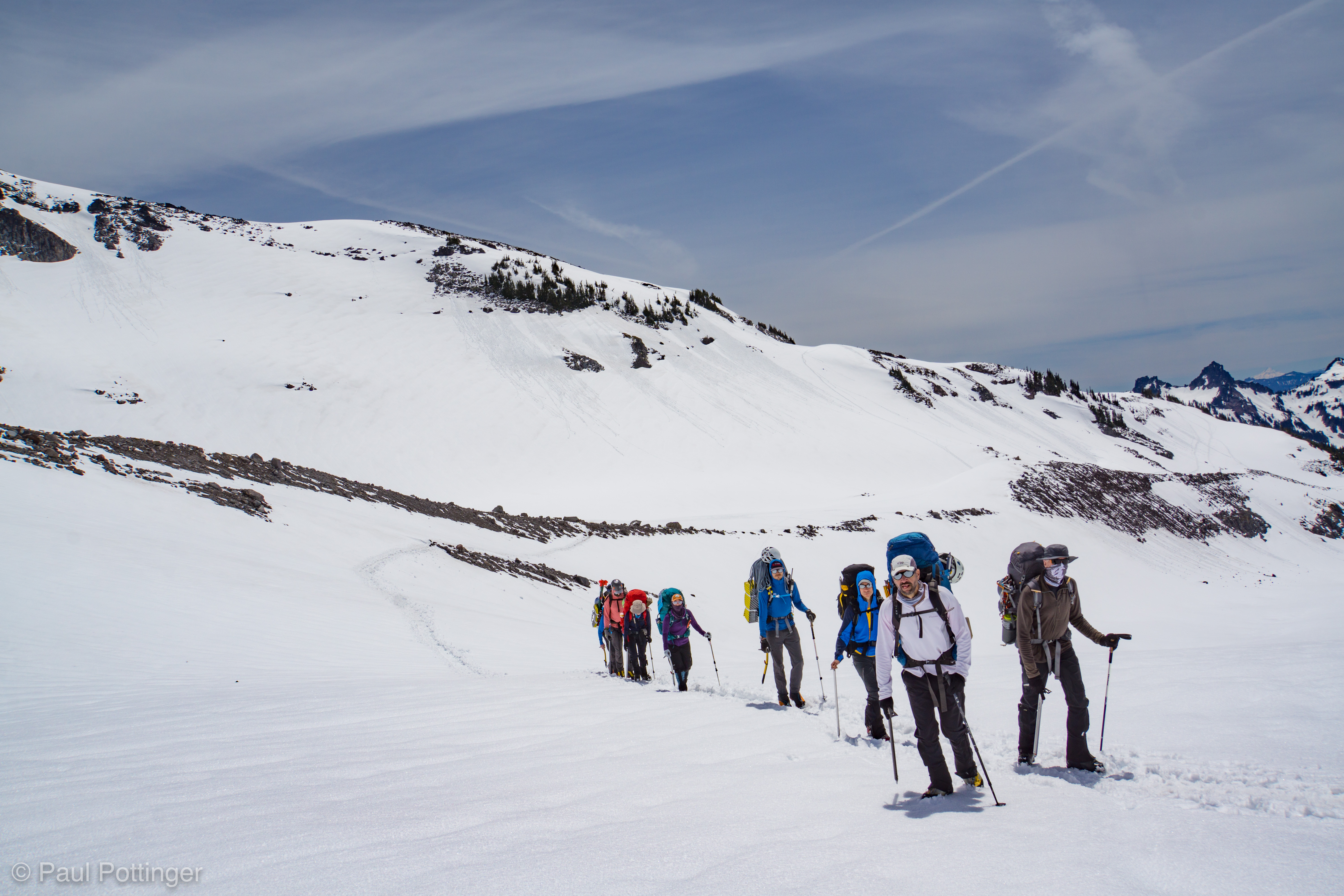
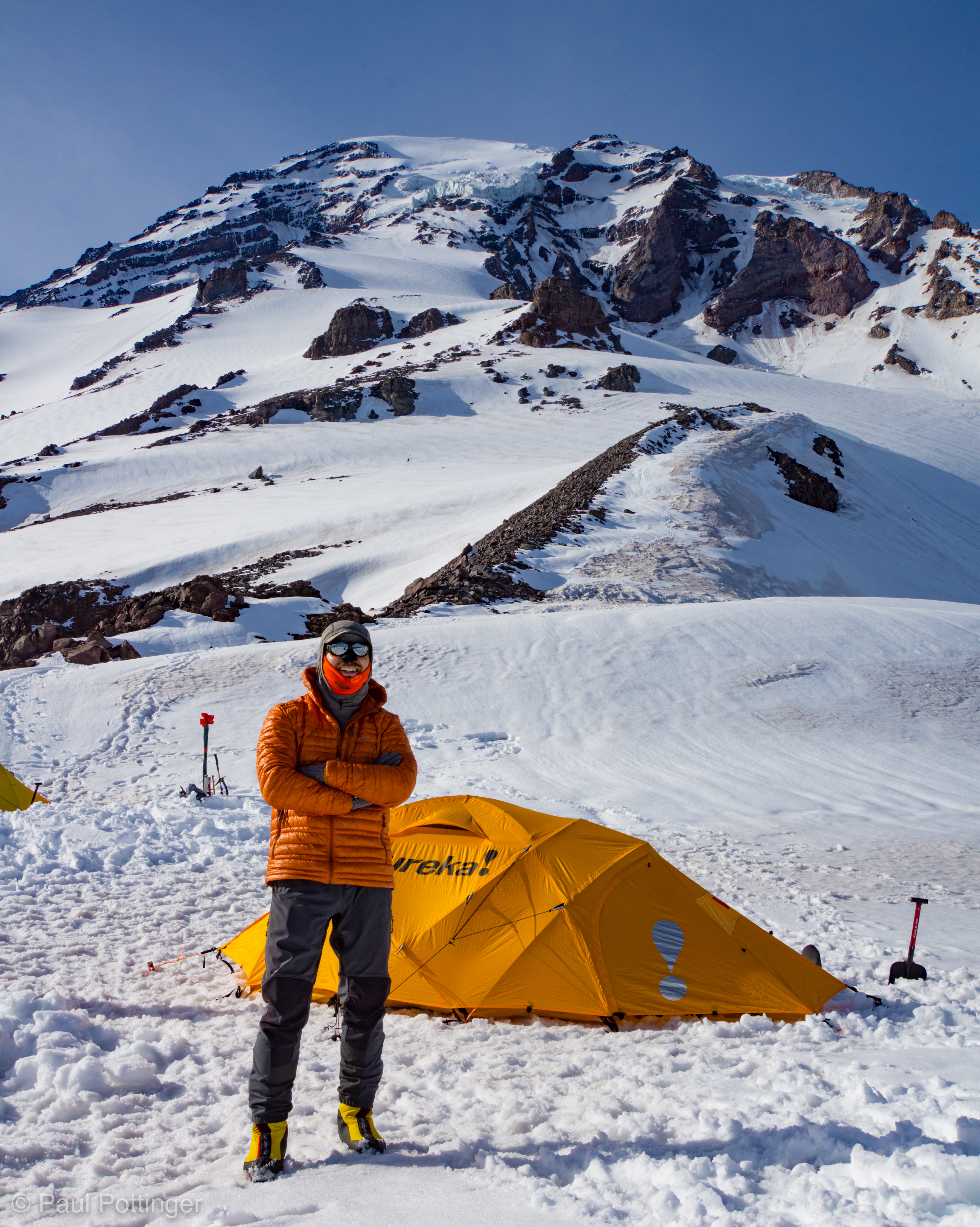
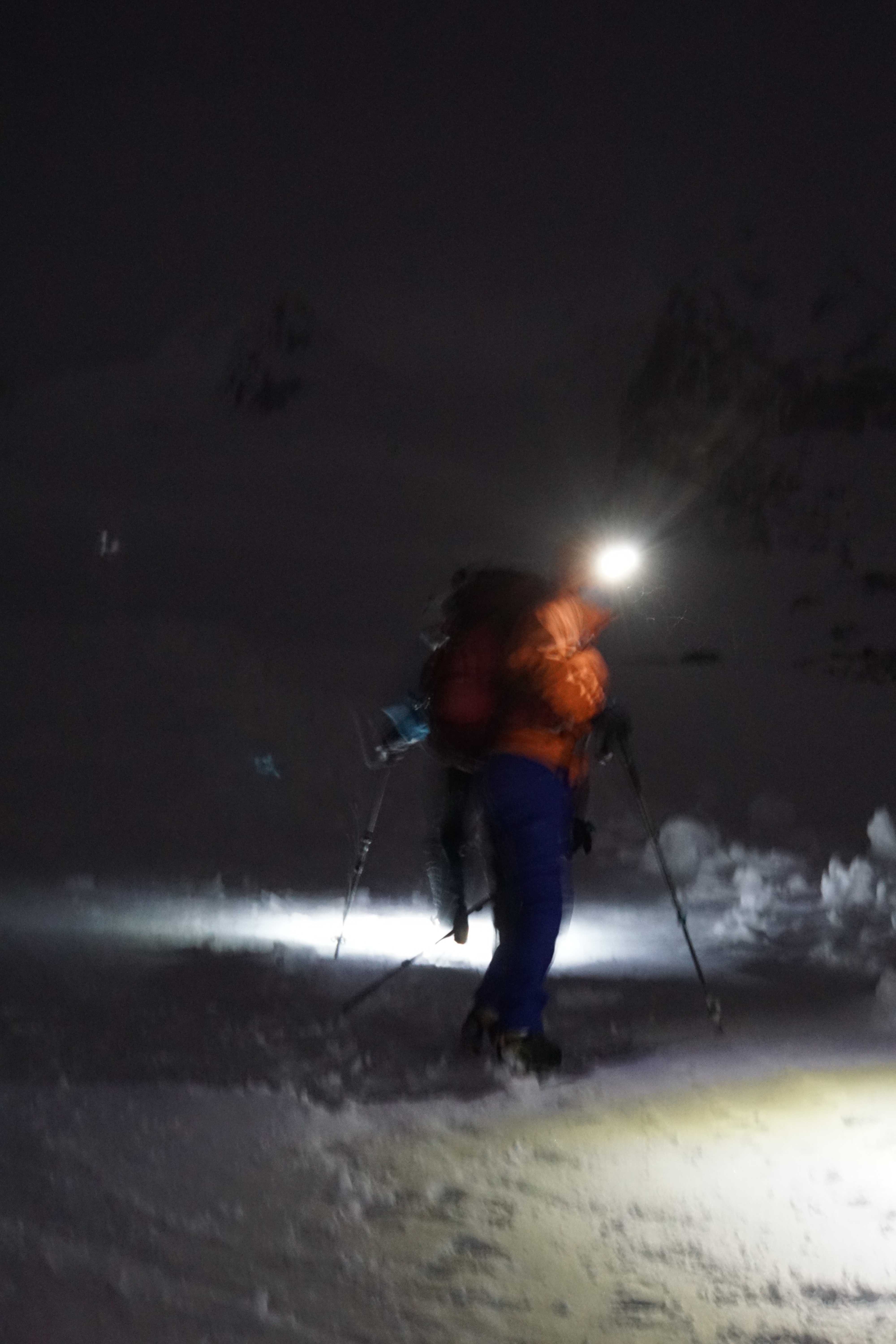
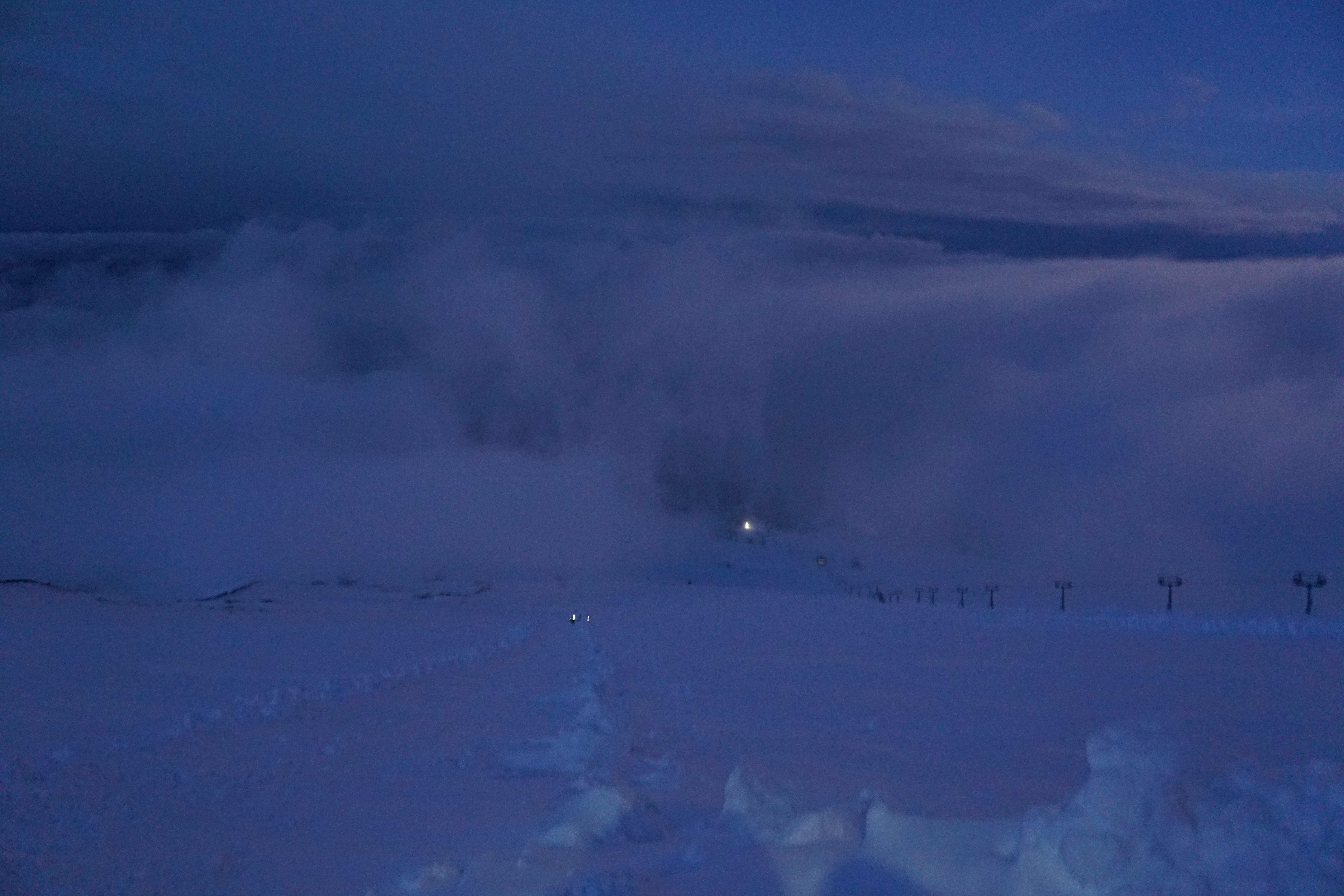
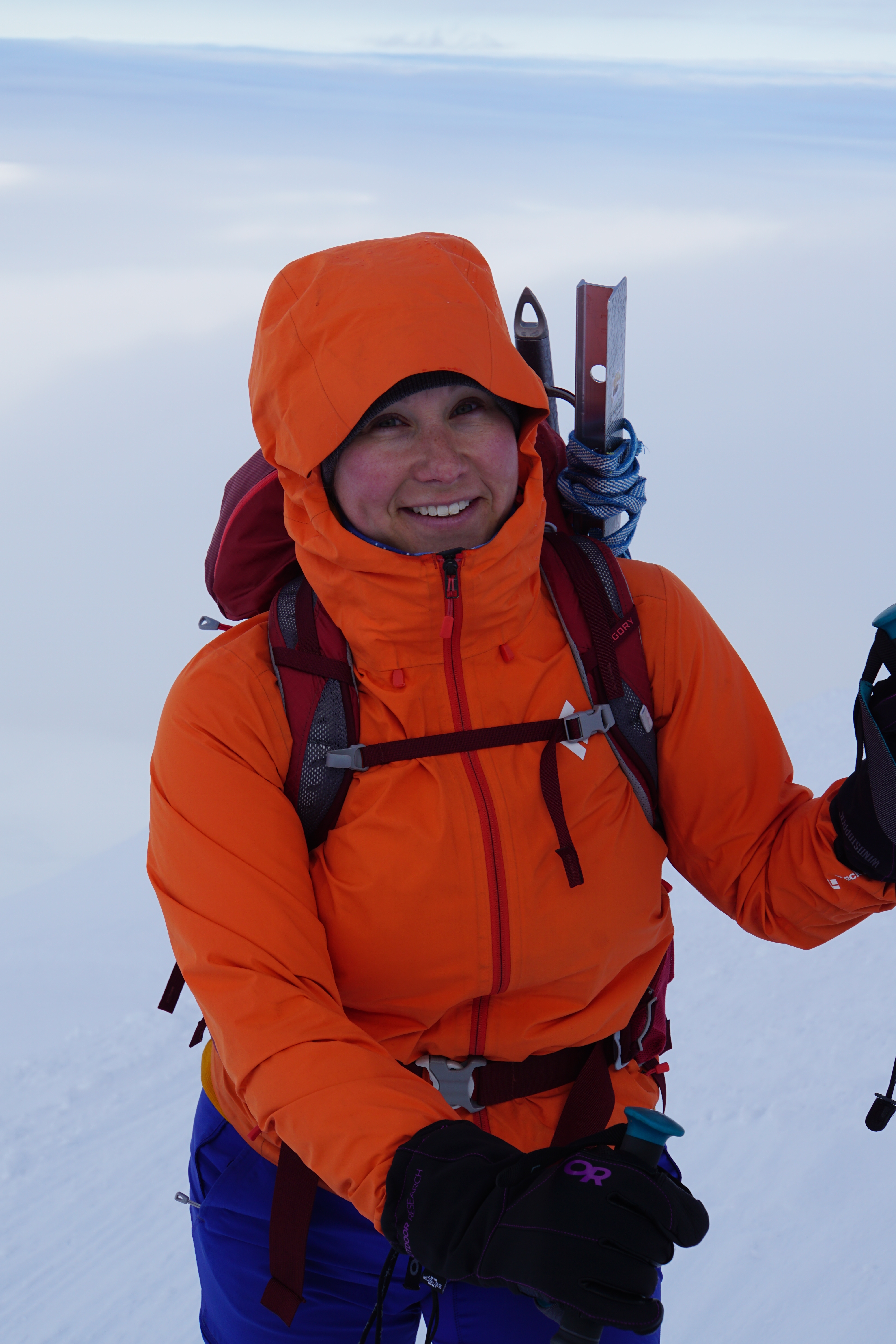
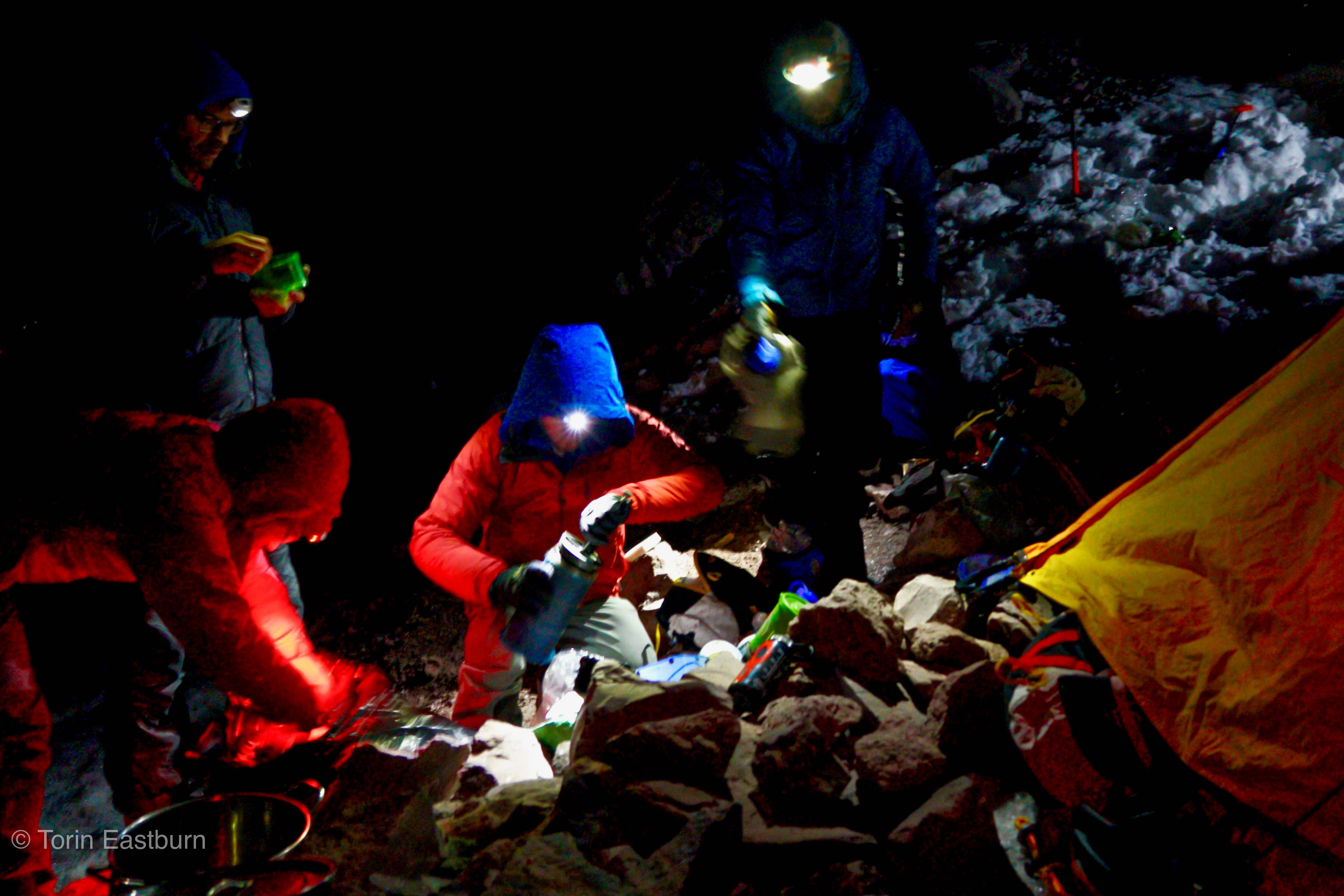
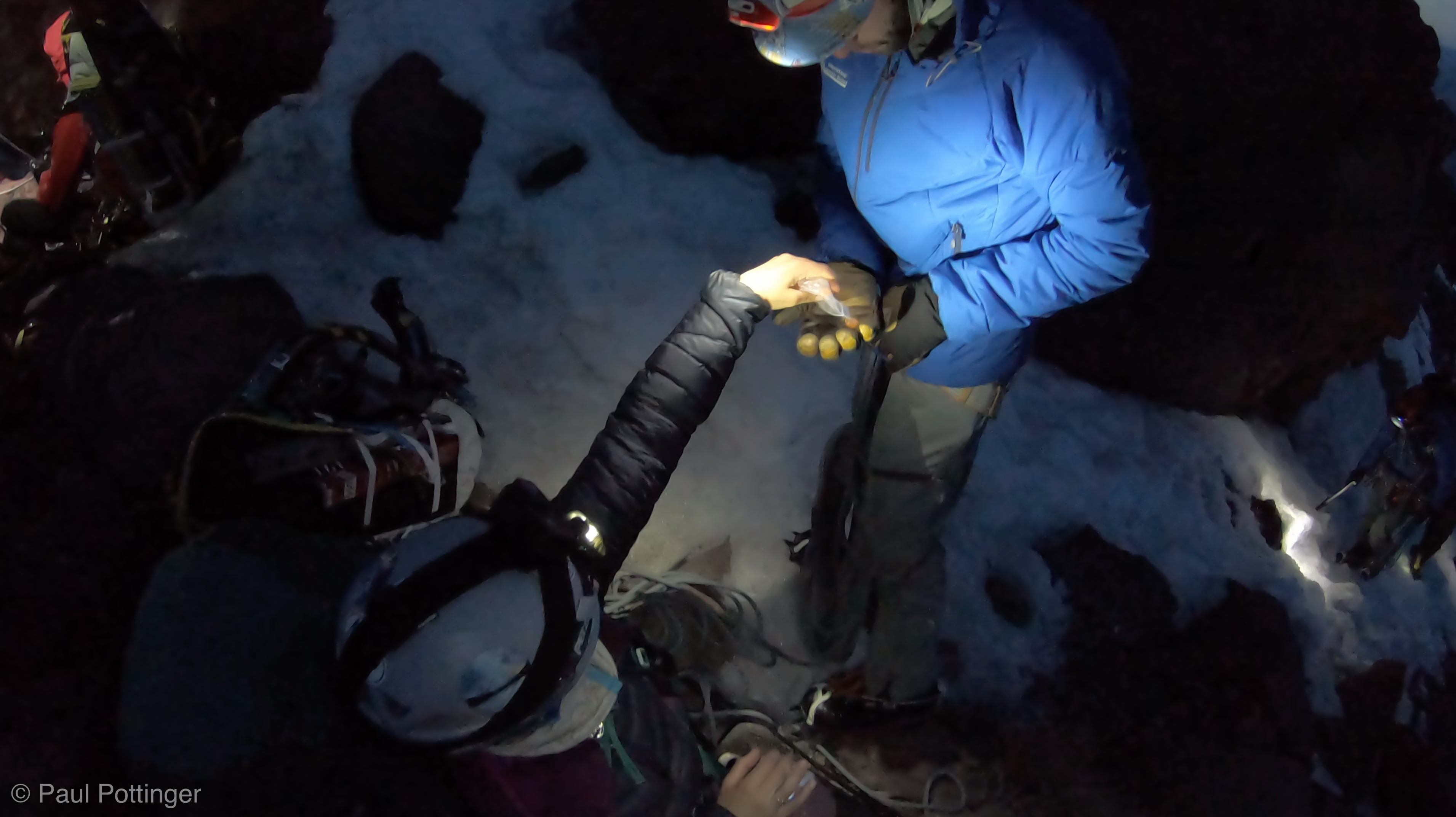
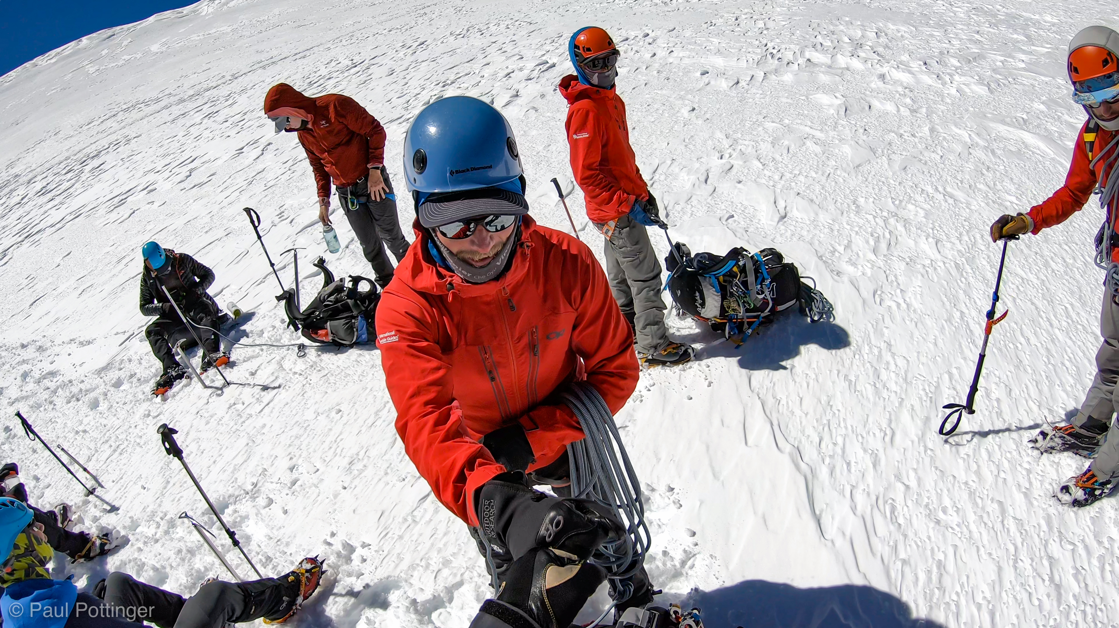
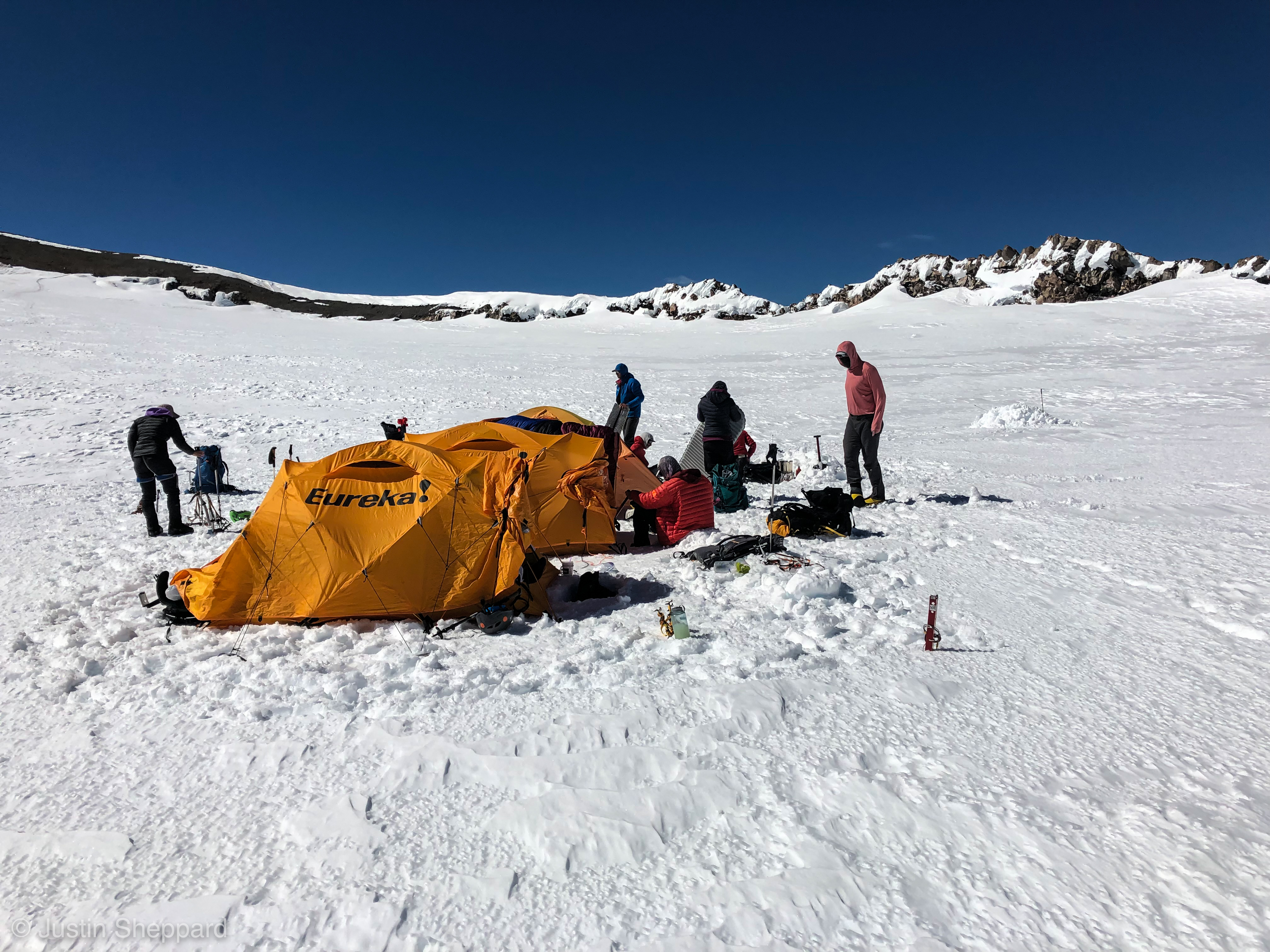
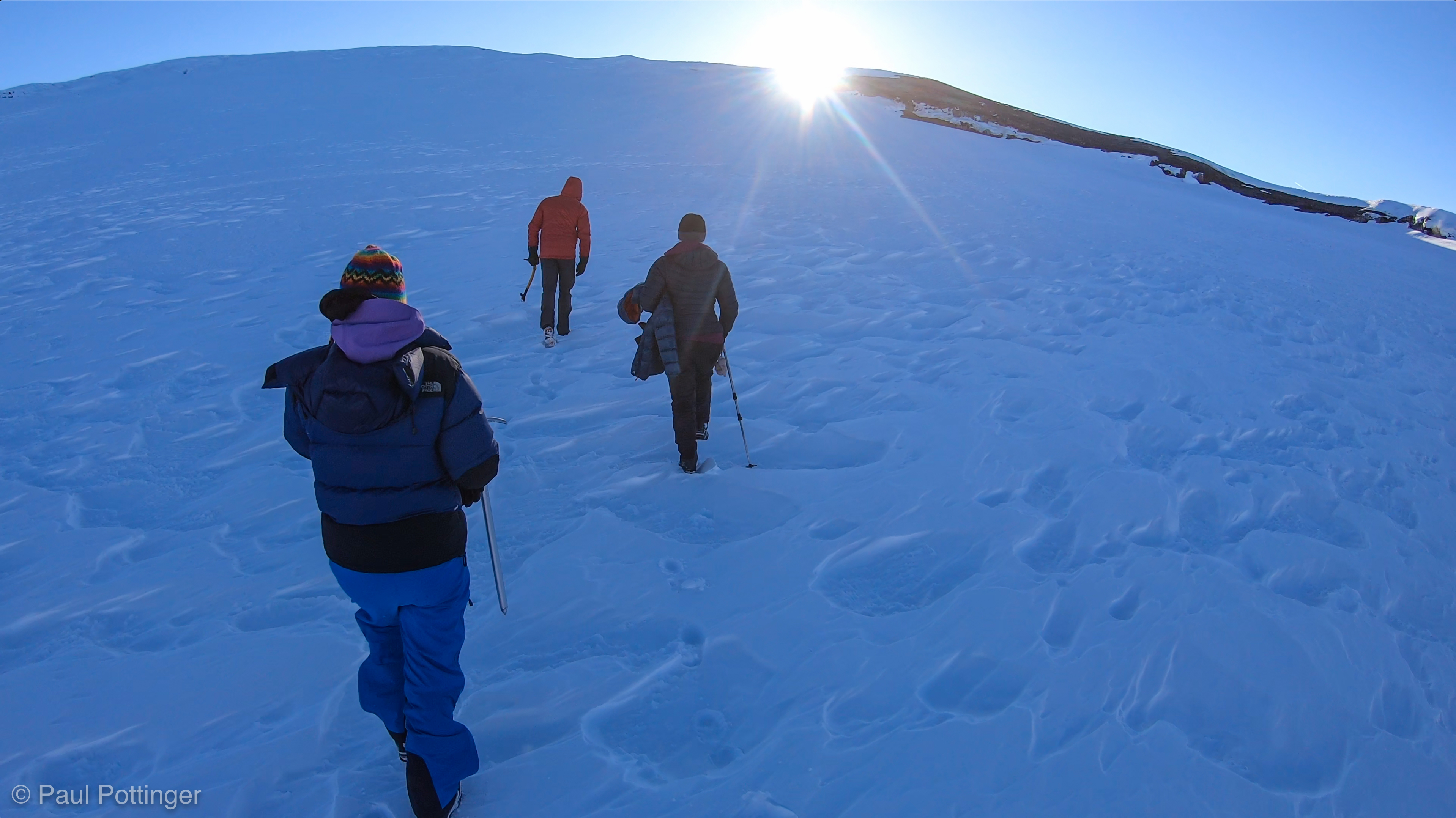
We got right to business by packing and simultaneously eating a quick breakfast of oatmeal and instant coffee. My bowels were quiet, no need to visit the latrine except to empty the cold, gnarly looking contents of the pee-squared bottle. The ominous breeze turned out to be no big deal—actually, it was surprisingly warm outside. Our blue bags remained squishy and fragrant in spite of being buried in the snow since before bedtime. Breaking camp went fine… the usual chaos of getting packed up in the dark was no issue, and we were more efficient than the prior day. By 3:55 AM, 90 minutes after waking up, we started walking.

Breakfast at Camp Hazard, circa 2:30 AM.
Saddling up at Camp Hazard.
Heading out of Camp Hazard by the glow of our headlamps.
Heading towards the Sneak. Upper mountain just visible in the dawn.

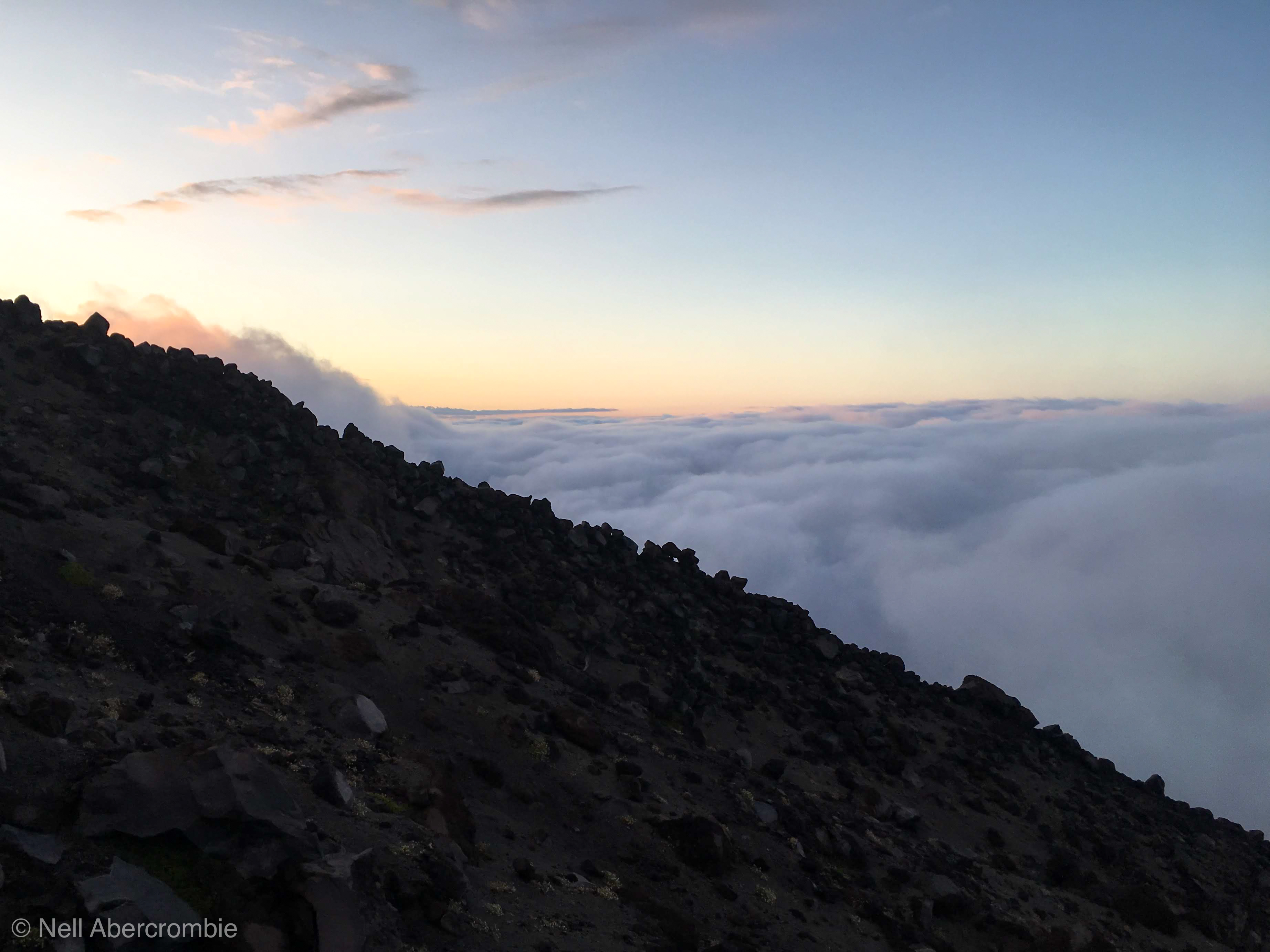
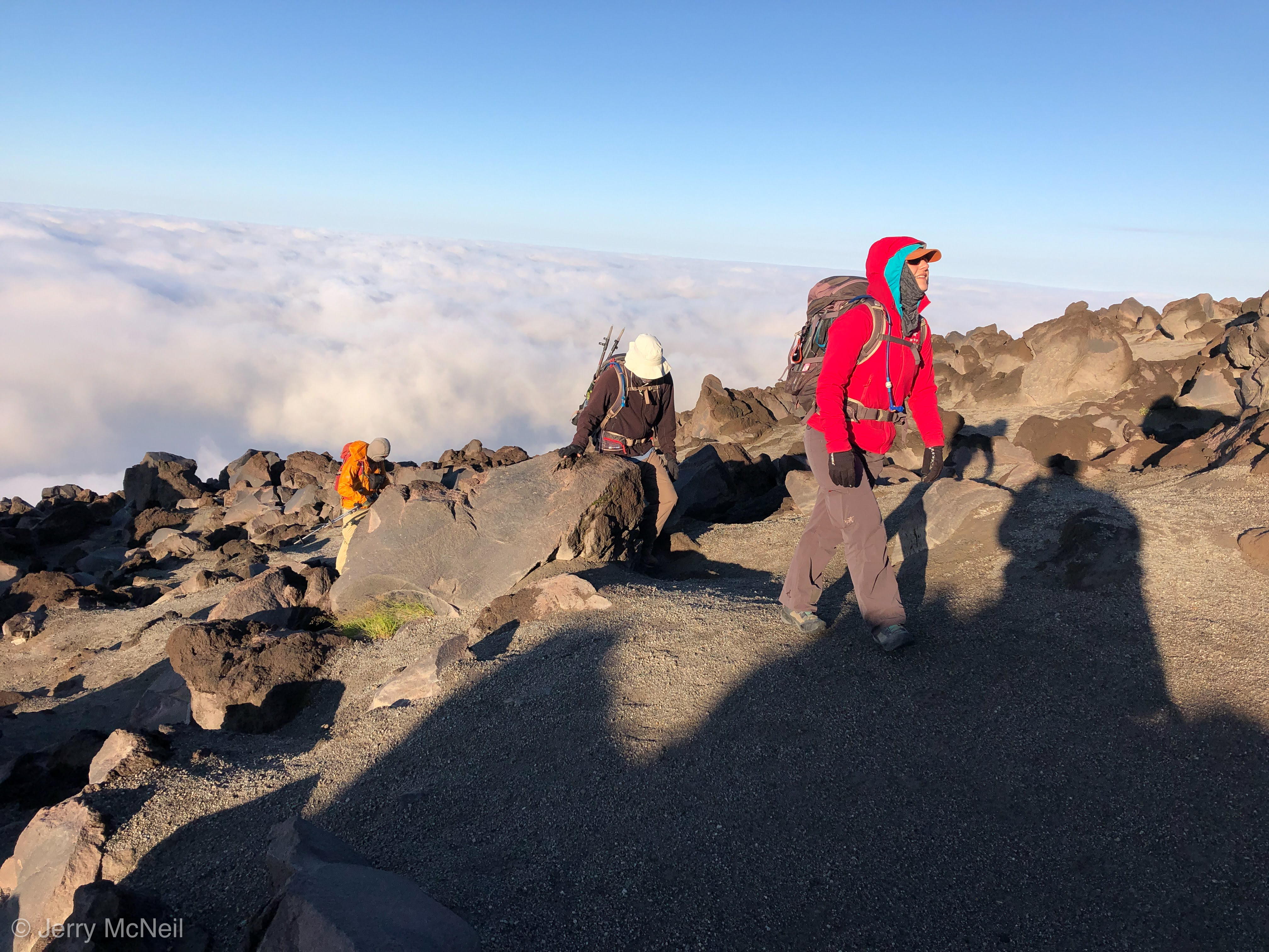
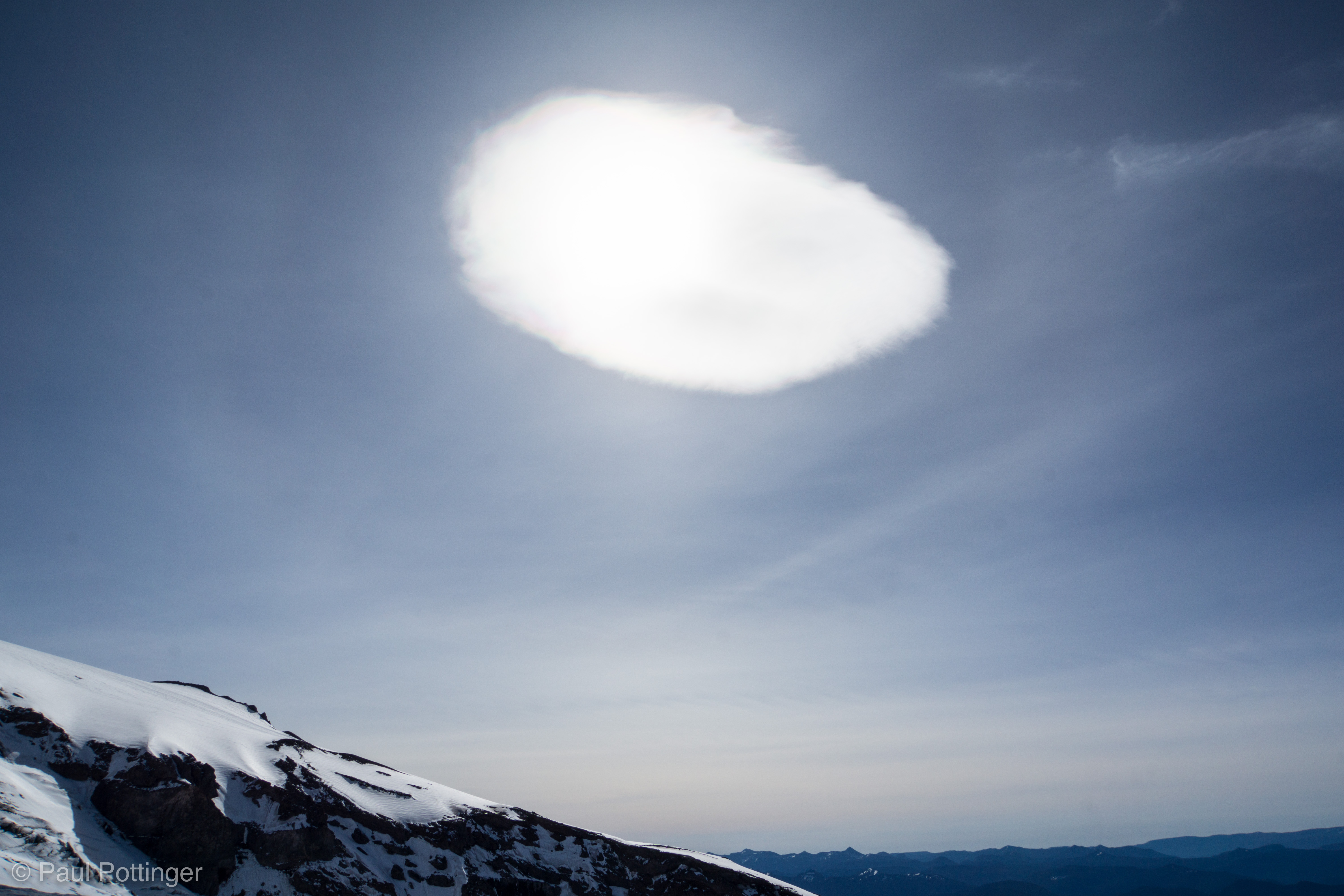
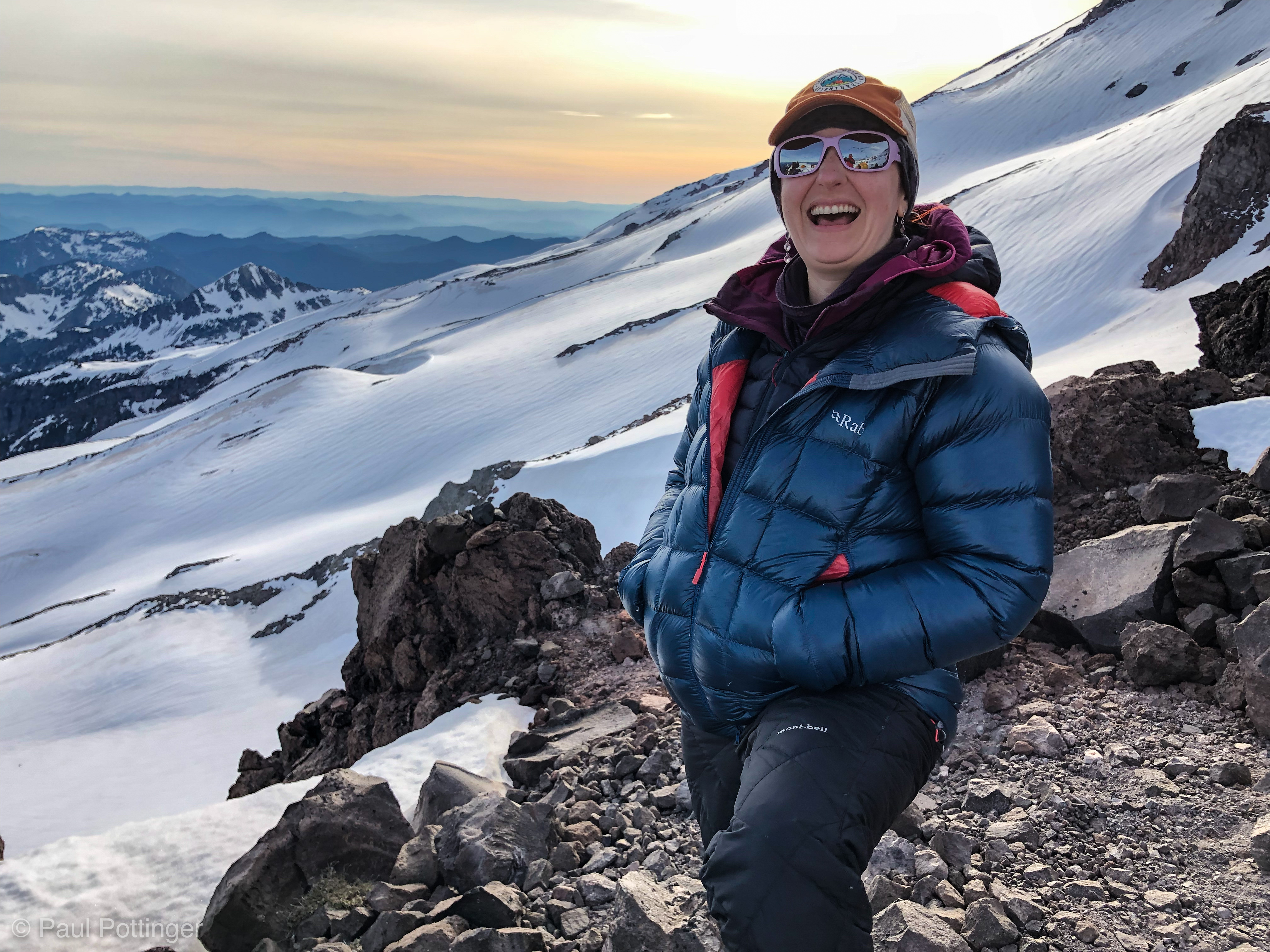
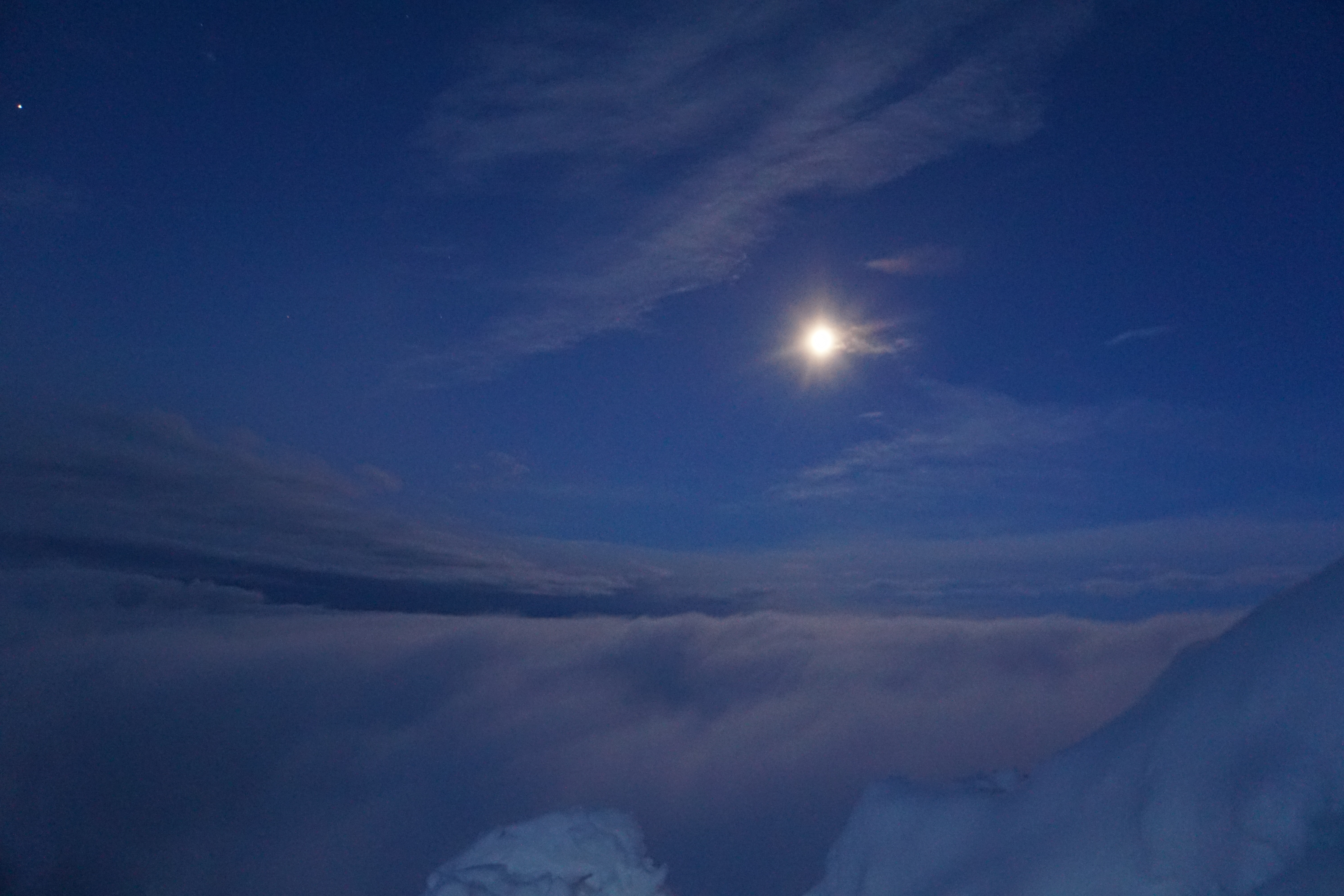
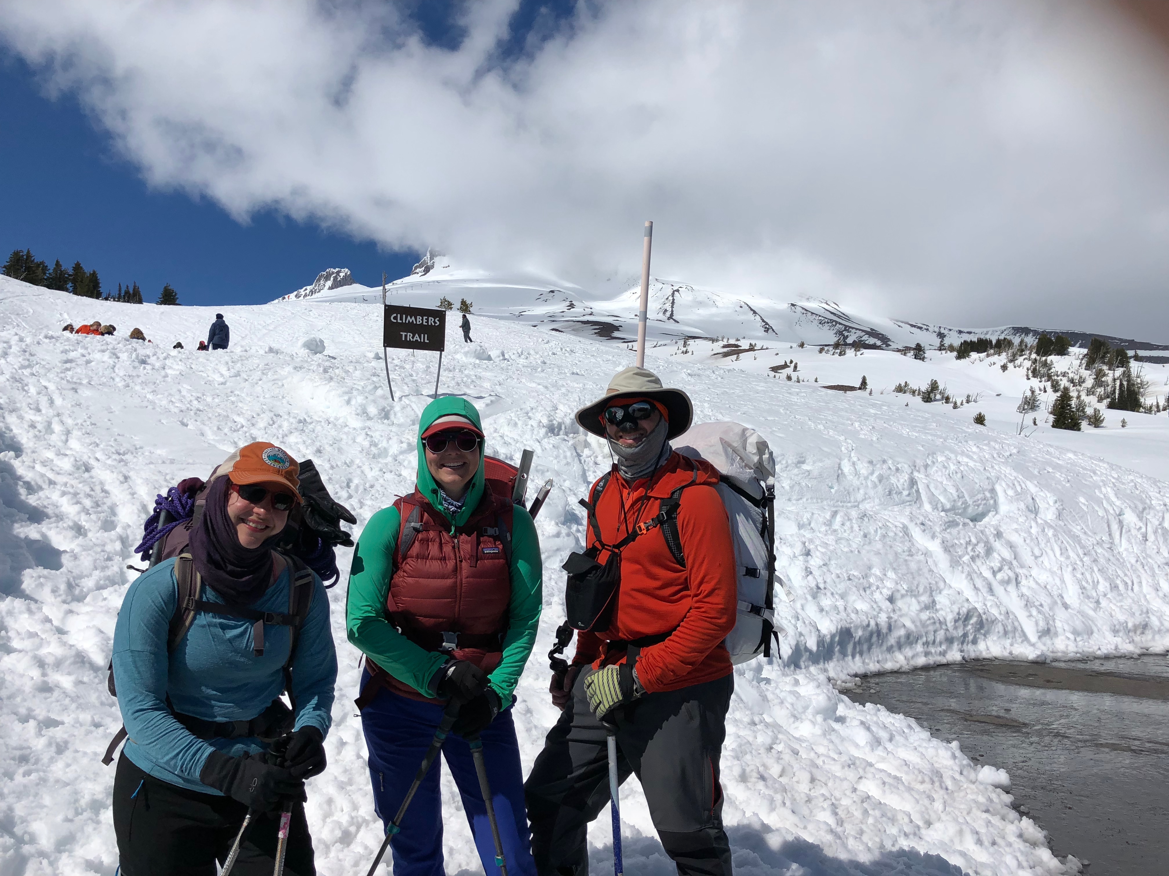
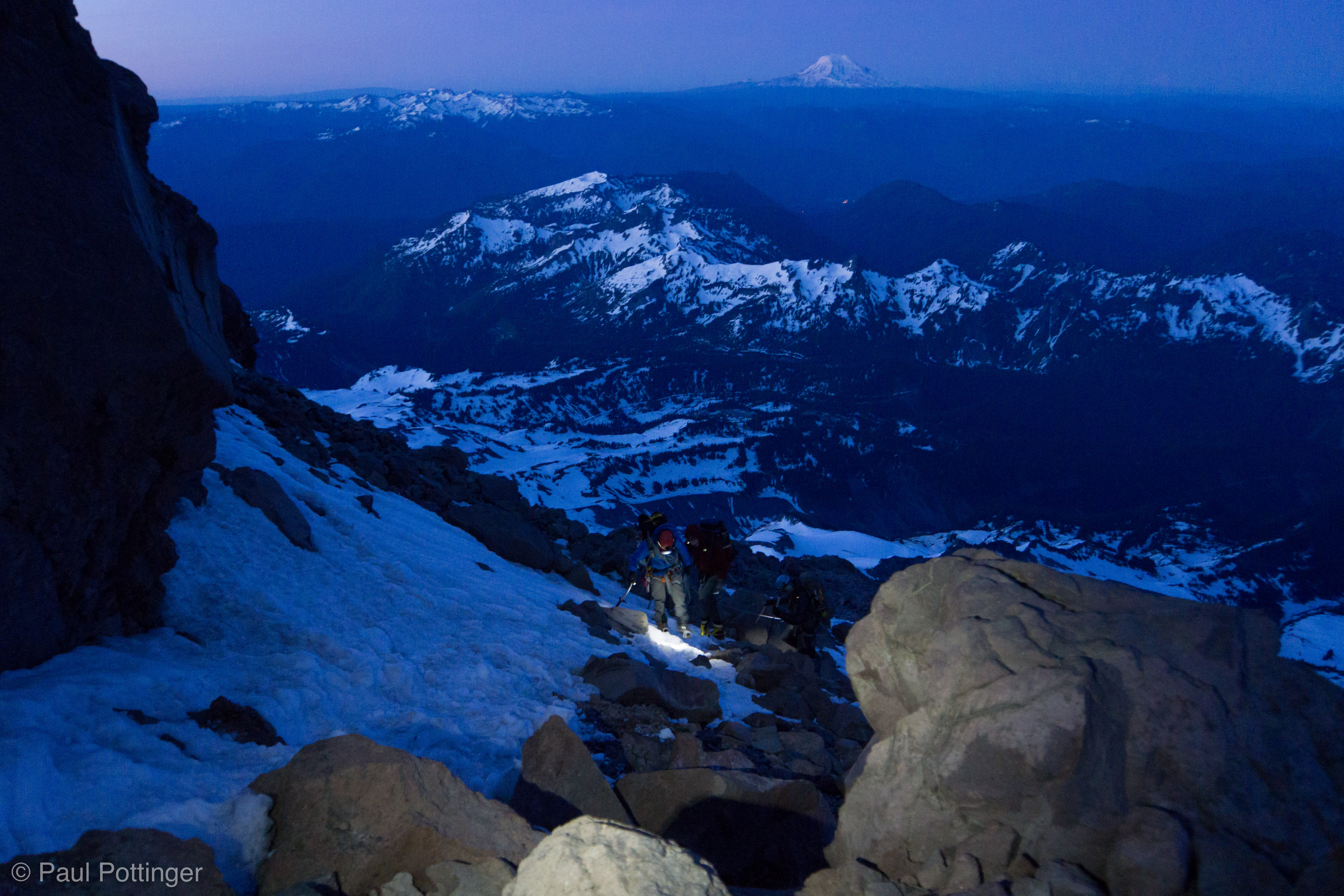
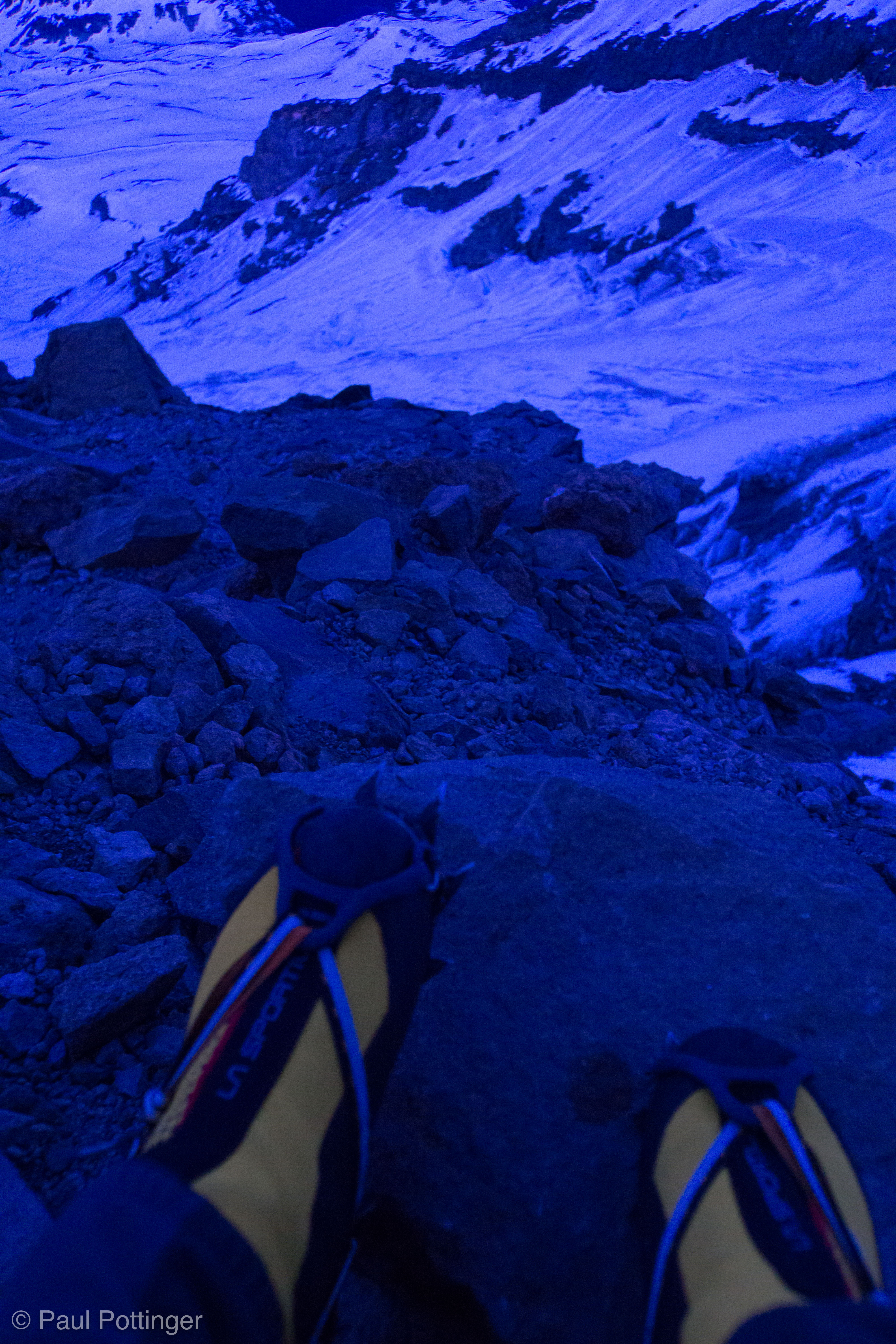
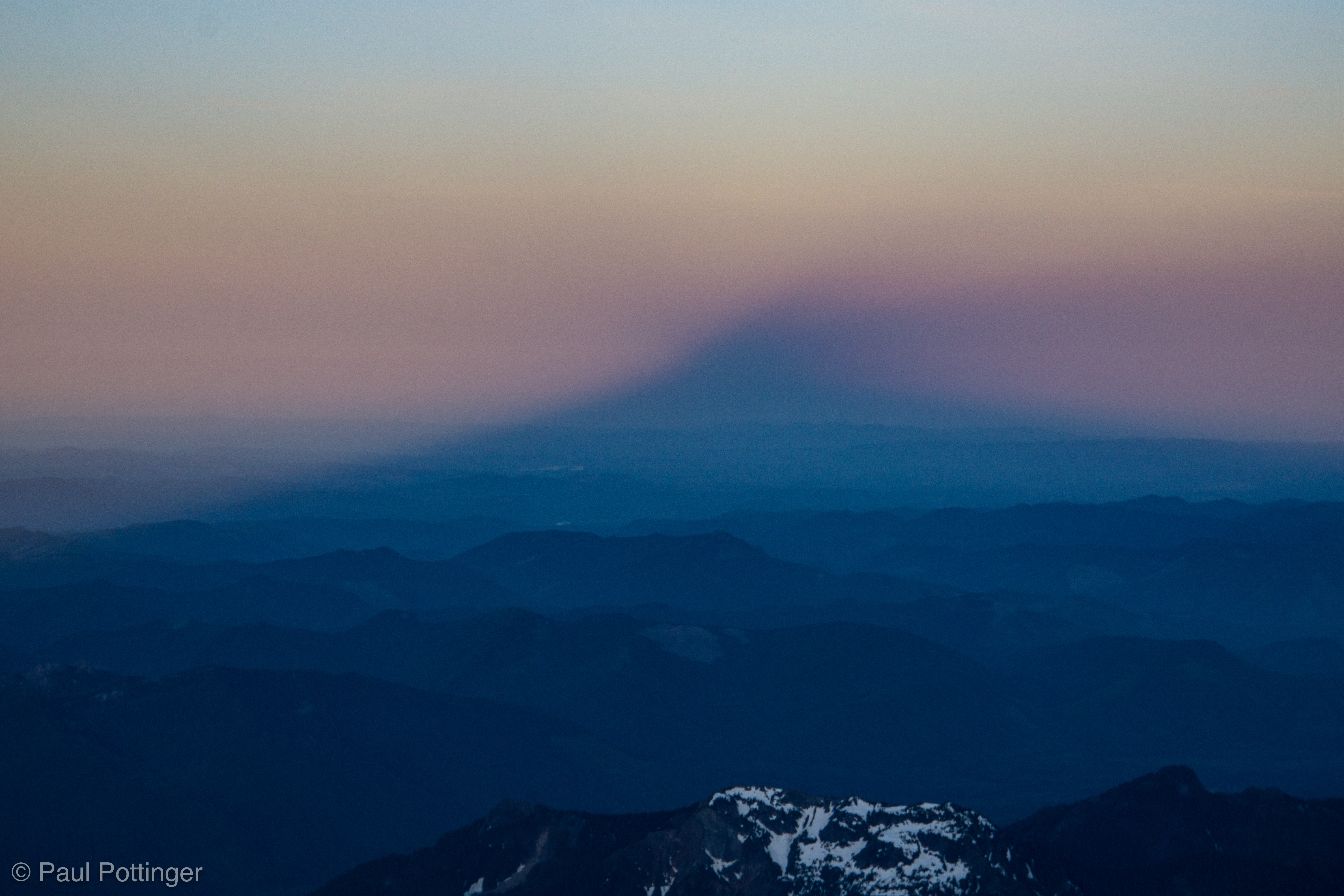
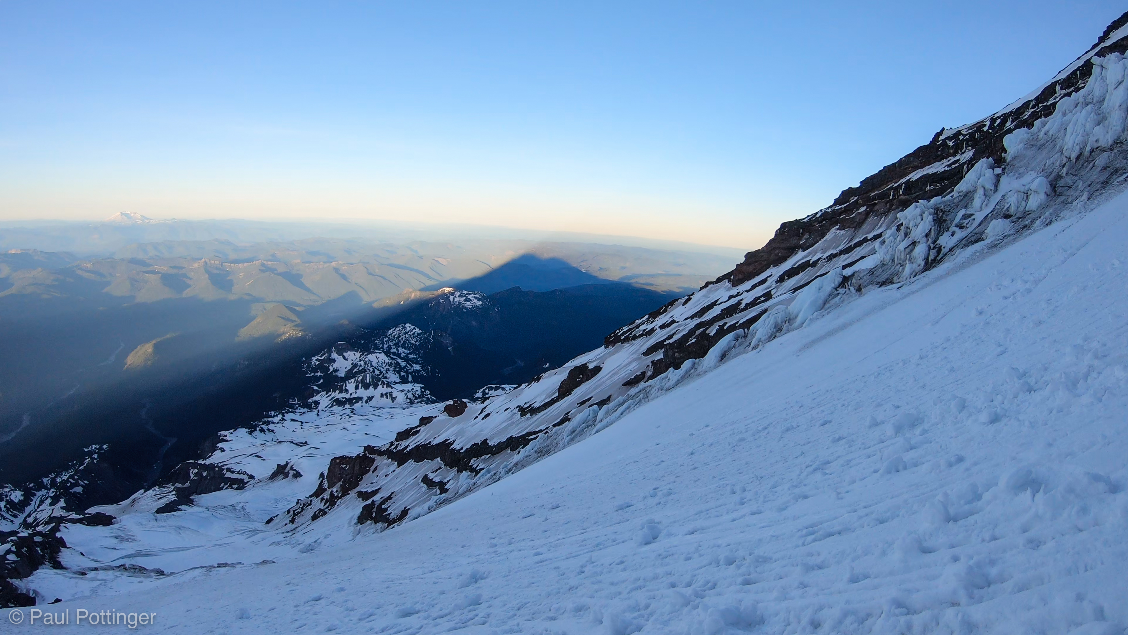
Conrad, Teresa, and I left Camp Hazard third in line that morning. While we waited for our buddies to ascend ahead of us, I looked to the East… and there it was: A deep burgundy sunrise beyond the Muir snowfield. No sign of clouds aloft… katabatics only, no true wind… it would be another spectacular, clear day. Just as forecast. Can we make it out of the Chute before the sun hits?

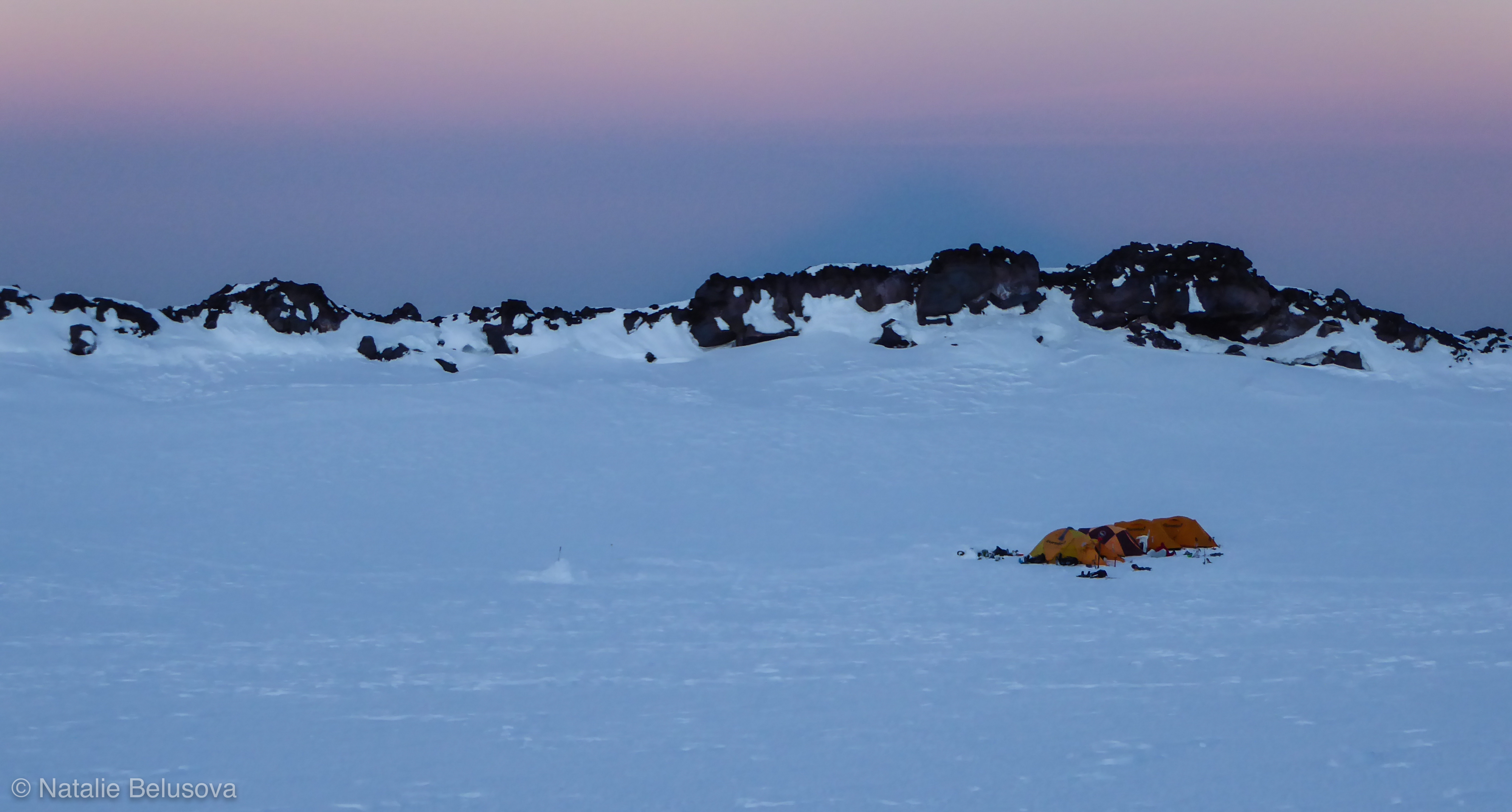
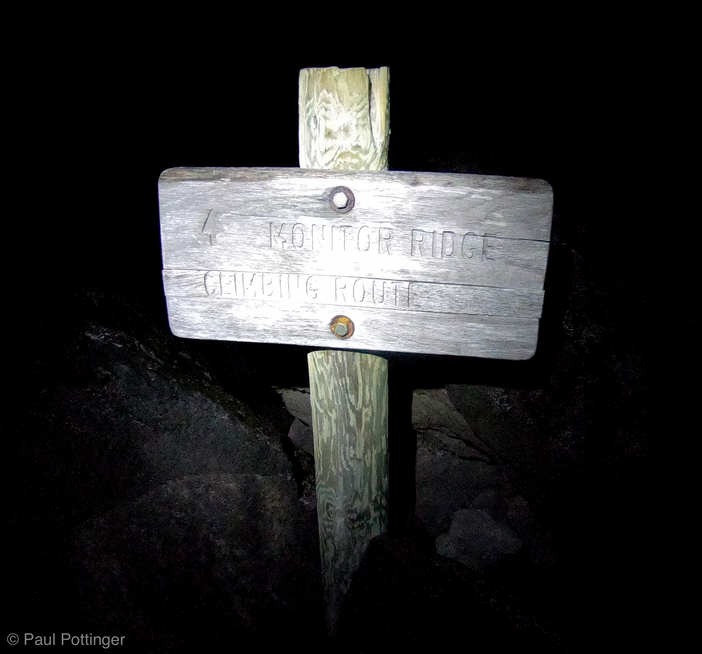
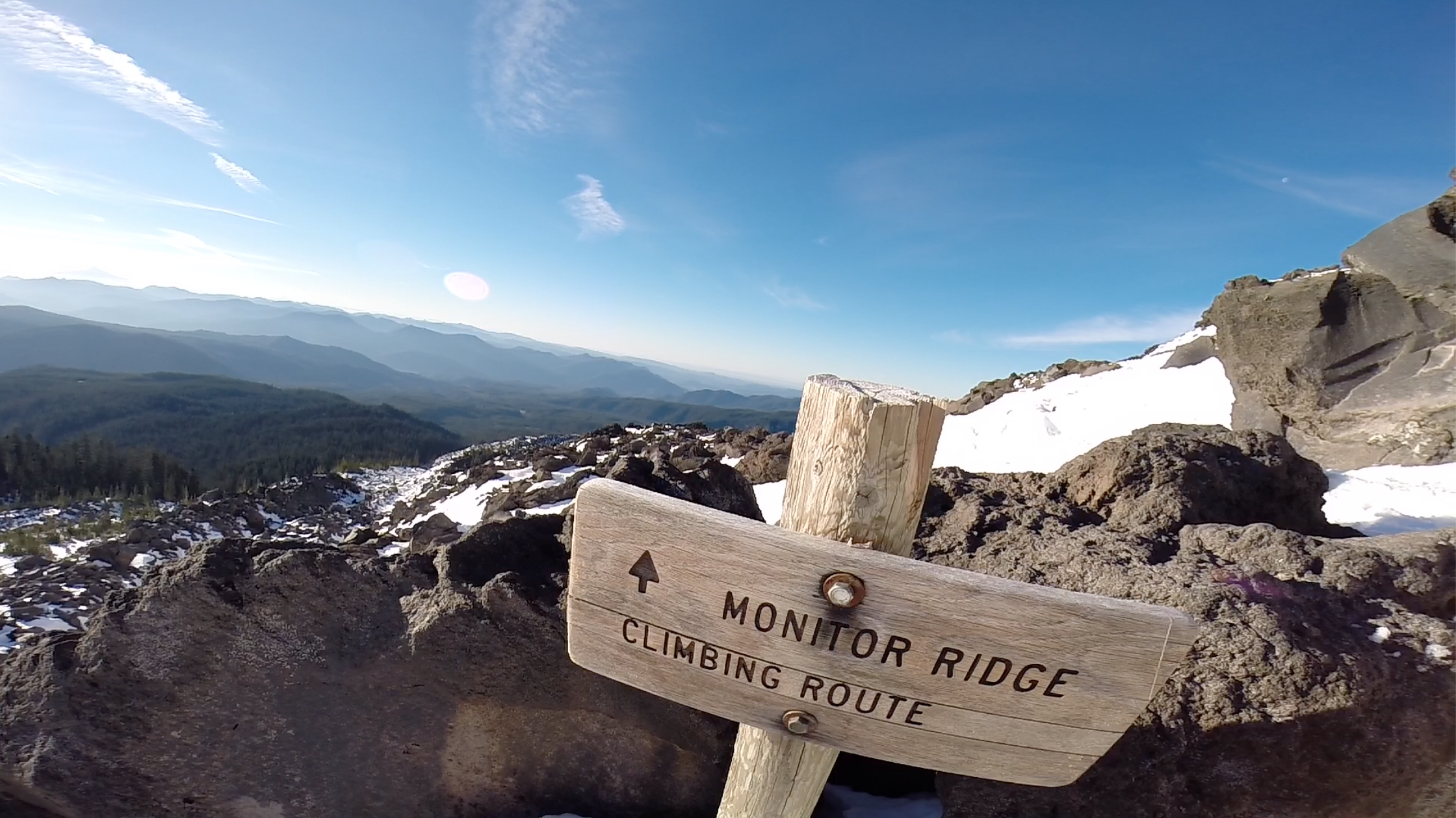
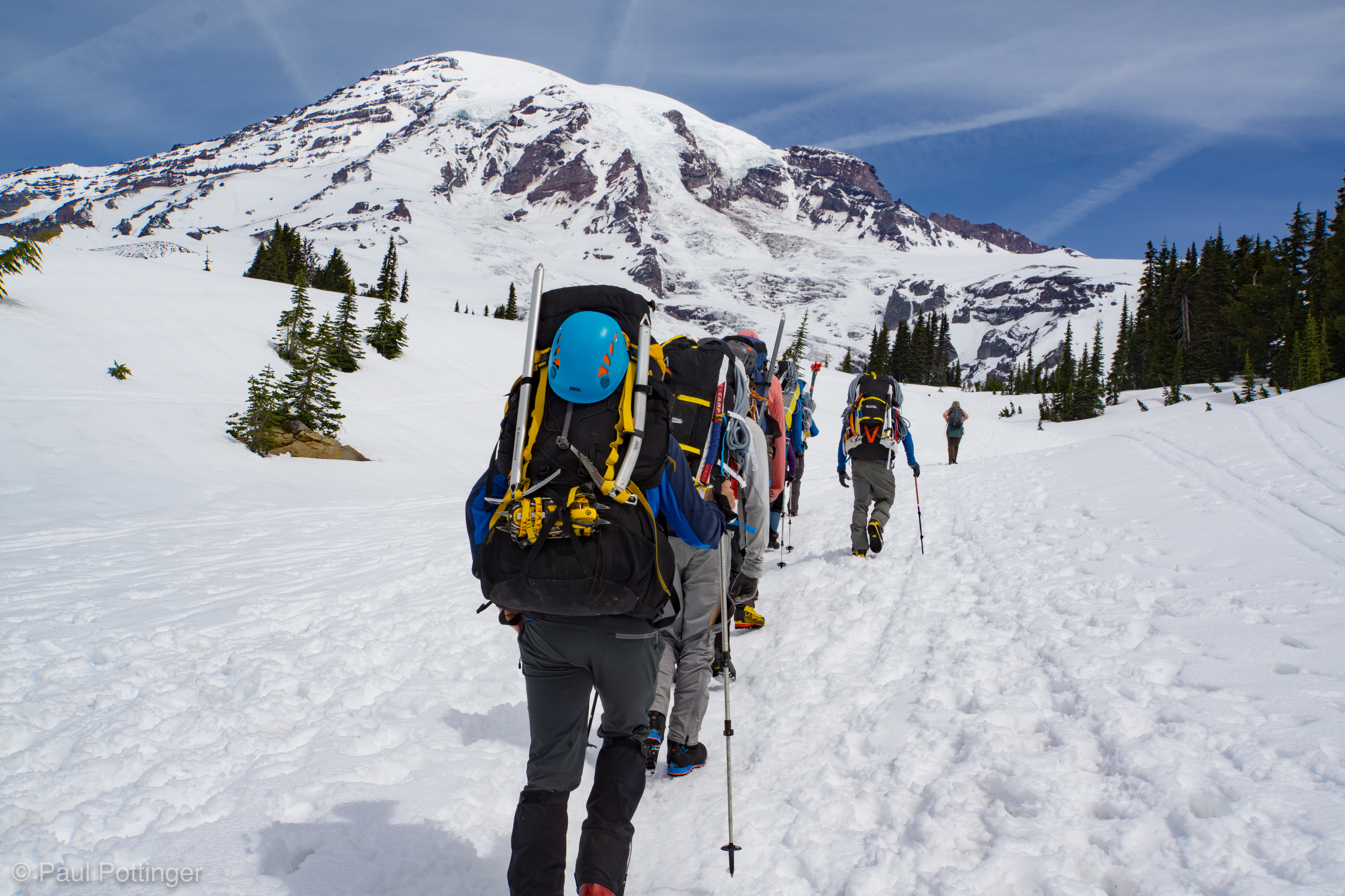
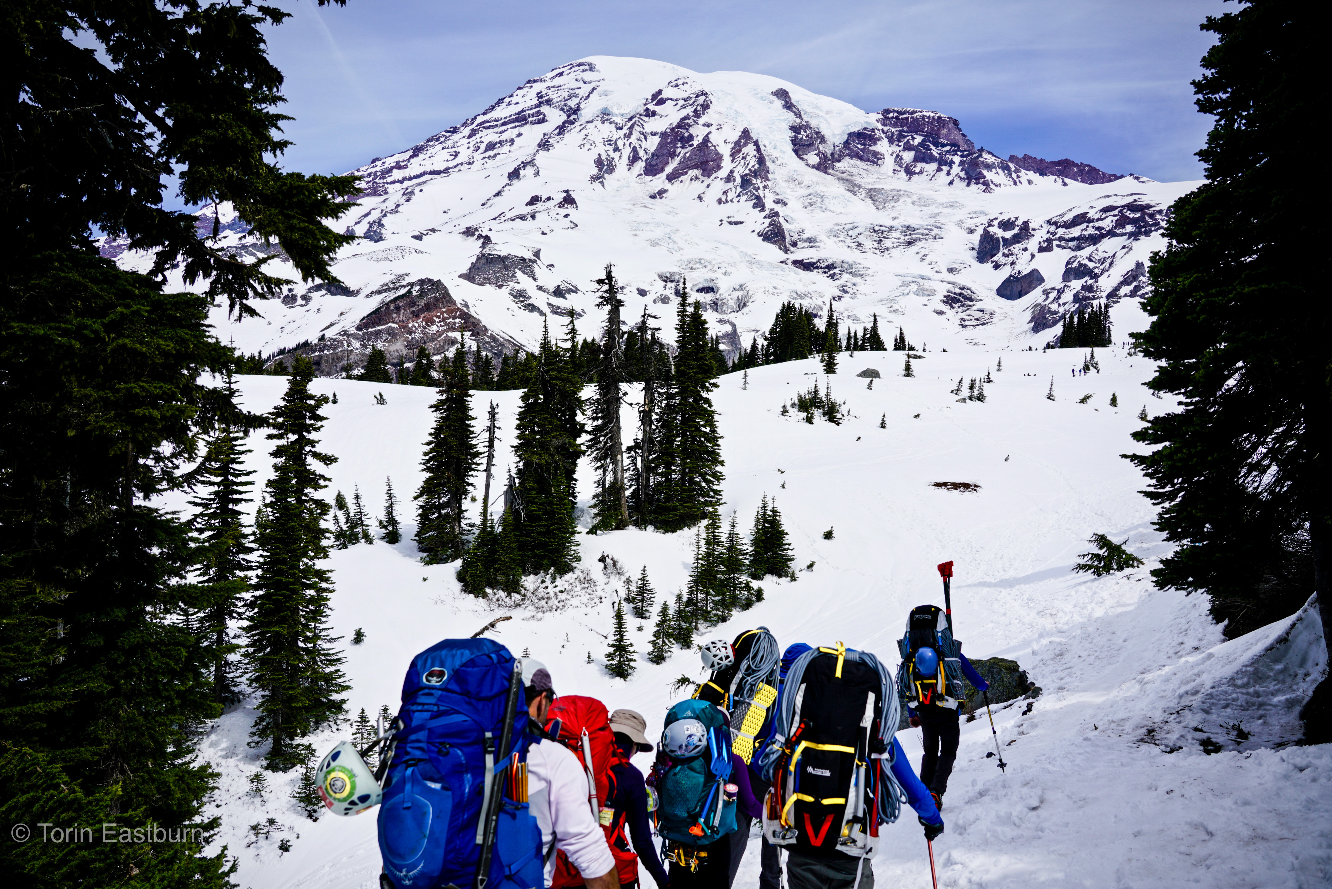
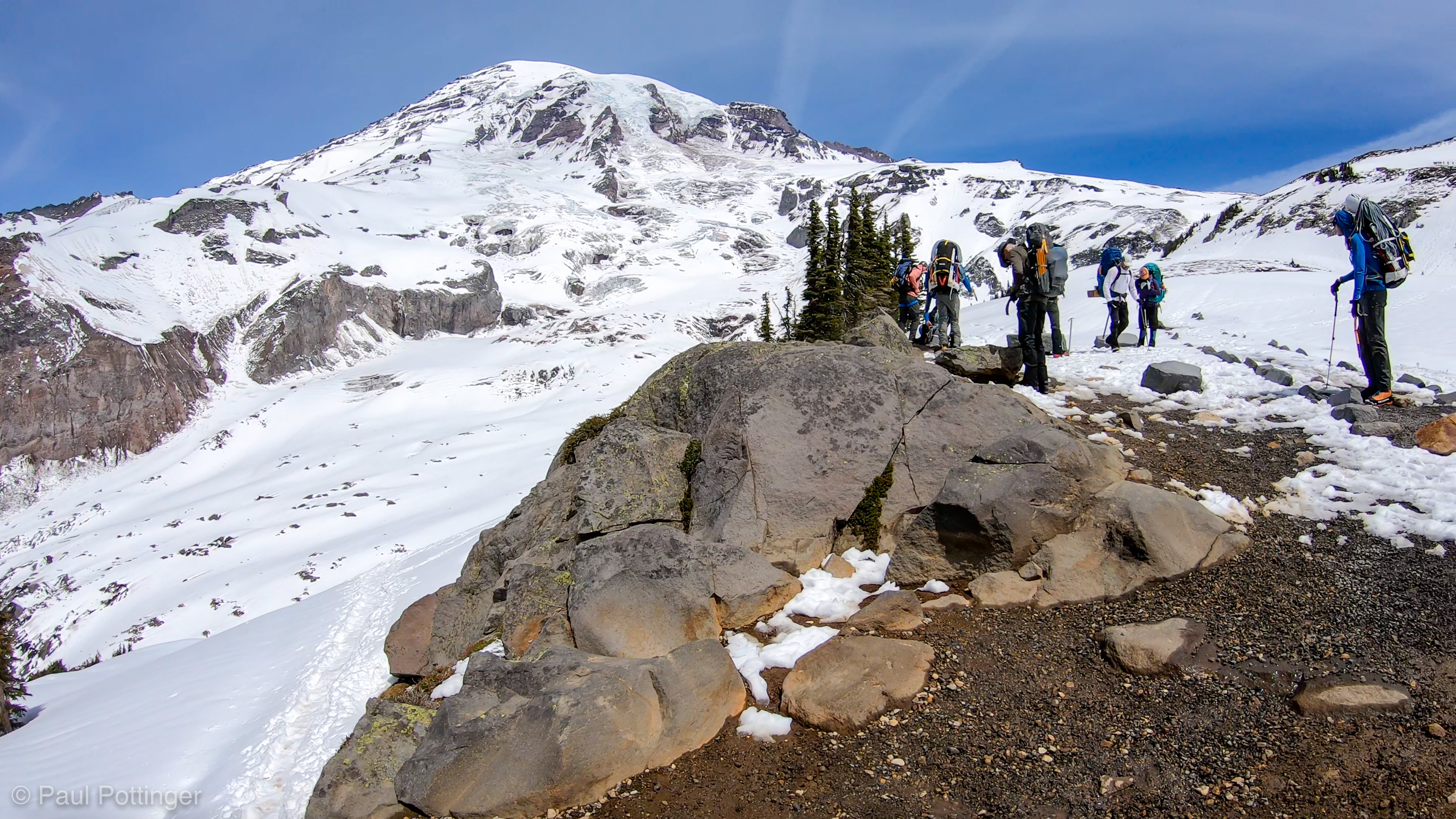
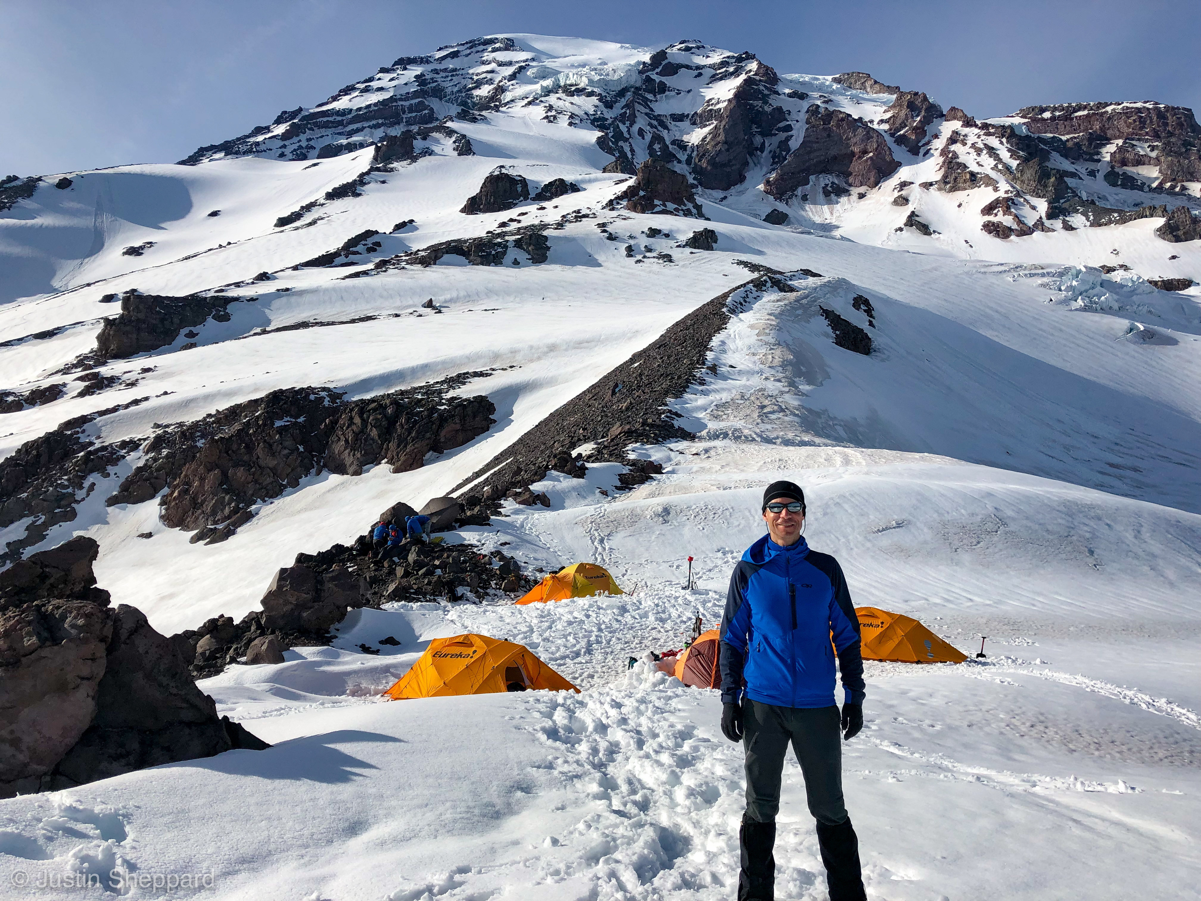
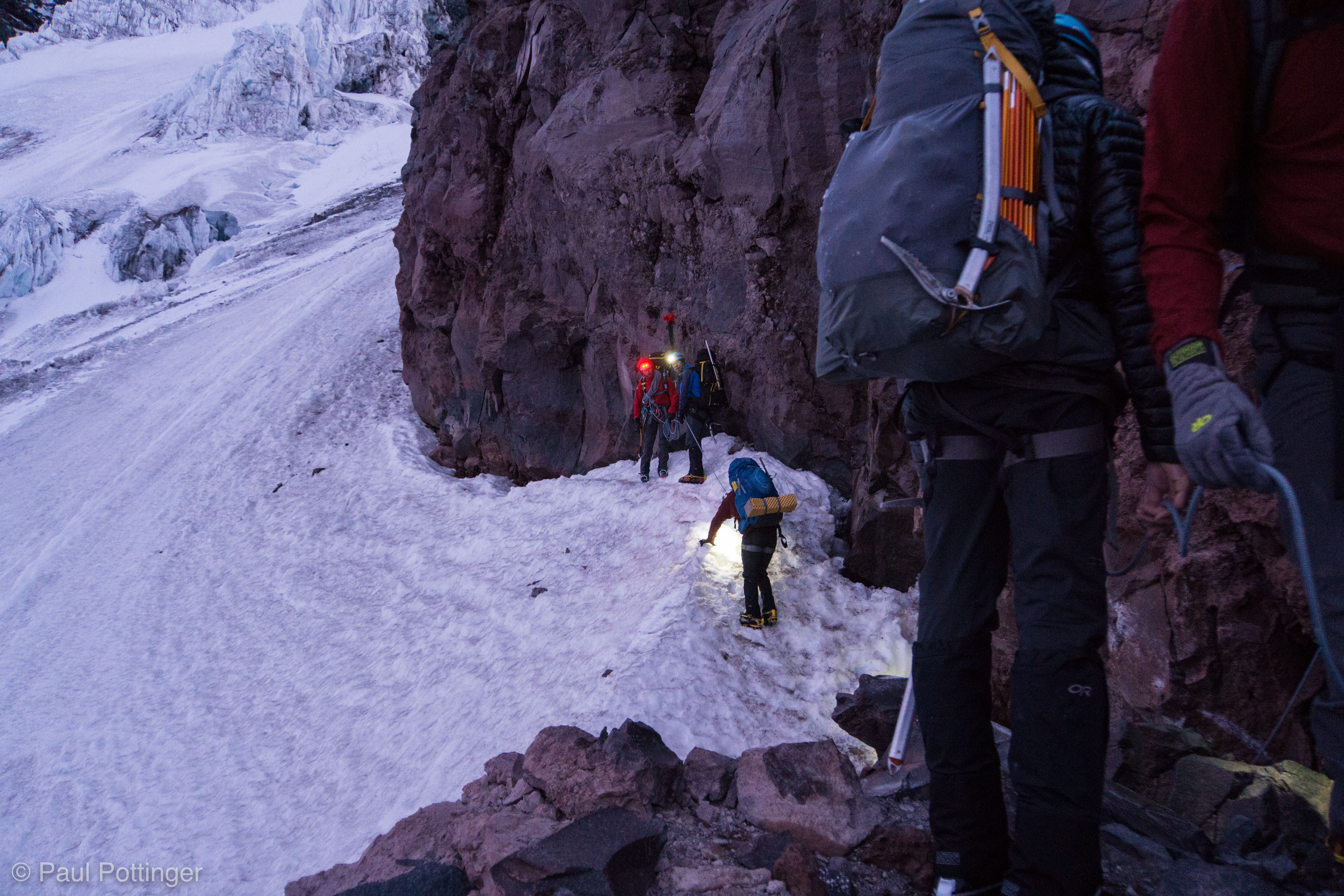
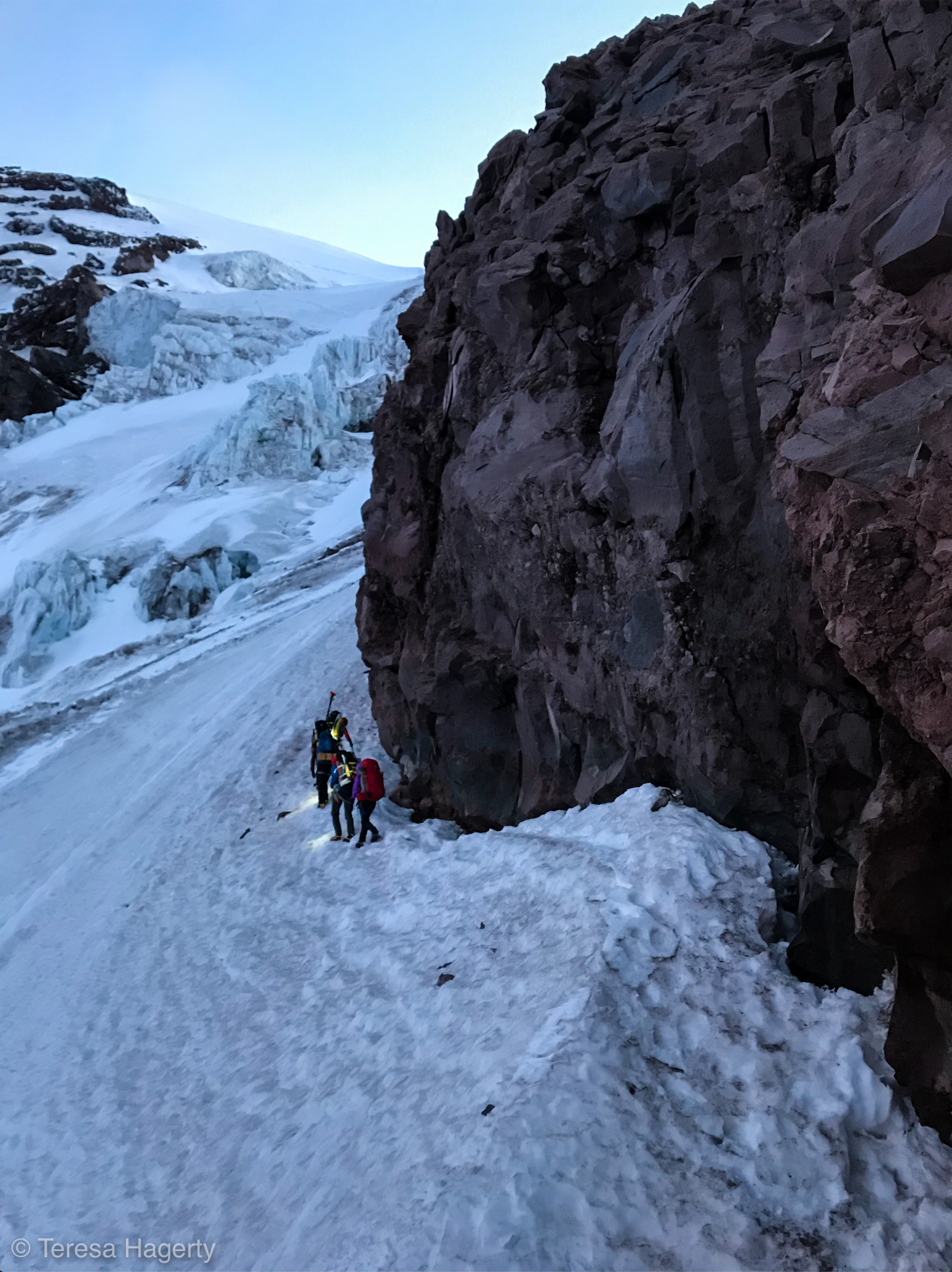
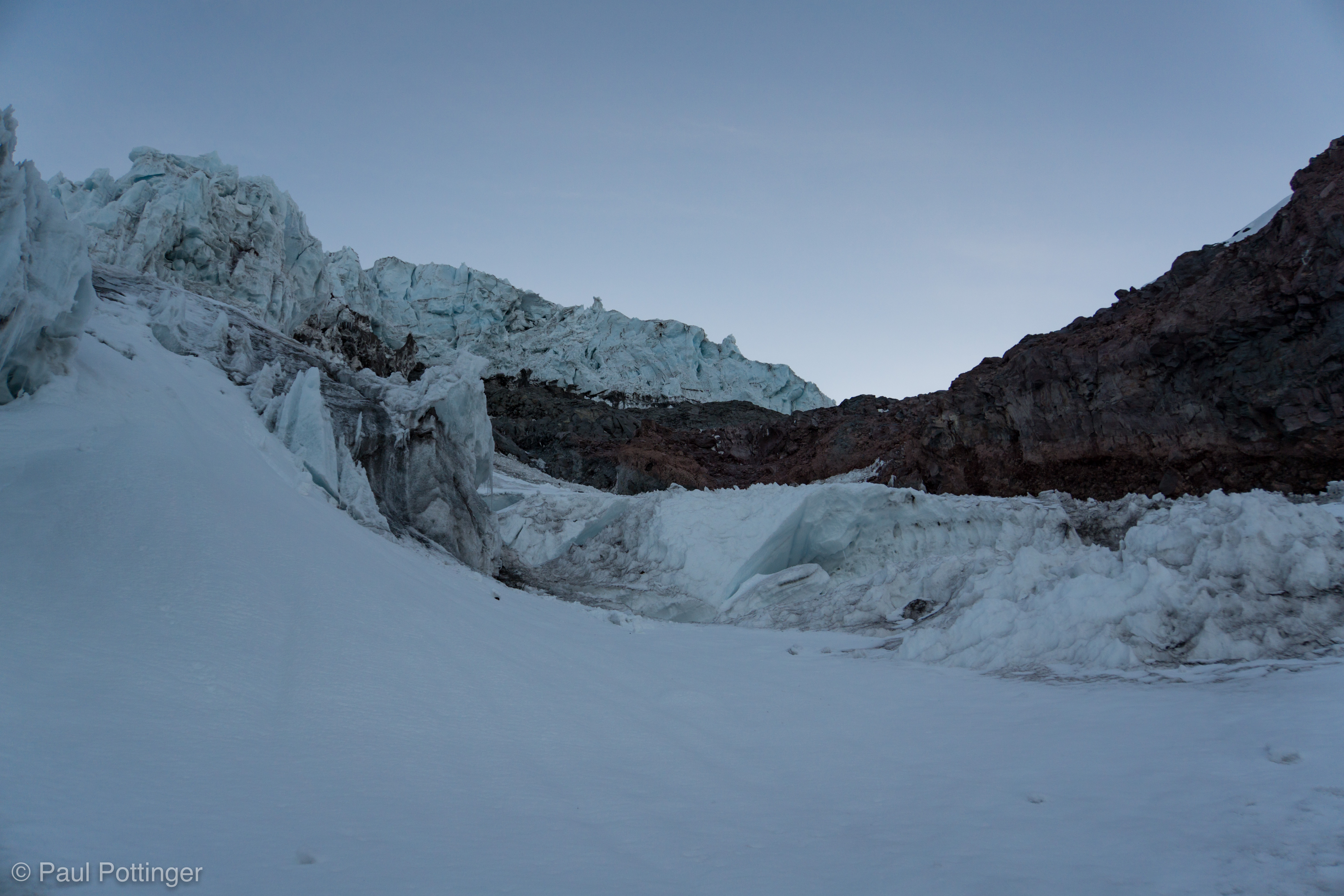
Our first objective was the Sneak, an unofficial, unmarked transition point between the Turtle and the Kautz Glacier. The rocky ridge that separates these two snow features can be down-climbed in a variety of locations… you can even do it right from the kitchen at Camp Hazard. But, our guides knew the ideal spot, a small rocky step that allowed us to “sneak” onto the Kautz without much fuss or hassle. And they had intentionally set camp just a few minutes below it.

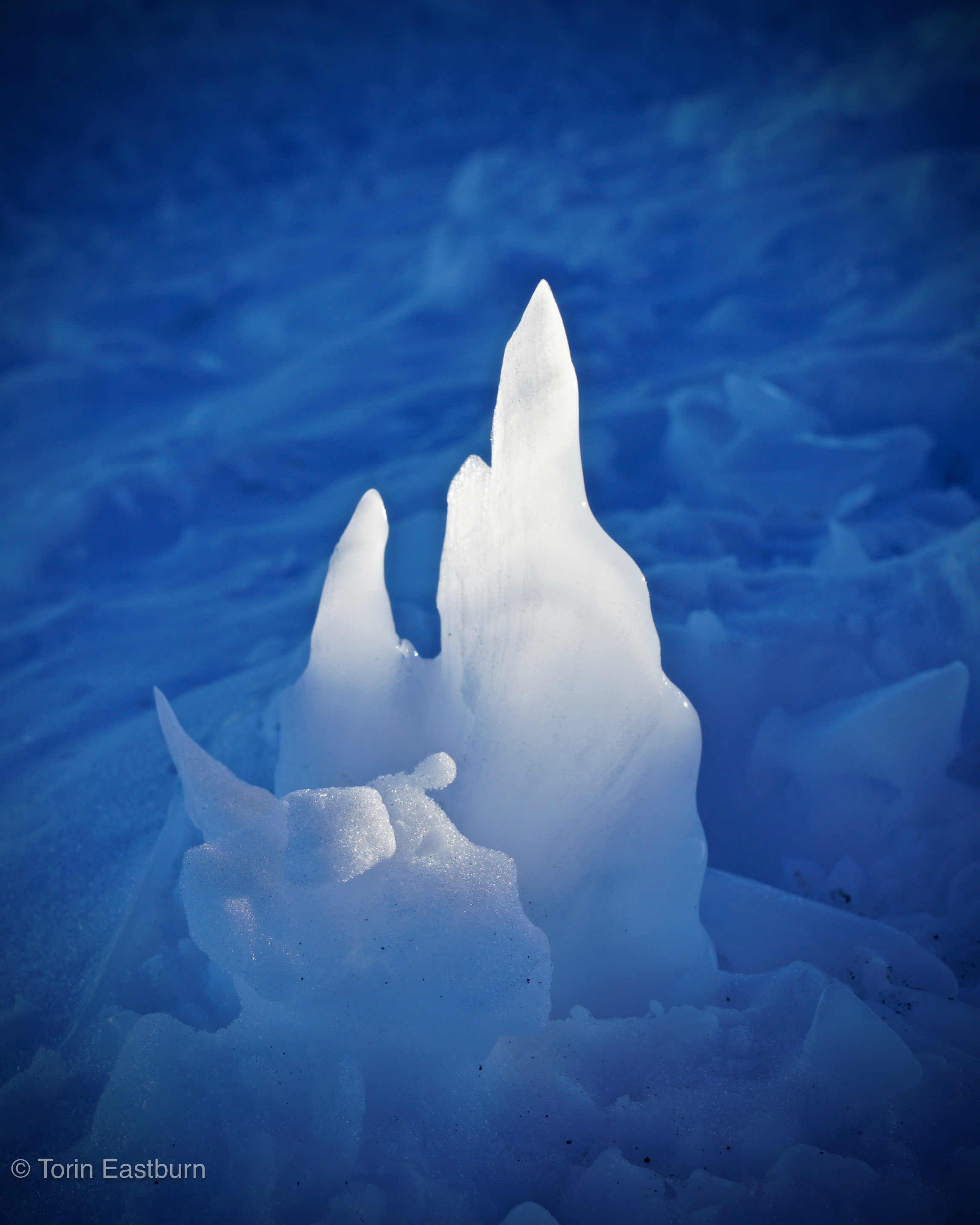
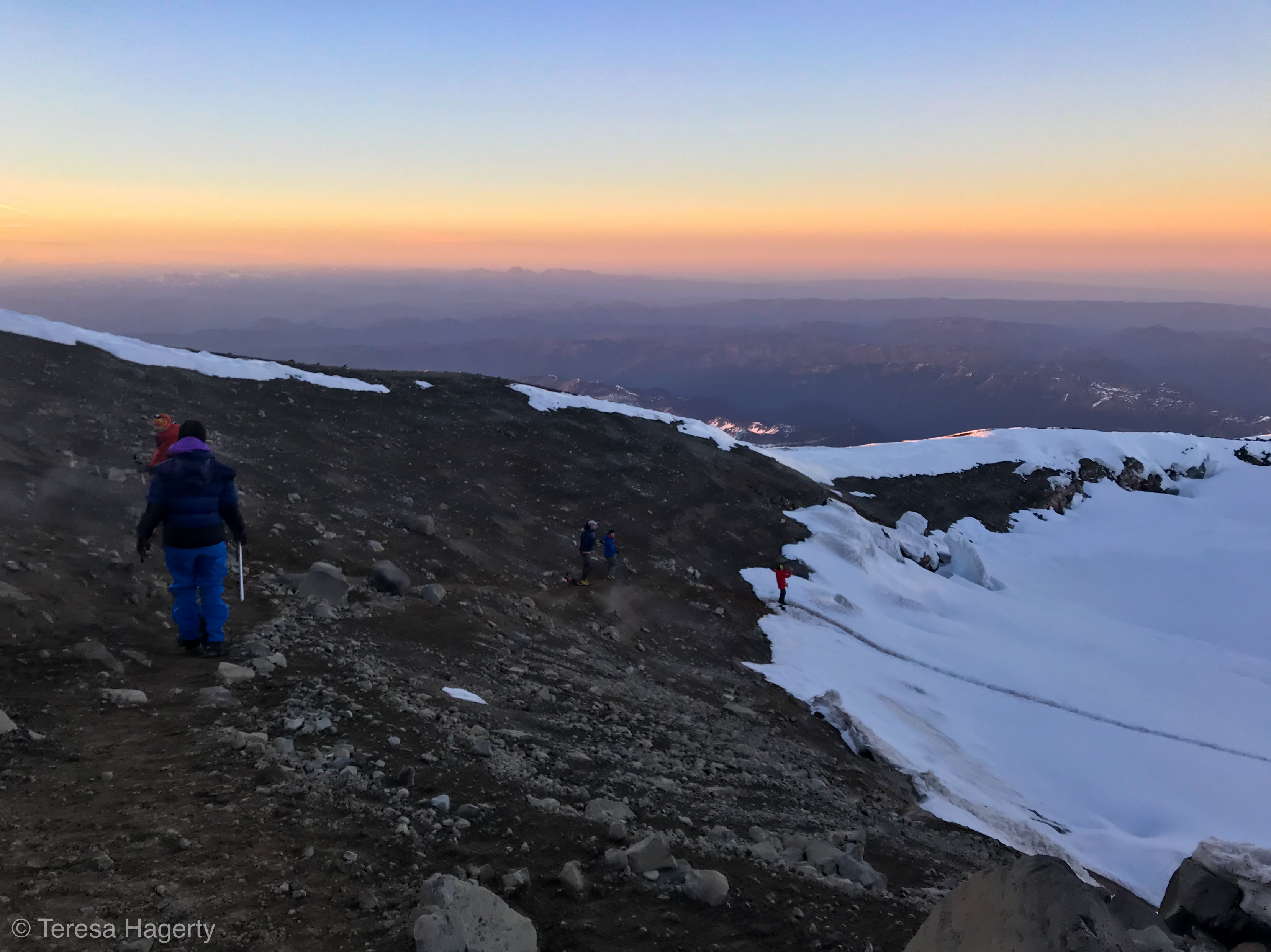
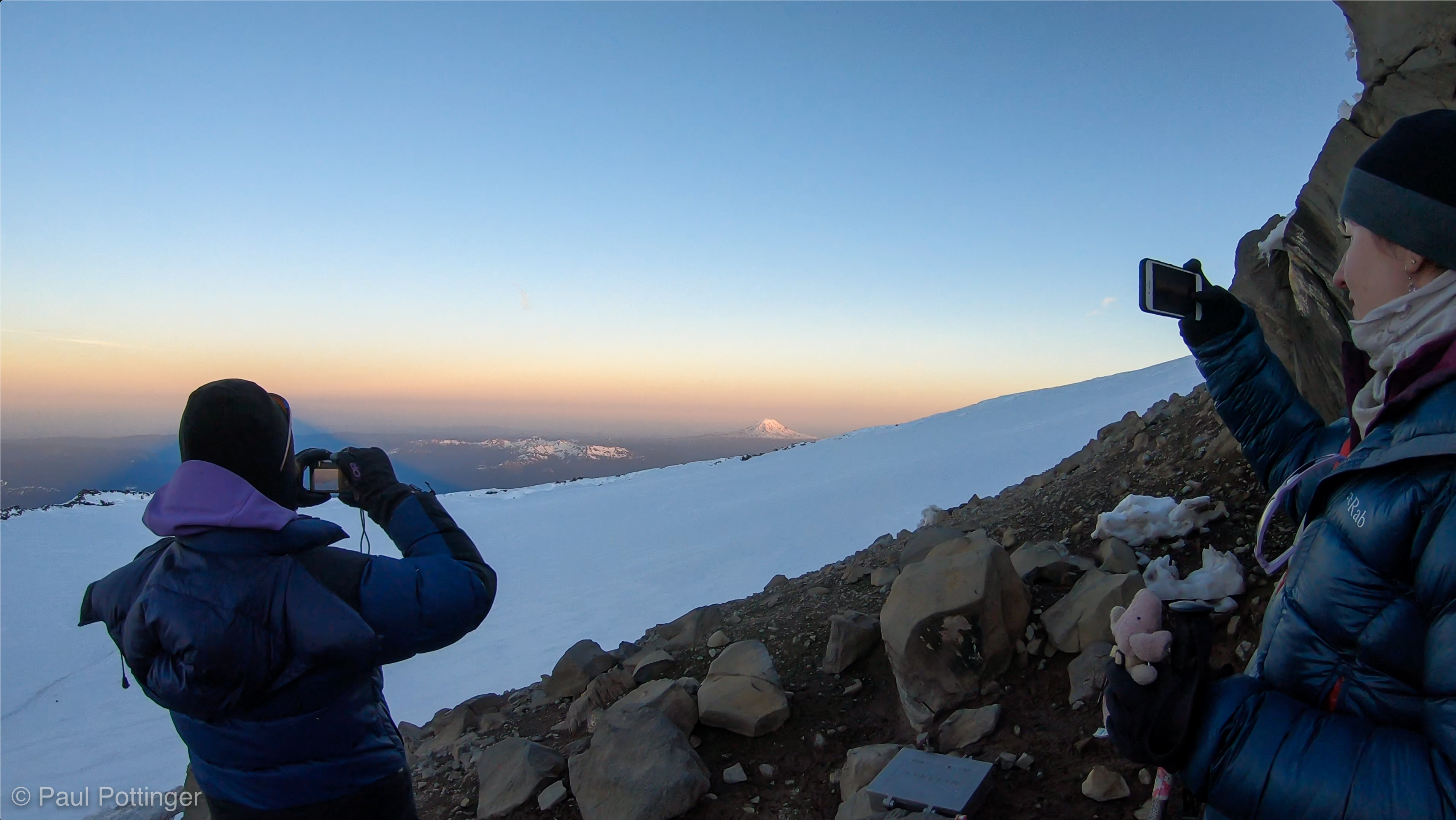
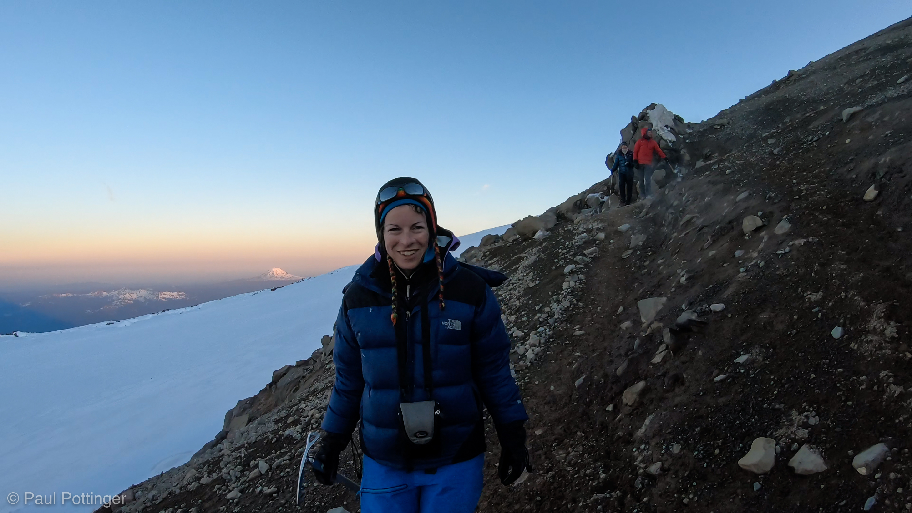
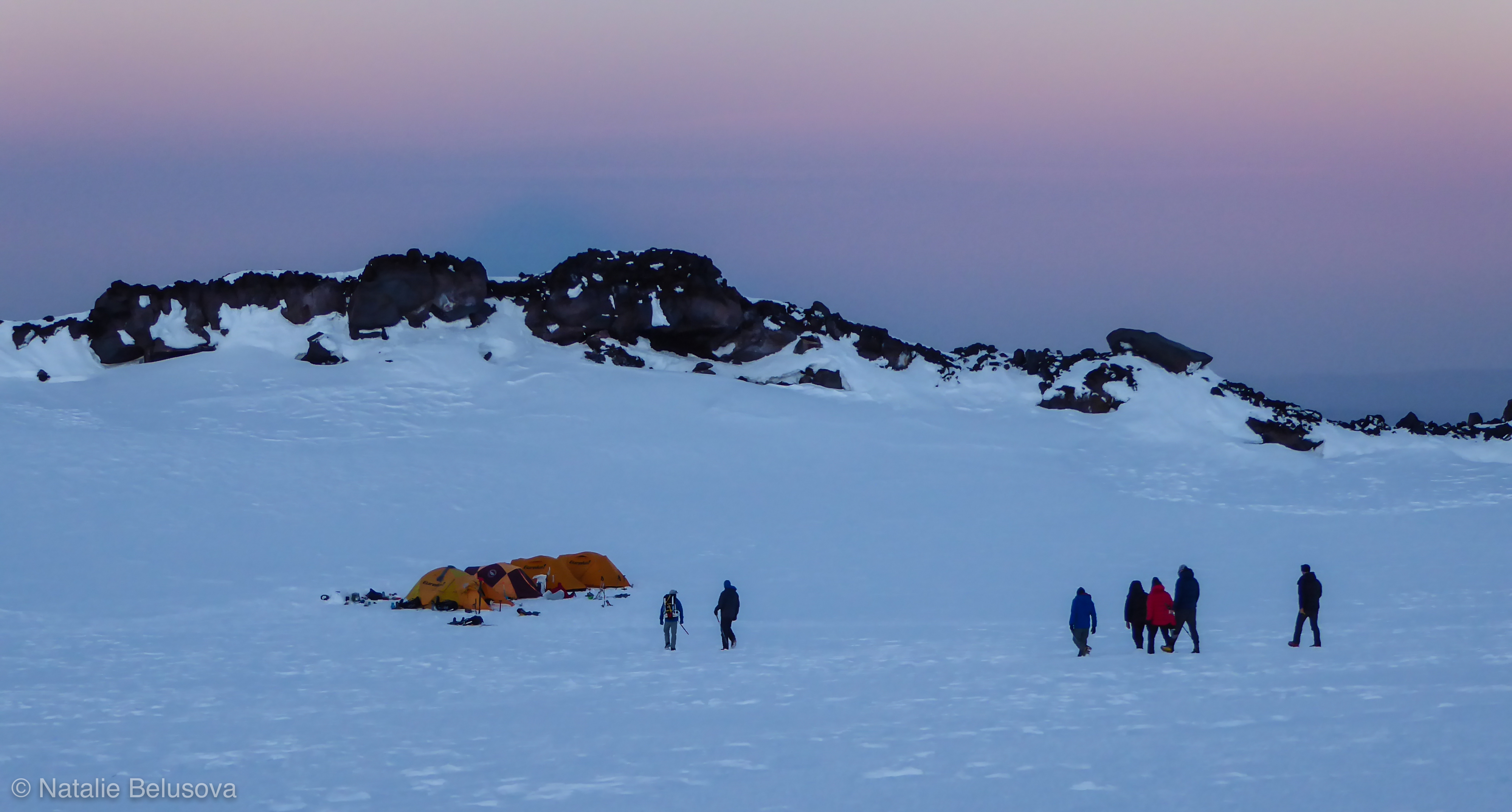
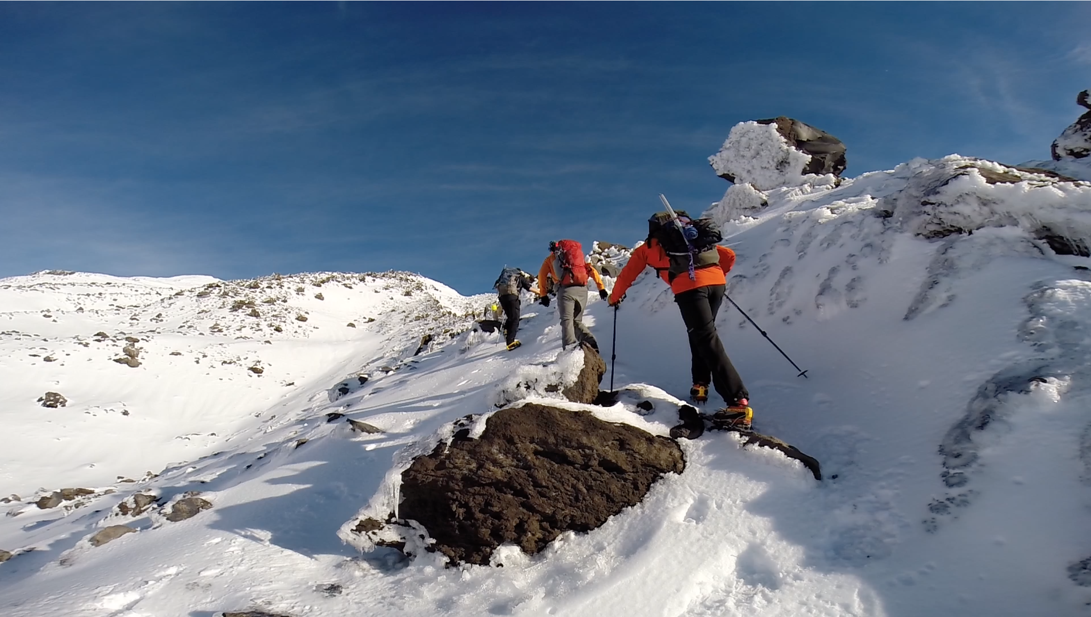
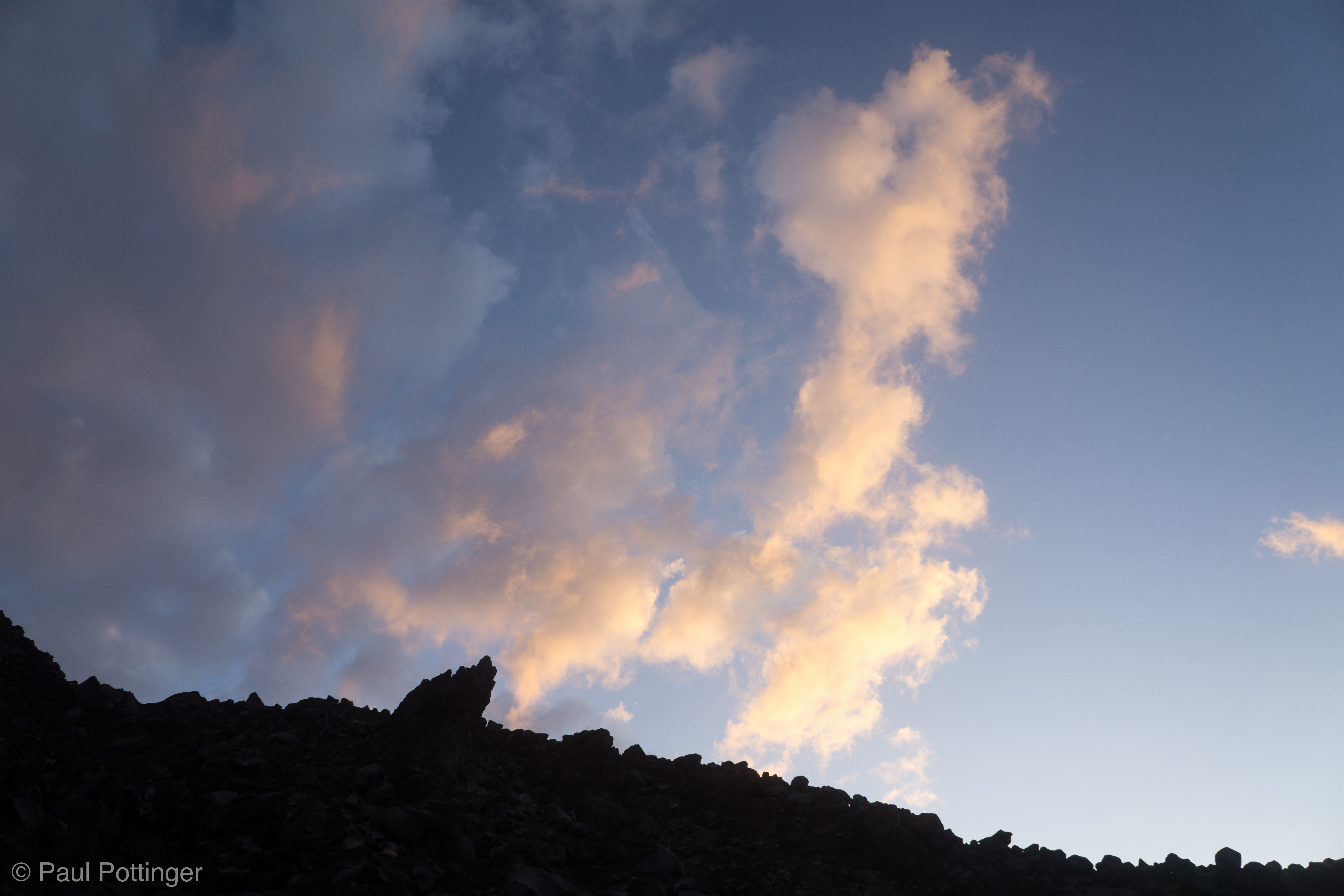
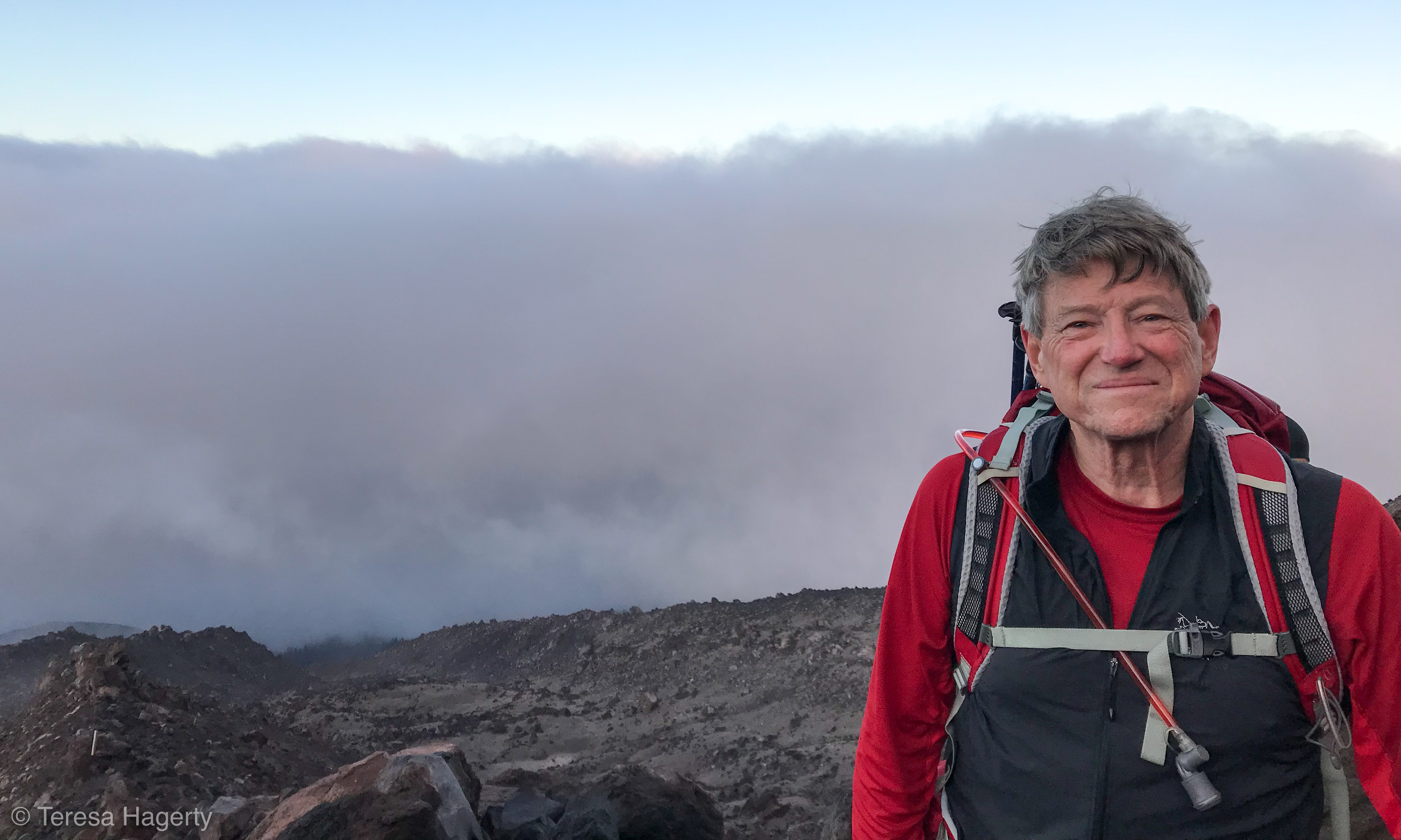
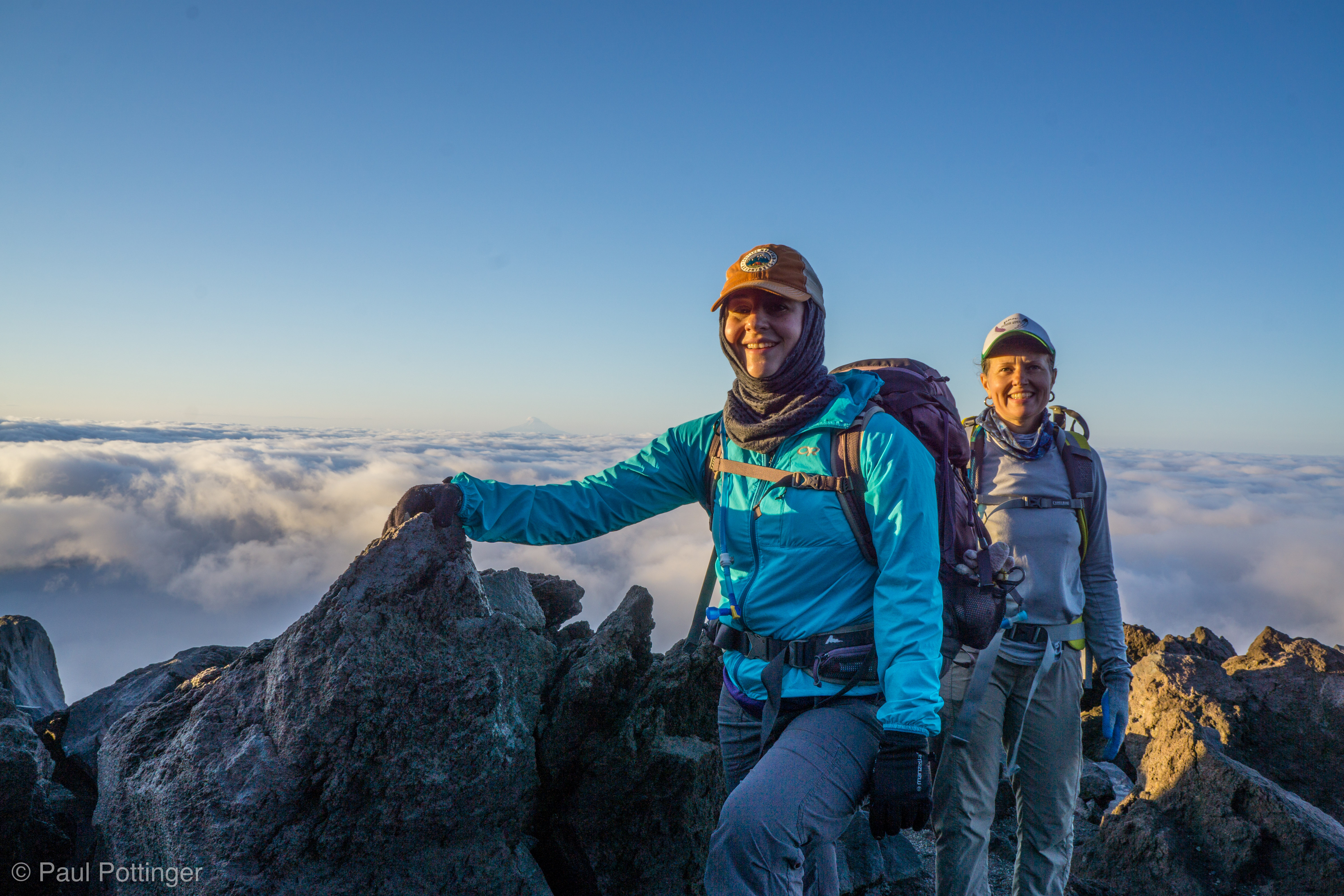
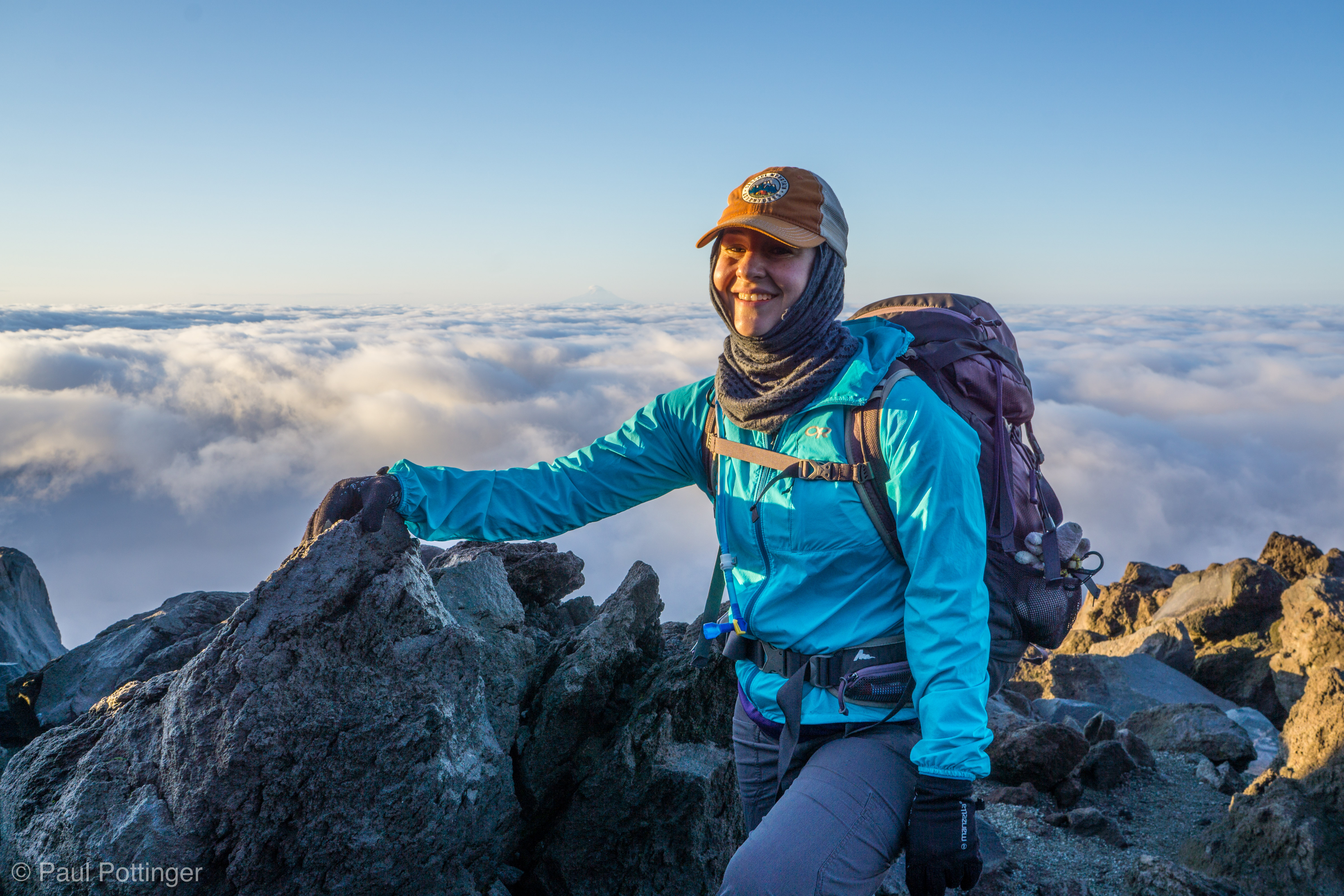
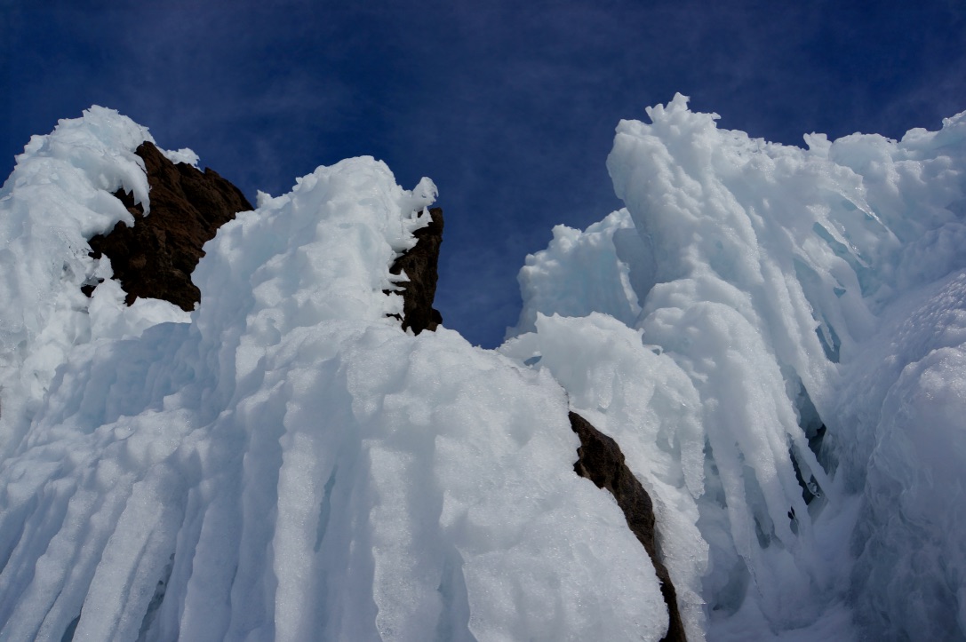
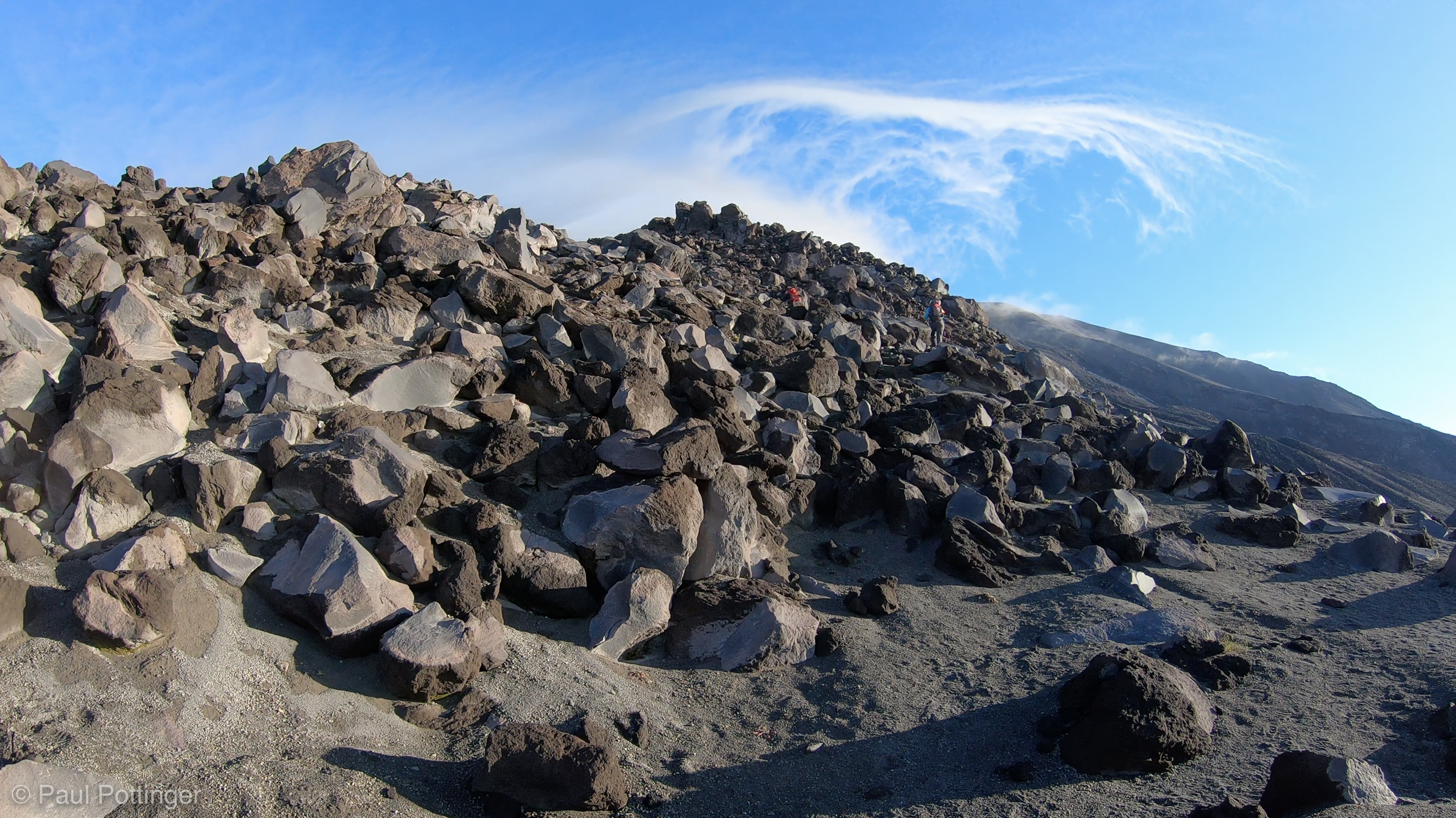
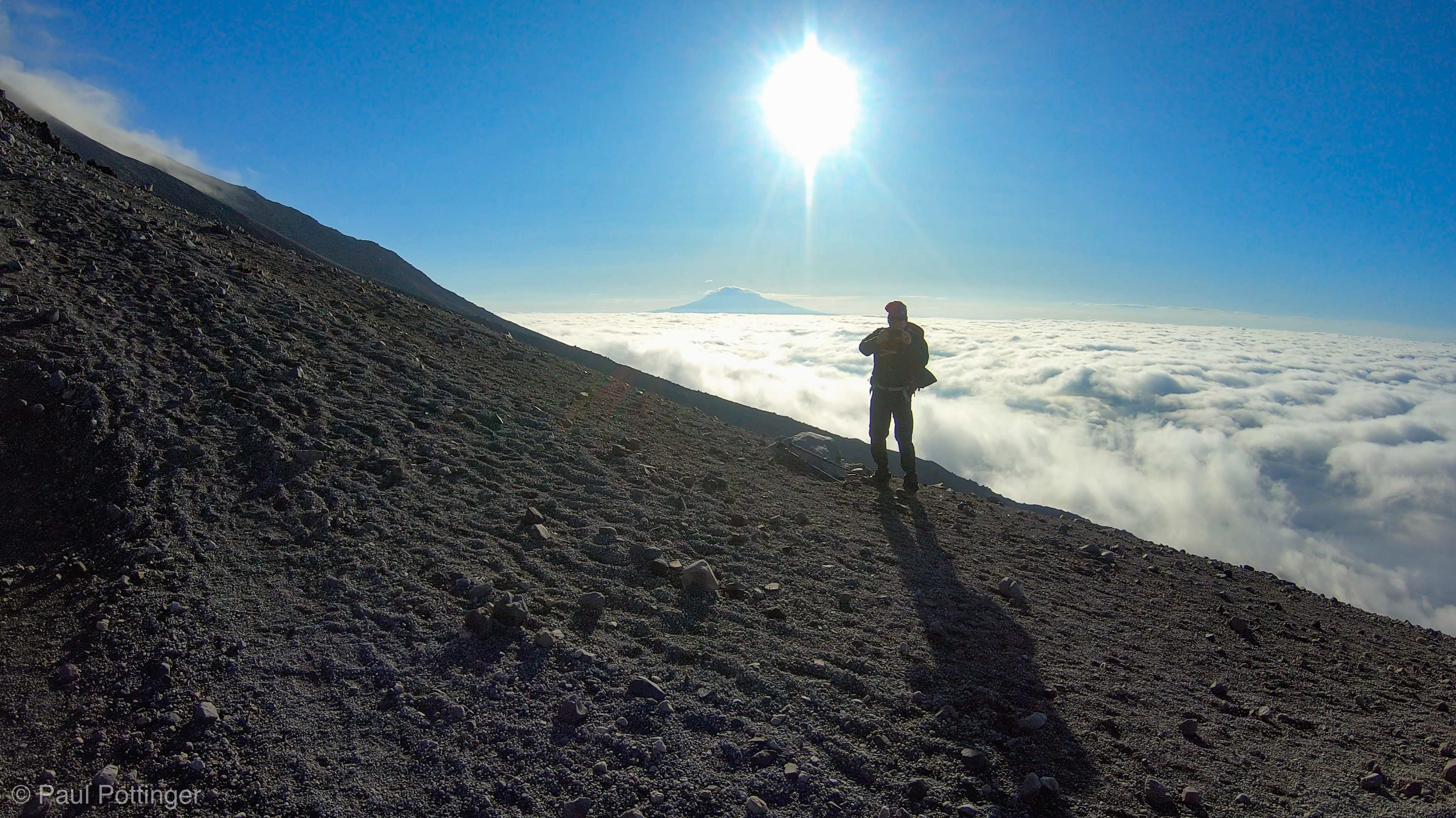
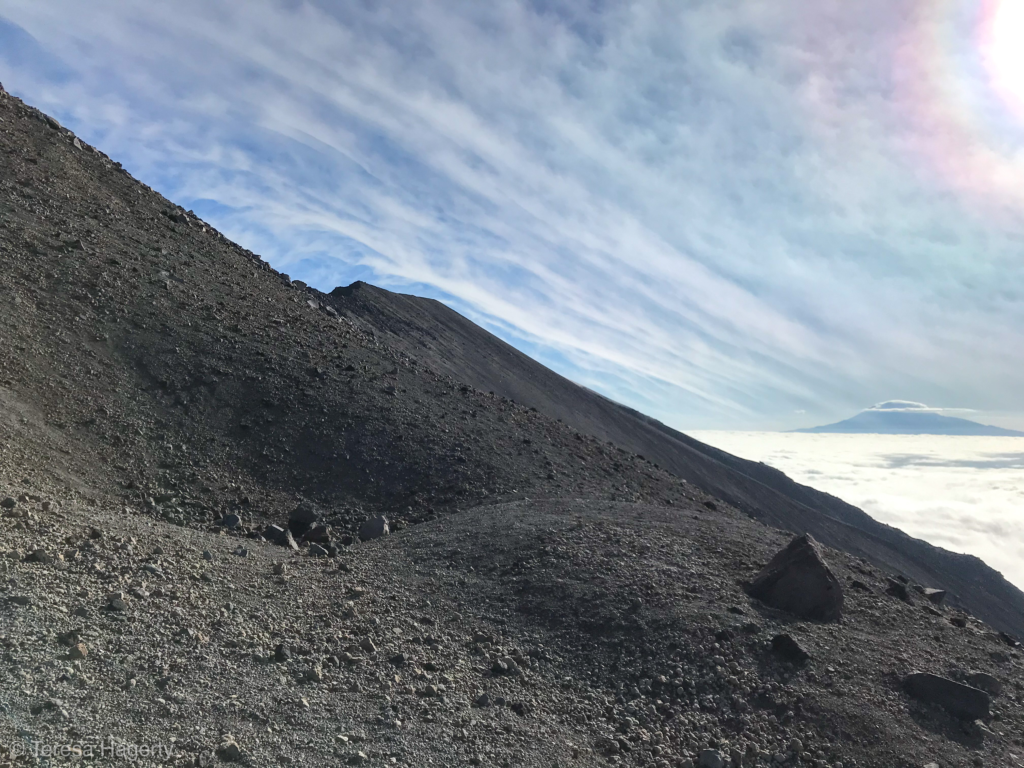
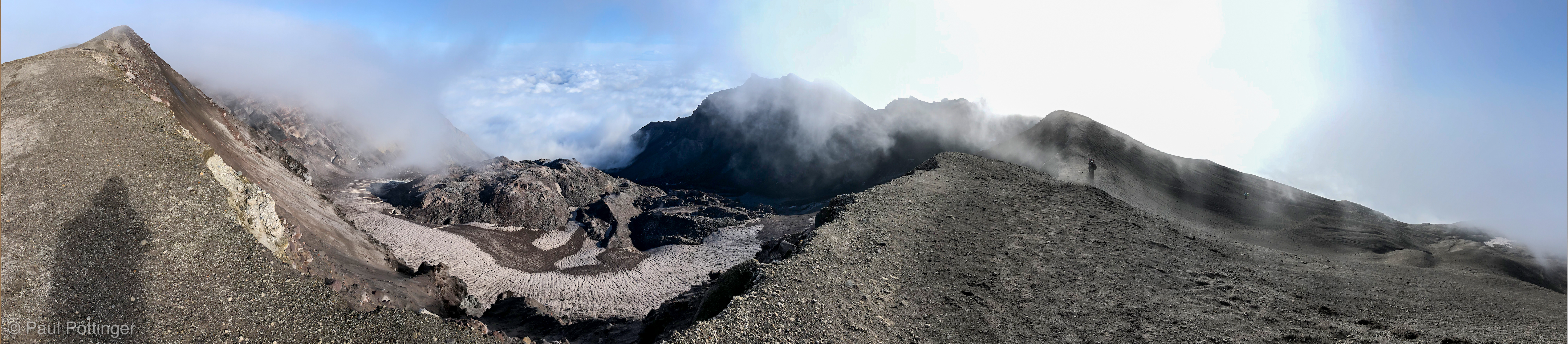
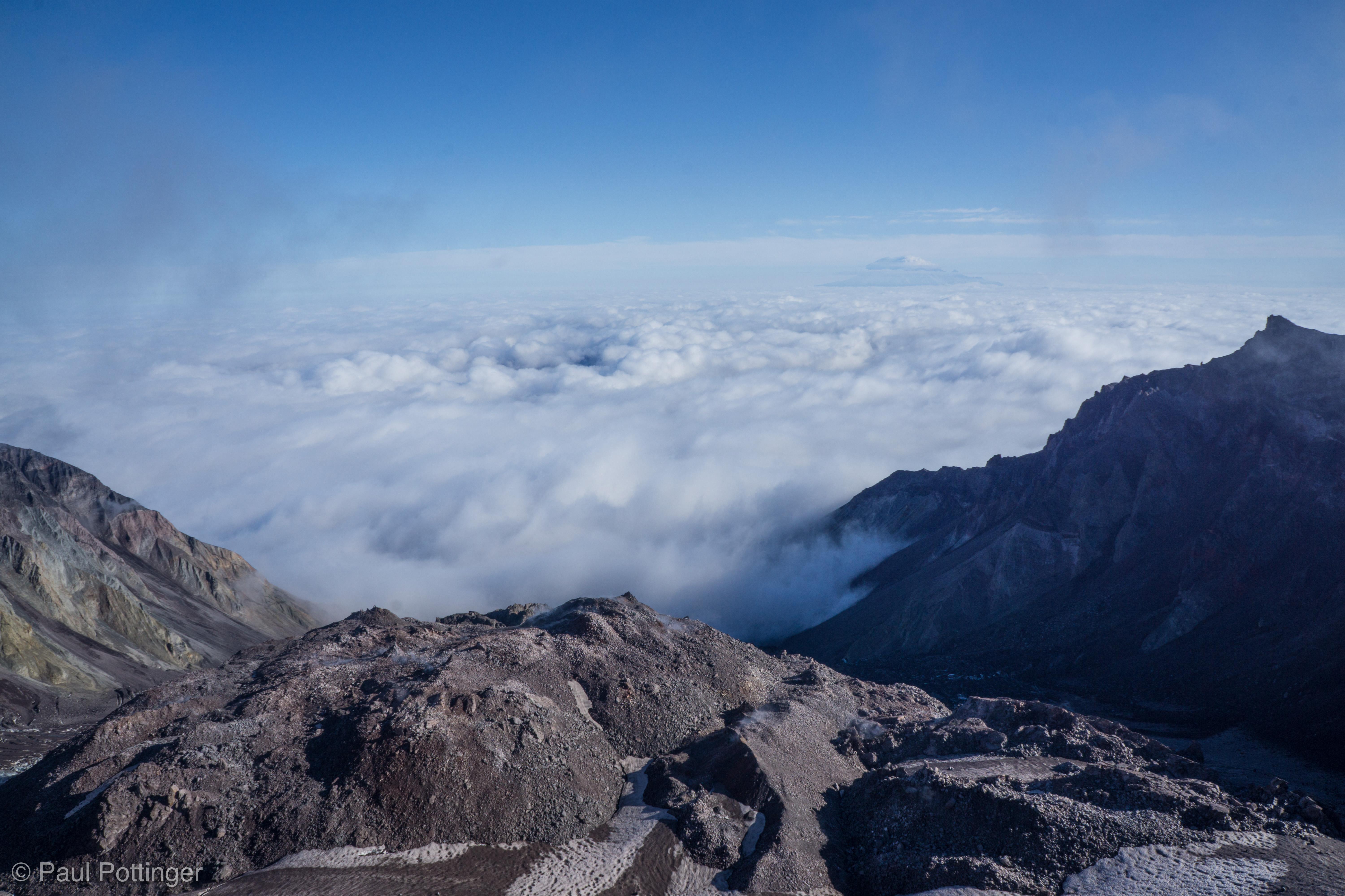
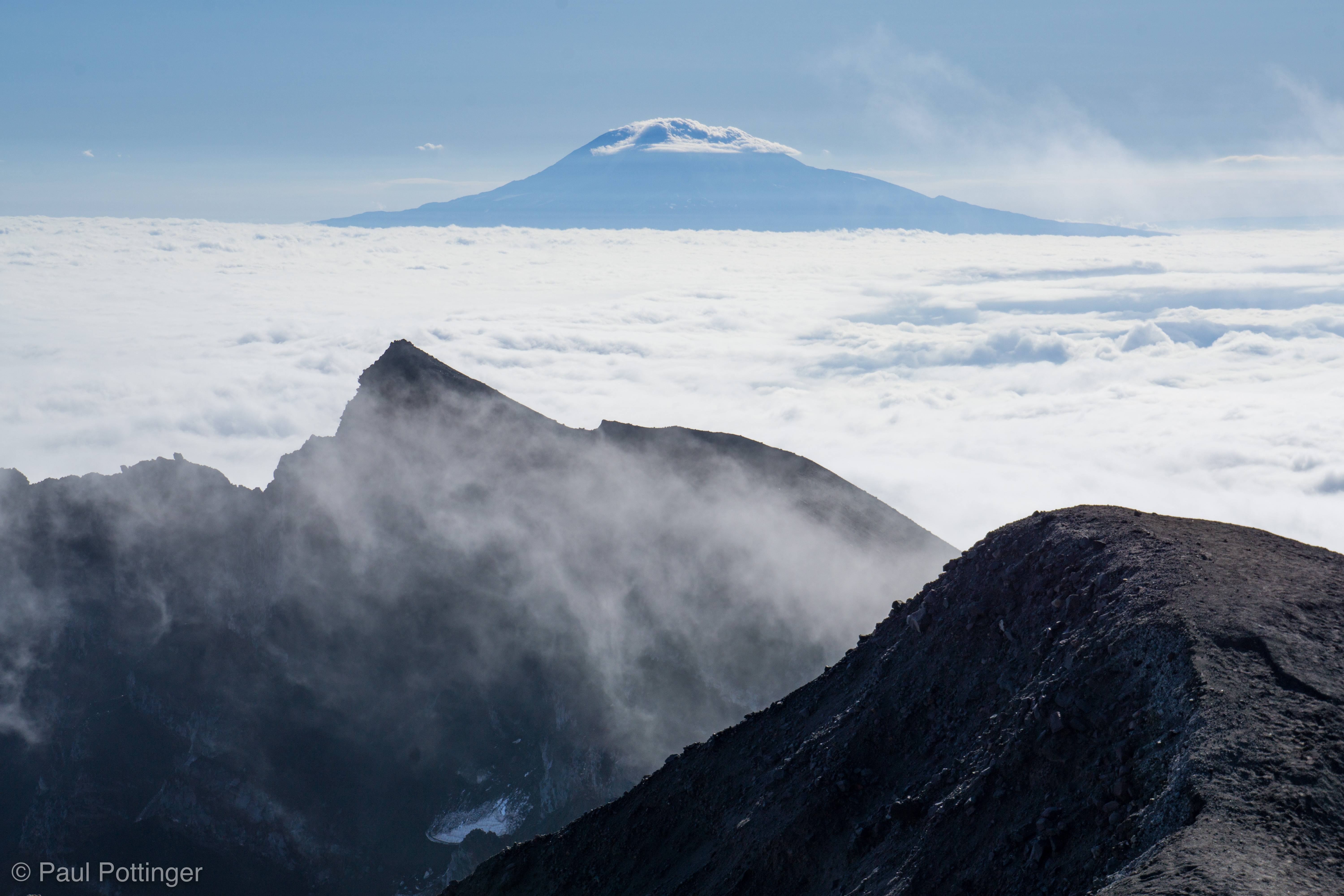
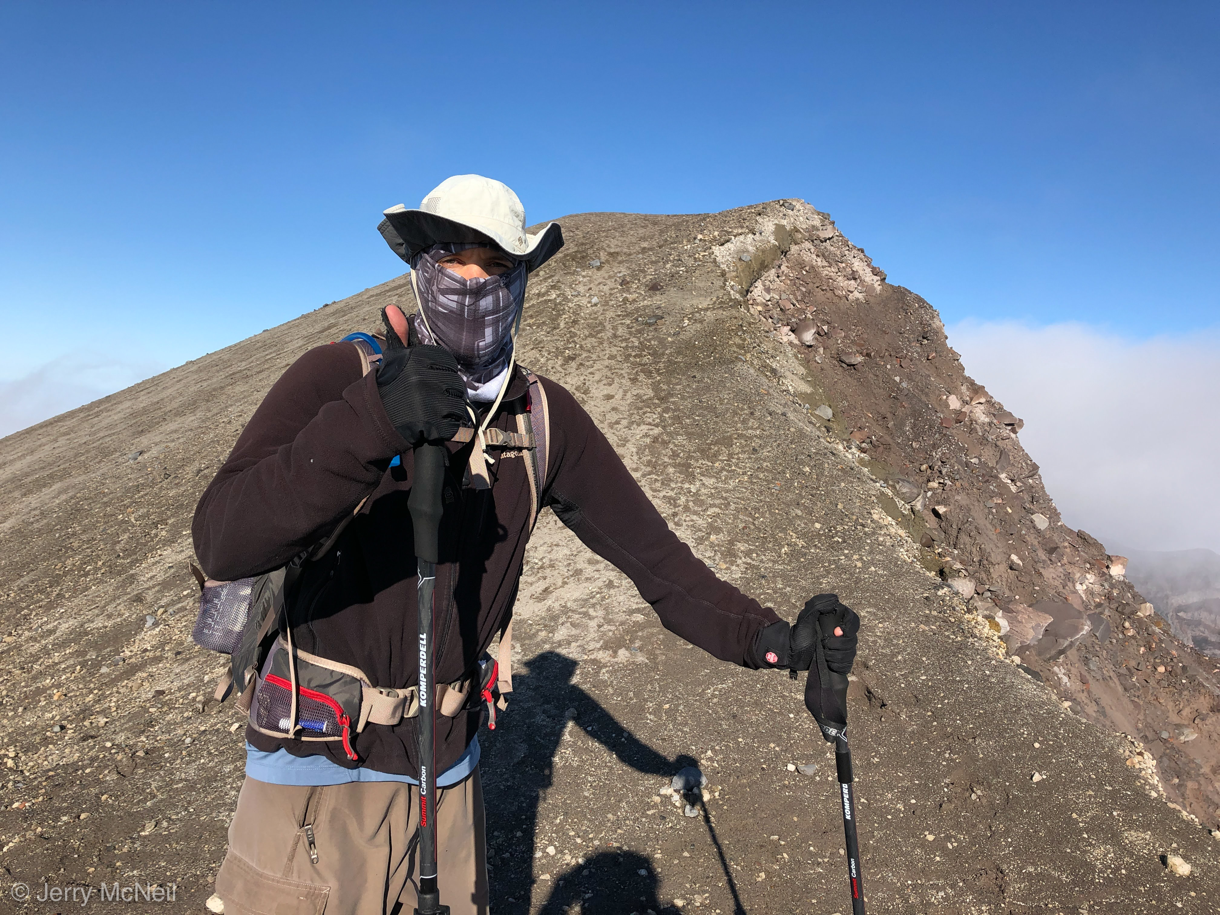
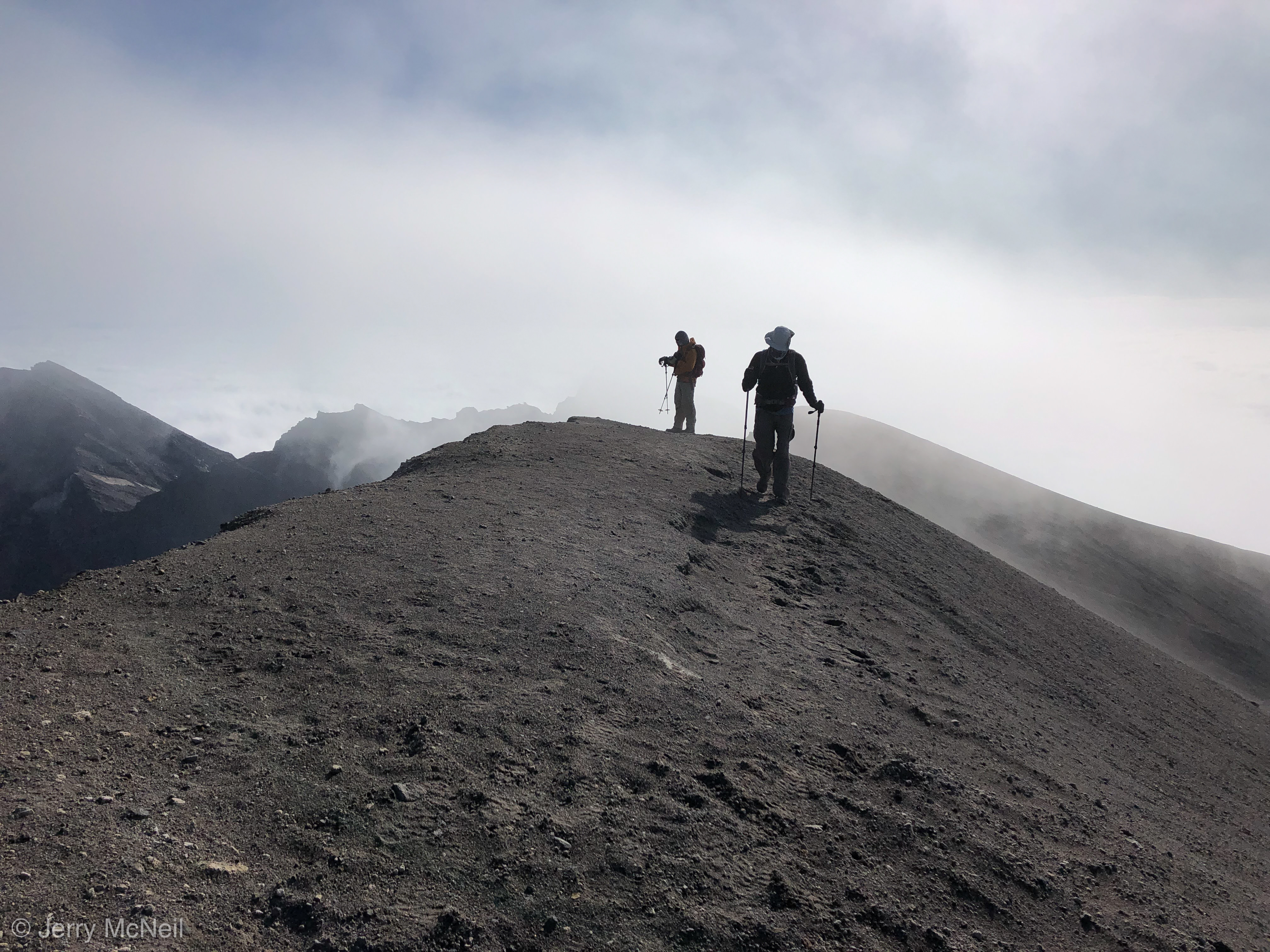
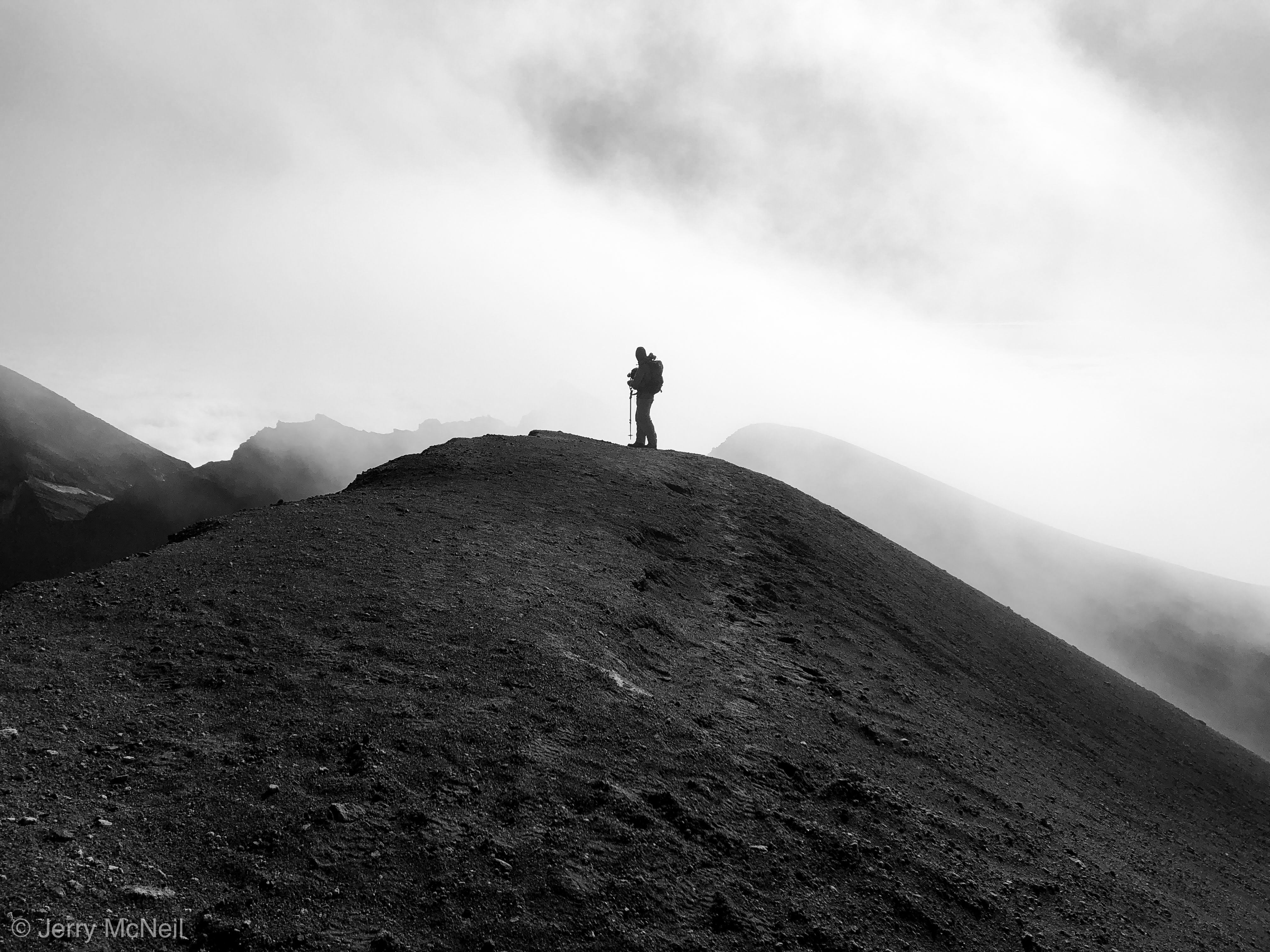
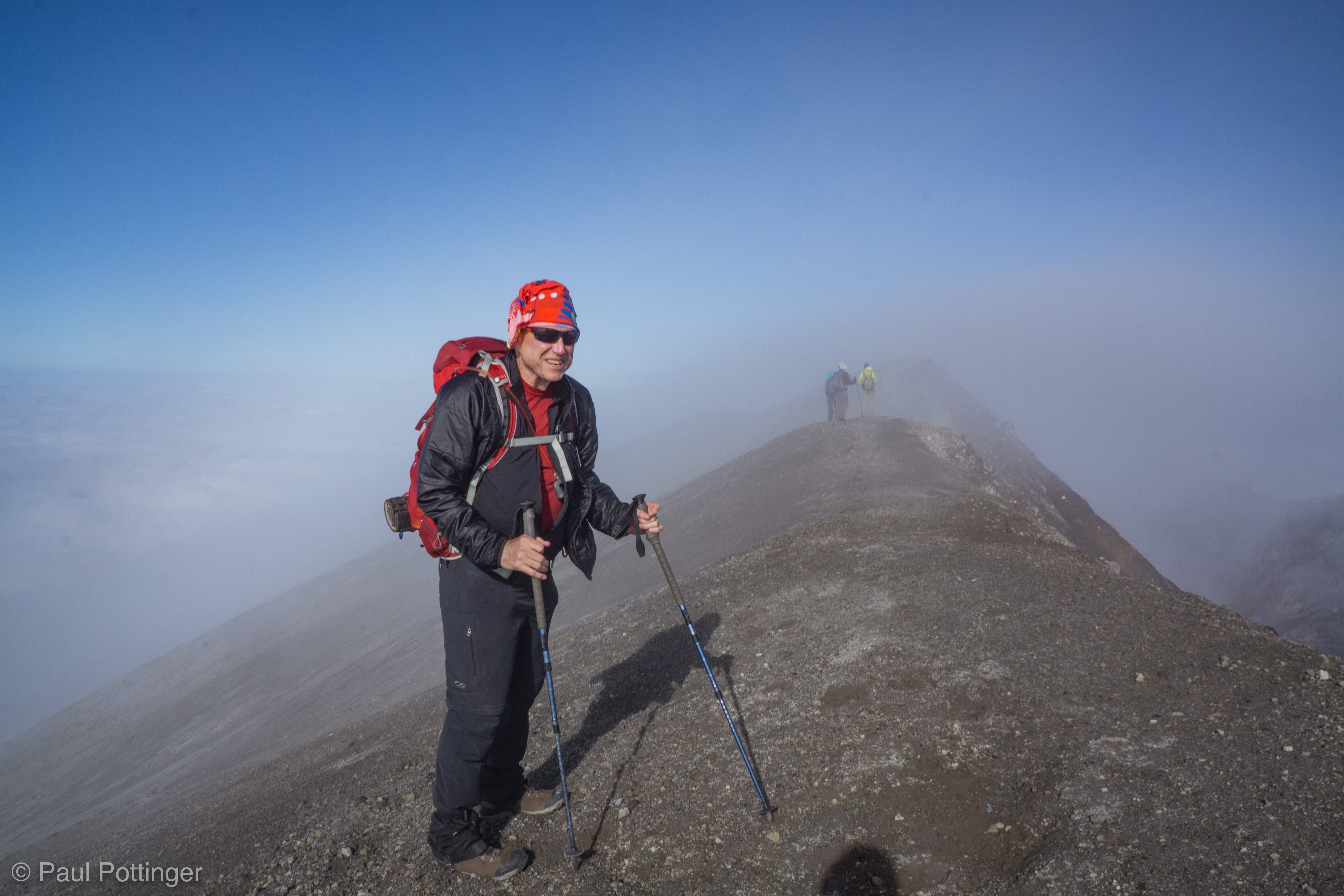
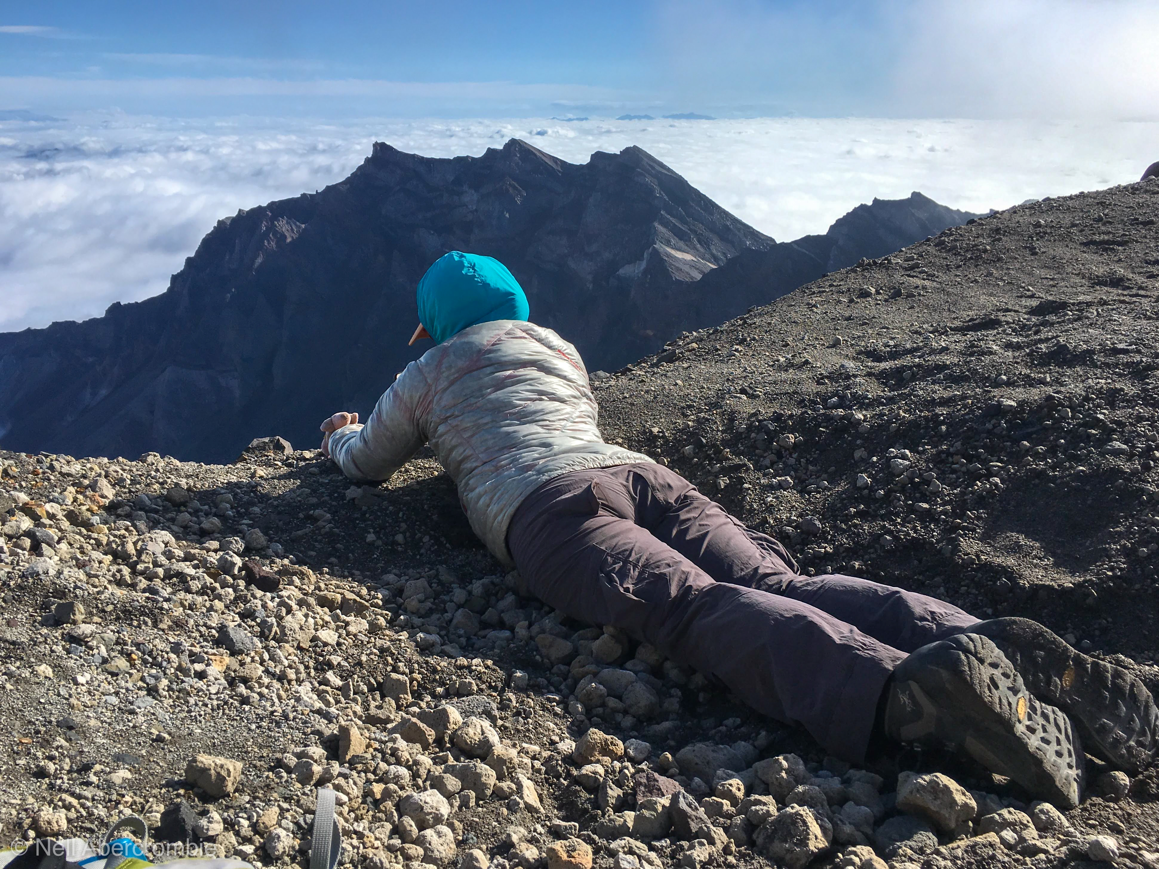
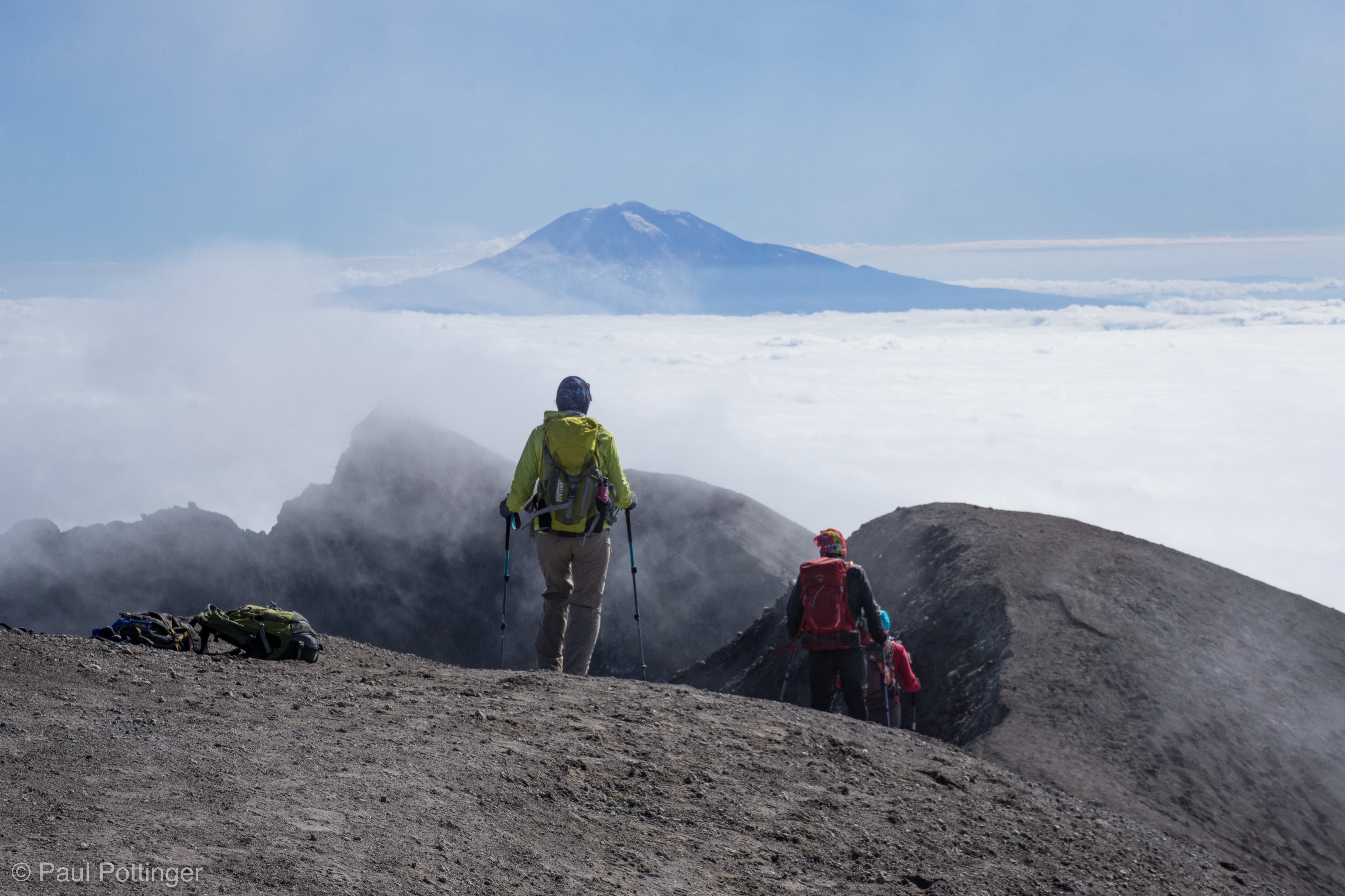
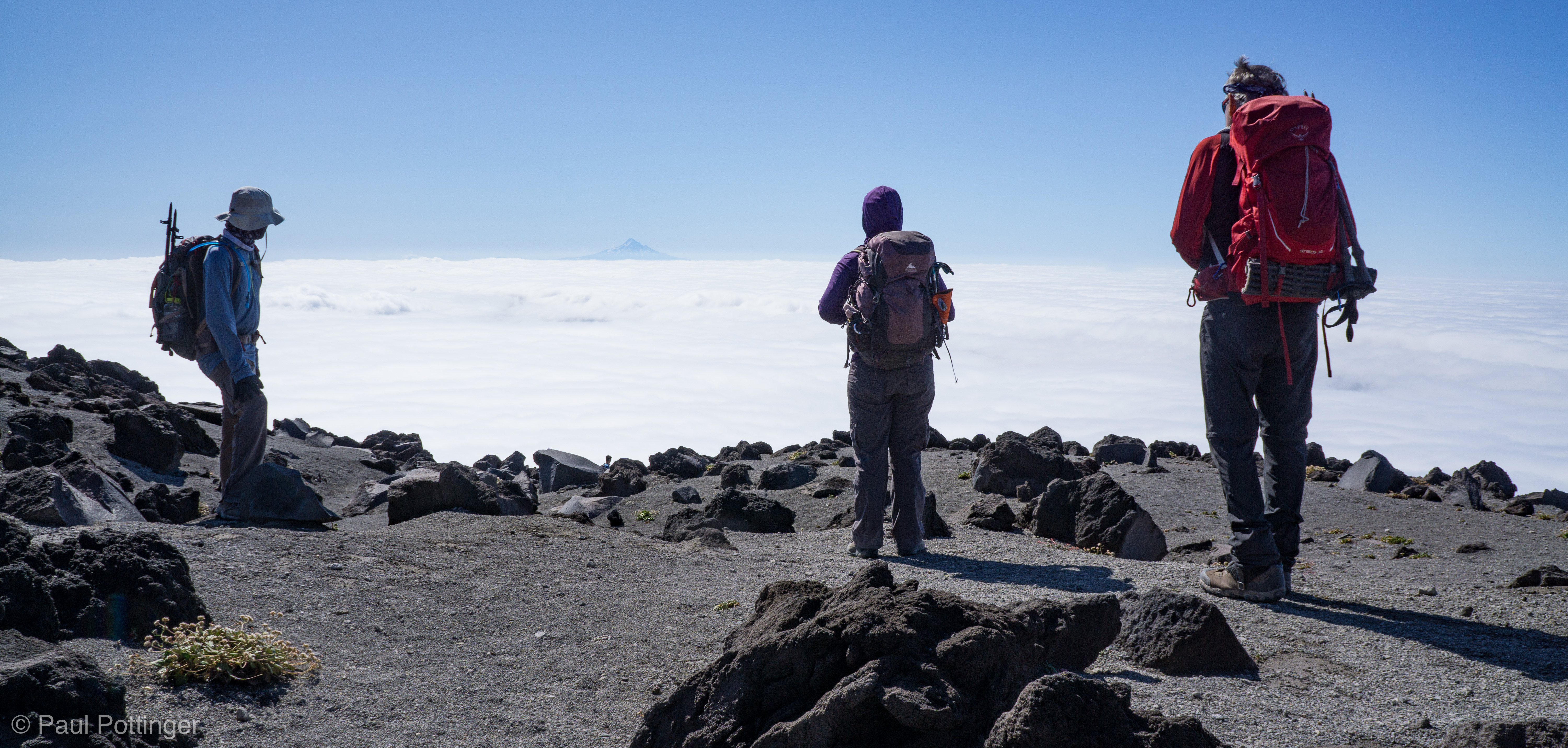
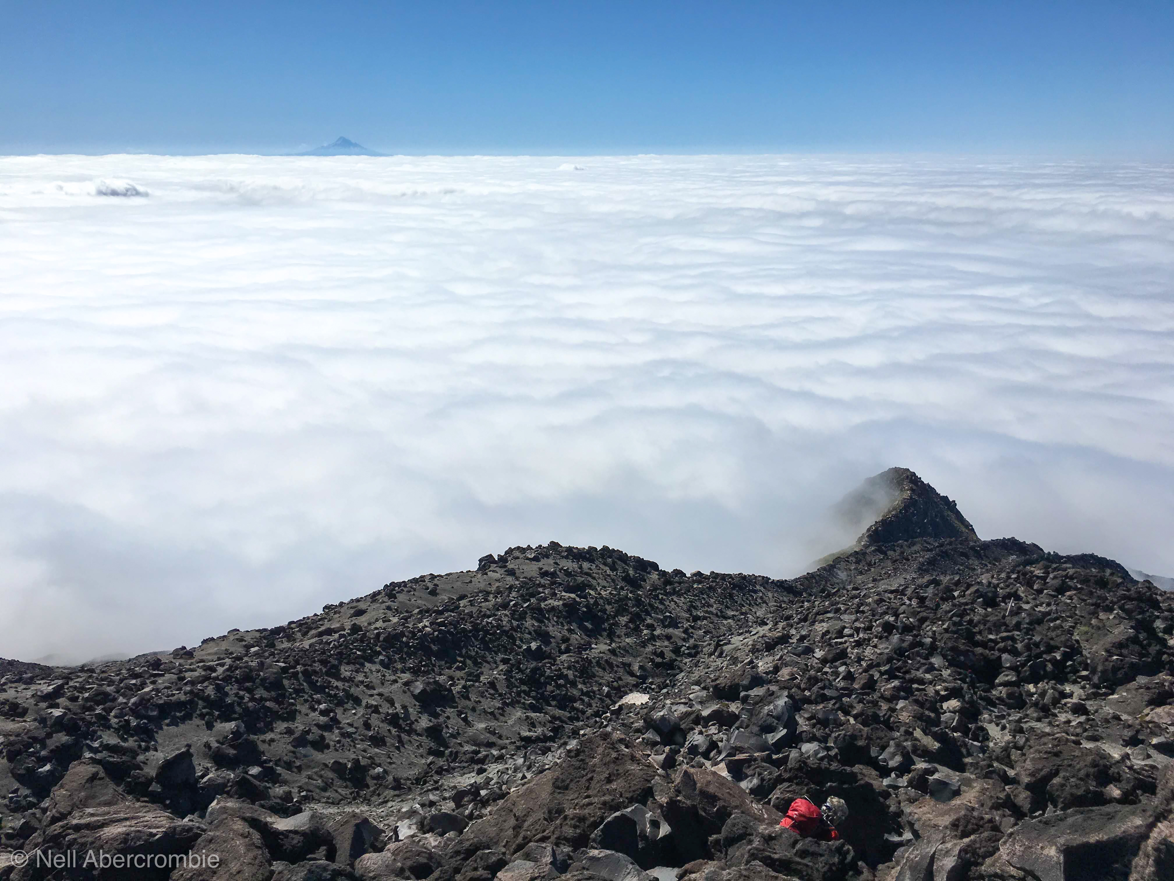
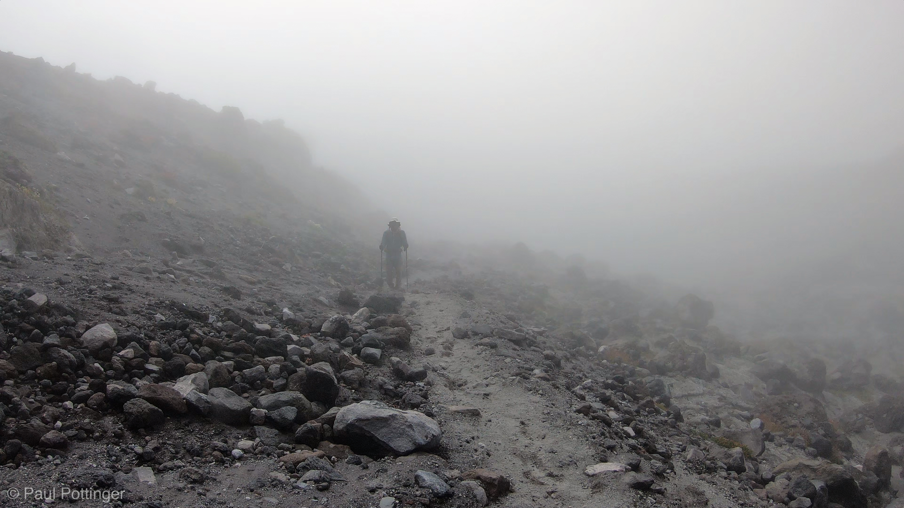
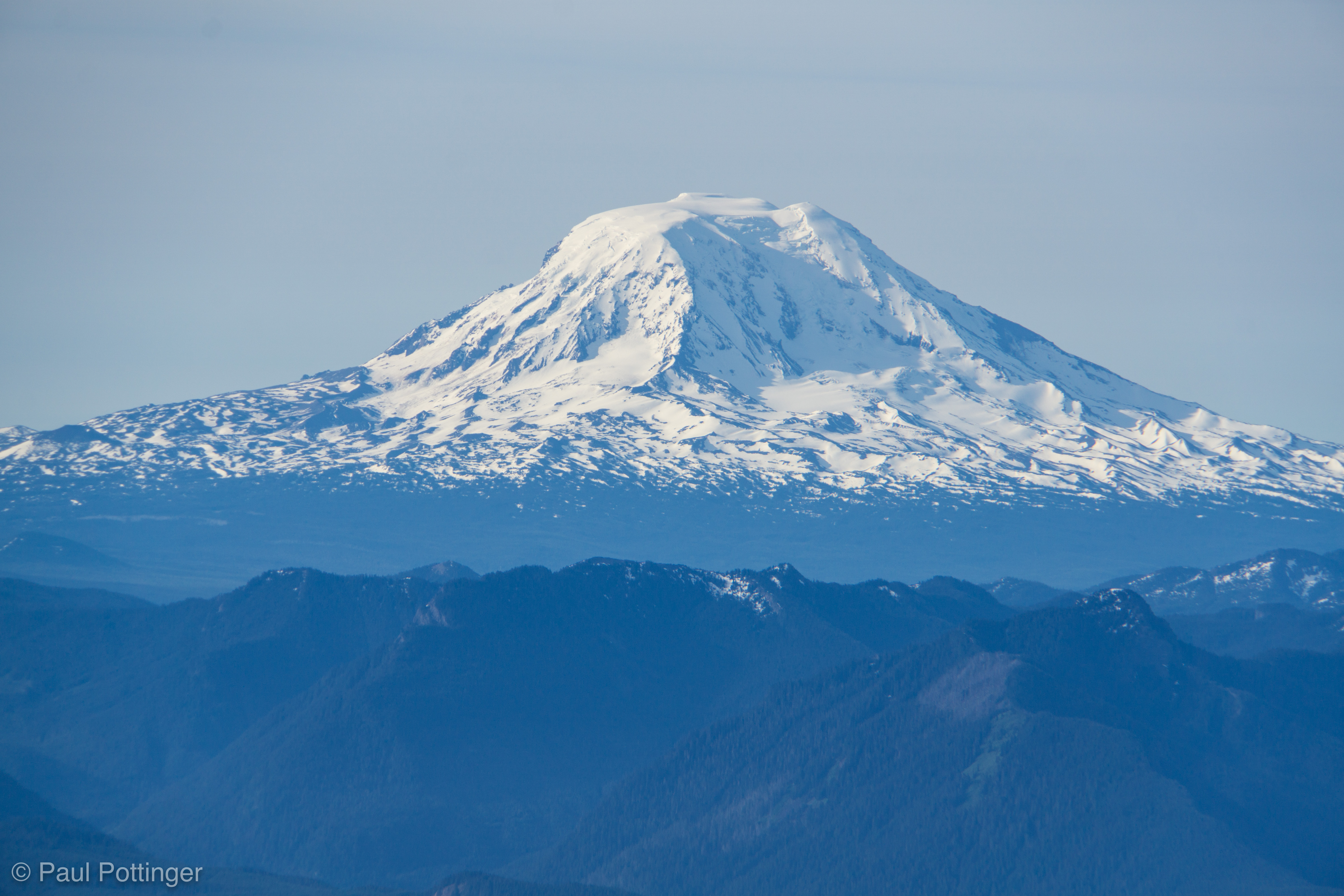
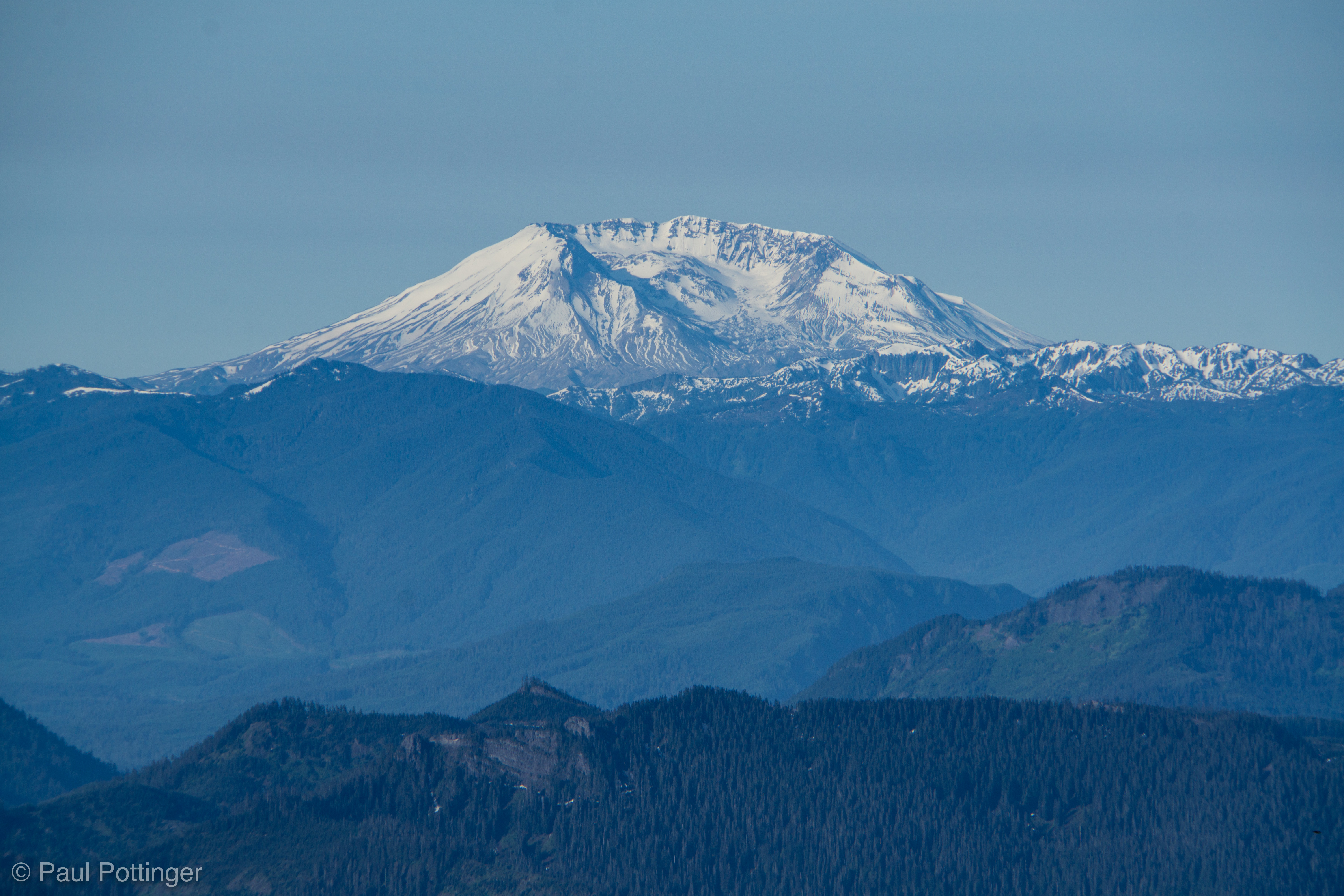
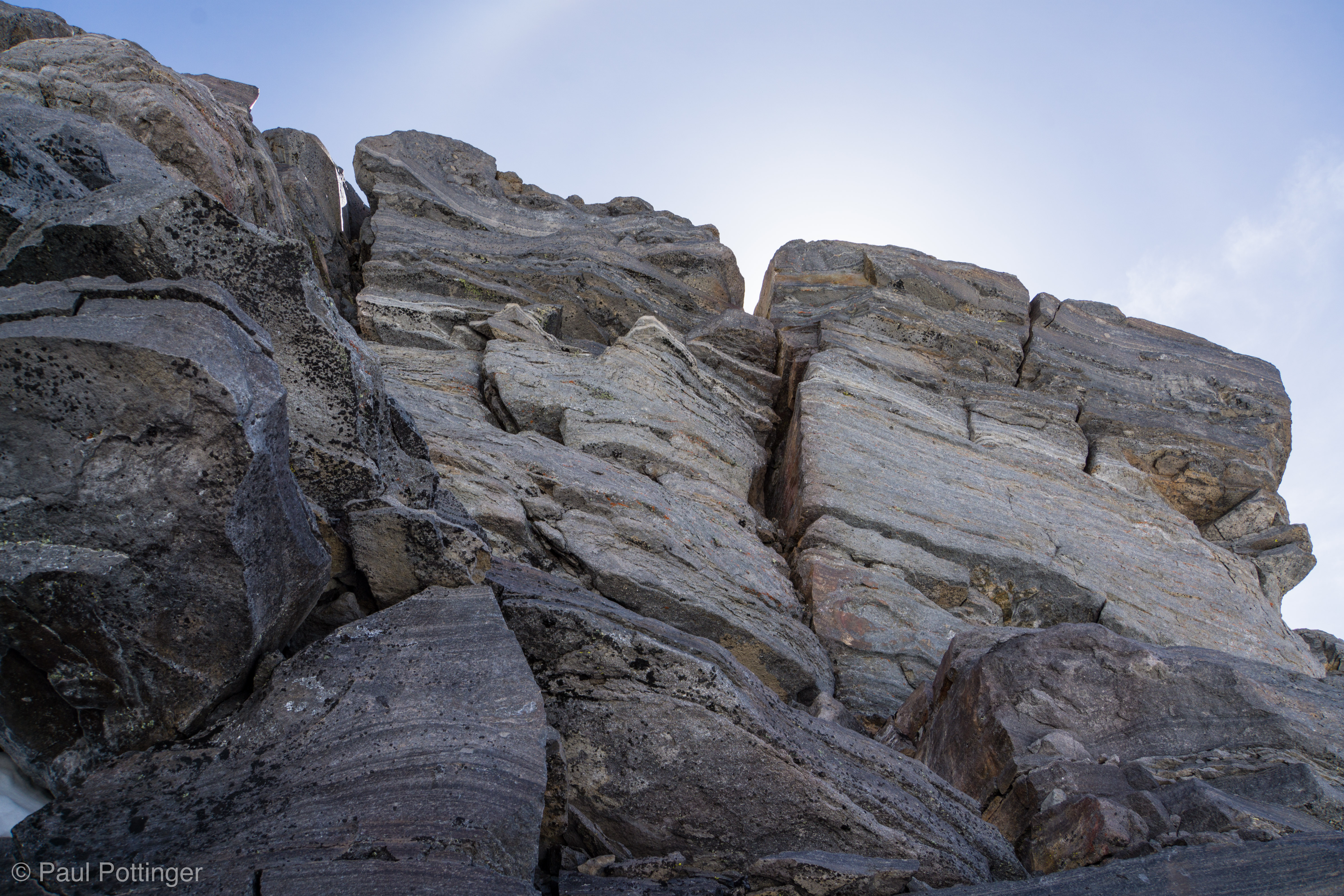
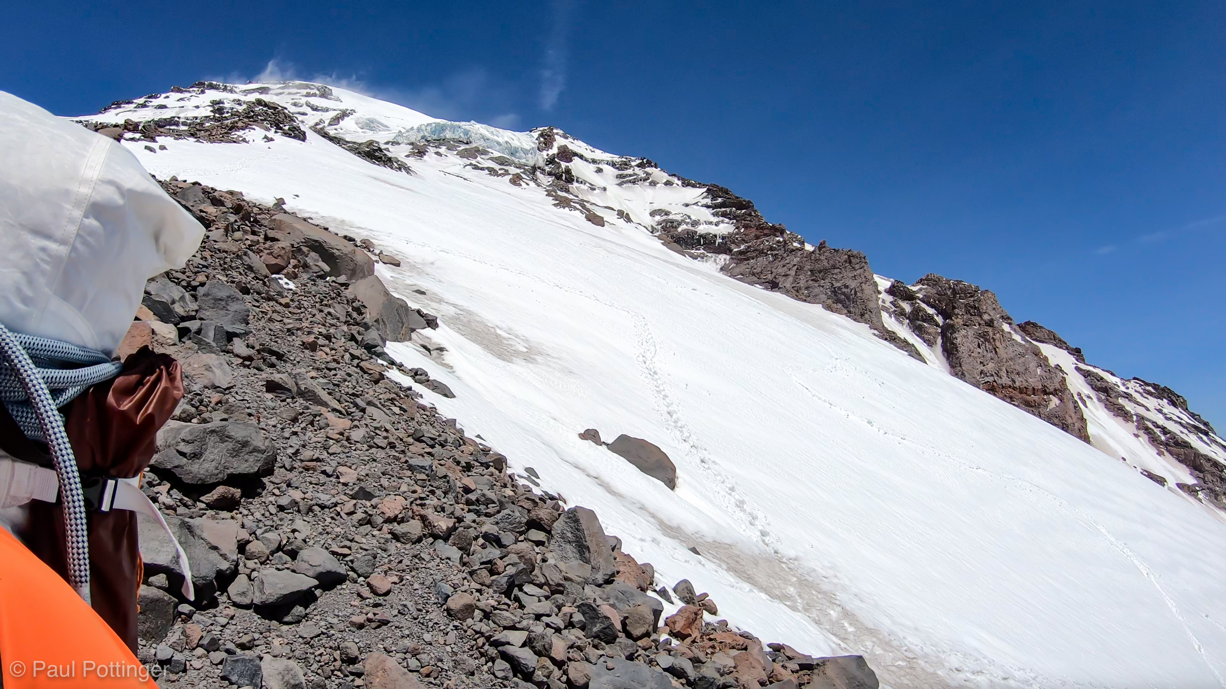
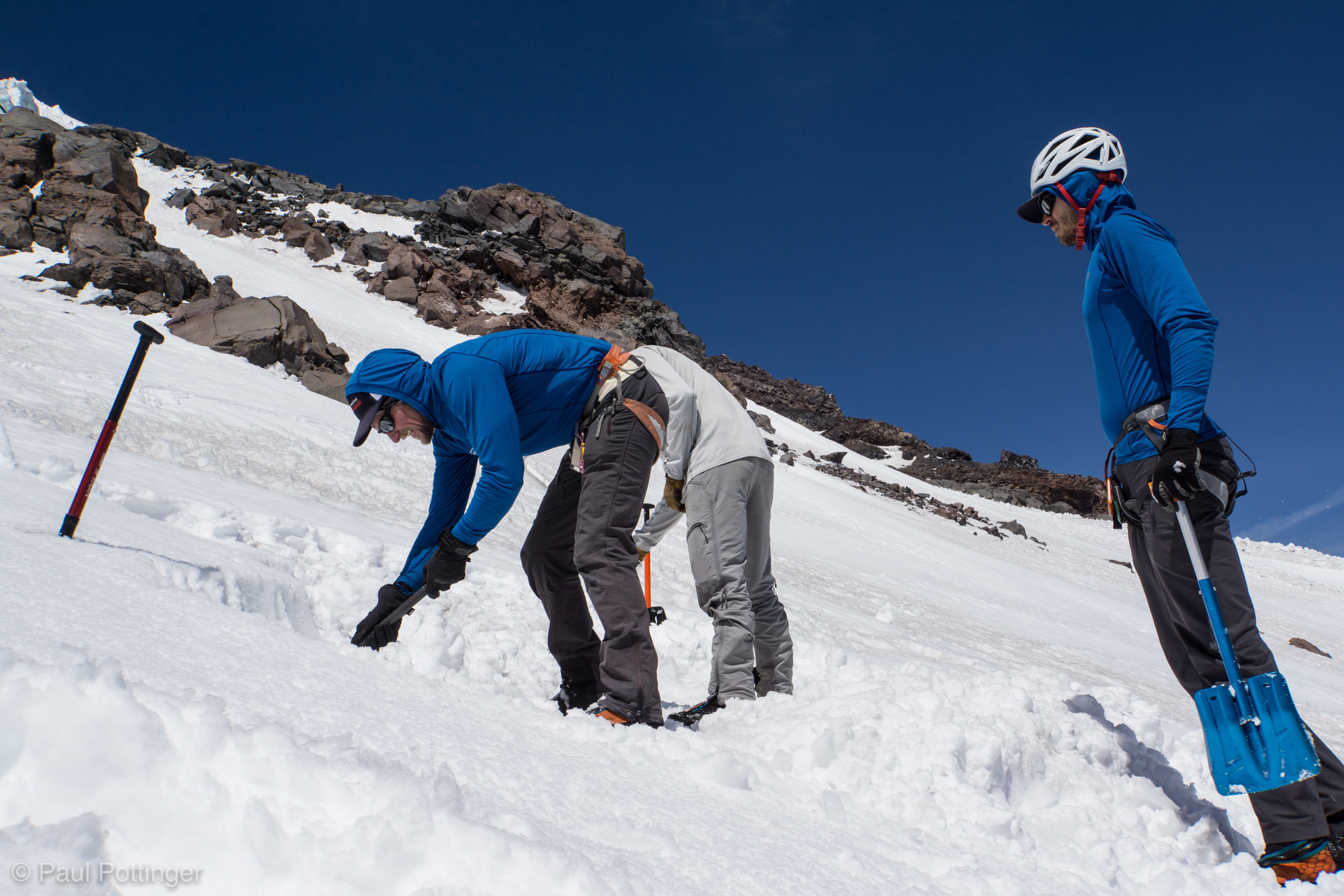
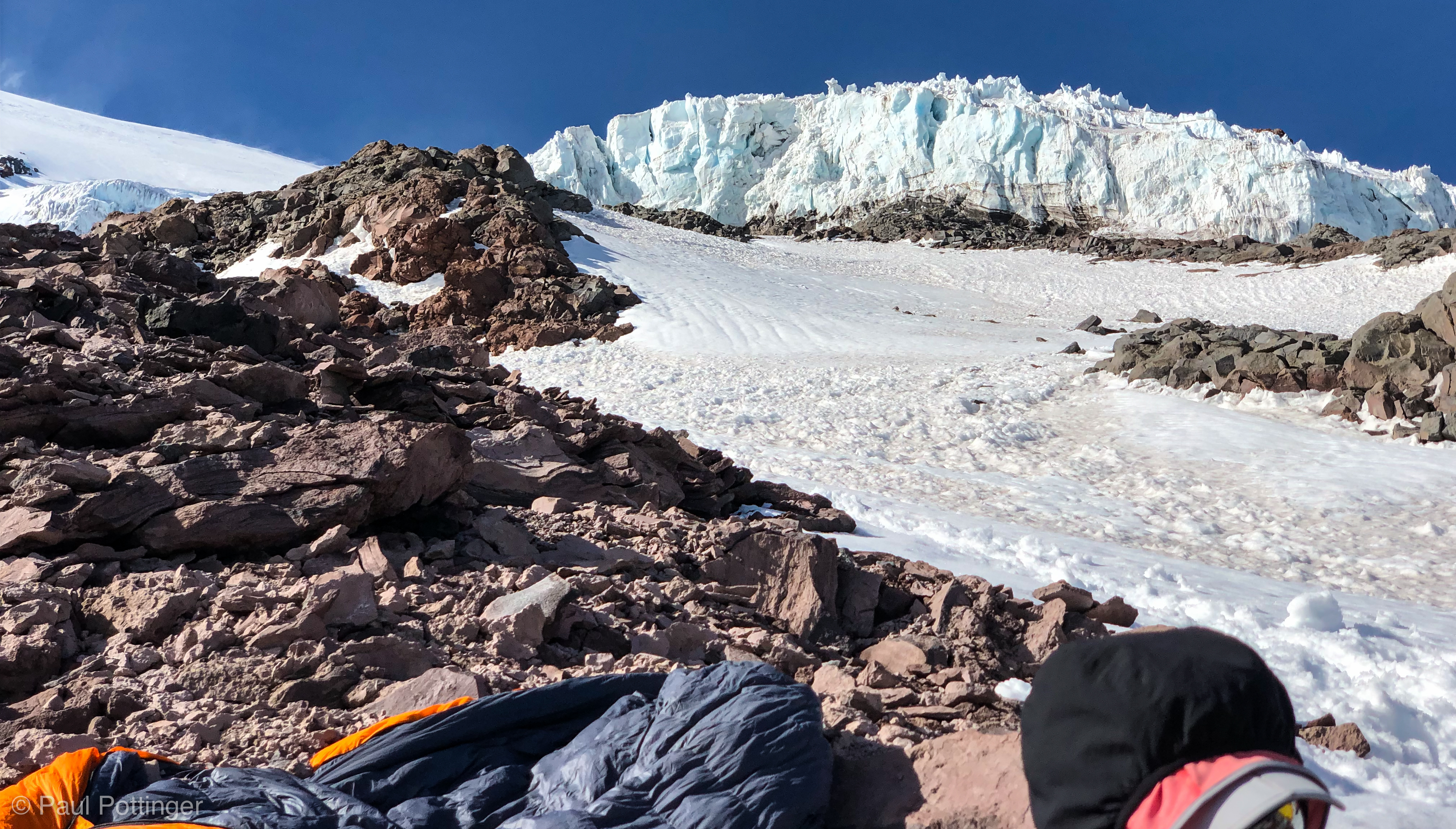
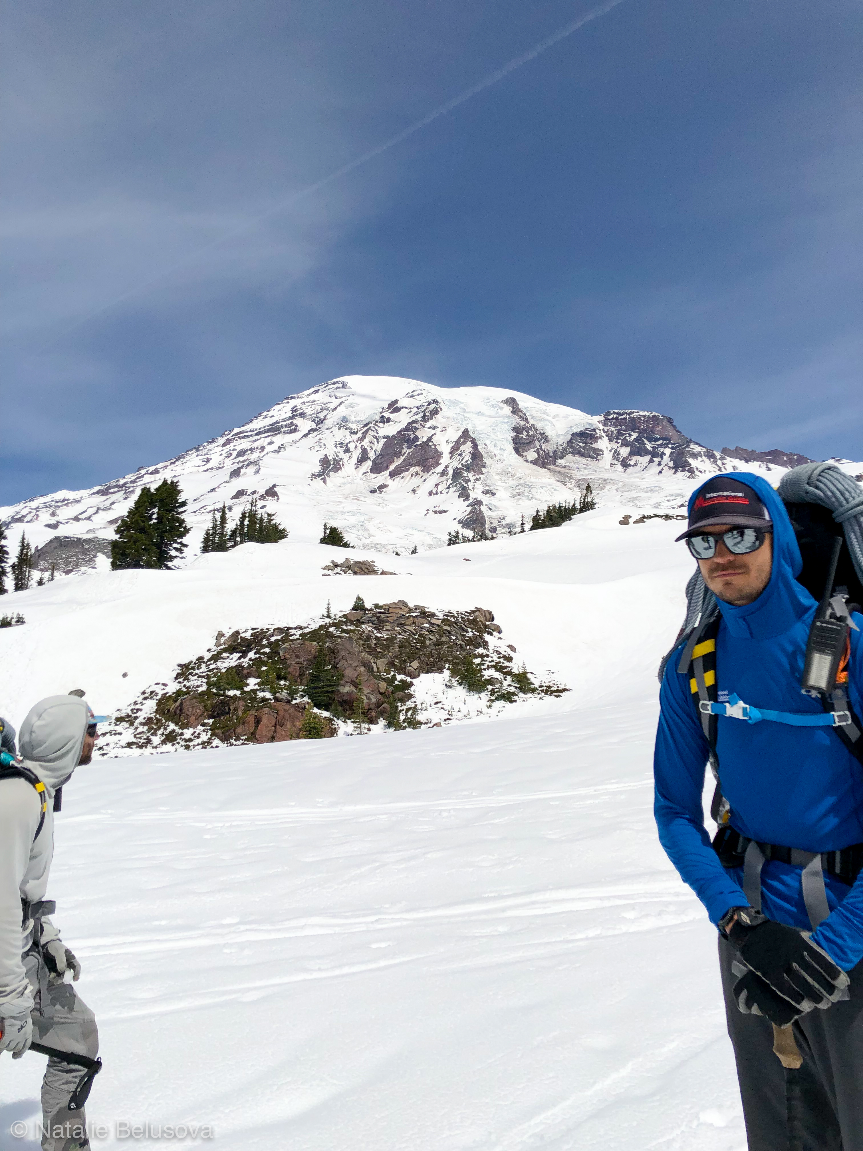
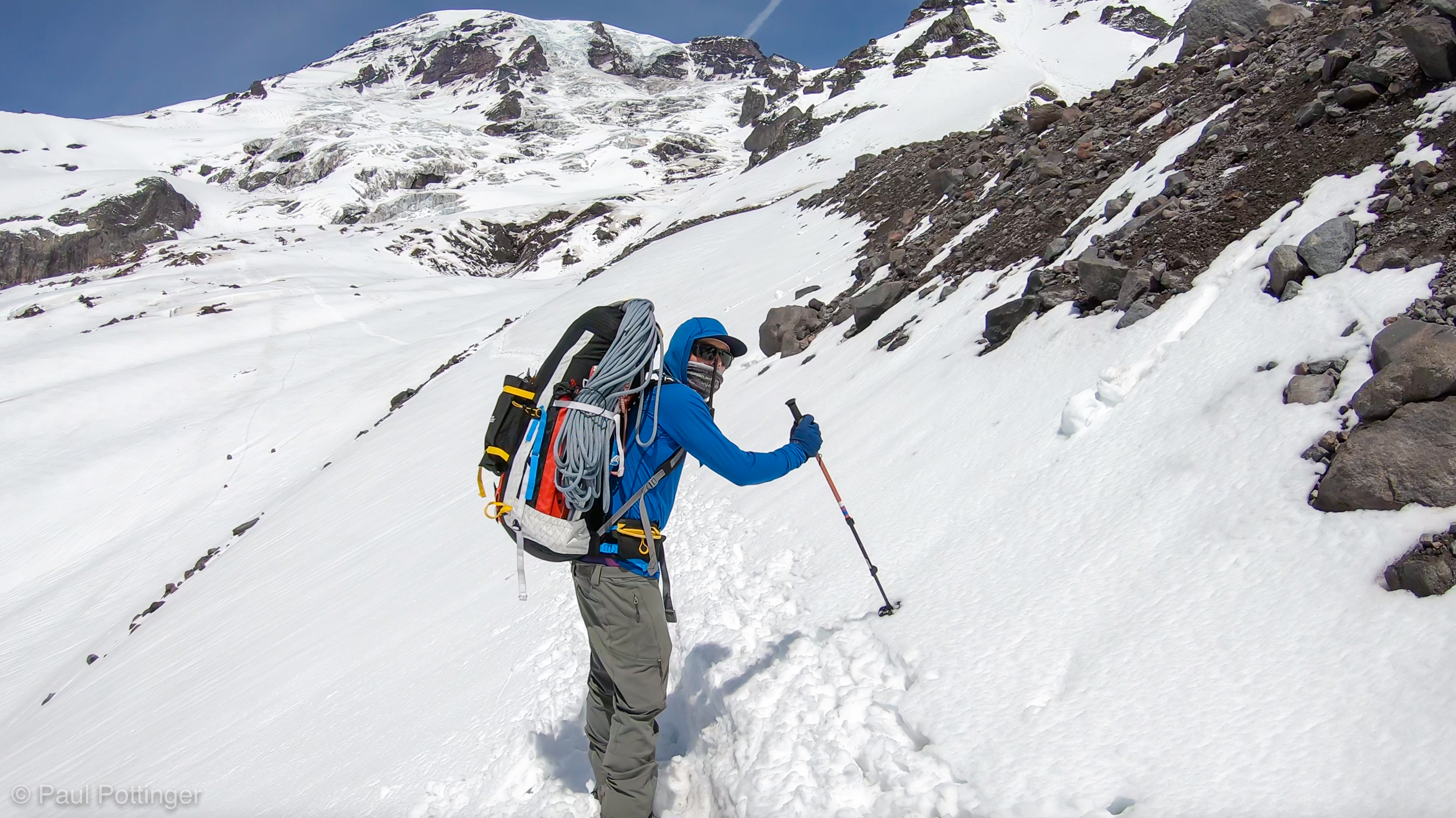
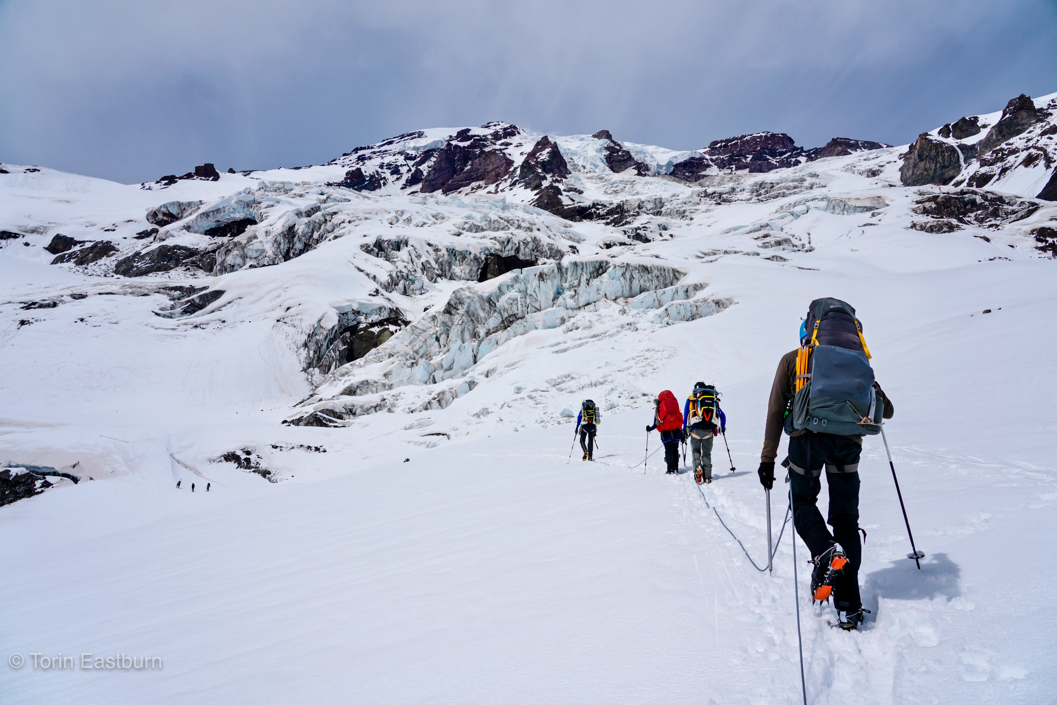
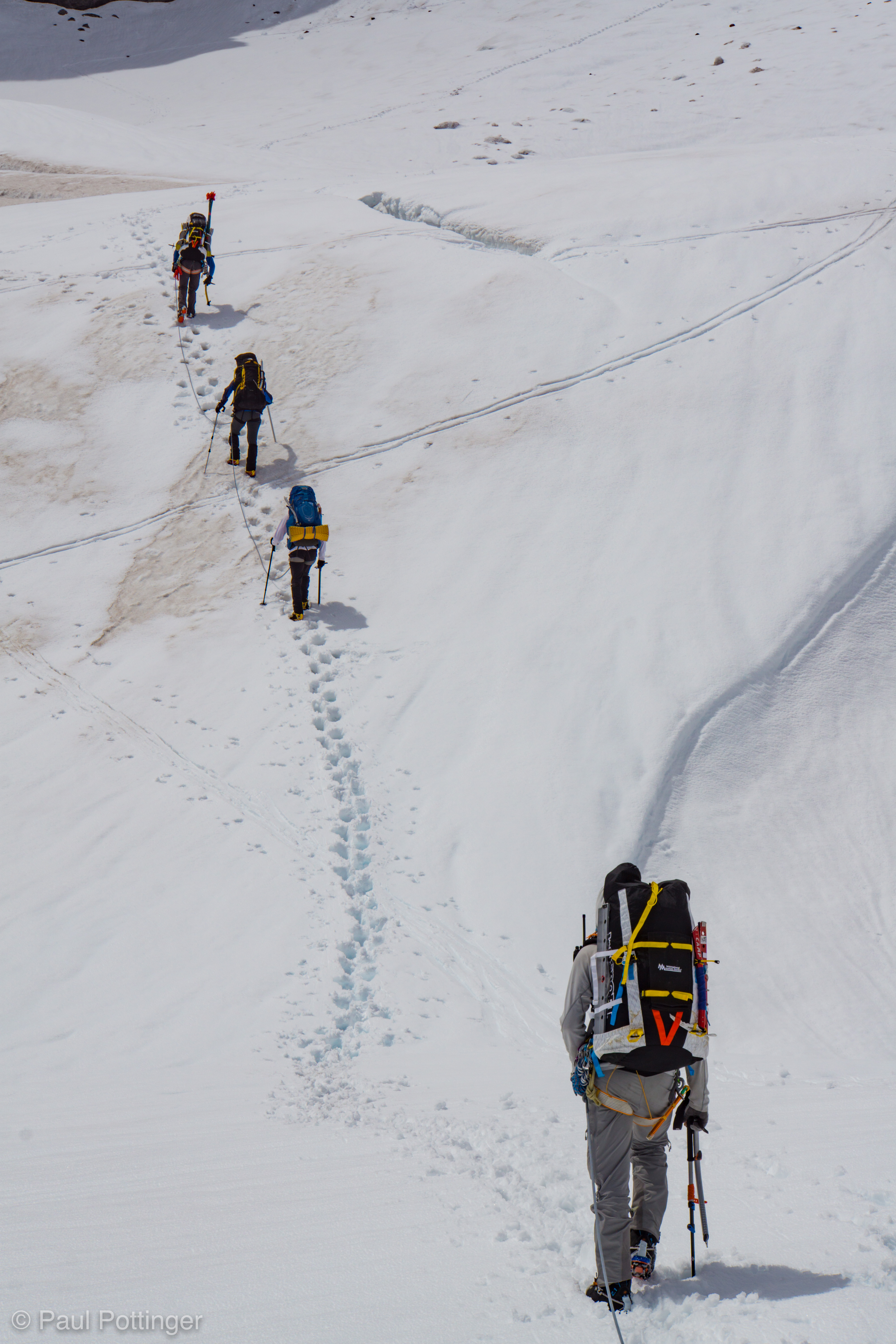
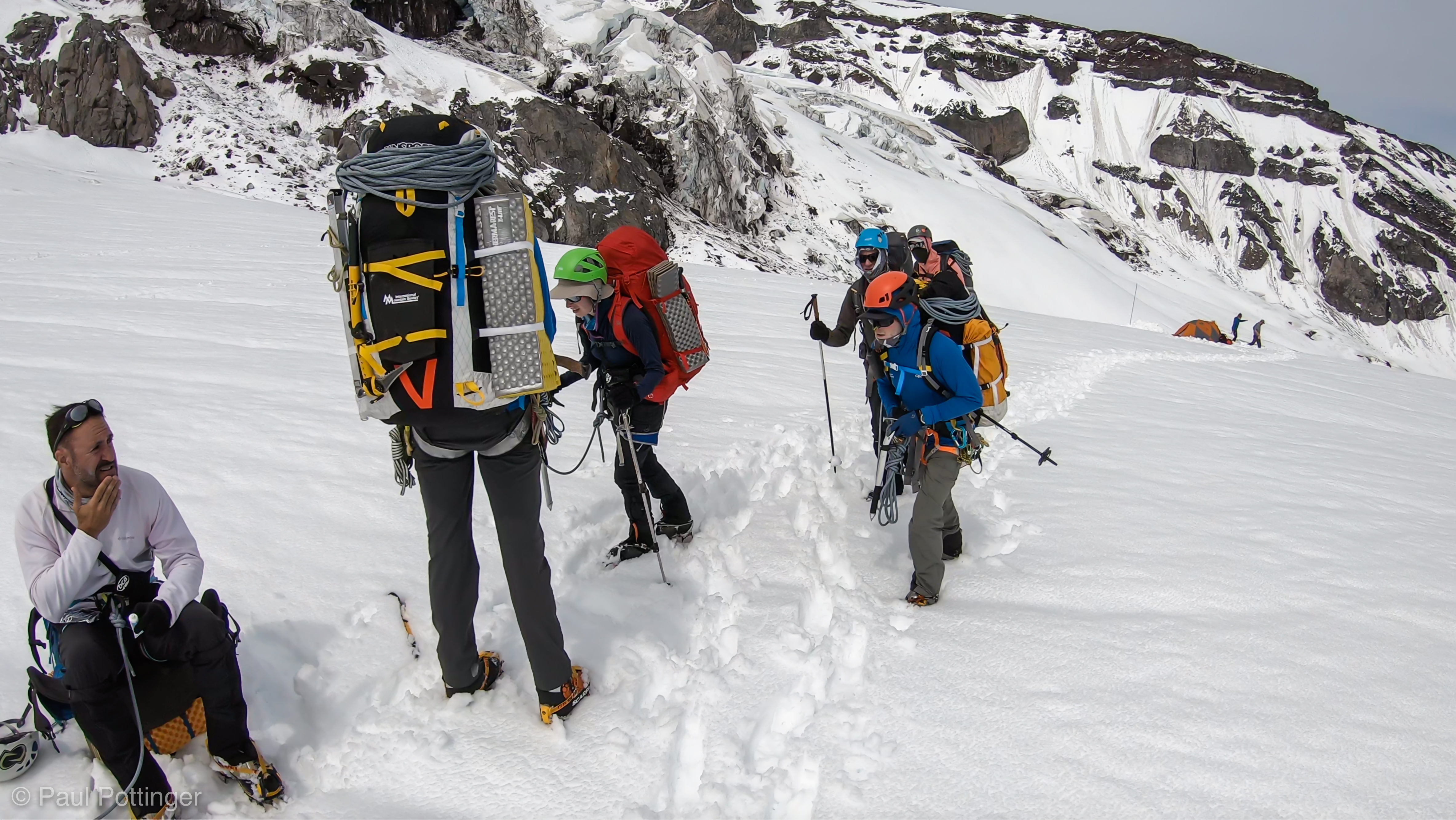
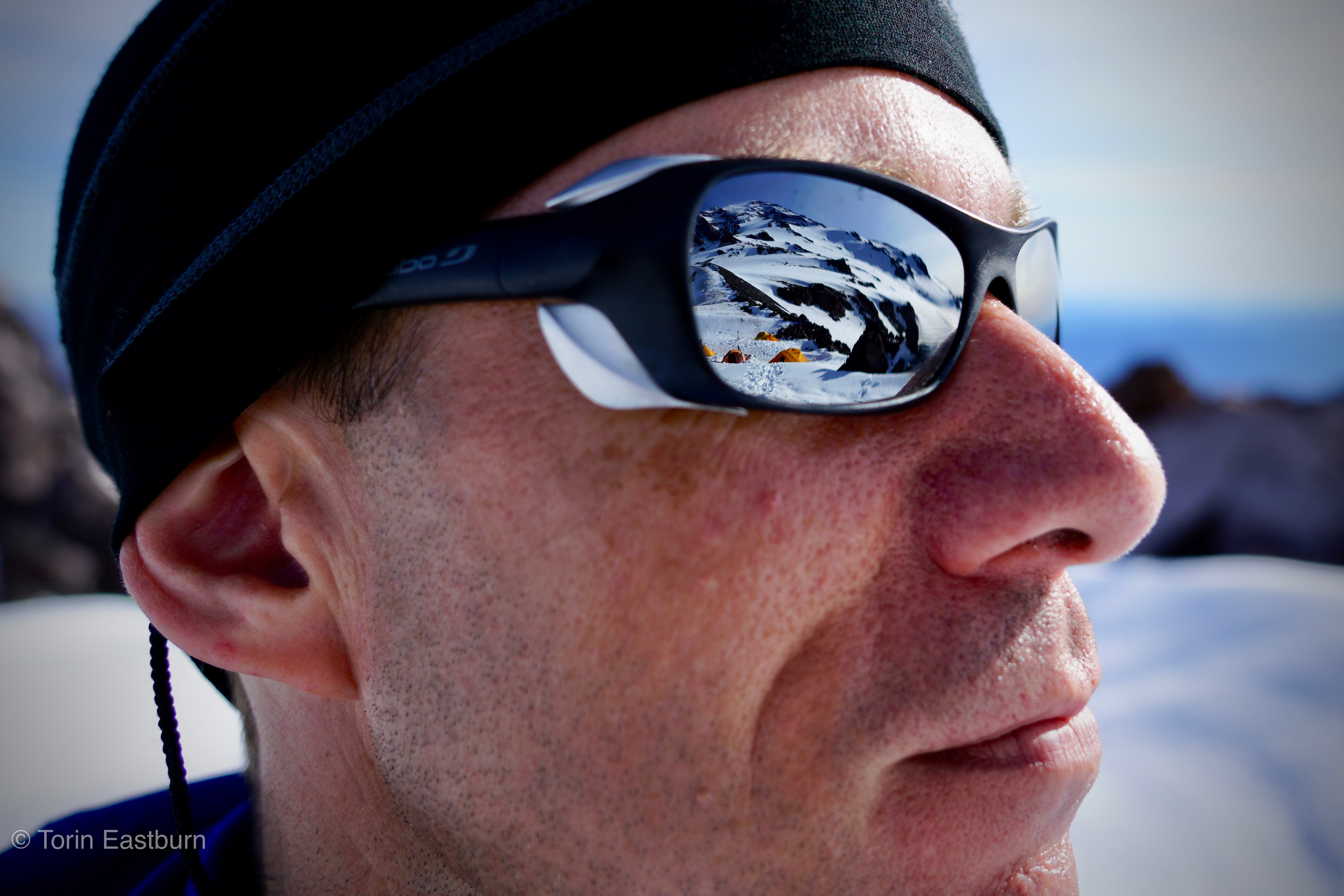
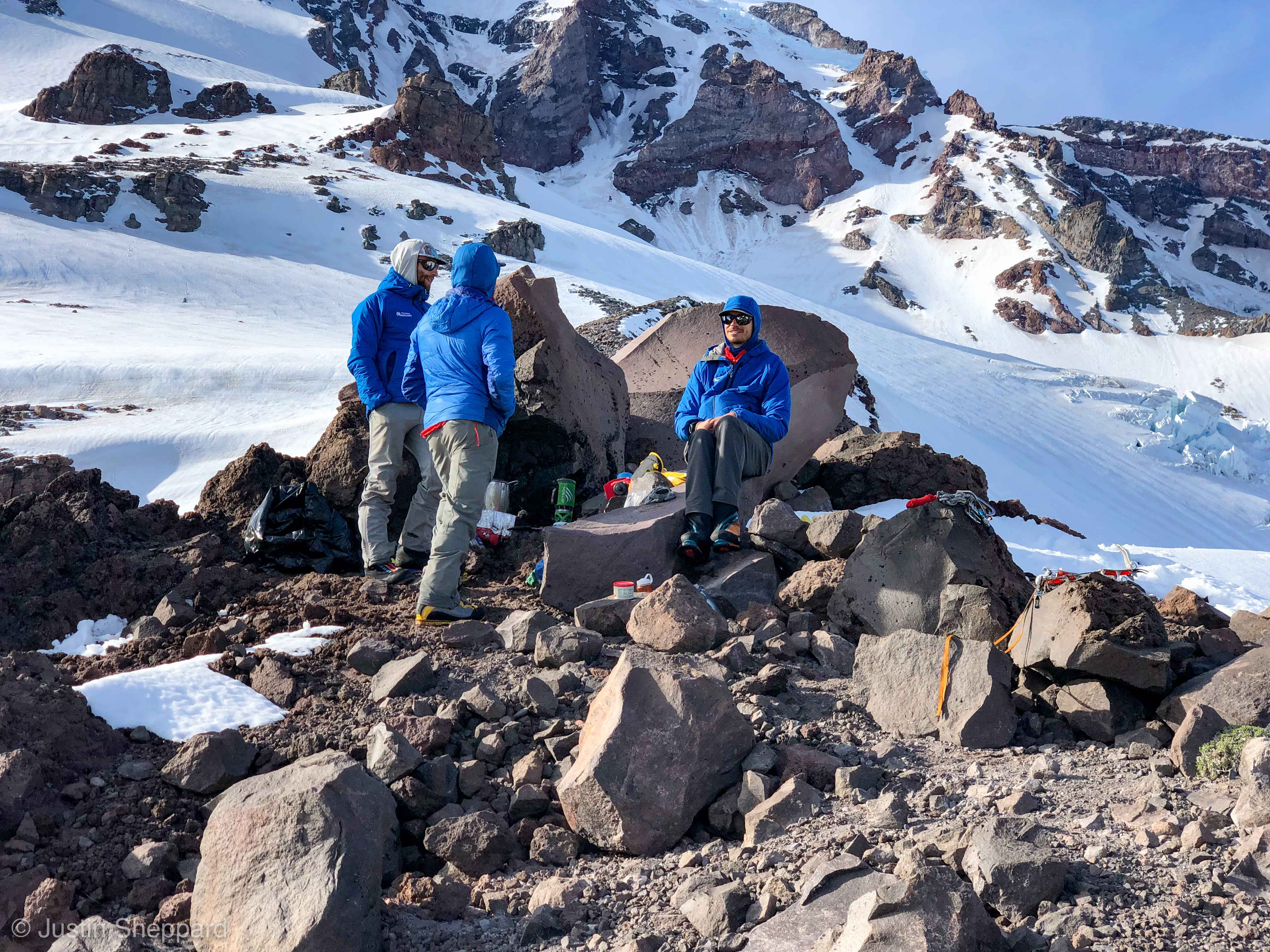
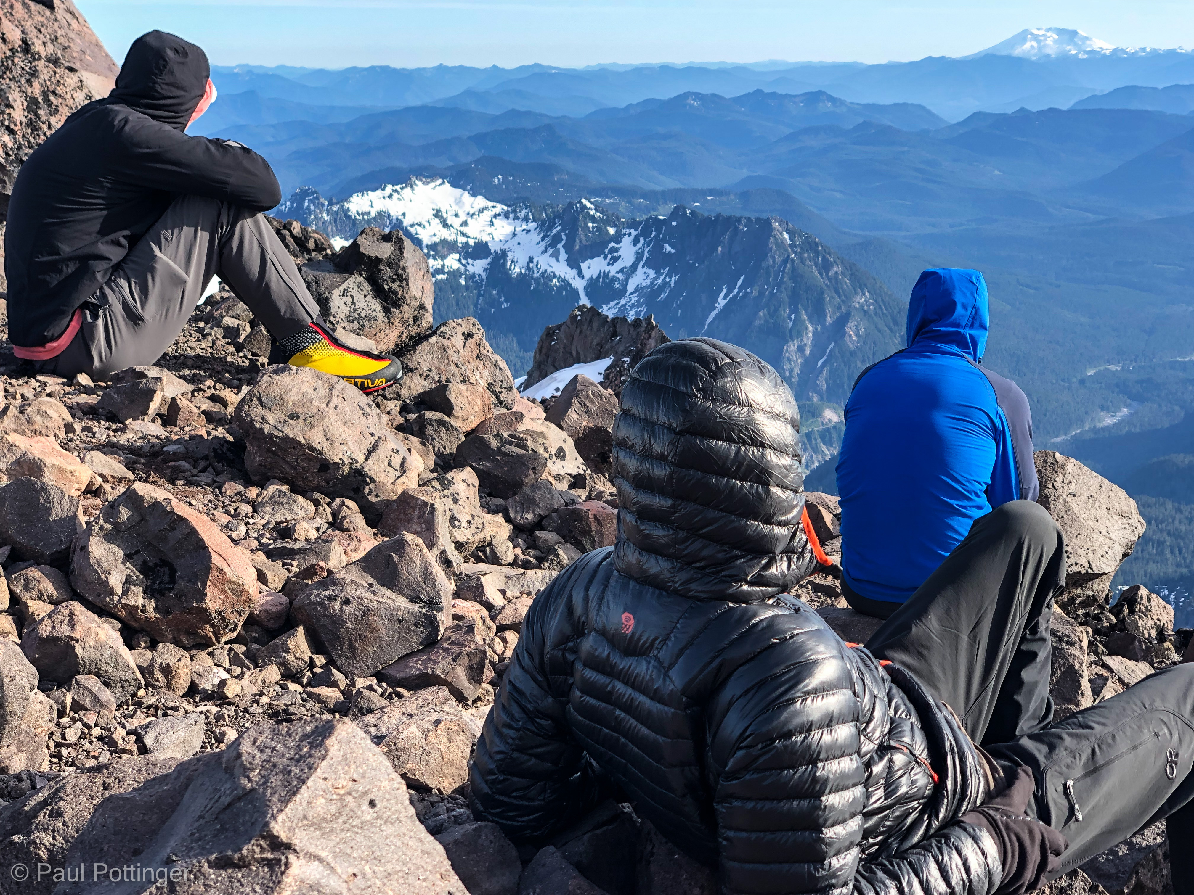
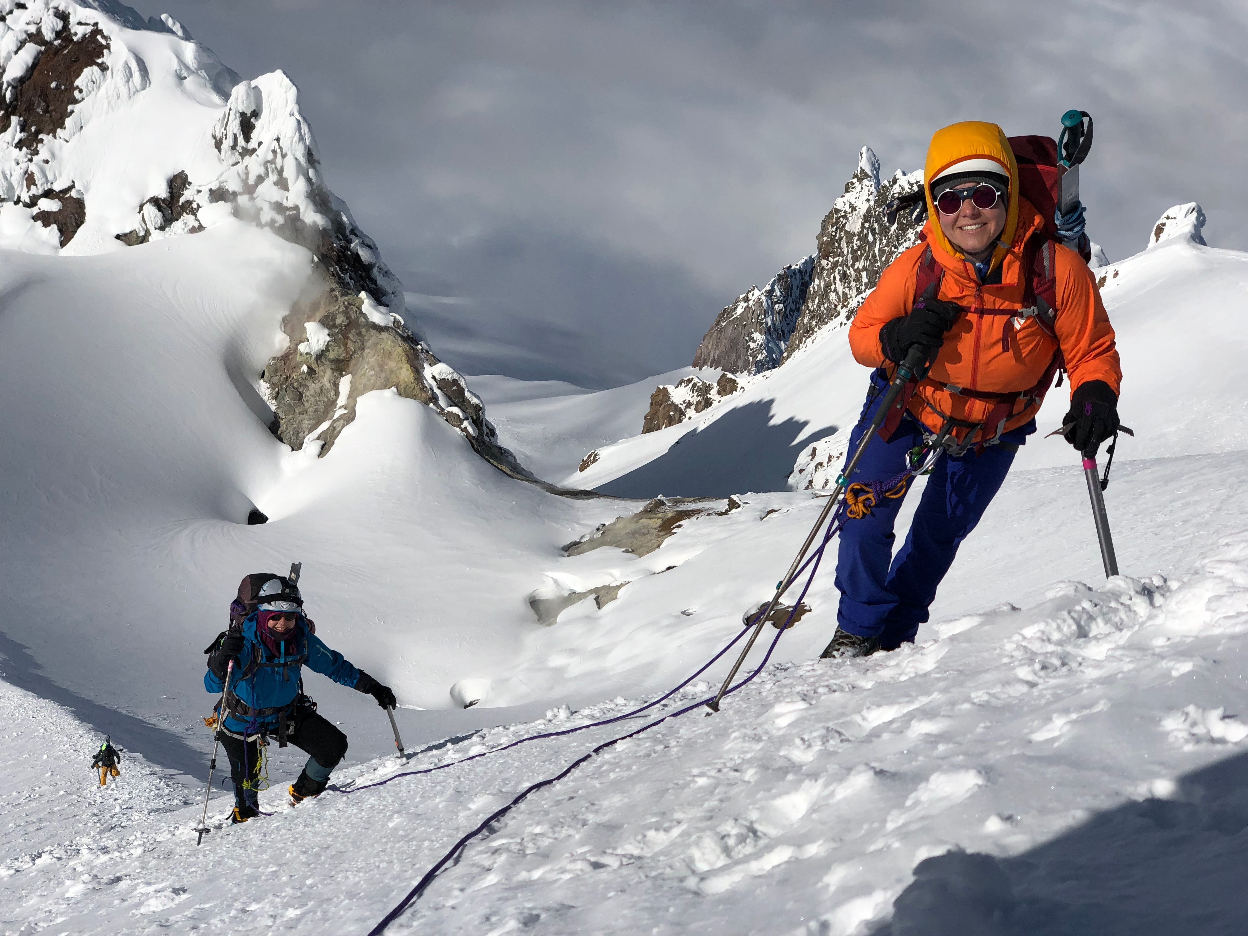
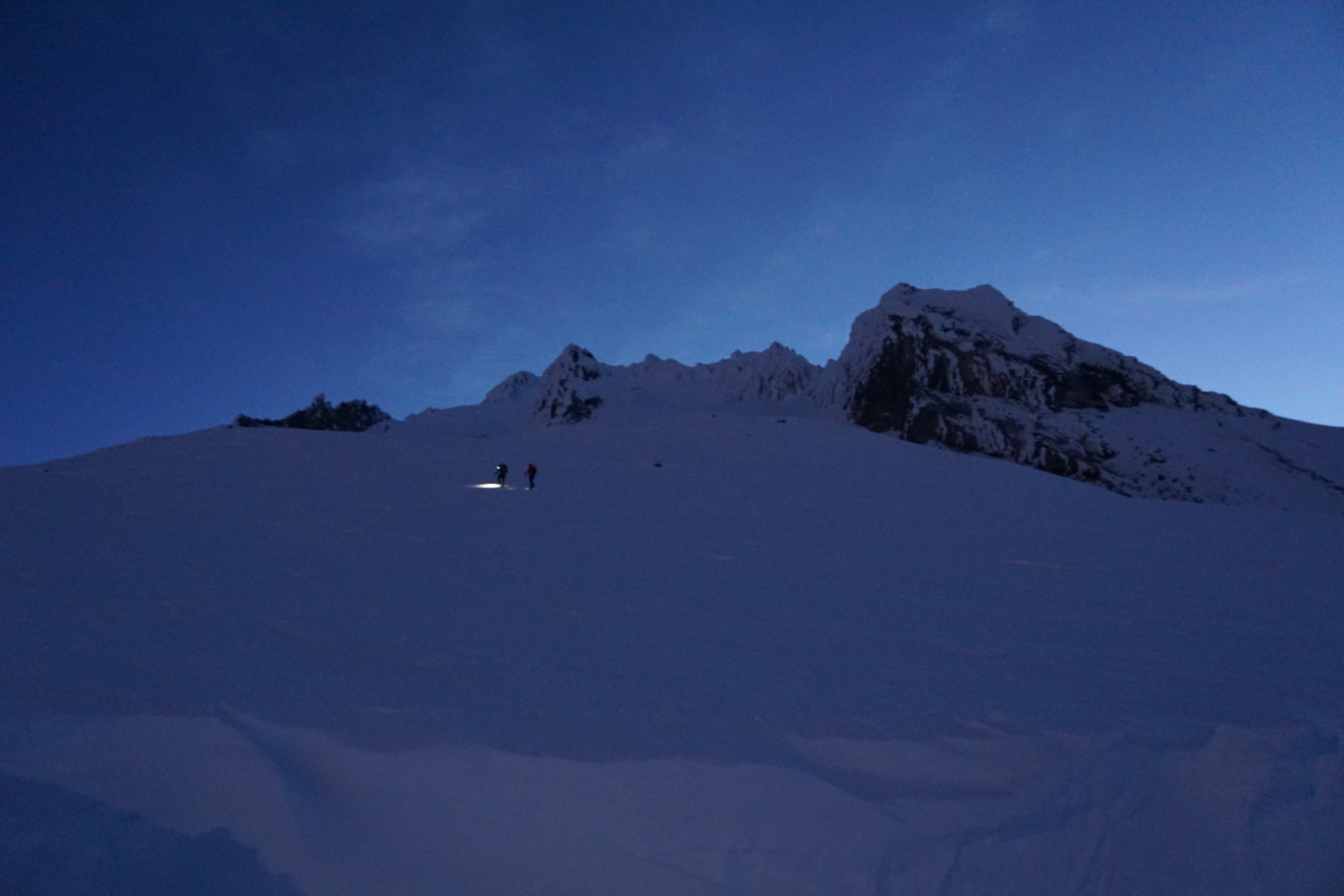
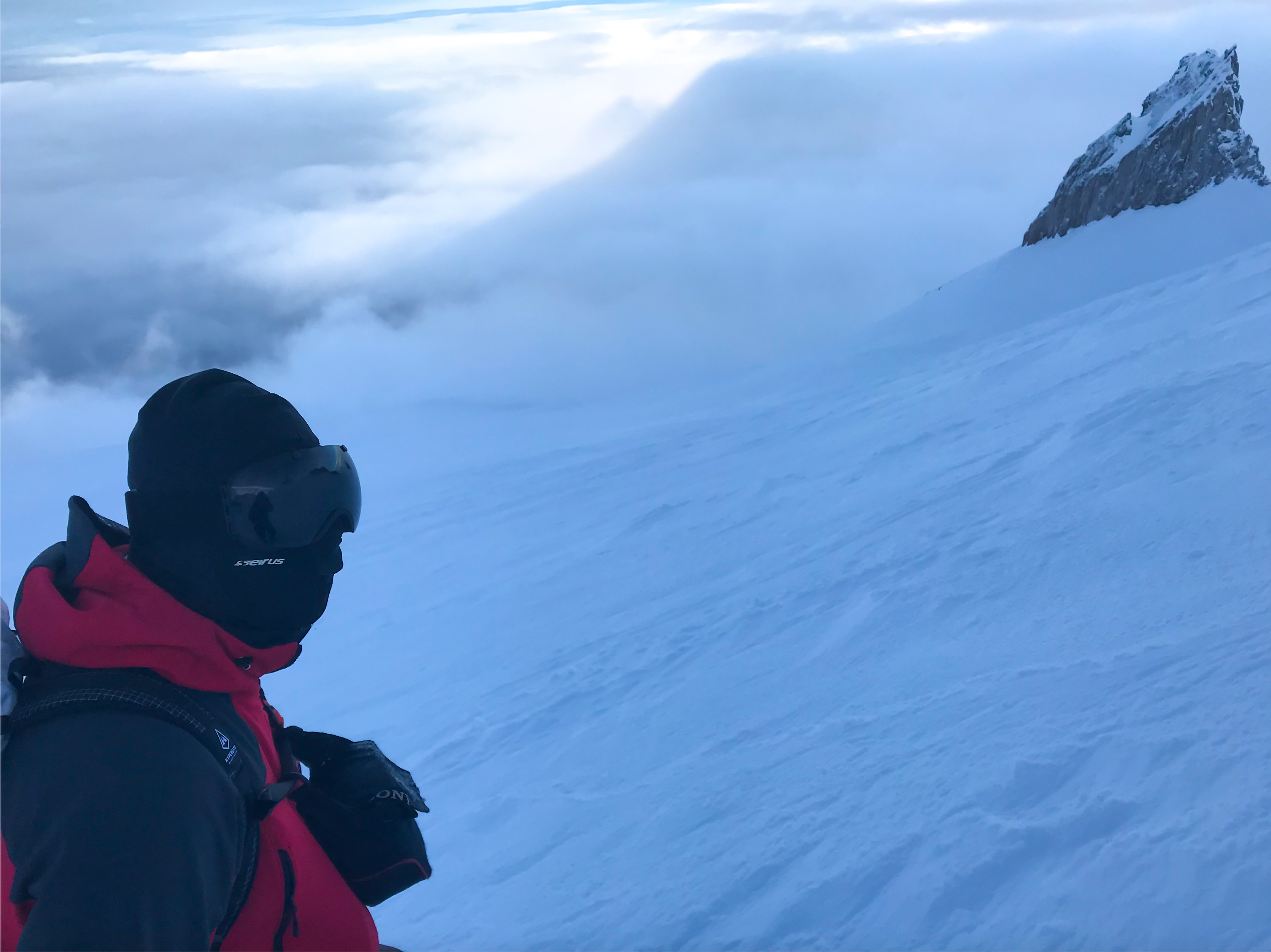
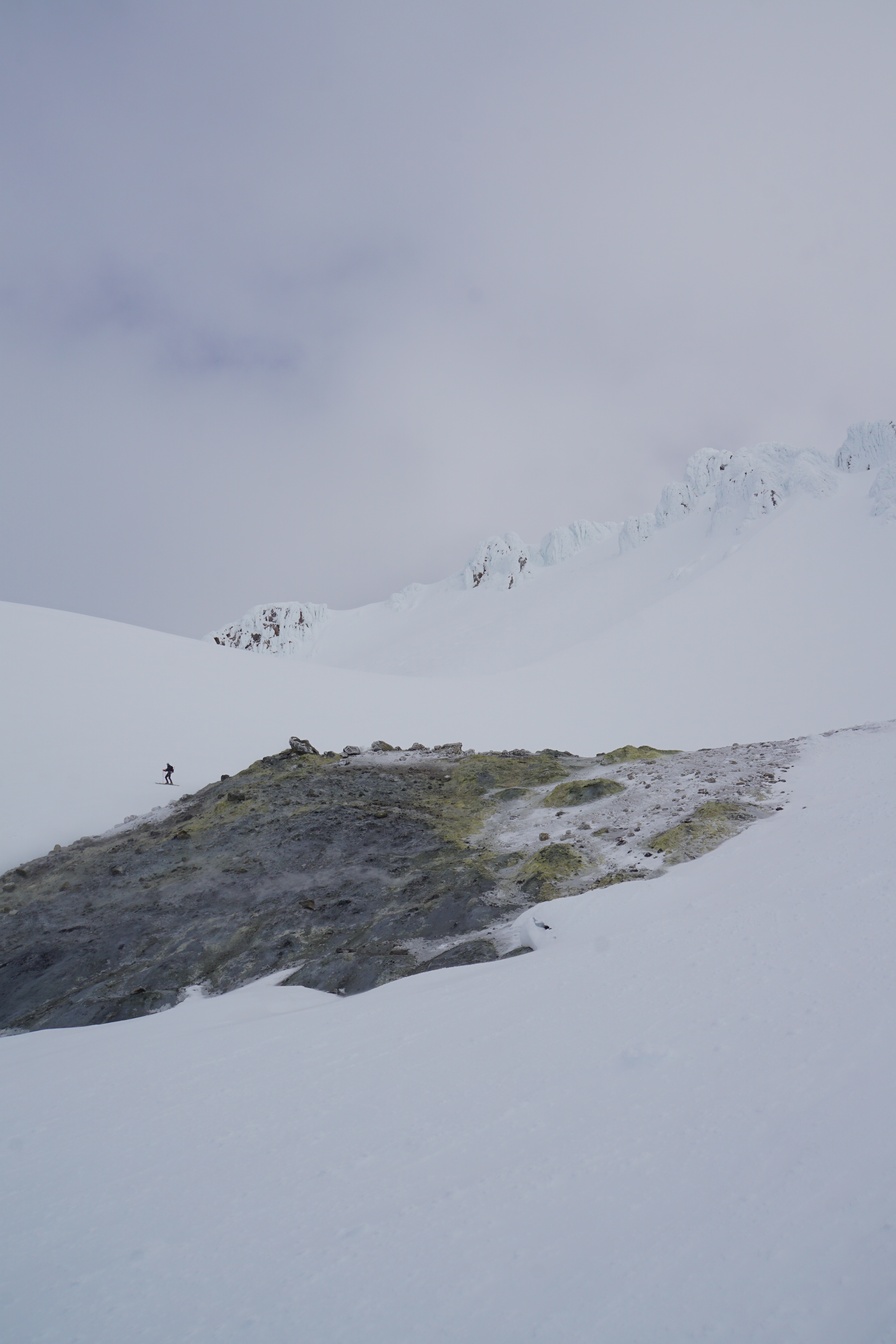
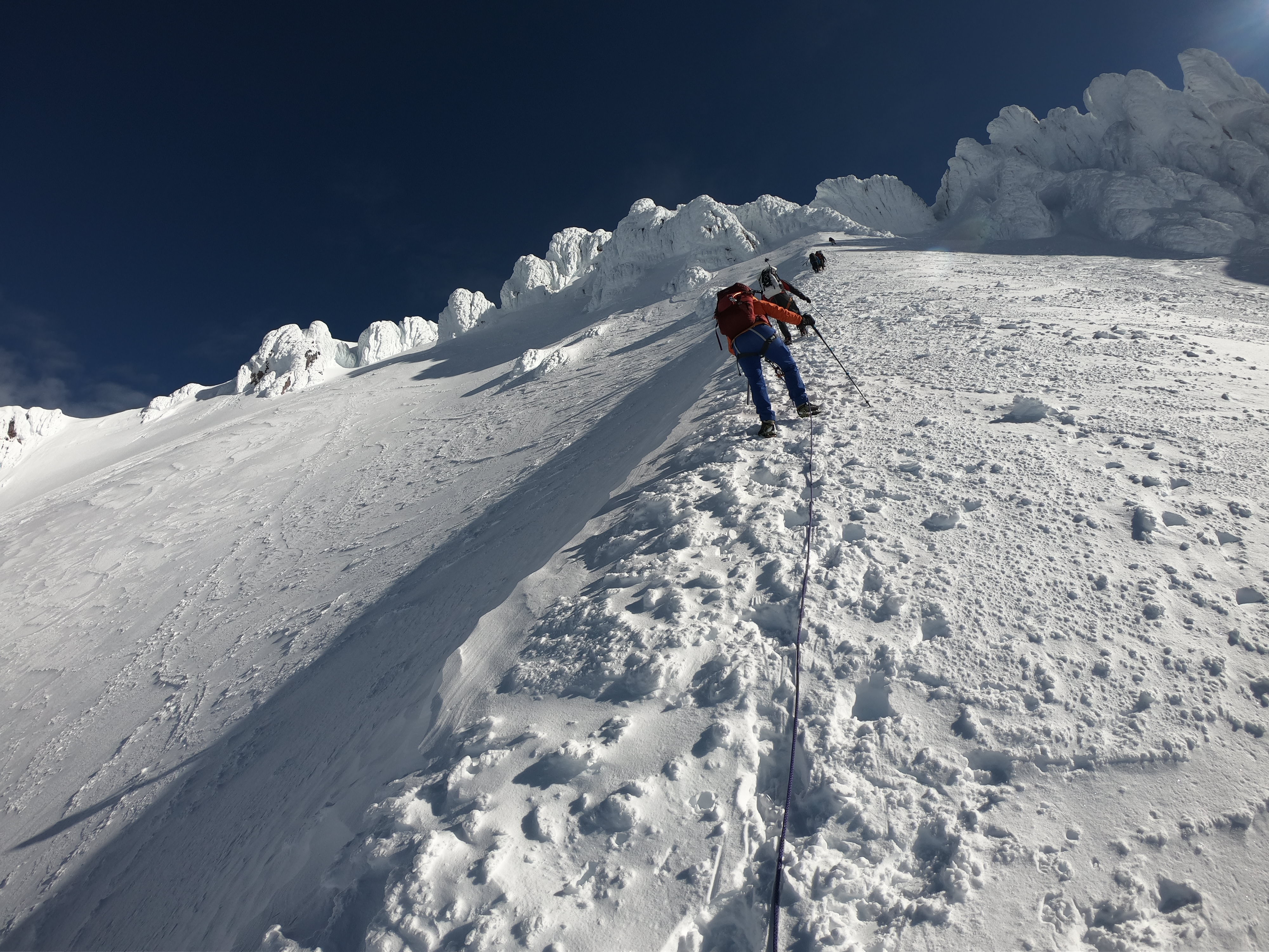
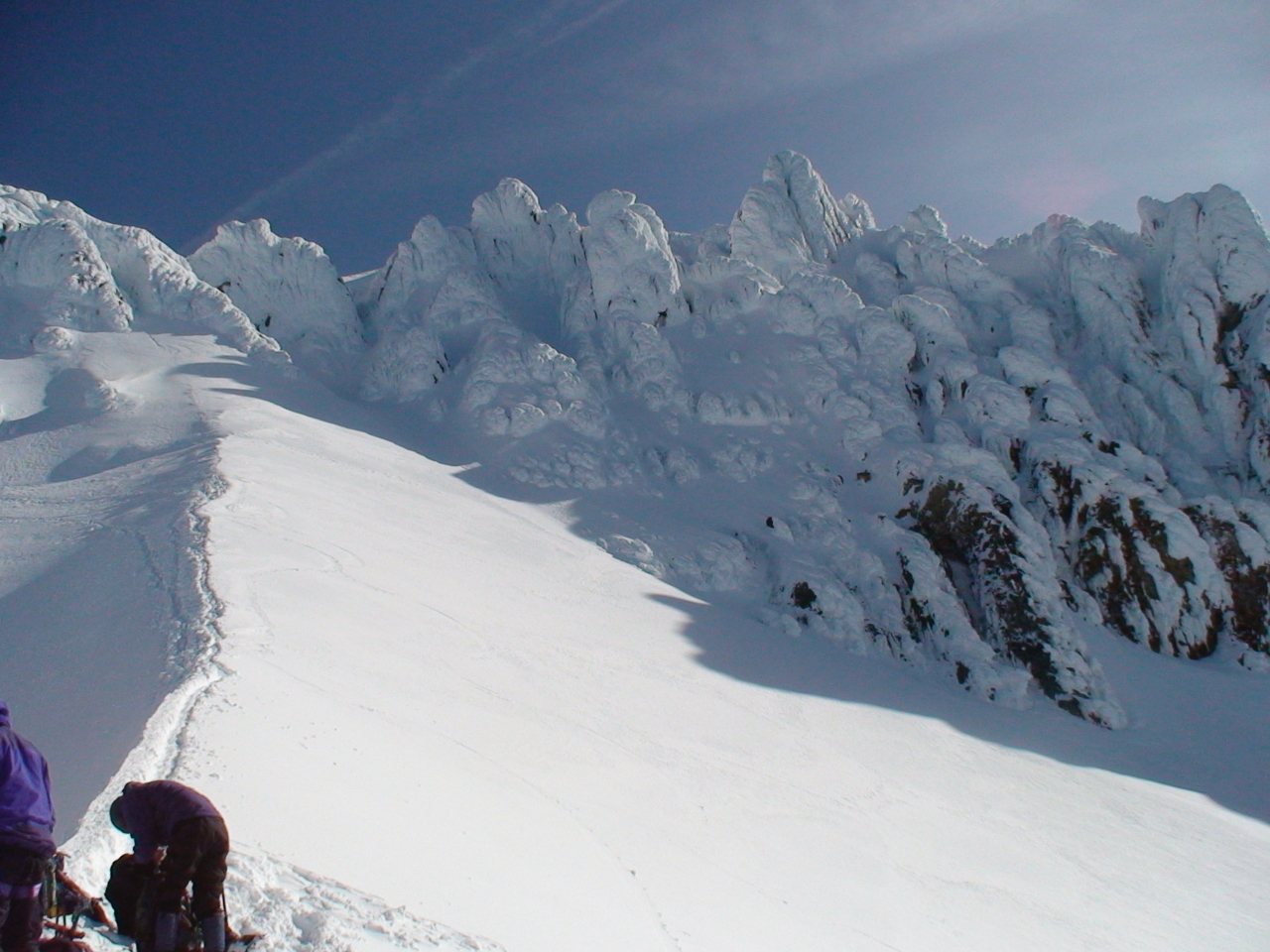
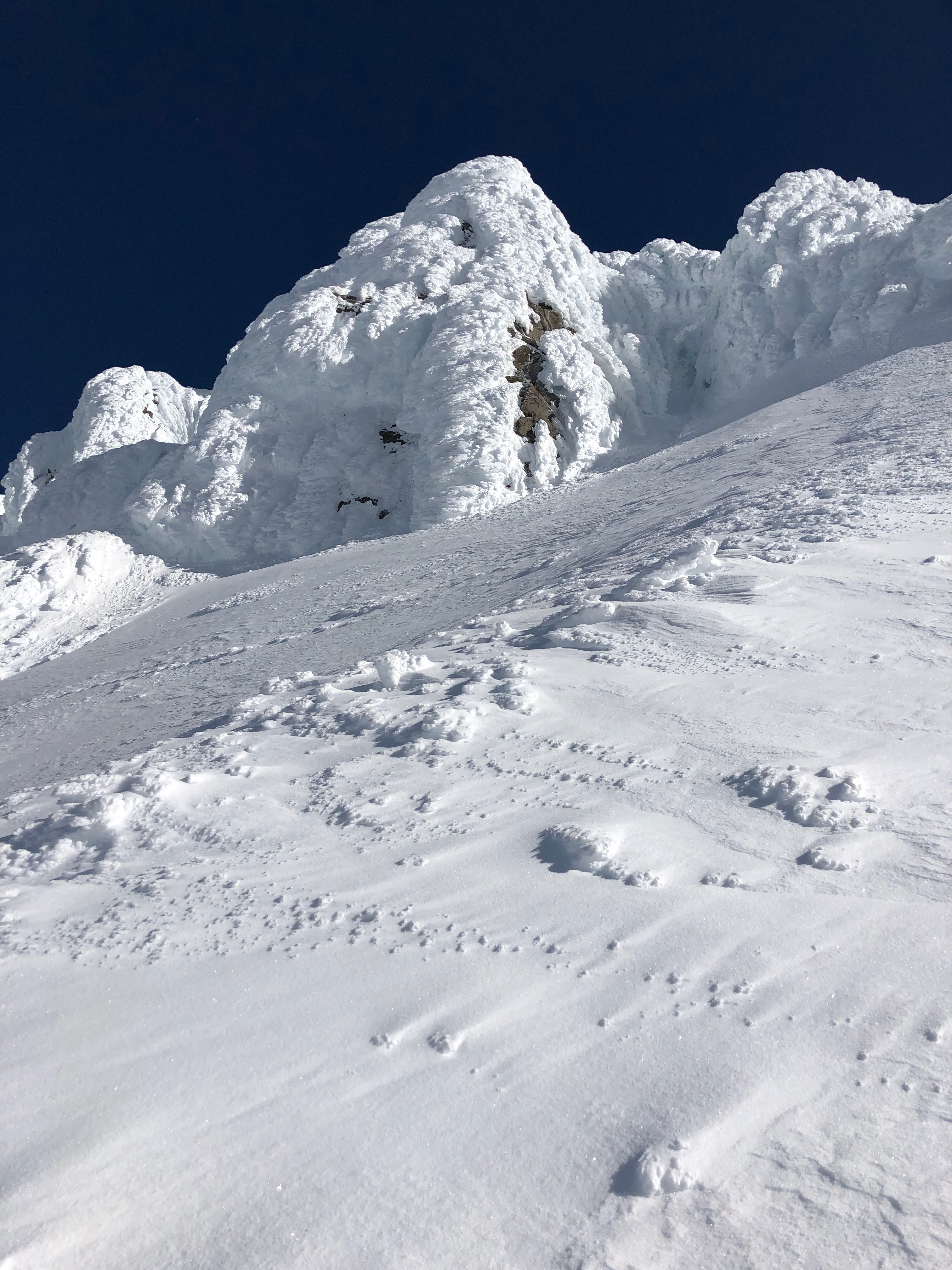
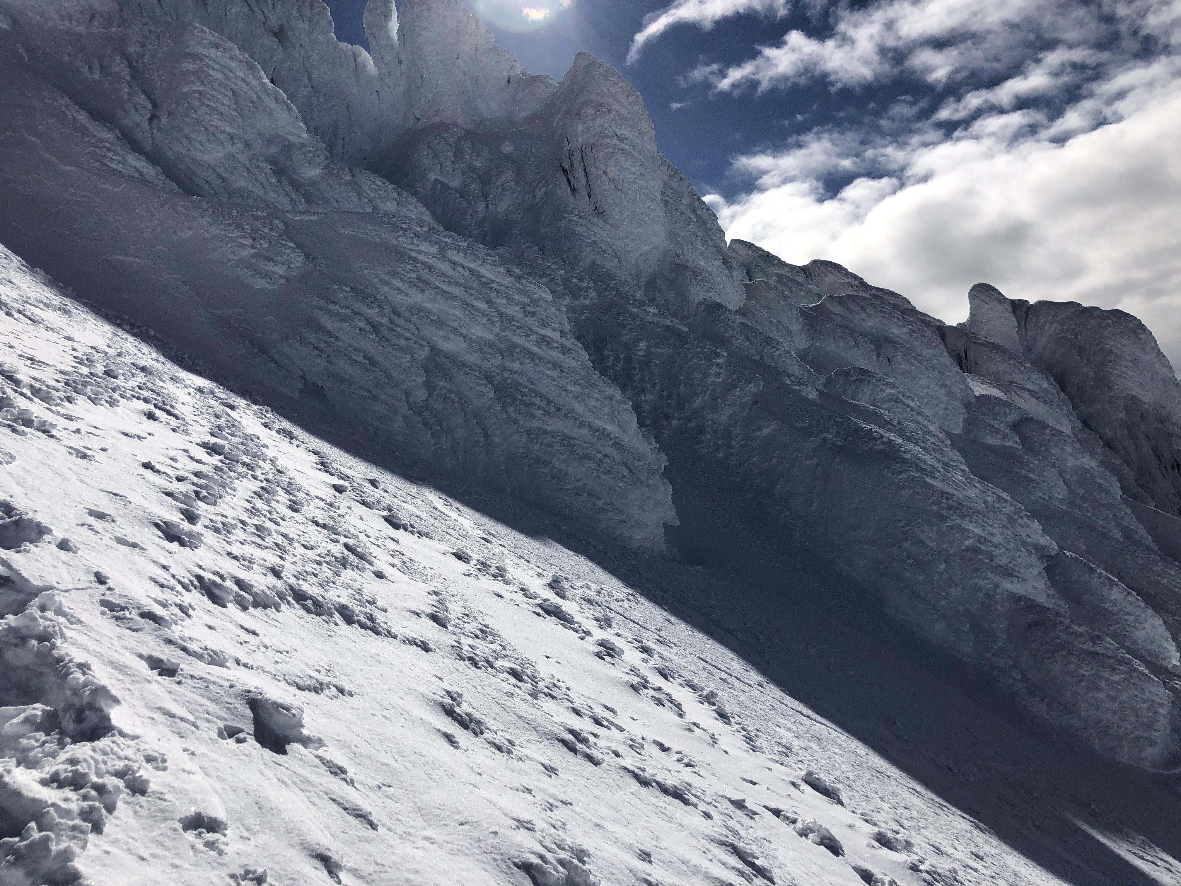
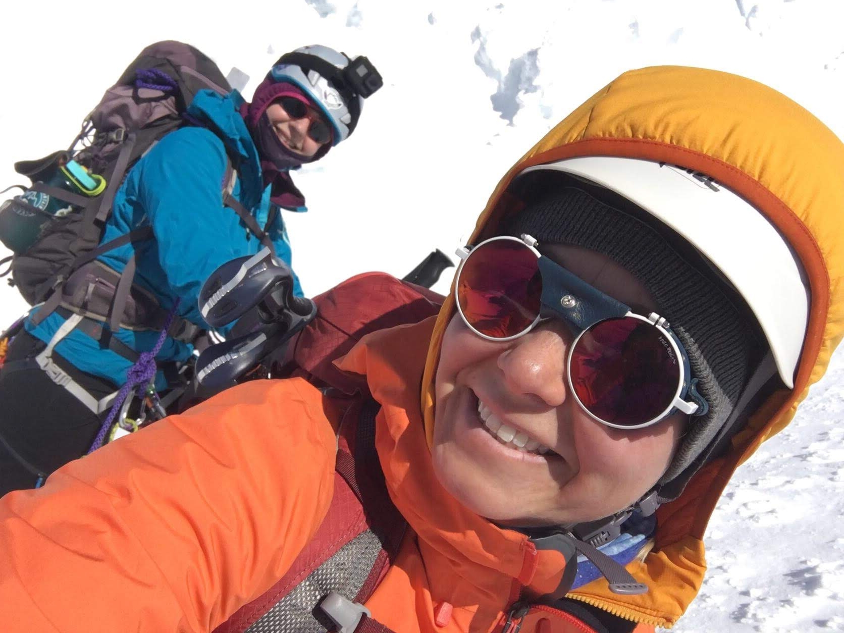
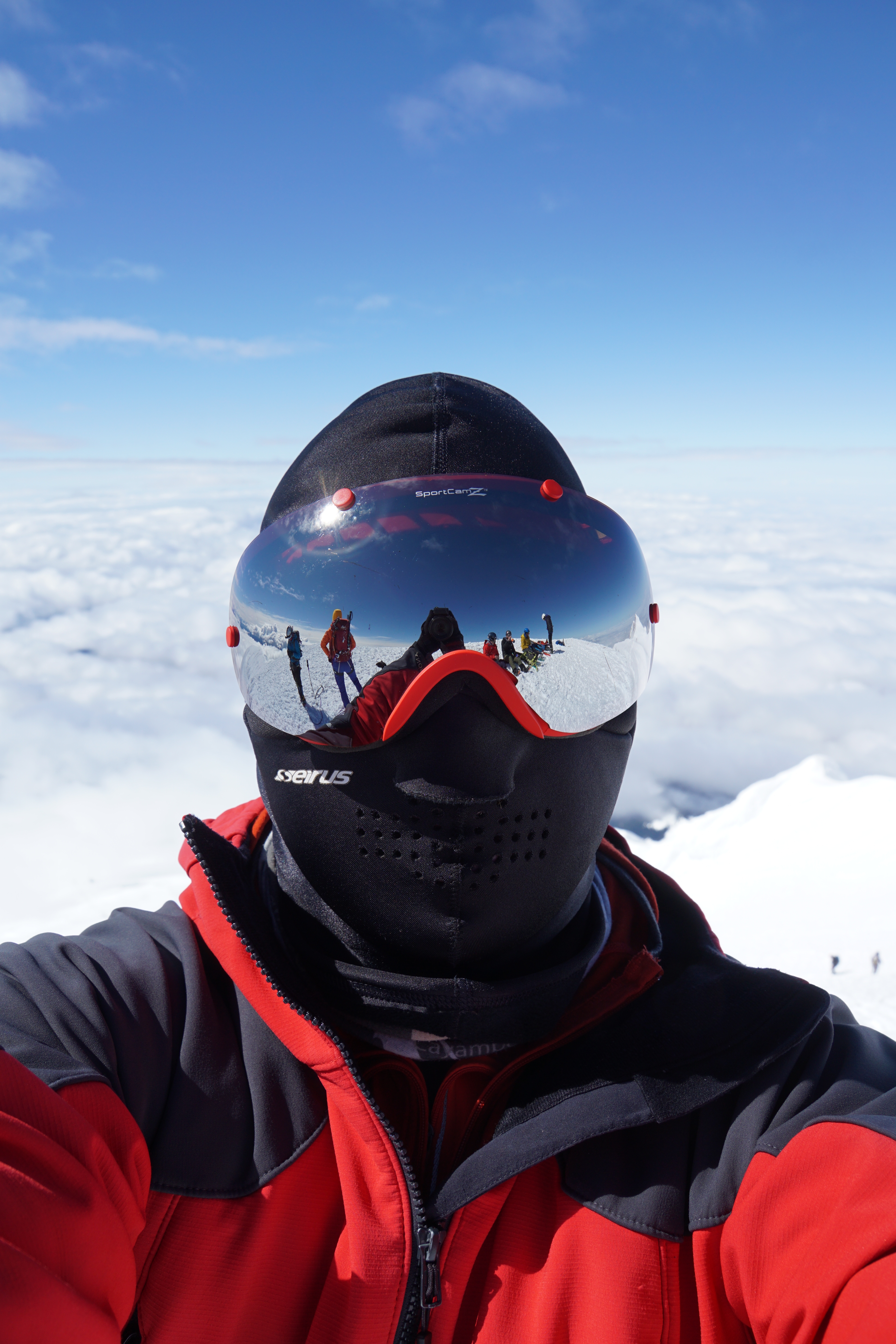
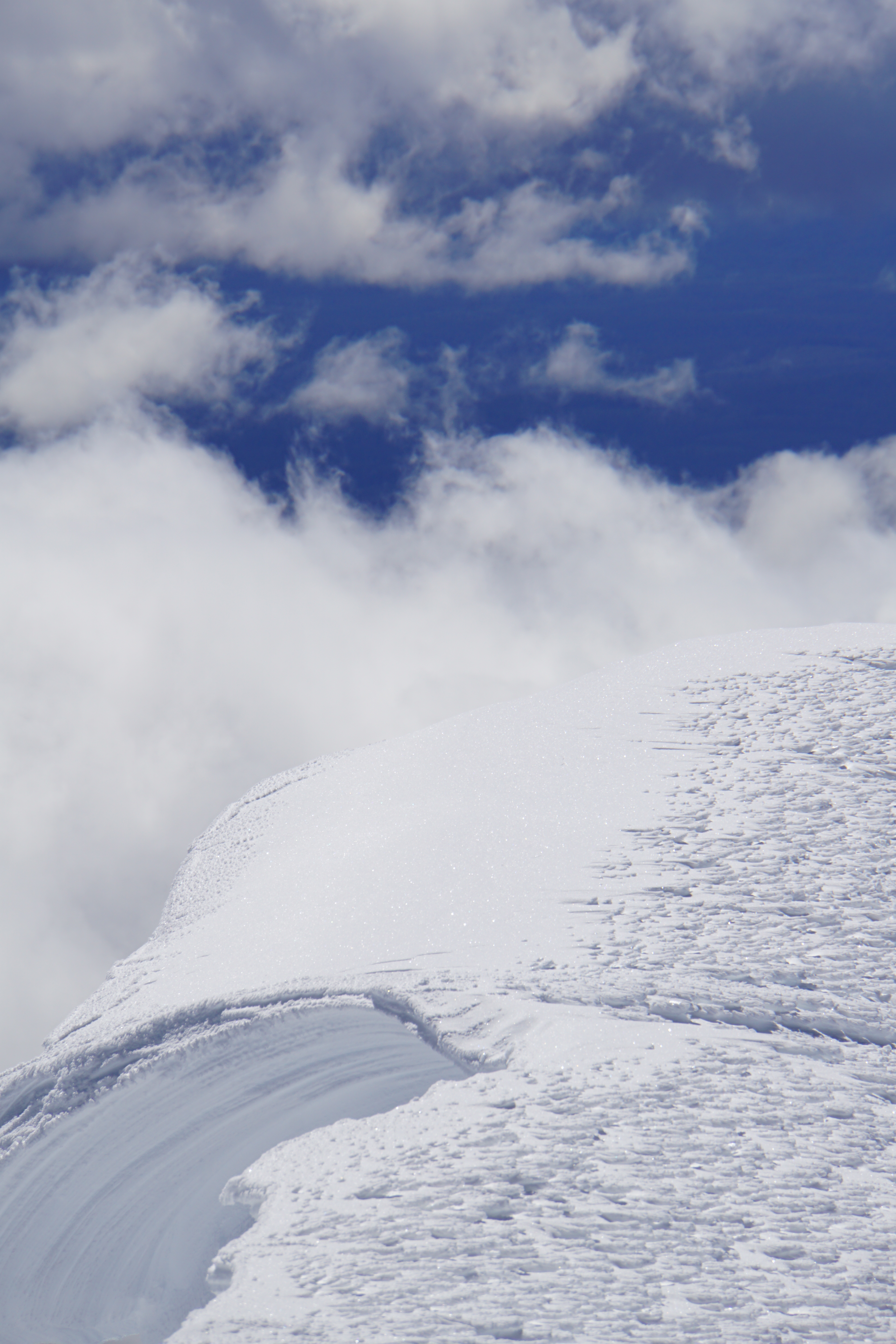
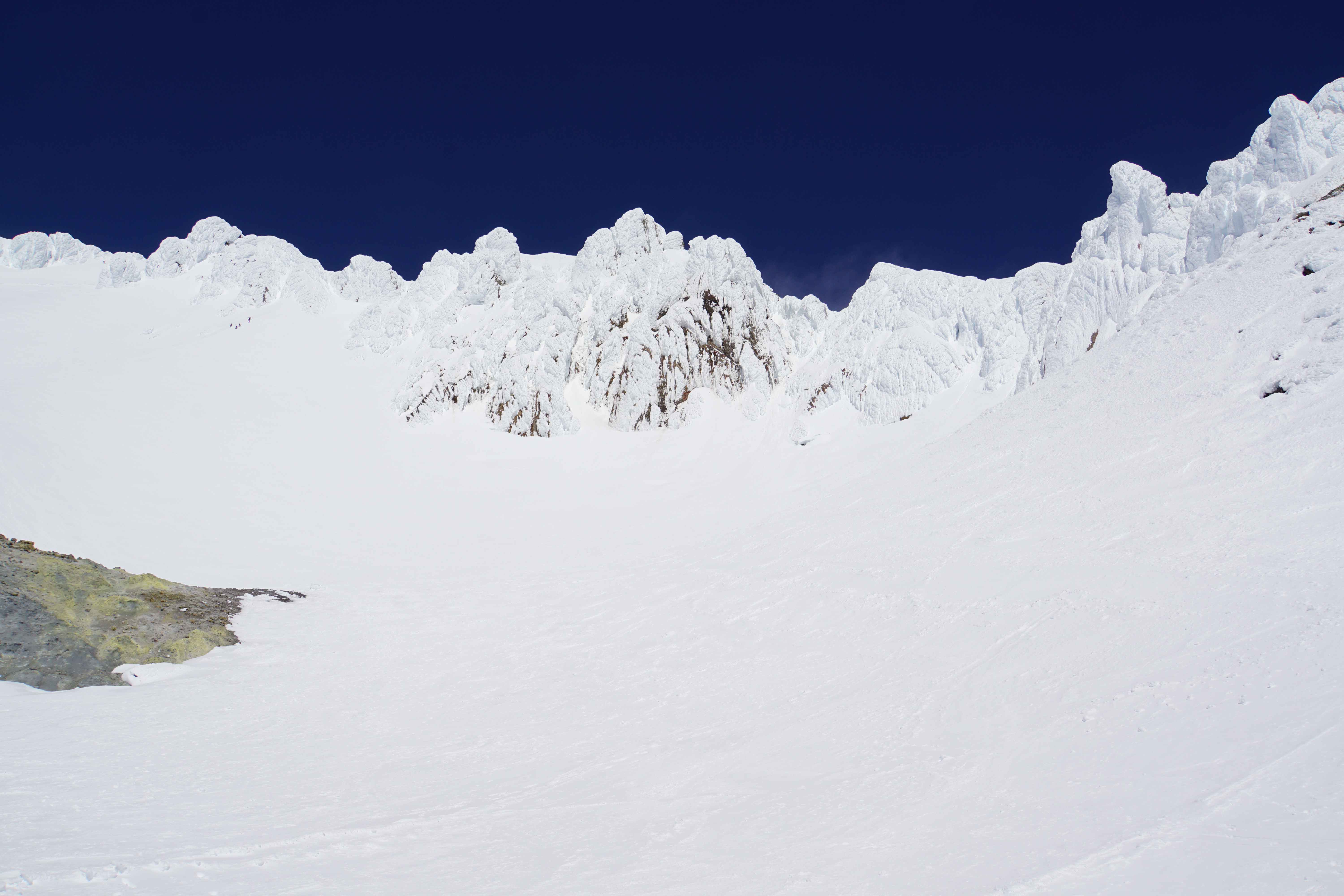
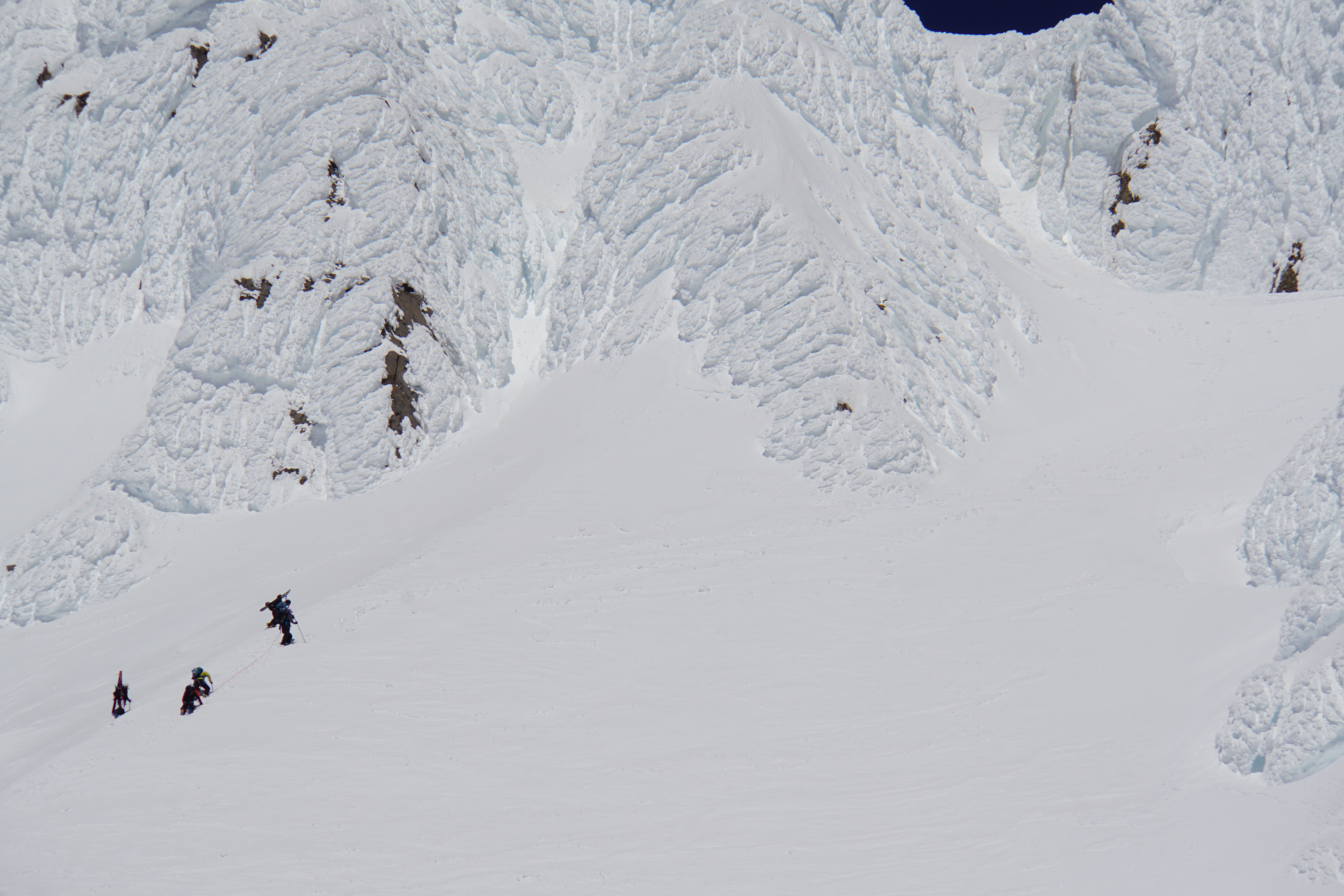
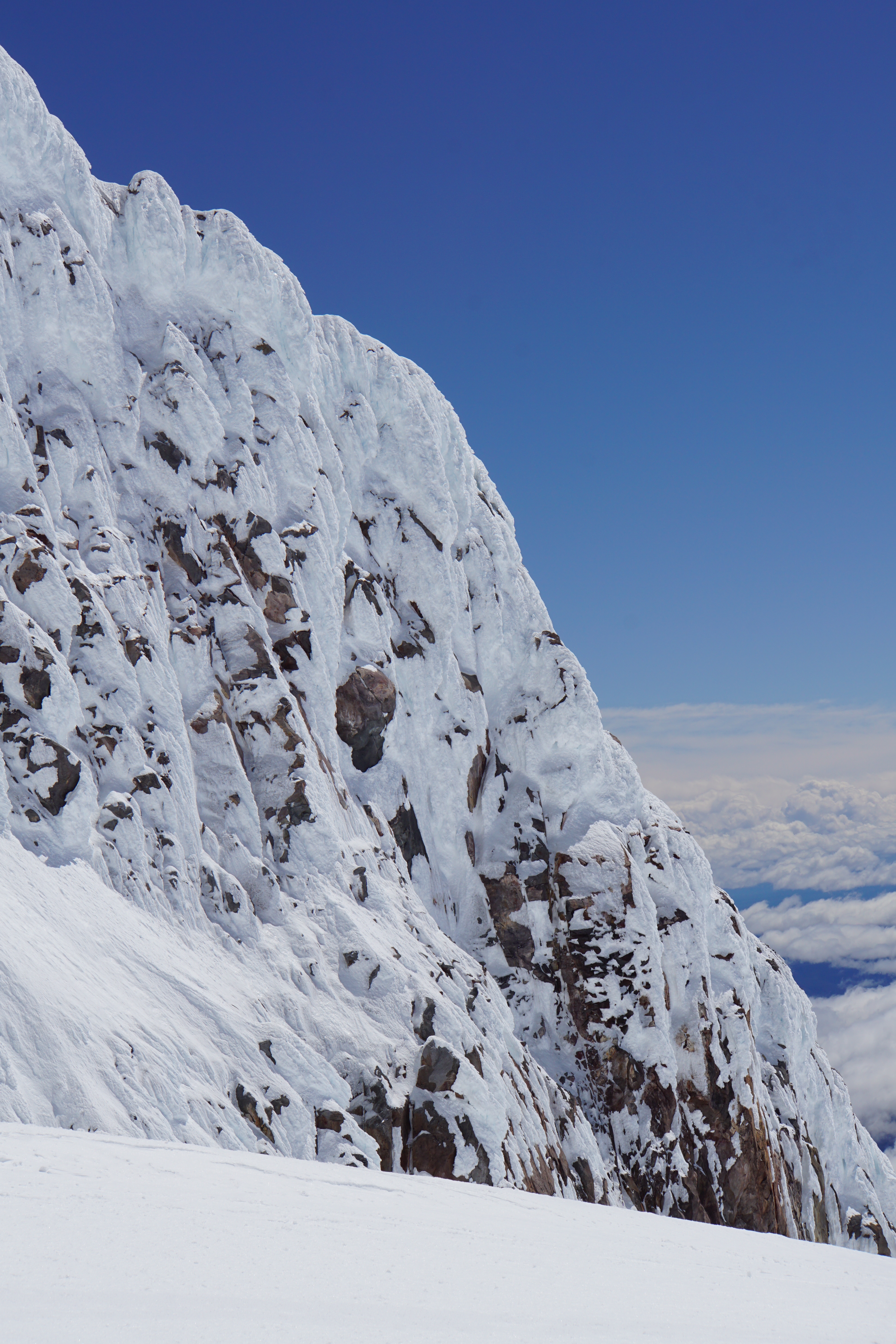
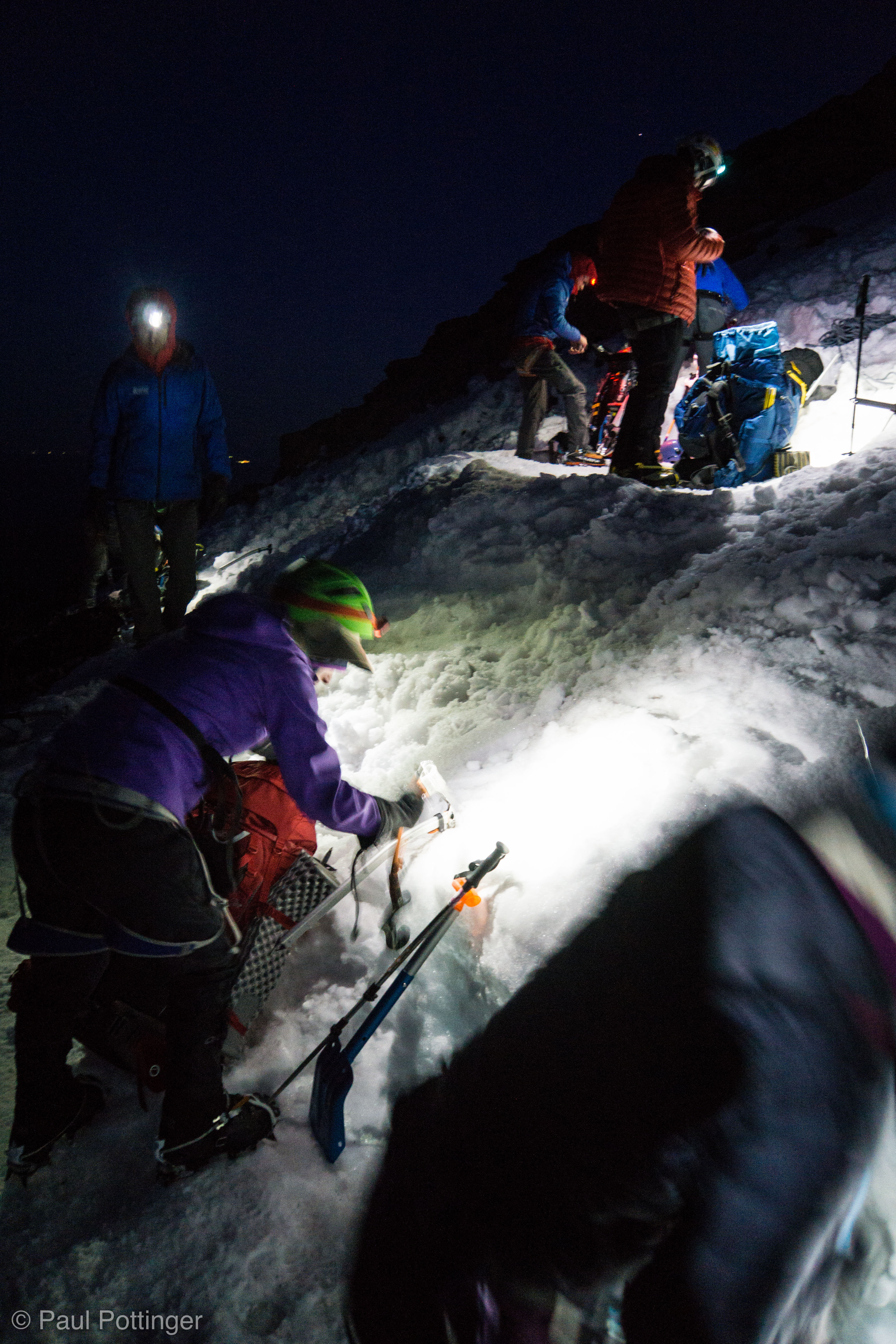
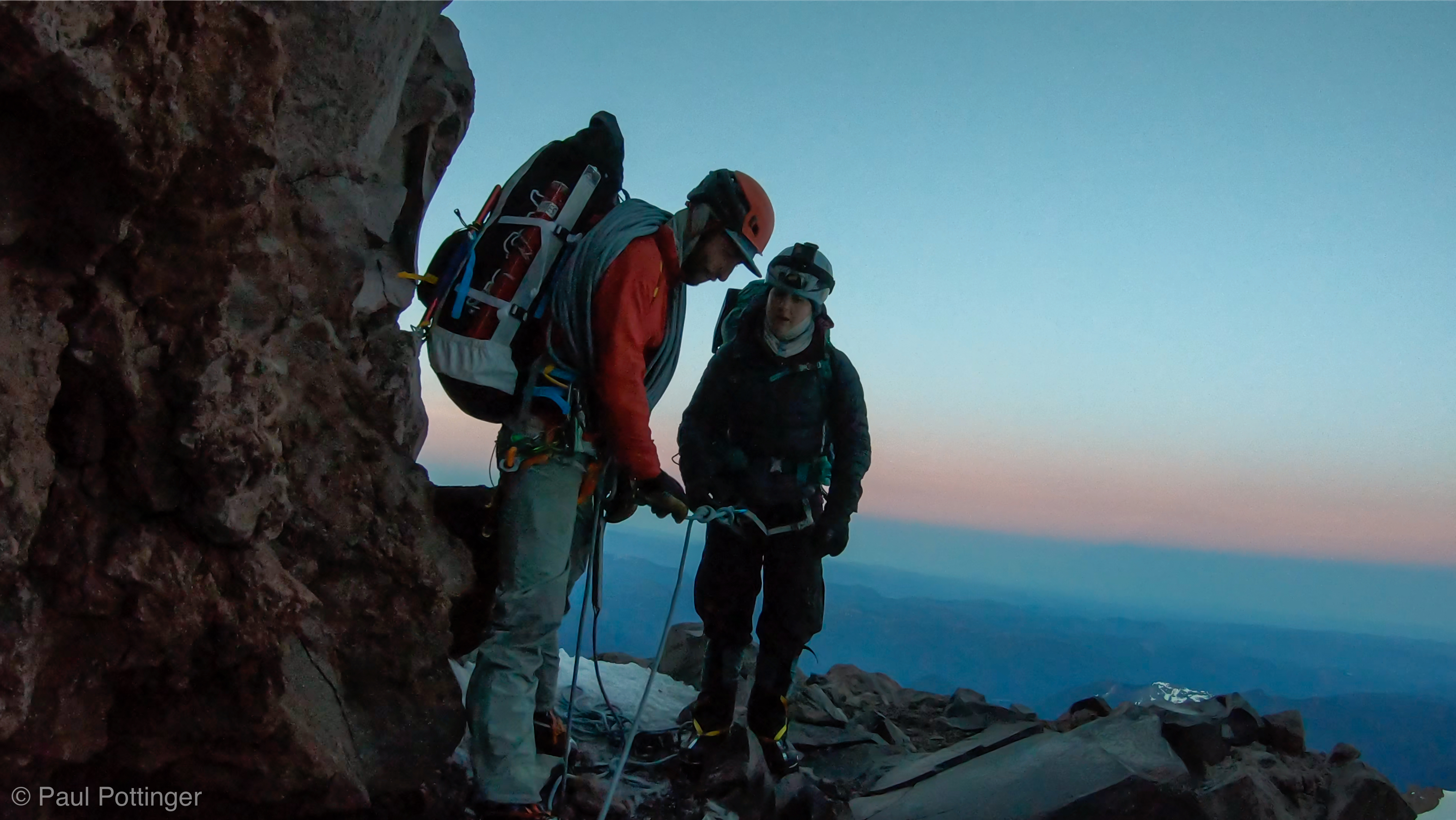
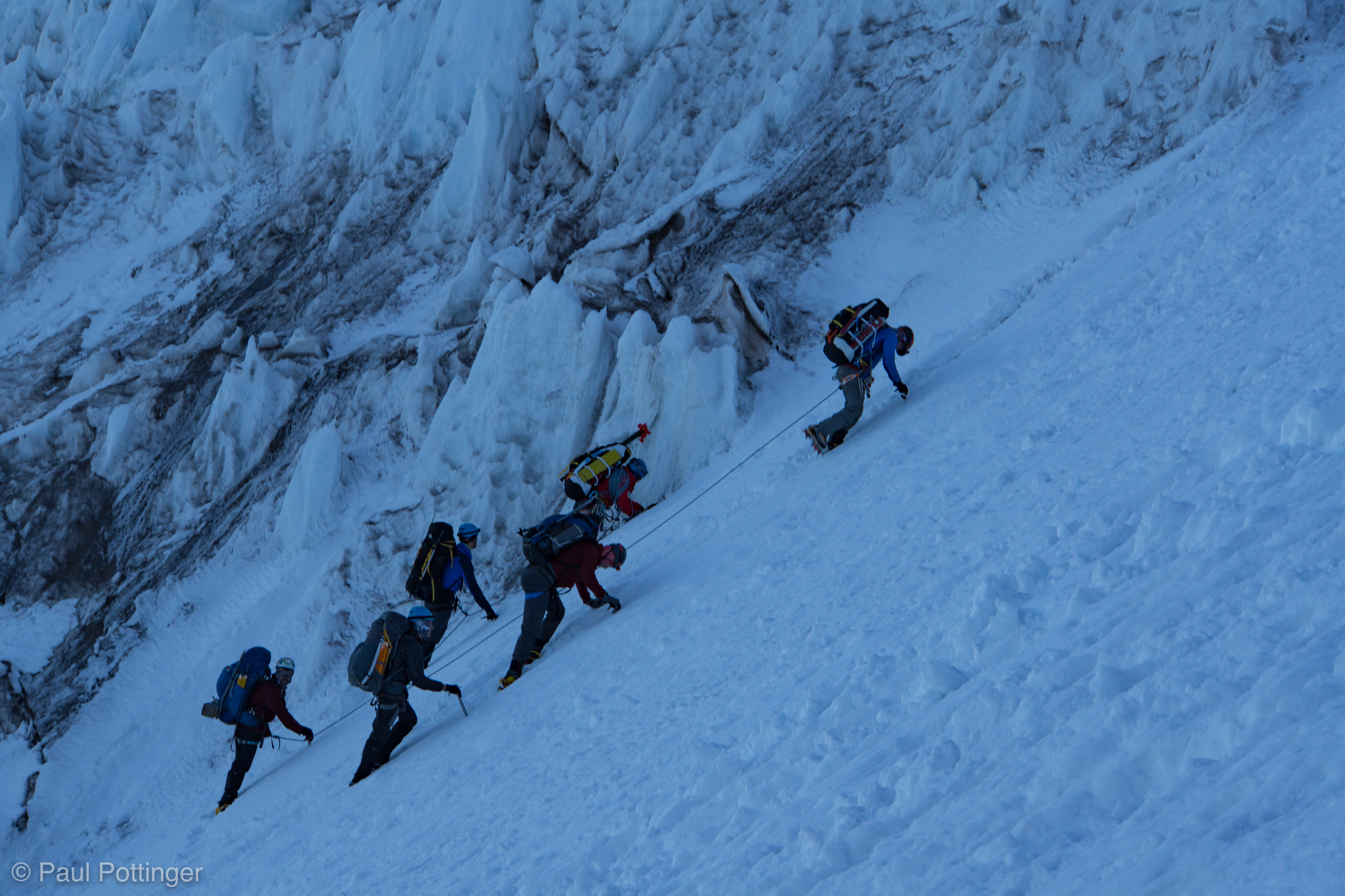
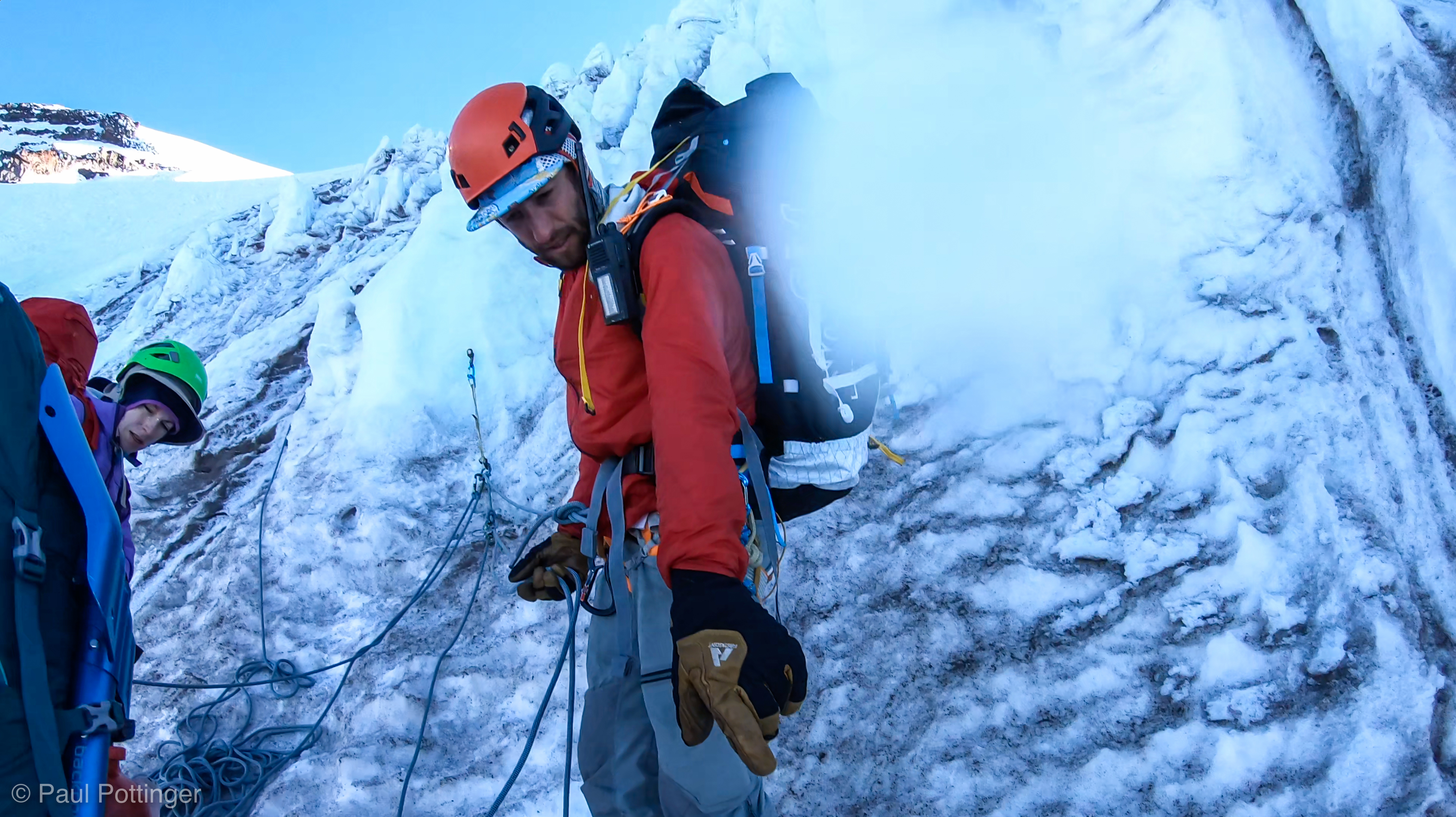
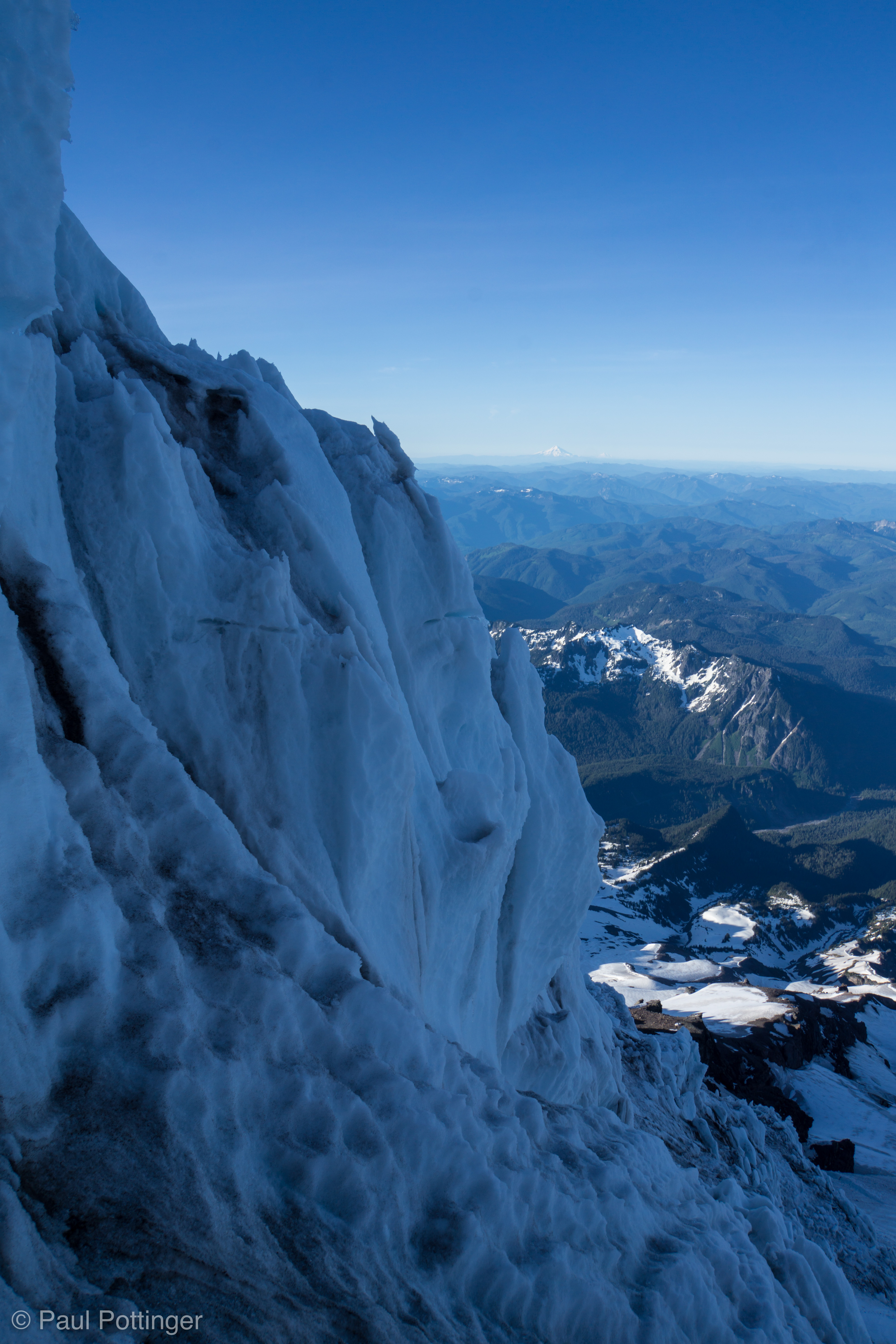
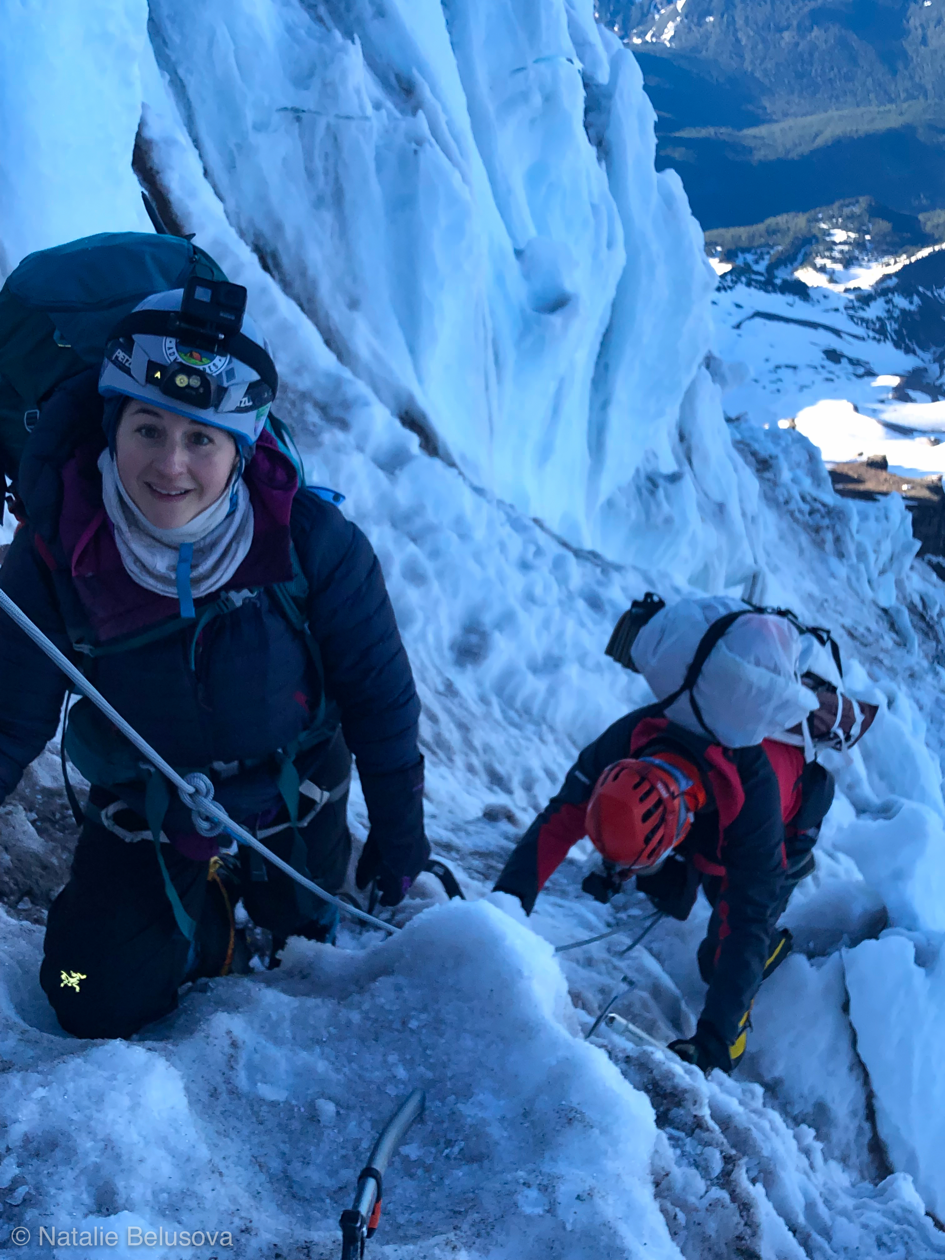
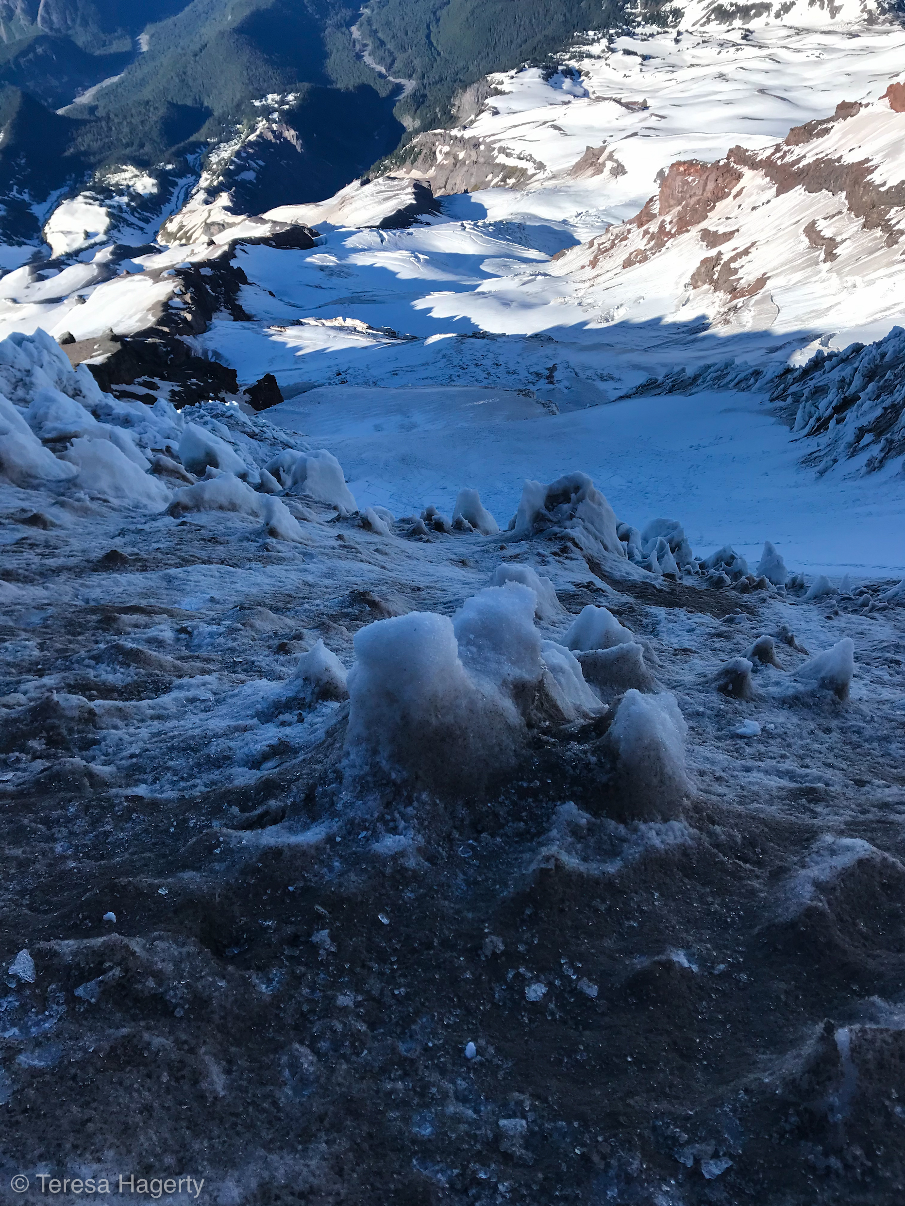
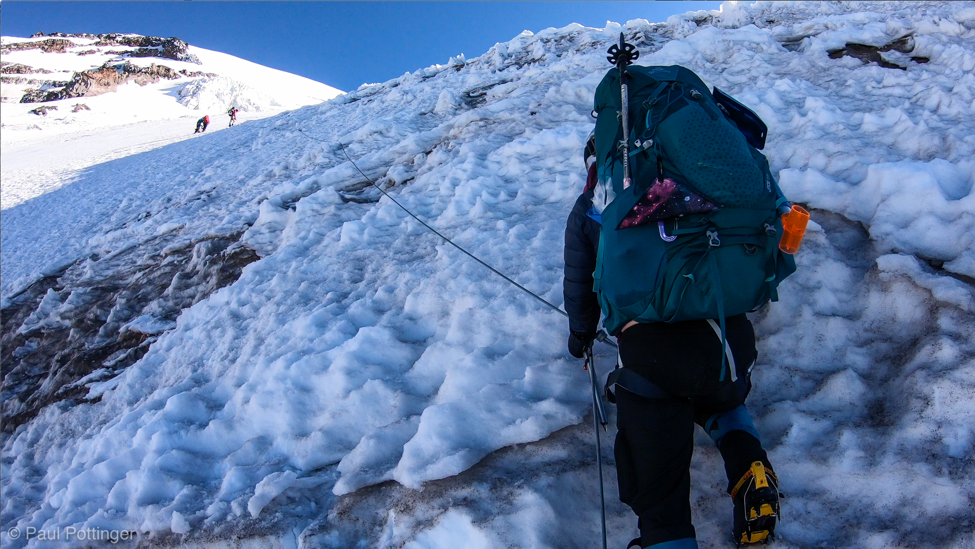
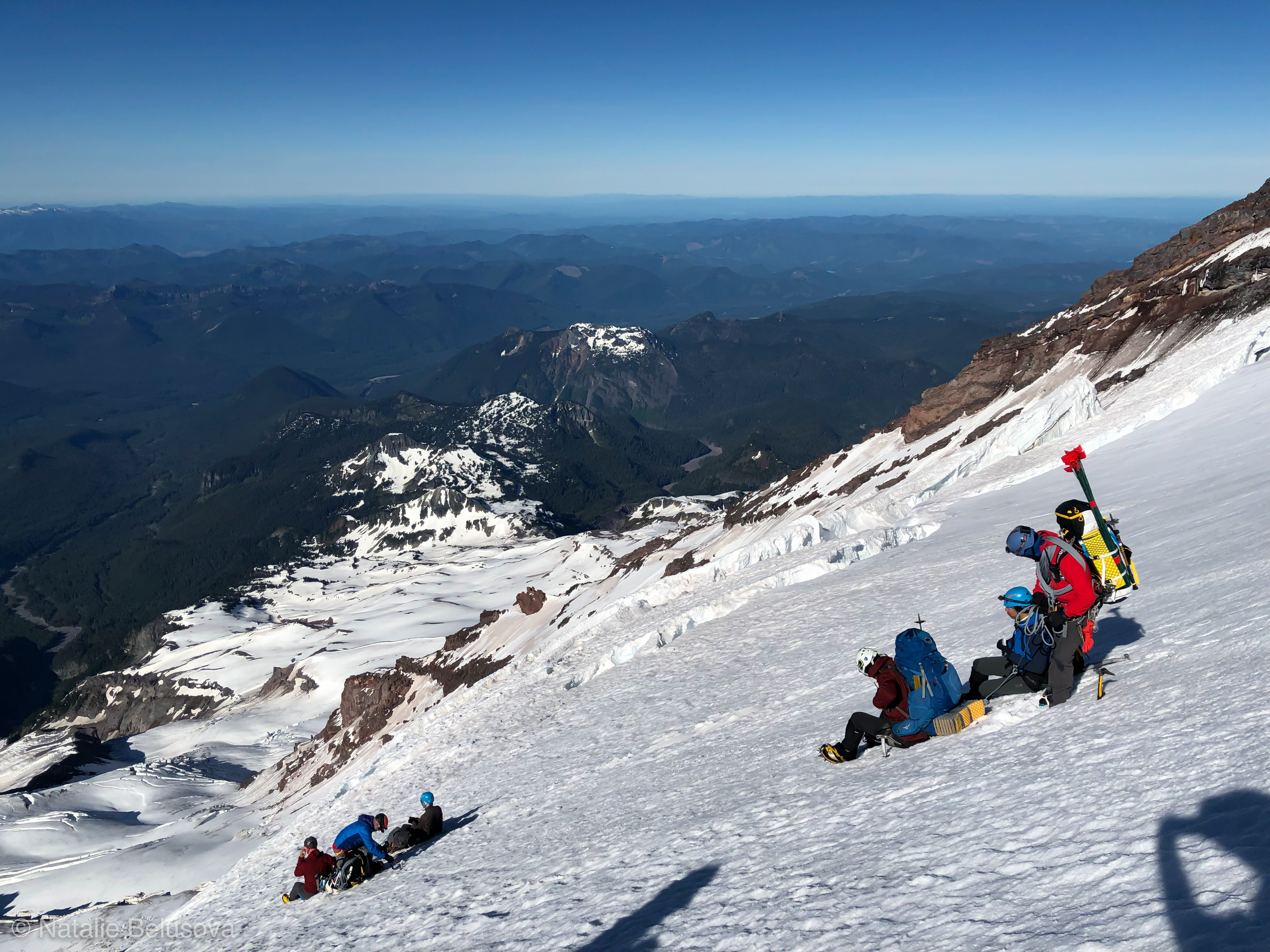
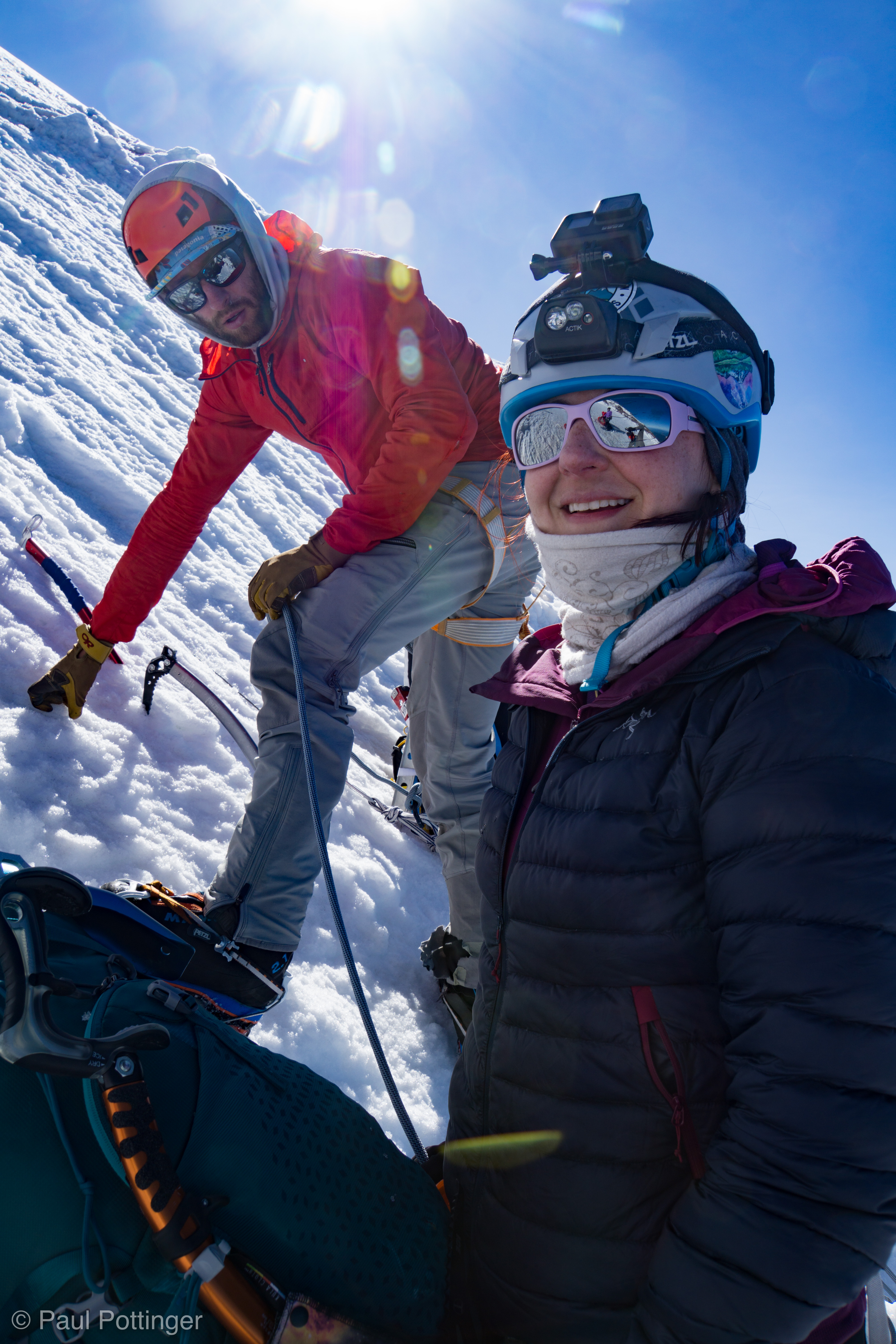
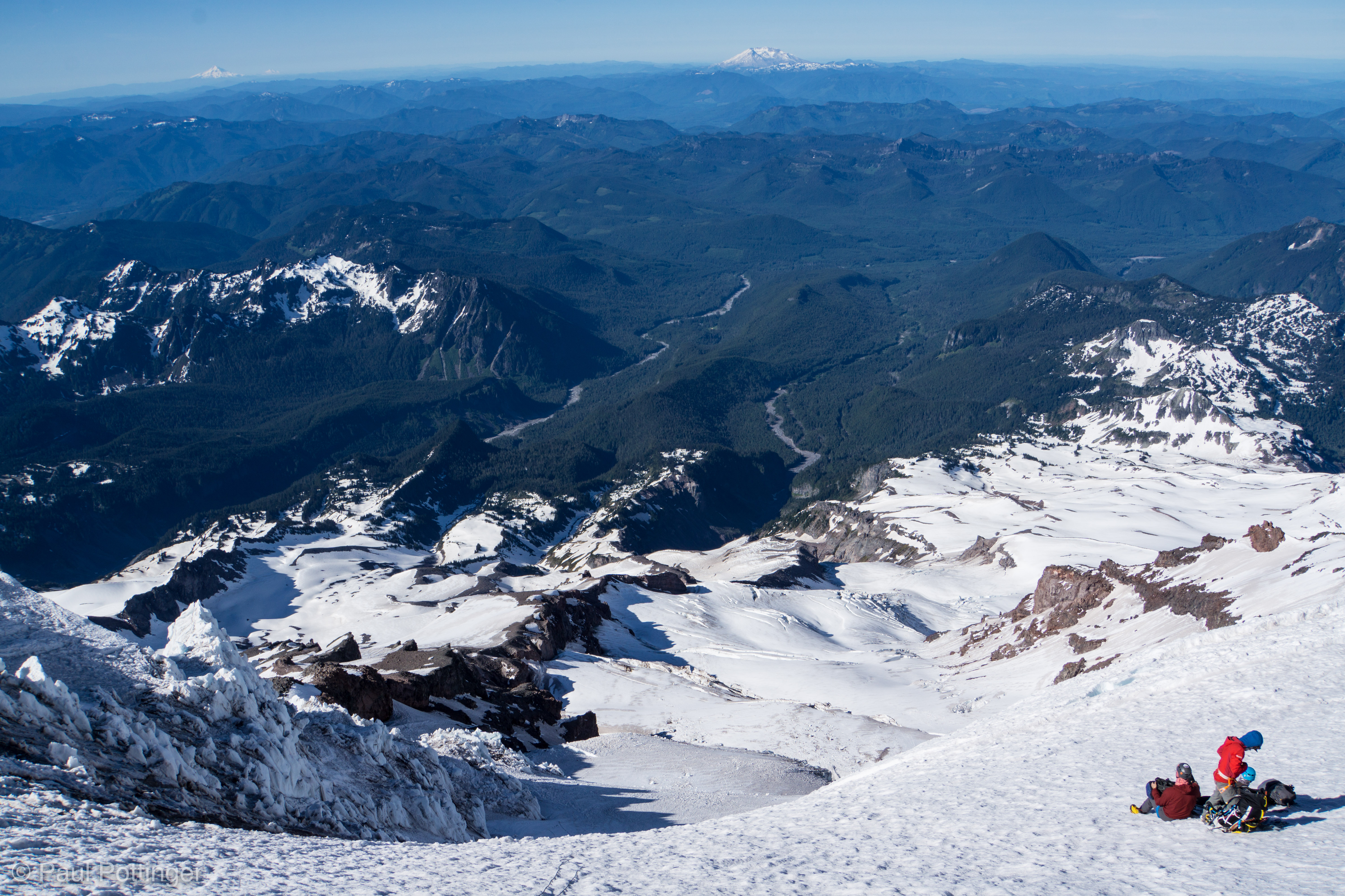
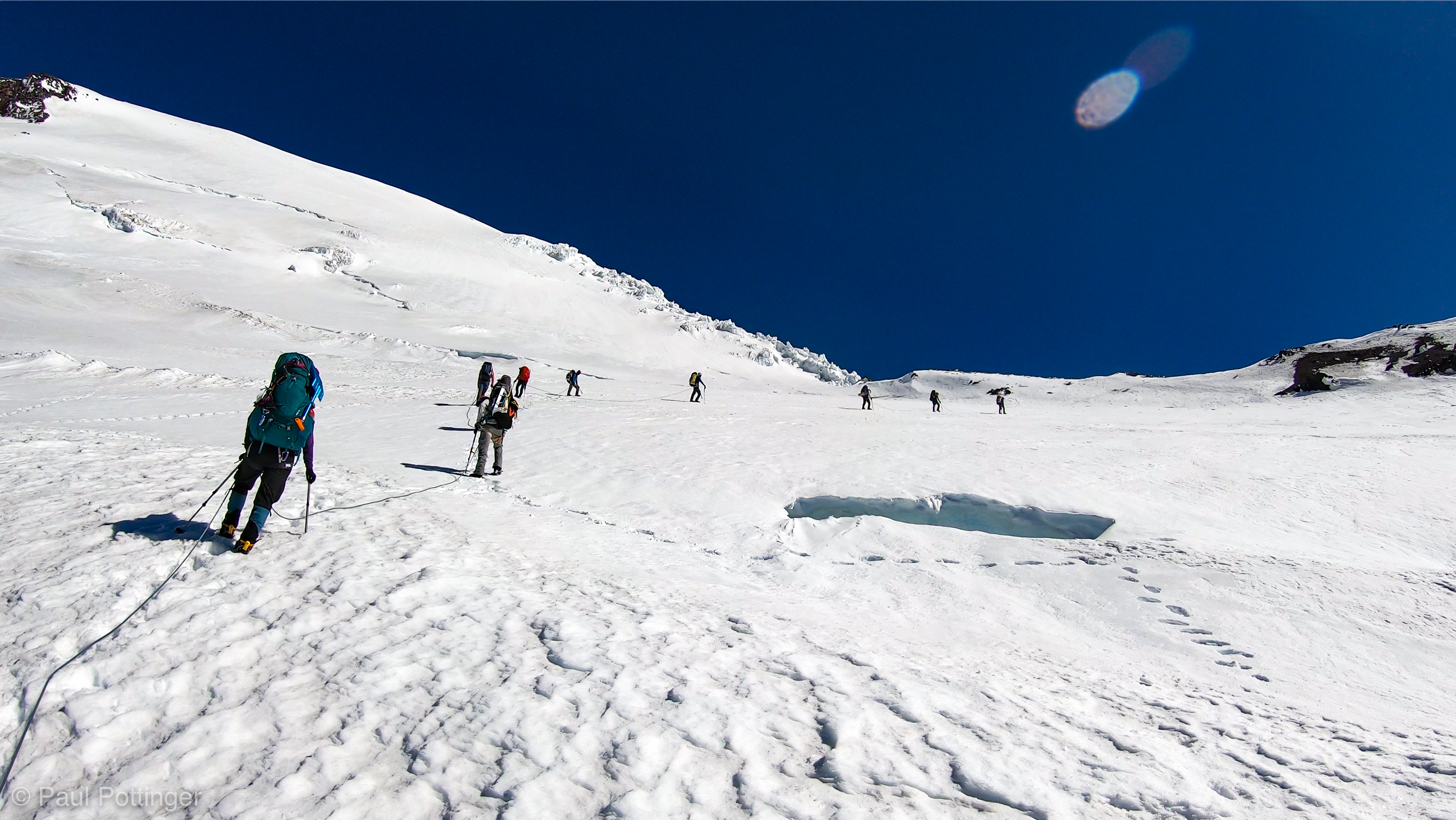
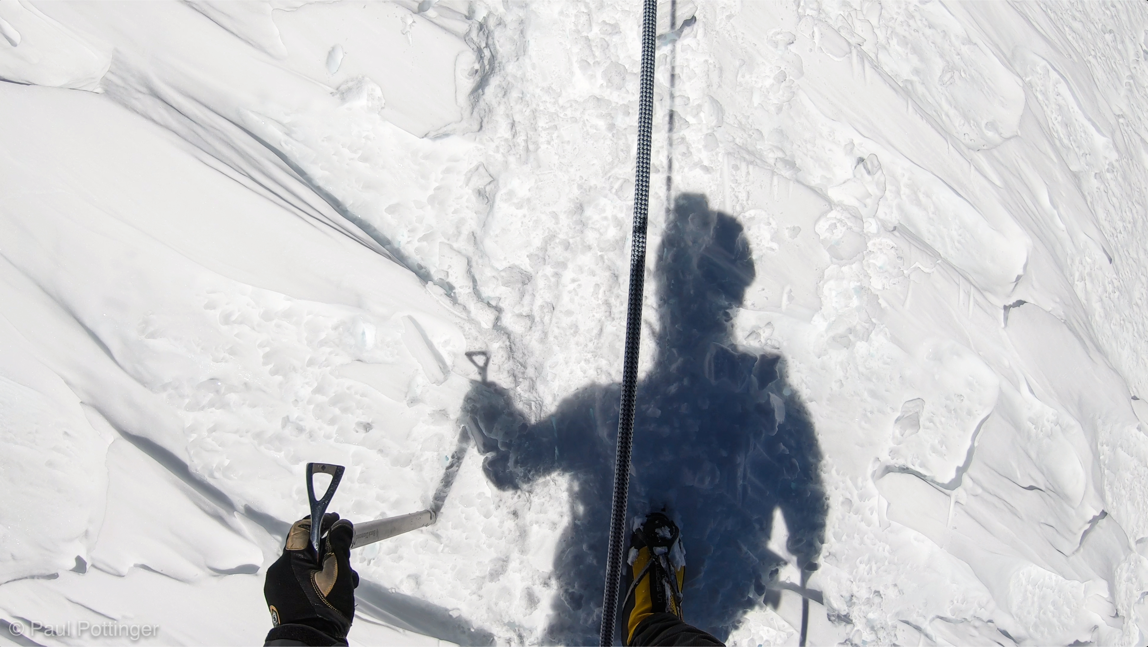
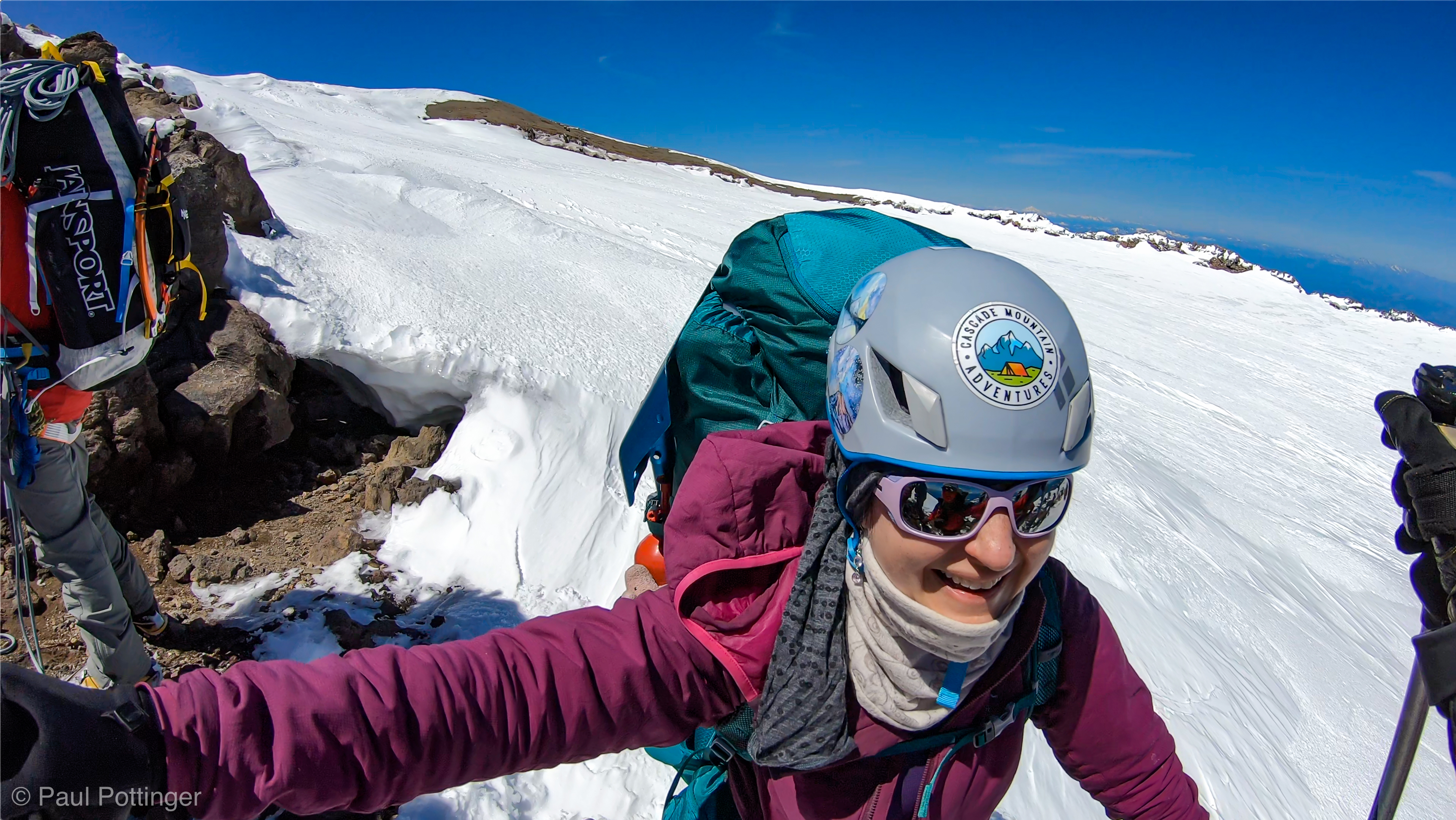
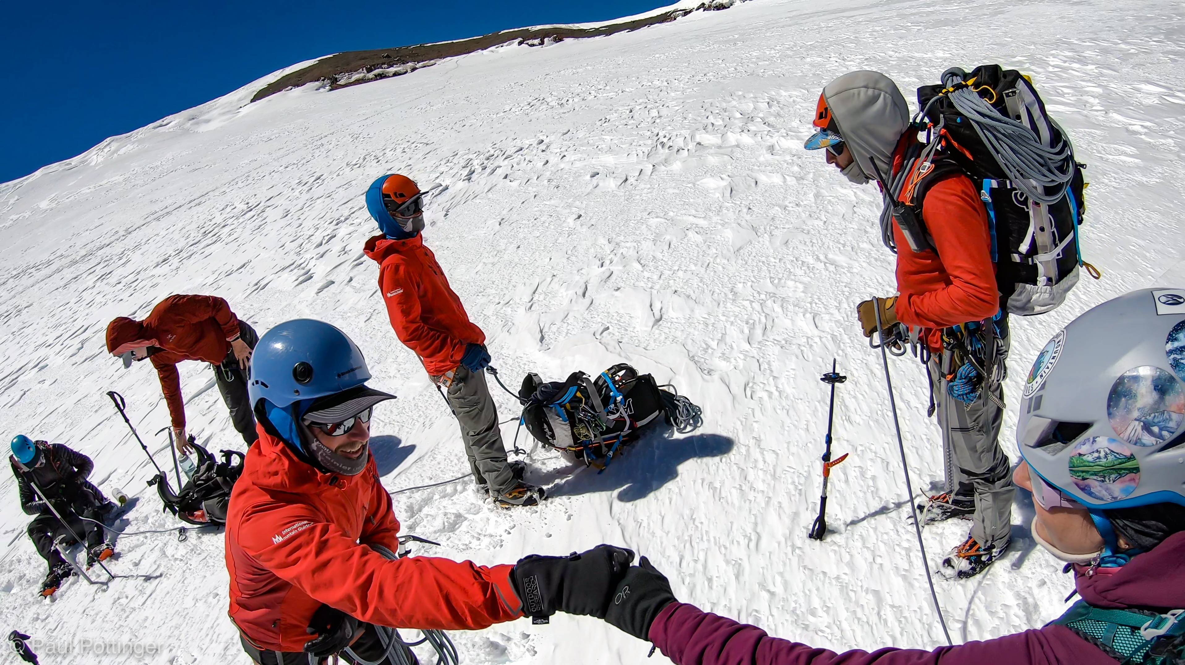
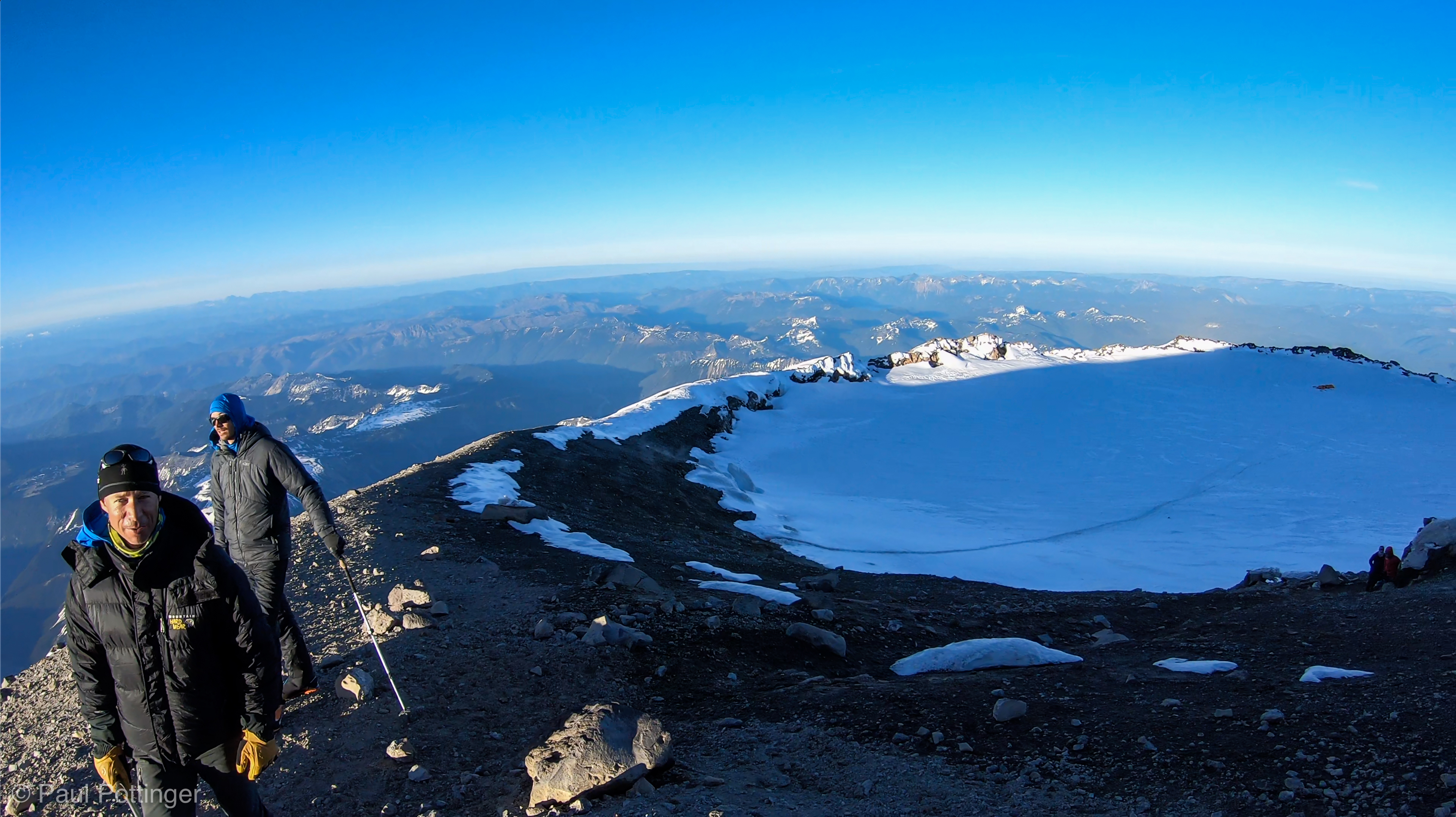
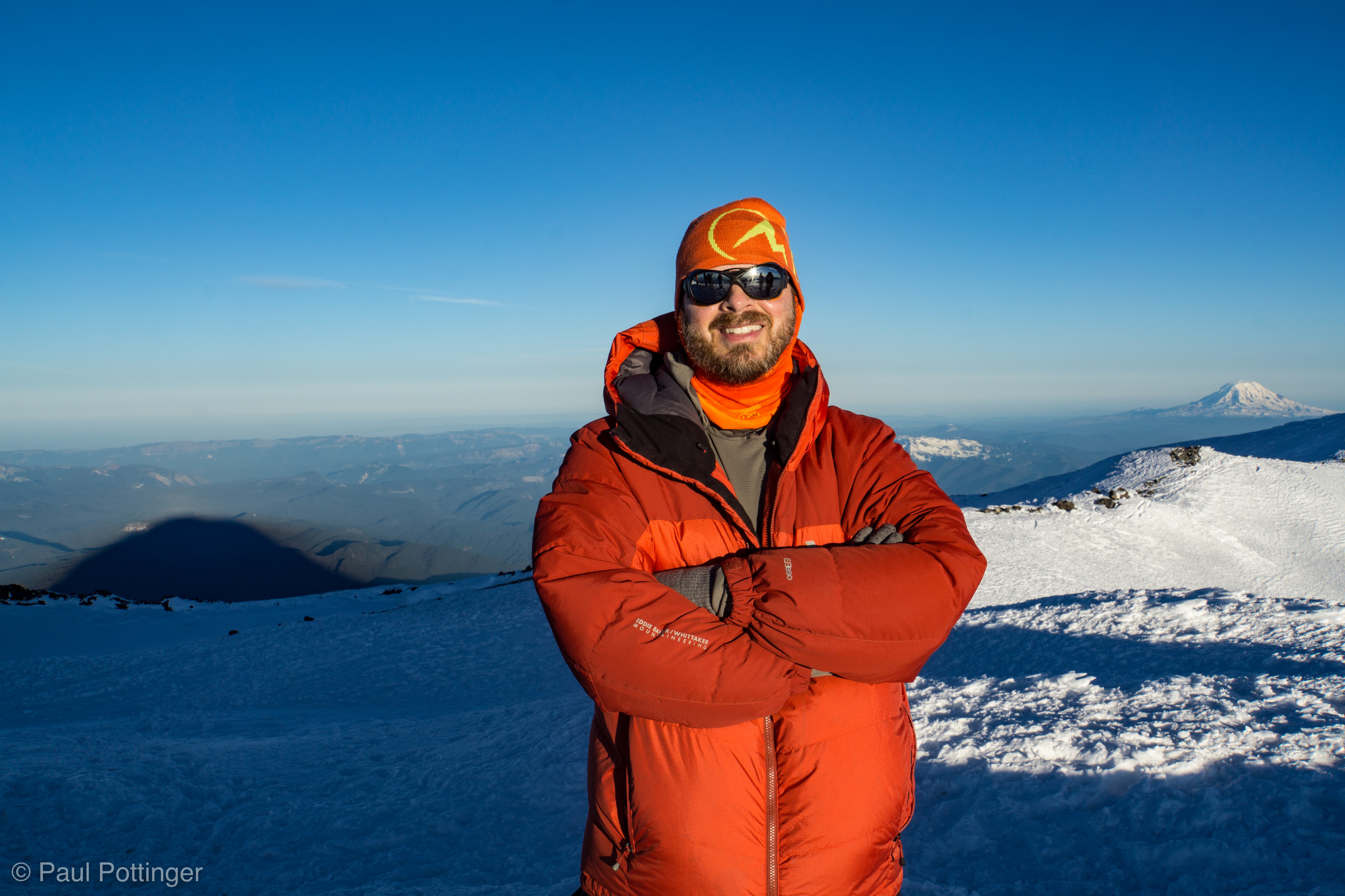
The Sneak was a jumble of dark volcanic rock that jutted out over a very steep snow face that fell away for hundreds of feet. This is the Kautz Glacier, finally revealed. The step was not high—perhaps 20 vertical feet—but the exposure to the snow face below was spicy. This was a no-fall zone, for sure. At the bottom of the step a narrow catwalk of snow abutted a tall rock cliff on the right. This catwalk led up and away, towards a broad, open section of glacier above. We stayed warm and snapped photos while waiting for our teammates to negotiate the step. The dawn brightened, revealing our volcano neighbors in the distance: Klickitat, Wy’East, and Loowit.

Traversing the choss below the Sneak.
Rowers of Rohan arrive at the Sneak.
Teresa dispenses cough lozenges while we await our turn at the Sneak.
Looking down the Kautz Glacier thousands of feet below my feet.
T$ seems to like it here.
Waiting patiently for our turn on the Sneak.
Conrad at the Sneak. Awesome guide!
The crowded platform above the Sneak.
Dawn, looking South from the Sneak.

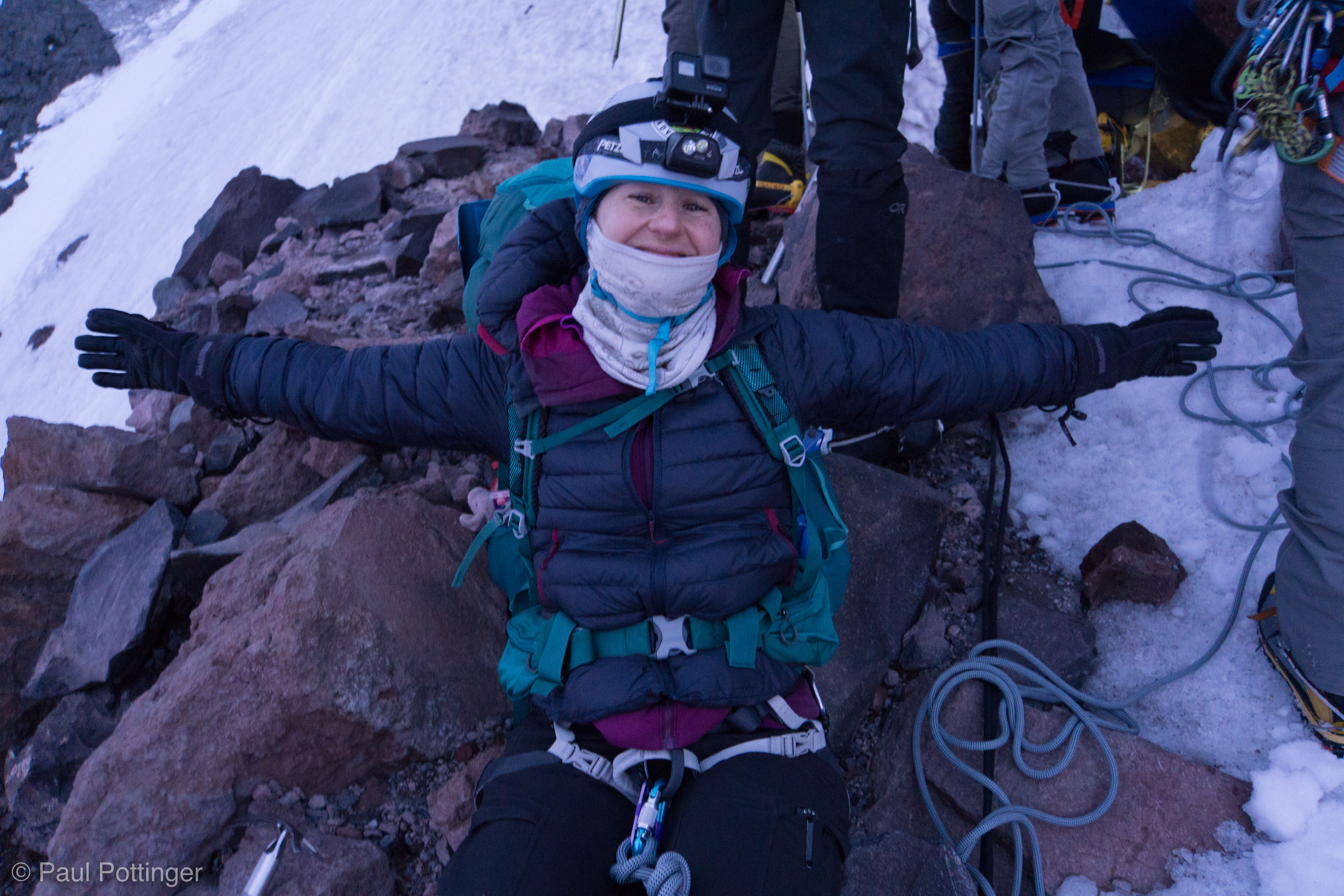
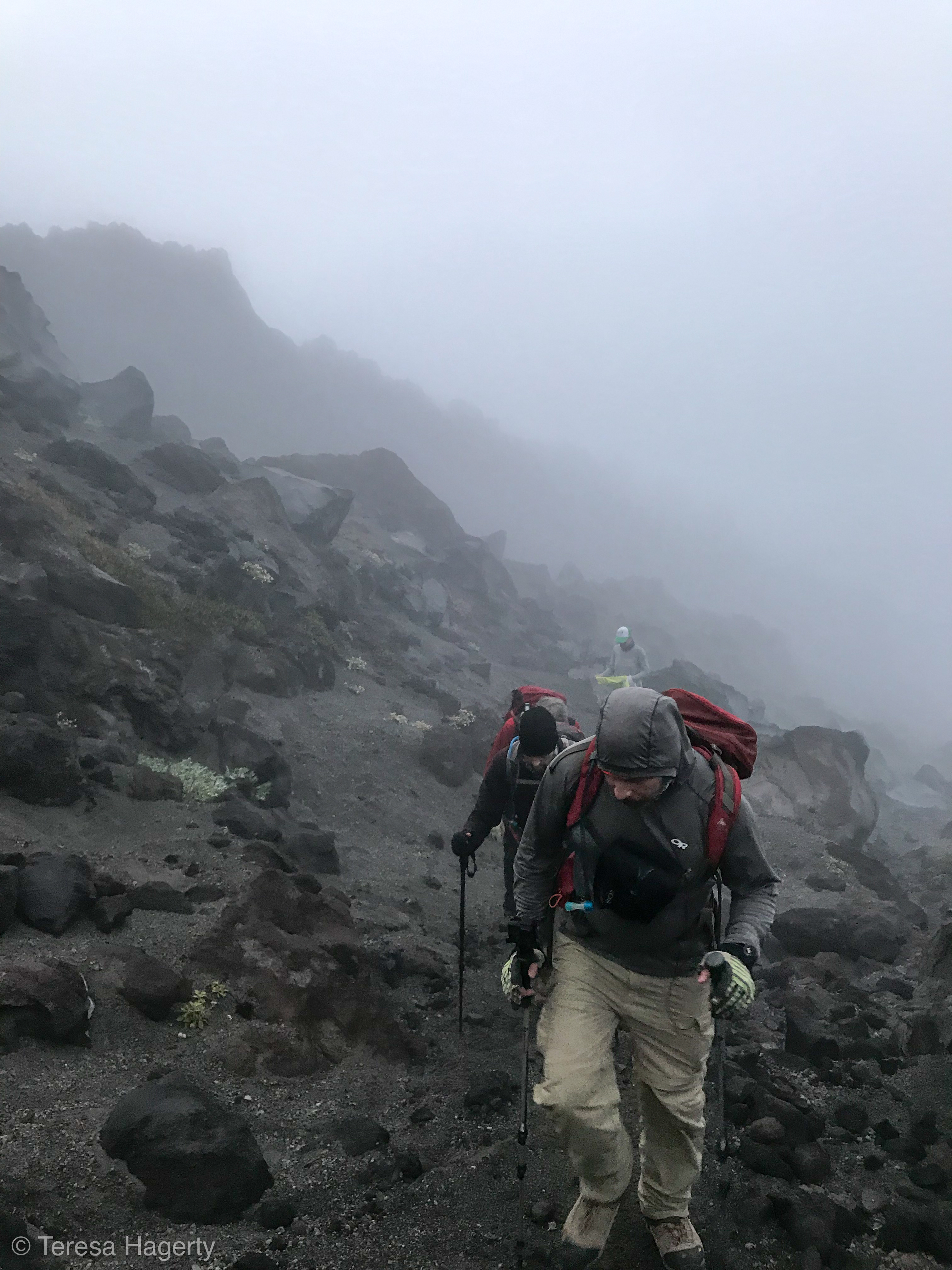
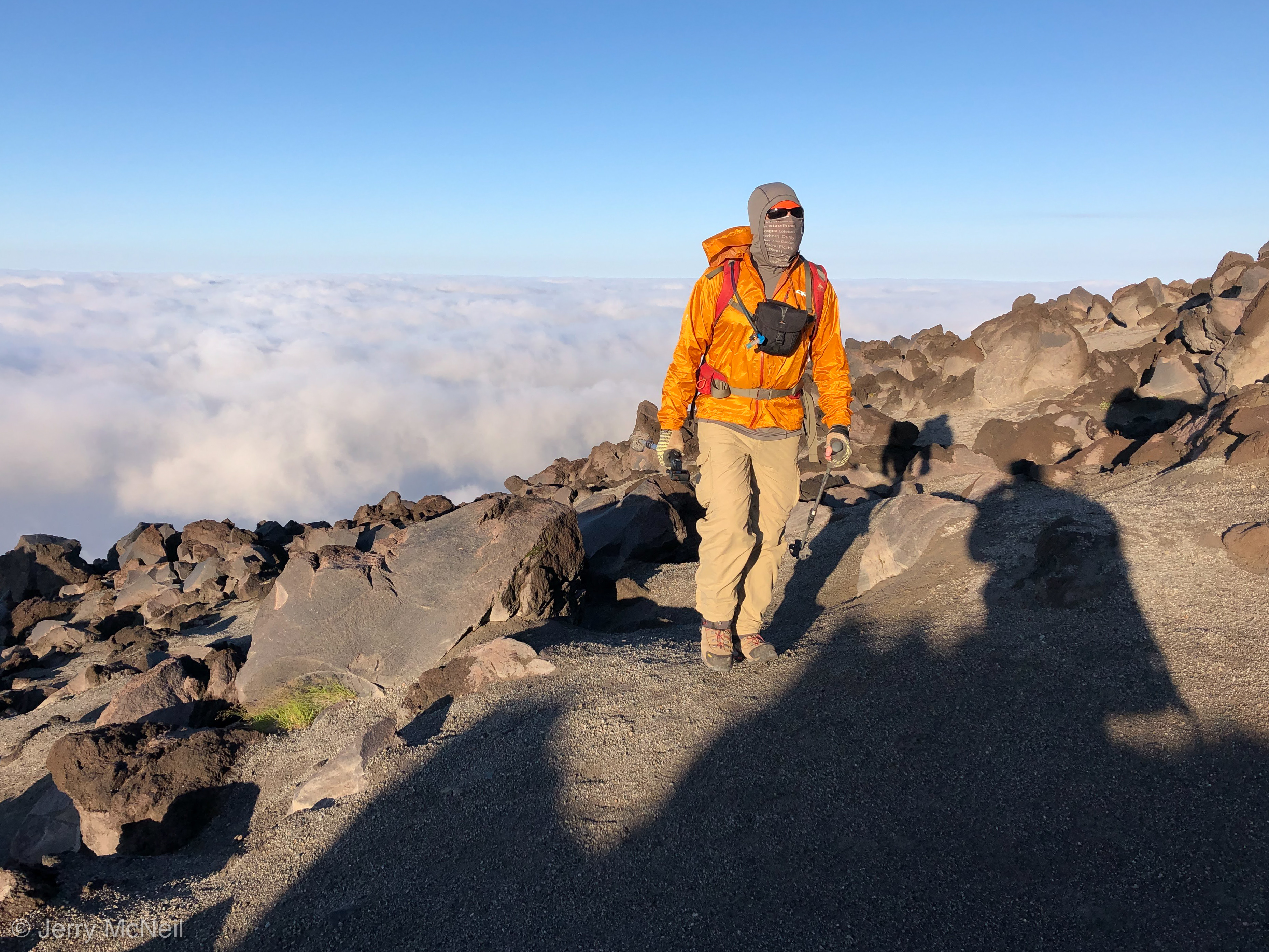
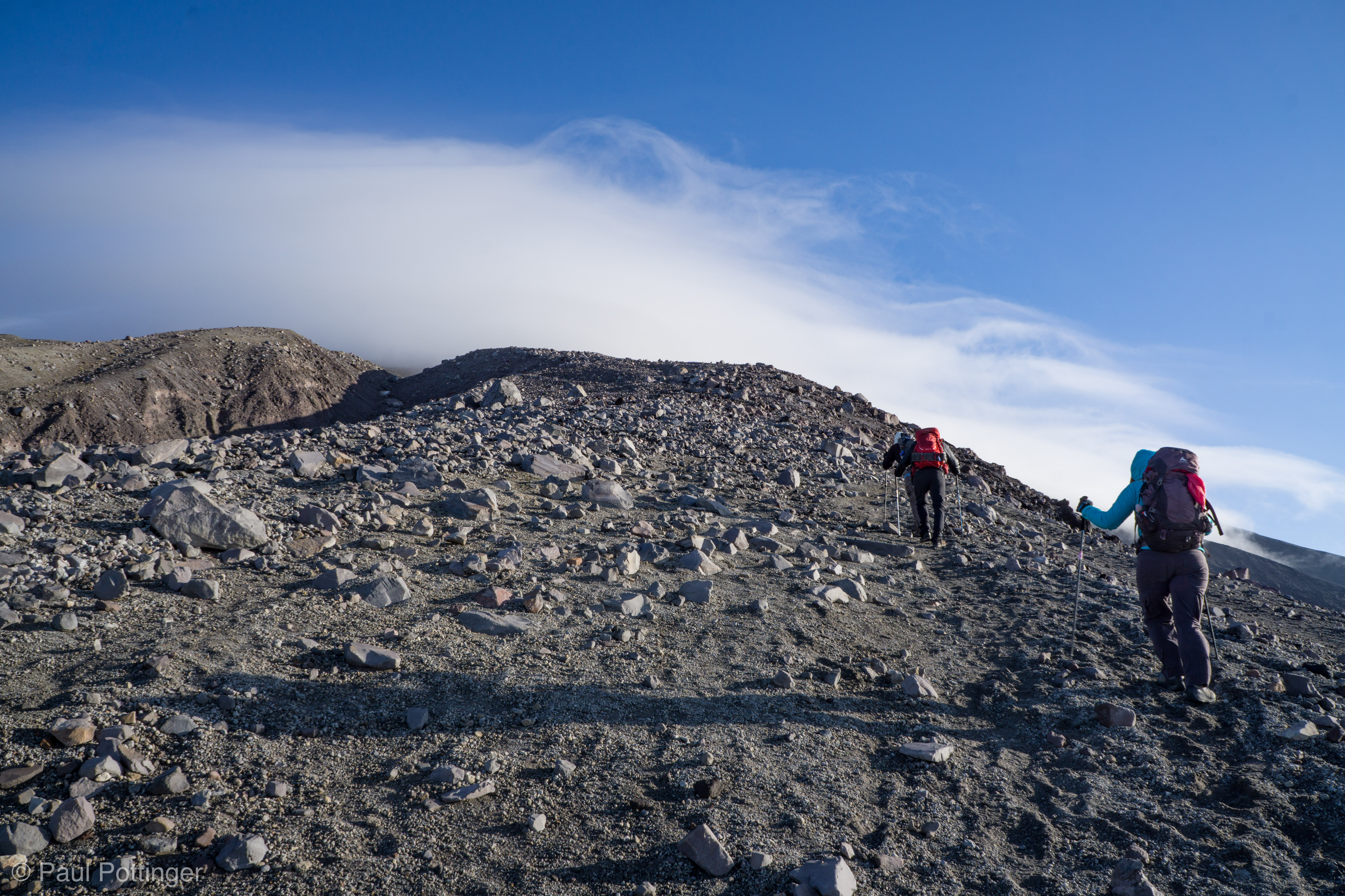
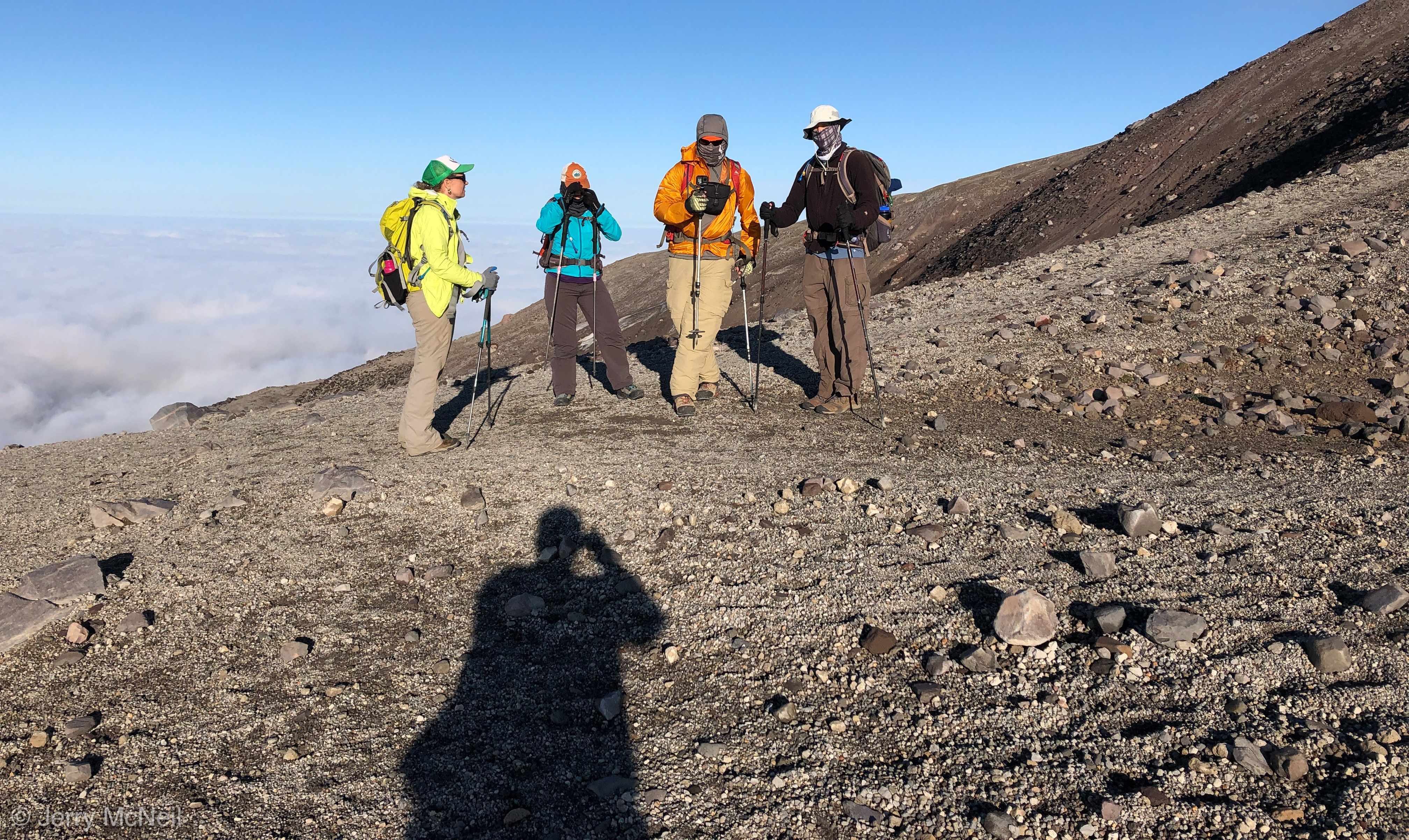
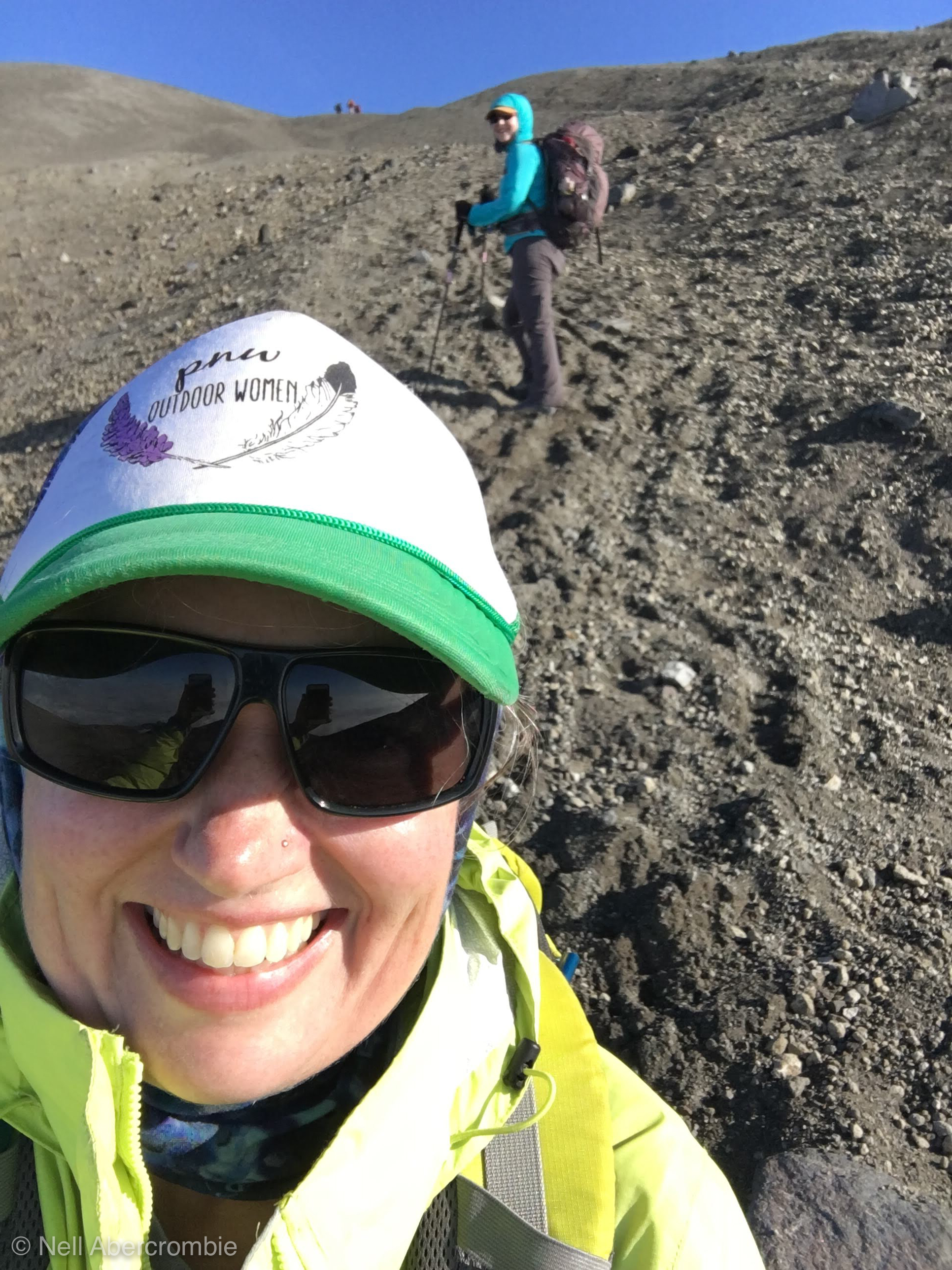
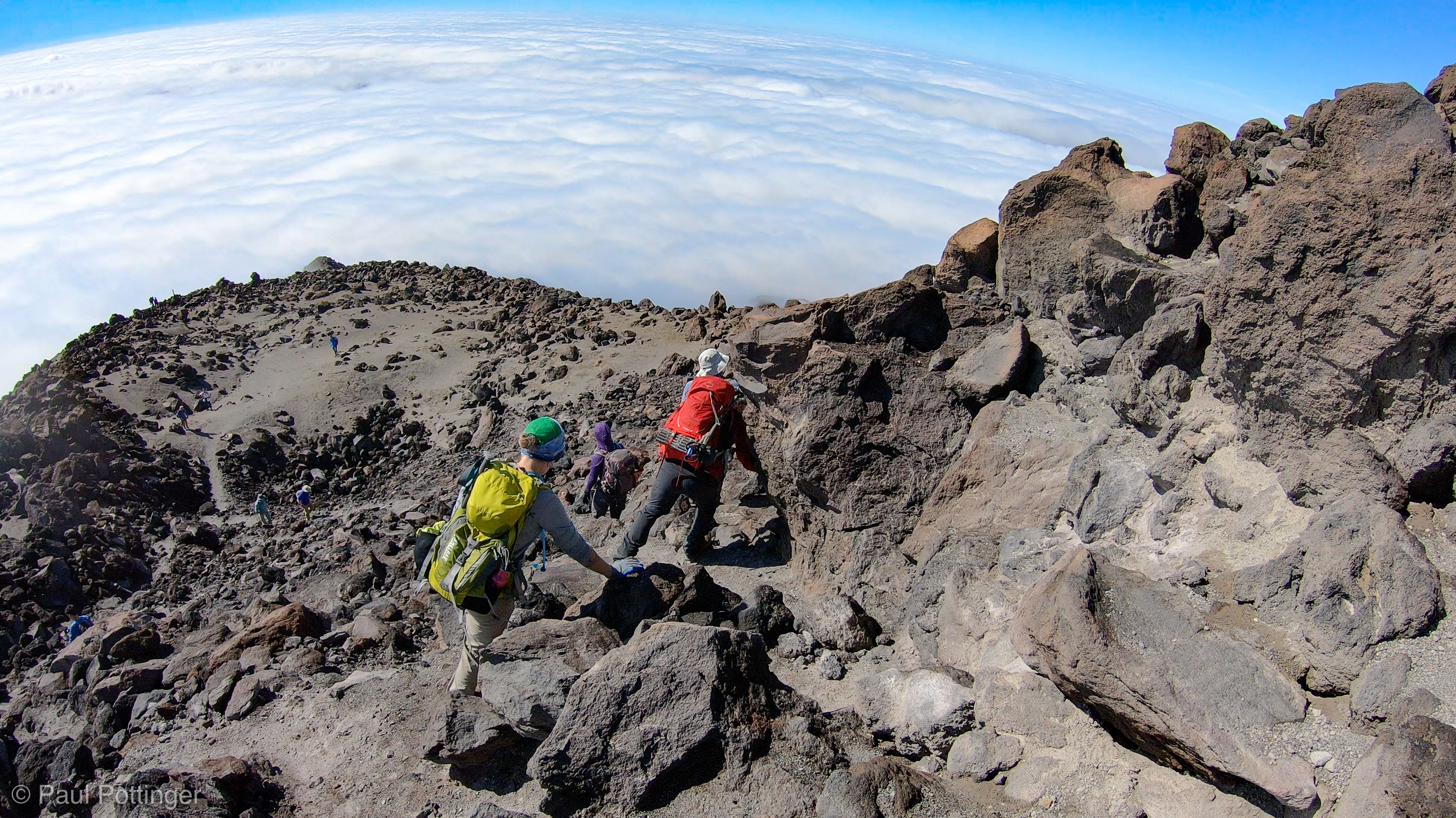
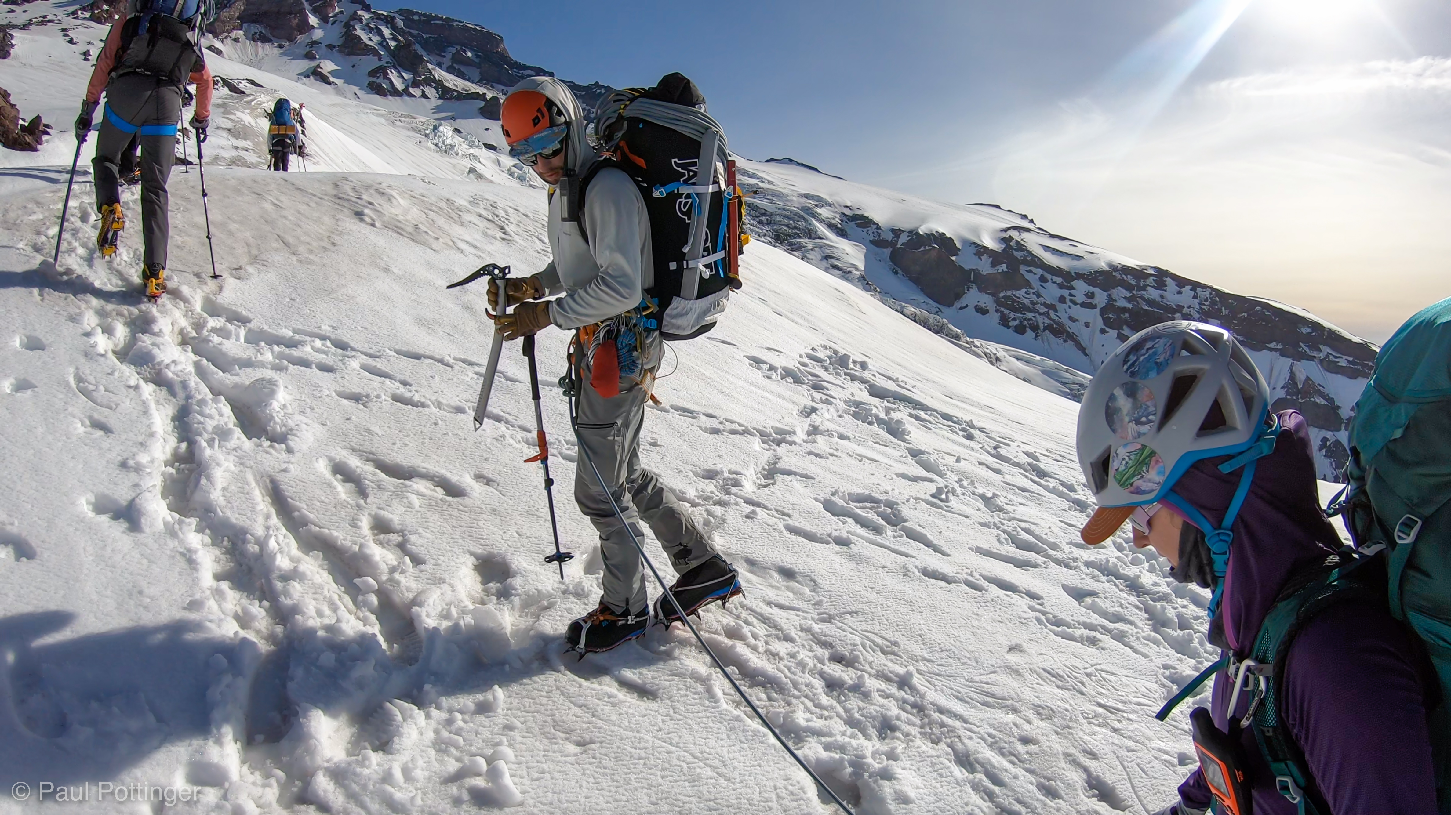
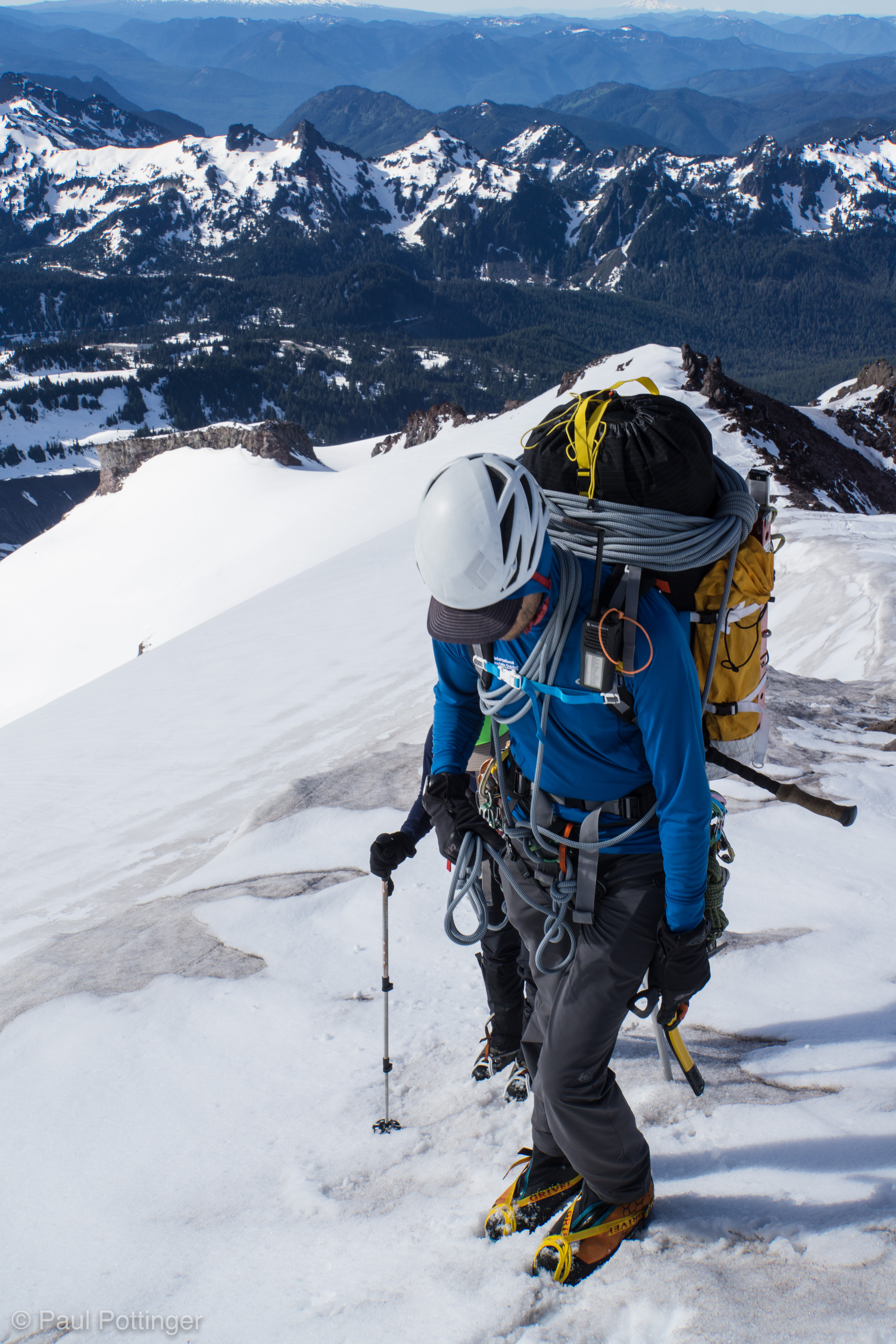
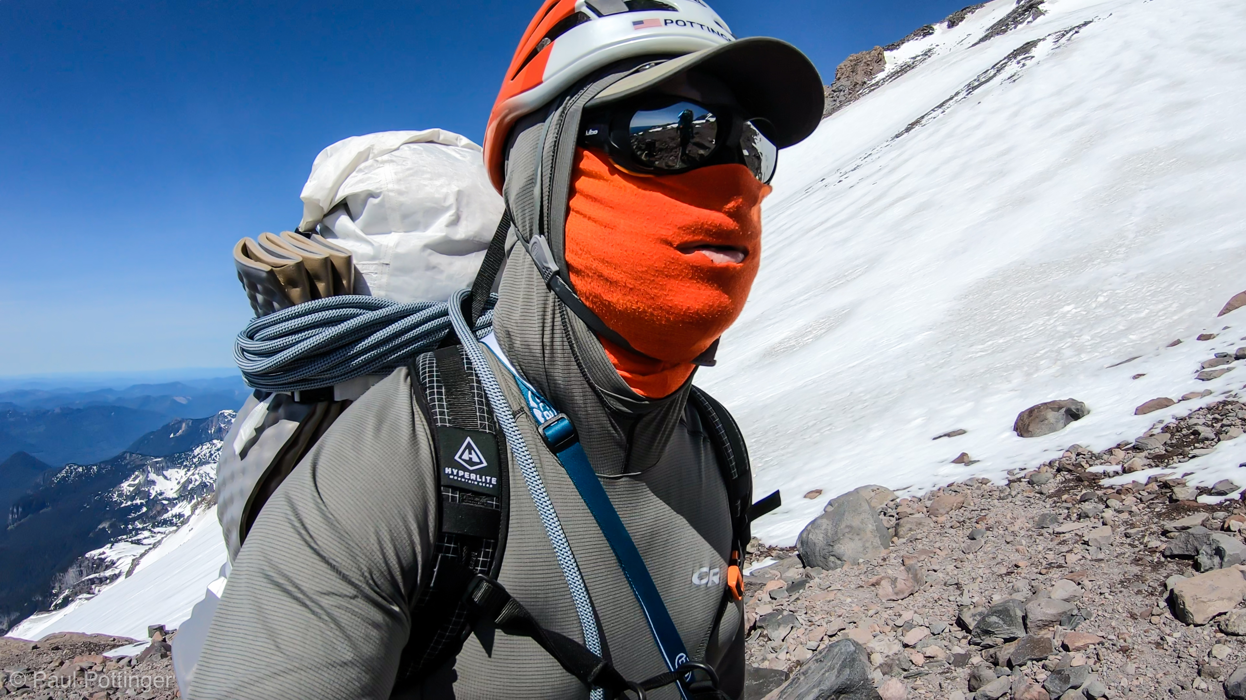
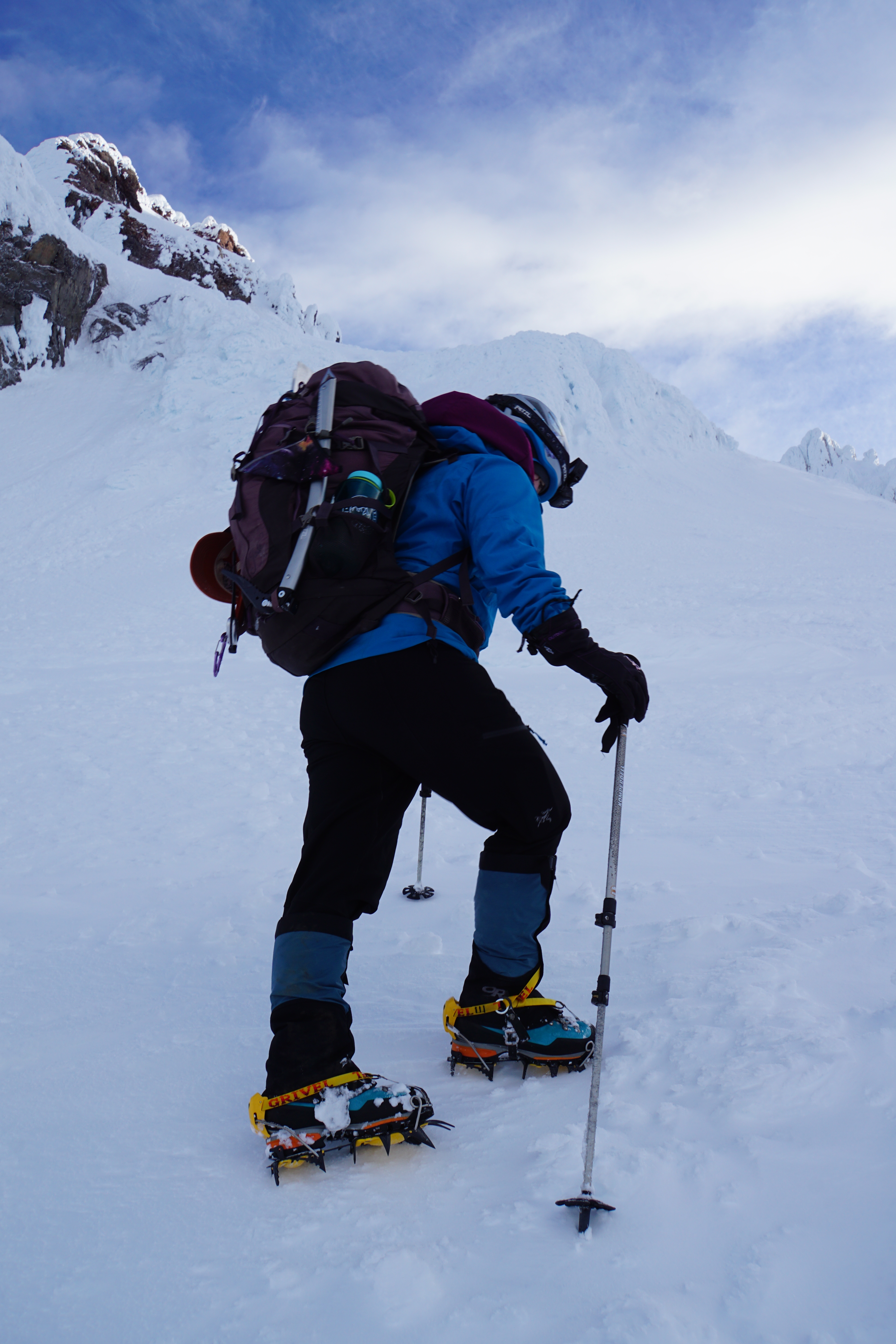
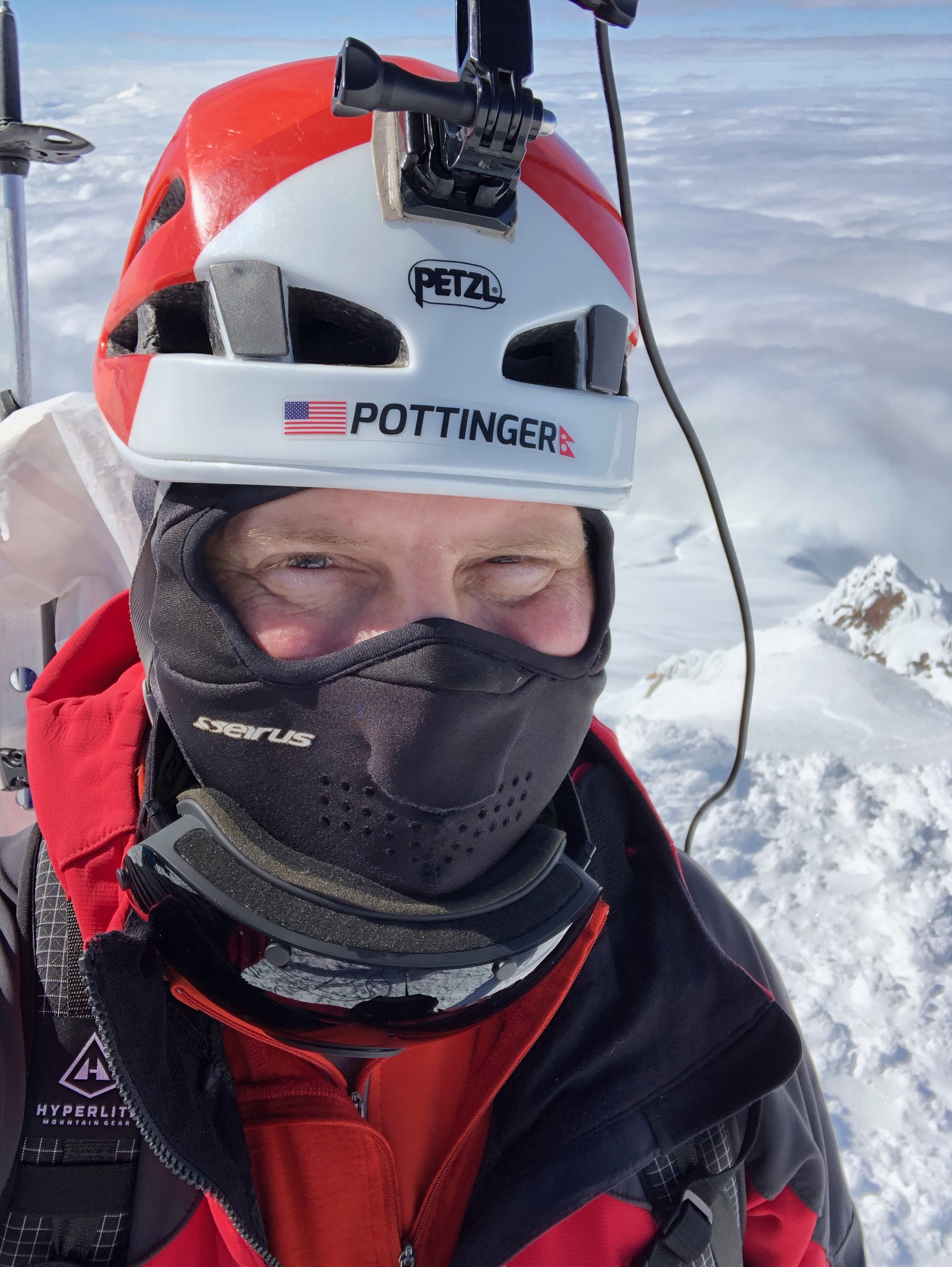
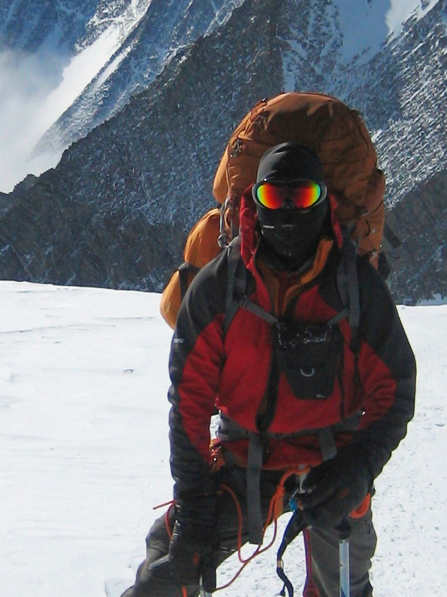
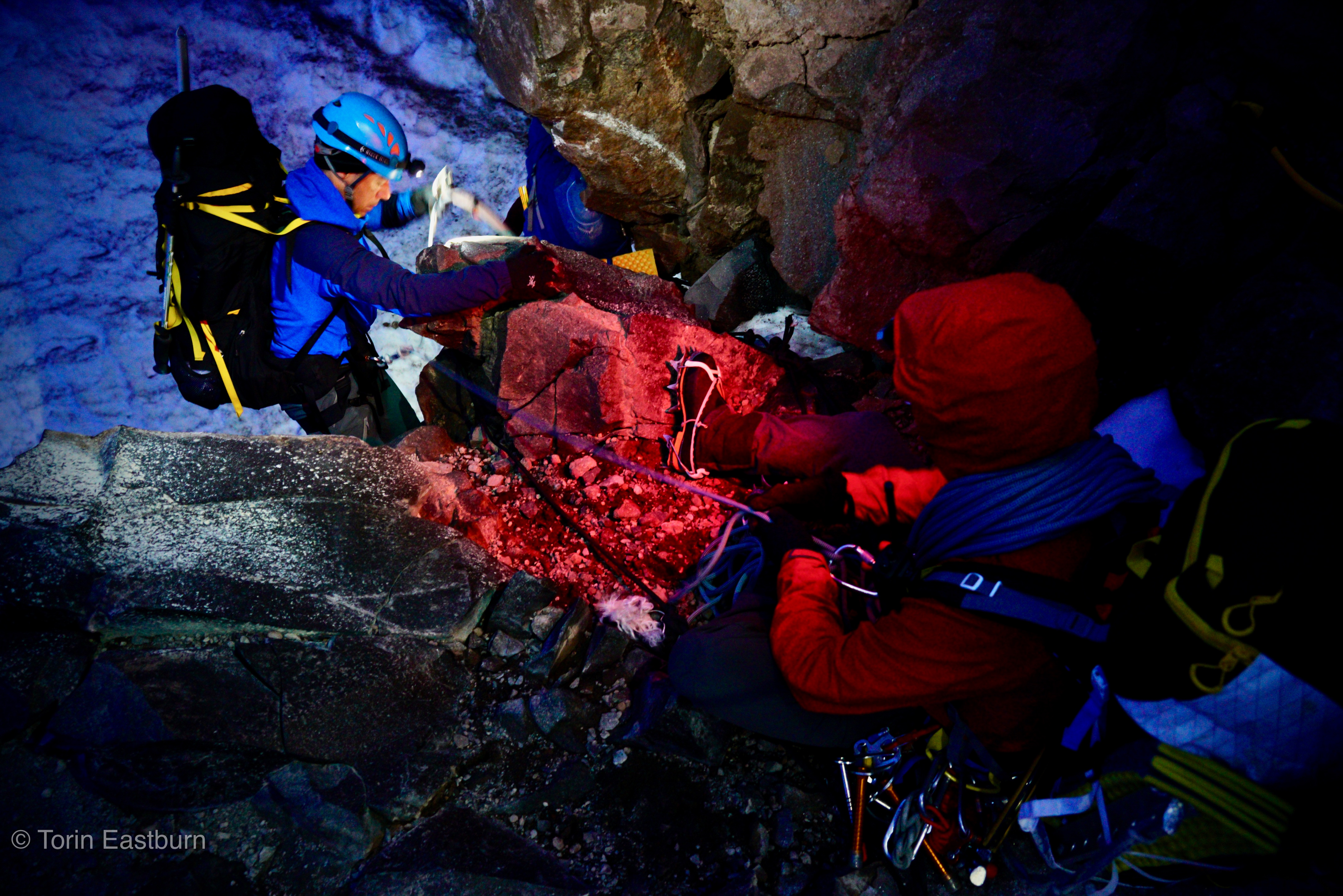
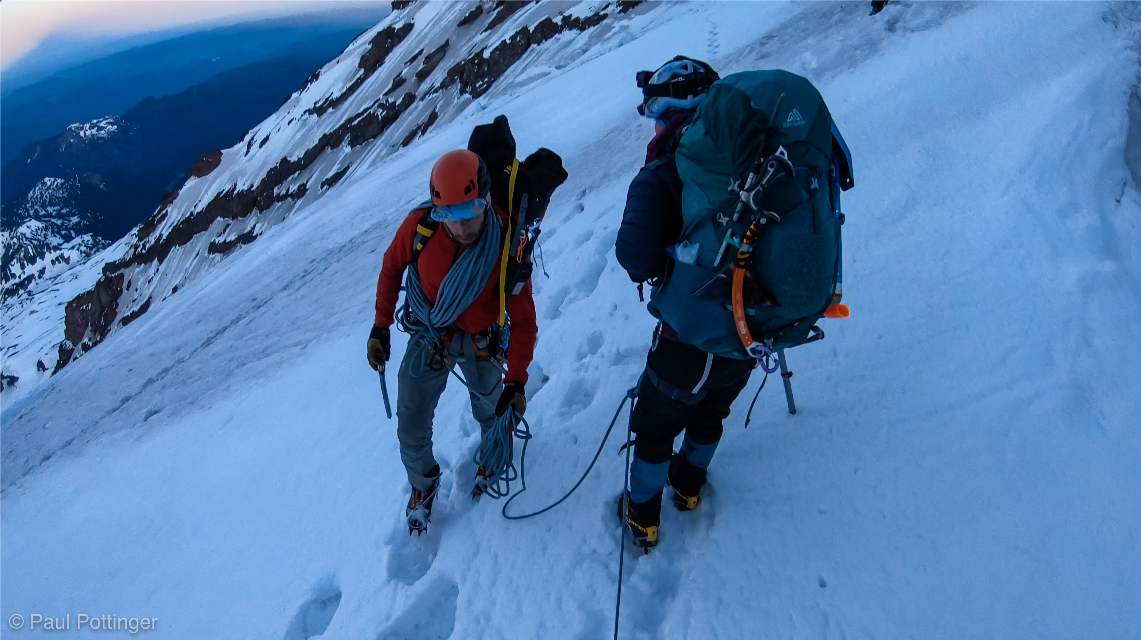
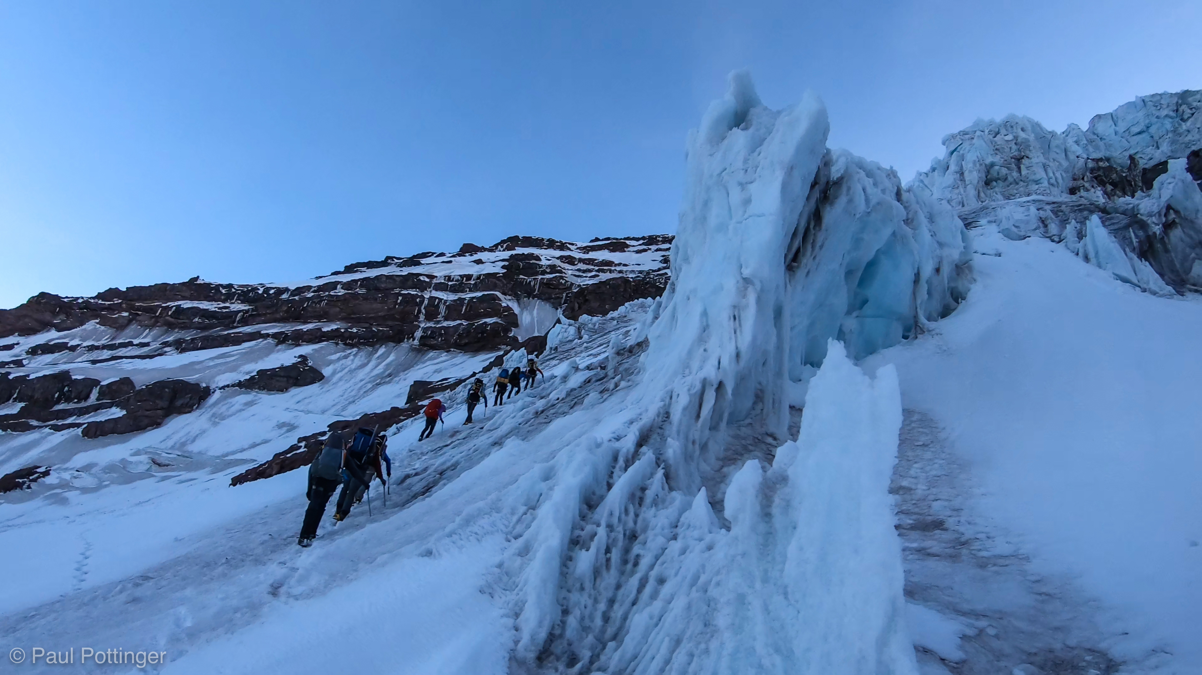
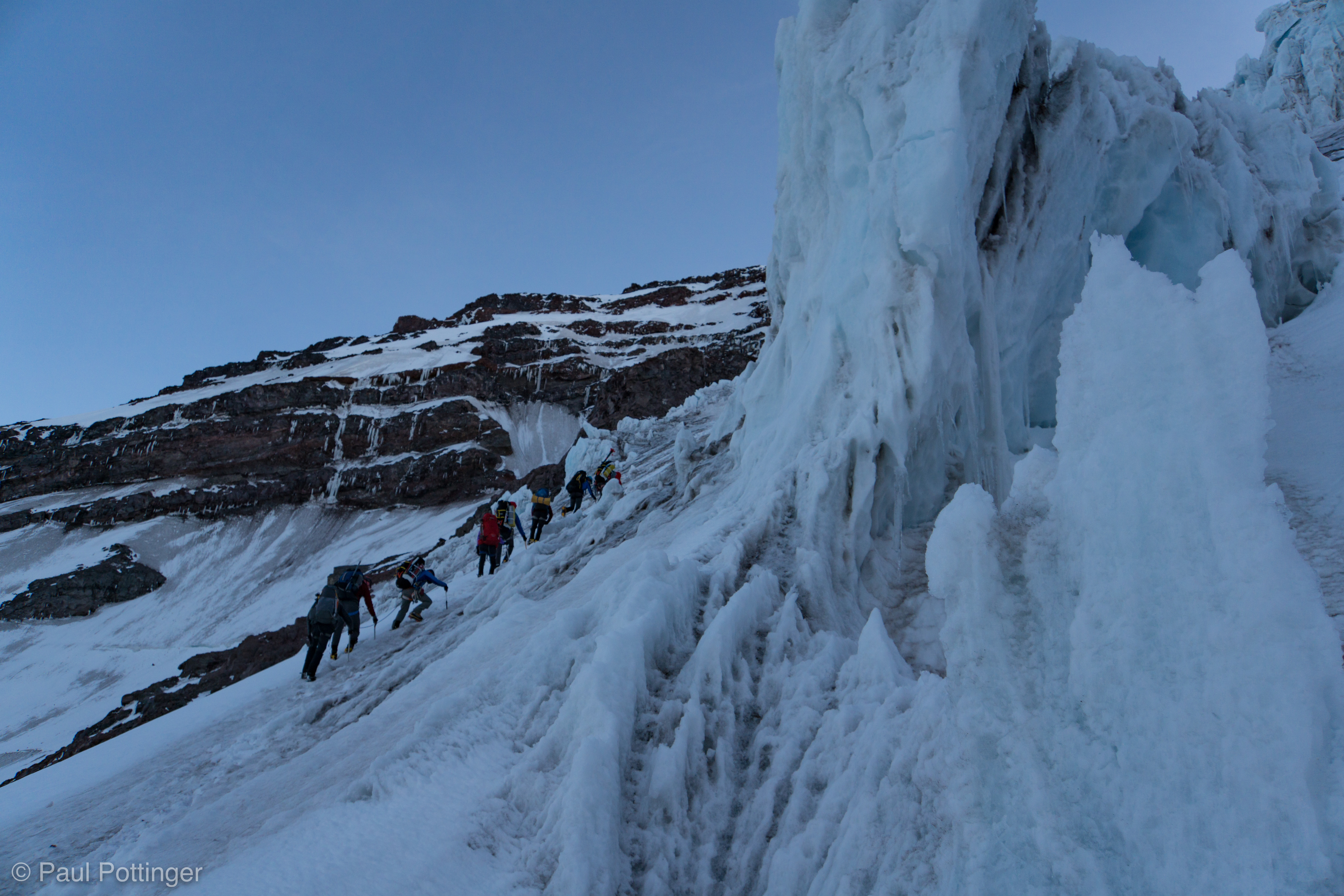
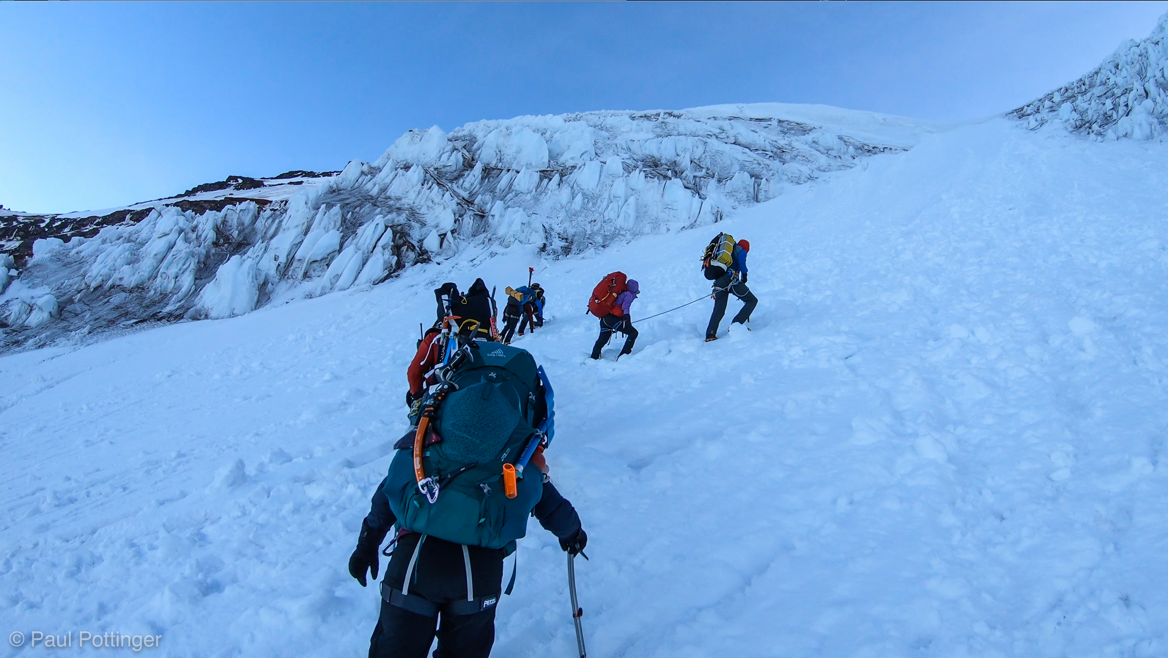
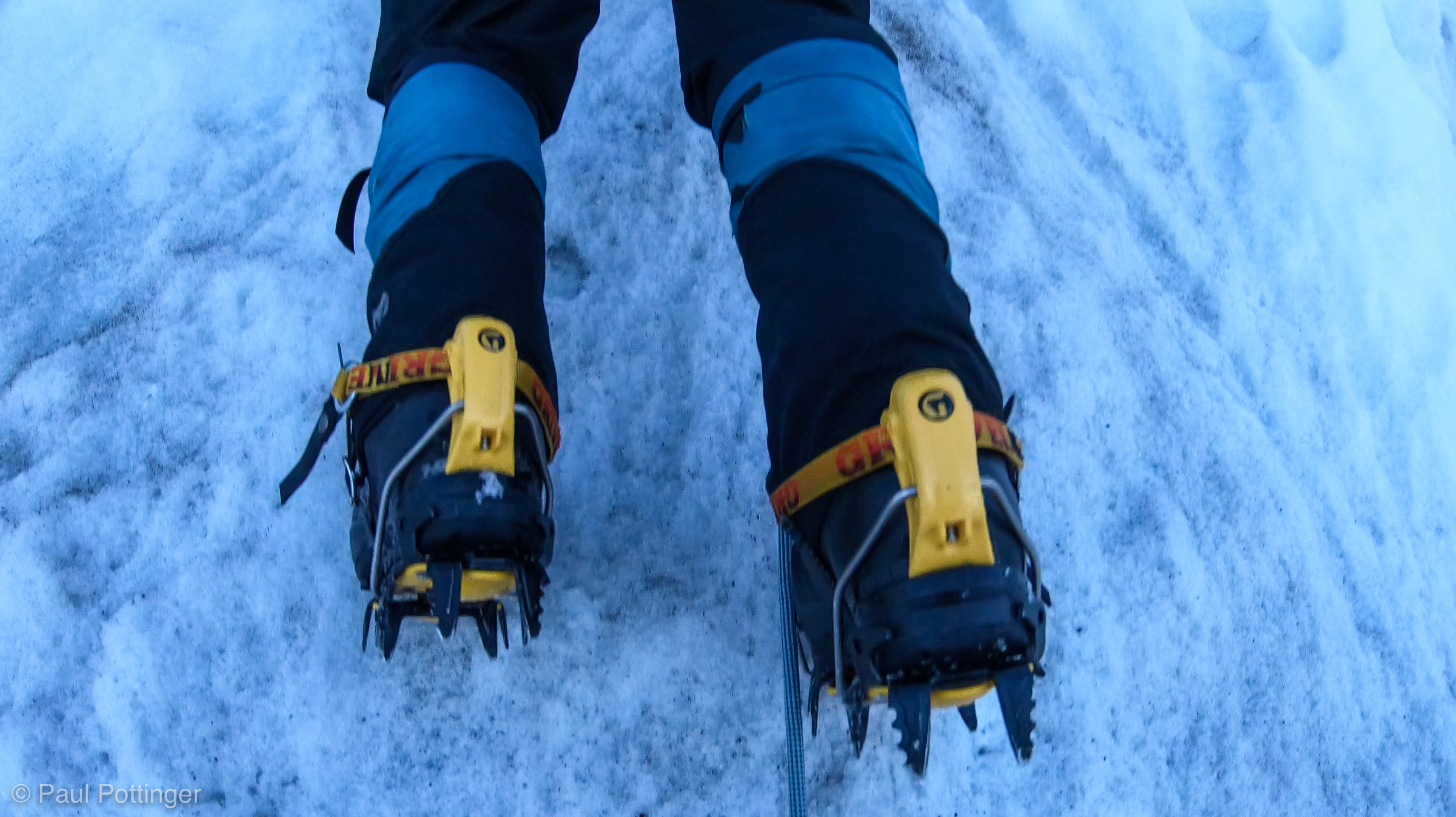
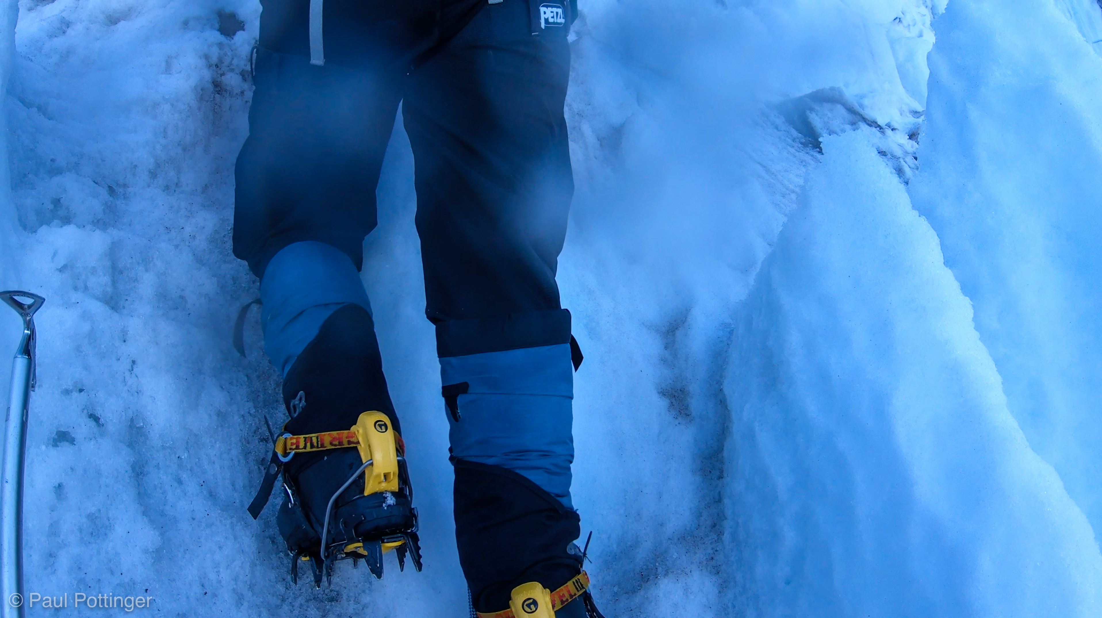
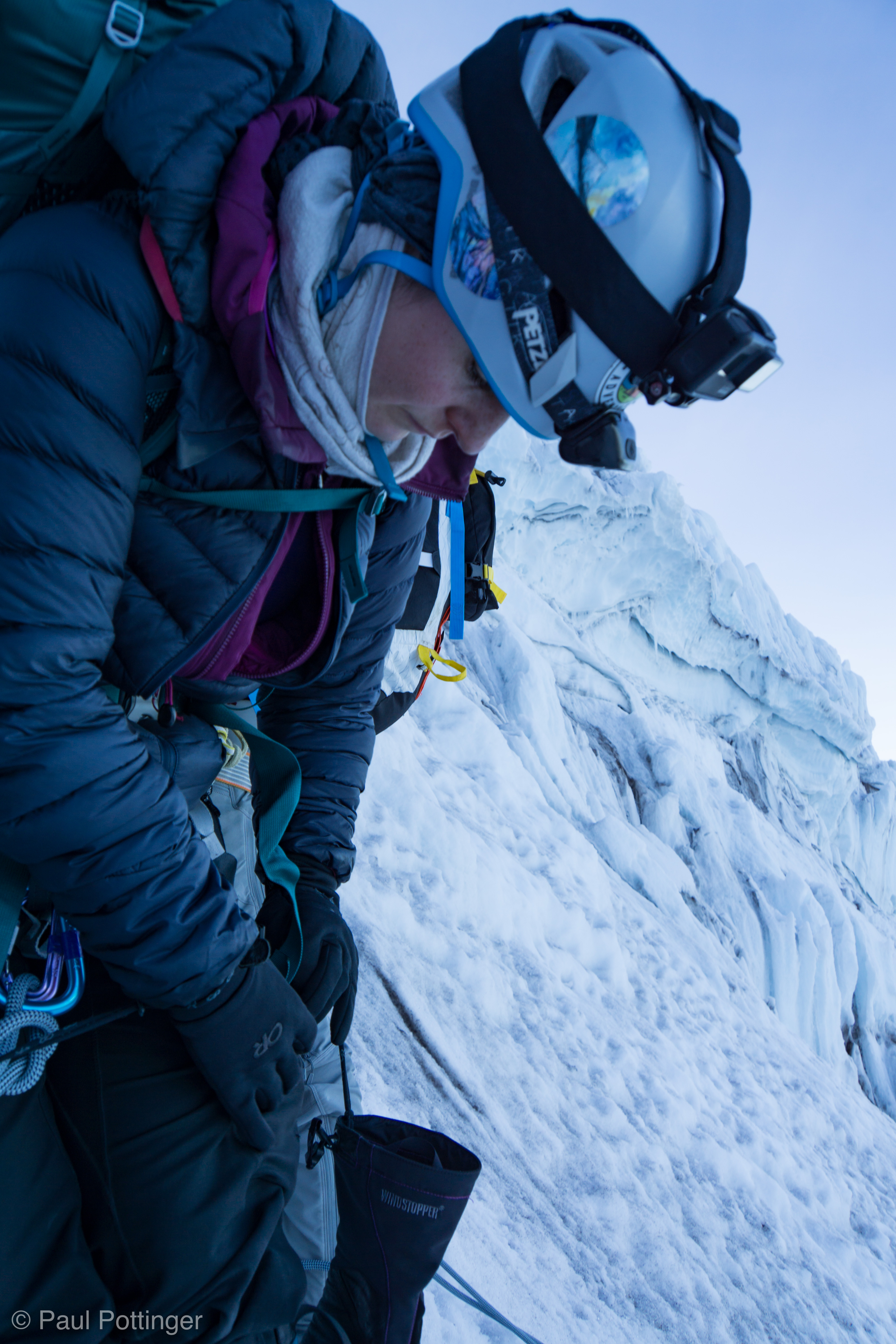
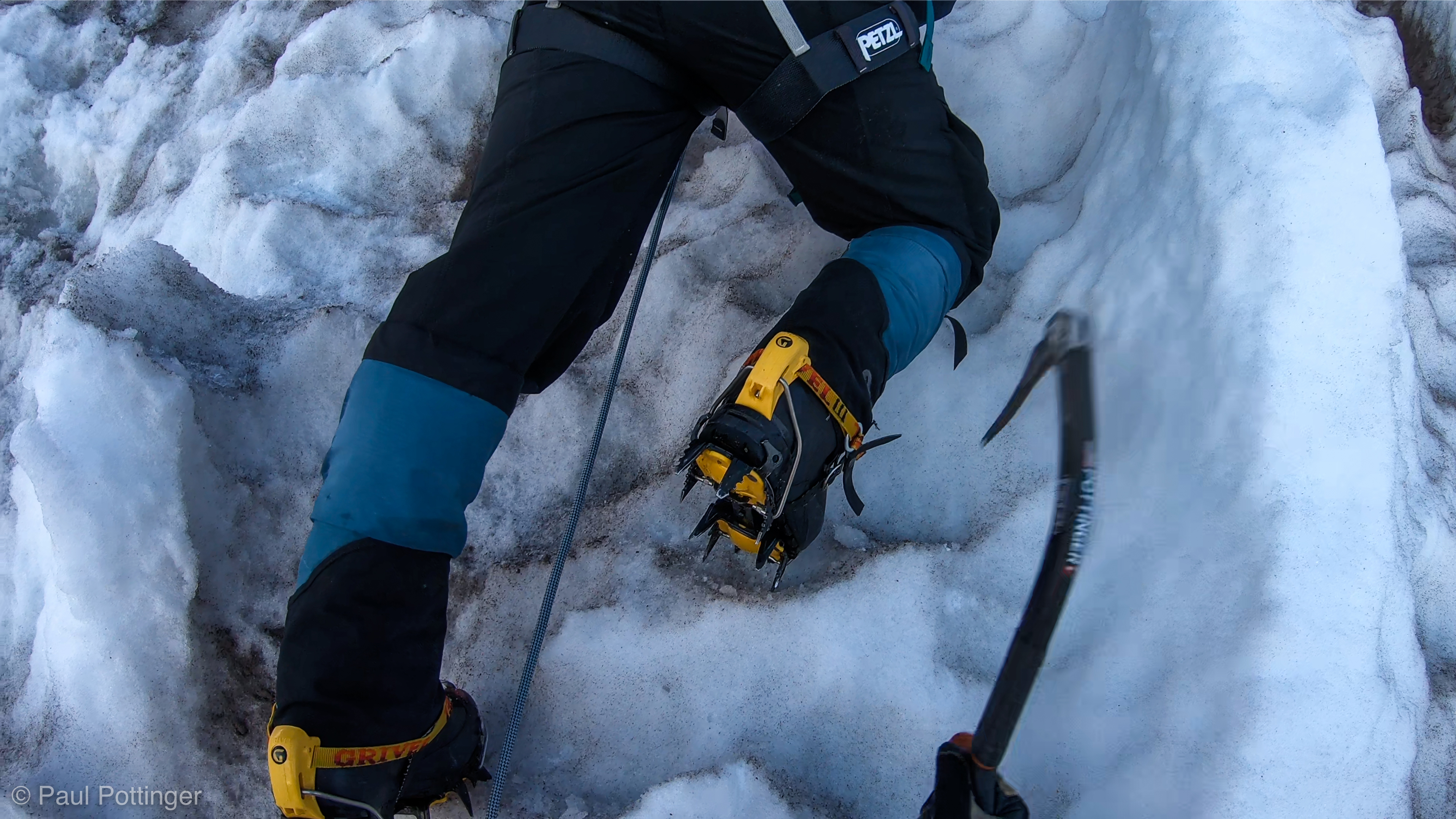
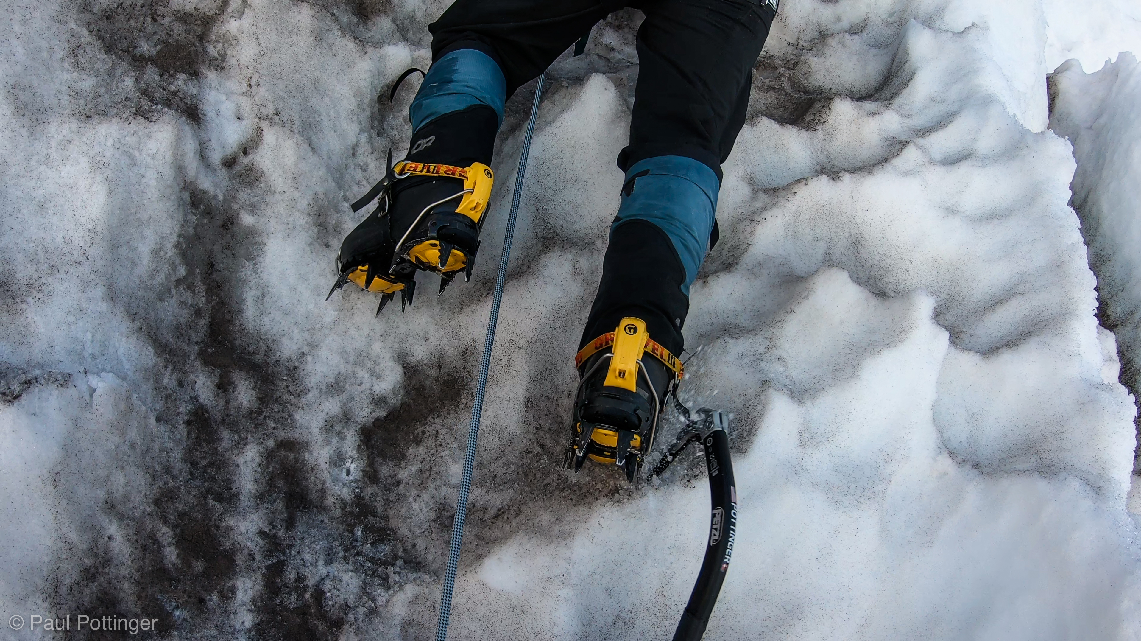
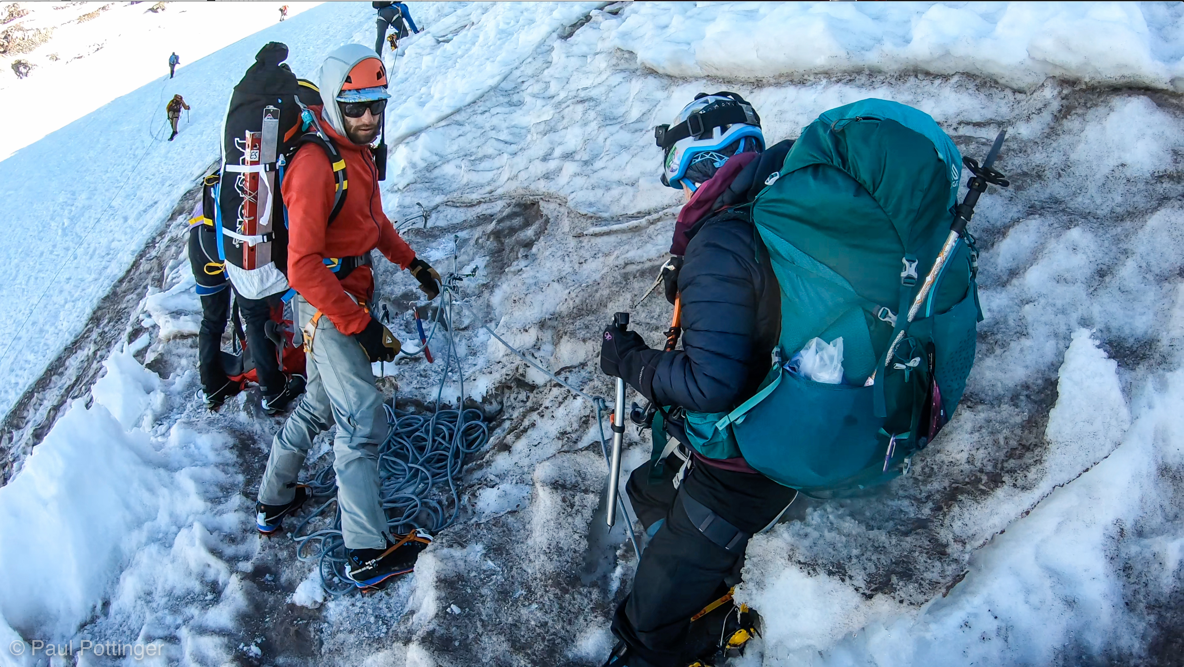
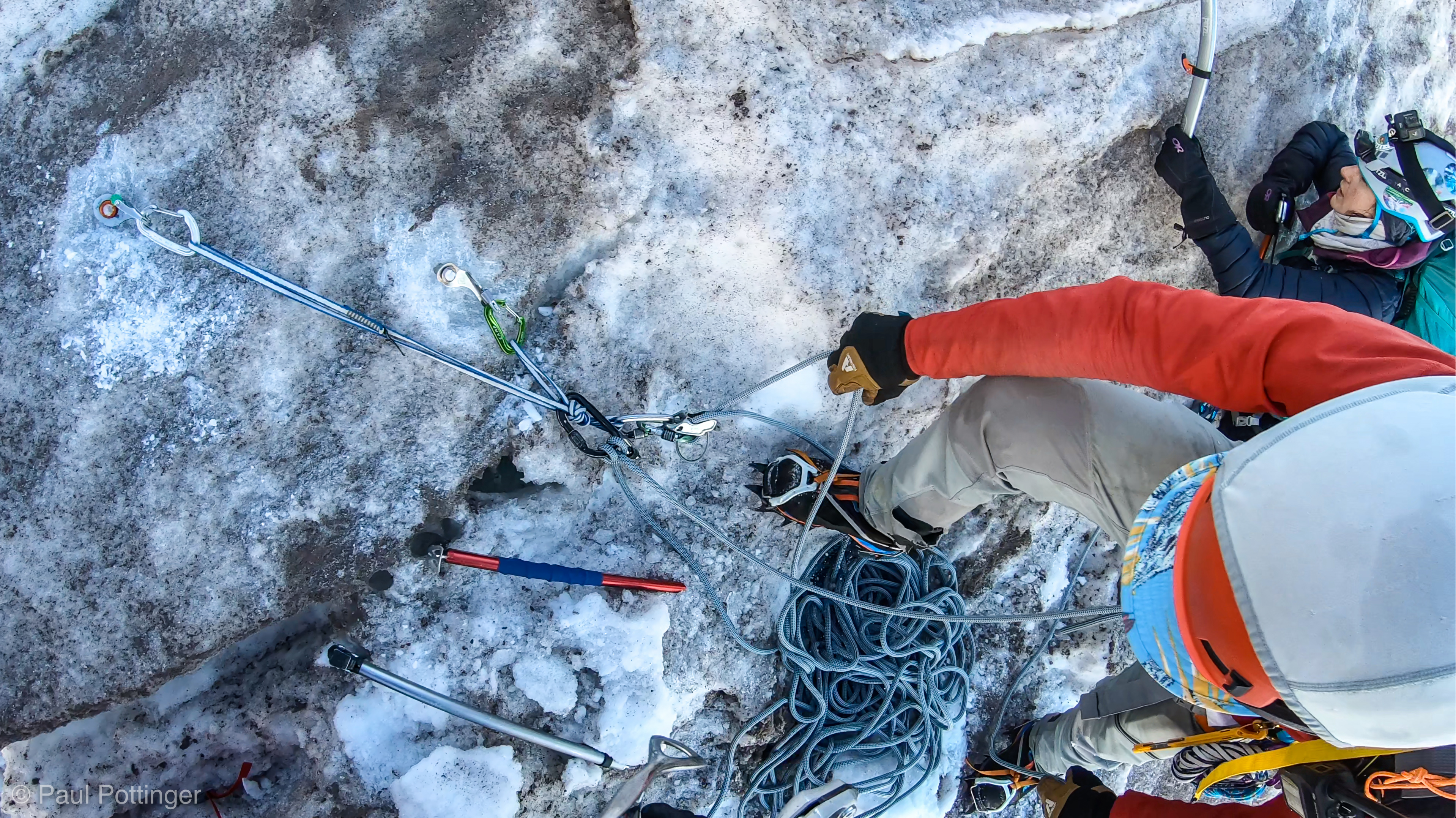
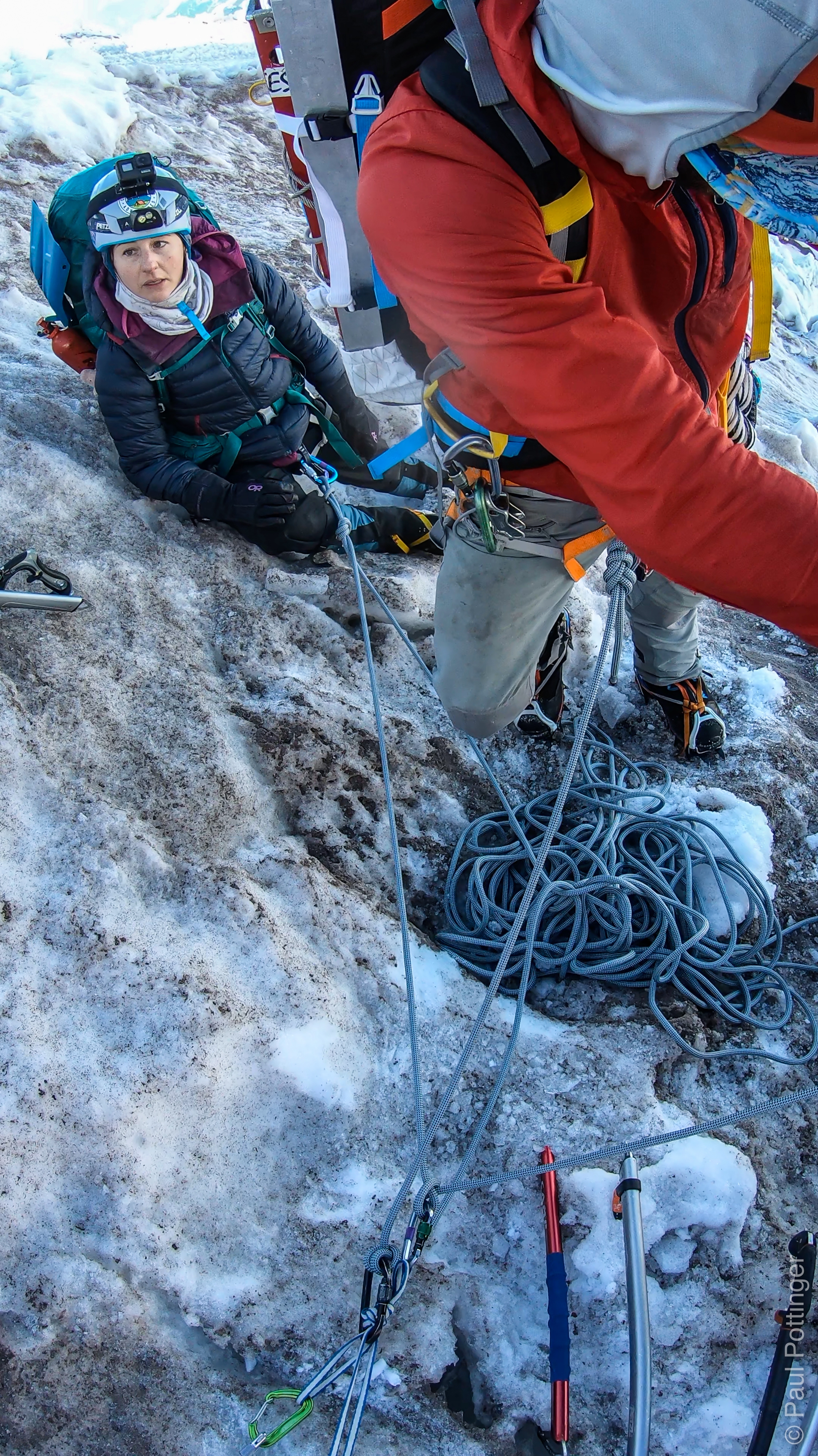
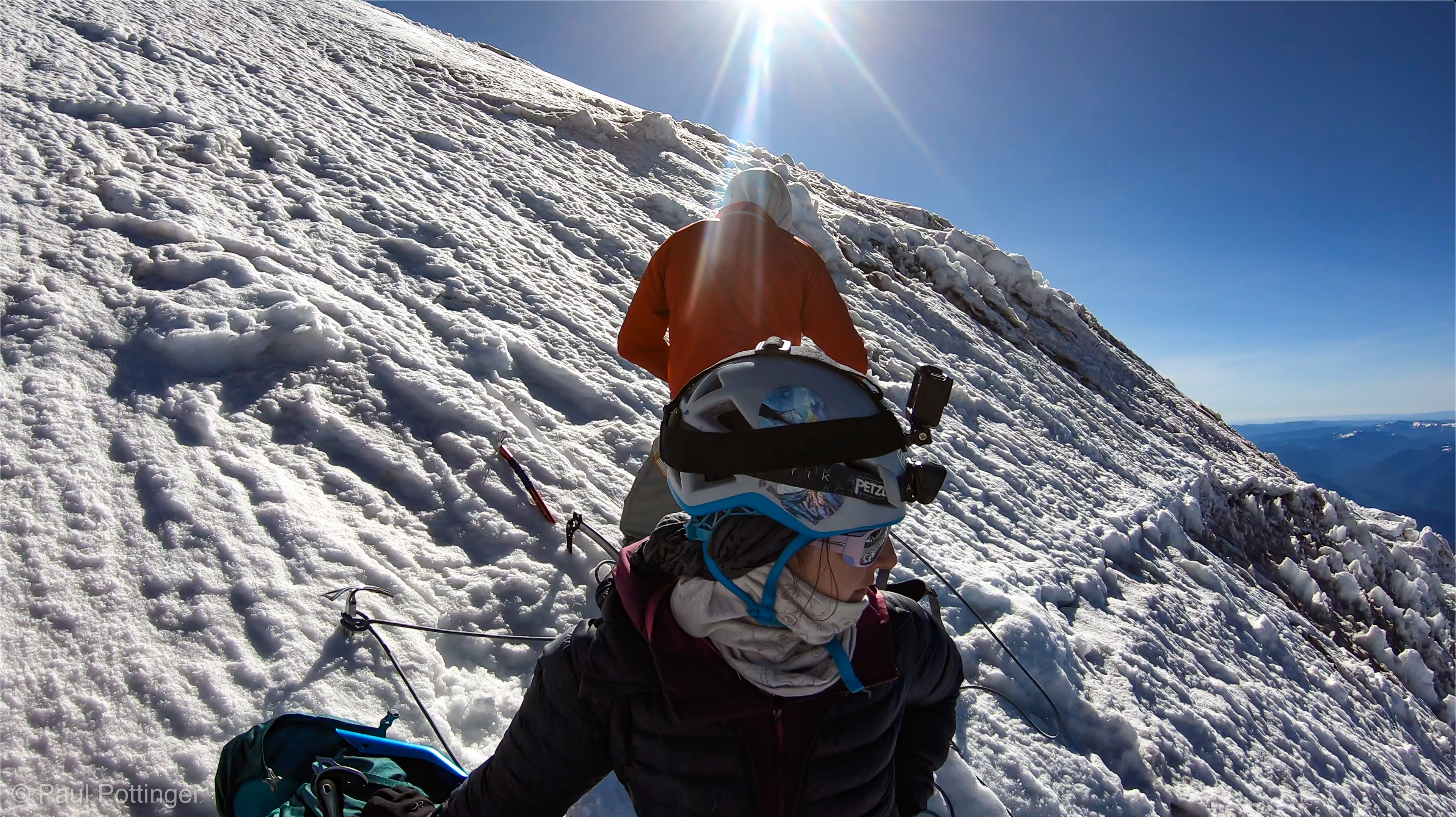
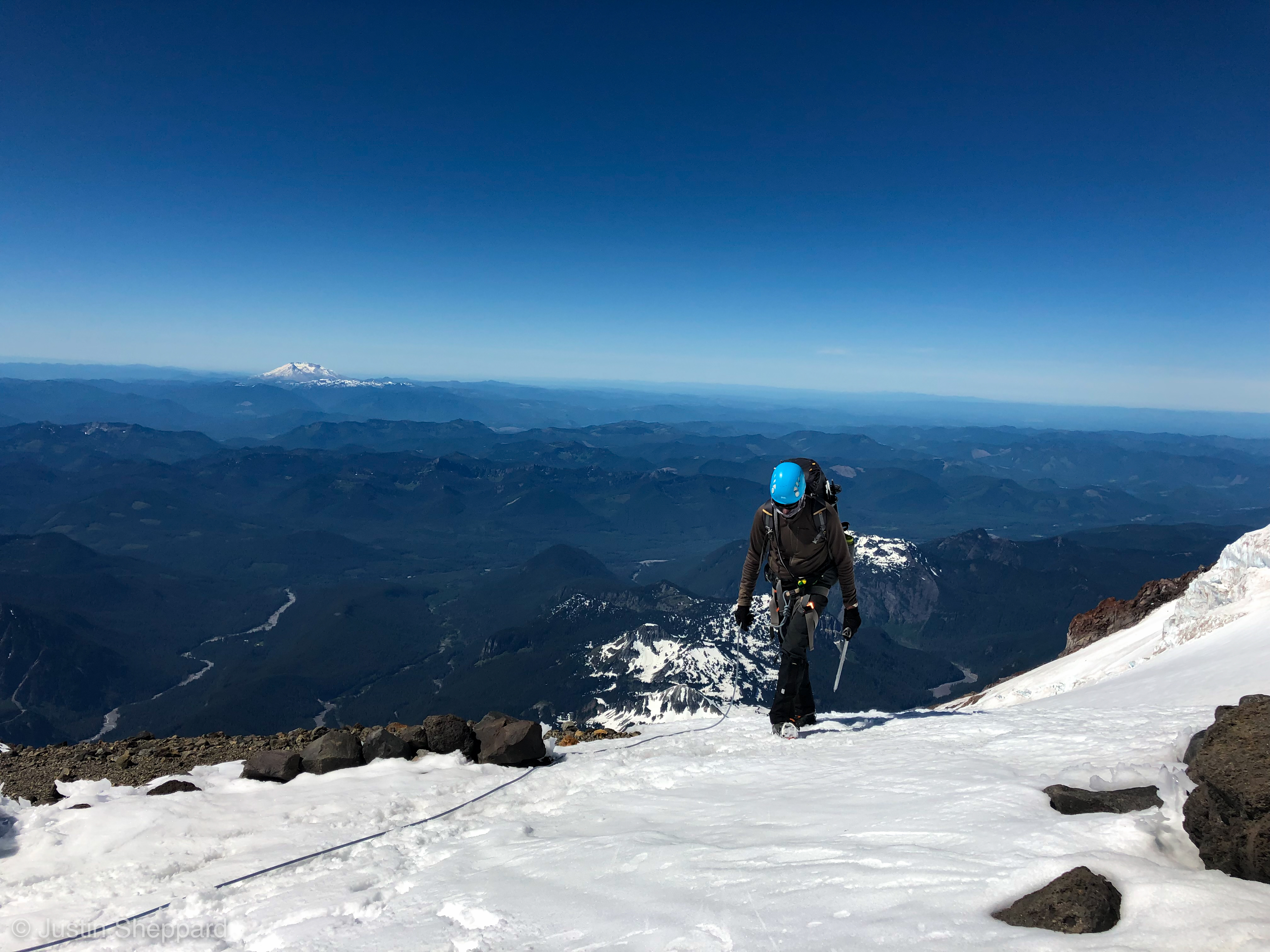
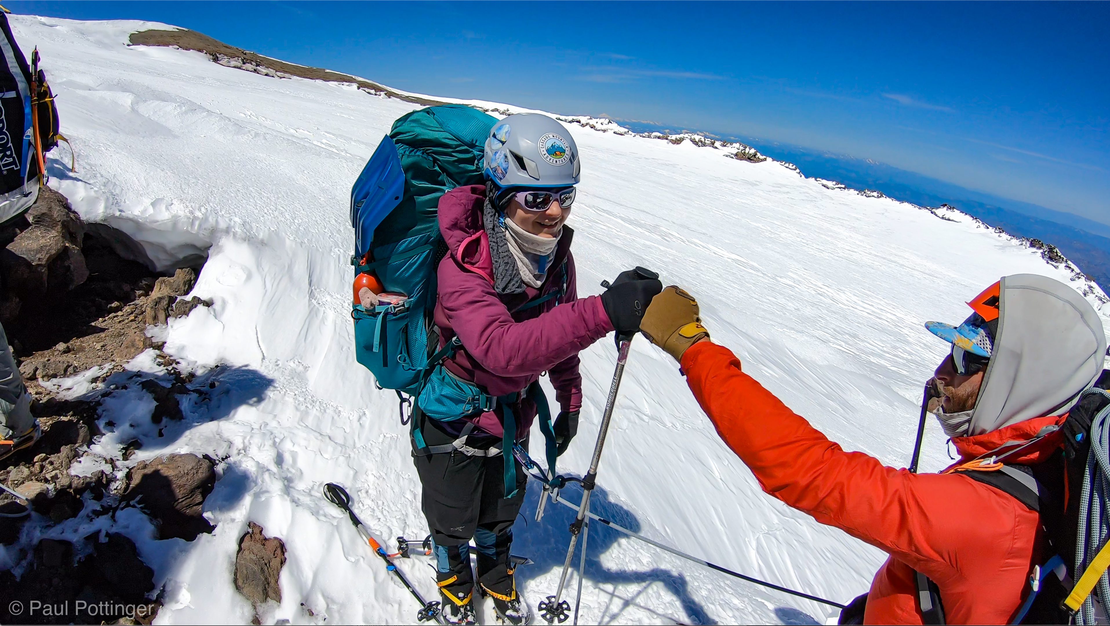
The Sneak formed a bottleneck: Each of us had to down-climb it one at a time, protected from above by a belay set by our guides. Well, not really one at a time… we were tied together at a couple armspans’ length, so this turned into simulclimbing after the first person was halfway down. Just like Forbidden. A stout static rope was fixed in place, which we could use as a hand line. For me, this was a dream come true: I trusted the hand line 100%, leaned out into space with my arms straight and relaxed, and focused on my footing. Plenty of fine footholds revealed themselves. Most people hate rock climbing in crampons, but I kind of like it. Anyone can climb in shoes… crampons make it harder, especially in the cold of morning, carrying 40 lbs, at 11,000 feet, with just a couple meters between you and your partner on the line. How fun is this?

The Kautz Ice Chute revealed, at center, from the Sneak.
Nickel belays Justin while he downclimbs the rocky step at the Sneak.
Ascending after the Sneak. Chute visible tope left.
Team Goonies heading up after the Sneak.
Our teammates ascend the steep snow ramp just beyond the Sneak. Kautz Ice Chute, filled with snow, at top left.
T$ prepares to drop down the sneak behind me.

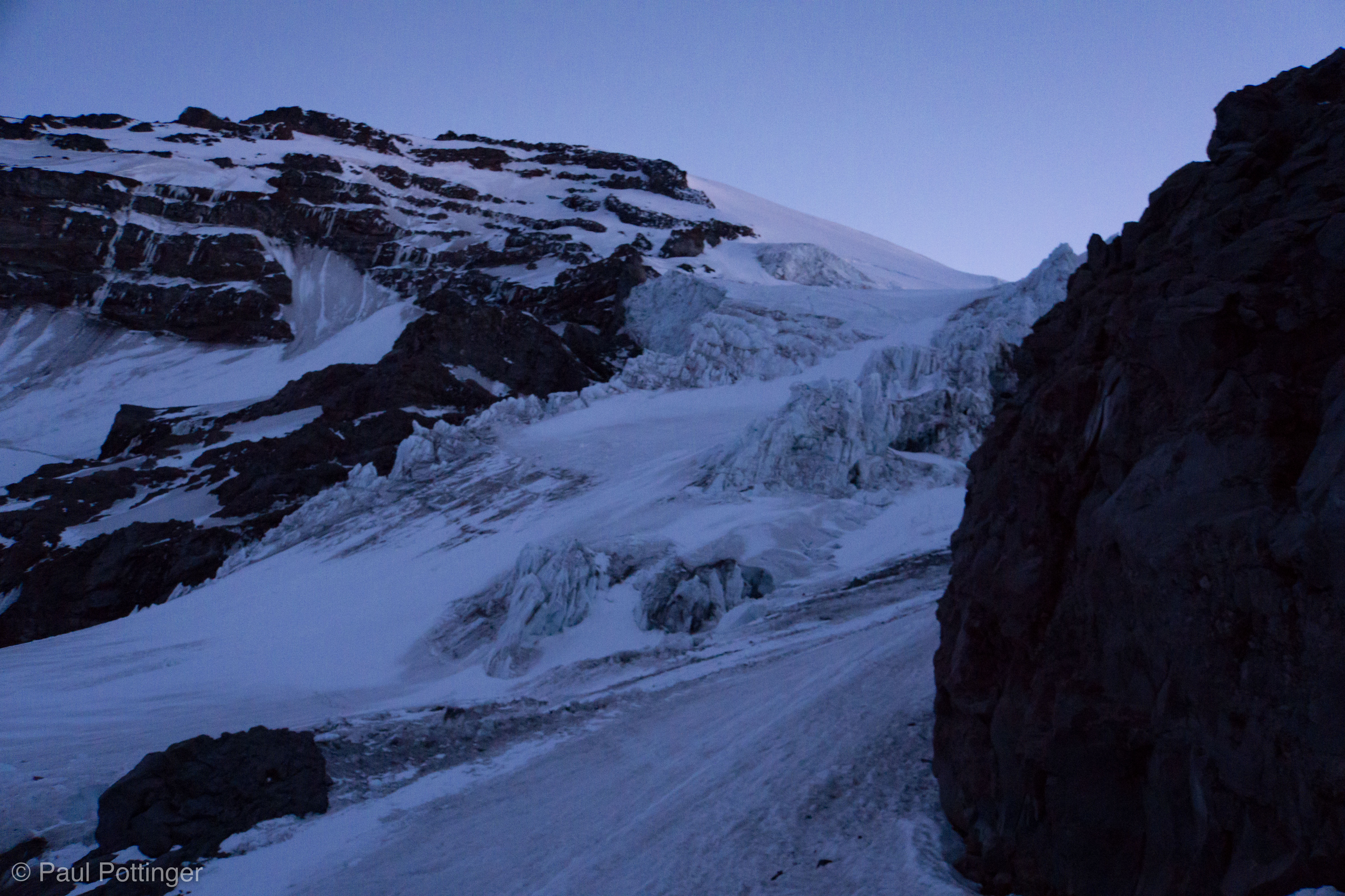
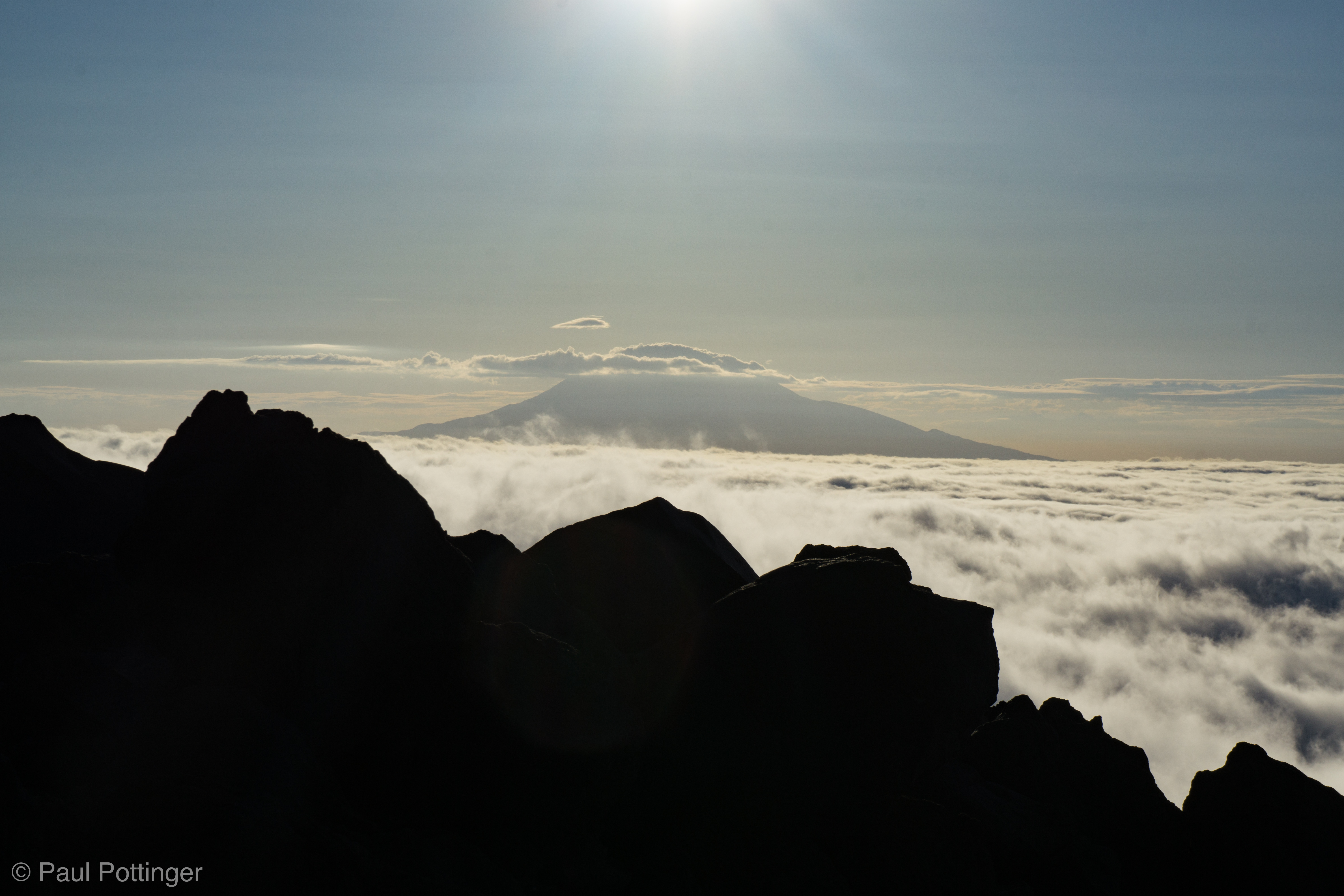
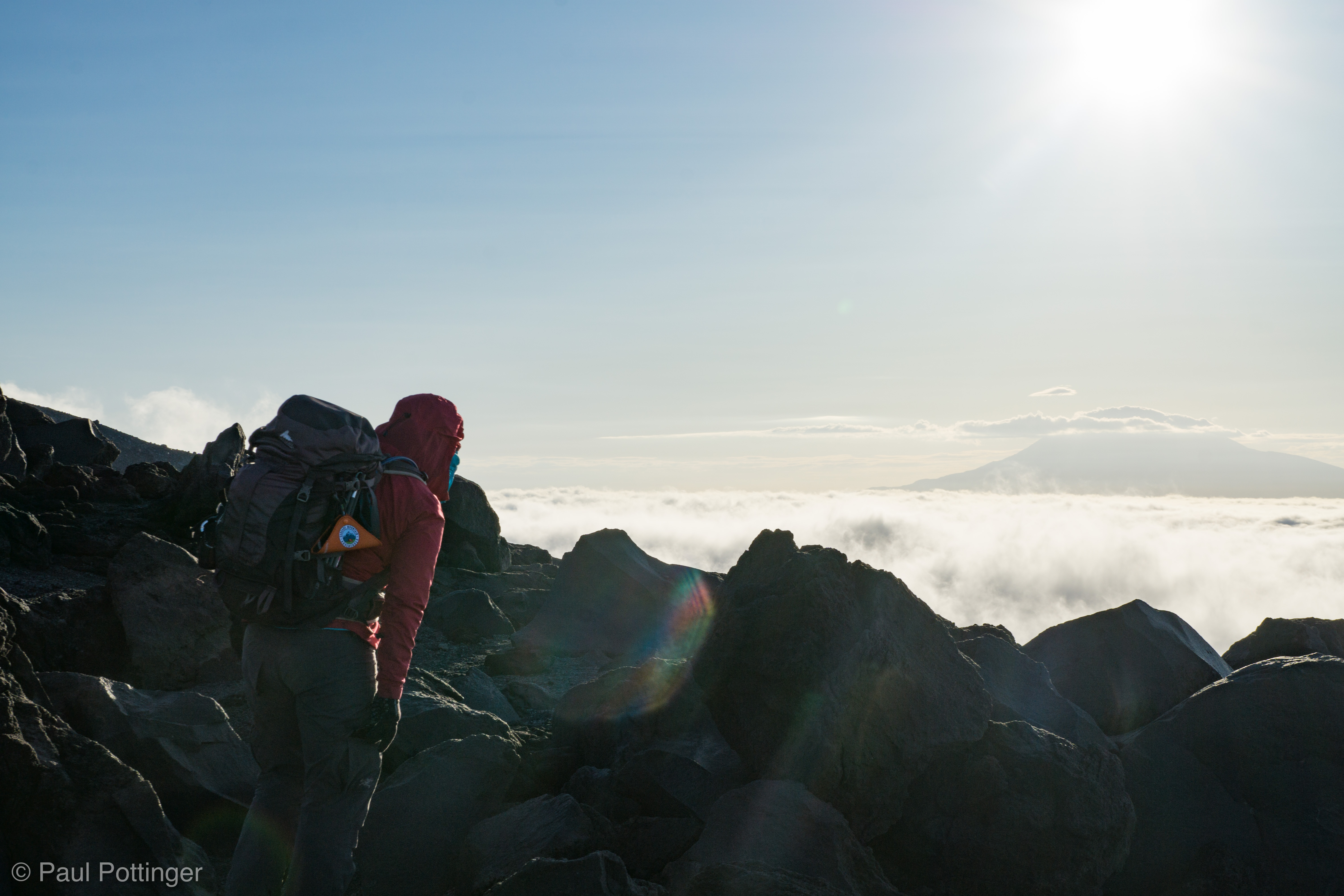
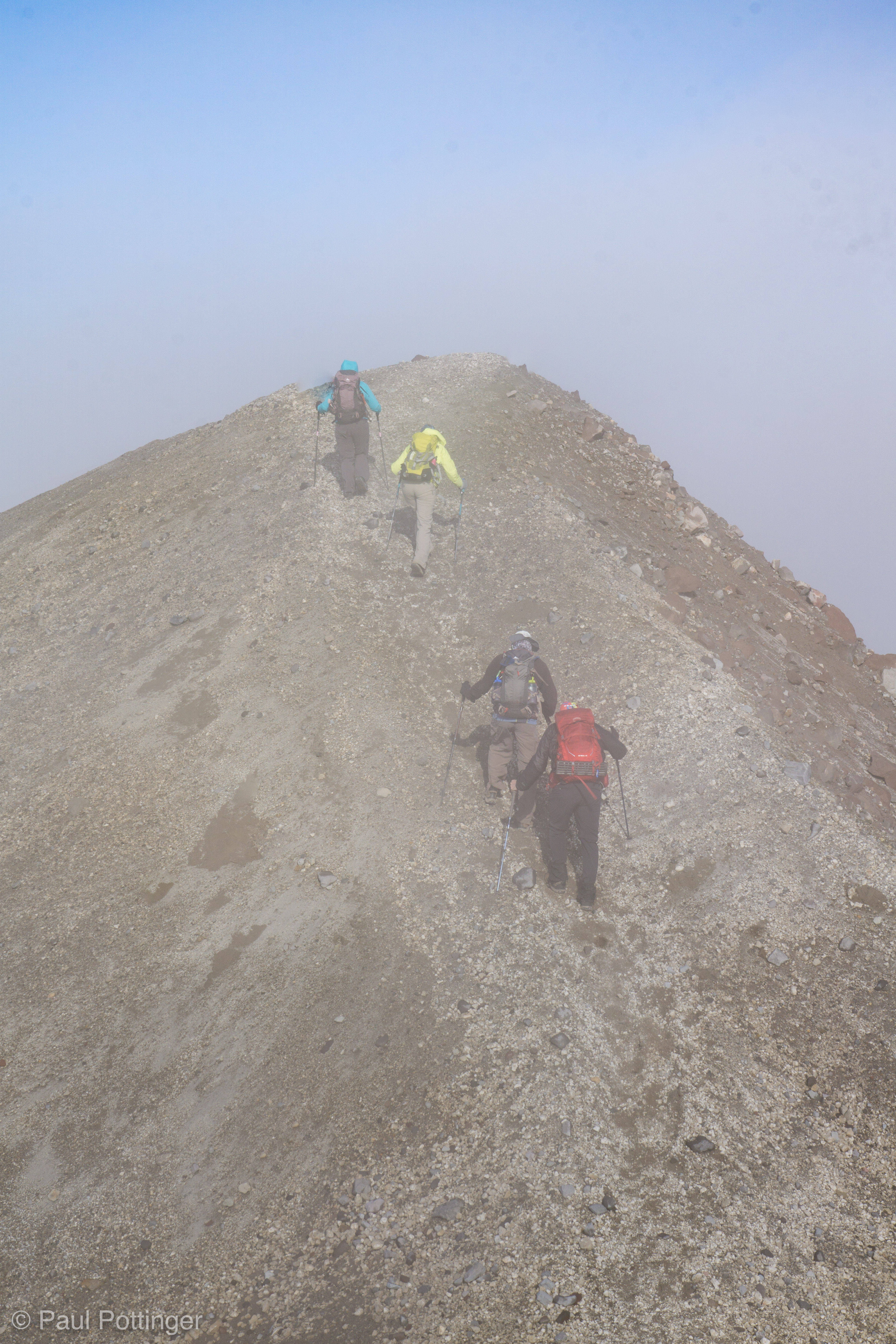
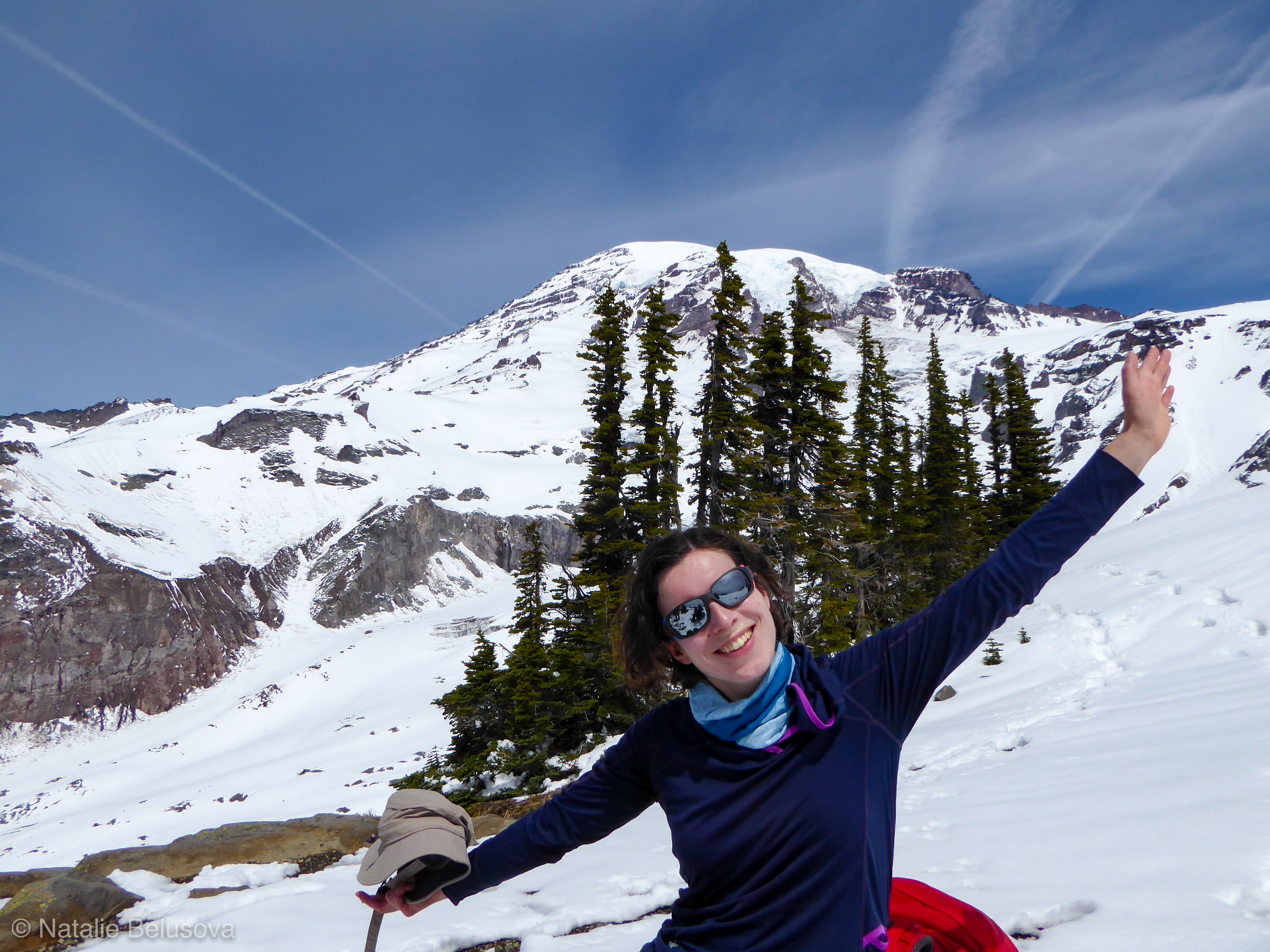
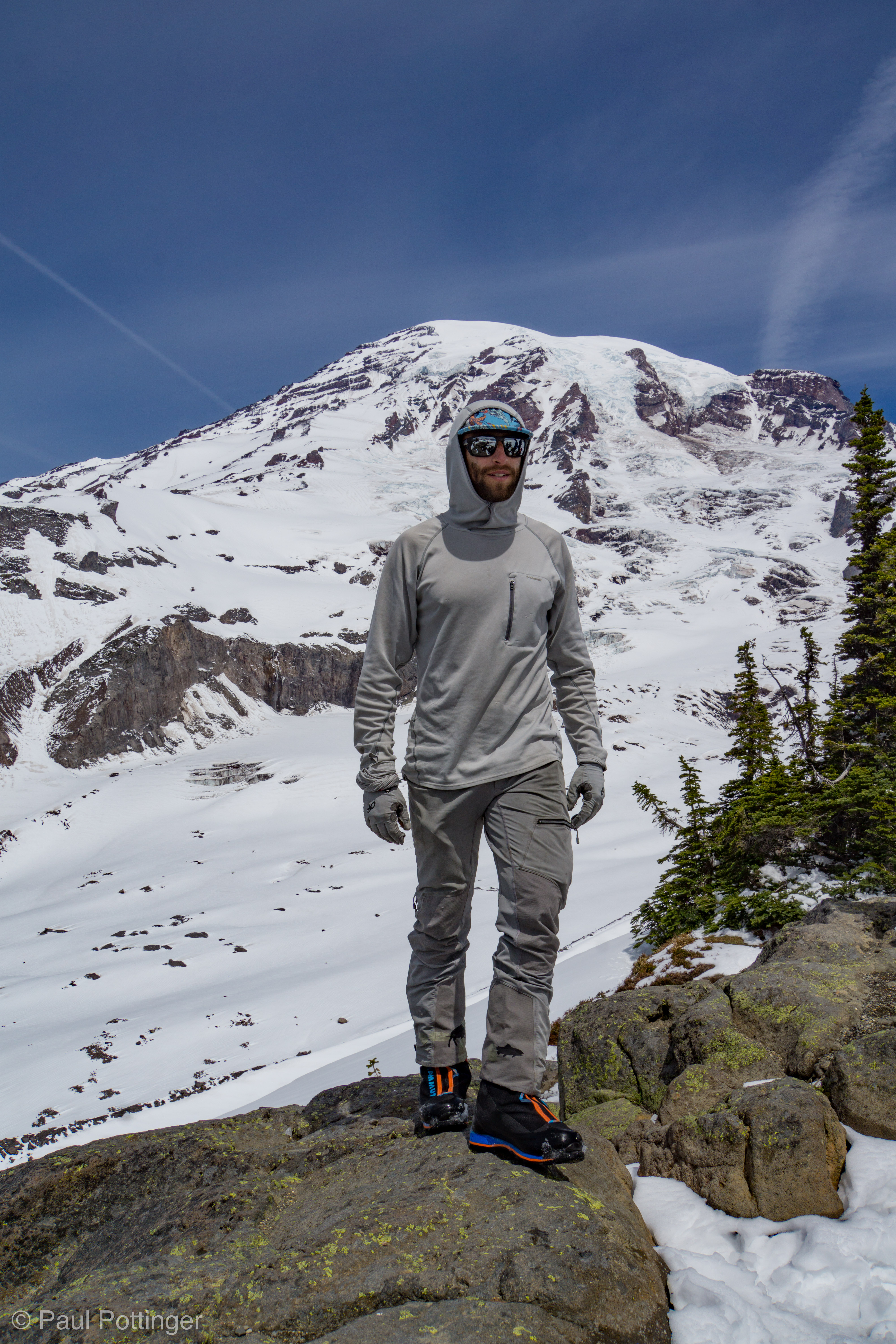
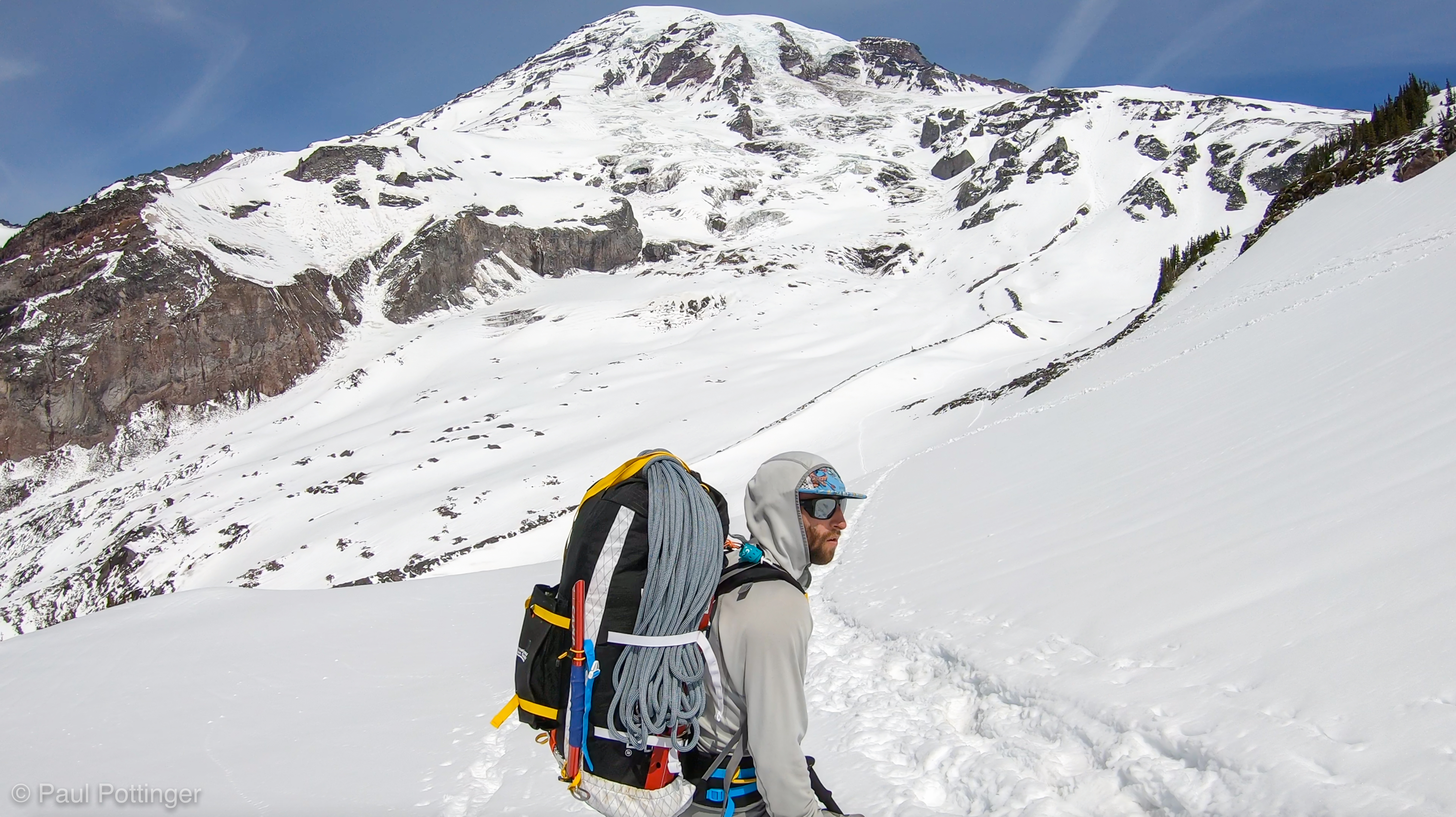
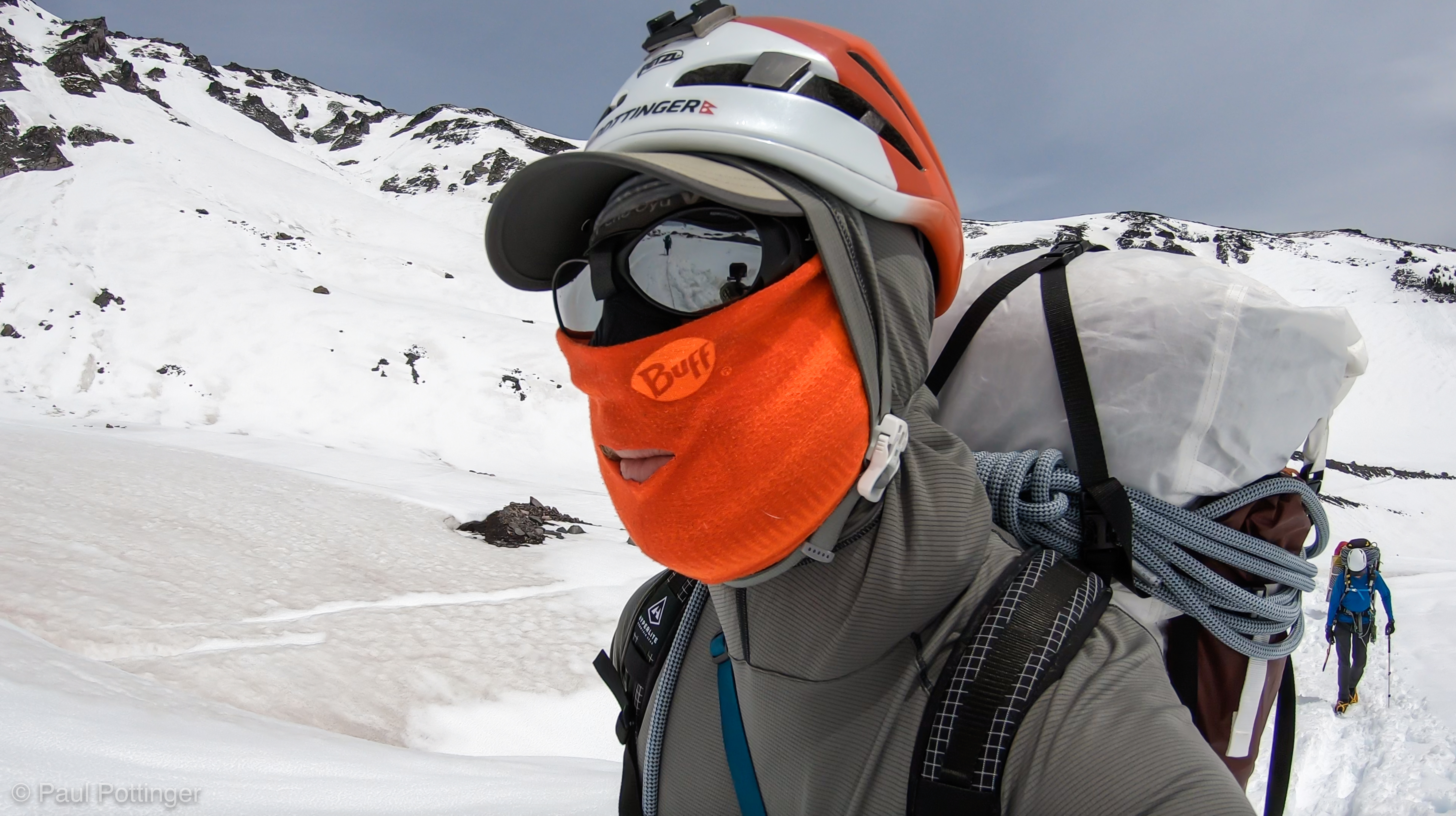
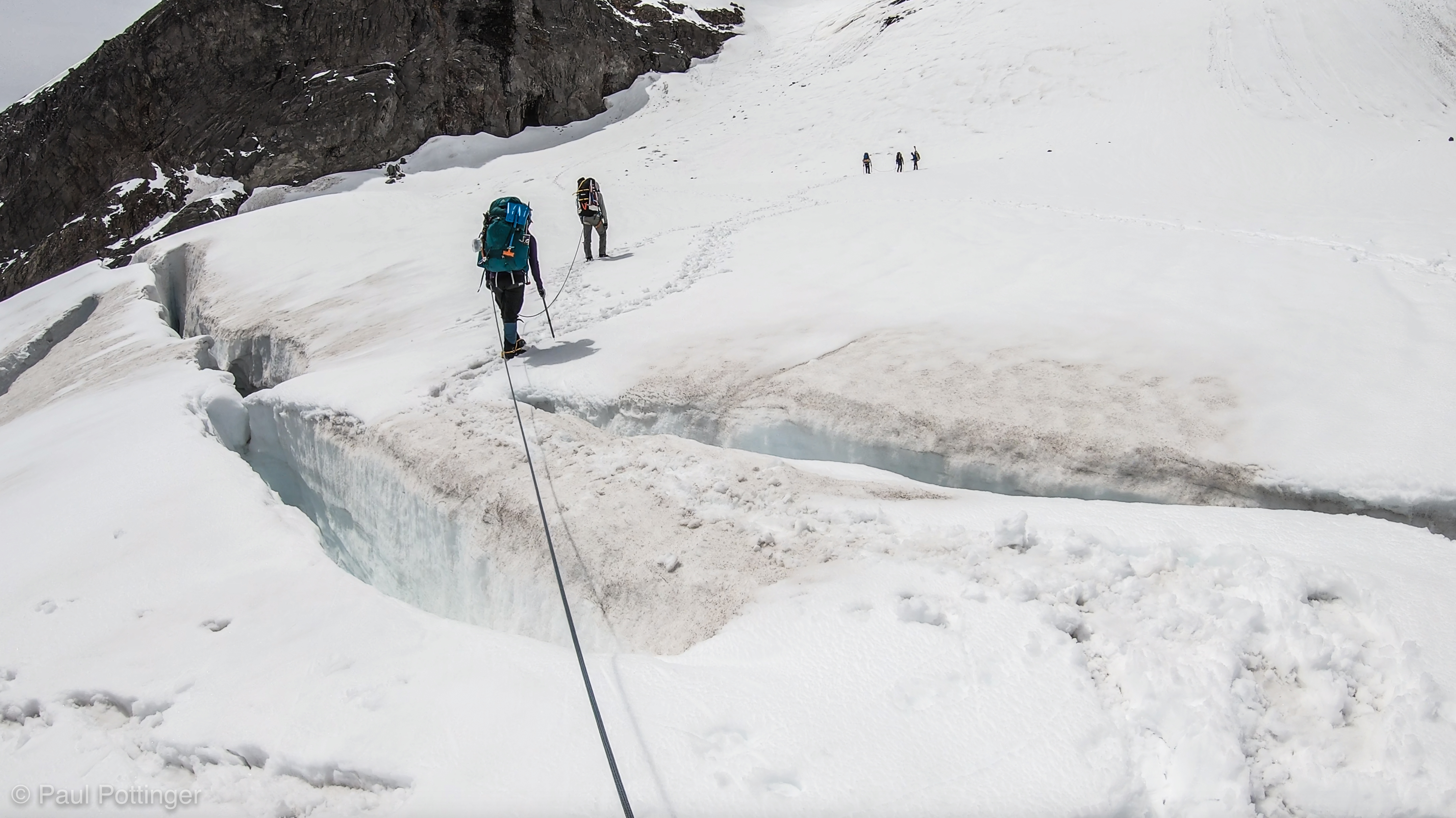
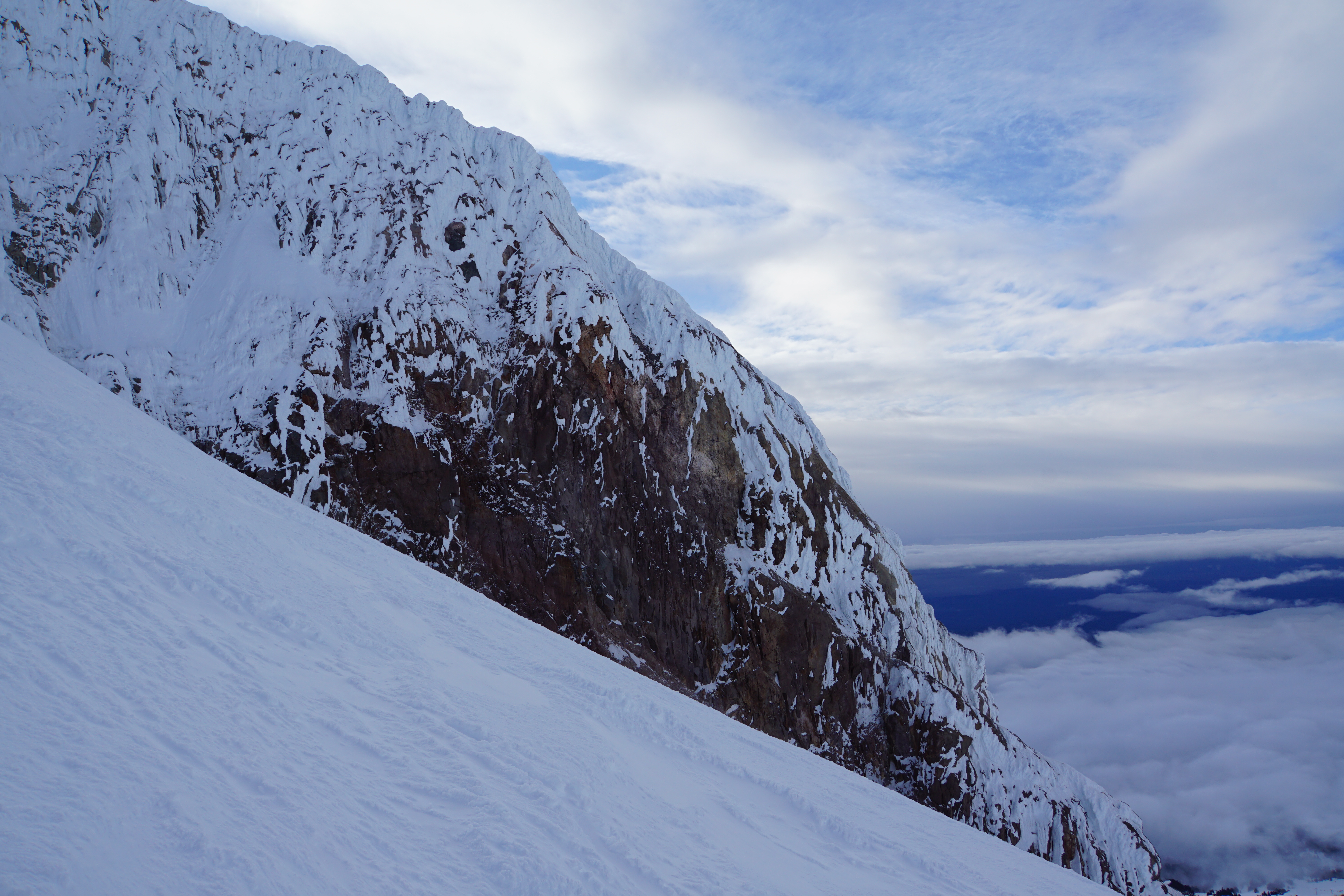
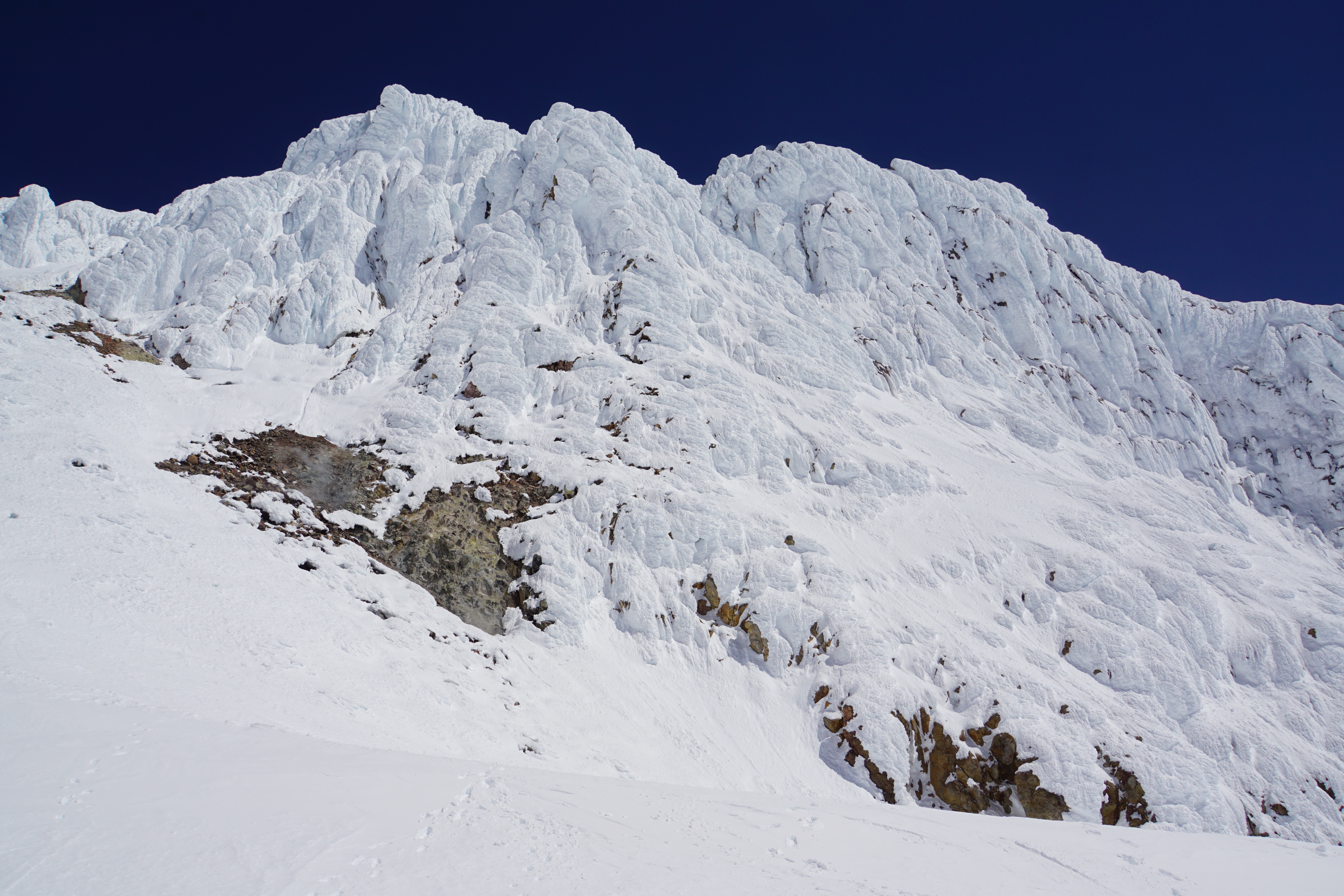
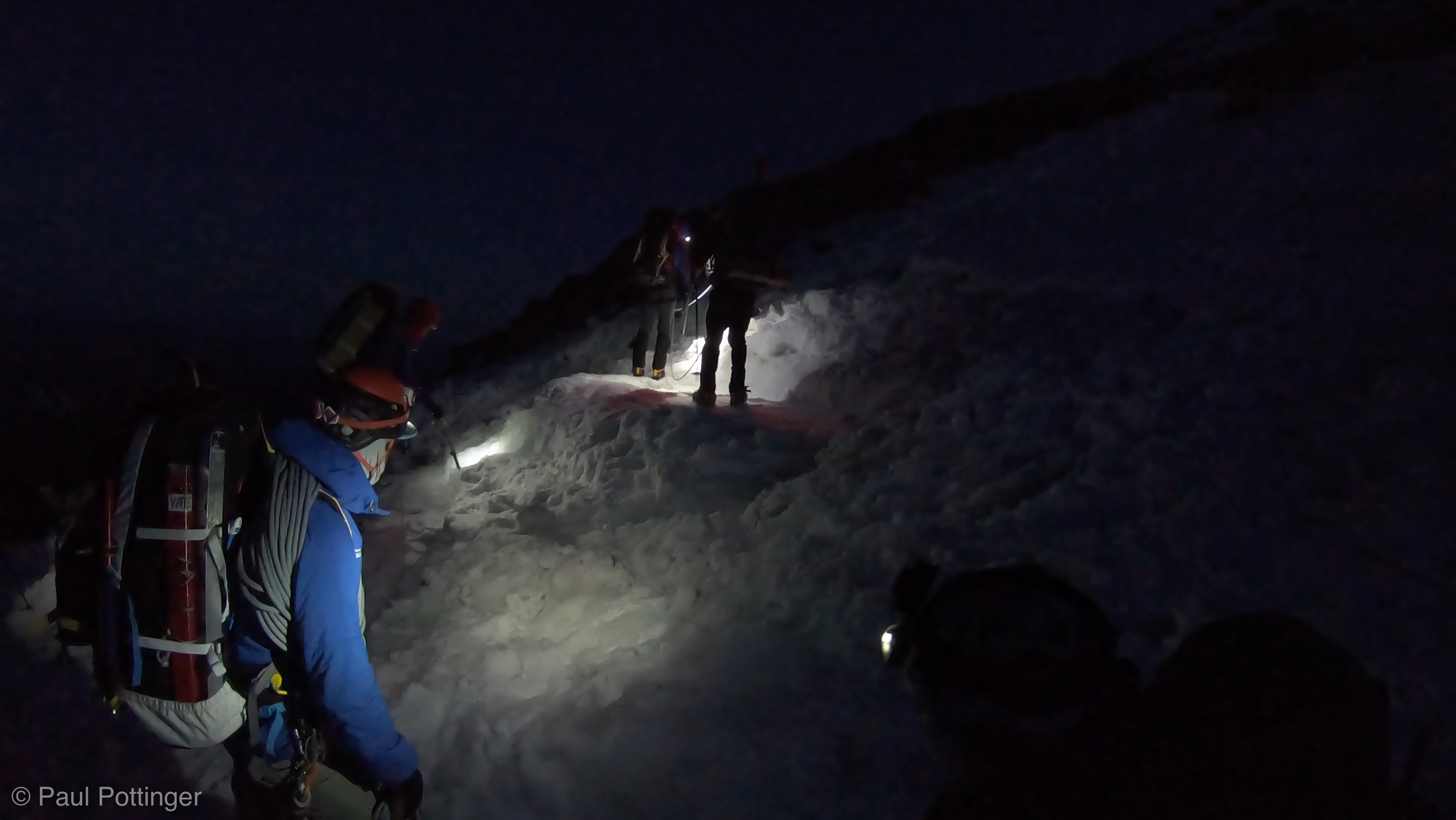
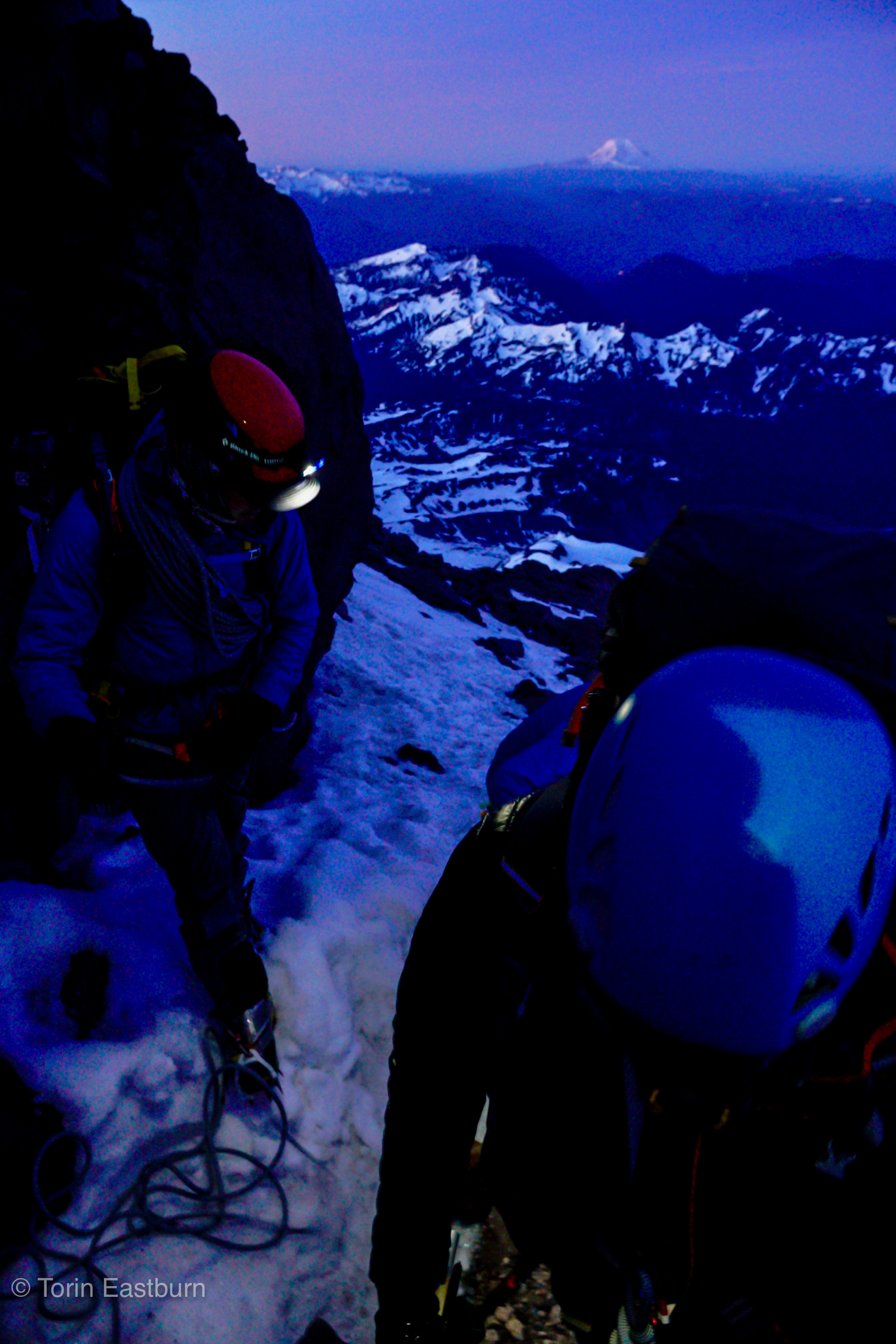
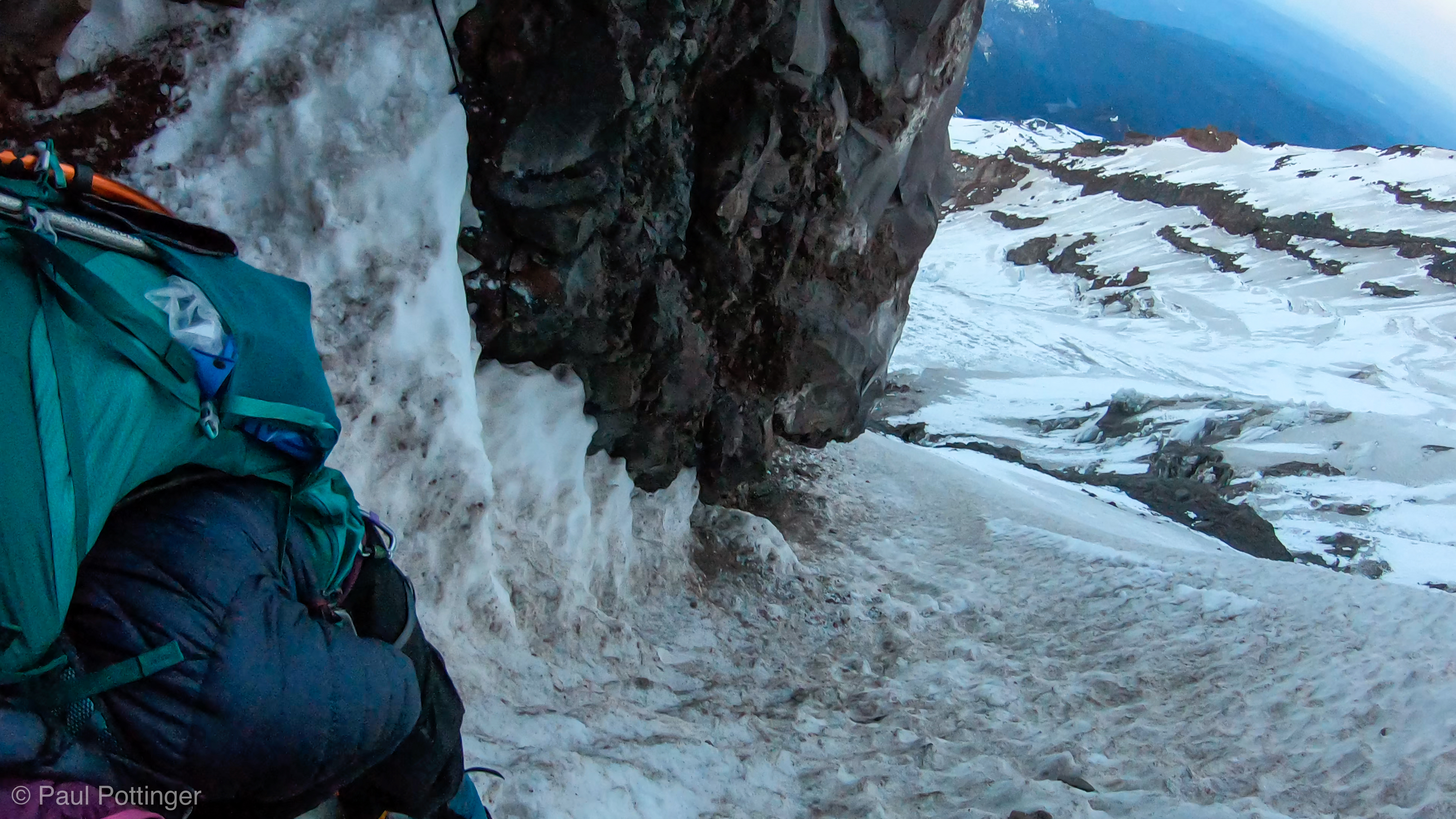
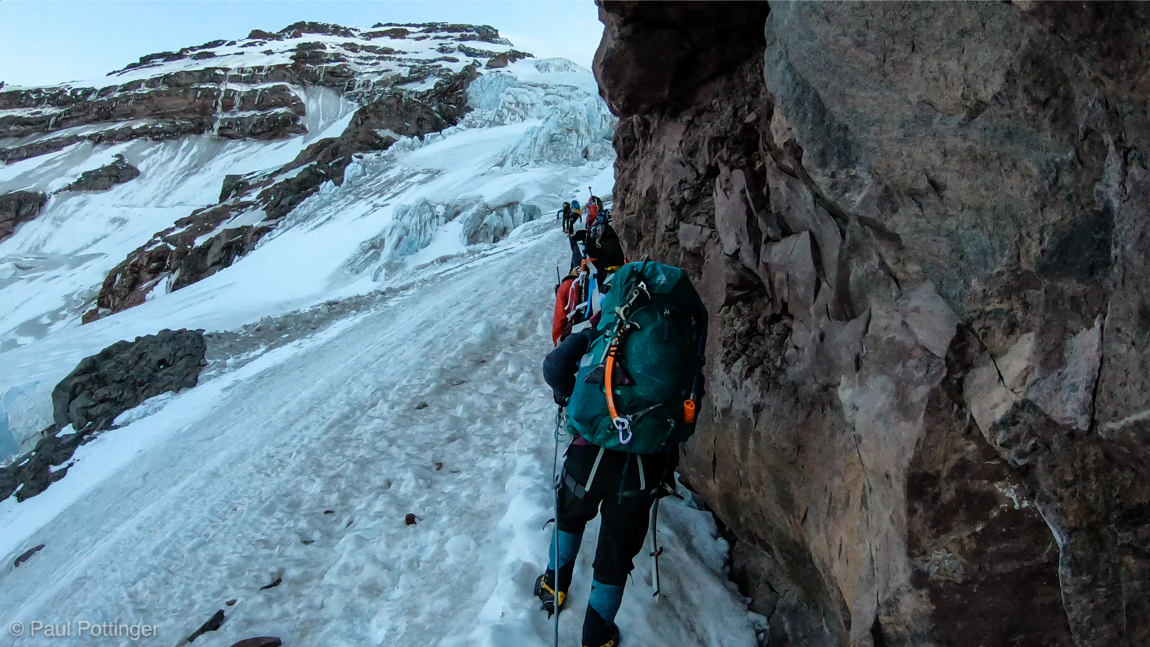
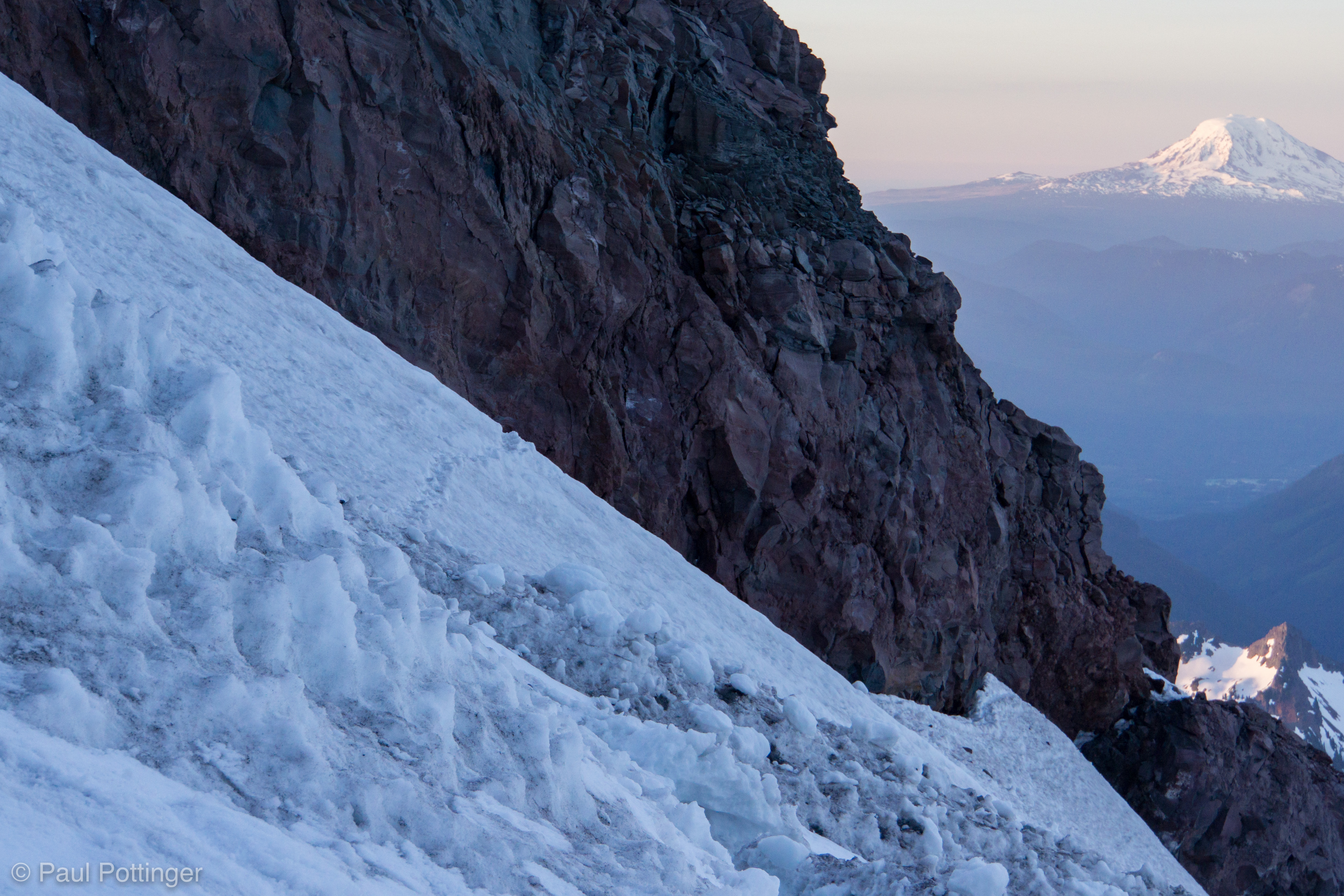
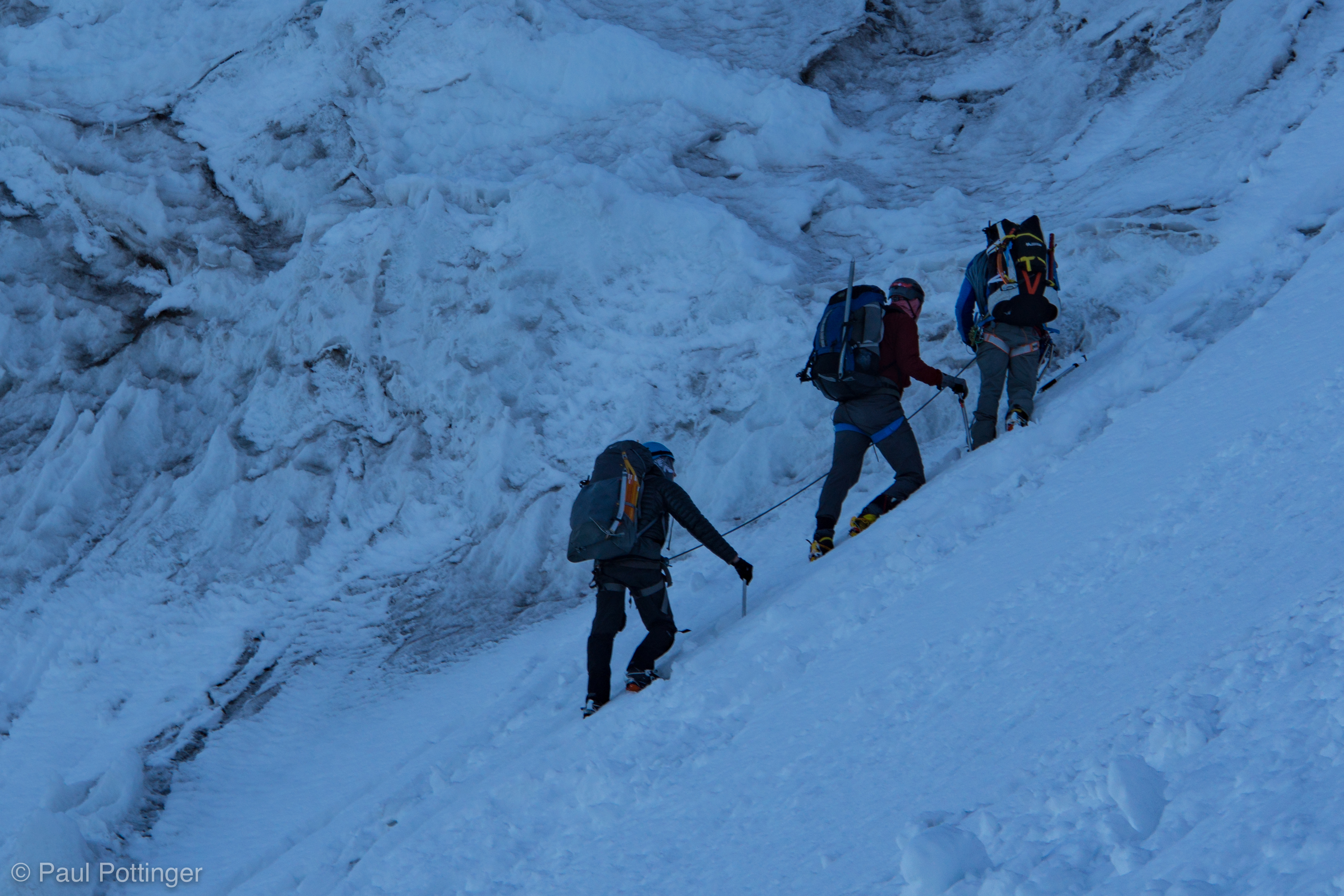
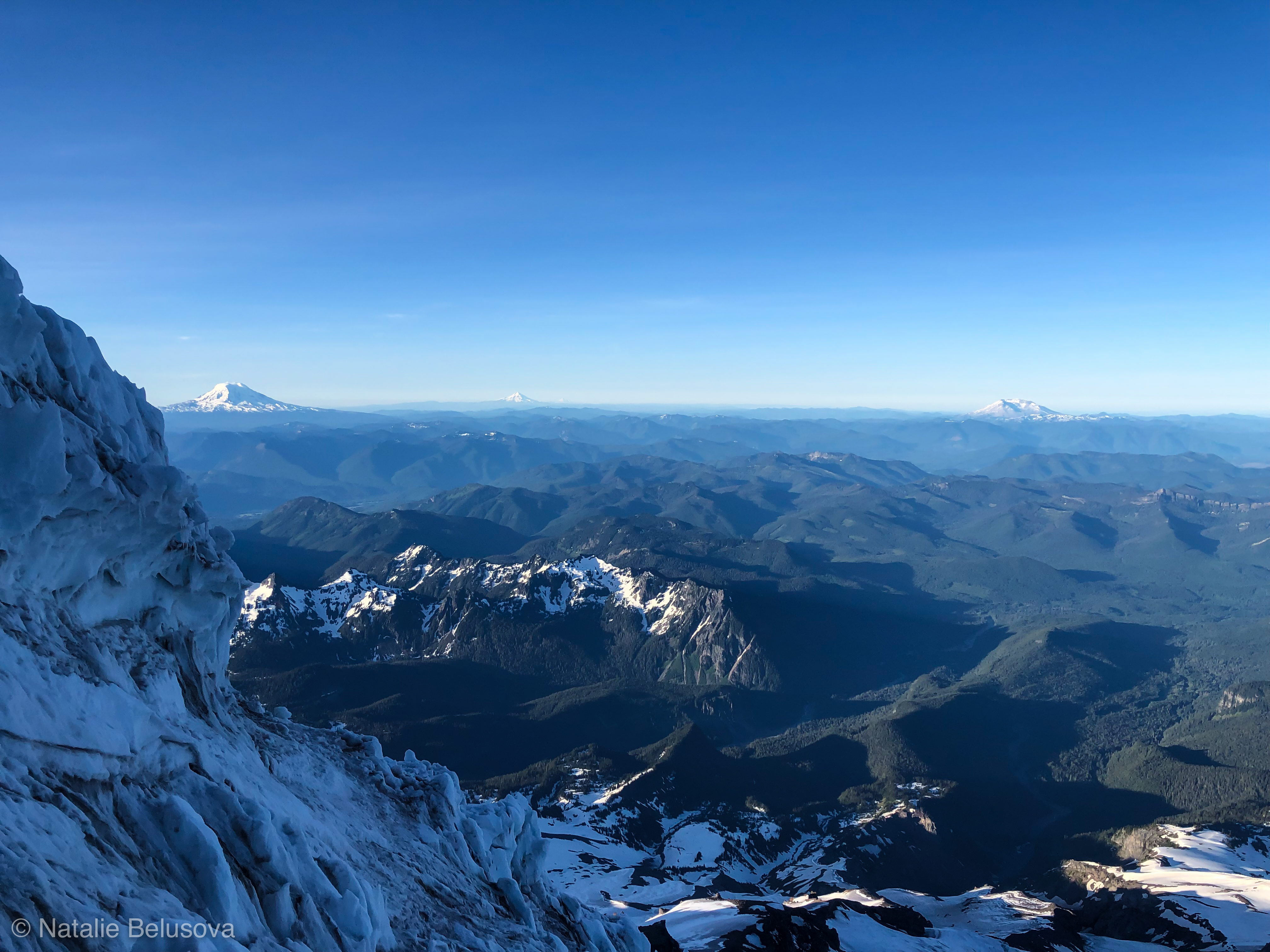
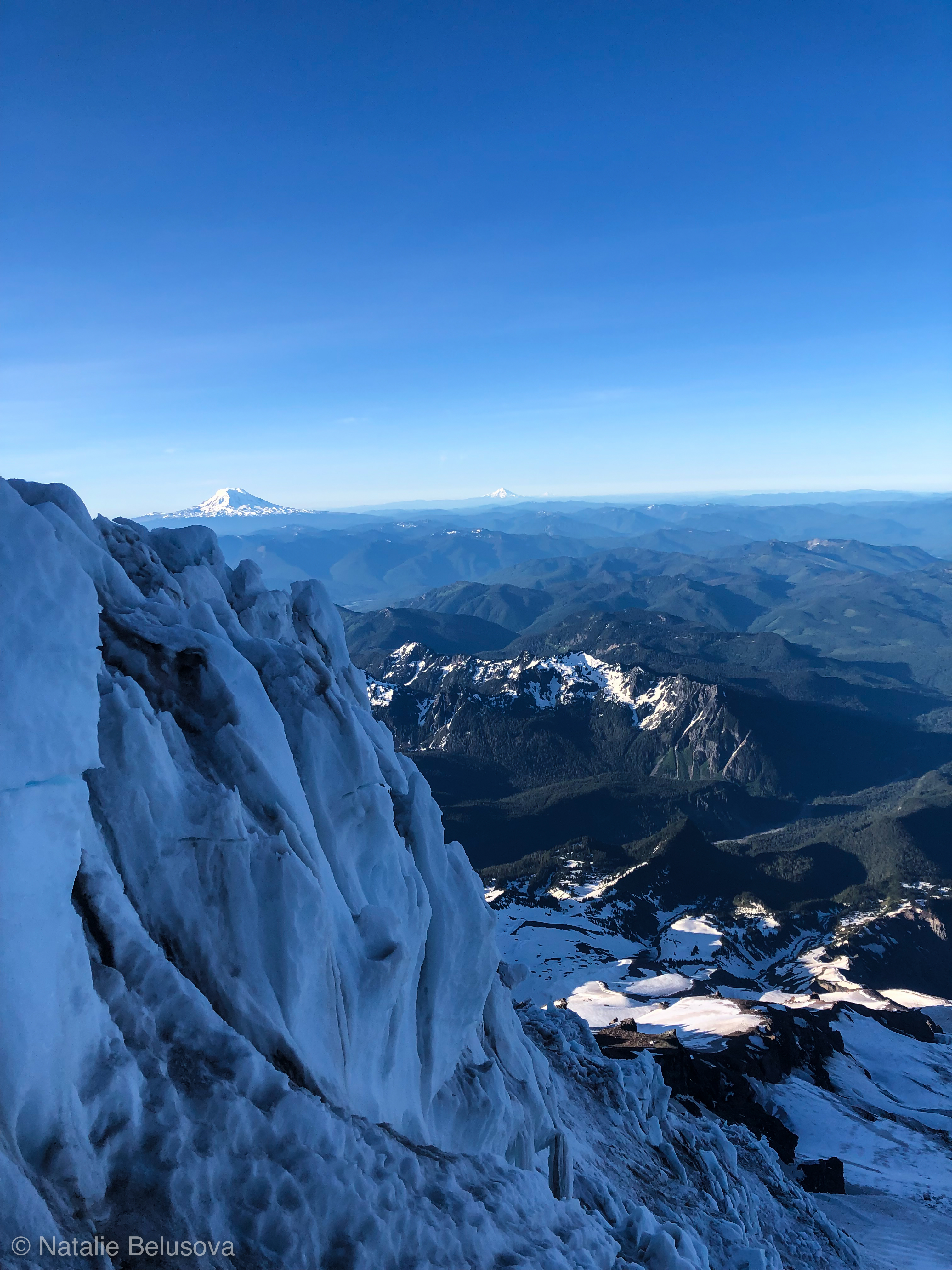
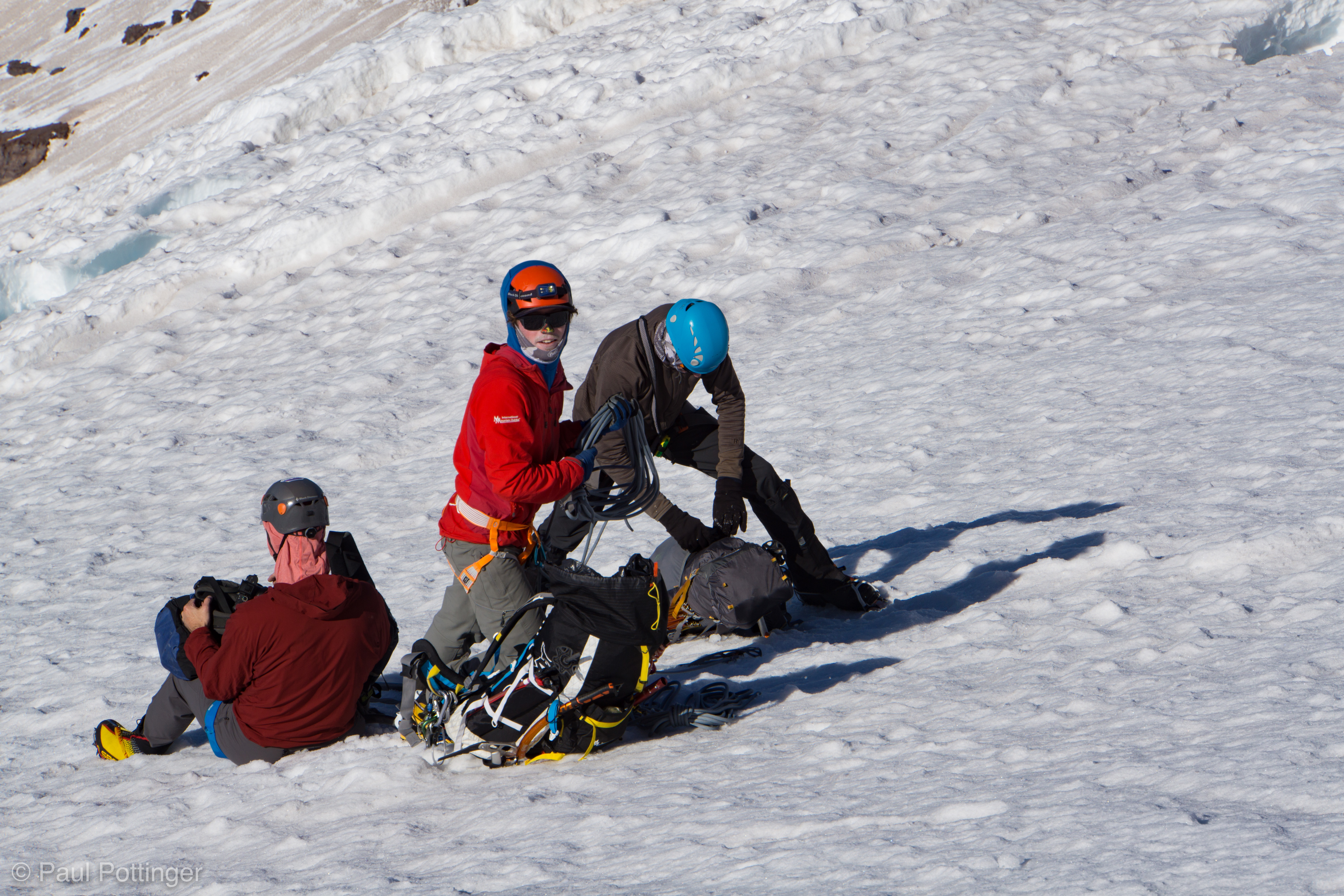
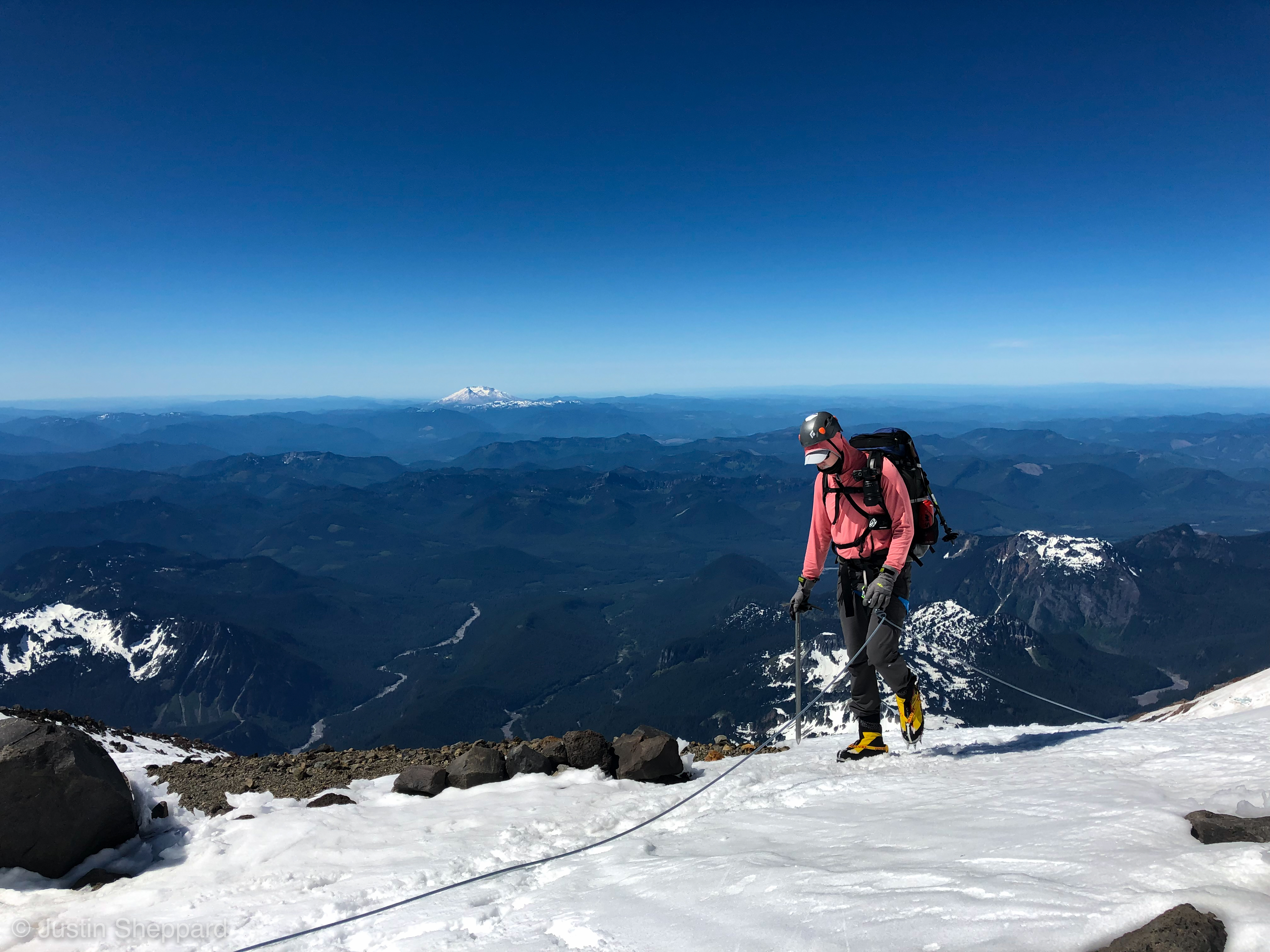
Teresa and I reached the snow ramp, plunged in our axes to their heads, and waited for Conrad to join us. He down-climbed smoothly without a top belay, then passed above us in an awkward transition on the catwalk. Once again, Conrad was in the lead, T took center, and I brought up the rear. We traversed up and to the left, crossing a portion of the Kautz Glacier. This was a wild place, for sure. Directly above, the mountain was littered with icefall spilling over a band of rotten, chossy rock. Up to our left, beyond the West side of the Chute, another stone face rose towards the sky, band after band of brown rock punctuated by layers of snow and ice, undeniably reminiscent of a chocolate layer cake with vanilla frosting. This must be the Kautz Headwall… the feature I had planned to climb this season with a friend, although our arrangements had not worked out for several reasons. Climbing via the Kautz Ice Chute instead now seemed like a wise move for my first time on this side of the mountain. And, so much fun to be a part of this expedition with these teammates.

Looking down the snow ramp below the Sneak.
Conrad sneaks past us at the Sneak.
Up we go.
Our shadow at sunrise.
Our shadow at sunrise, seen from the lower Chute.
Looking back at our tracks, leading down to the Sneak (small snow platform and notch bottom right).

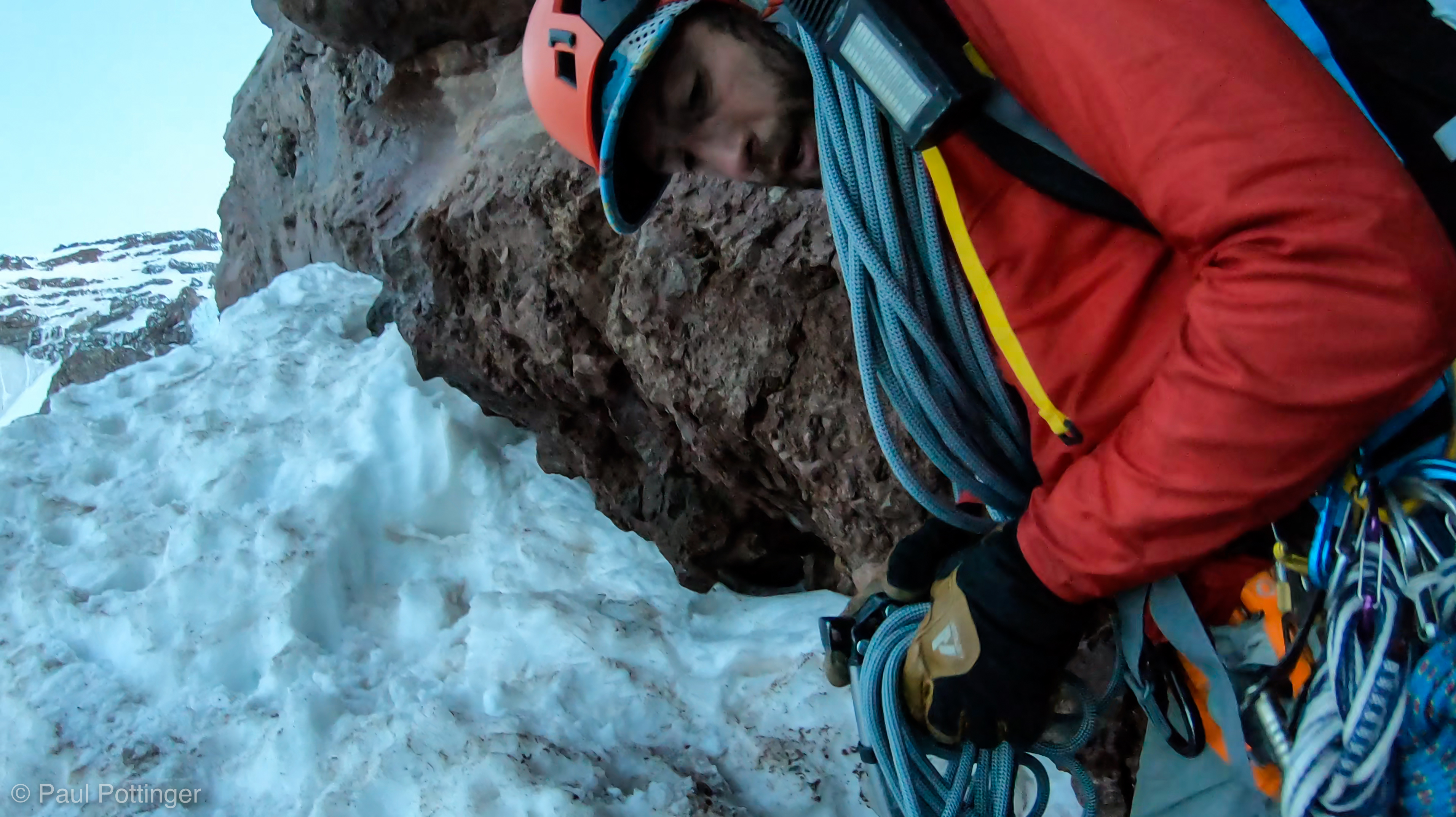
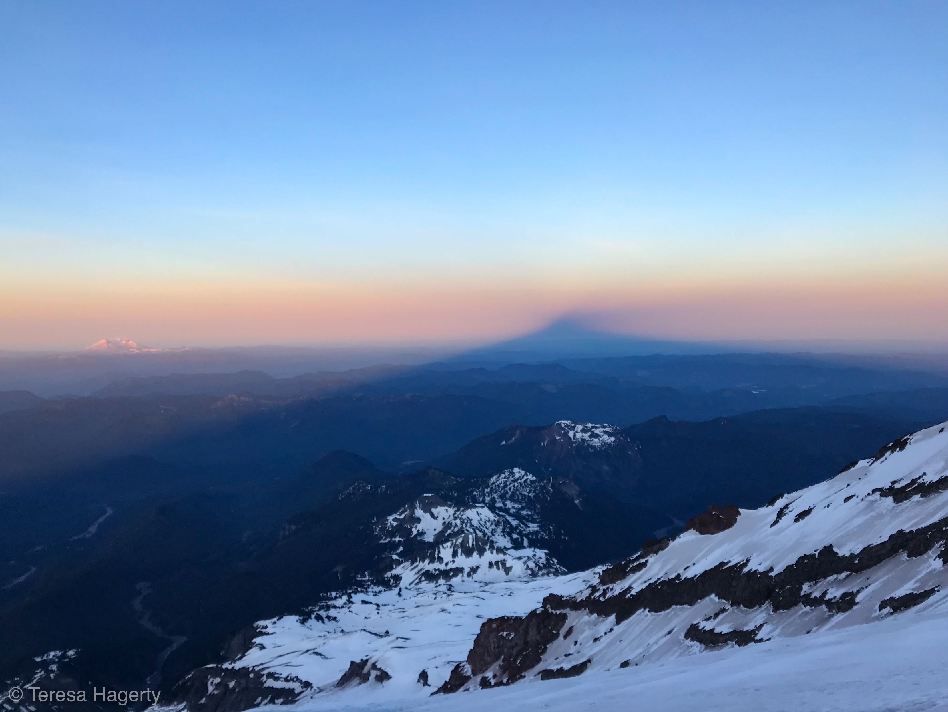
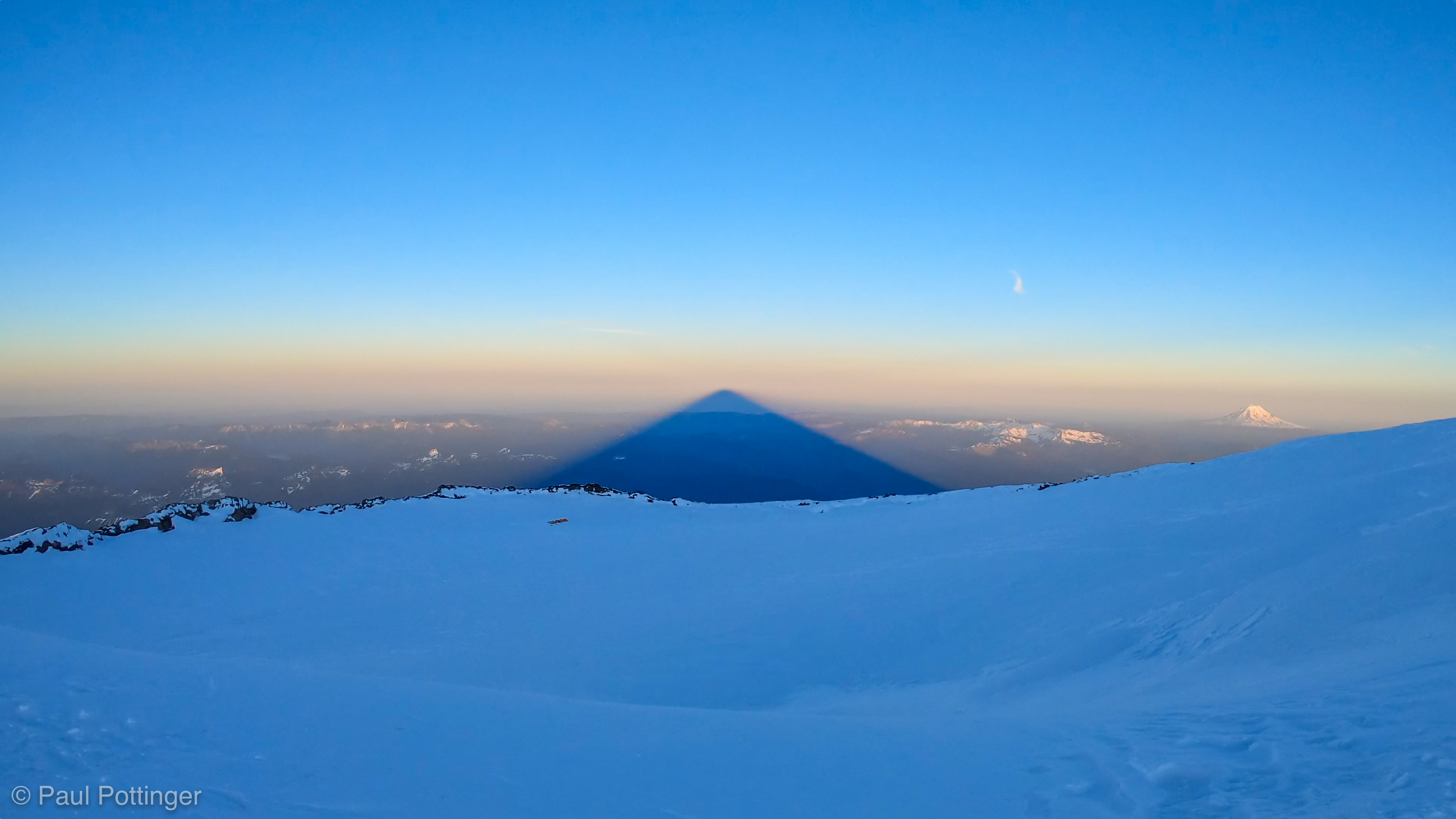
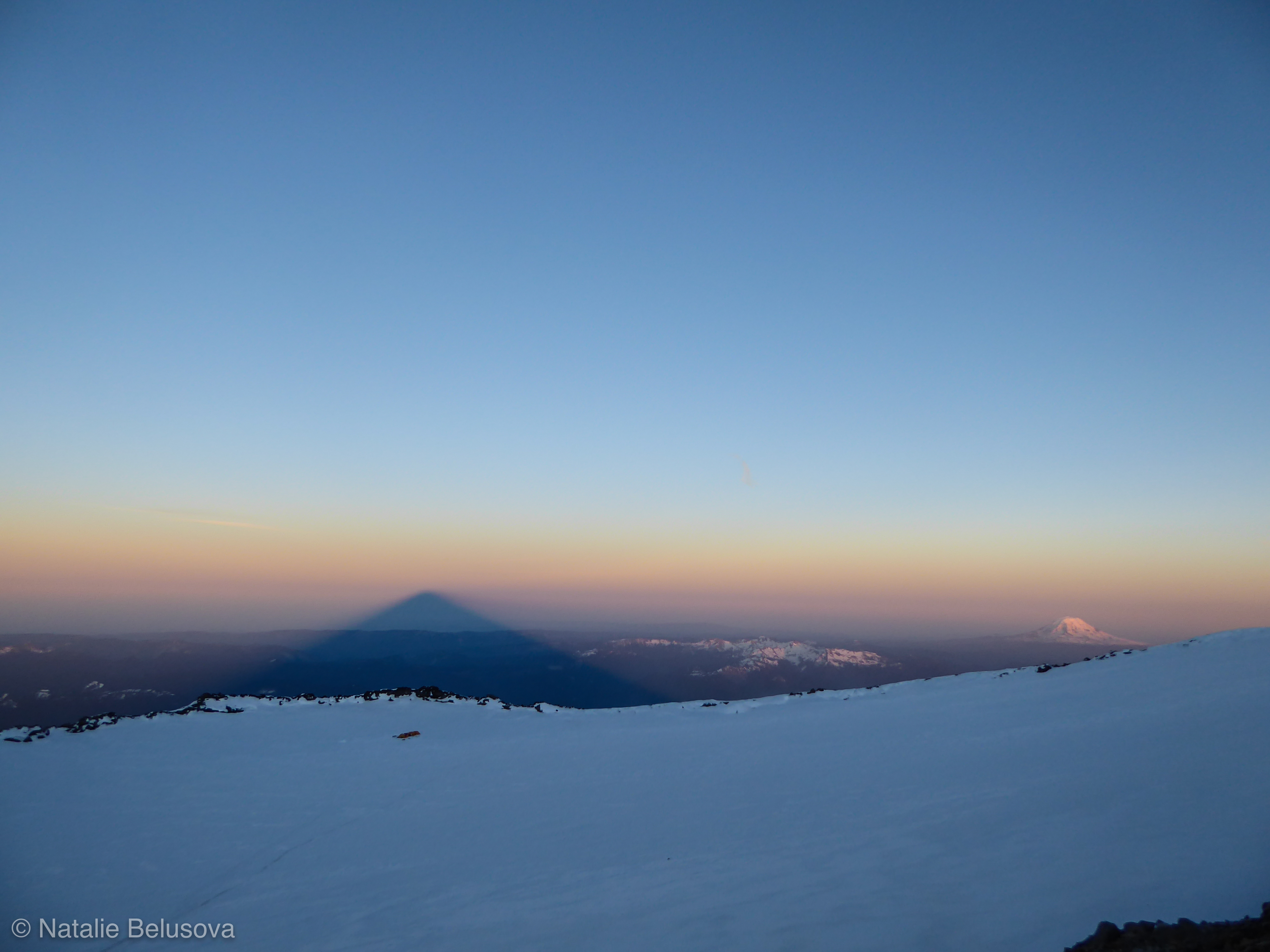
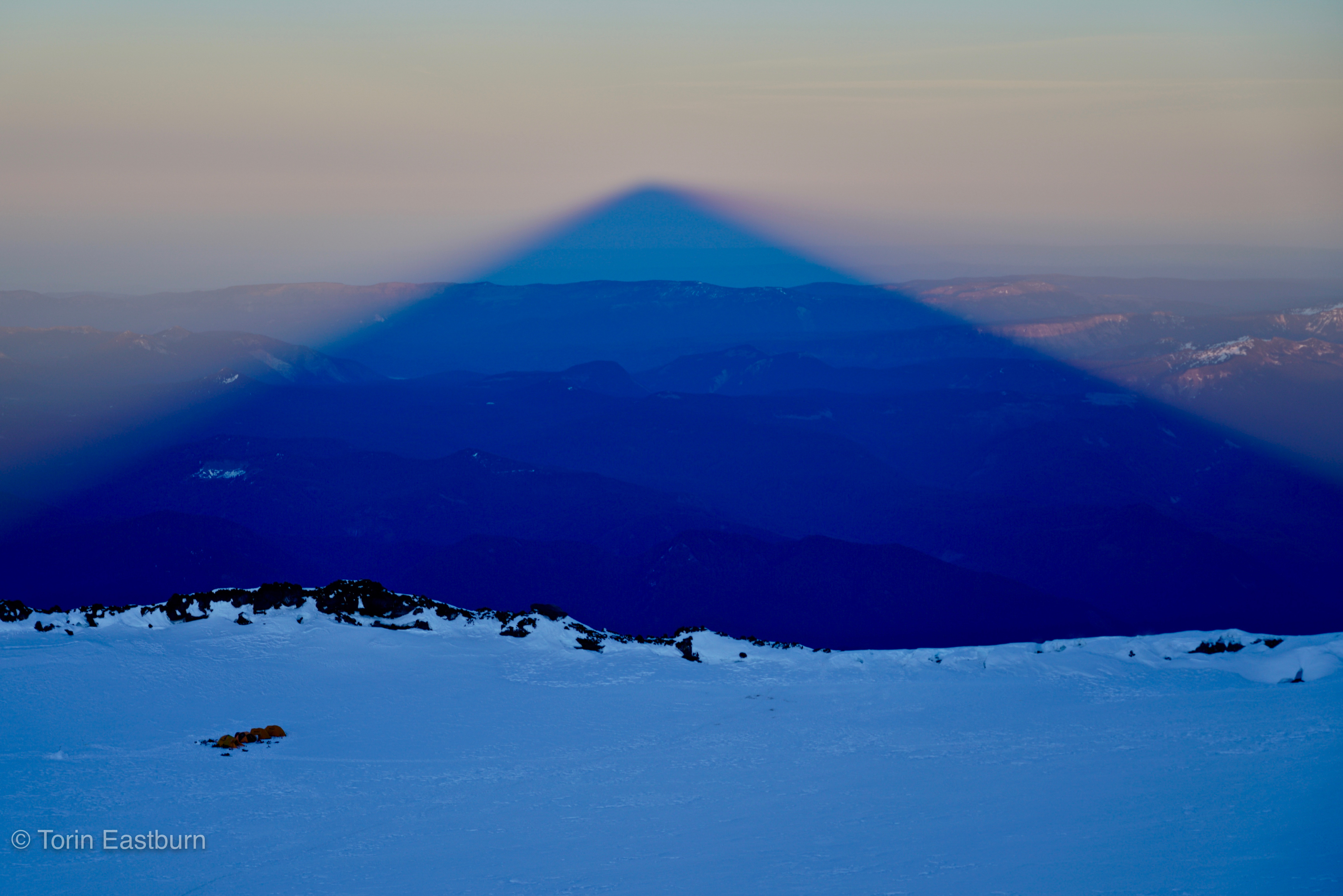
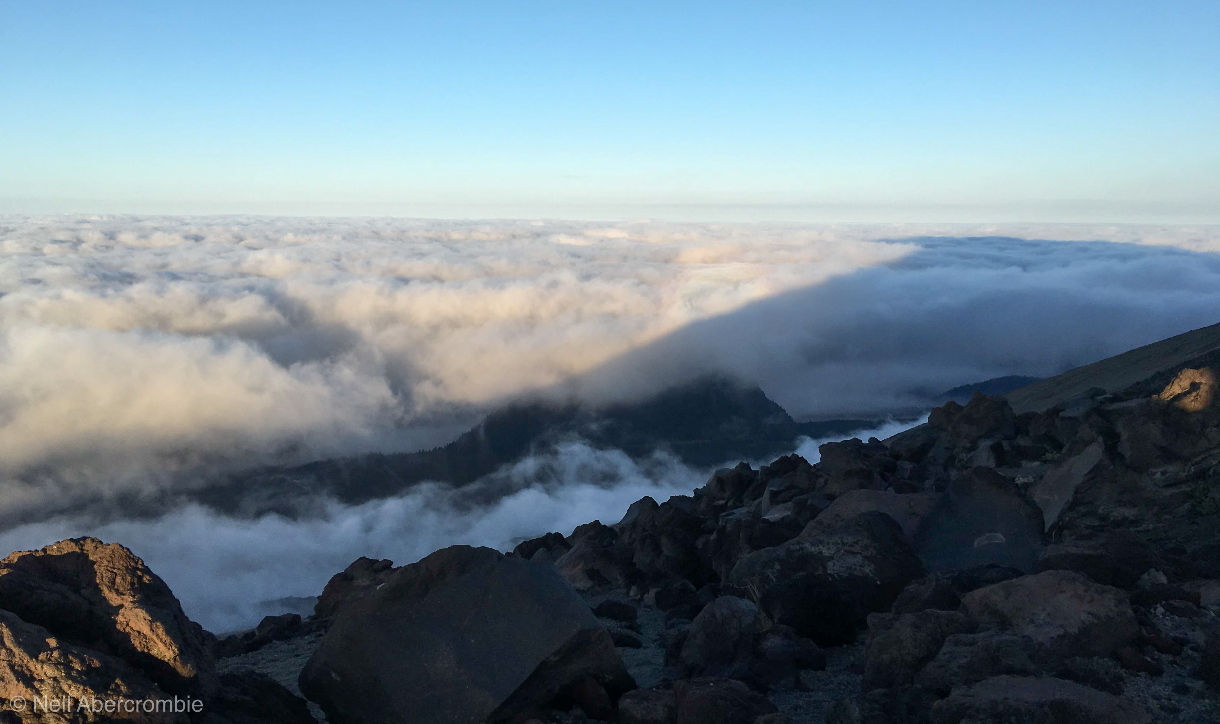
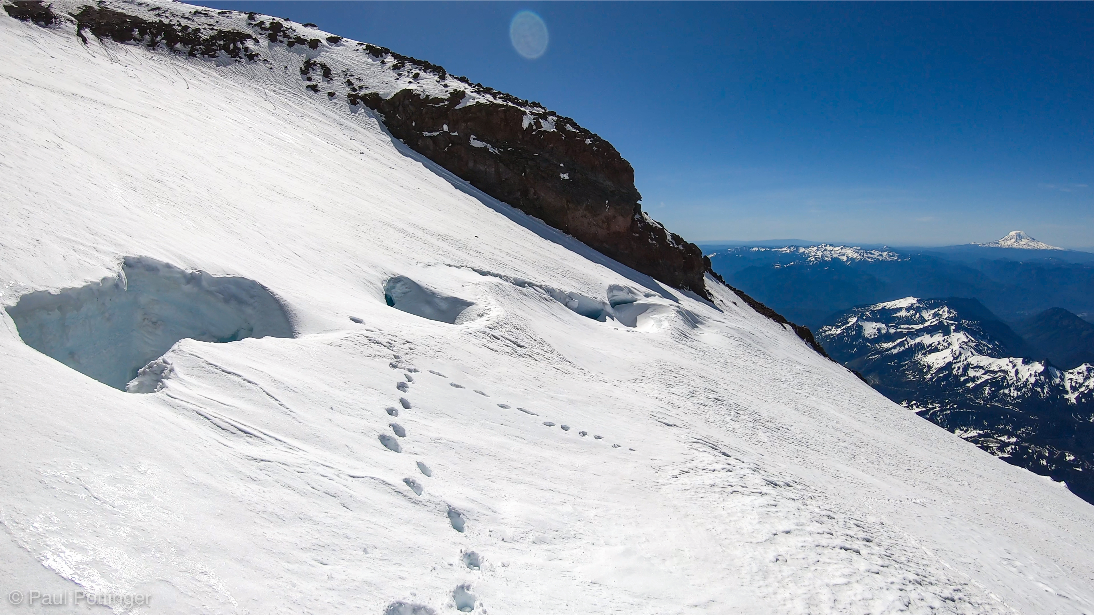
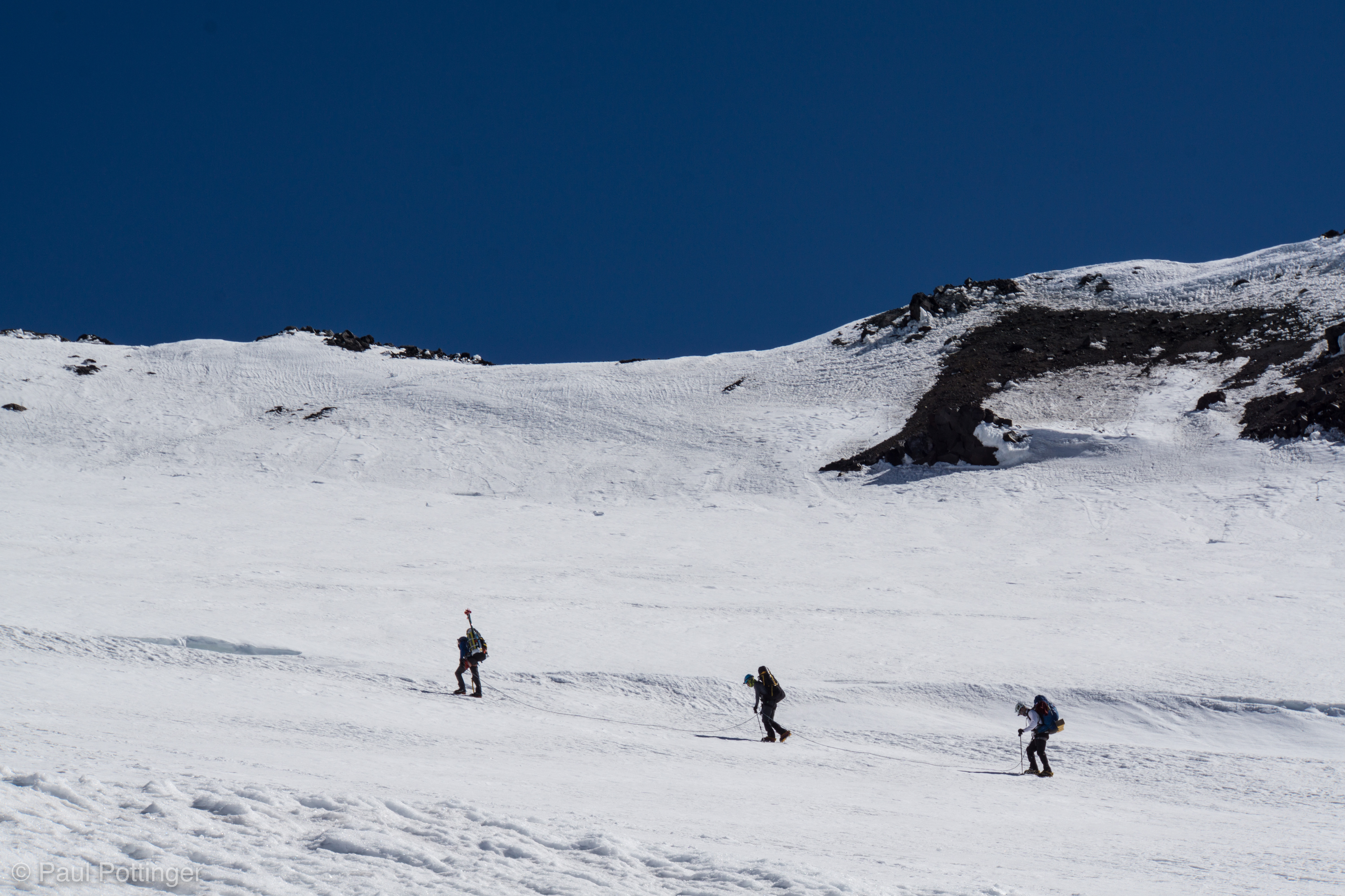
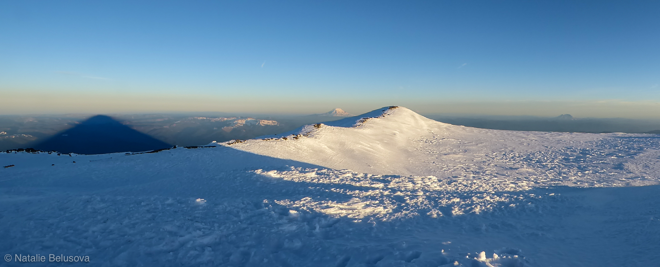
When we reached a slightly more stable position on the face, Conrad adjusted our rope interval, in light of the steep stuff to come. Below, in the distance, our shadow stretched across the dark green land and pale sky.

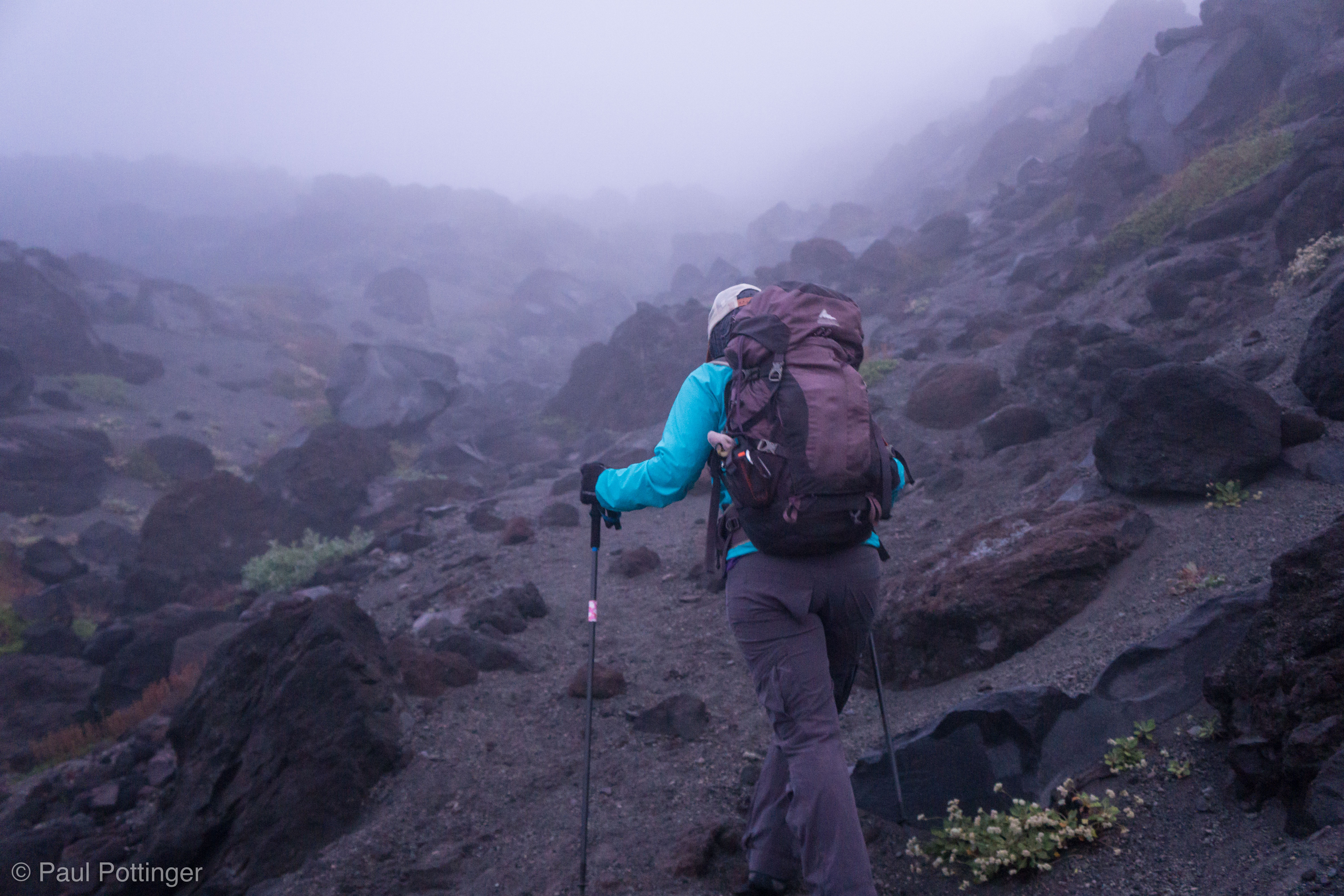
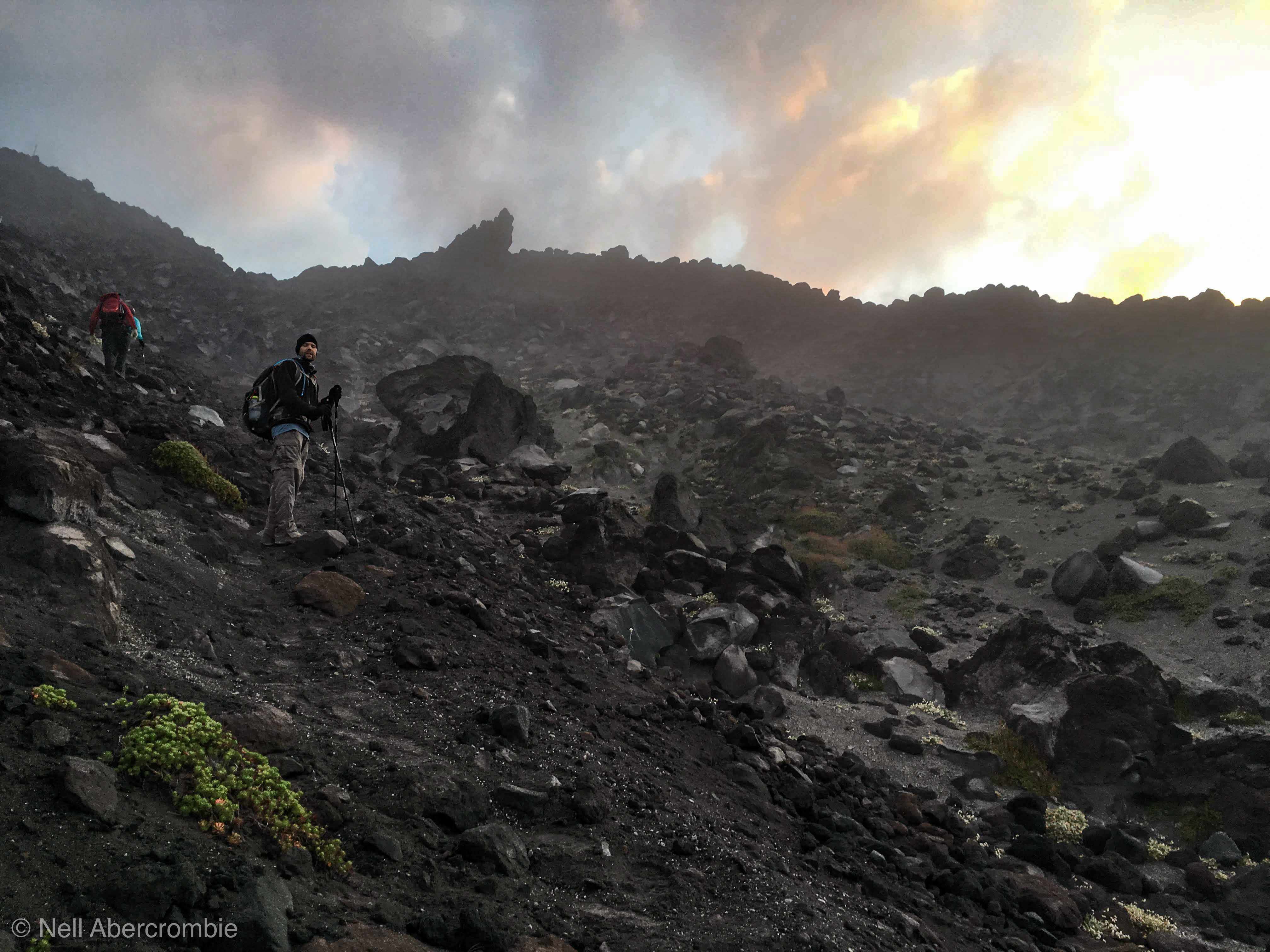
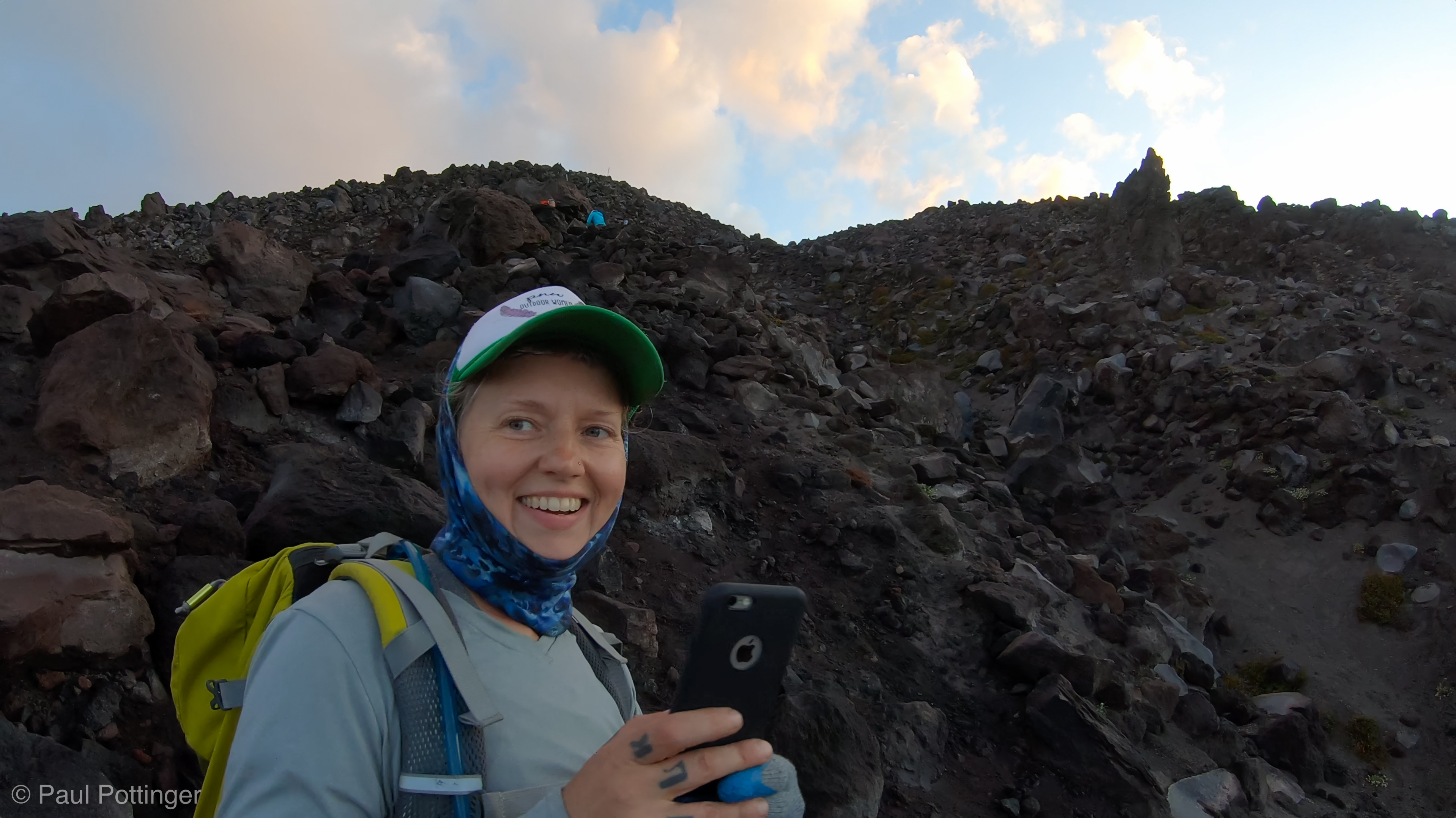
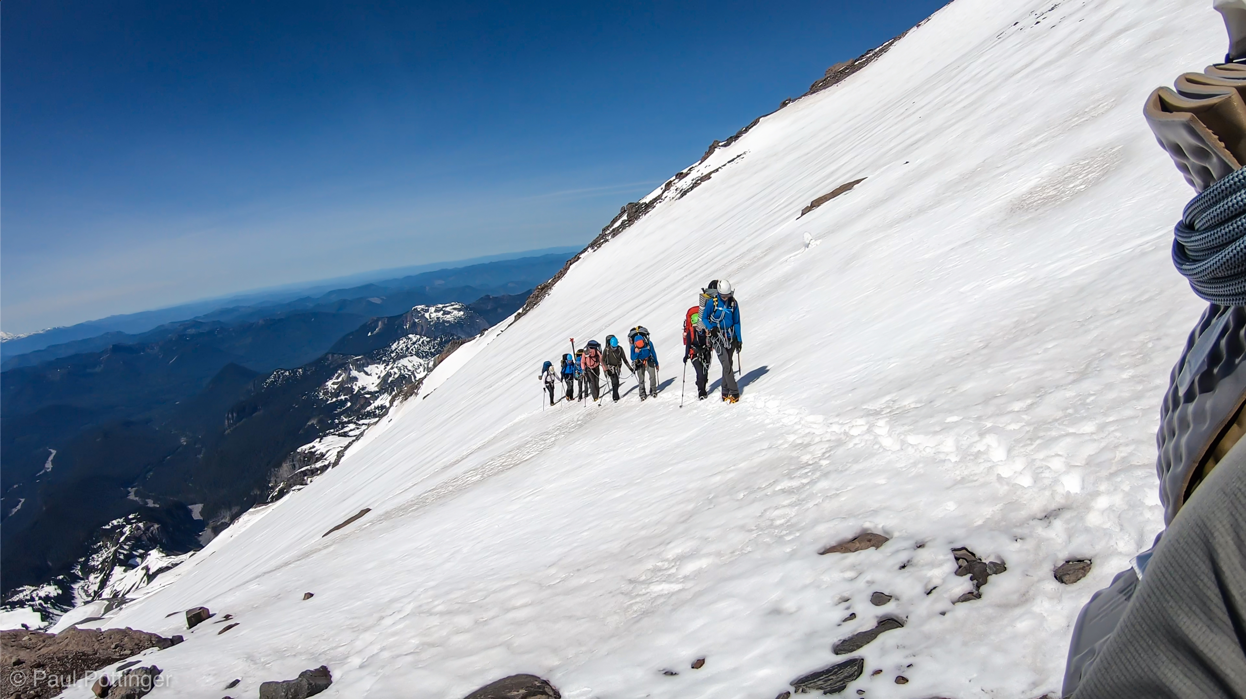
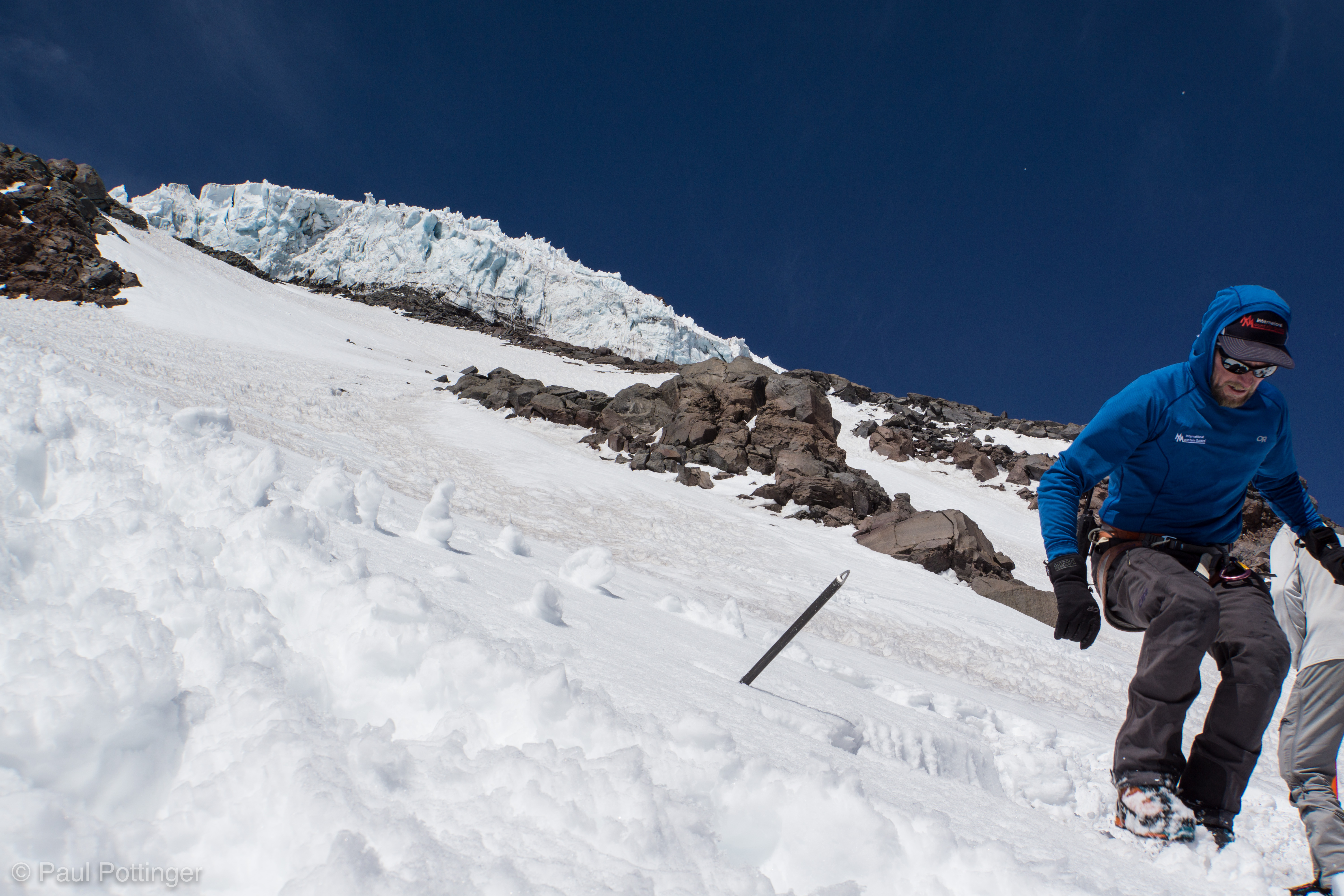
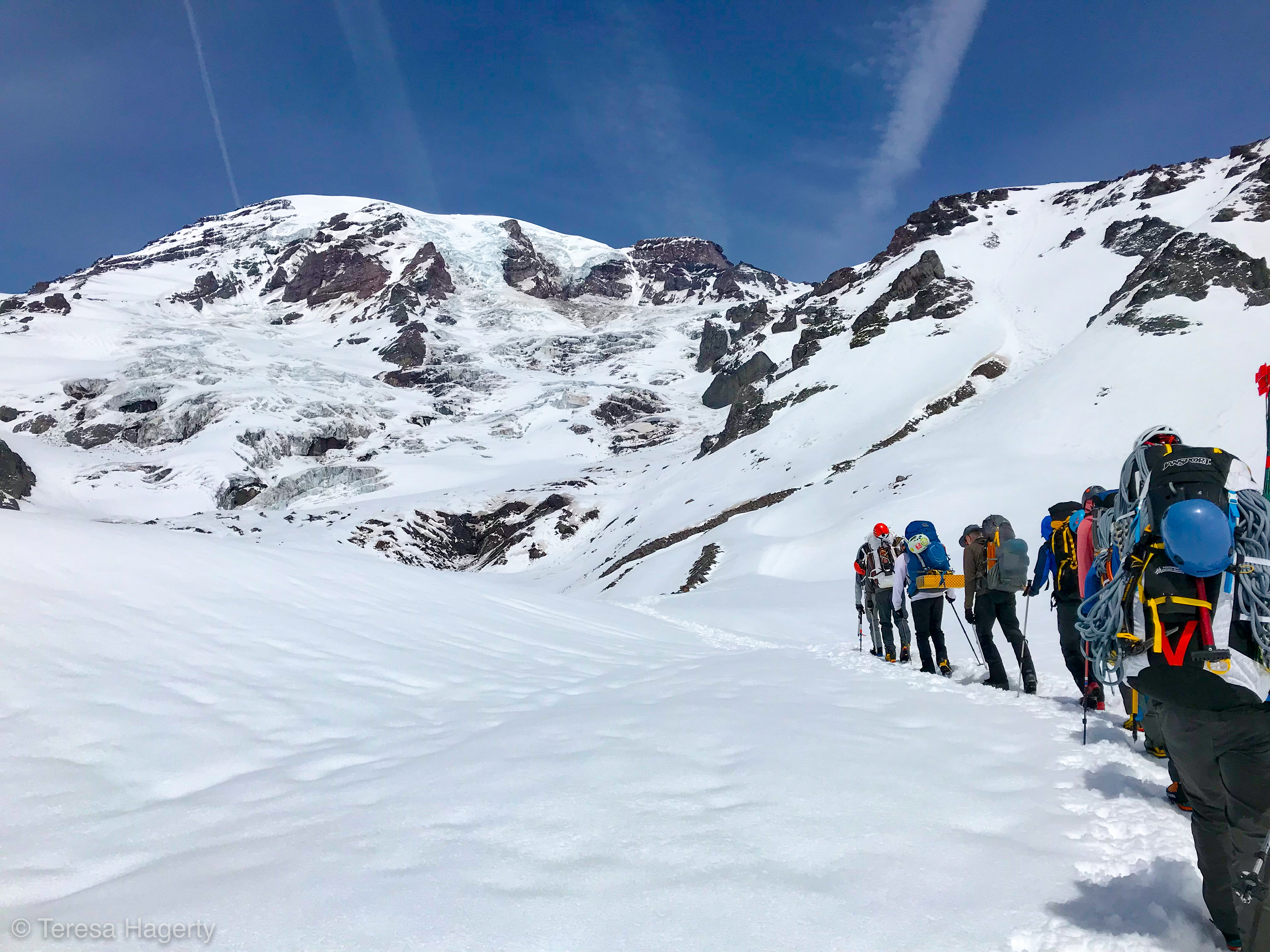
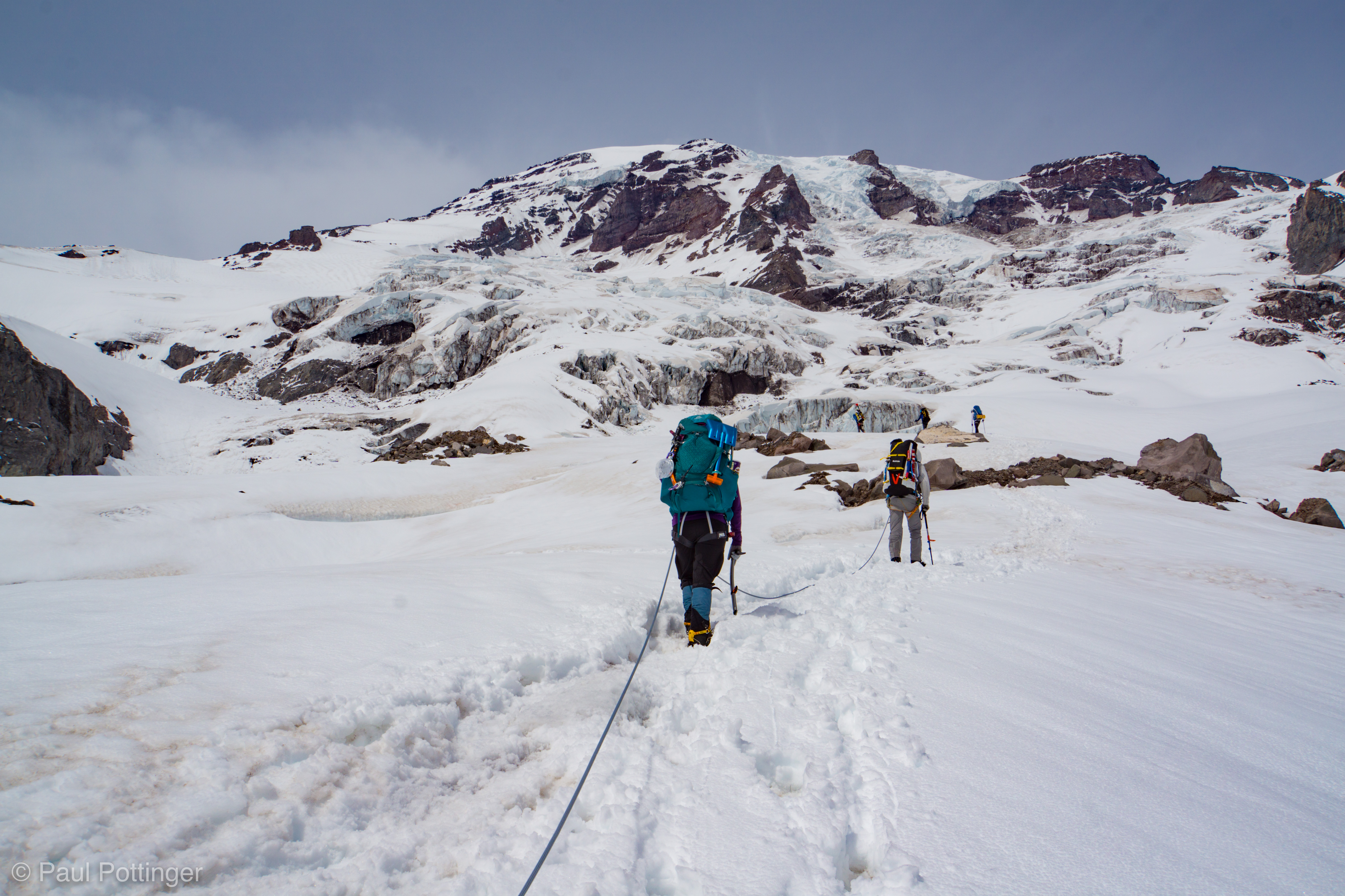
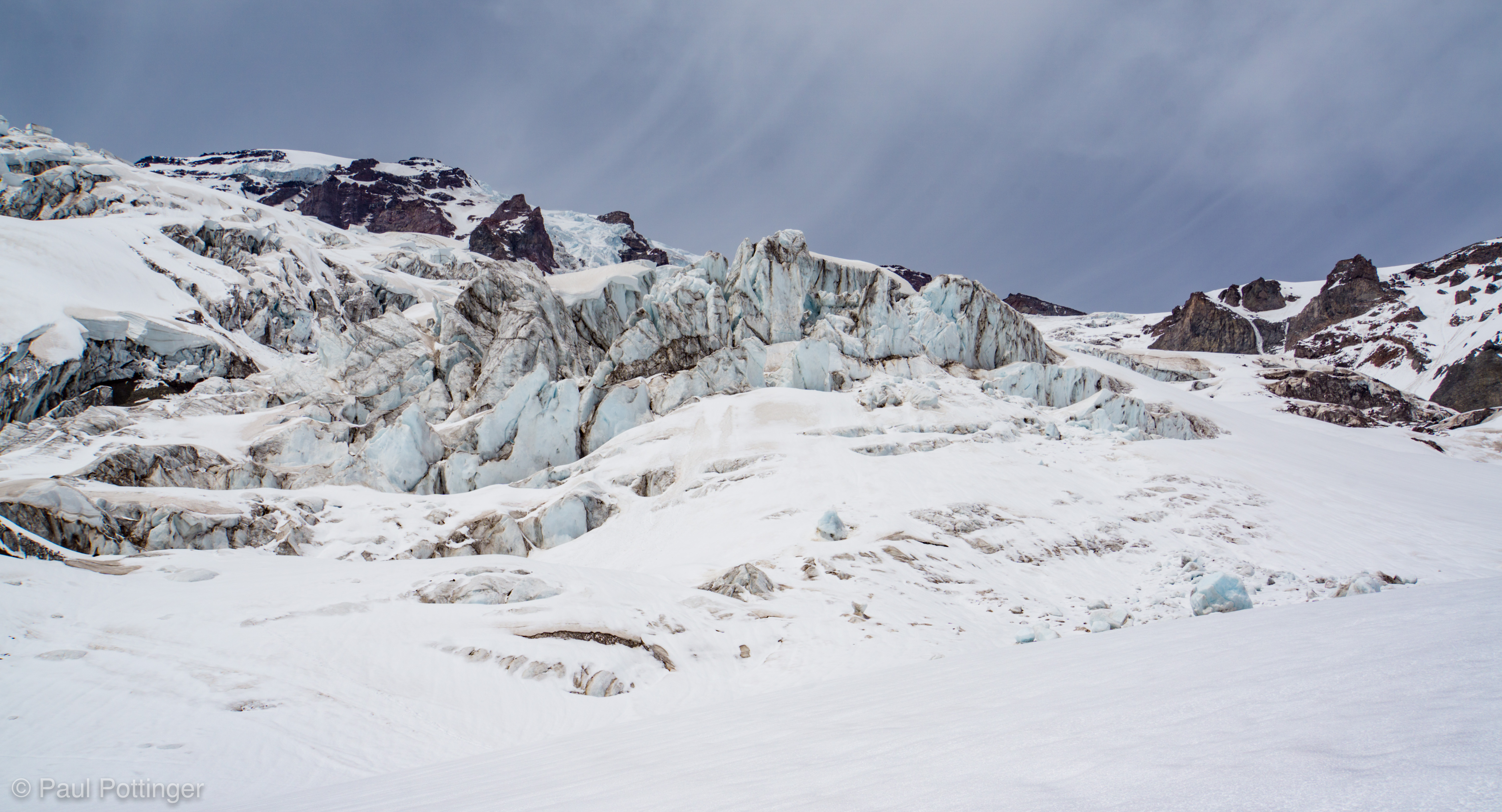
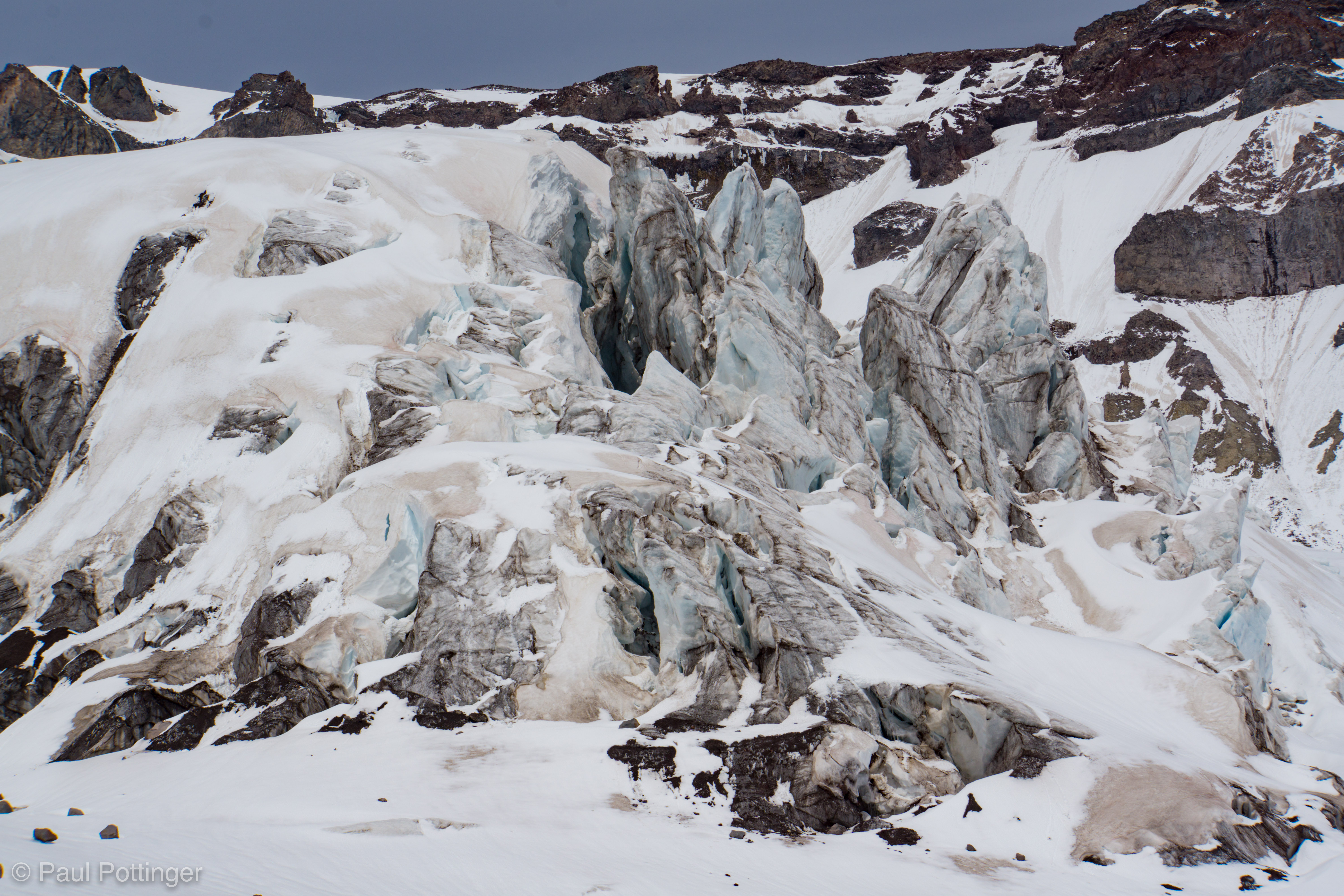
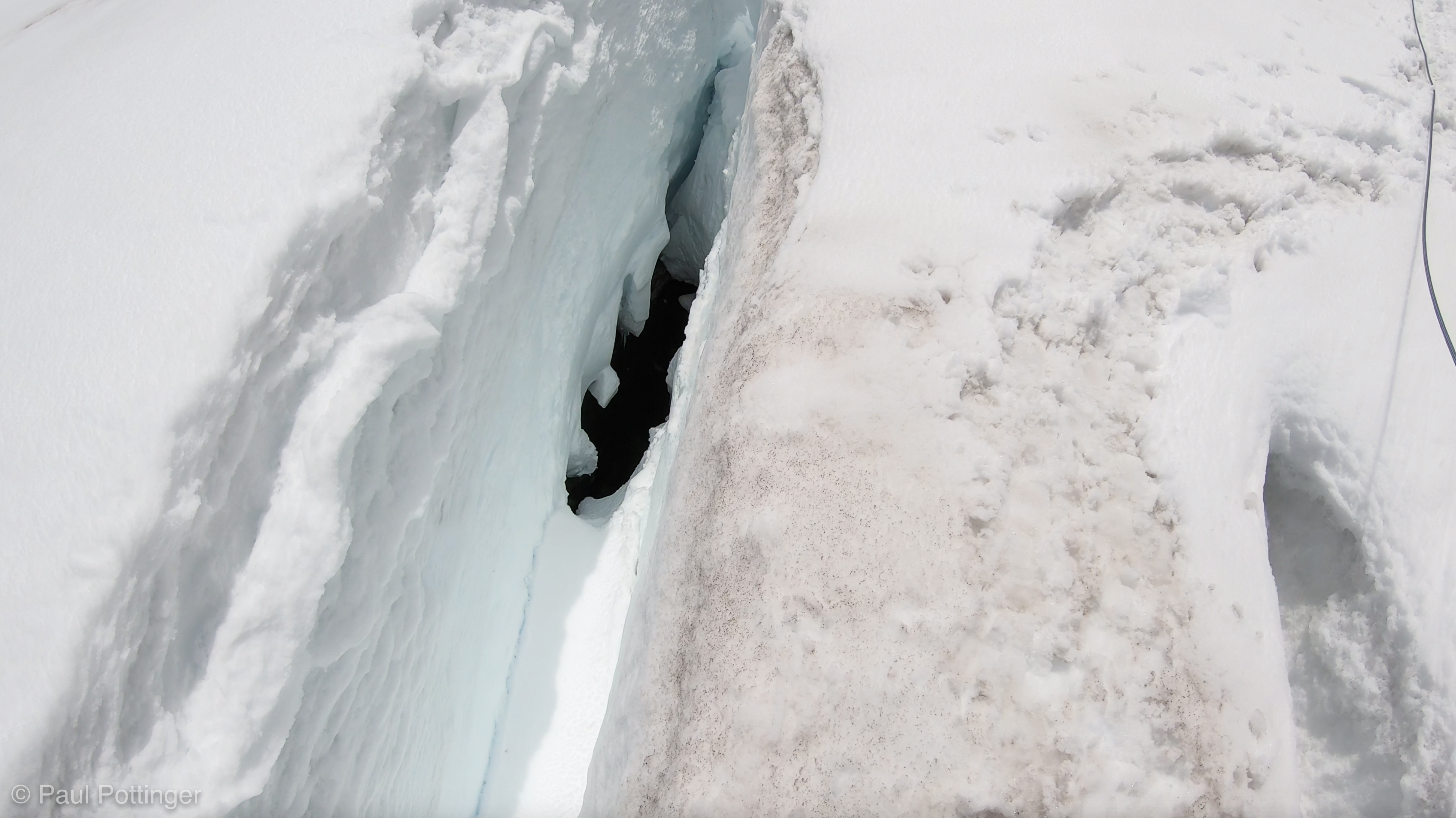
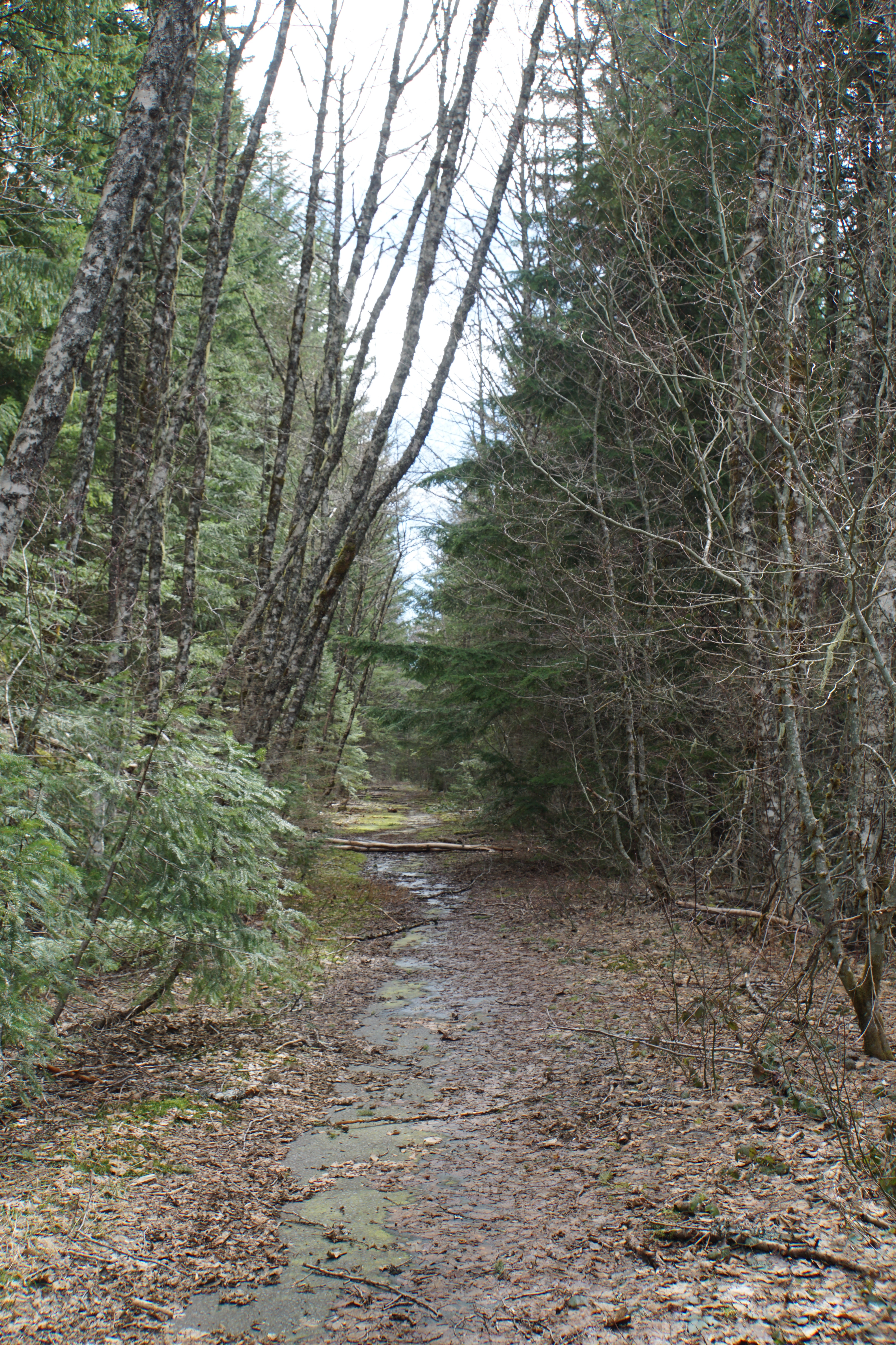
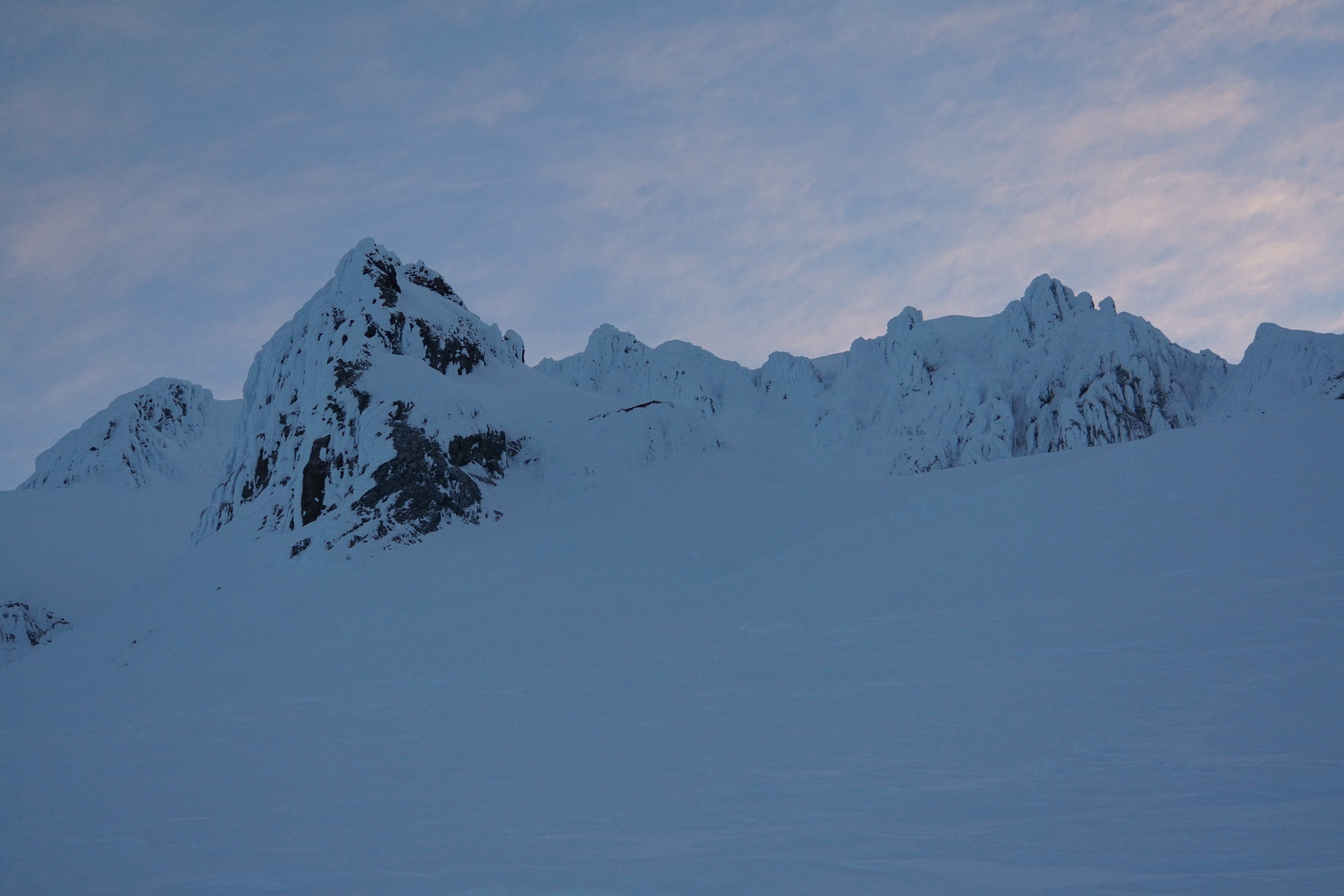
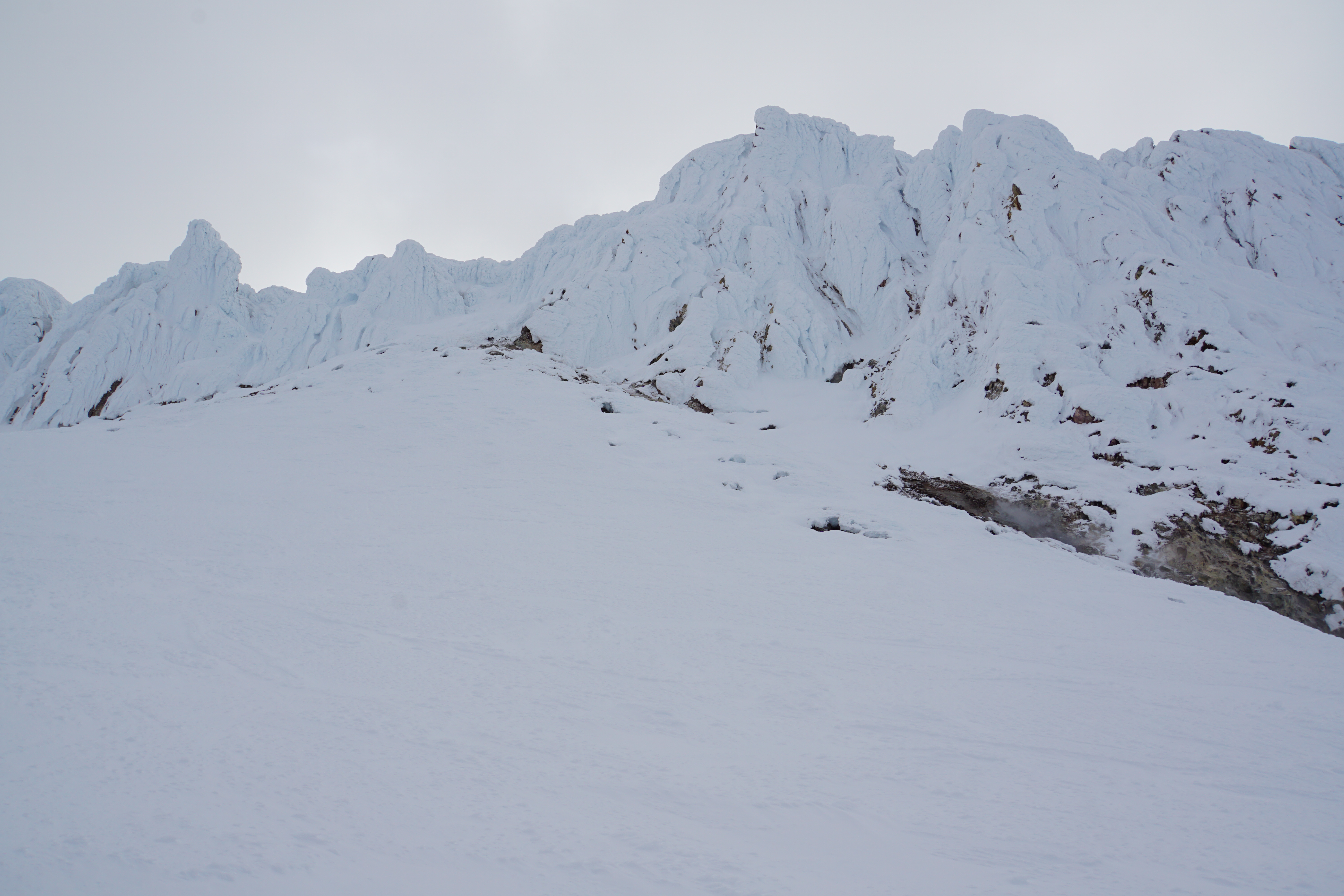
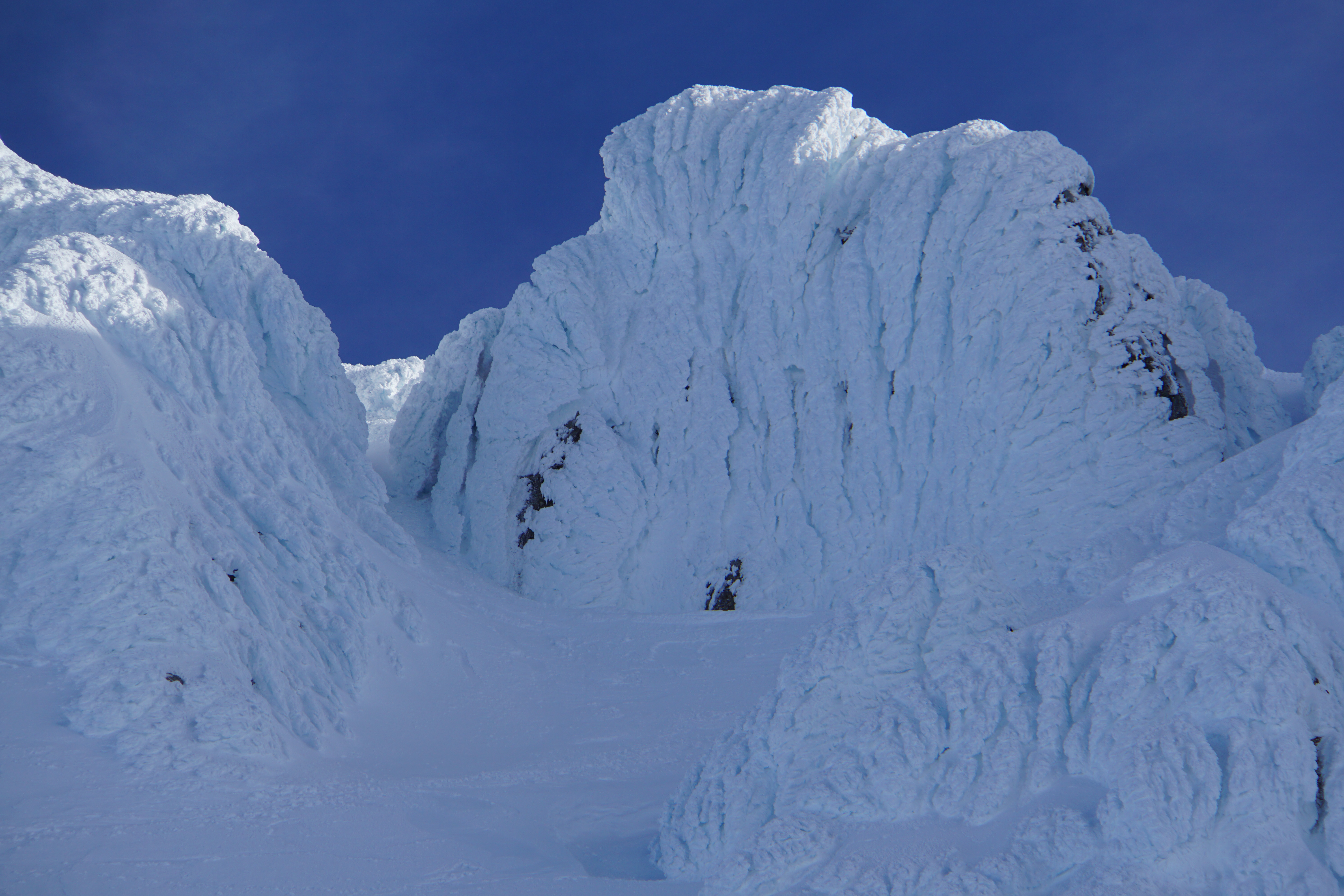
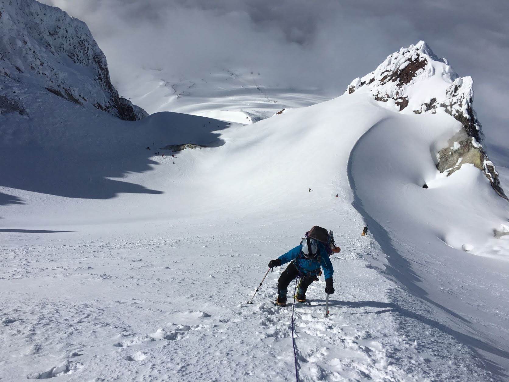
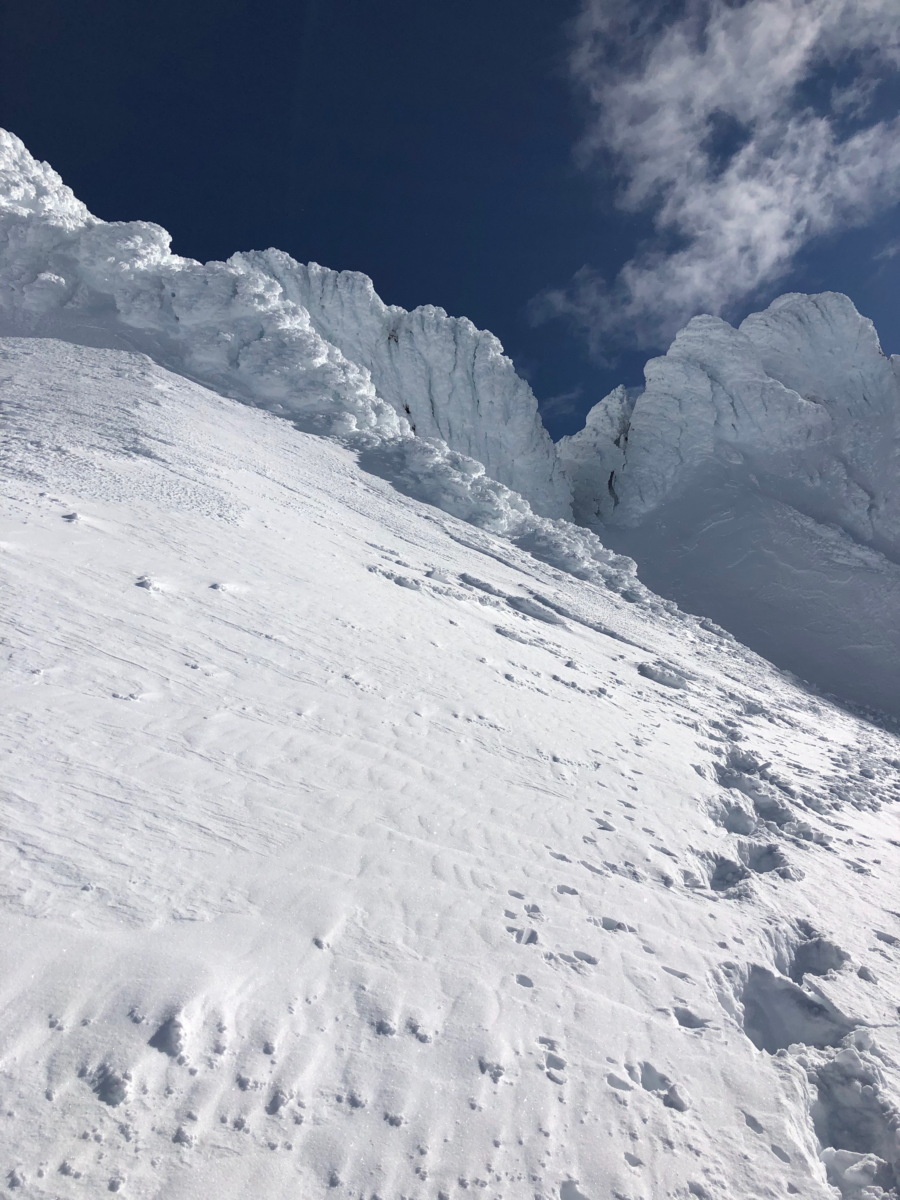
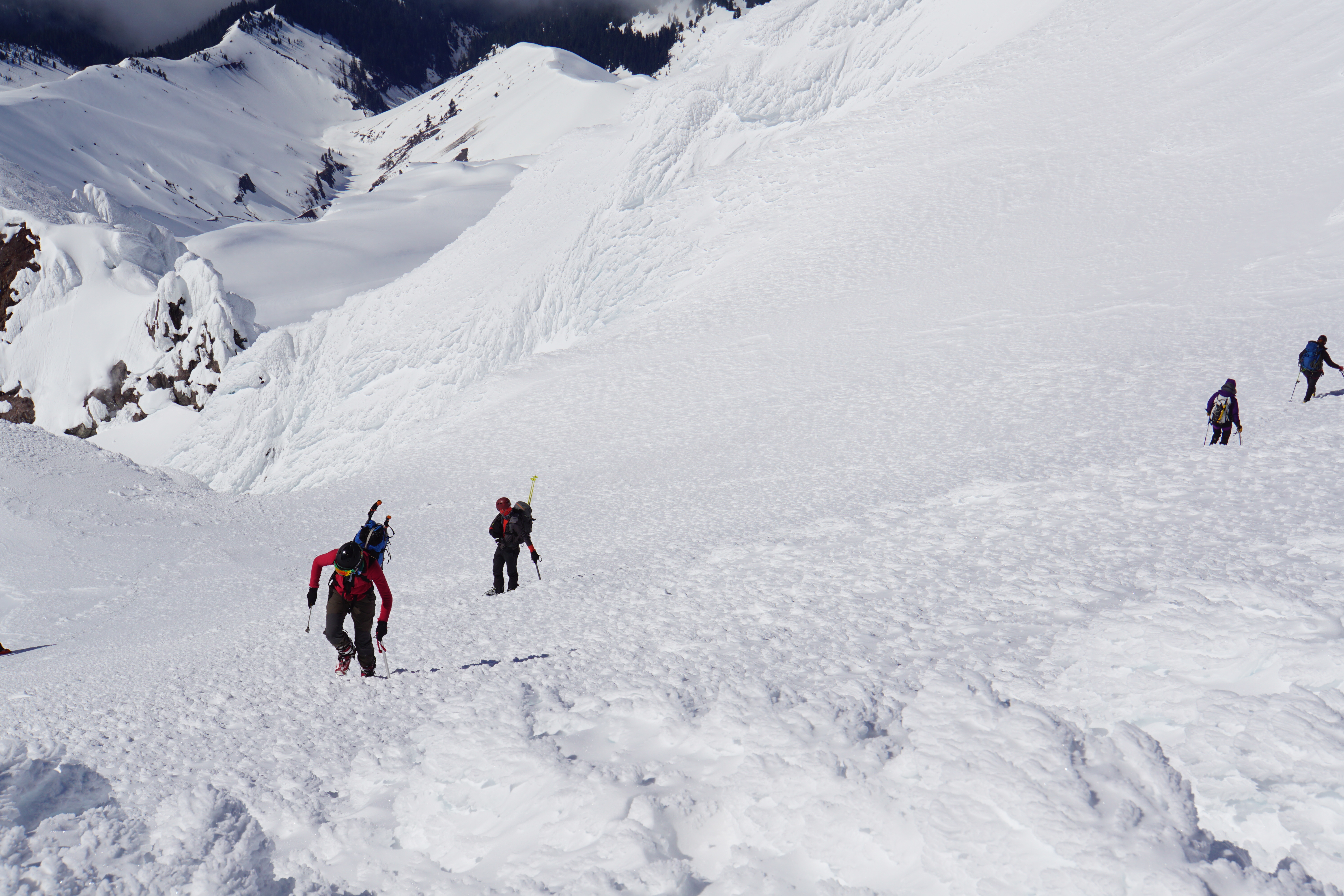
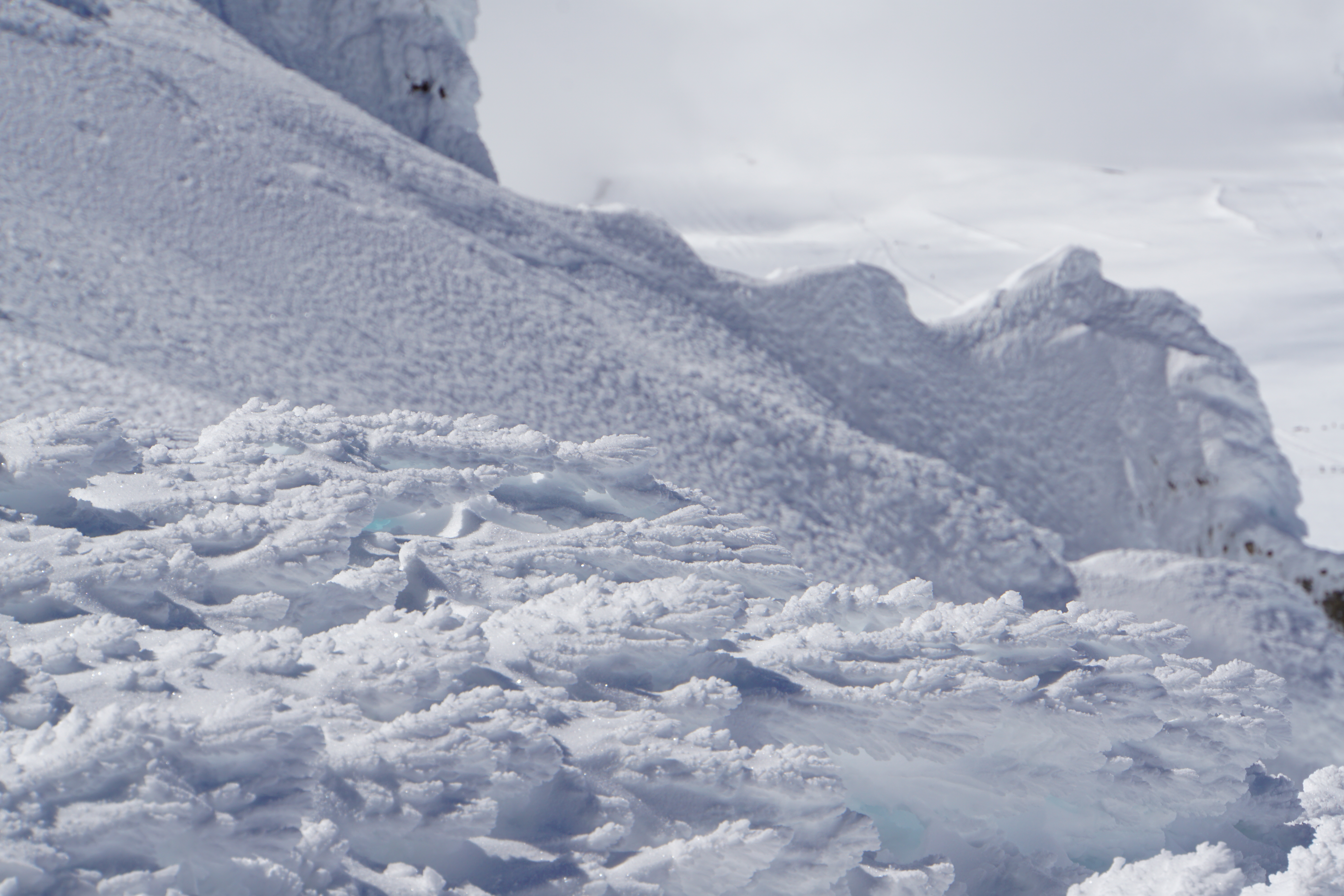
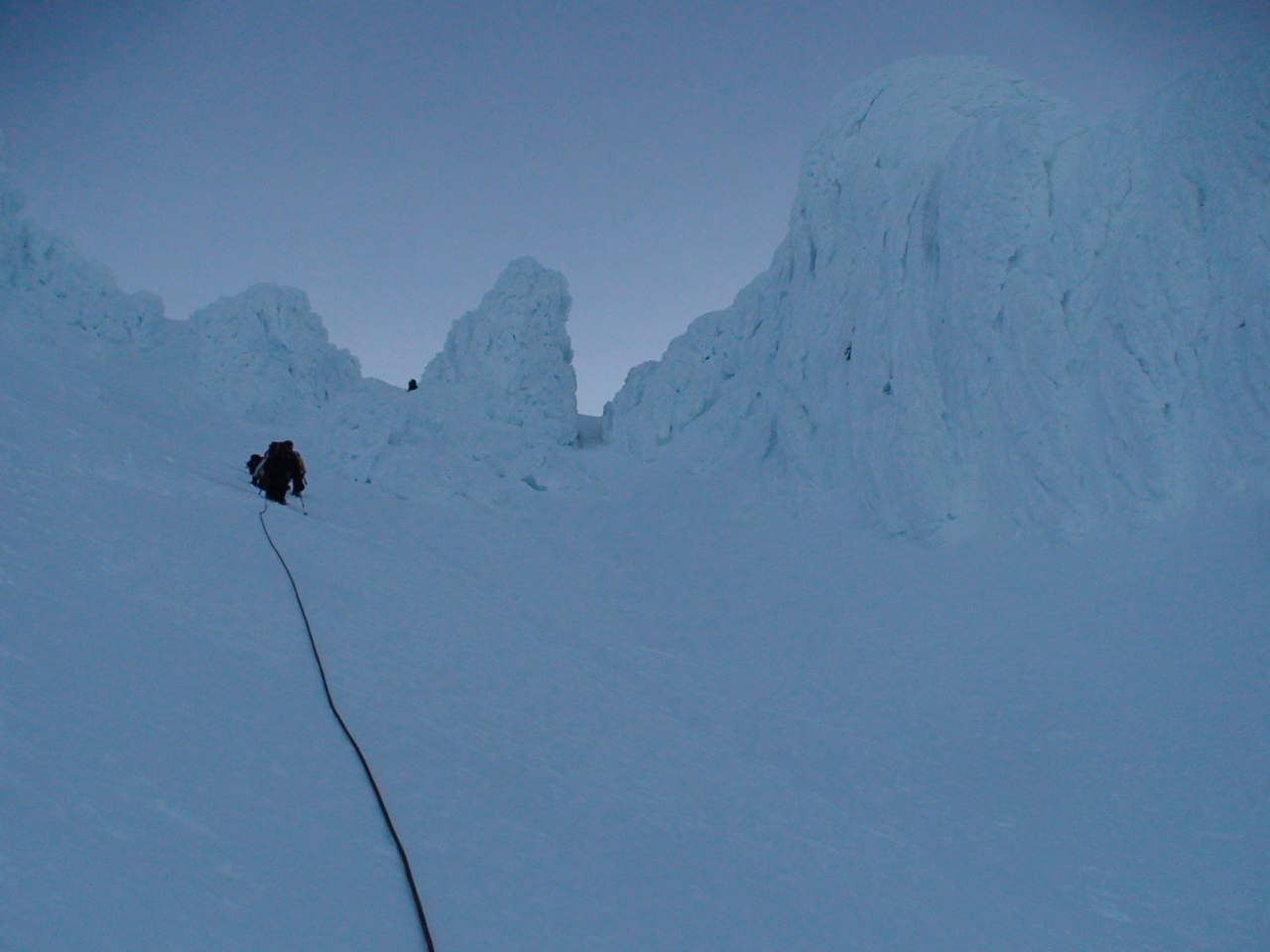
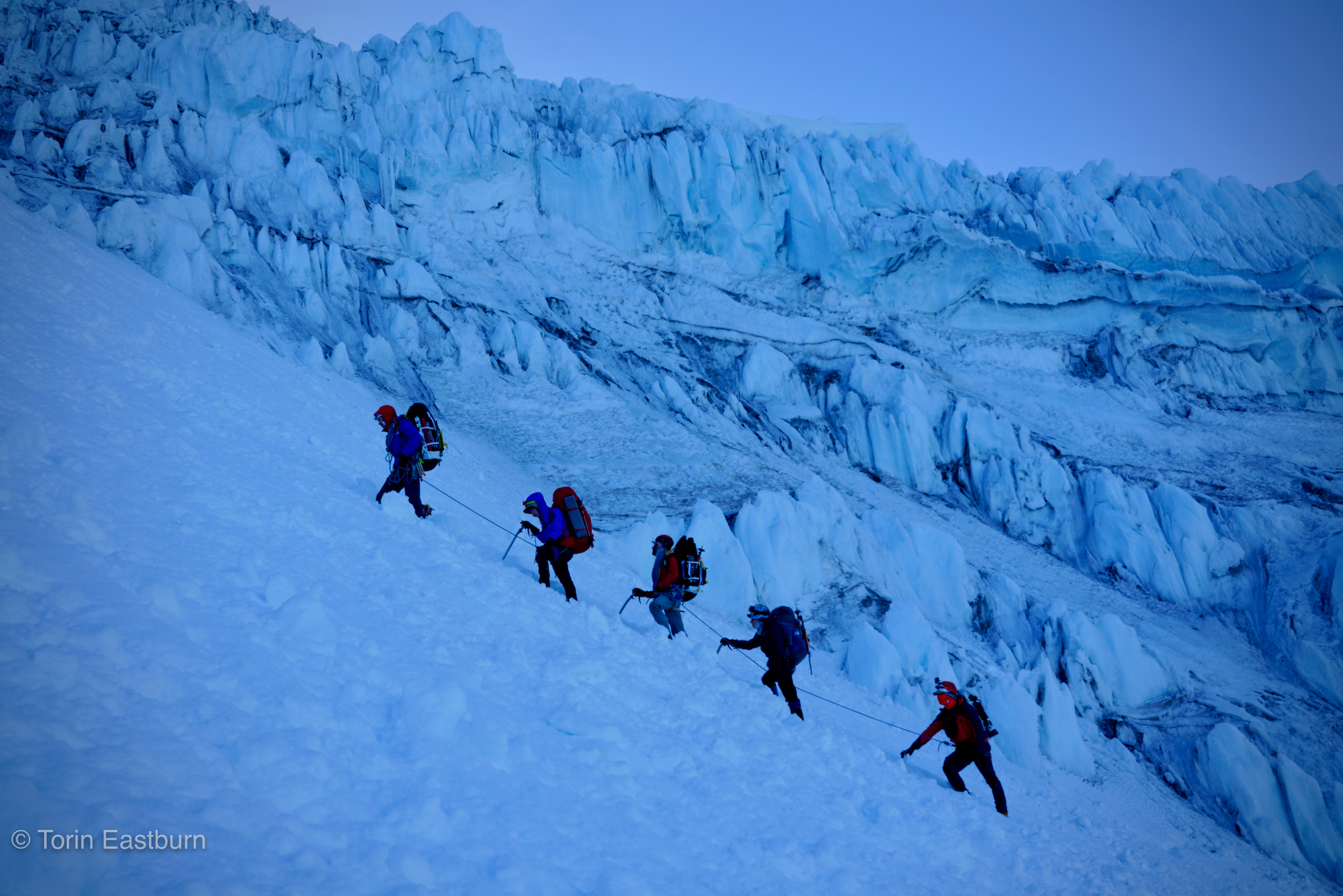
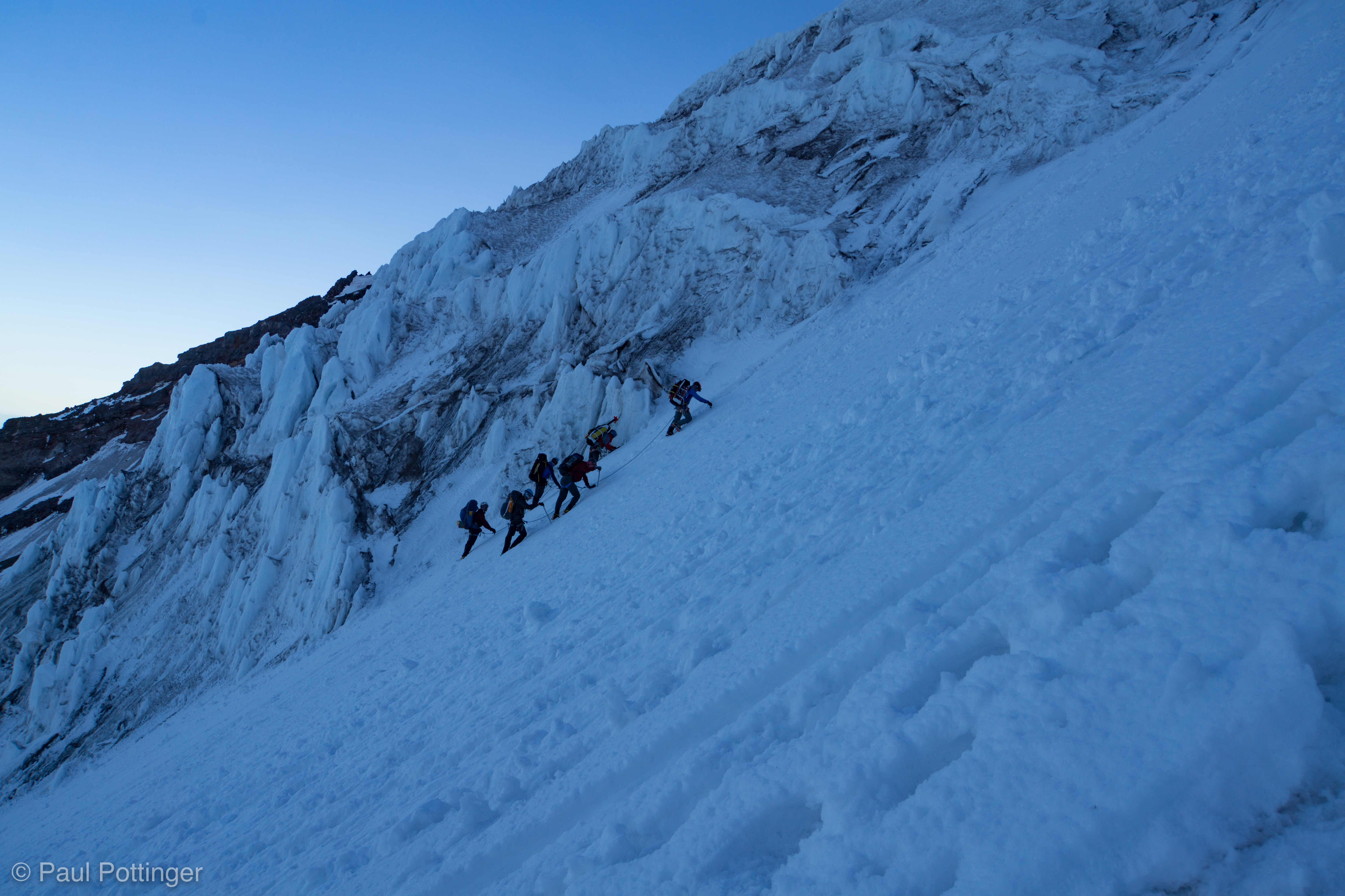
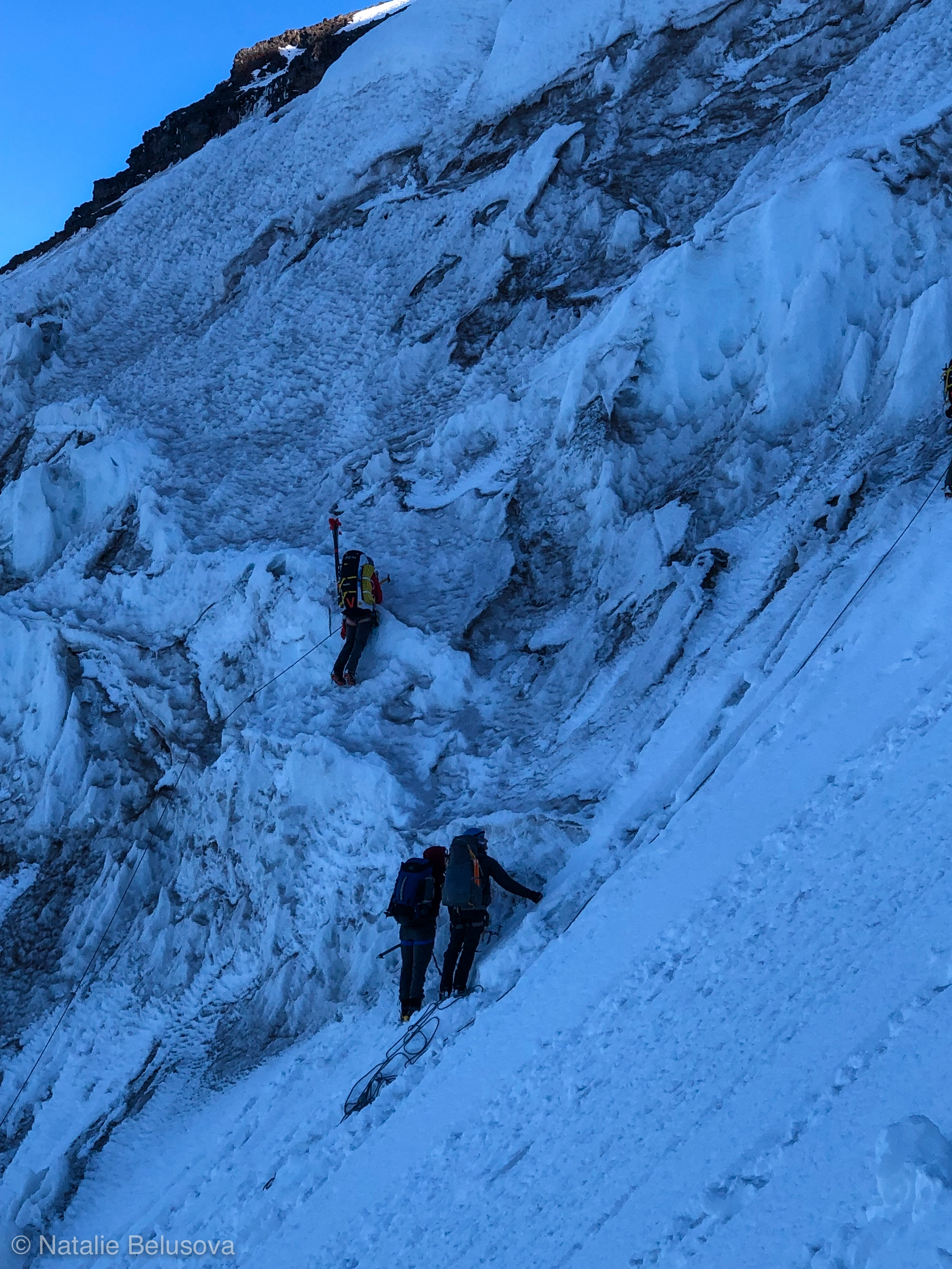
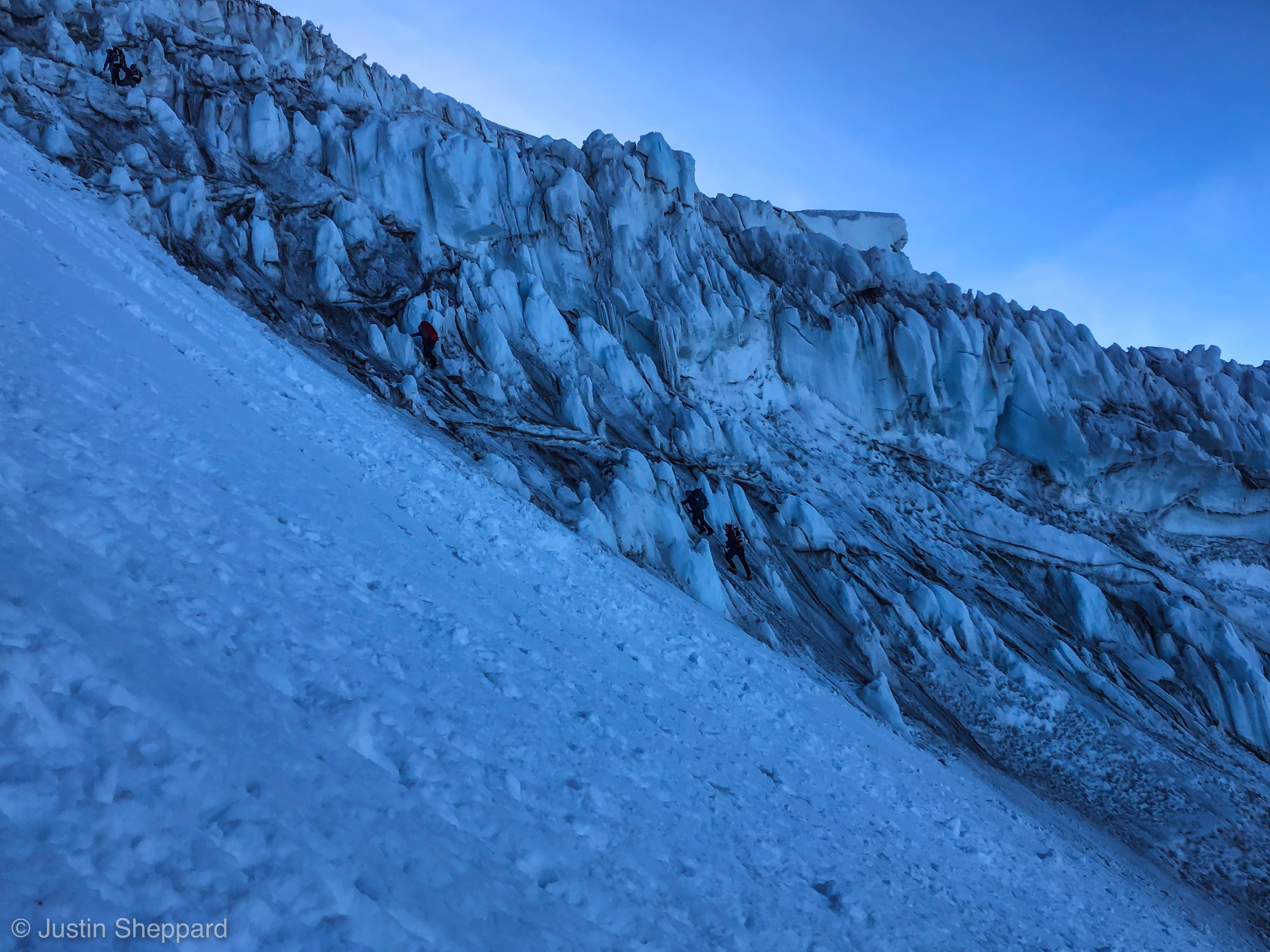
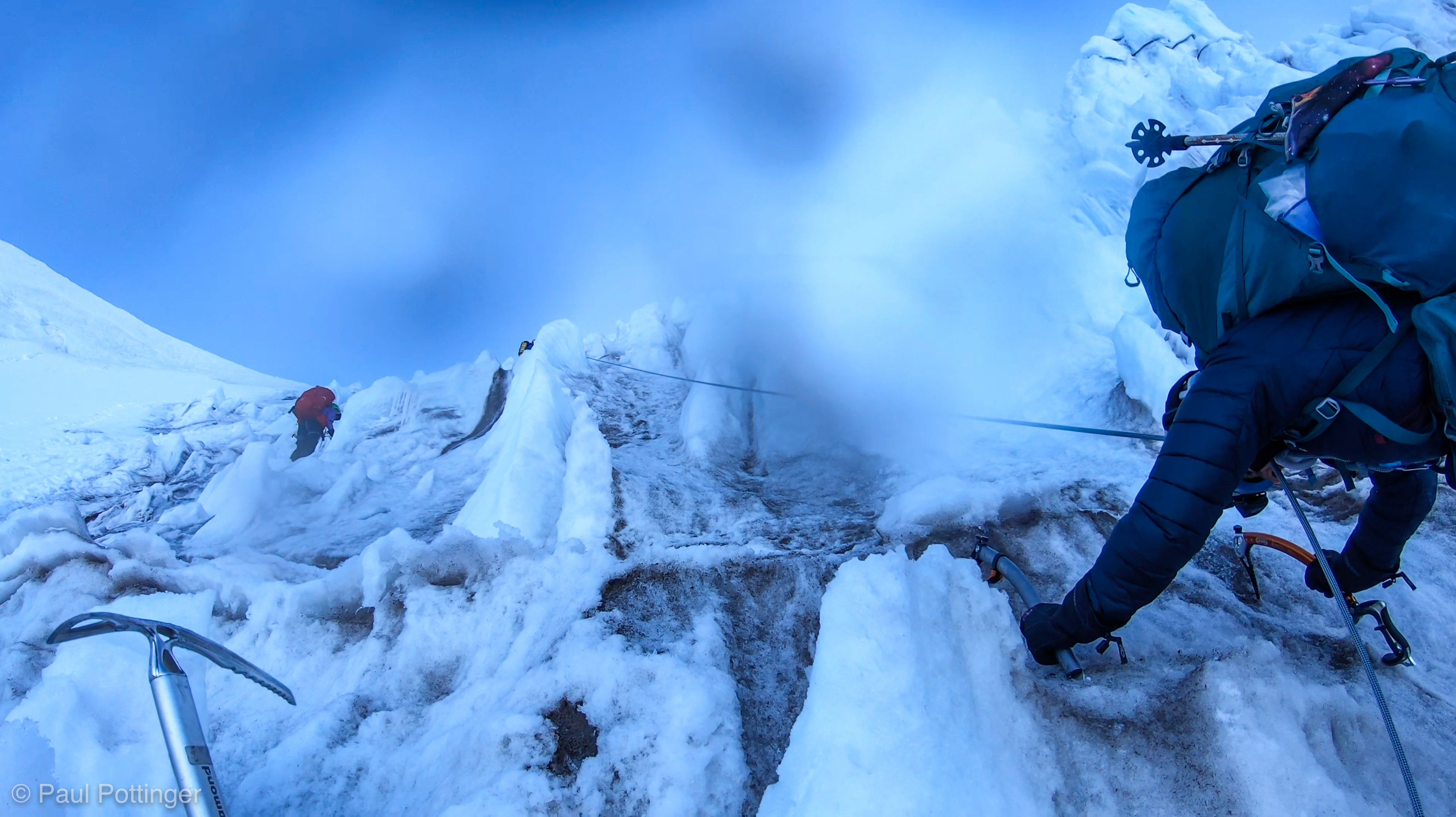
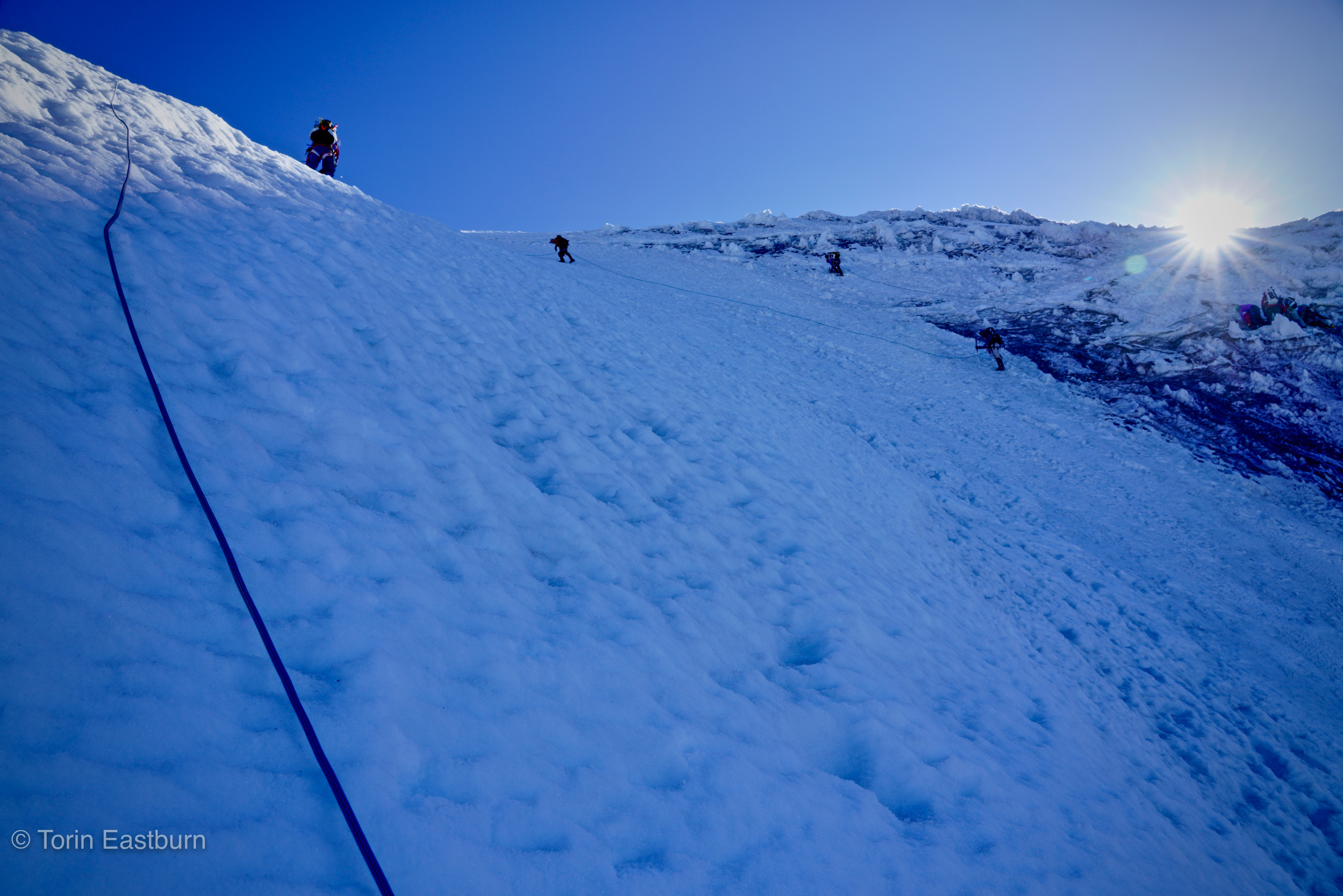
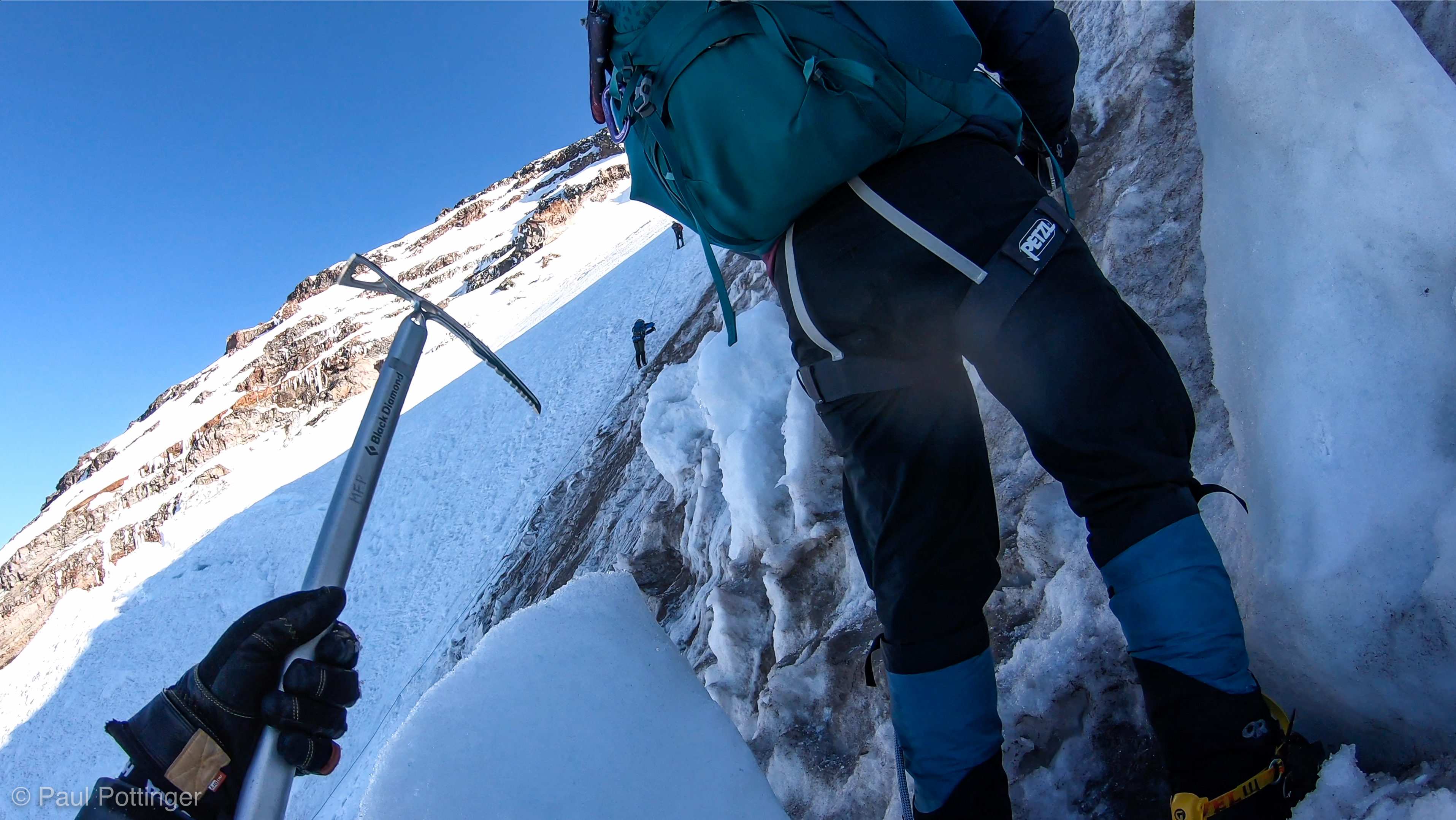
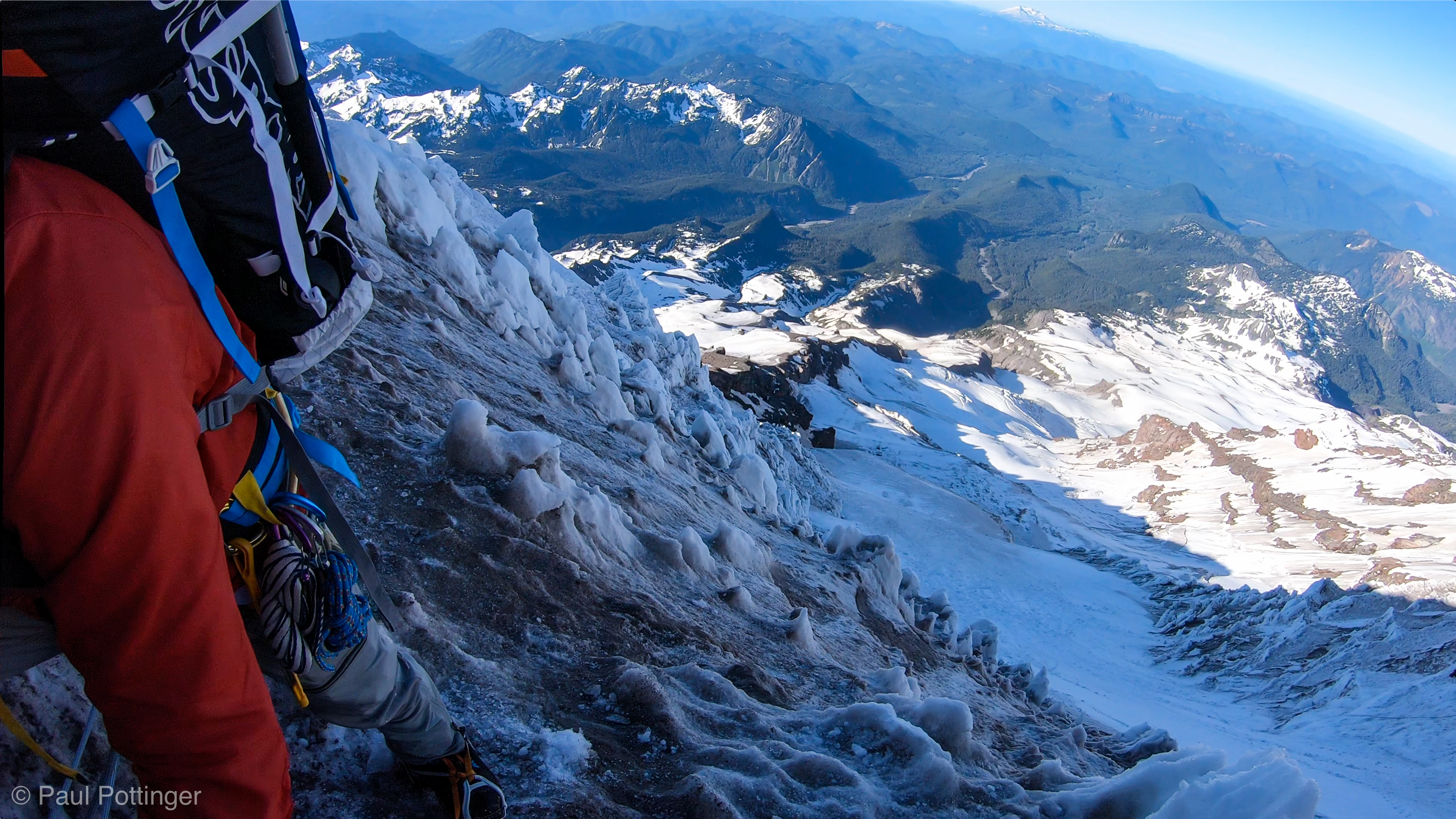
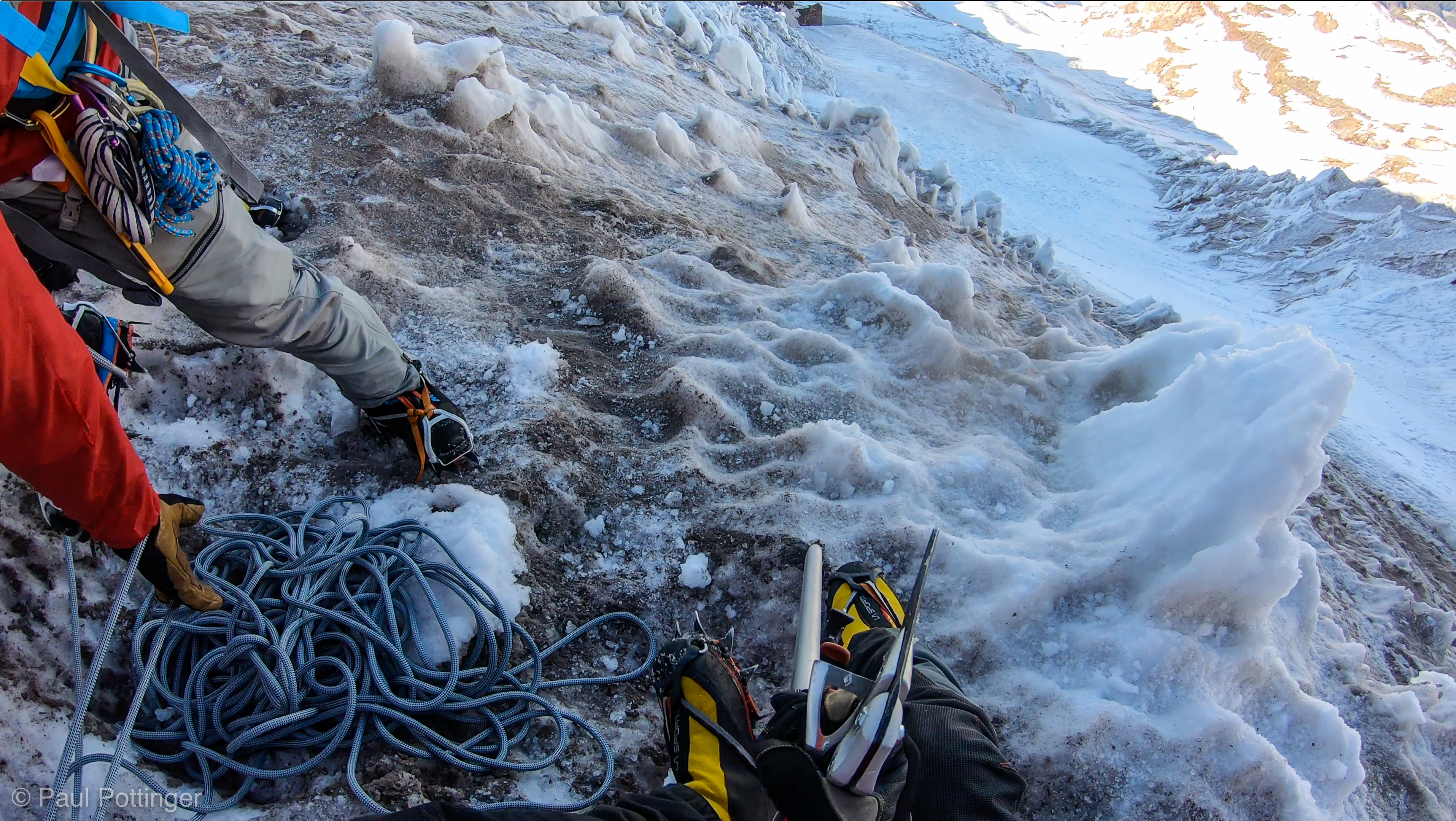
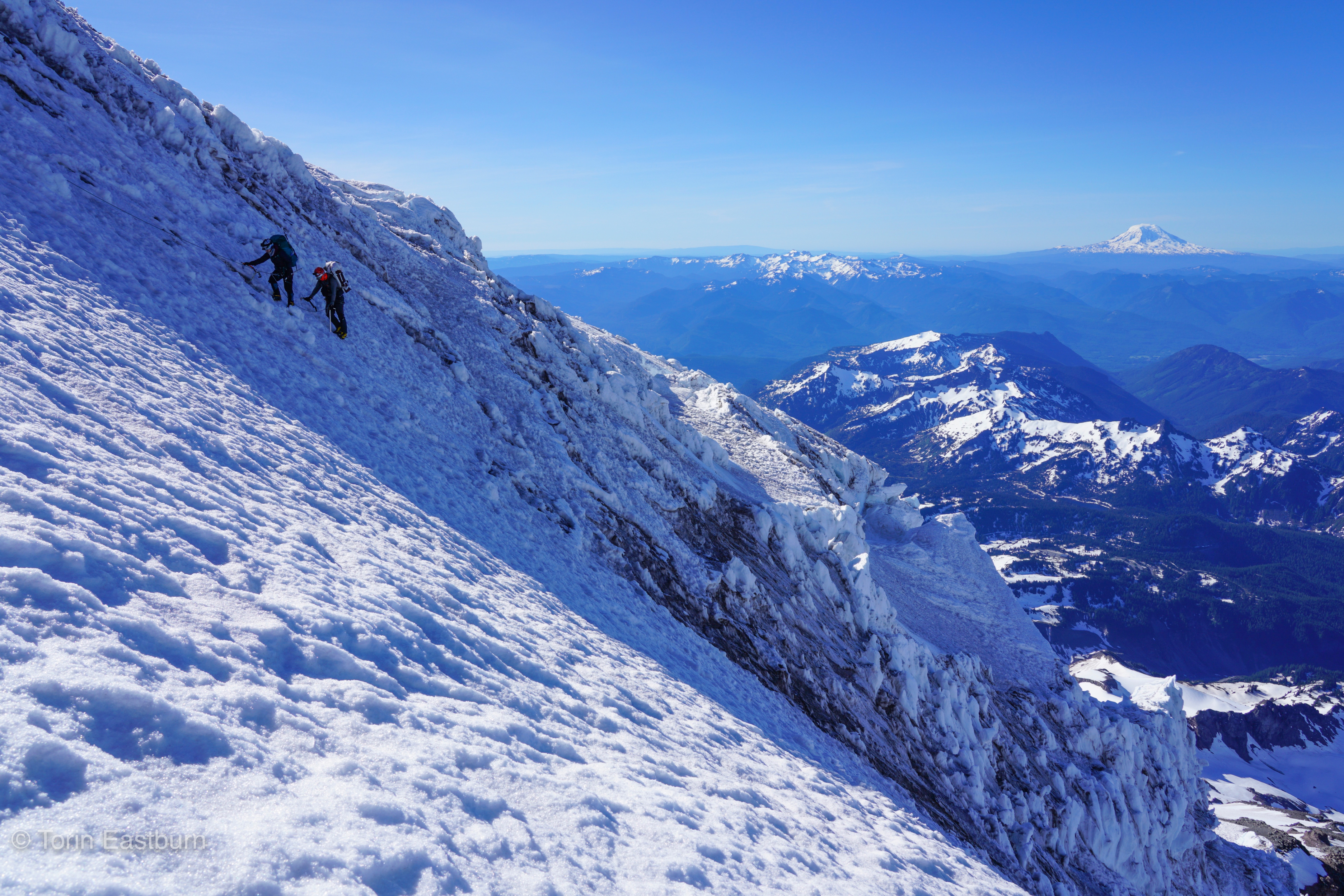
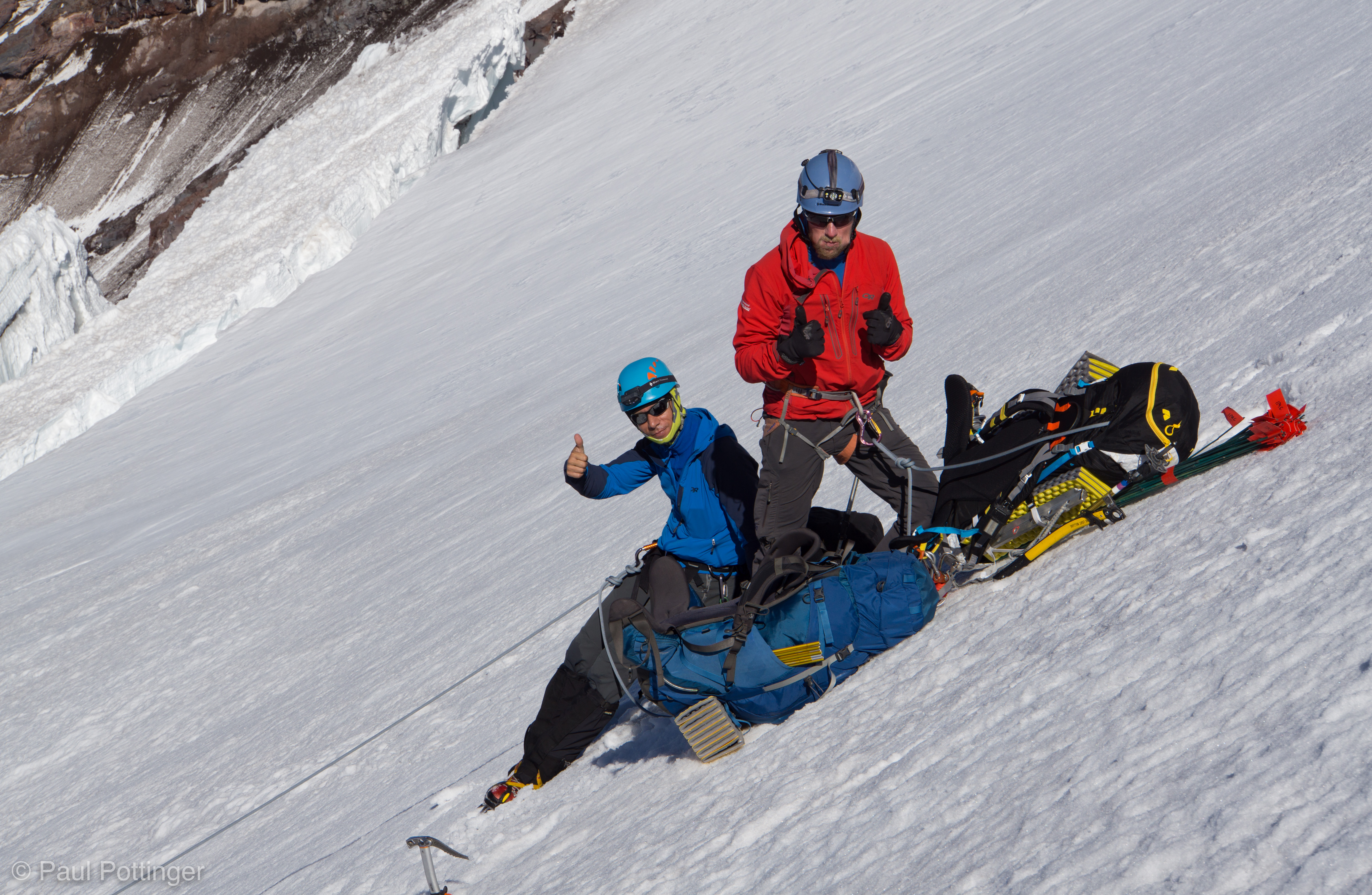
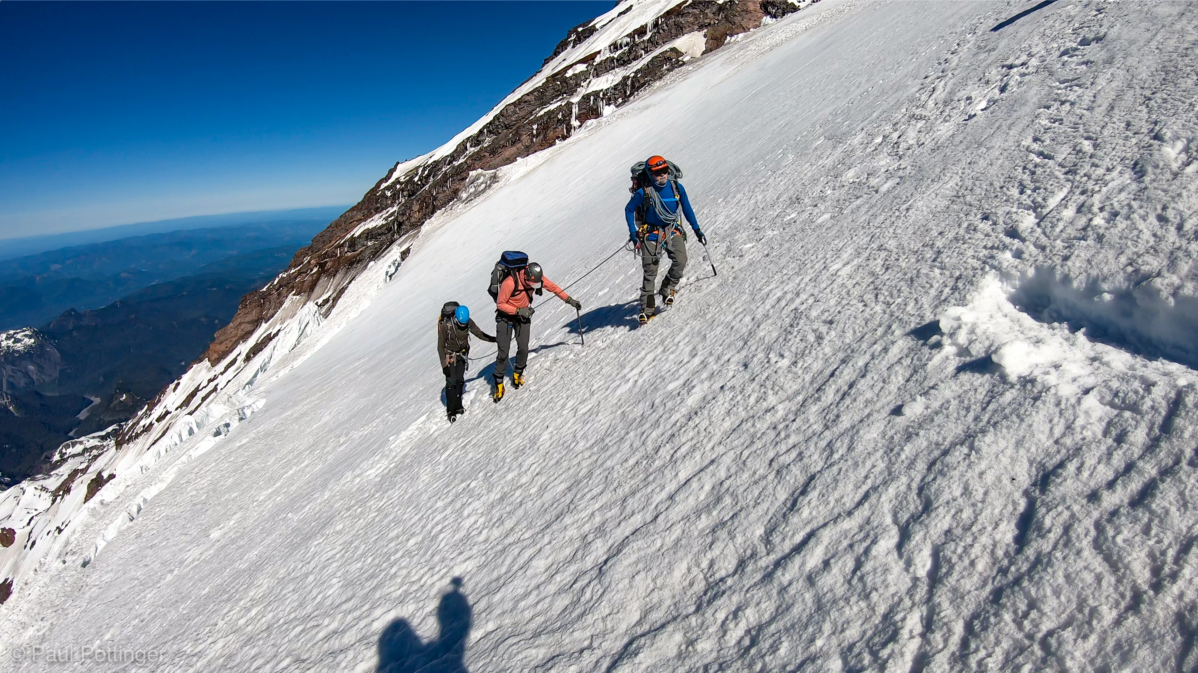
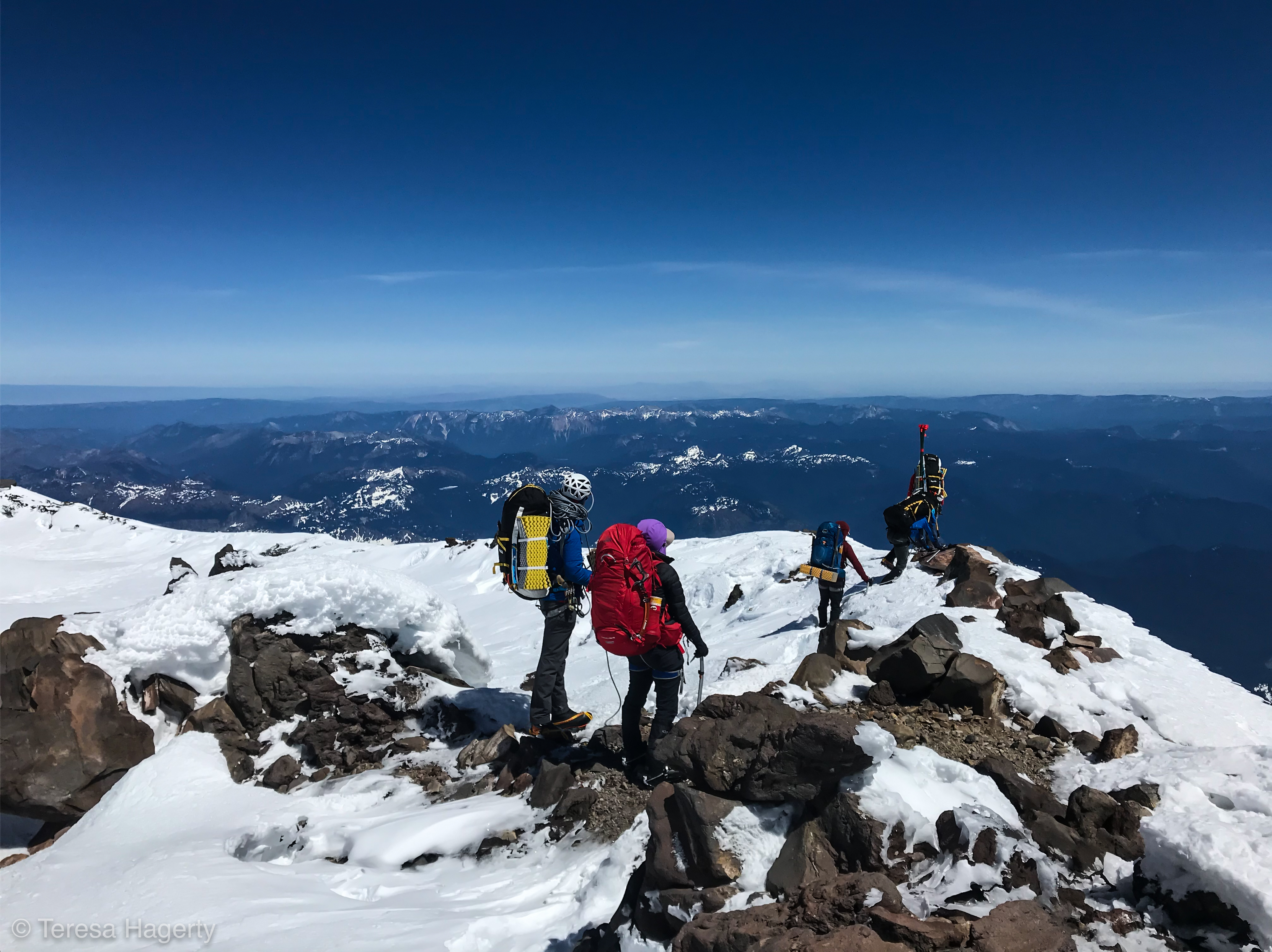
After a short time we were finally on the Kautz Ice Chute: a steep, triangular snow ramp, bound on two sides by compact snow ice. The walls were dirty, complex, and tortured by snow-melt cycles into penitentes and sun cups. Even at its narrowest point at the top, this was exponentially wider and more open than the Pearly Gates of Wy’East. In fact, it looked like we could just climb right up the center of the snow field, which seemed like an obvious, direct, seductive option… although I had to admit that it was littered with lots of recent slides. Maybe the penitentes are a better option.

Transitioning to slightly longer interval before we step onto the Kautz Ice Chute. Our shadow visible top left corner.
We hustled past this rotten terrain to the Chute proper, immediately left of the ice you see at the left hand side here.
We turn up and onto the Chute as soon as we pass this wall of icefall, the ultimate terminus of the East side of the Chute.
Getting onto the Kautz Ice Chute.
Stepping onto the Chute for the first time as we round the East wall. Kautz Headwall in the distance.
Welcome to the Kautz Ice Chute. Headwall on left… then the Western Wall, then the snow ramp, then the Eastern Wall, which we will climb.
Yeah. We’re happy to be here.
Our shadow includes Point Success and the Liberty Cap. First time I have seen this level of detail on a mountain shadow.
Climbing the snow ramp. Evidence of slides underfoot. Keith and Natalie turn right towards the Eastern Wall. We will follow.

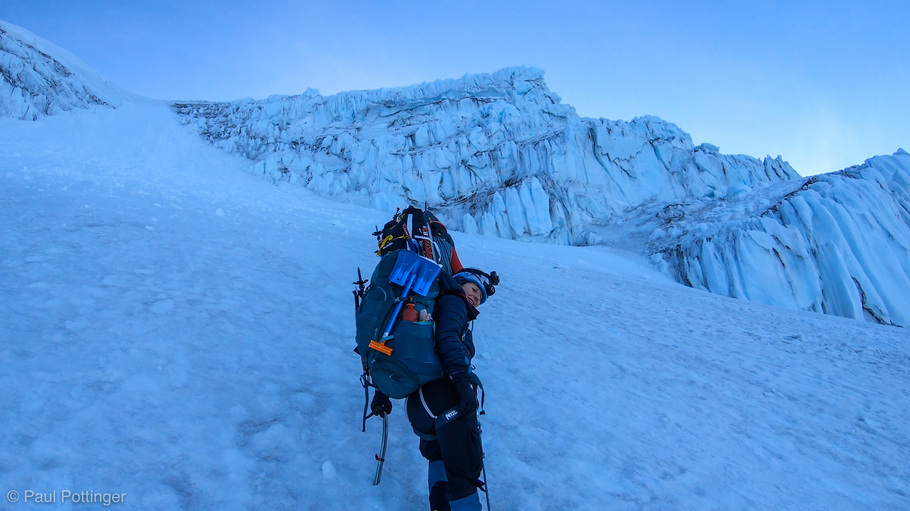
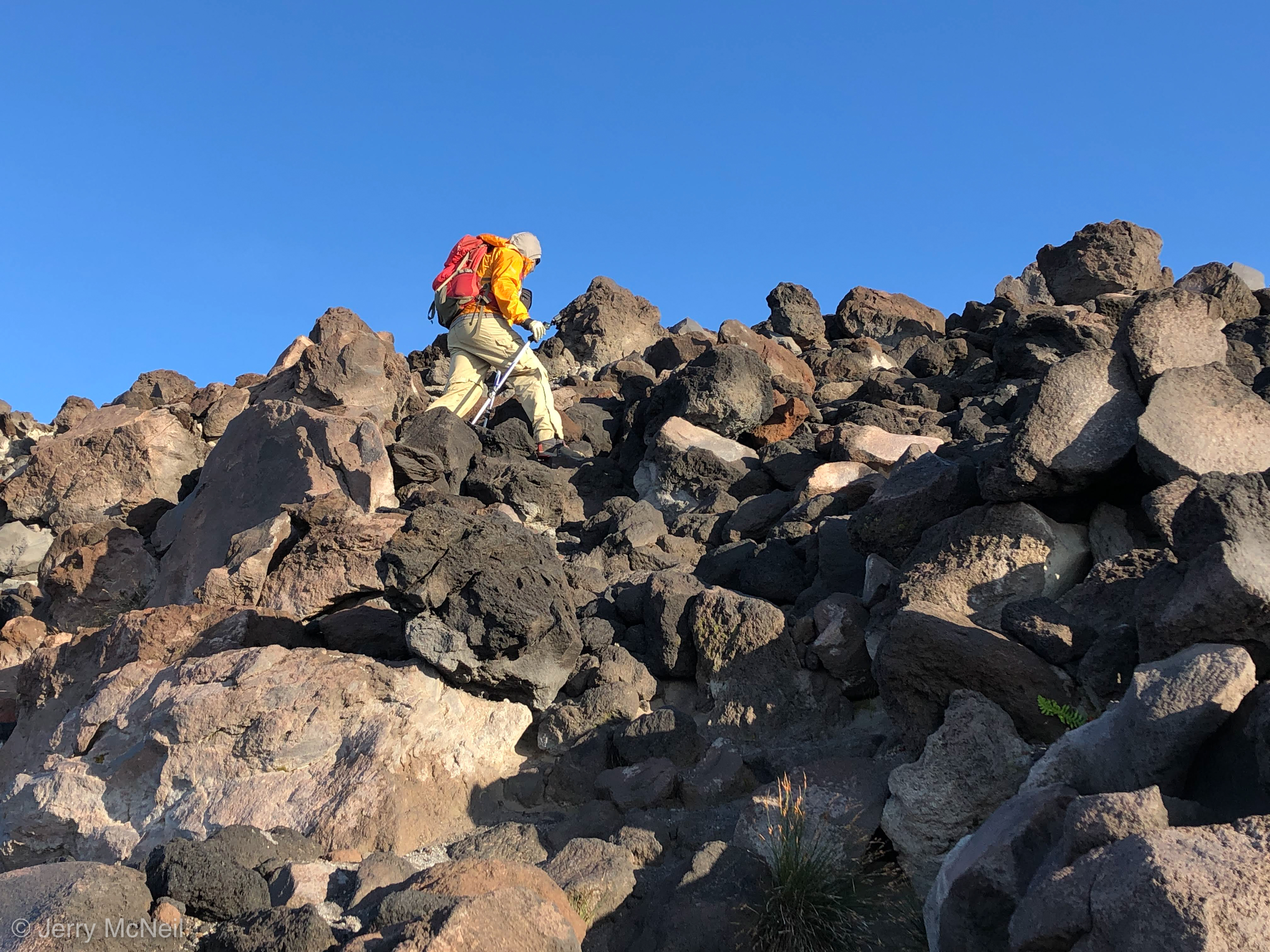
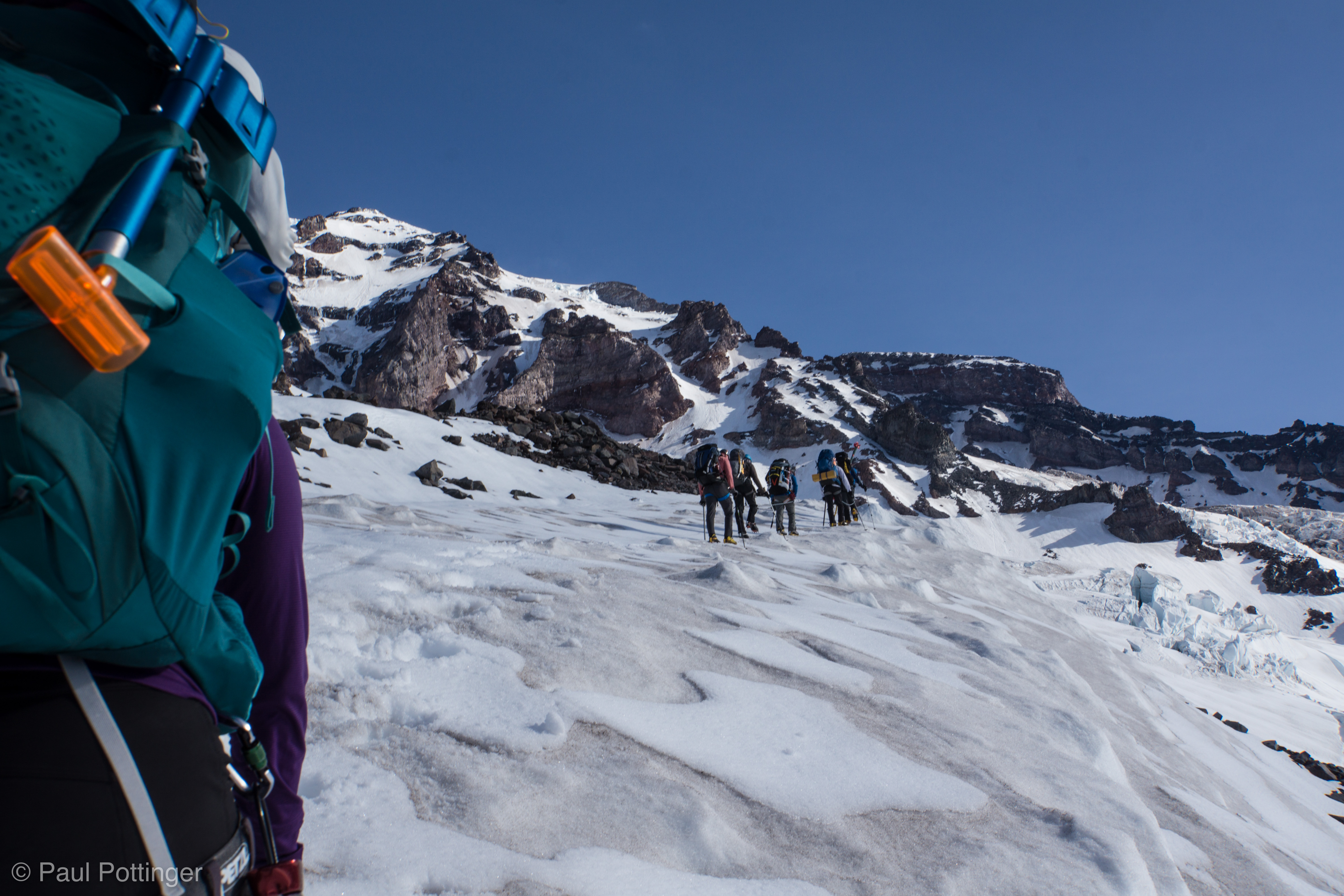
The Goonies and Rowers of Rowan went left… teams She-Wee and Big Agnes went right. T and I watched Conrad start up the ice. The slope was not vertical, more like 60 degrees for the most part, and he threaded a route between the ice spires with ease. Then, it was our turn.

On the snow at center of the Chute. Keith… Natalie… Conrad… Teresa… me. Shortly after this was taken, all of us would turn right and climb the penitentes of the far Chute wall seen just beyond.
Our teammates making progress up the Chute.
Rowers of Rohan and Goonies ascend the snow chute before climbing the ice on their left.
Rowers of Rohan start their first ice pitch.
Nickel leads his team (out of view), while Torin and Ken wait for Rowan (out of view) to establish a belay station above.
Conrad leads out for our first ice pitch.

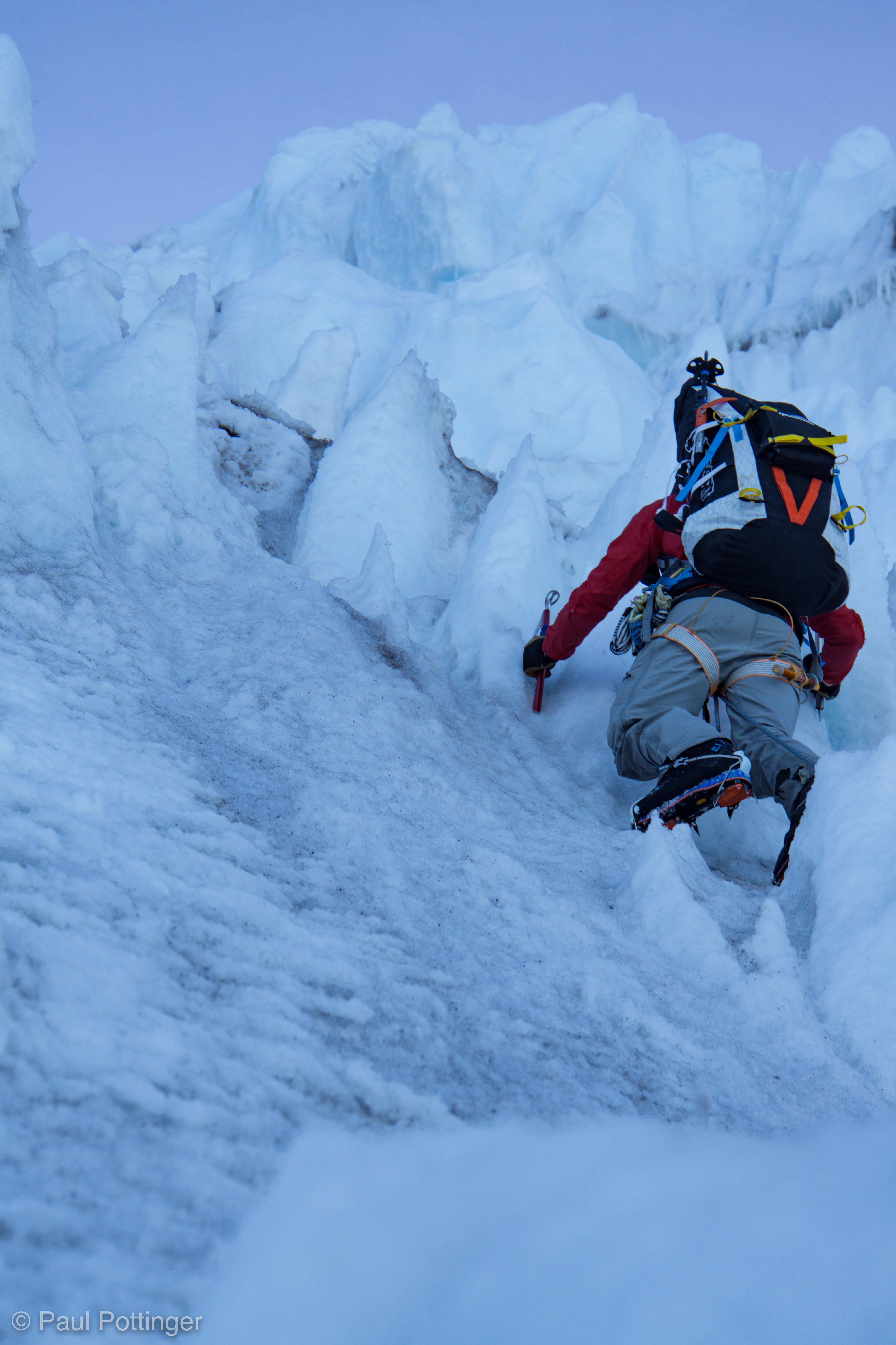
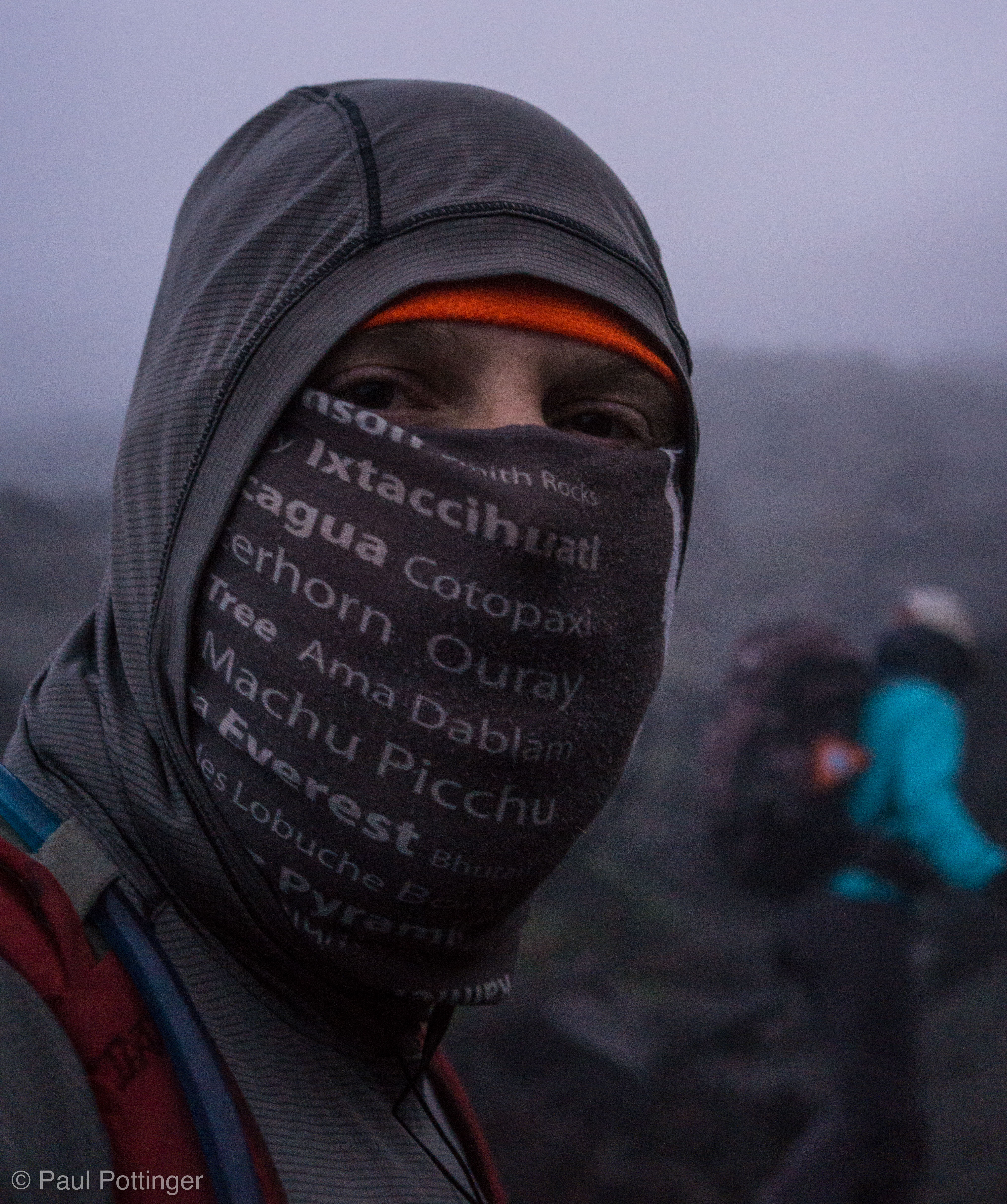
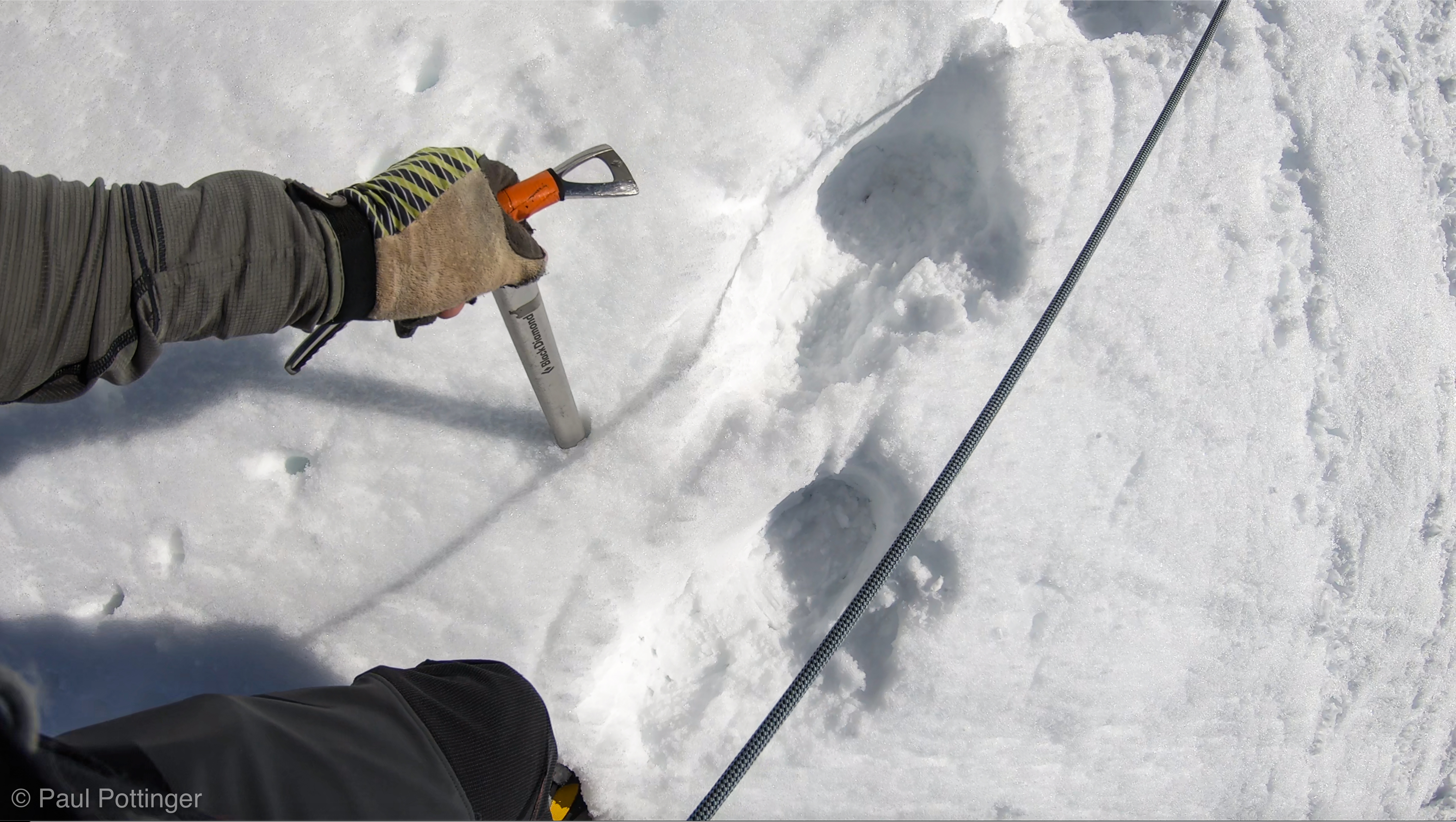
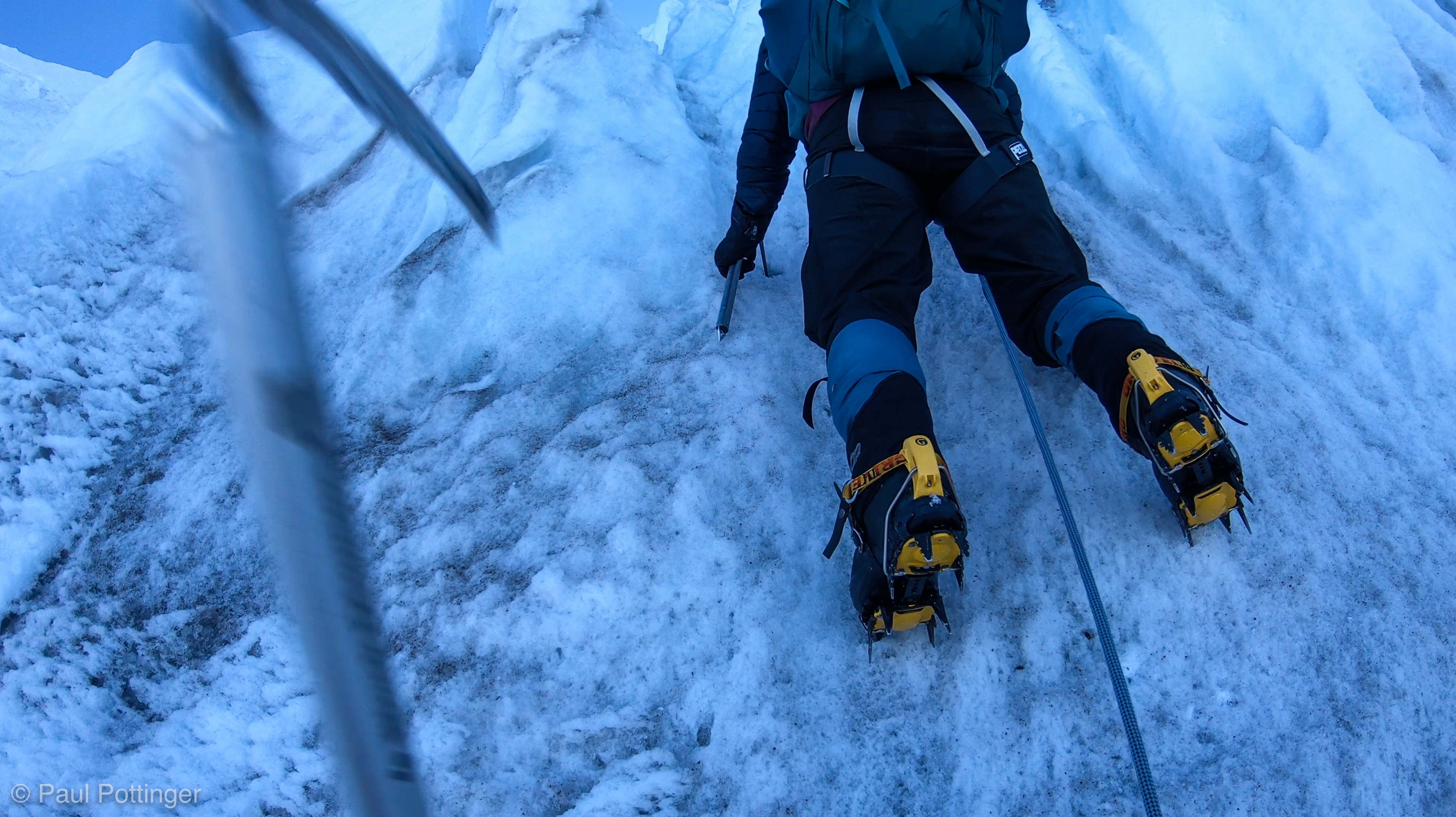
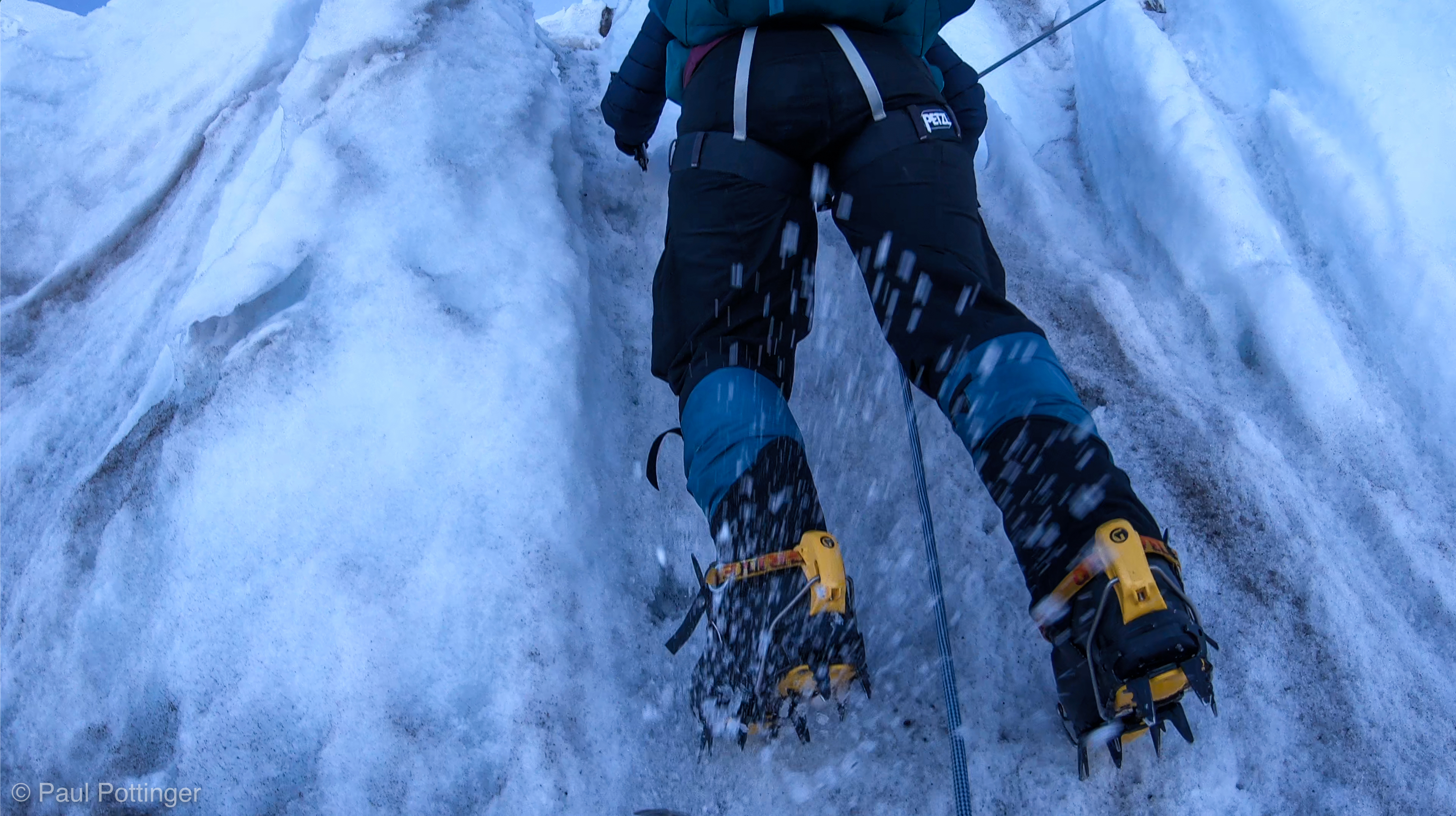
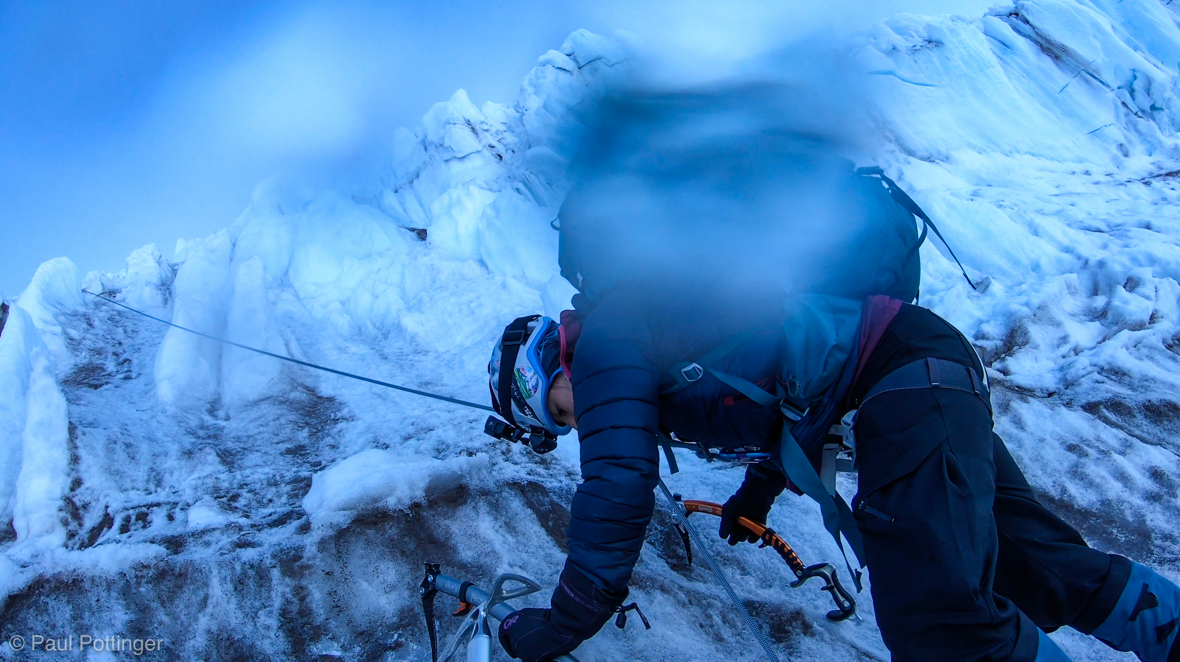
Teresa and I climbed together, just a couple meters apart. This was so reminiscent of climbing Forbidden’s North Ridge with Justin and Ann, but here we were higher… colder… heavier… less exposed… and climbing ice. And those first few moves out of the gate felt very, very steep indeed. We labored in synch. The ice was still very firm from being in the dark all night long, and it usually took more than one swing to set the picks. Often, the best spot for my tools were Teresa’ foot positions… landing my tools into her feet would be a very bad move, for all sorts of reasons. I swung hard, and I never hit her. Not once. Afterwards, she told me that the most stressful part of the climb was imagining what would happen if she kicked me in the head, or peeled off and landed in my face. But T is a very strong climber. “Oh,” I said, “I knew you’d never lose your position. It never worried me.” I suppose she did all the worrying for both of us.

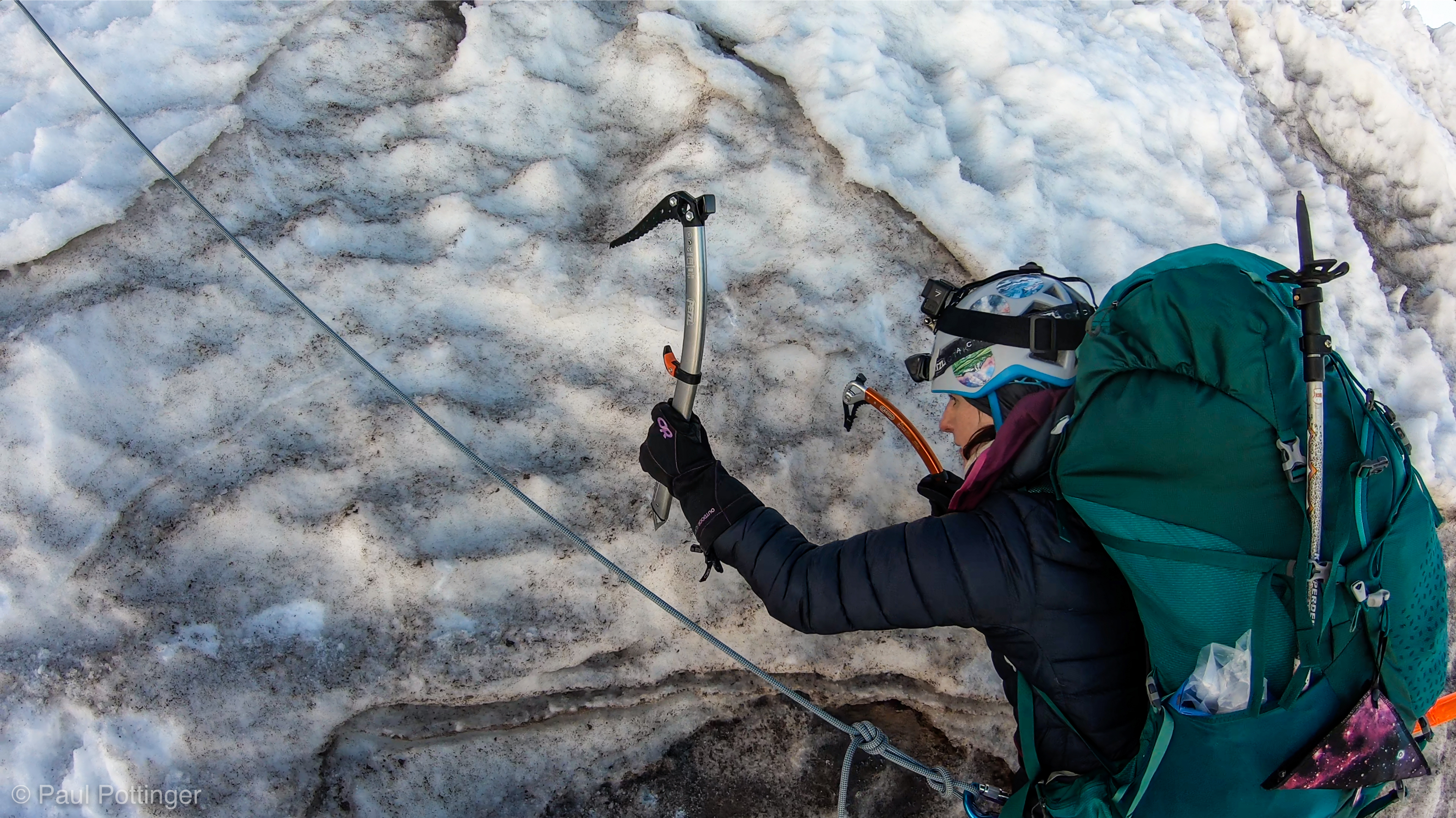
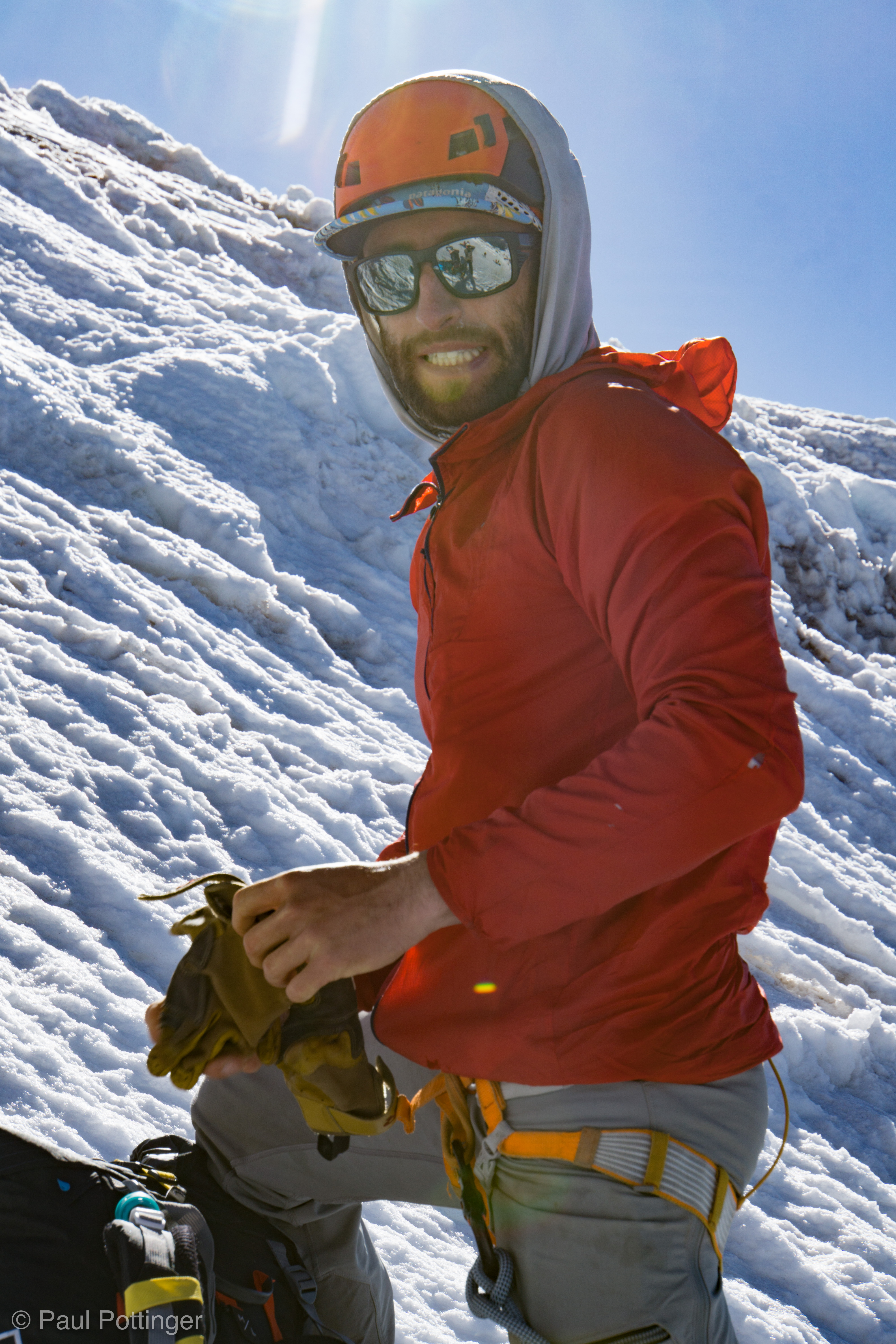
That first pitch really was the toughest. Conrad shouted encouragement from his belay stance above: “It moderates soon, trust me.” Sure enough, the face went from about 70 degrees to less than 60, I would guess. Still exhausting, but doable. As we reached Conrad at that first station, he looked at my Raven Pro and asked, “How’d it go with that thing?” I carried a Nomic in my right hand, but just the standard old Raven Pro in my left.

I caught my breath. “Yeah… it wasn’t designed for this, no doubt. But, it went fine!” I actually liked the long shaft, which allowed me to hook penitentes that would otherwise have been out of reach. But, as for really setting the pick in verglas… not nearly as useful as the Nomic.

The G12’s of T$, right at eye level.
Swinging the Raven Pro right at my buddy.
Lots of surface ice goes airborne with every swing.
Teresa and me at center screen, belayed by Conrad at top left. Natalie above and to the left, belayed by Keith from same position as Conrad.
In some cases my pick lands higher than her feet. Poor T, being hemmed in like this.
Starting a traverse to the left.
Terrain moderating here.
Making progress.
The surface snow was relatively soft here.
An independent party starts up the snow ramp.
Teresa swings as we approach the belay station. Natalie takes our picture from above.
Conrad points out a good spot for me to sit.

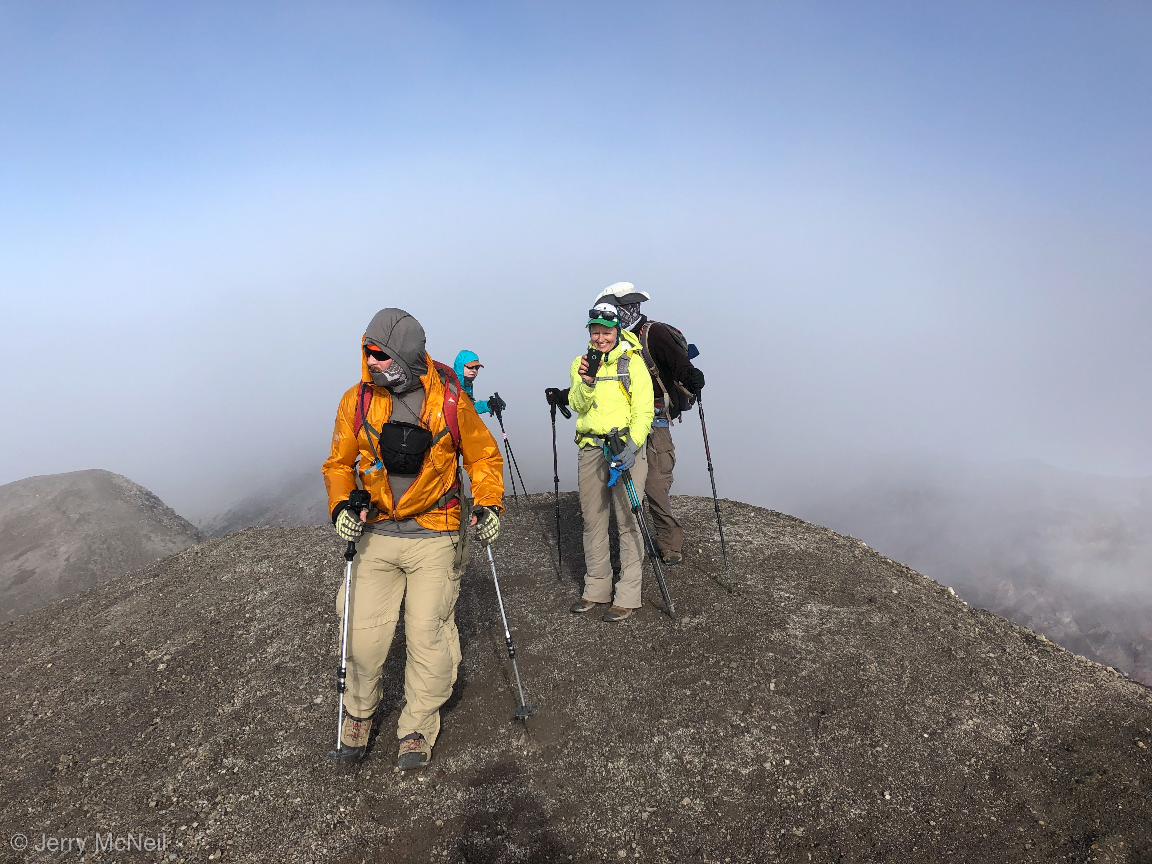
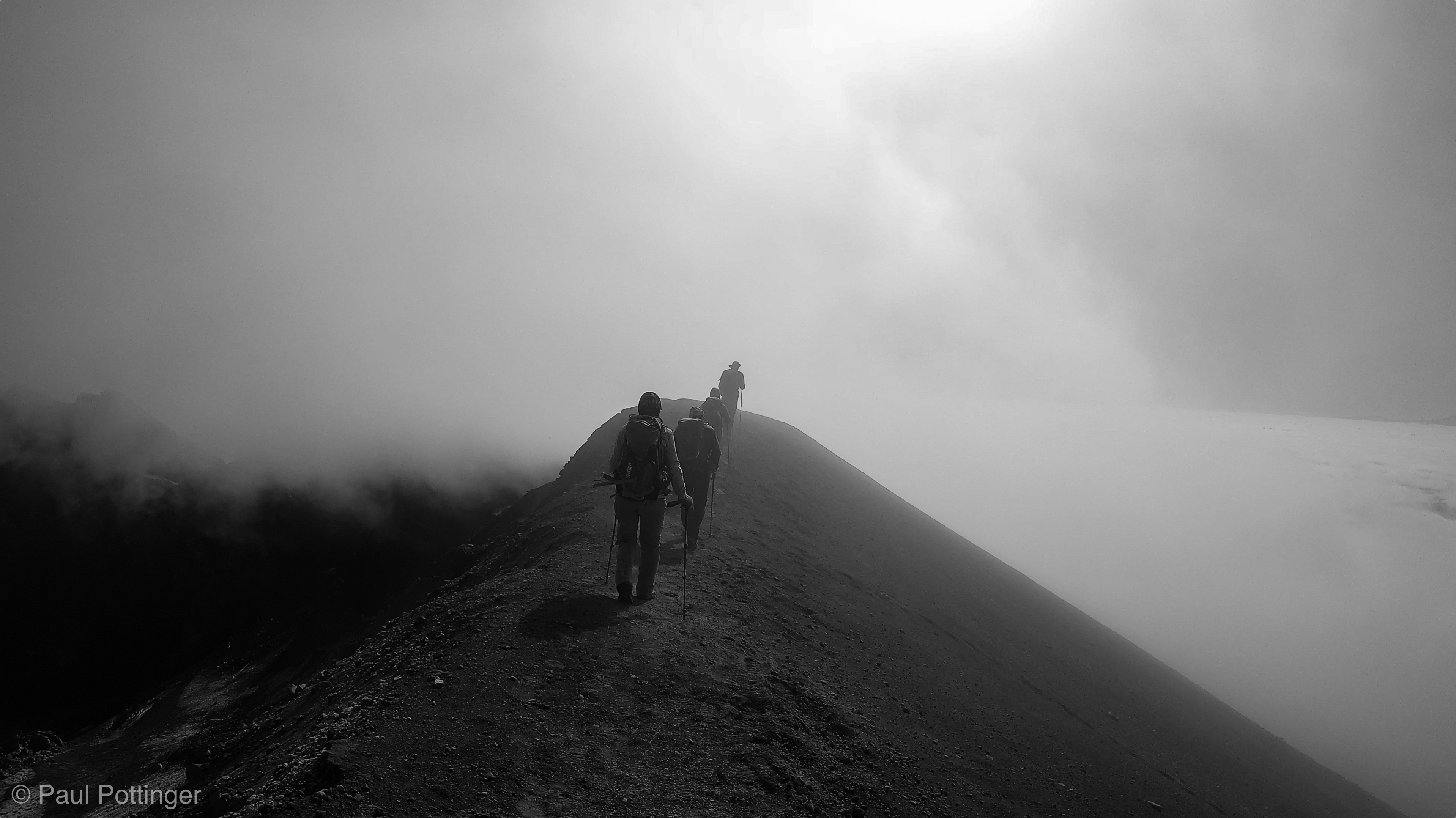
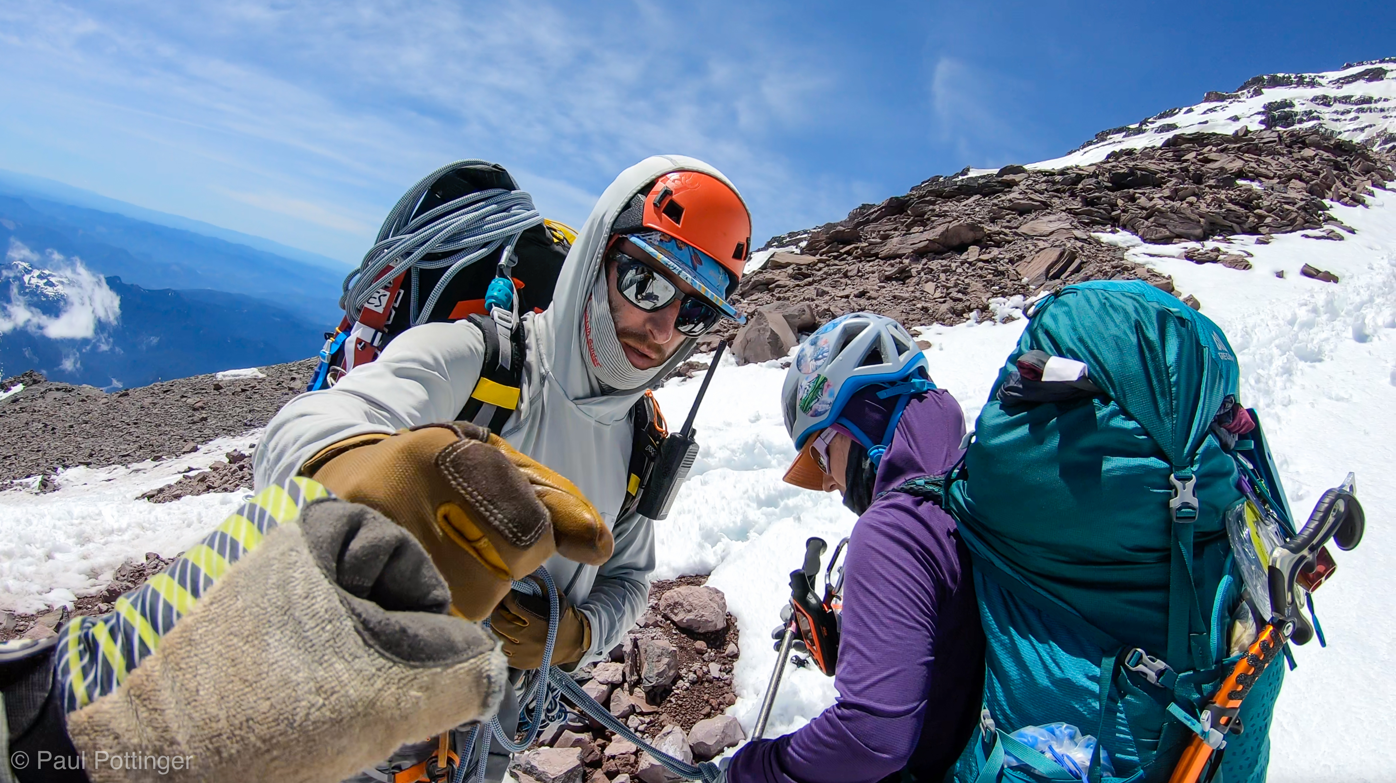
While Conrad re-racked the screws I had cleaned, and got situated to lead the next pitch, we had a few minutes to take in the scene: Airy… open… wild. “Here comes another team,” I said, after spying a roped party heading right up the middle of the Chute. These were independent climbers who looked strong, and I’m sure they were very nice folks. But, damn… they could have used some pointers from IMG. Their interval was many, many meters, and often the rope curved below the followers in great oxbows of more than 10 meters. This is a real no-no, because if someone falls it will allow the line to get shock-loaded, and dramatically increases the risk of others getting pulled away with them. I recalled Nickel’s clear command from the prior day: “Never climb above the rope in front of you.” So simple….

Nickel leads his team up the Chute.
T at a break.

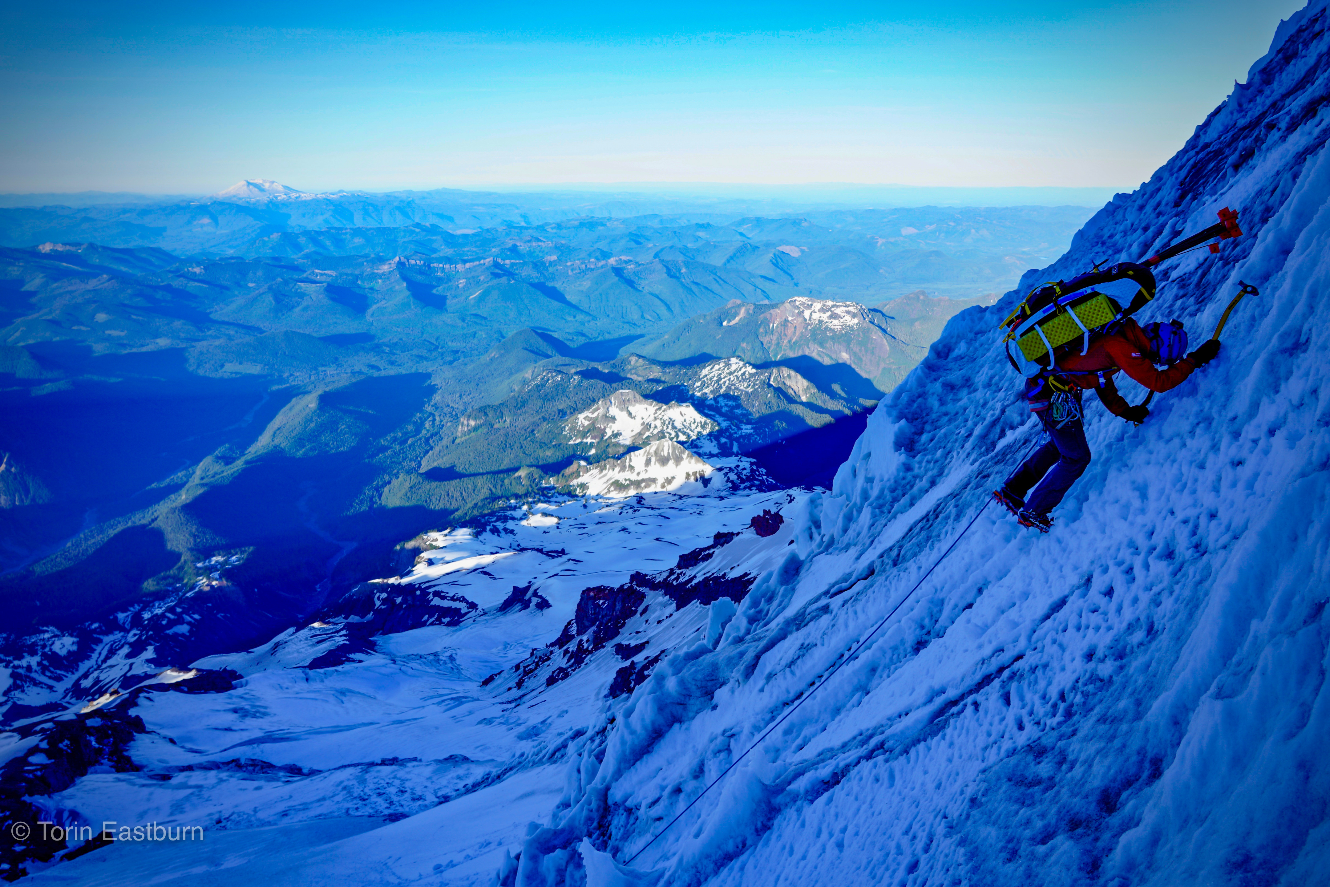
We started up the next pitch: Smoother, less steep, easier to catch my breath. There’s something about setting the front points, trusting them, standing on them with full confidence that is so inspiring. The Baturas and Vasaks behaved themselves, mostly. I have big, wide feet. It’s not my fault, I was just born this way. Anyhow, it turns out that most mountaineering boots are not available in wide widths; some are, and I have found the ones that work best for me. But, when it comes to technical ice boots… not so much. The LS Baturas are fine, totally fine for general mountaineering and also acceptable on steep ice so long as I can shake out my feet periodically and allow arterial blood supply to return. I was careful to do this every few steps that day, and it worked out fine. This was definitely the highest, and heaviest, multi-pitch ice I have climbed. And it was amazing.

Teresa: Mountaineer… Badass… My friend.
The surface snow was relatively soft here.
Kautz Ice Chute, seen from above.
Looking down from near the top of the Chute.
Looking upwards towards the top of the Chute.
Pahto / Klickitat… Wy’East… Loowit.
View of the side of the Chute, taken towards the top.
Teresa swings as we approach the belay station. Natalie takes our picture from above.
Teresa approaches a belay station. I’m right on her 6.
Looking back at our progress.
You’d think I might hit her foot, right? No bloody chance.
At least a centimeter of clearance! #spoton
This section is pretty steep.
Occasionally a lovely little plaftorm presents itself.
Top of this penitente provides a spot to hook onto.
Looking down the Eastern wall of the Chute, which we have climbed. Dirty, dirty surface dust.
Our friends wait for us at the belay station.

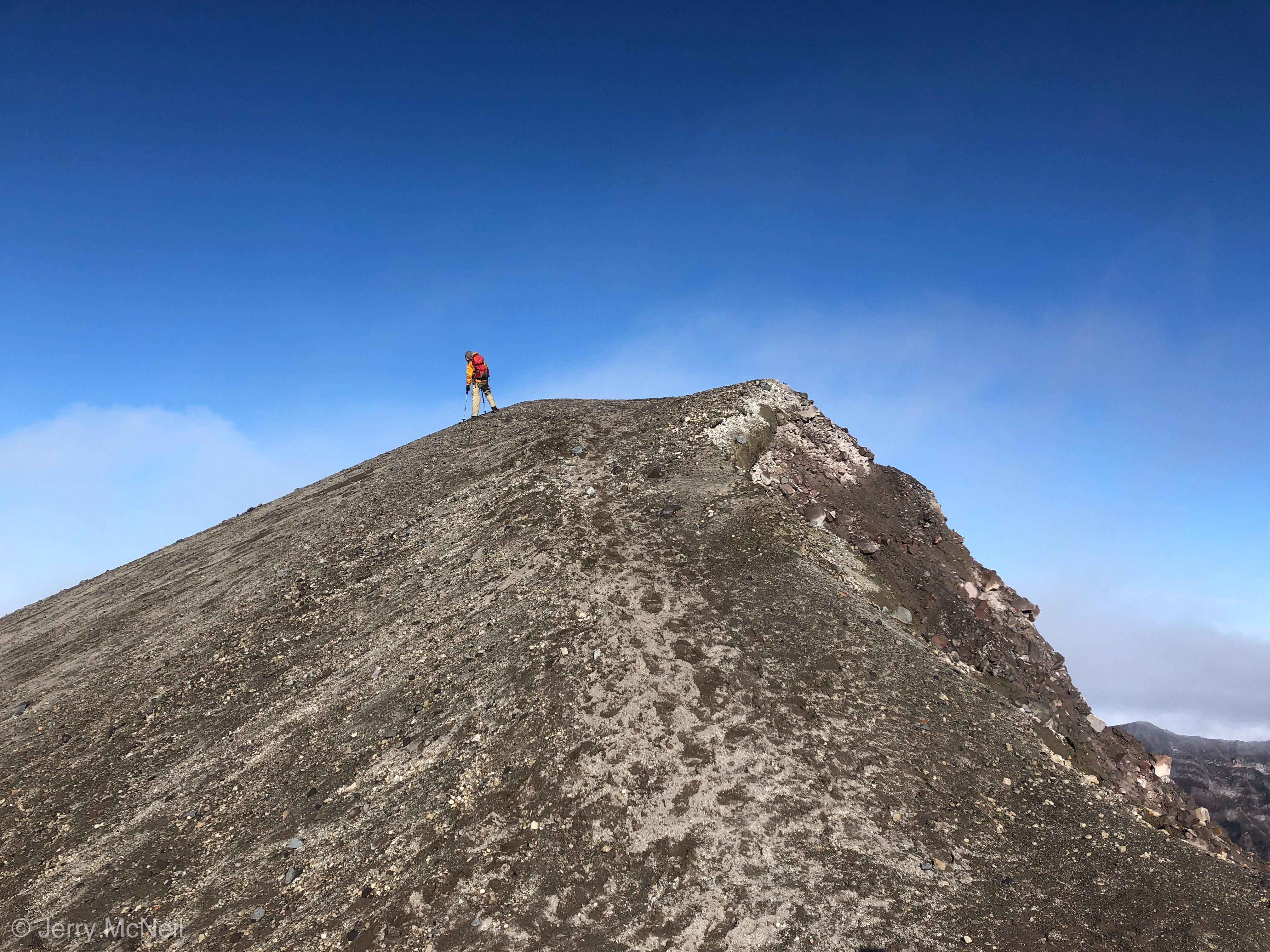
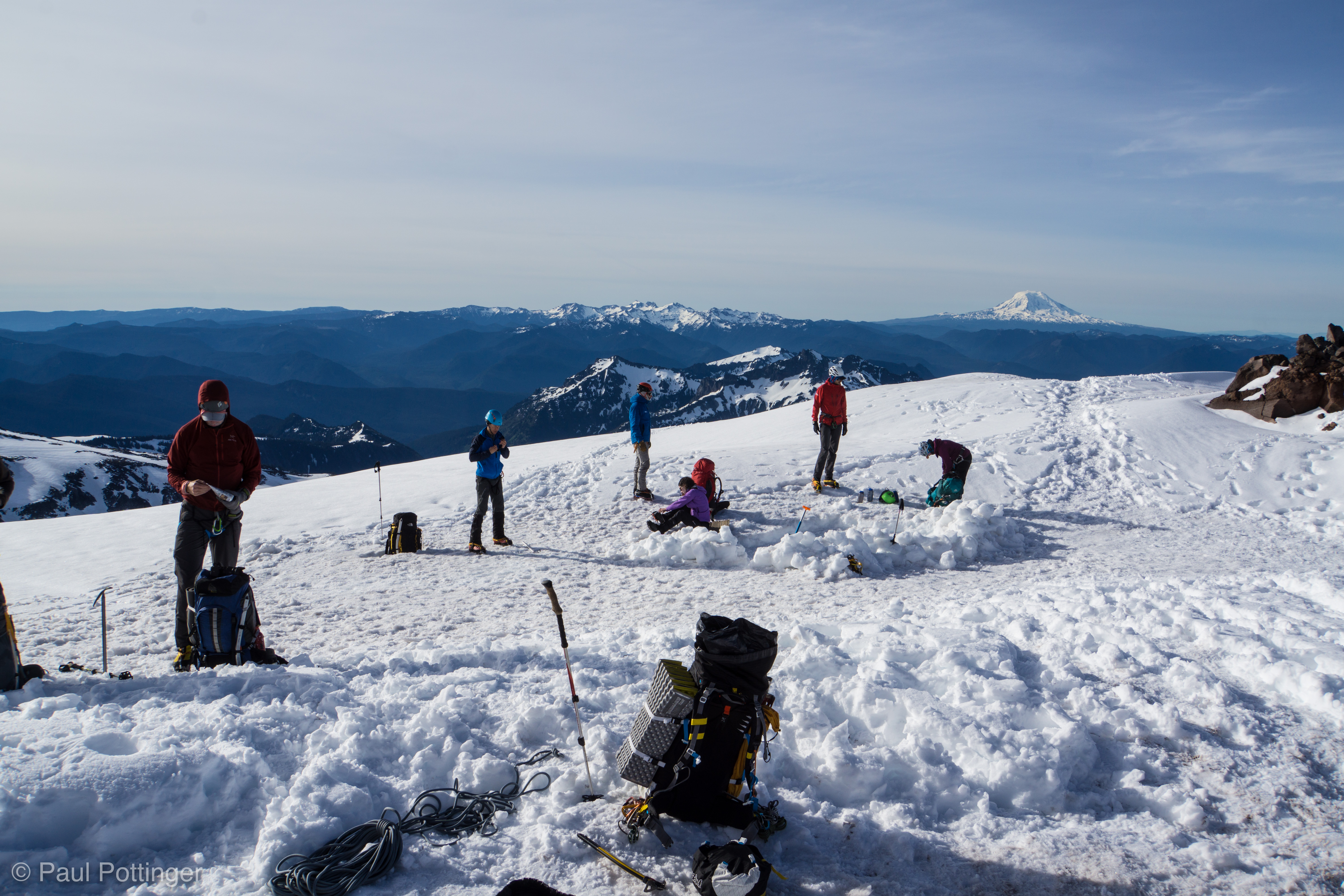
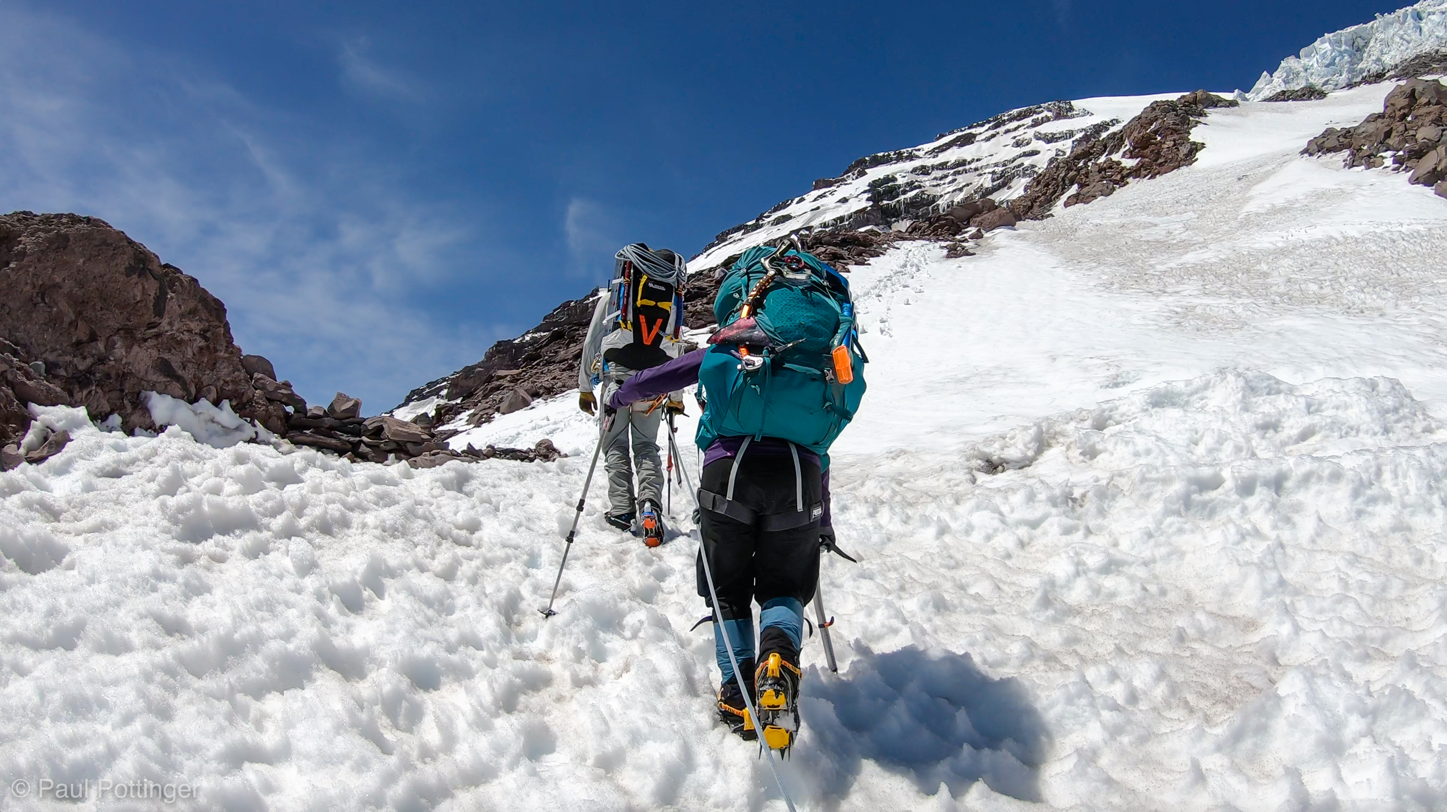
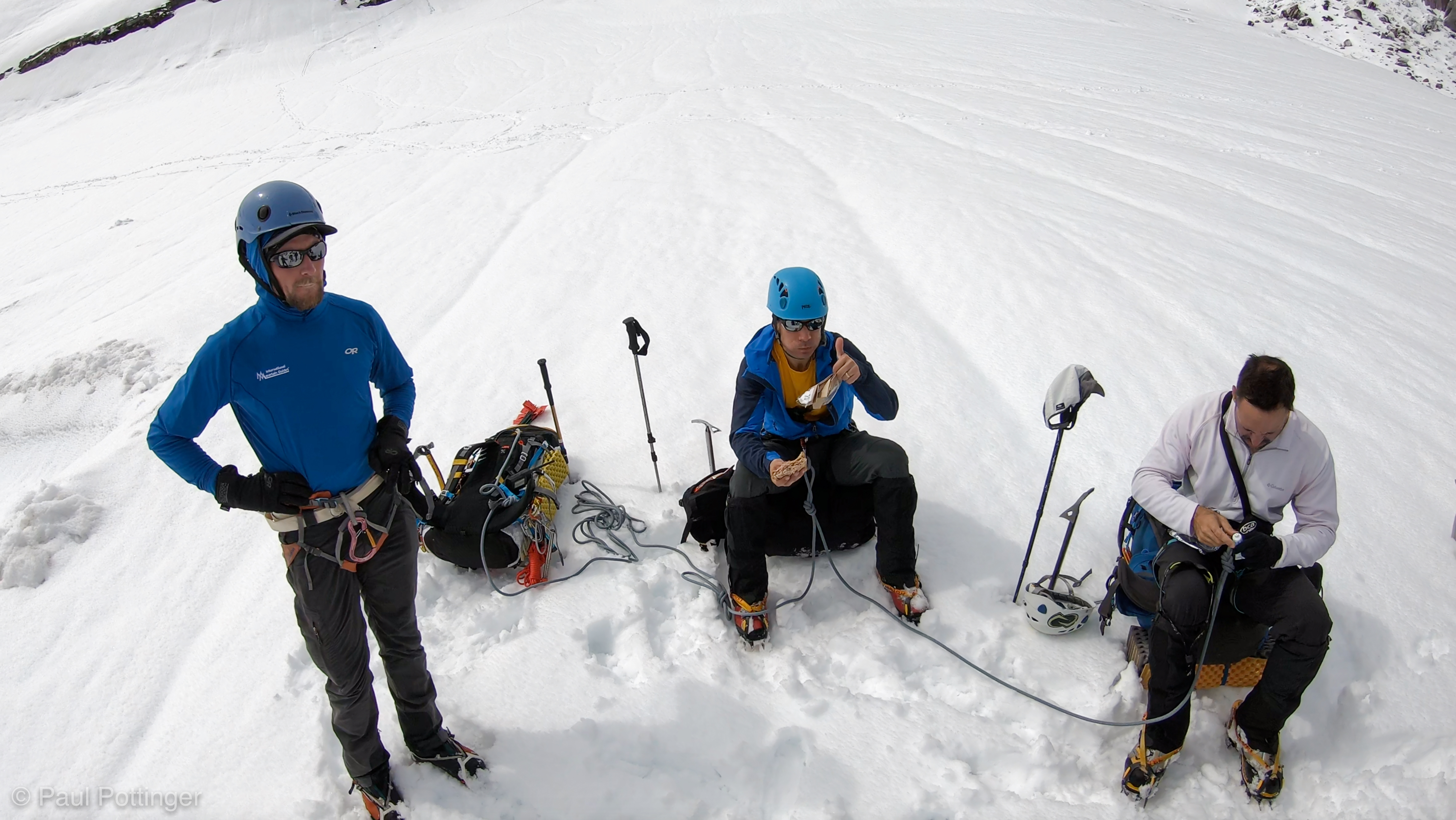
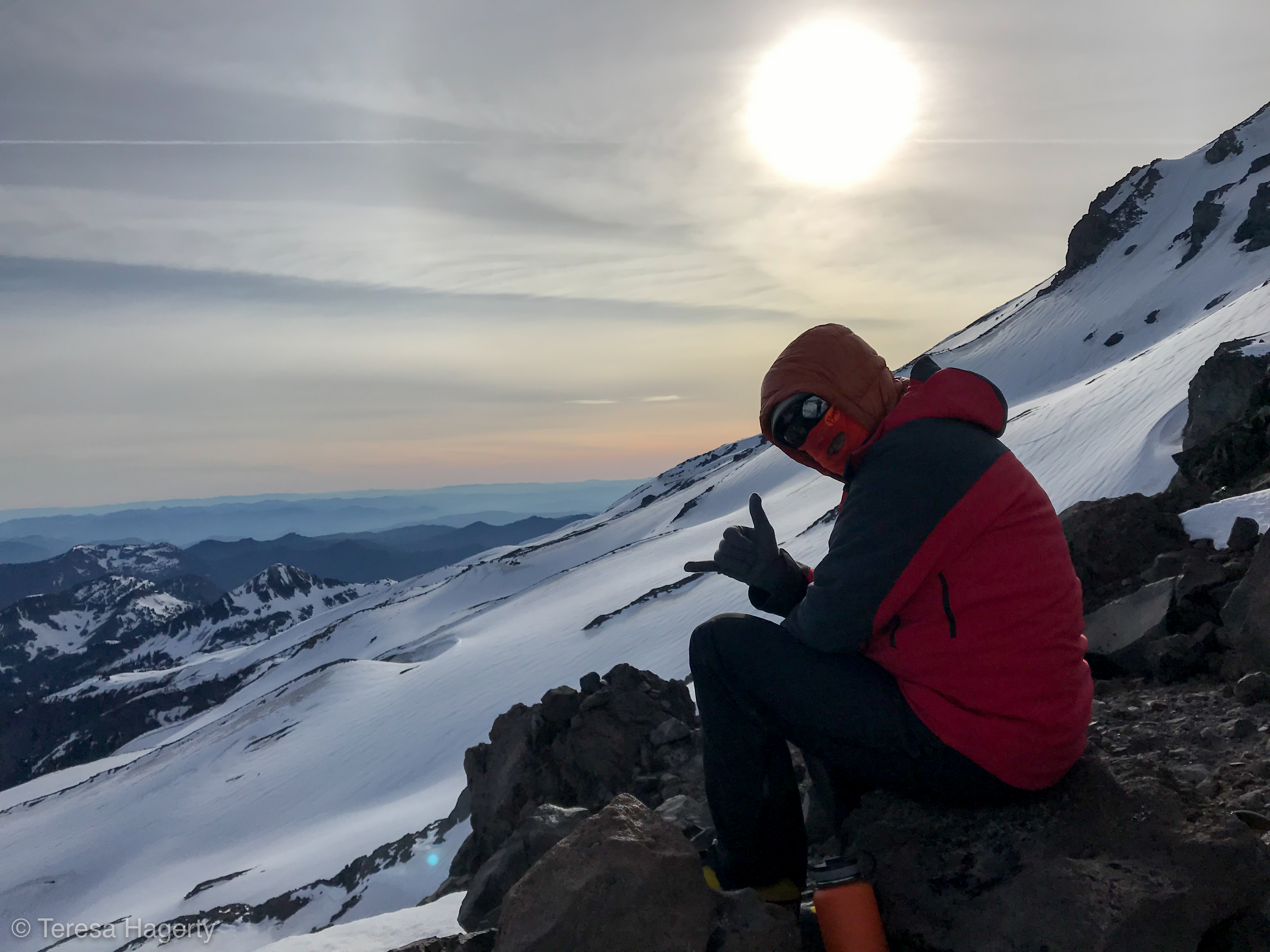
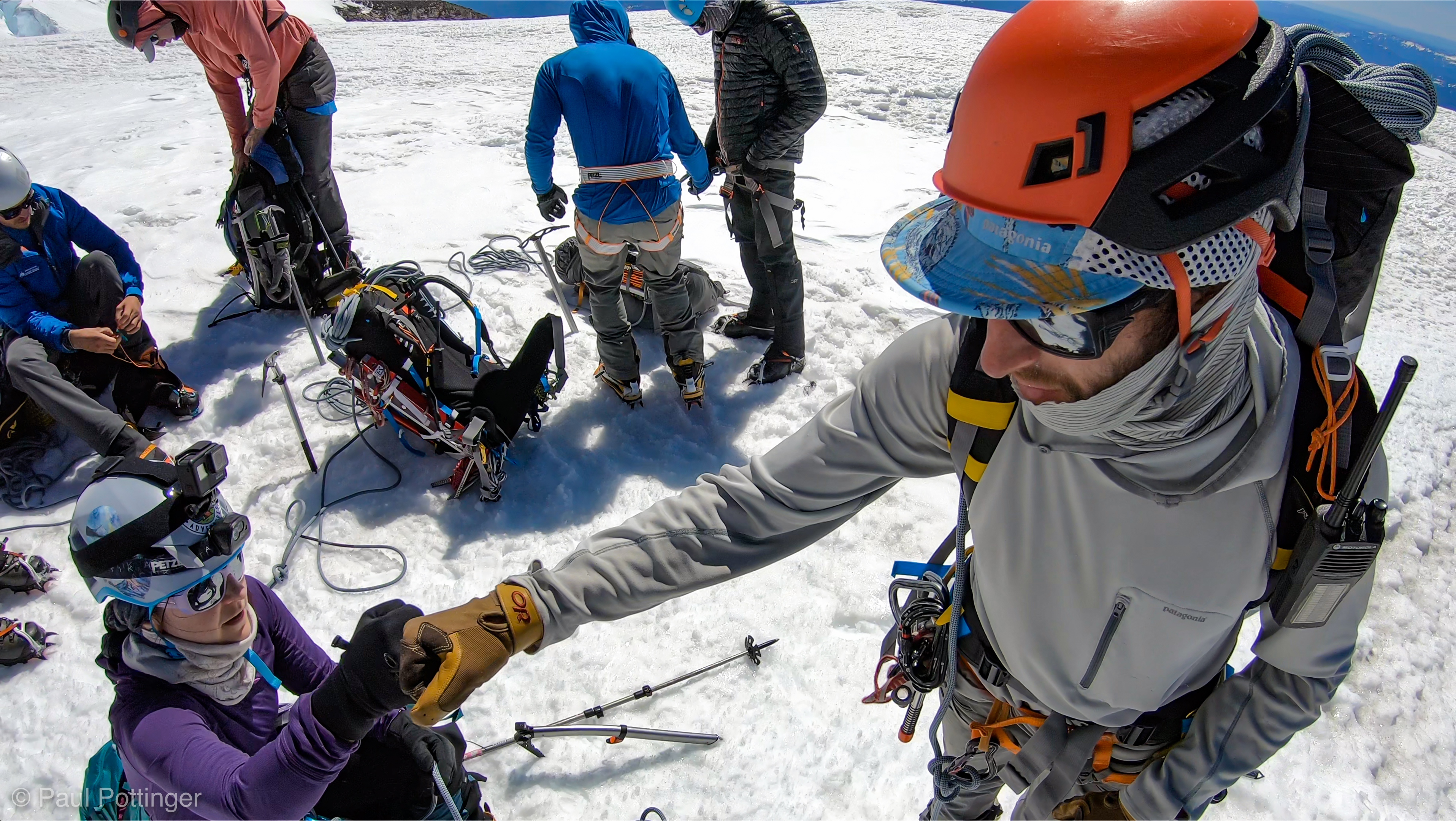
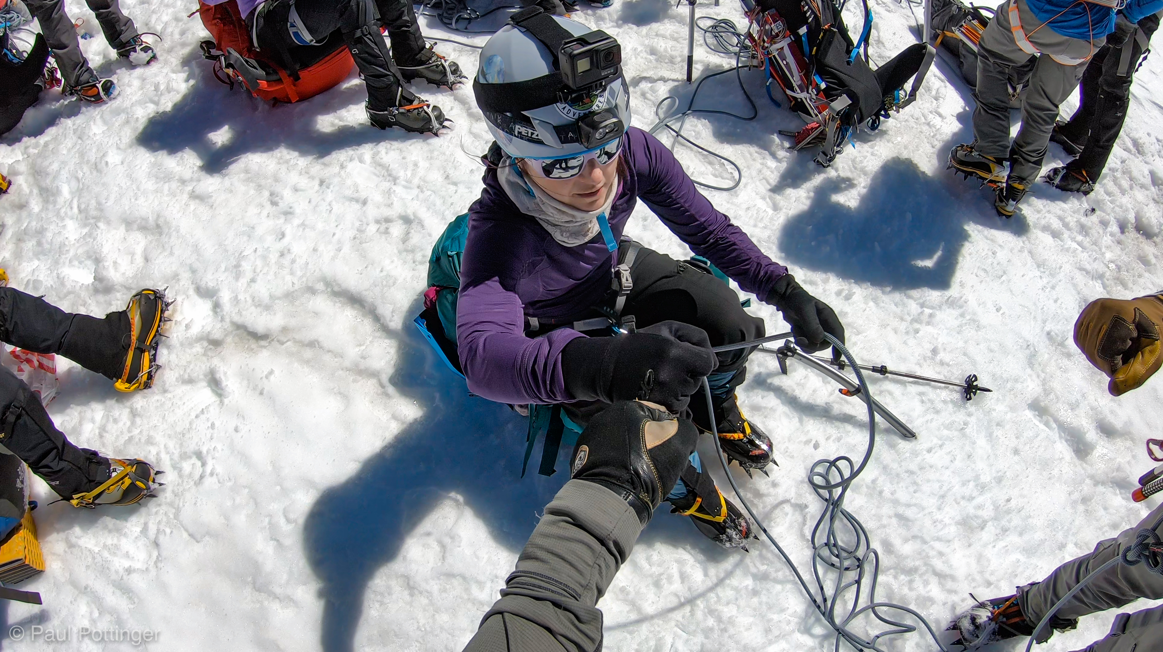
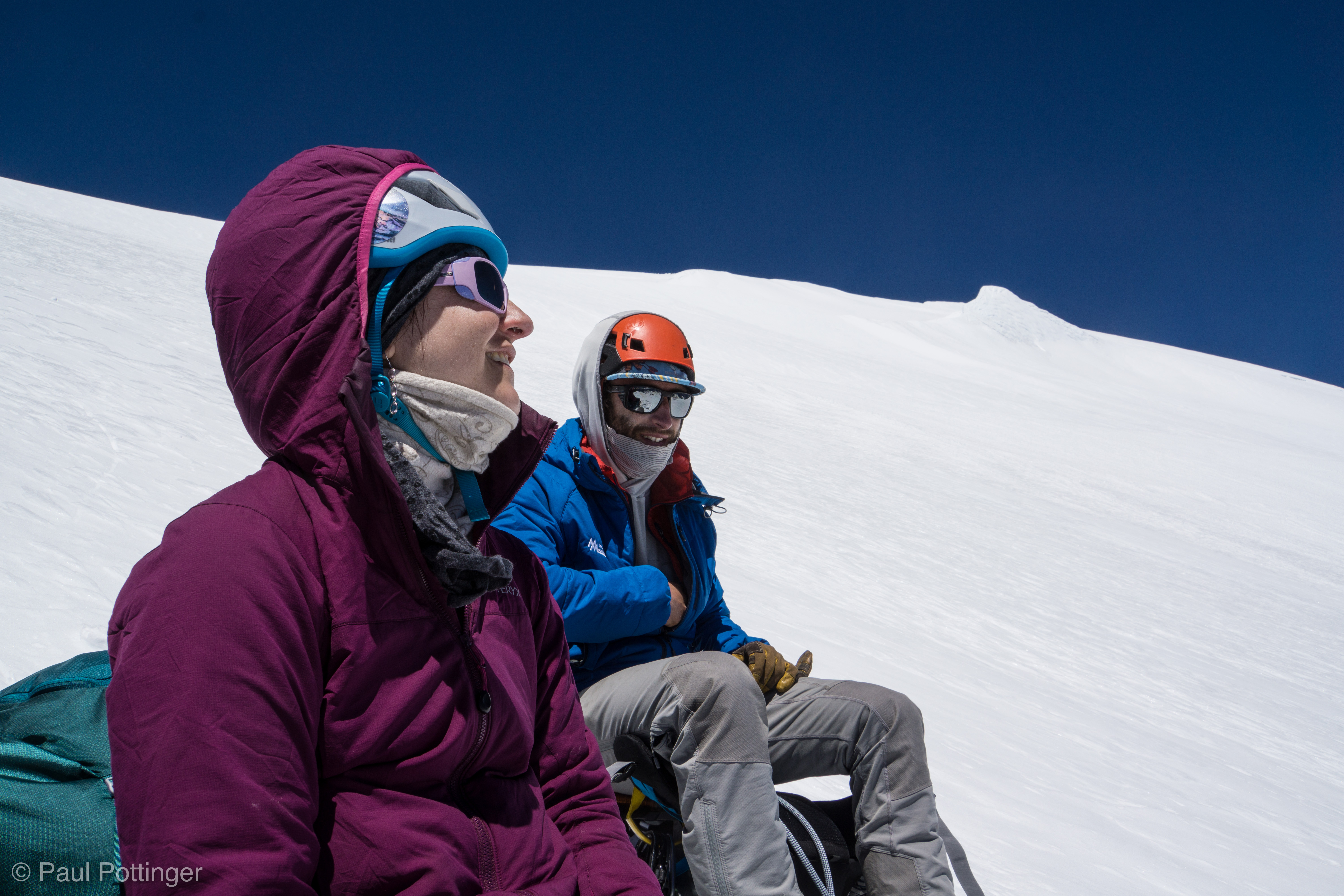
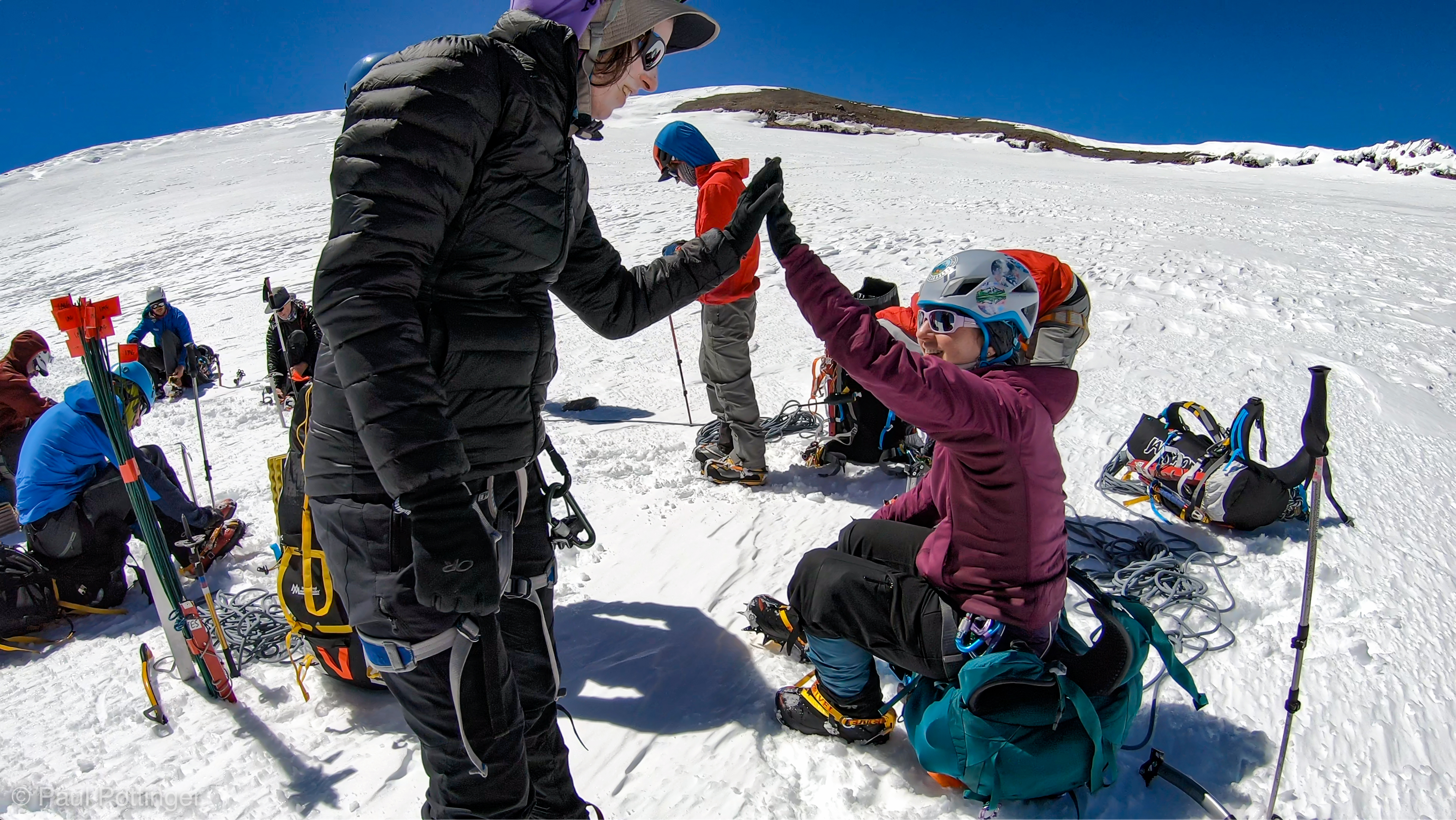
Another break atop this pitch, while Conrad set up and led the third pitch. Ultimately we traversed up and left until we were out of the ice and rejoined him on the snow above the chute’s bottleneck. The terrain here was steep, so Conrad quickly chopped a bench out for us to sit in. It was a beautiful place for a break. As we got sorted out for the glacier travel above, I looked down on the Chute we had just climbed. It was gnarly, steep, and very beautiful. The moment deserved a shaka, no doubt about it. I saluted the mountain, and thought of Lloren’s lyrics:

It’s a high I can’t come down from,
It runs electric in my veins.
A drug I can’t come around from,
And I know you’ll feel the same.

There’s a fire in my body,
And it’s burning up my skin…
A kind of fever and I can’t fight it…
Now the fire’s getting in.

Can you feel it? It’s just the start.

There’s no greater form of worship
Than this holy kind of prayer.
Every bruise and break was worth it,
Just to feel something so big.

I’ve been tempted, I’ve been tortured,
Just to taste what I want.
They can’t take my new religion,
I’ll only come on back.

I am restless, it keeps me breathless
And sets a fire in my soul.
I keep it burning, beneath the surface,
Until that fire consumes me whole.

It makes me needy, and keeps me greedy,
I fear that fire that I know.

Can you feel it? It’s just the start.

—Lloren: The Start

Welcome to the belay.

Conrad suggests a spot for me to sit.
This is a better sittin’ spot right here. Check the anchor, in great condition.
Daylight in full swing now… we are still blessed with shadow.
T$ susses out the next pitch.
This belay is still plenty steep.
Conrad gets ready for the next pitch.
Heading out from the last belay.
Conrad awaits us in the sun.
Teresa and I enjoy the last vestiges of shade for the day, near the top of the Chute.

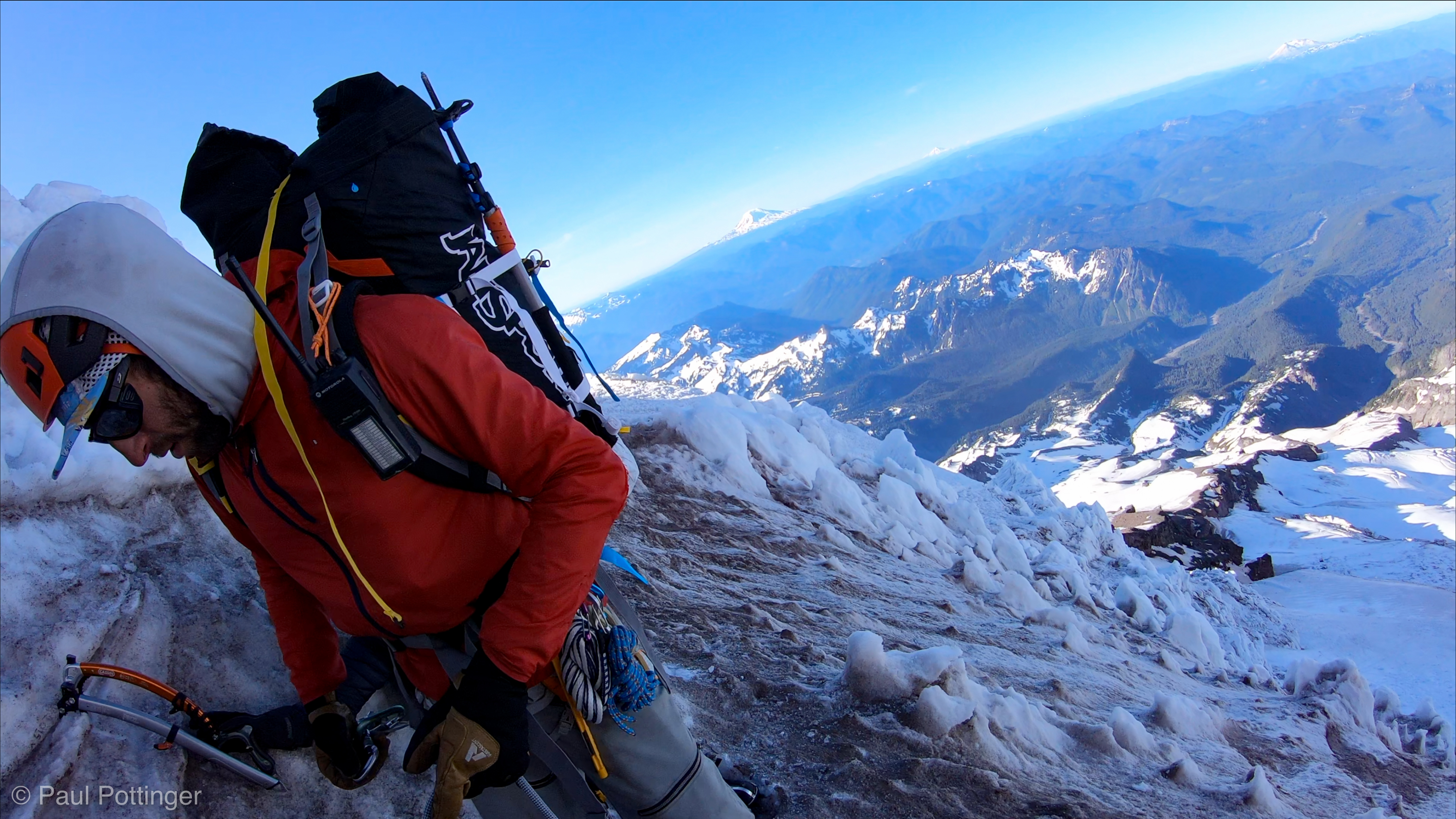
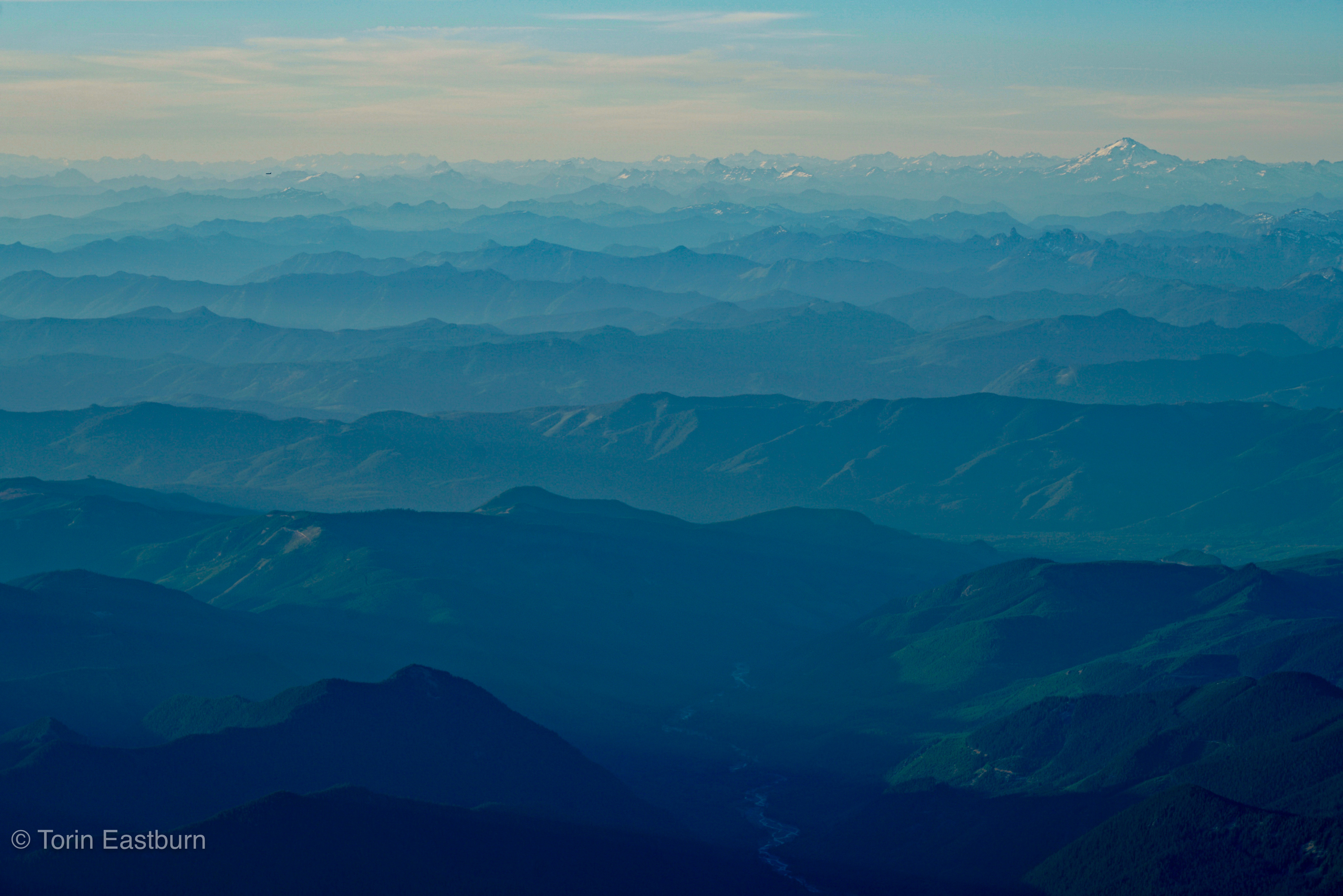
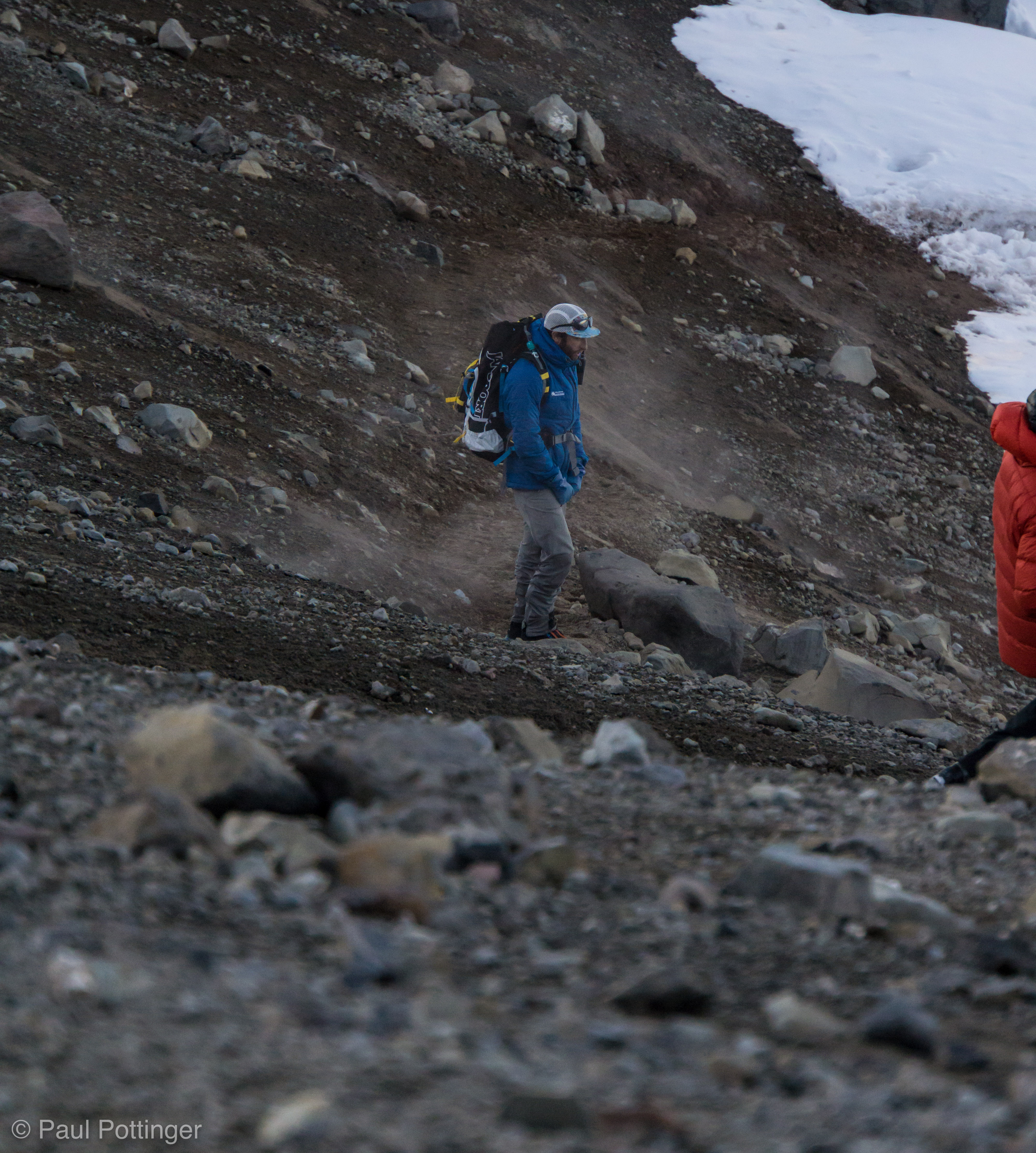
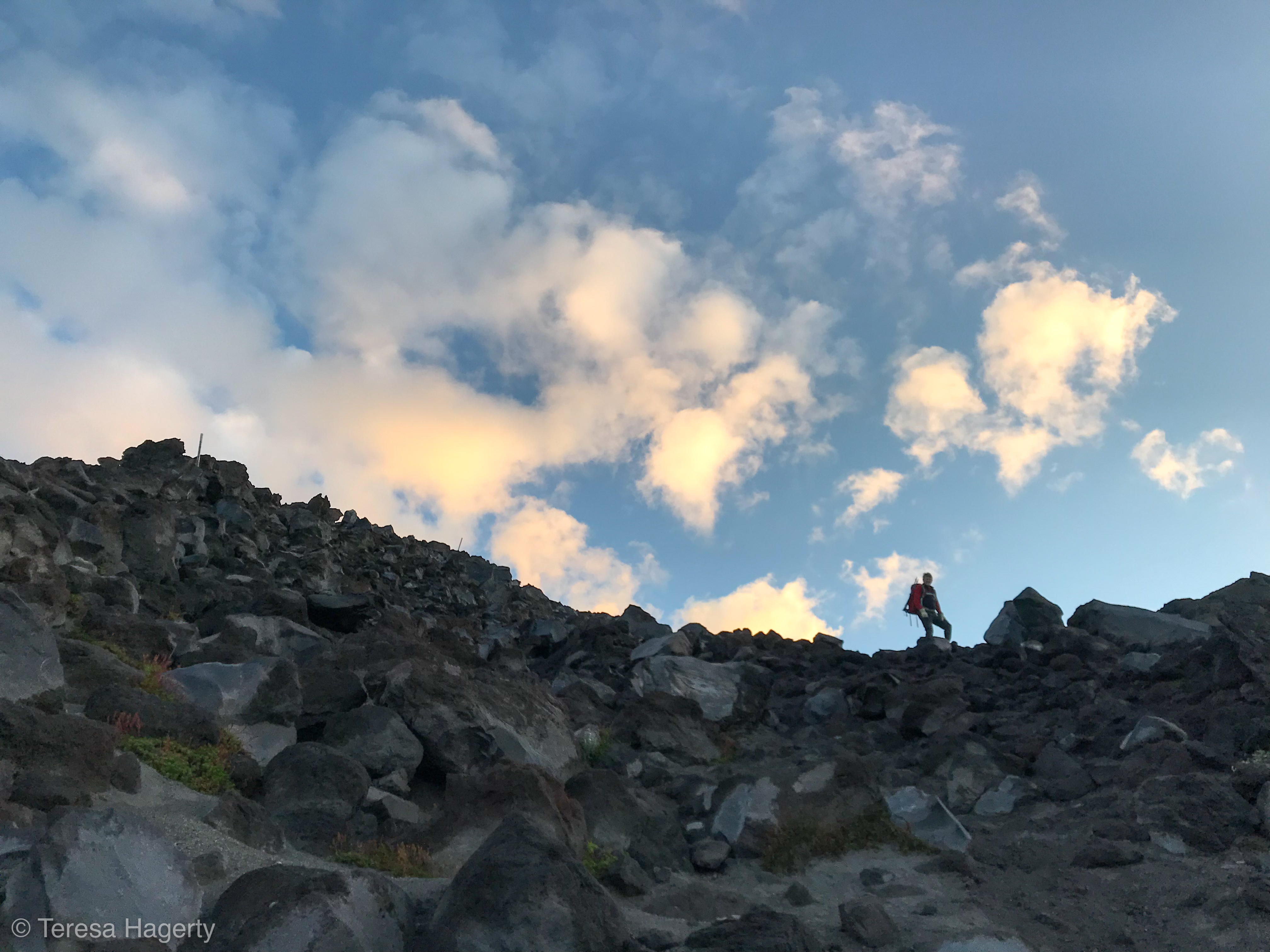
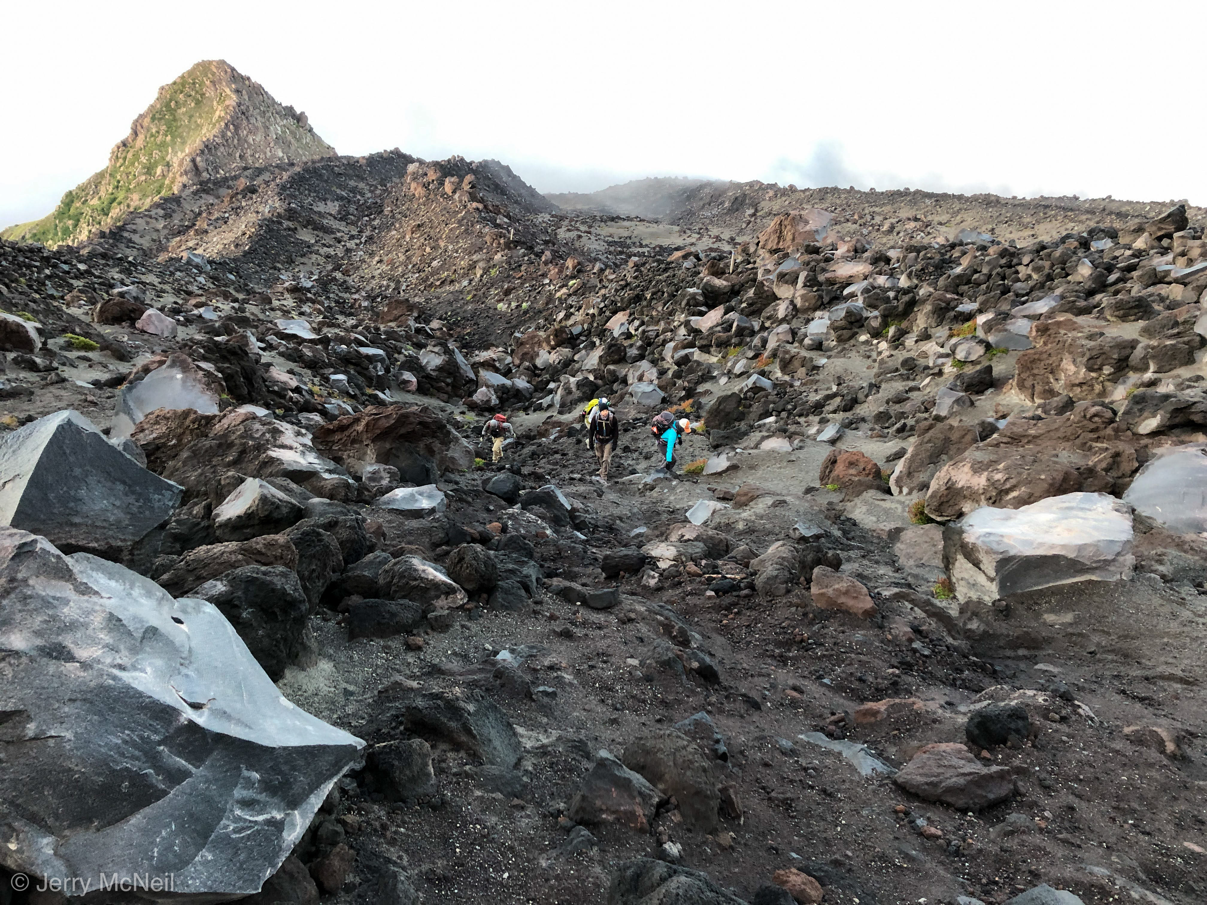
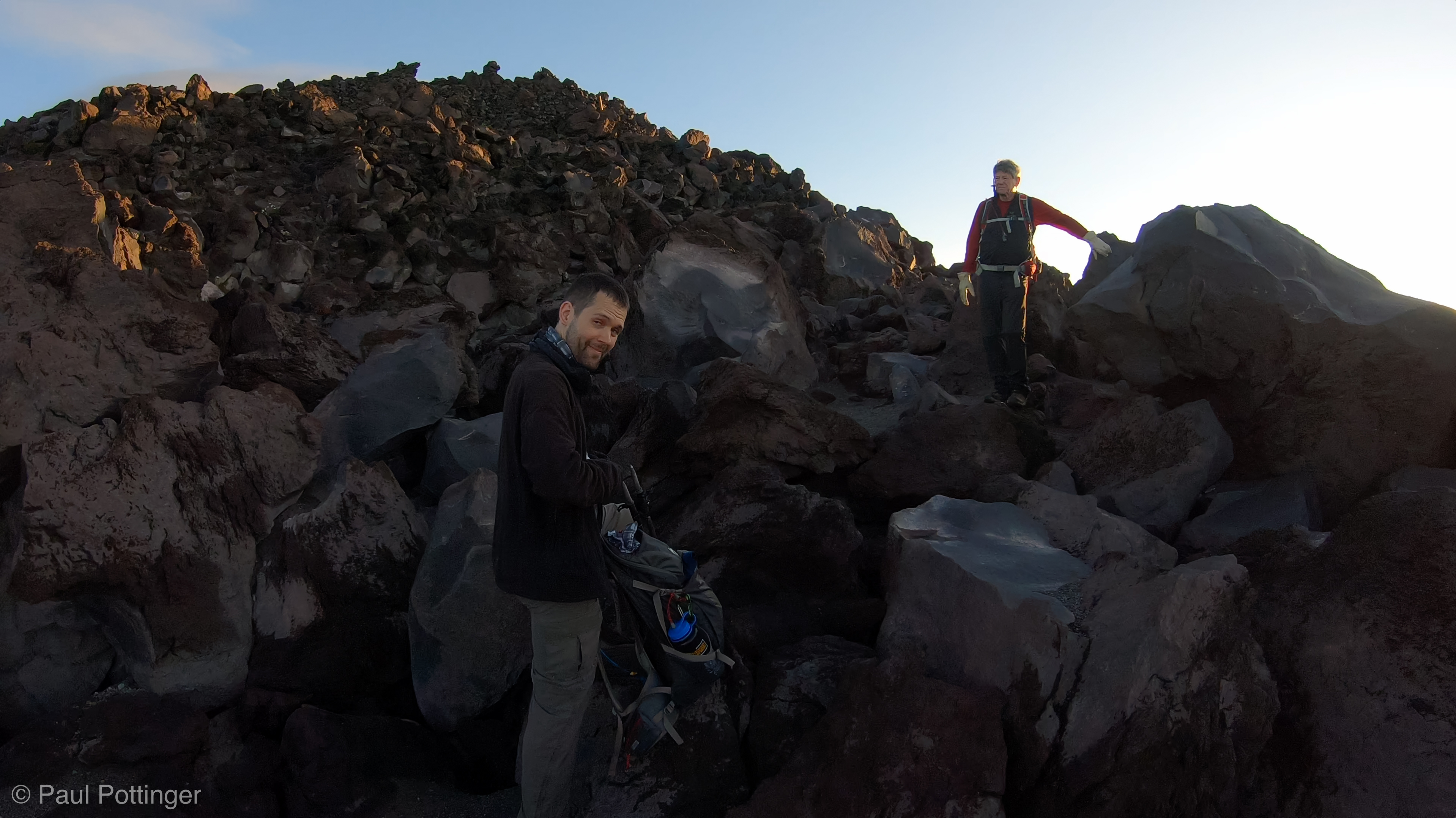
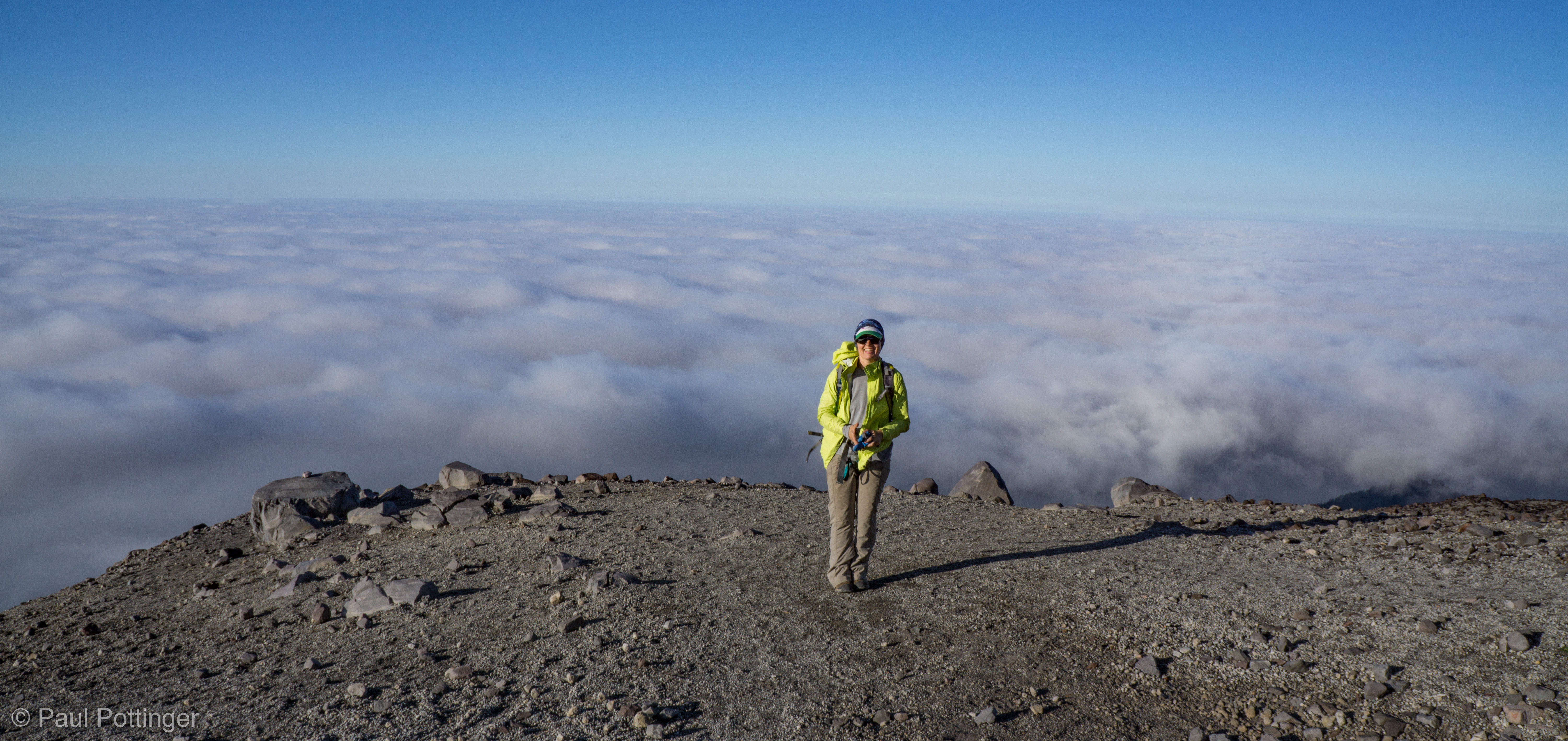
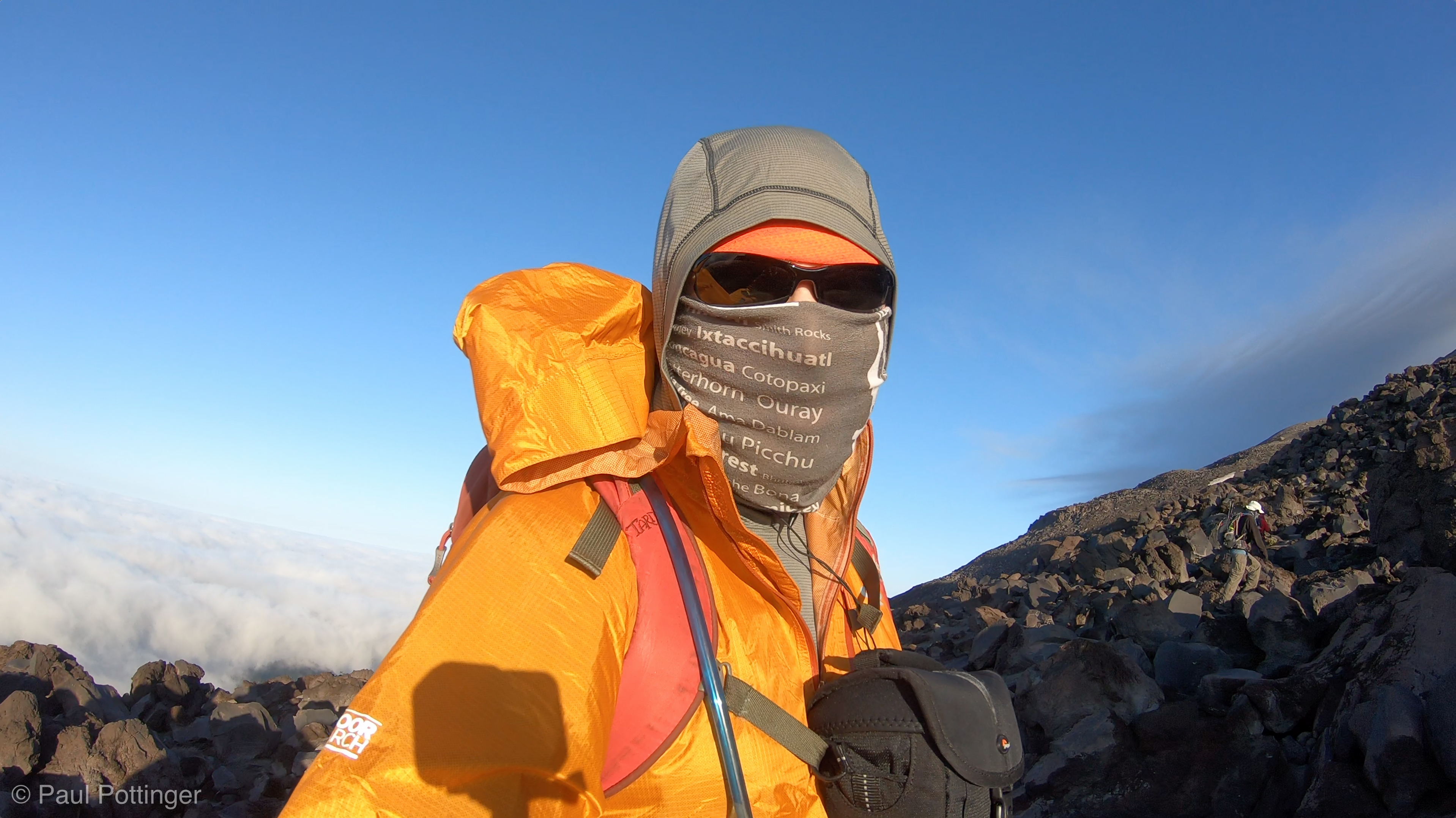
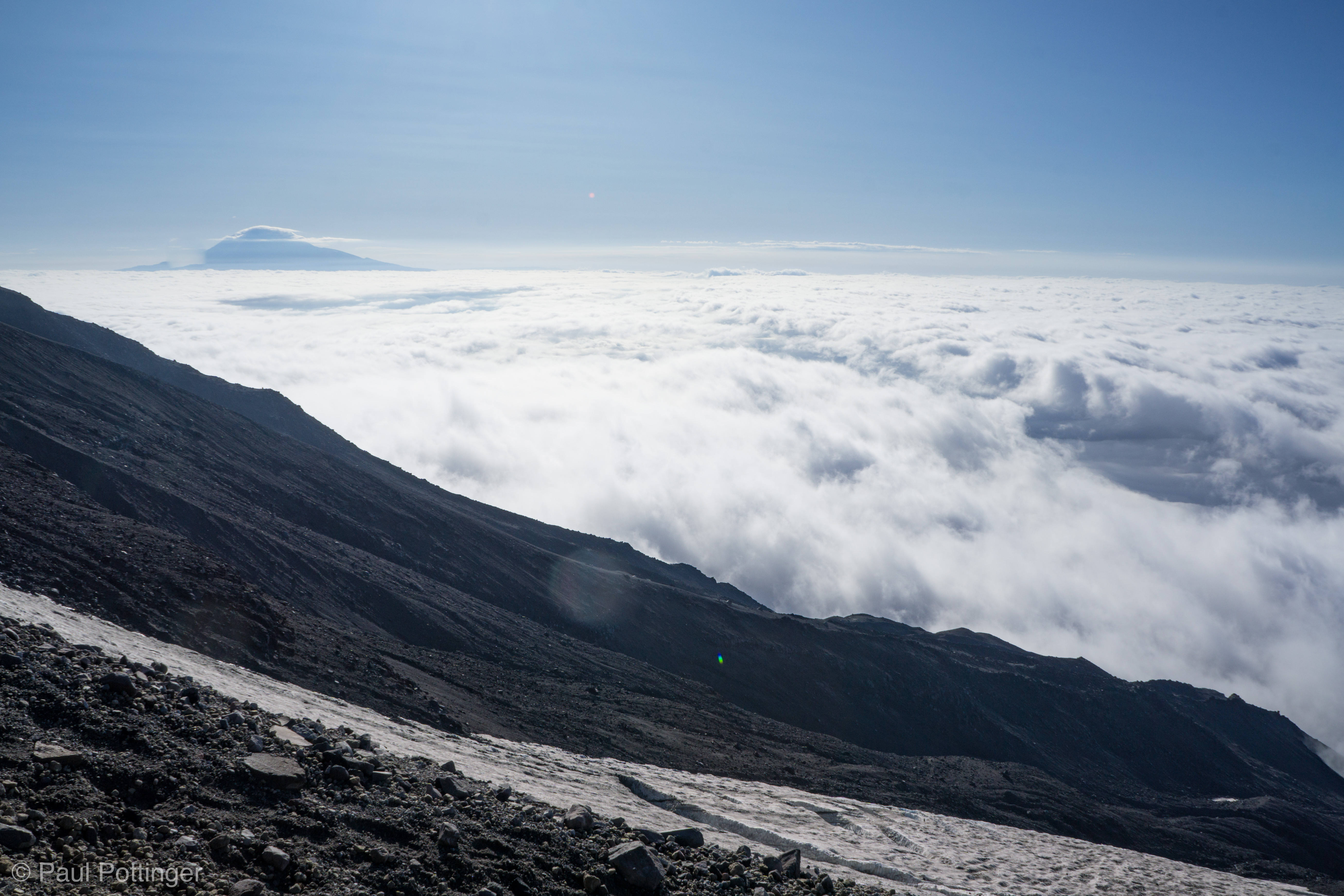
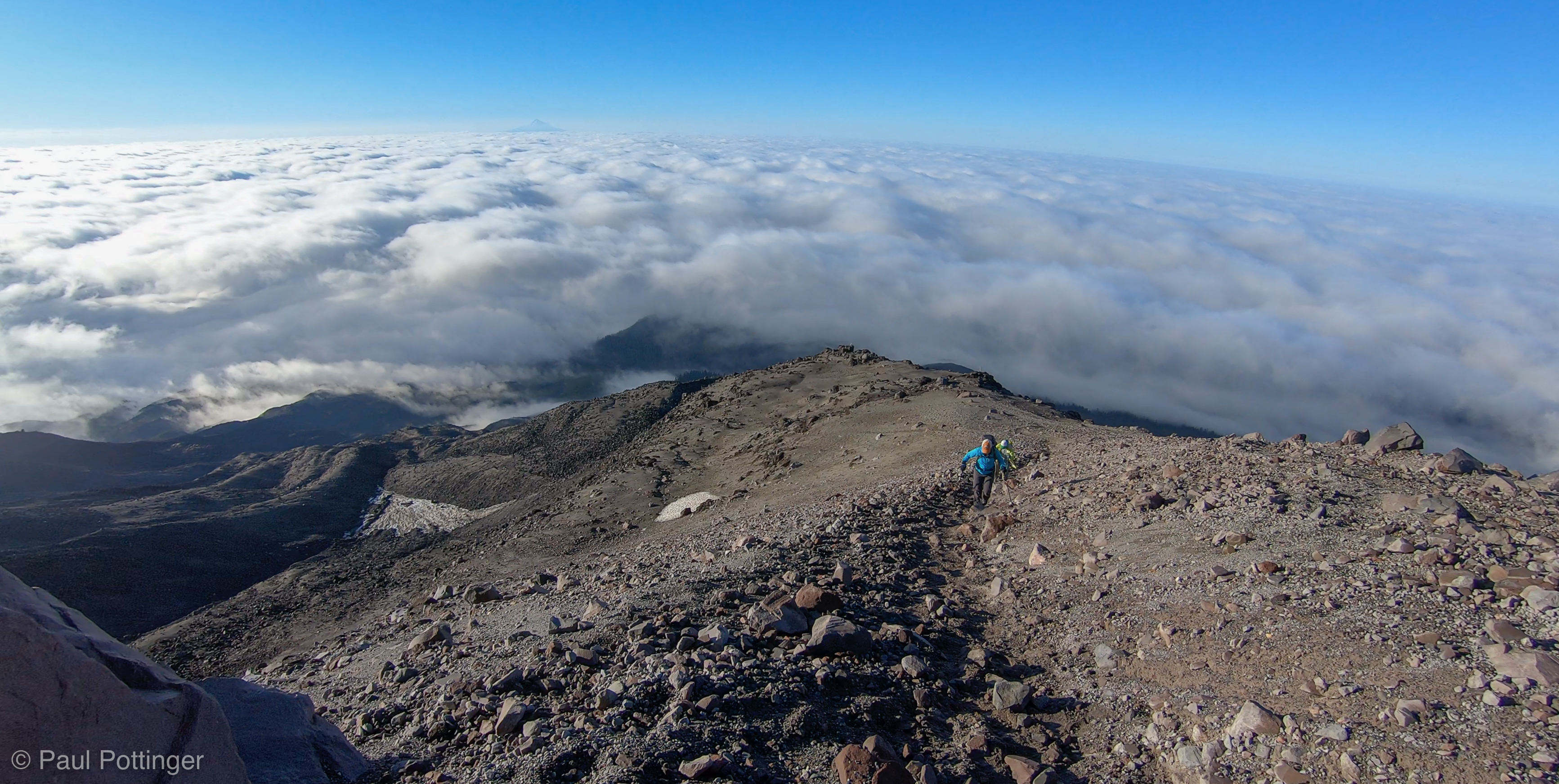
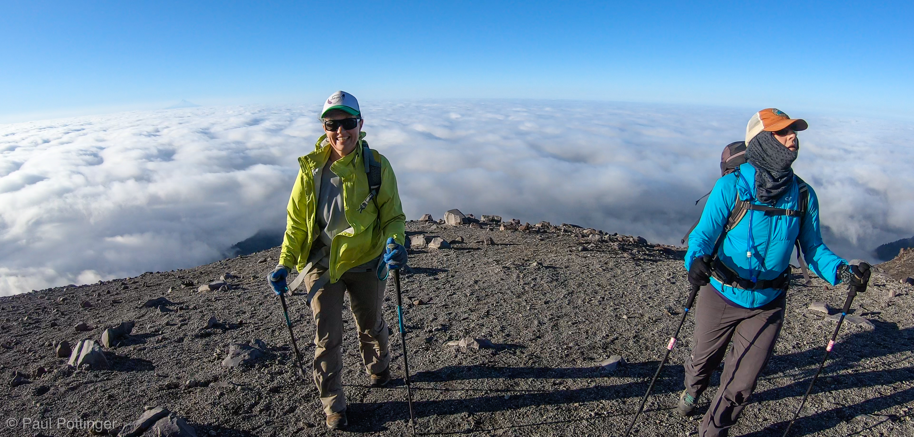
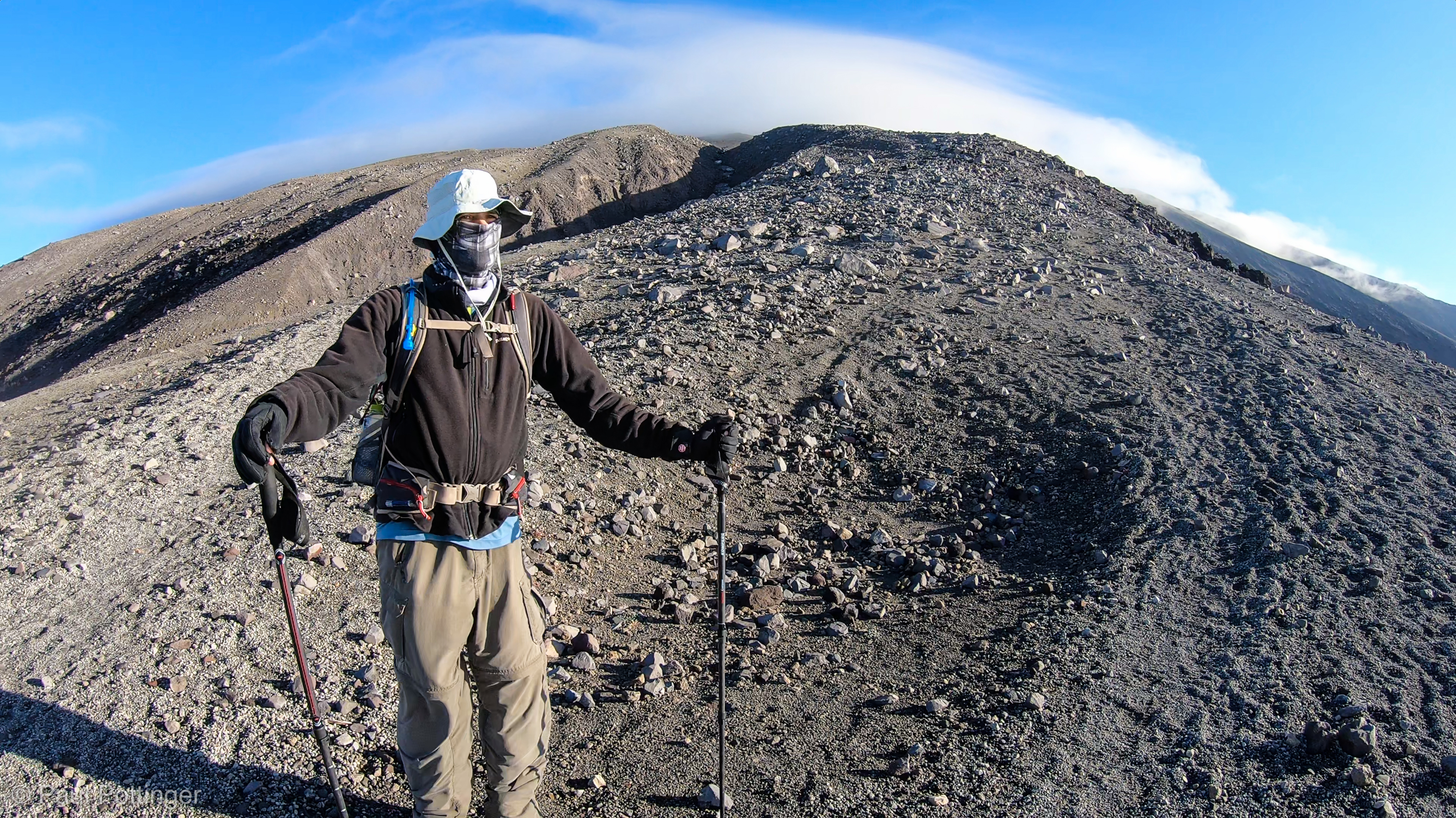
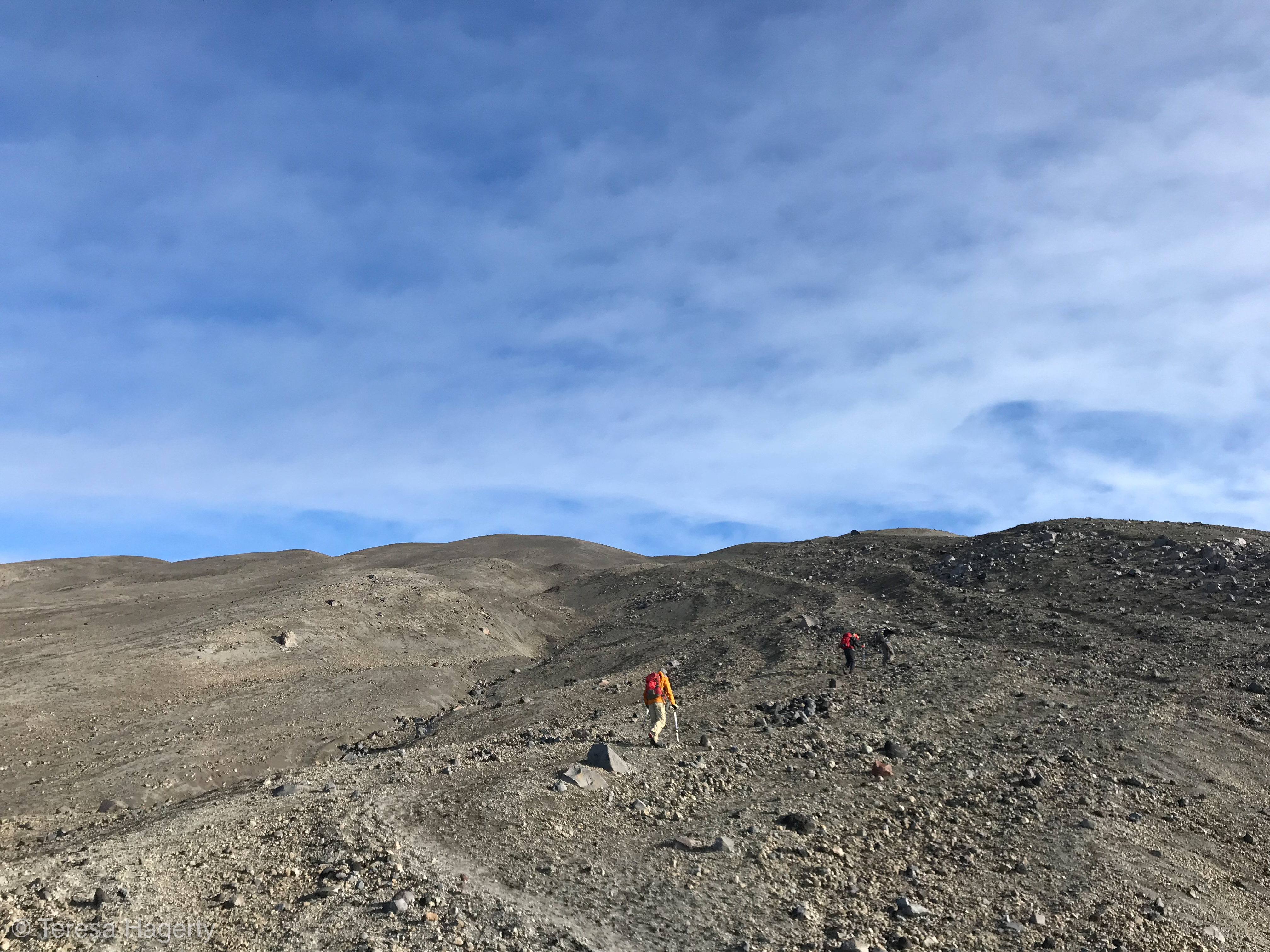
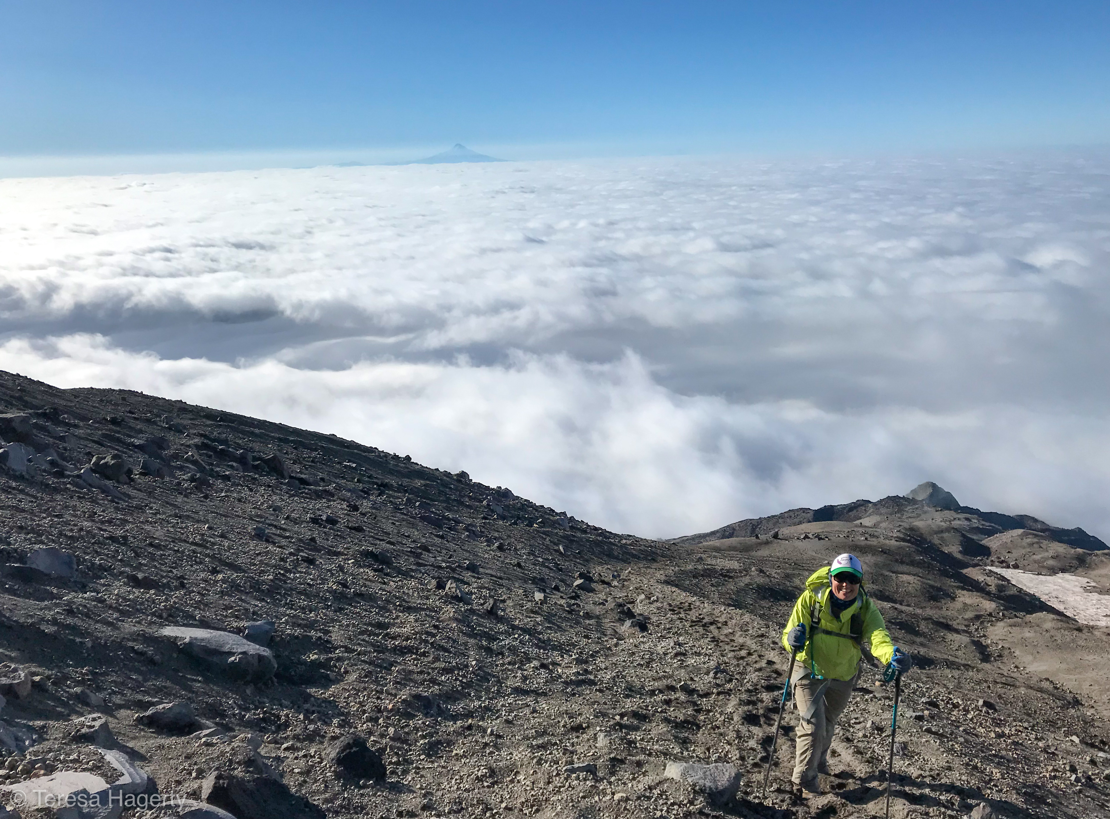
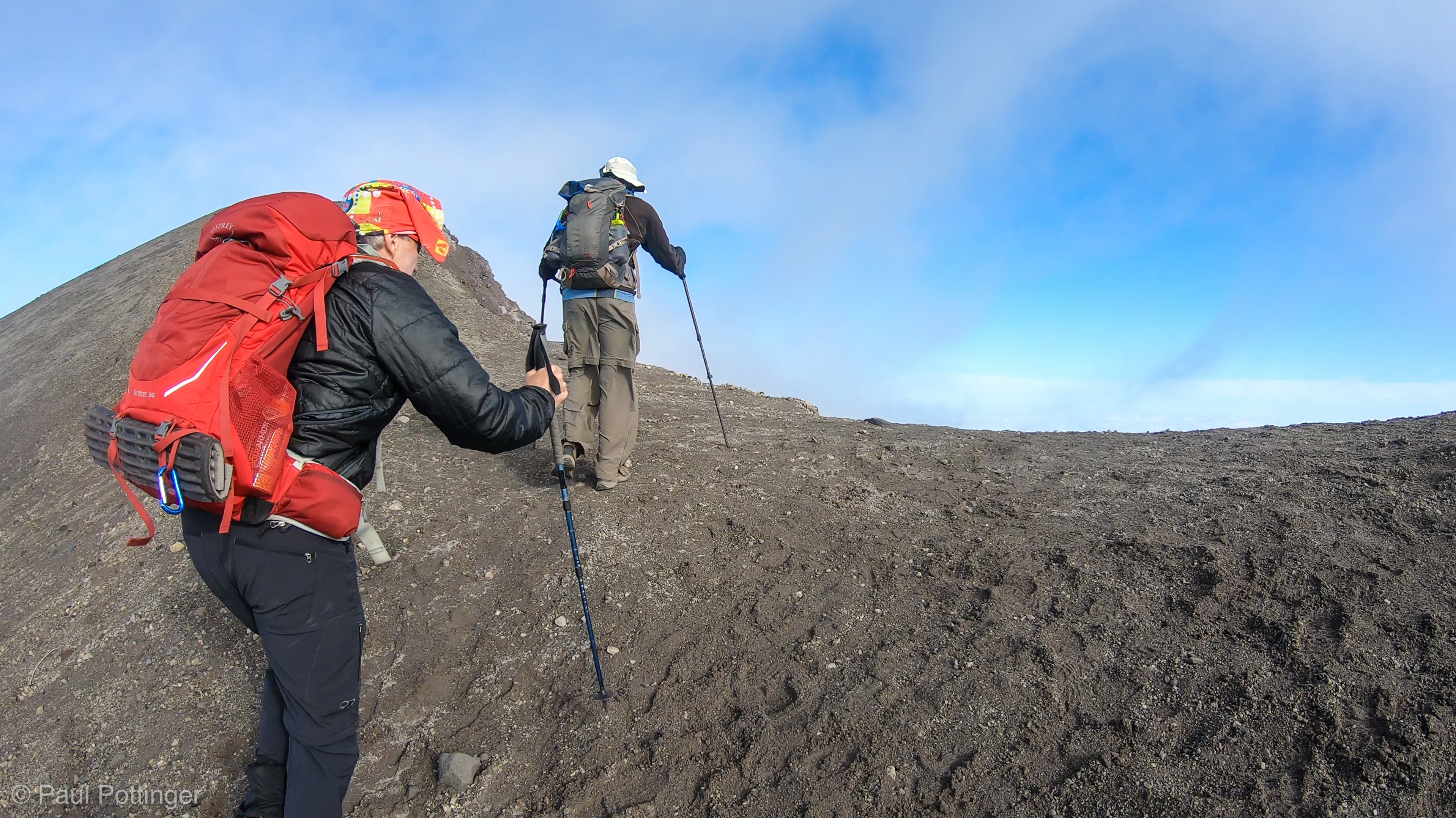
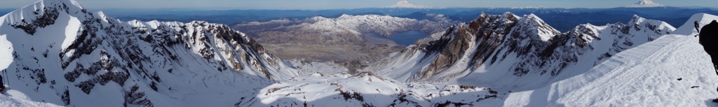
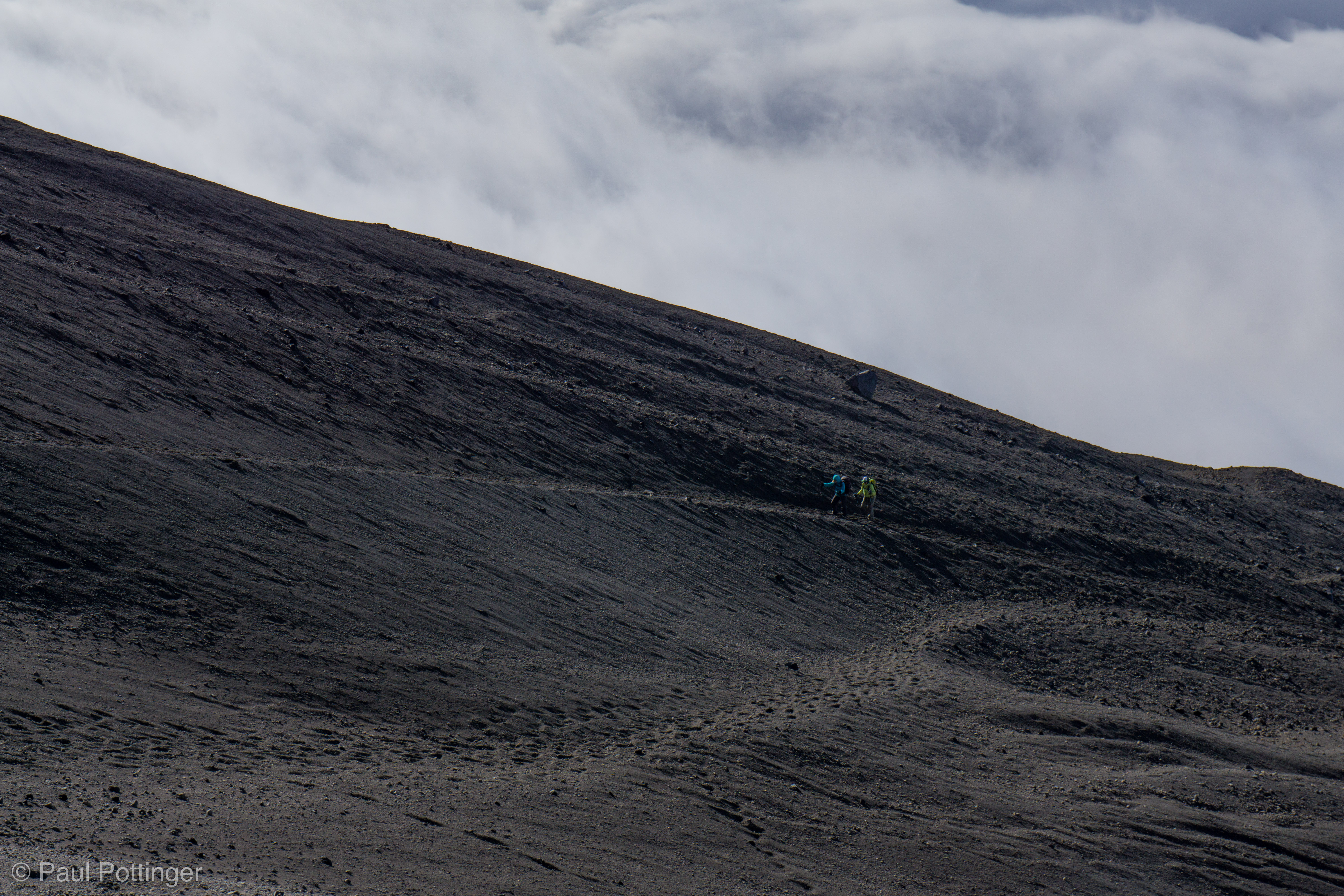
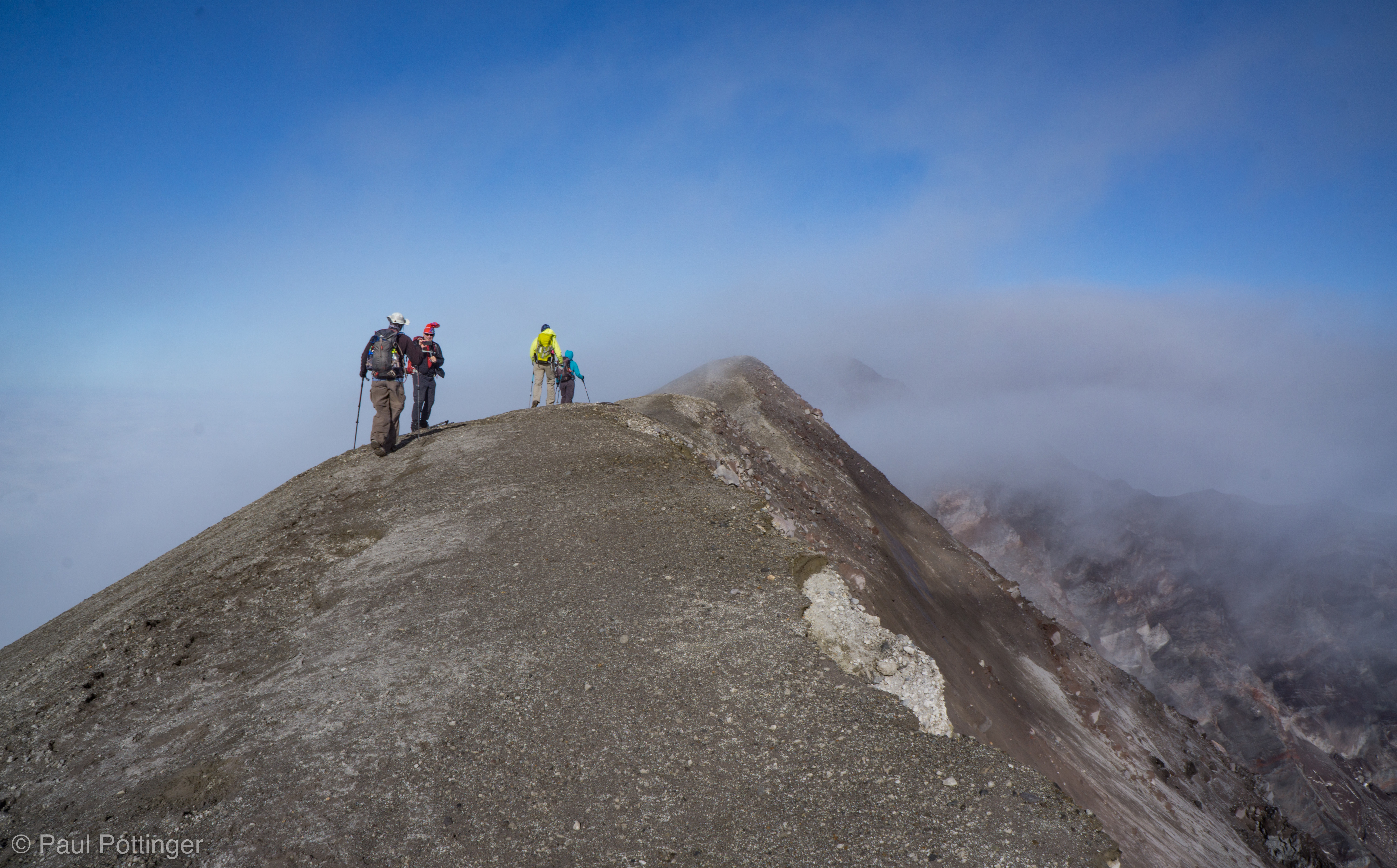
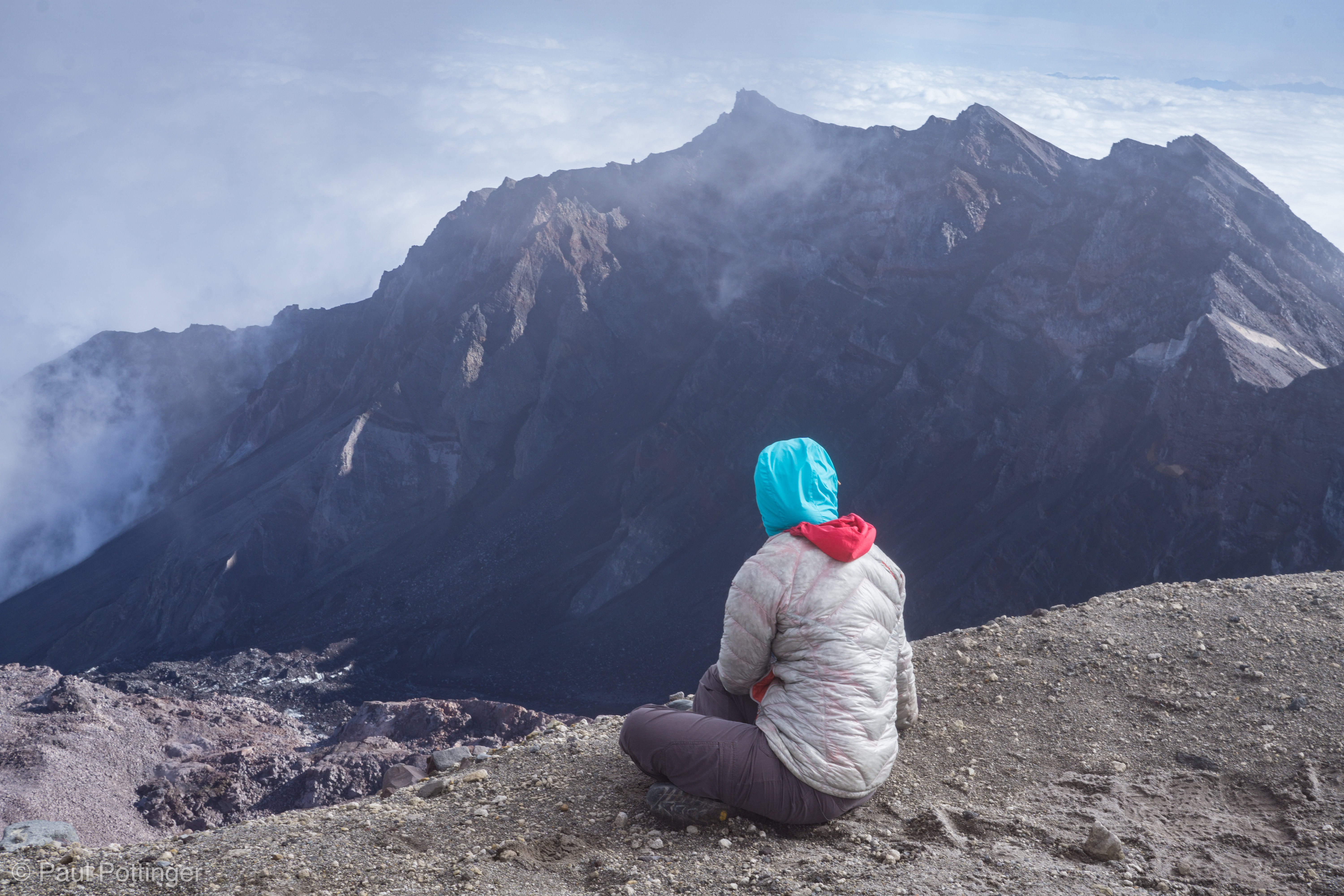
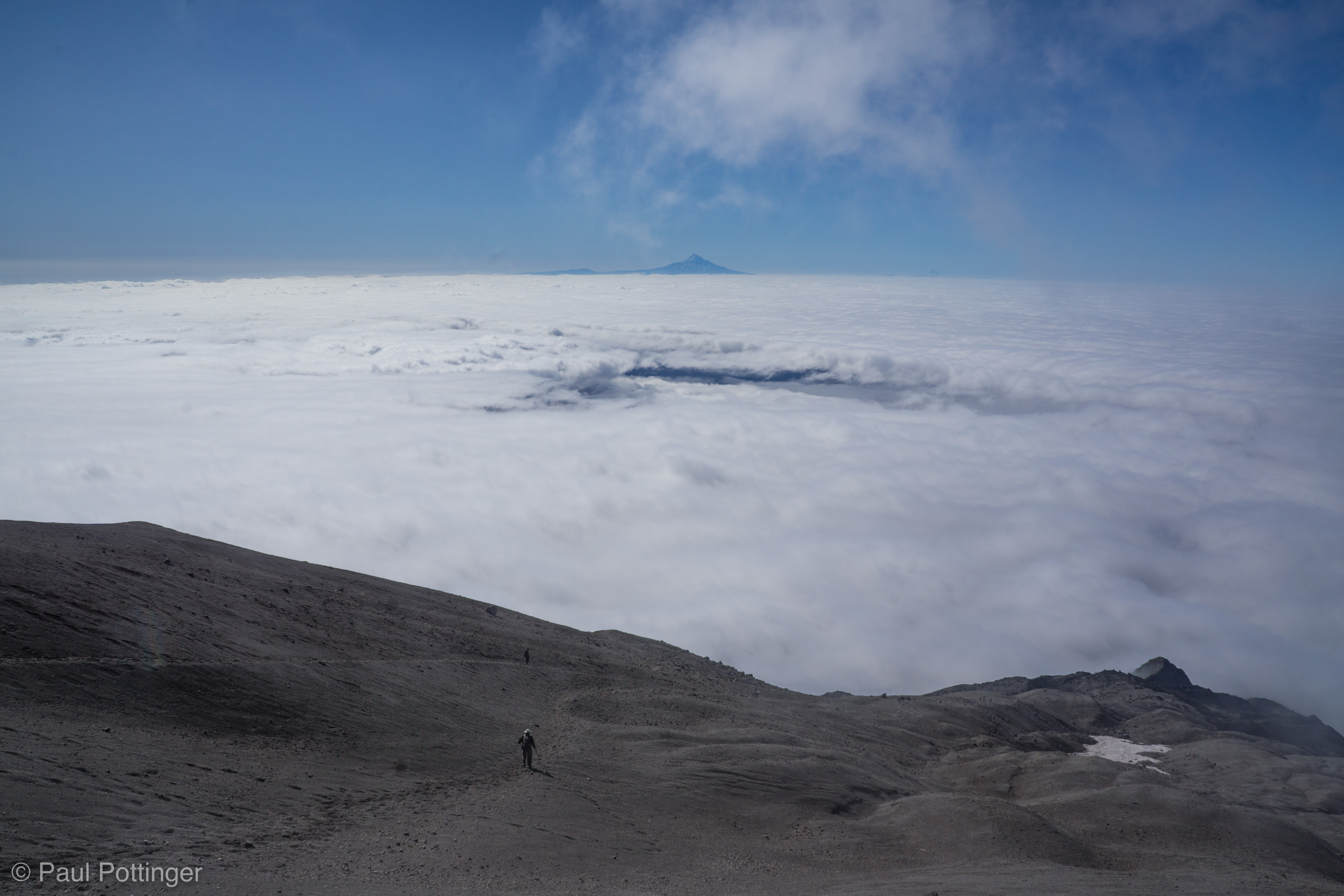
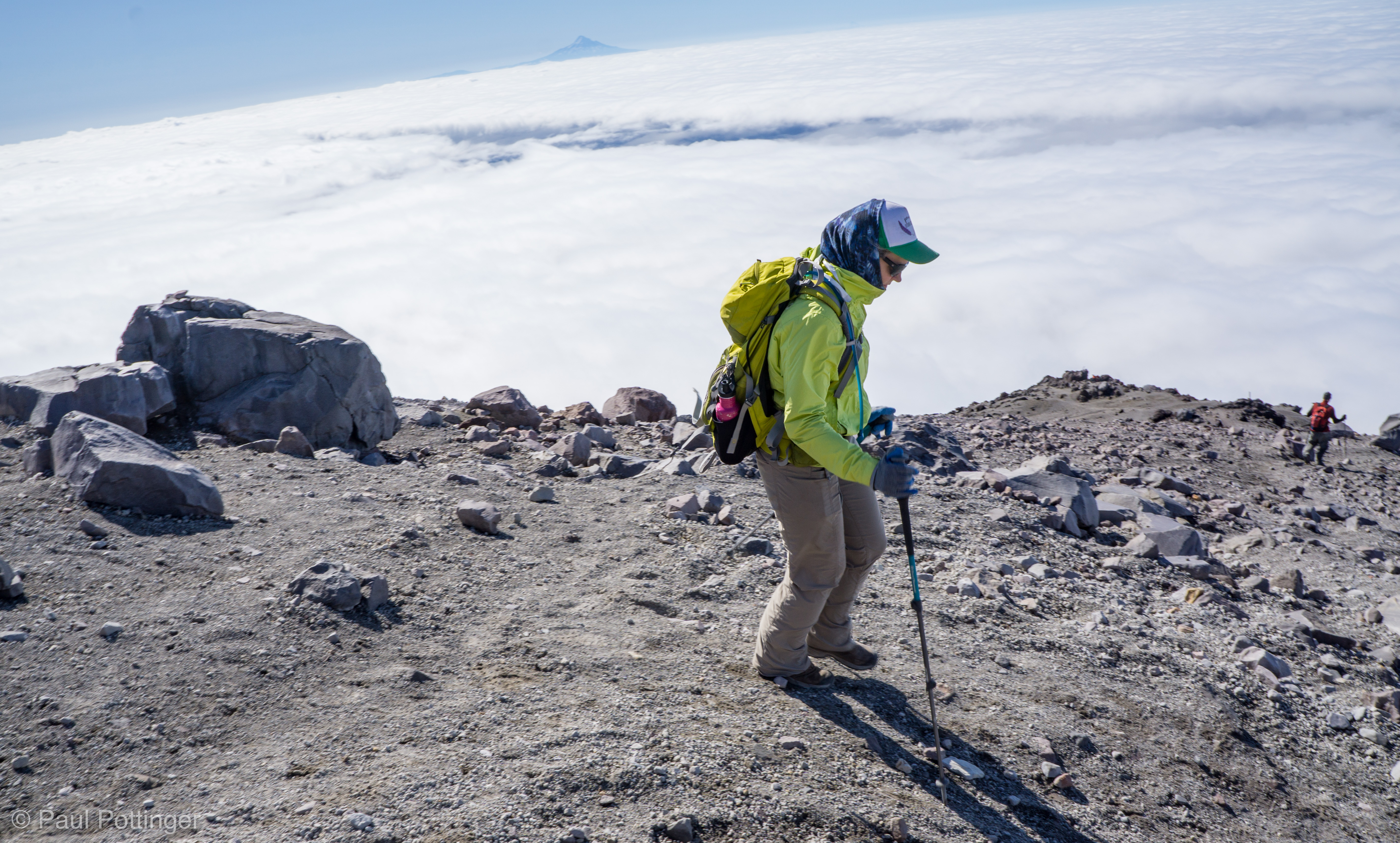
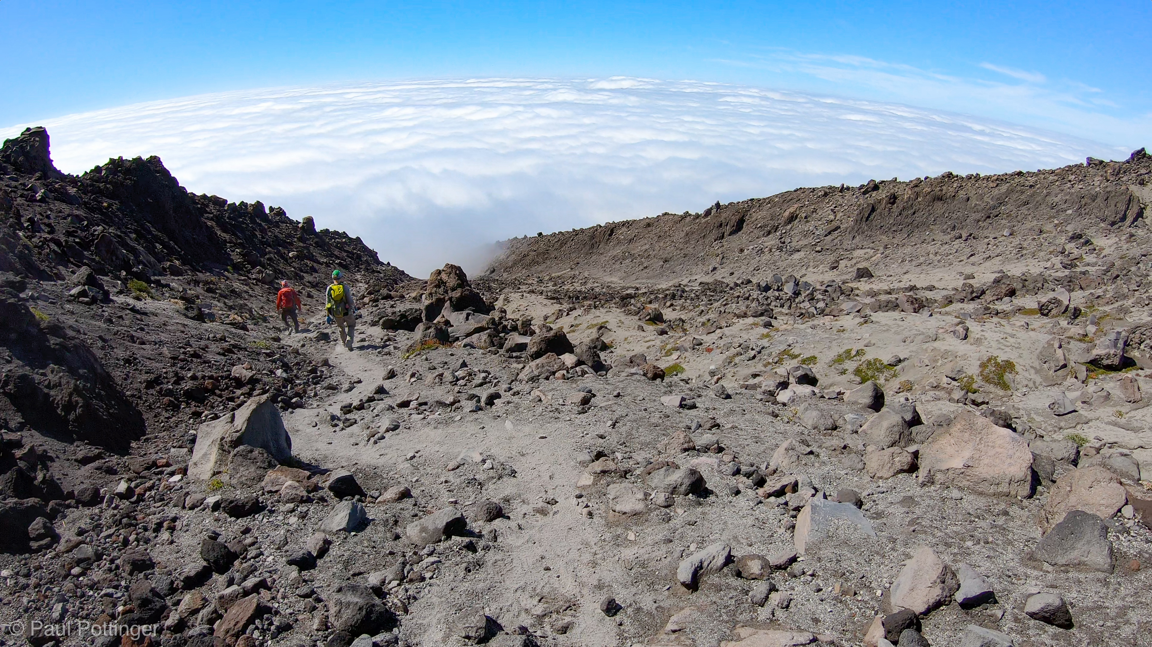
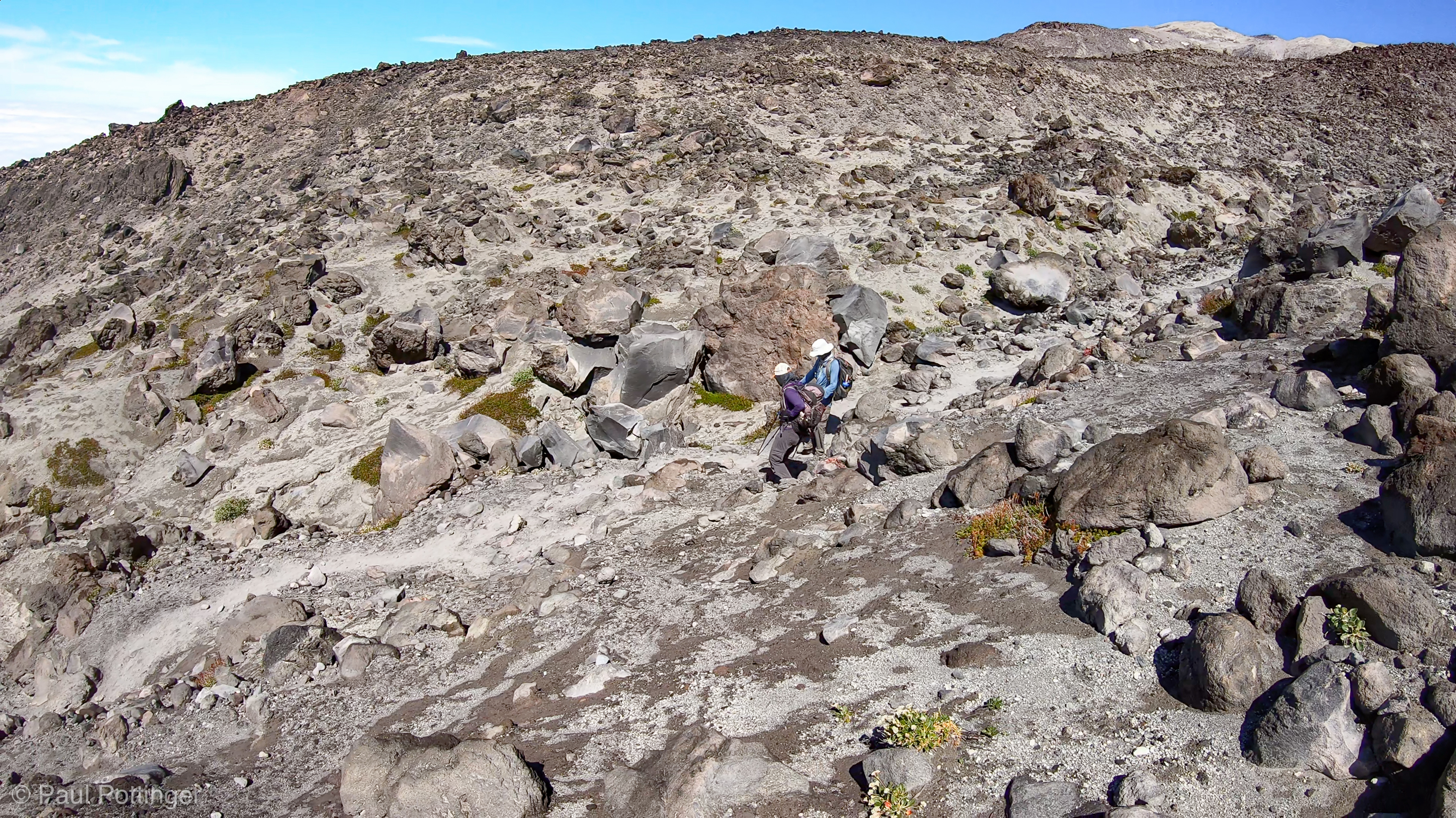
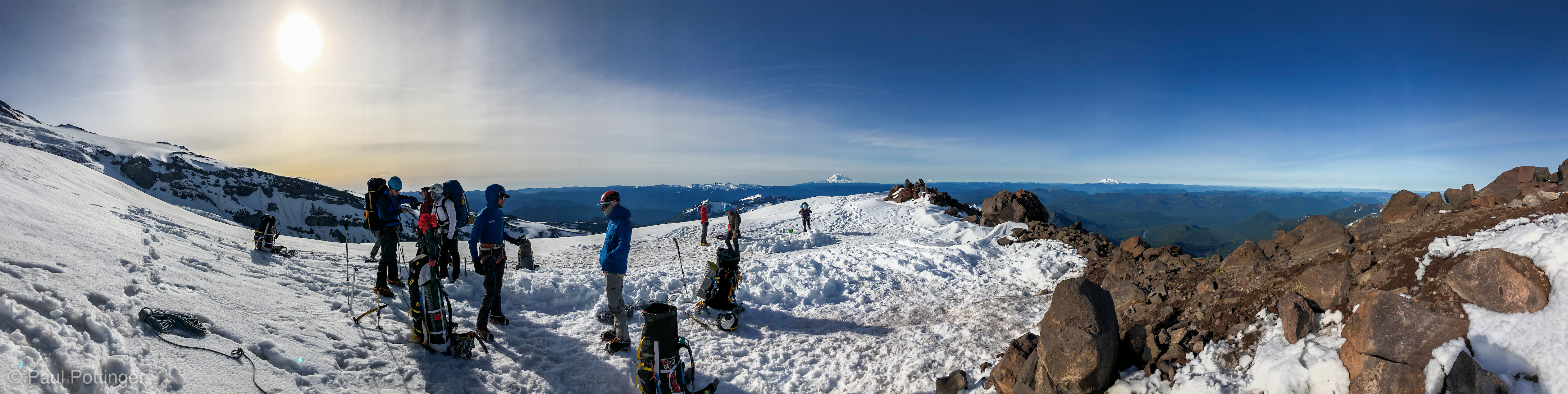
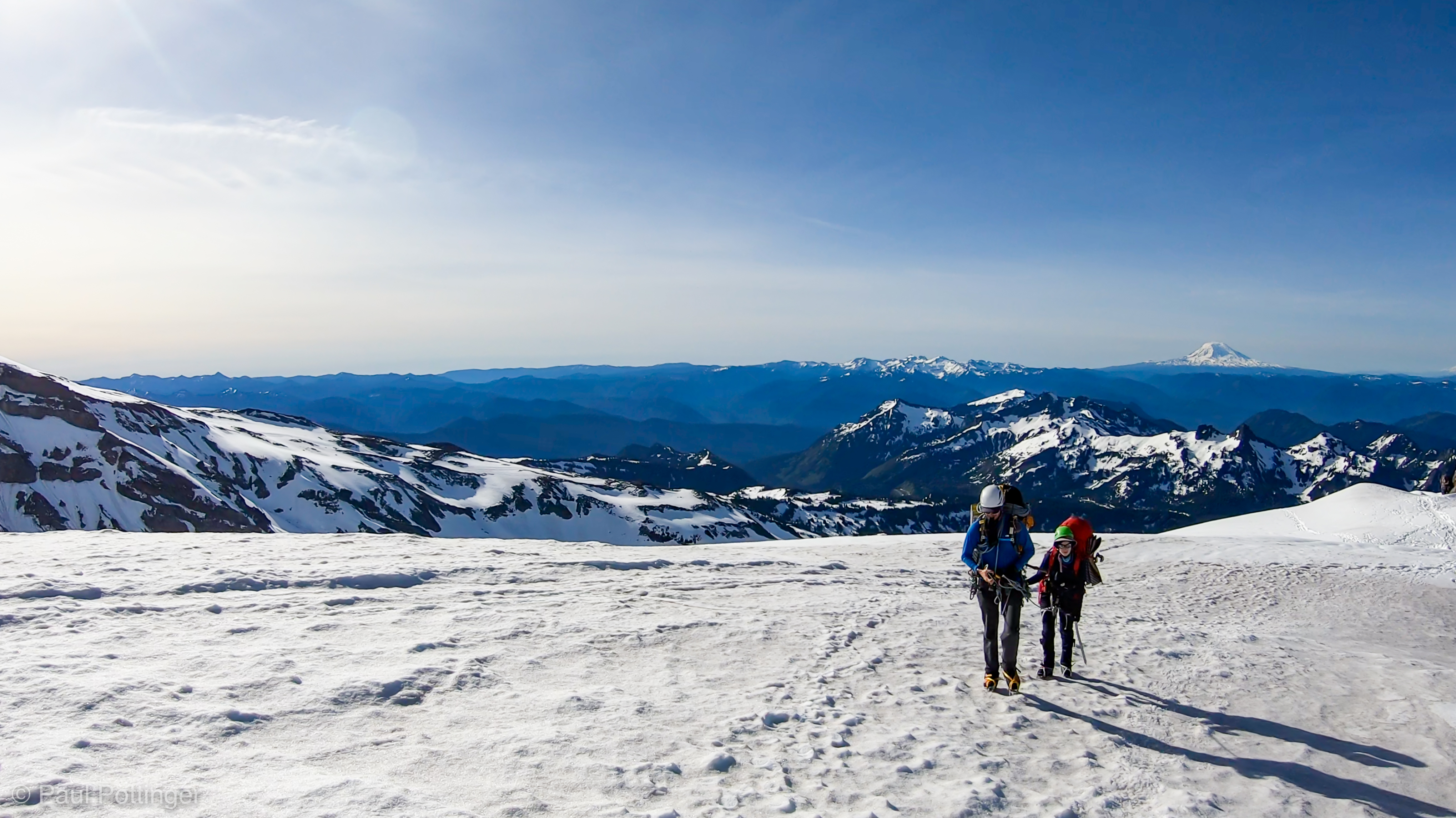
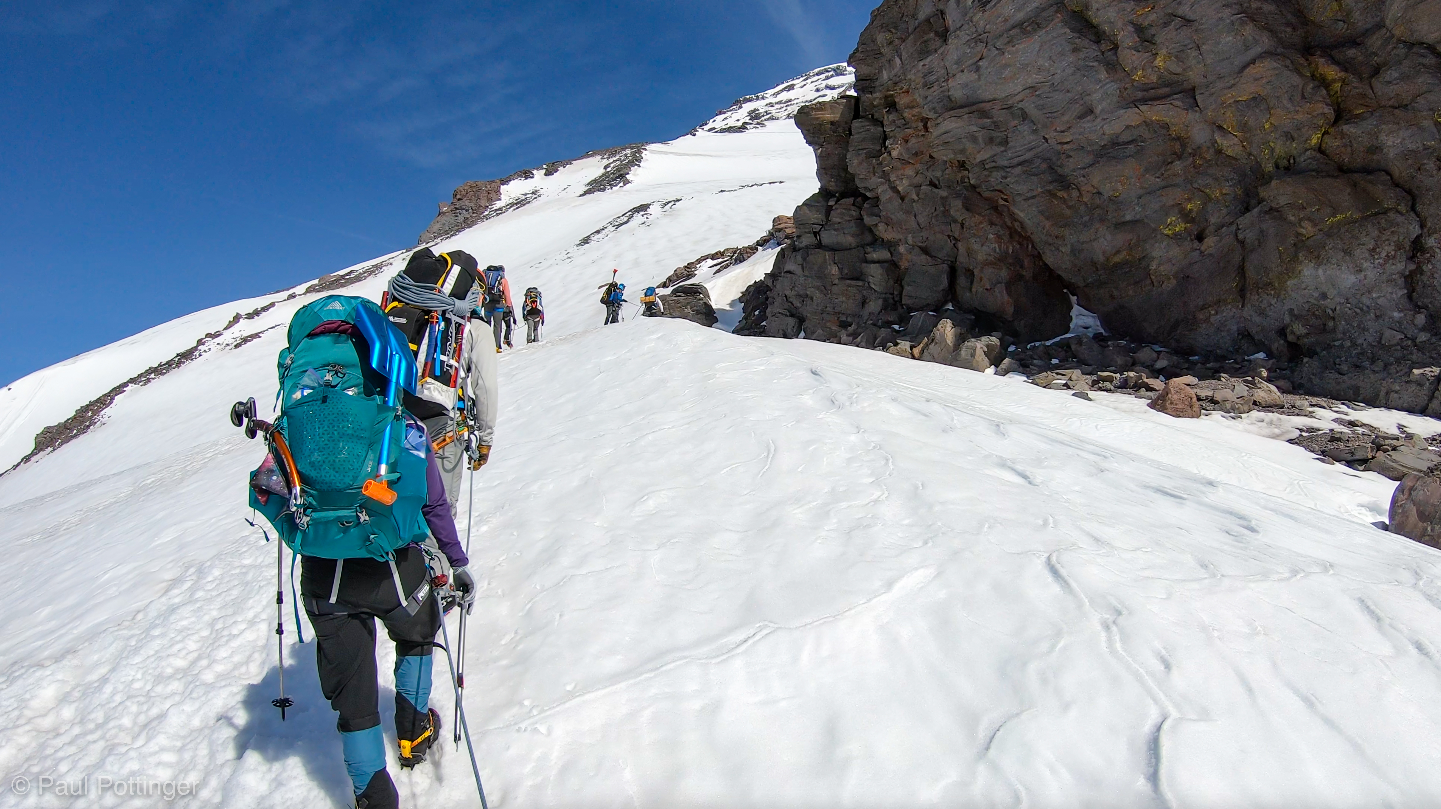
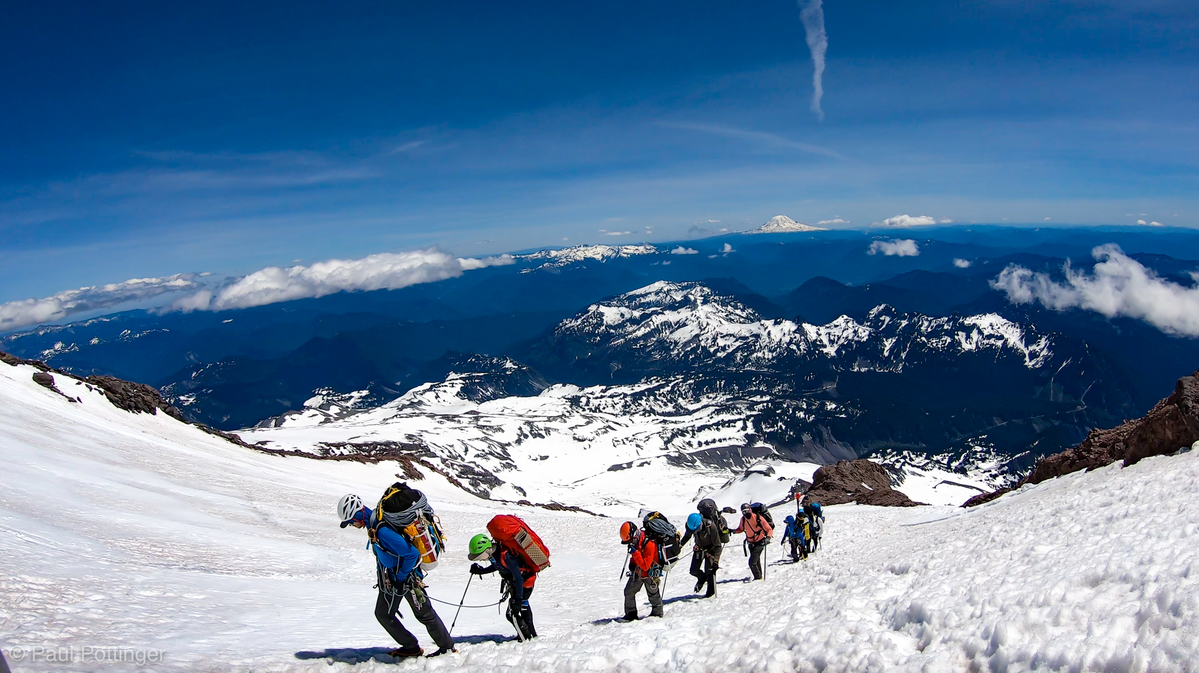
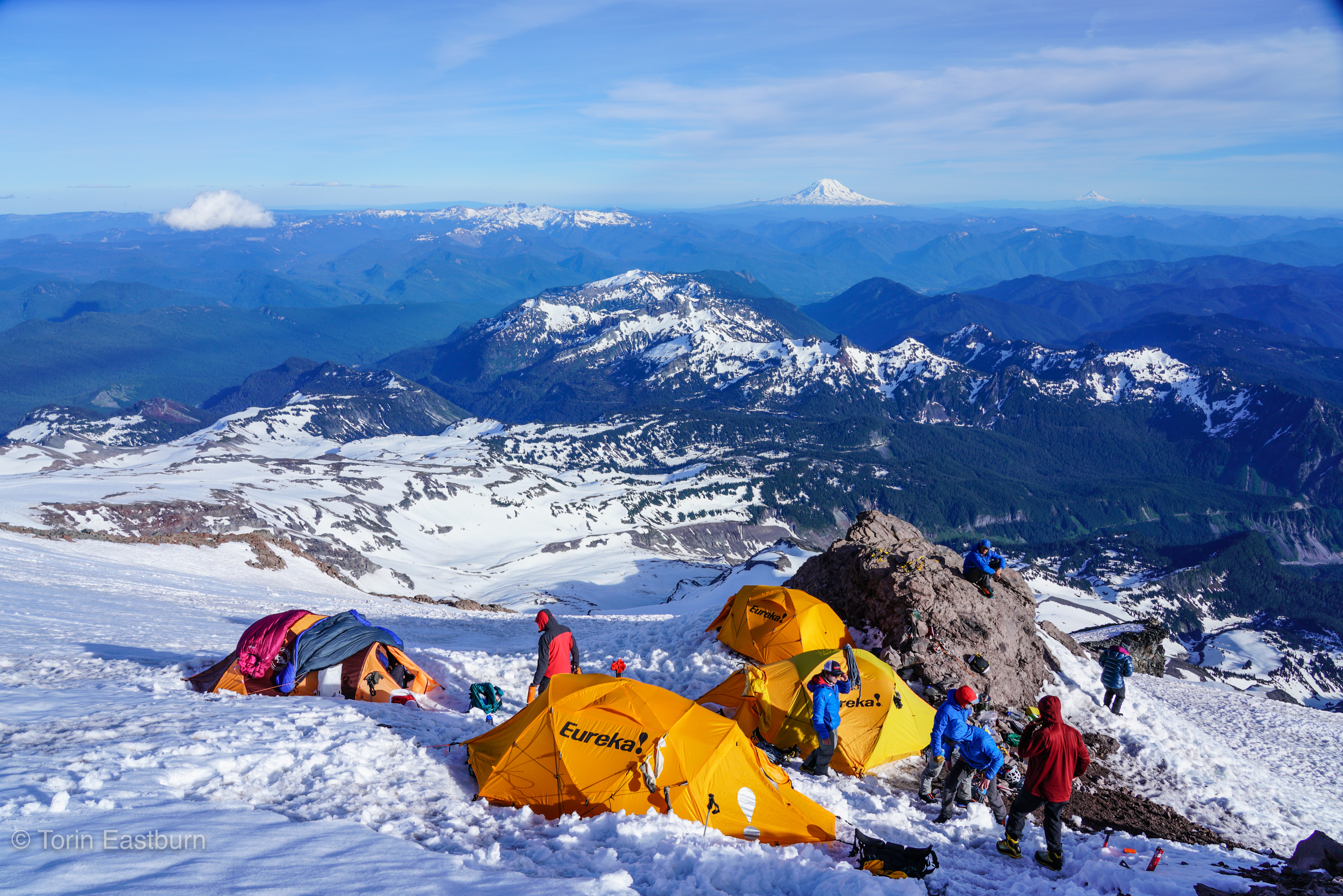
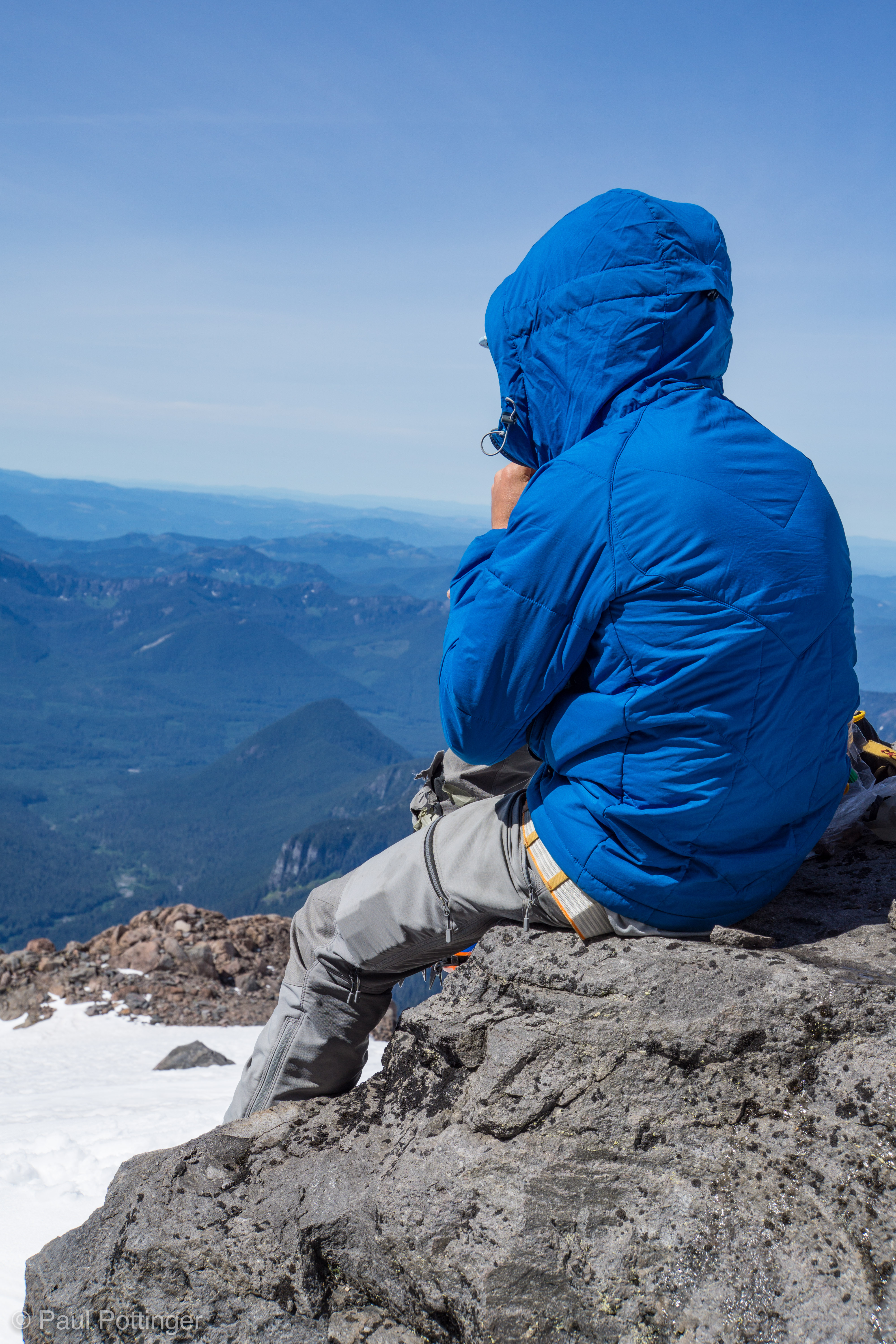
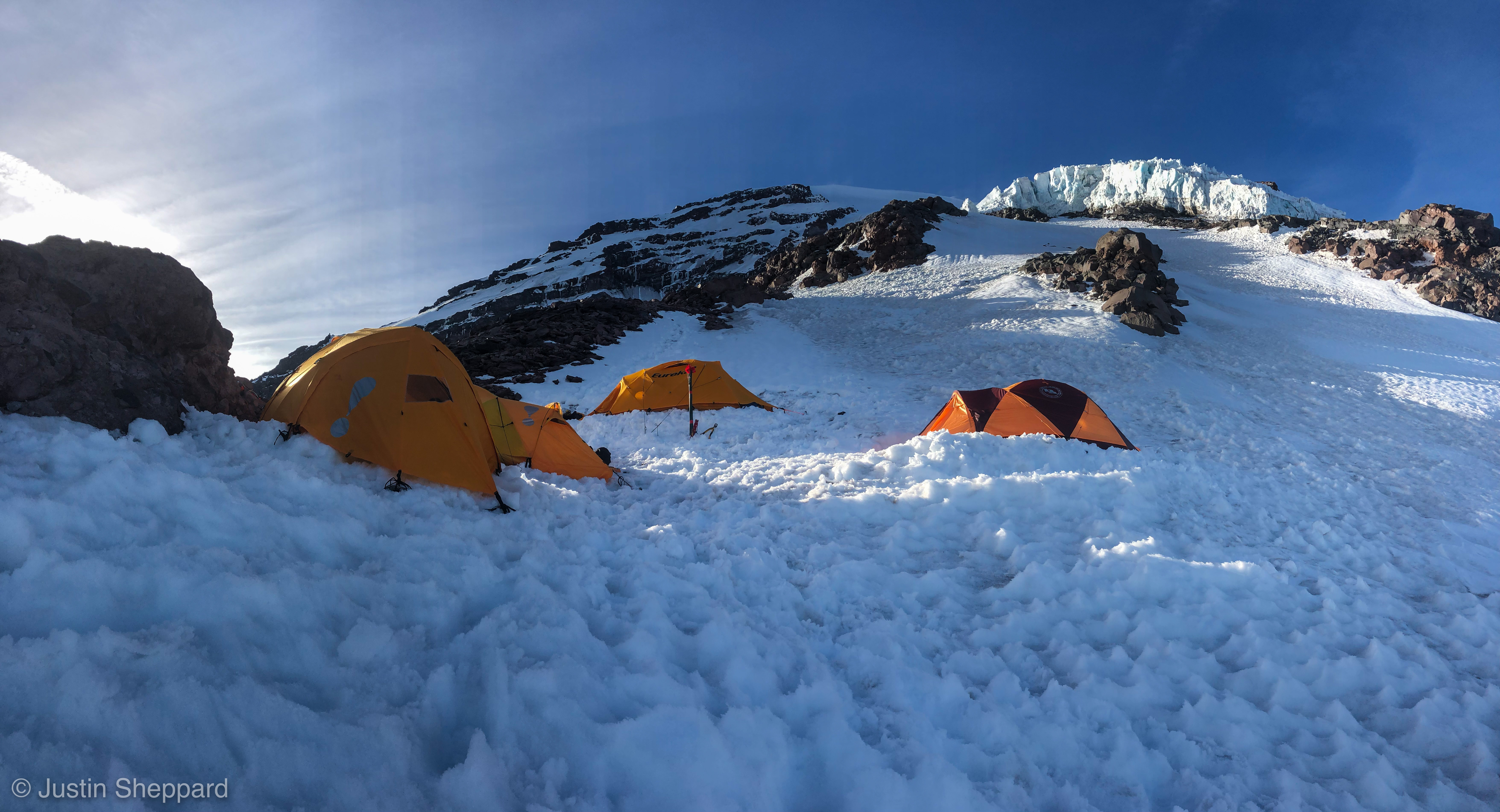
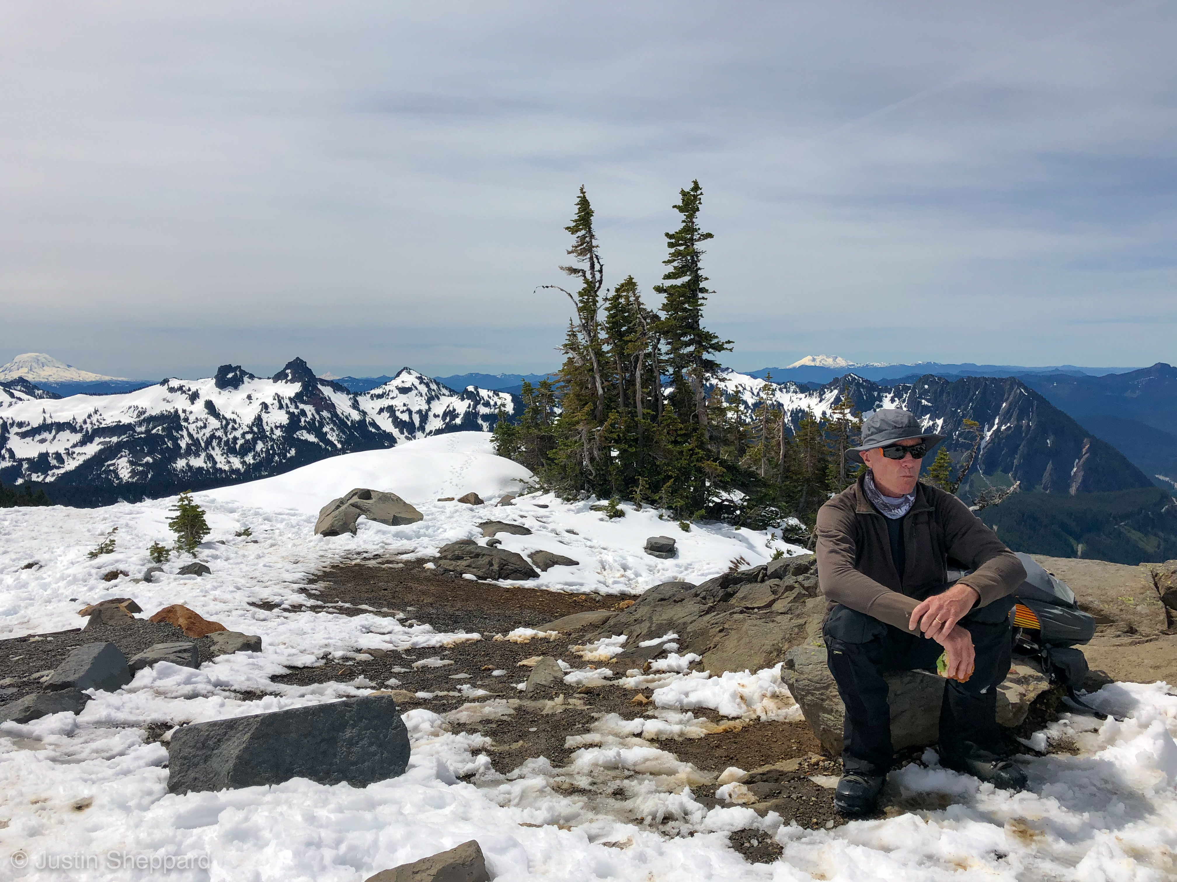
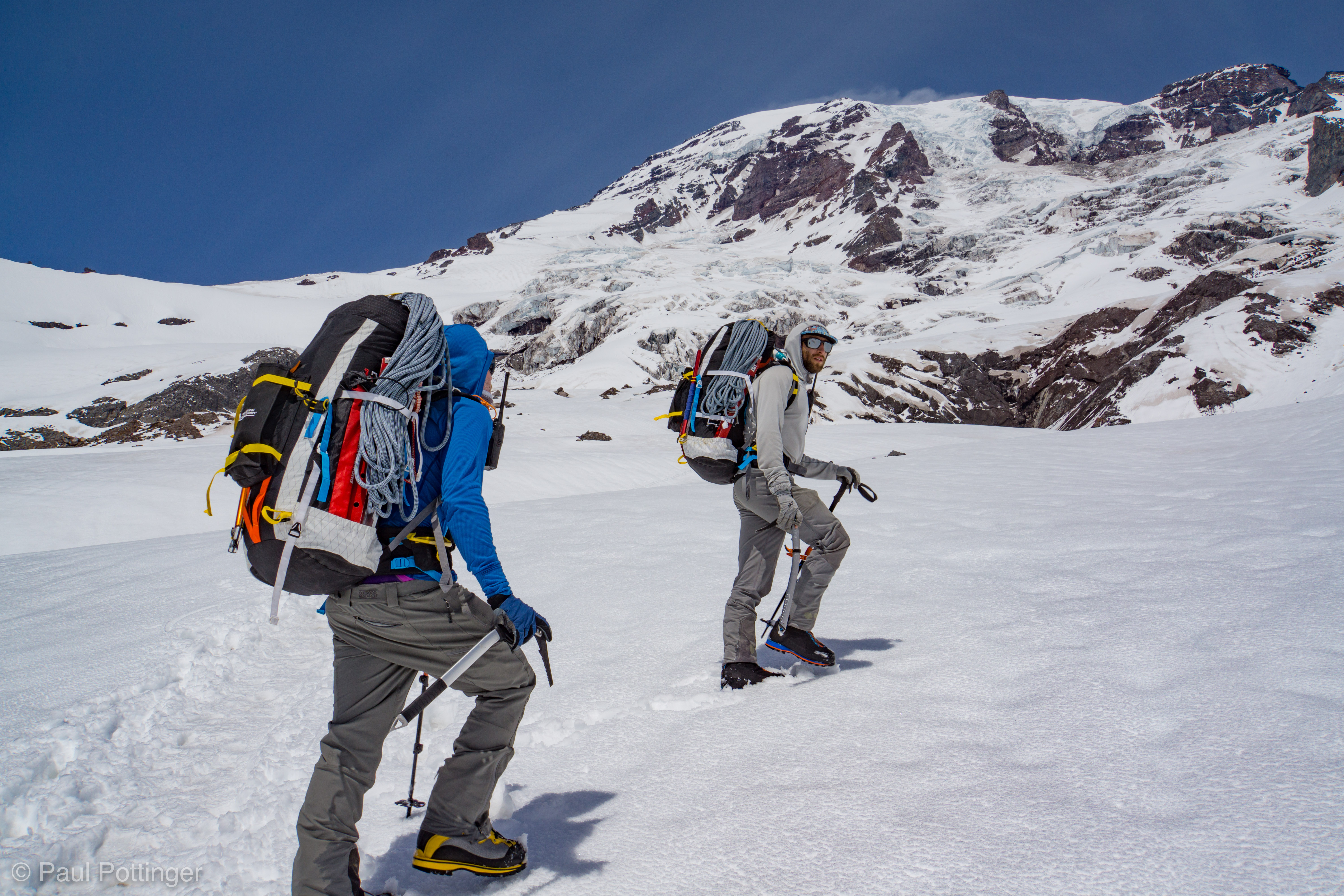
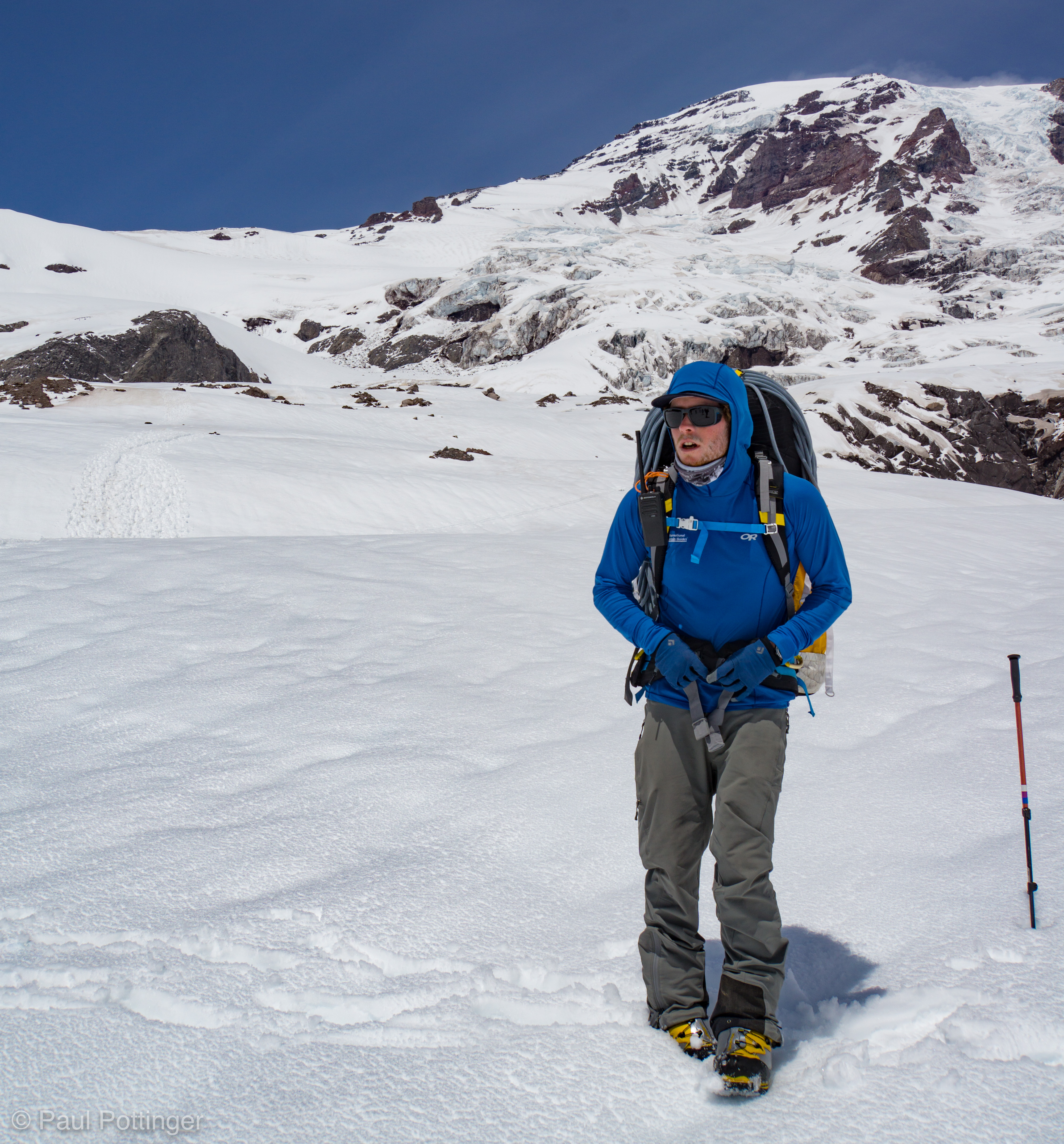
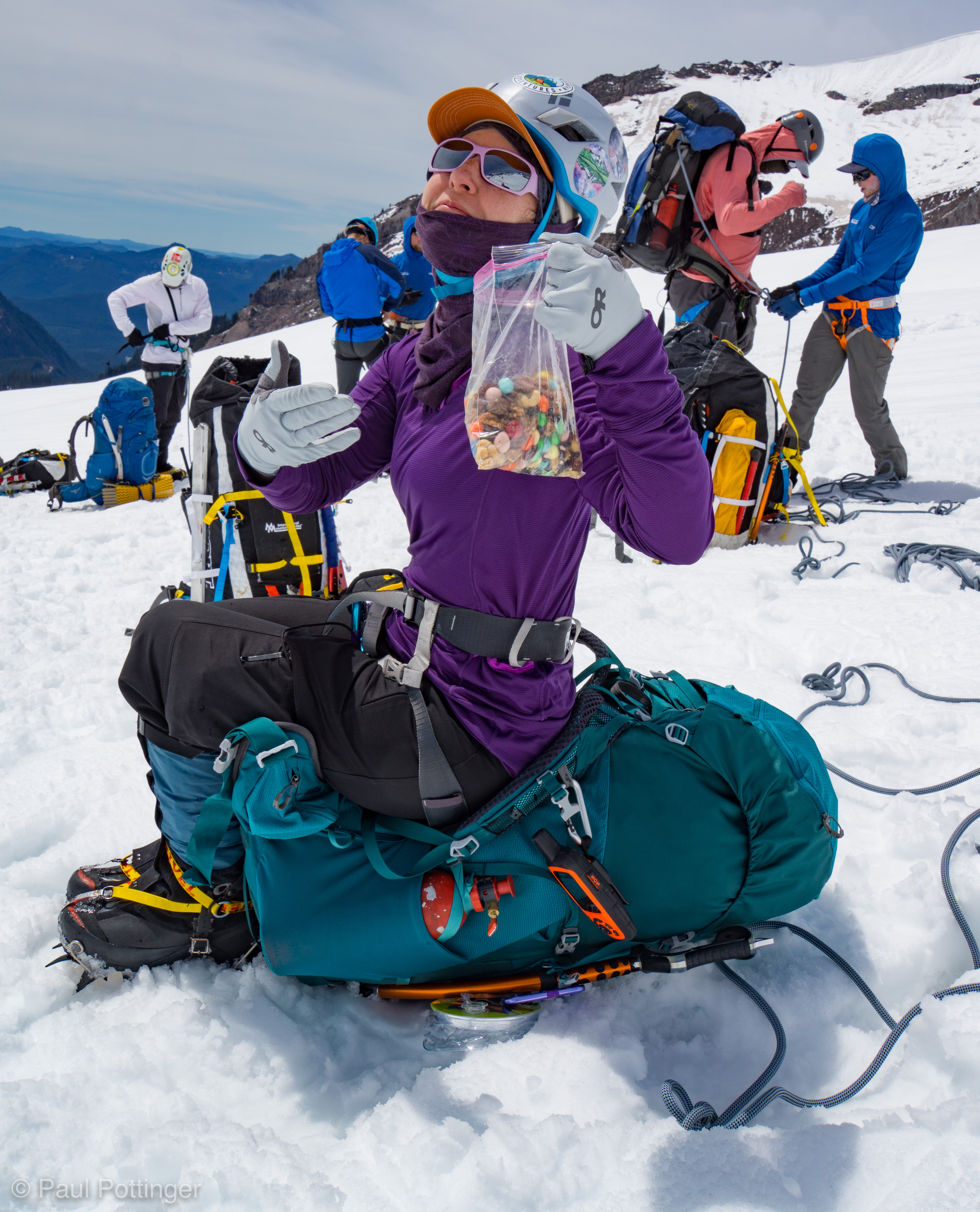
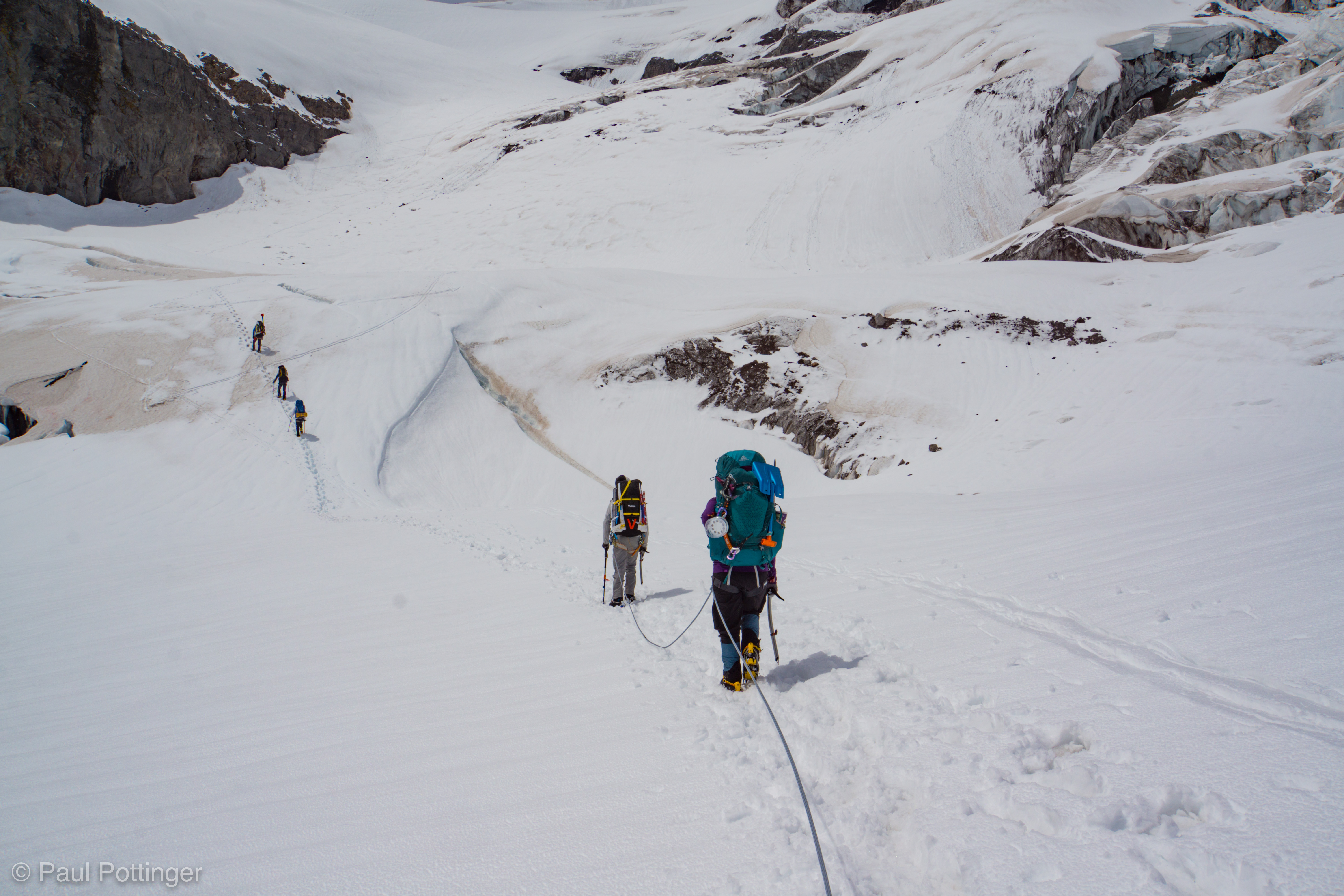
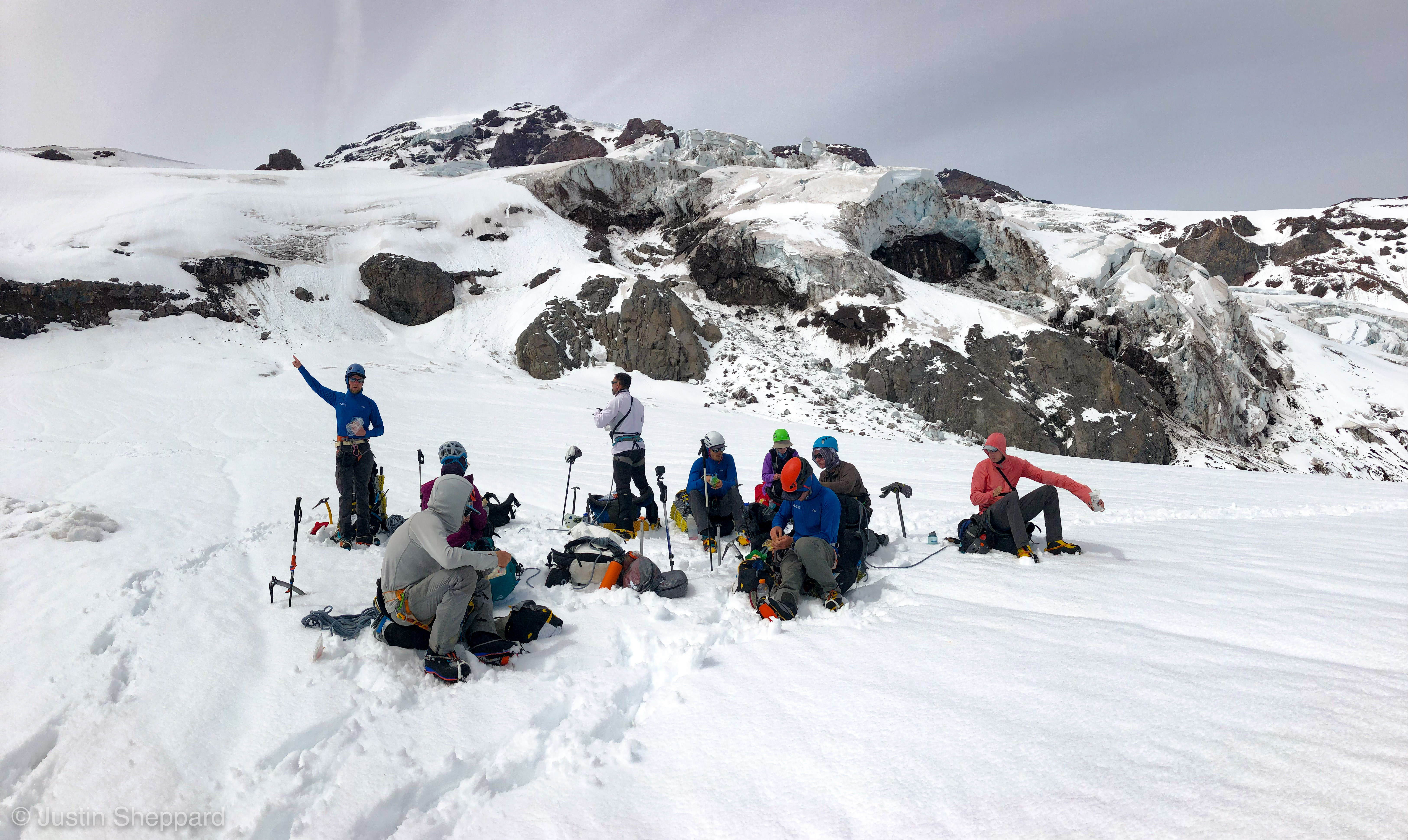
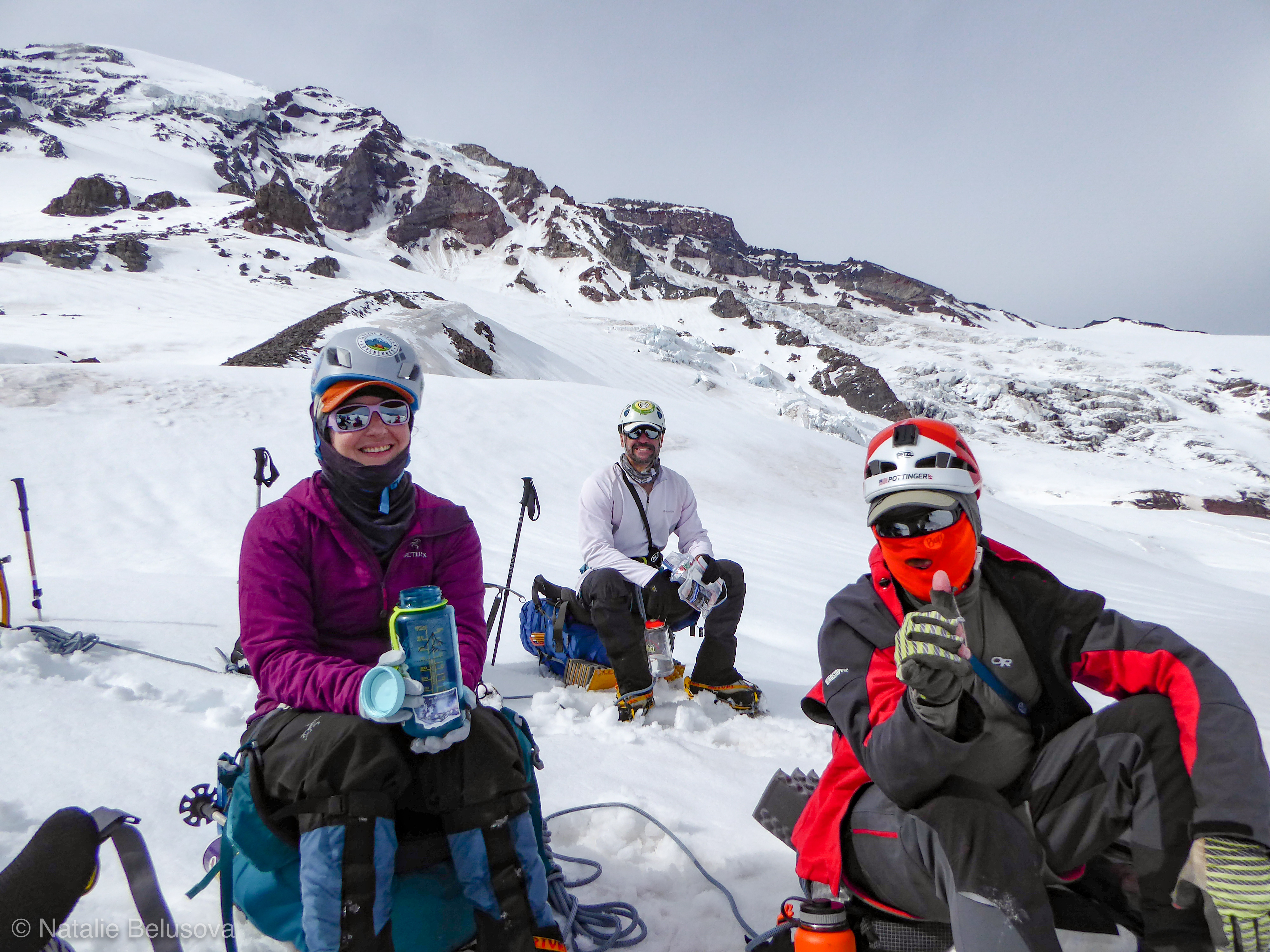
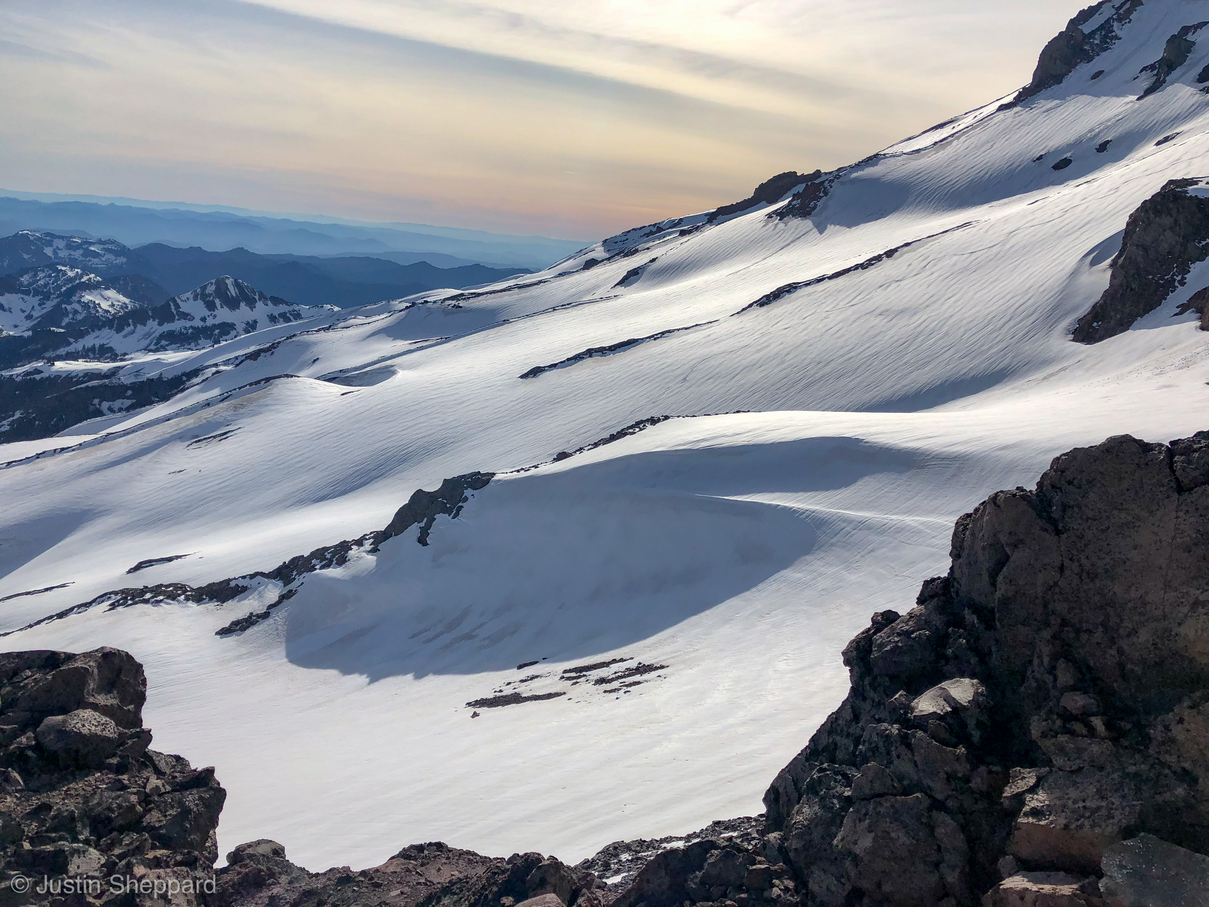
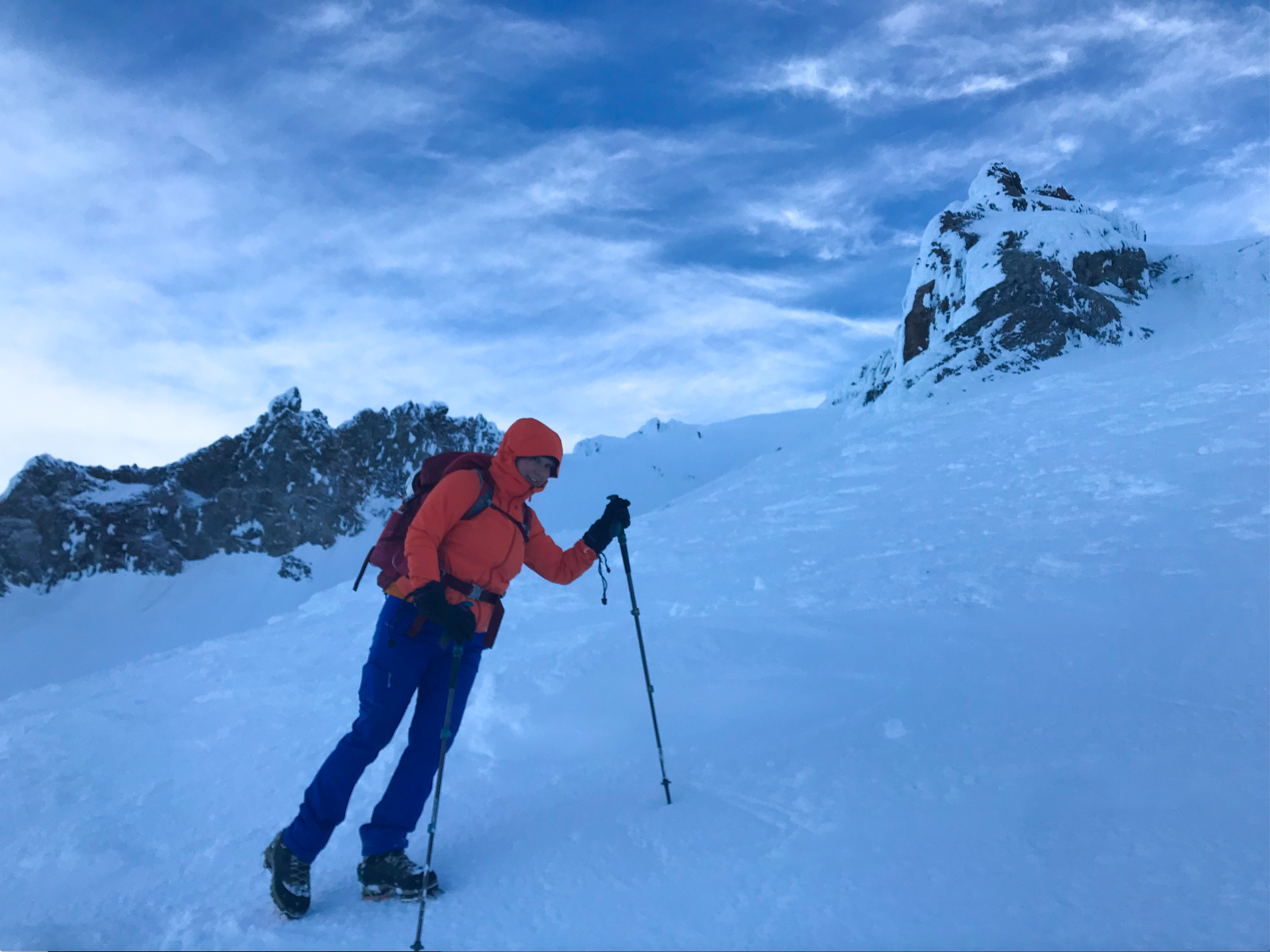
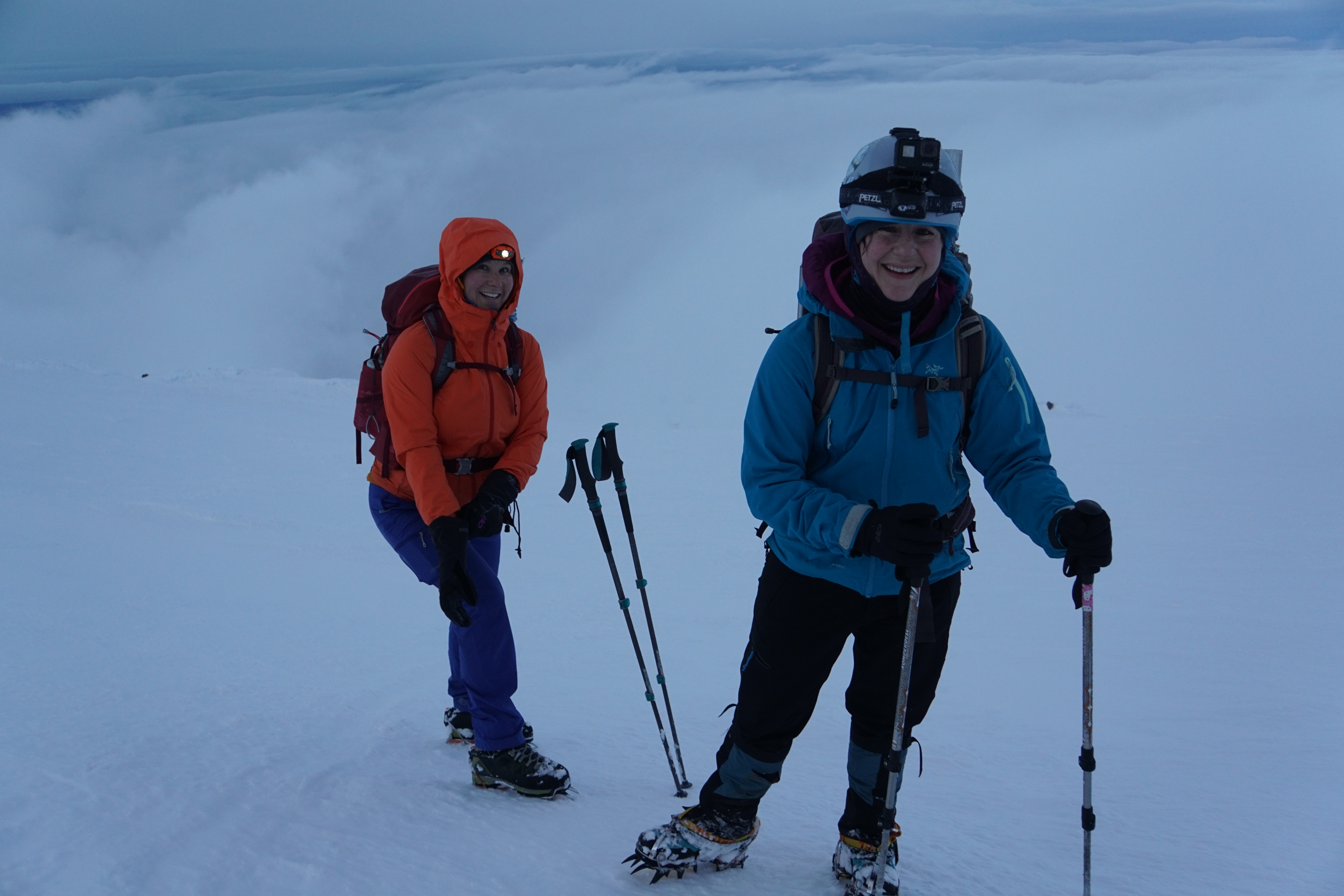
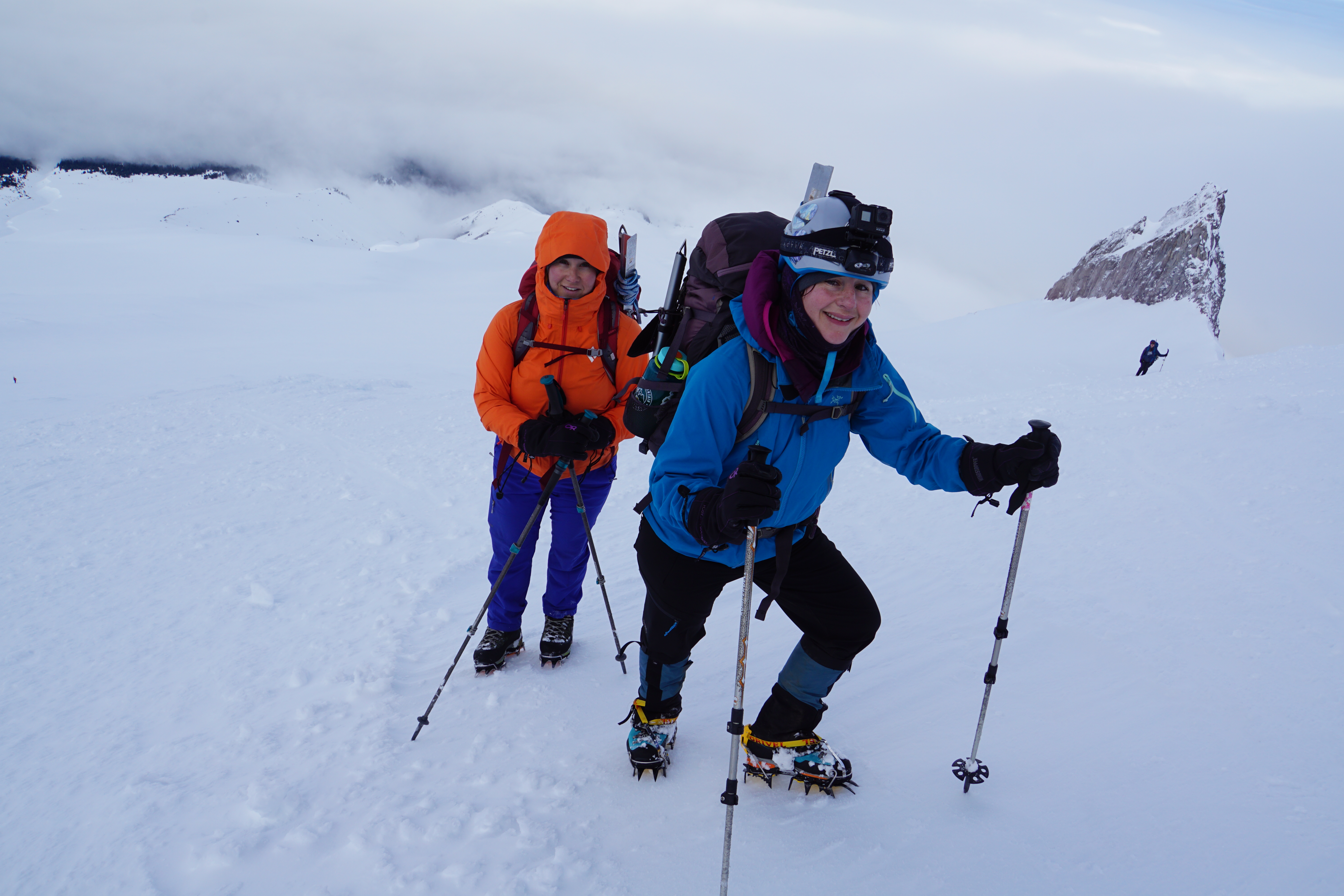
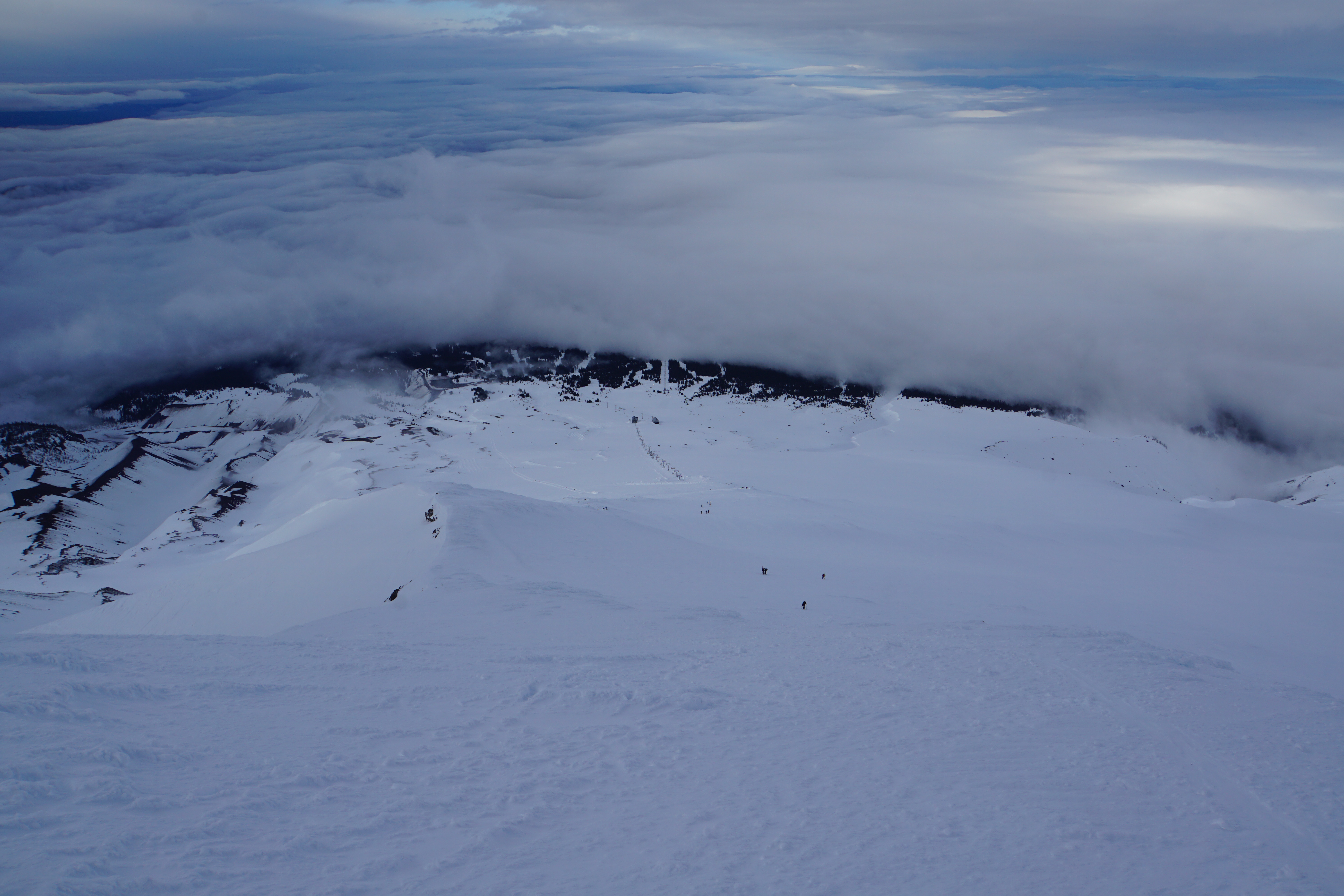
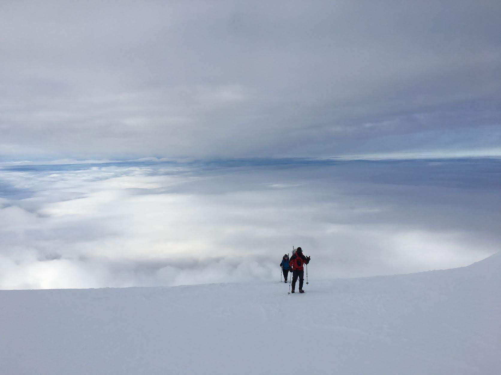
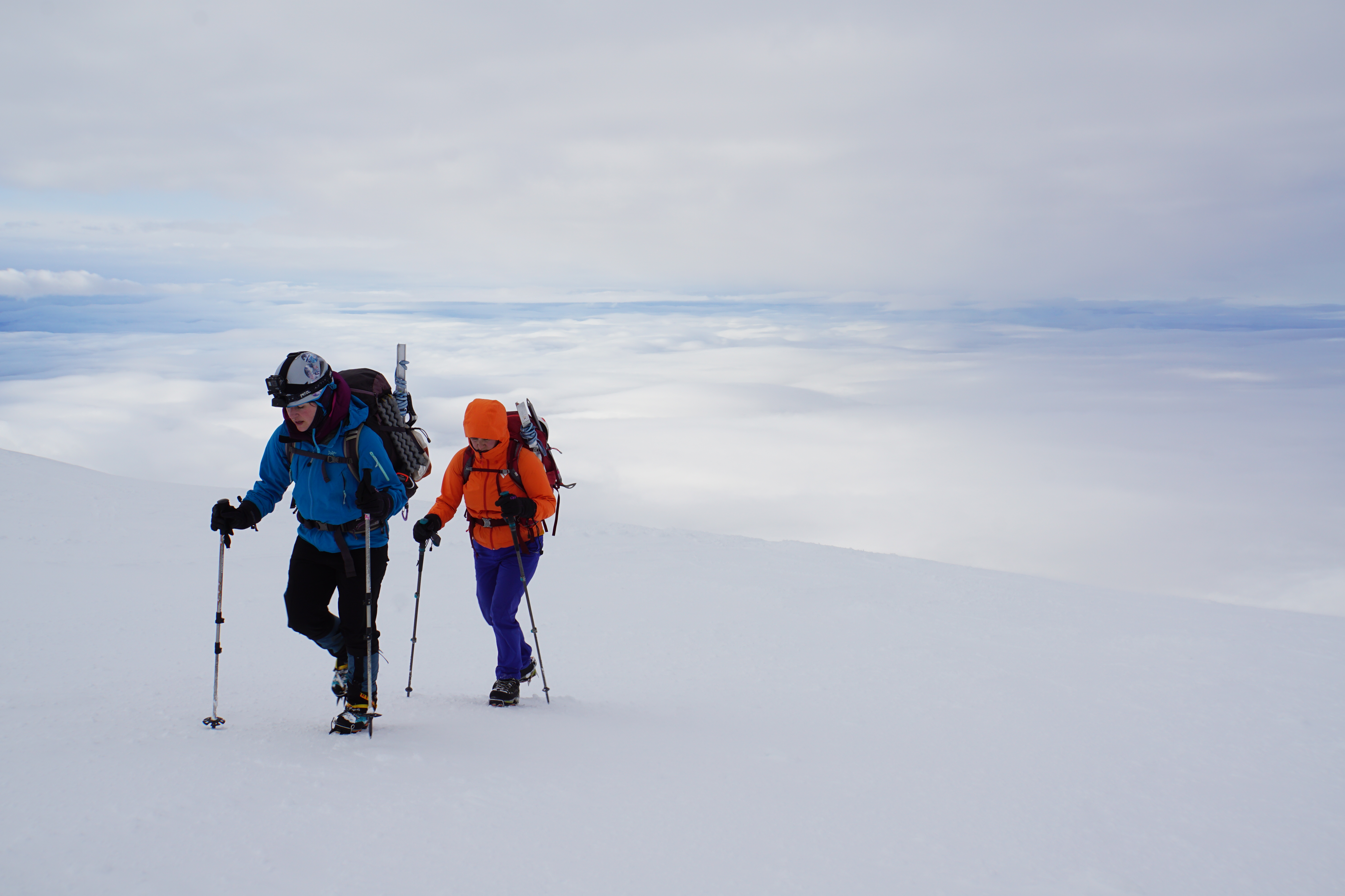
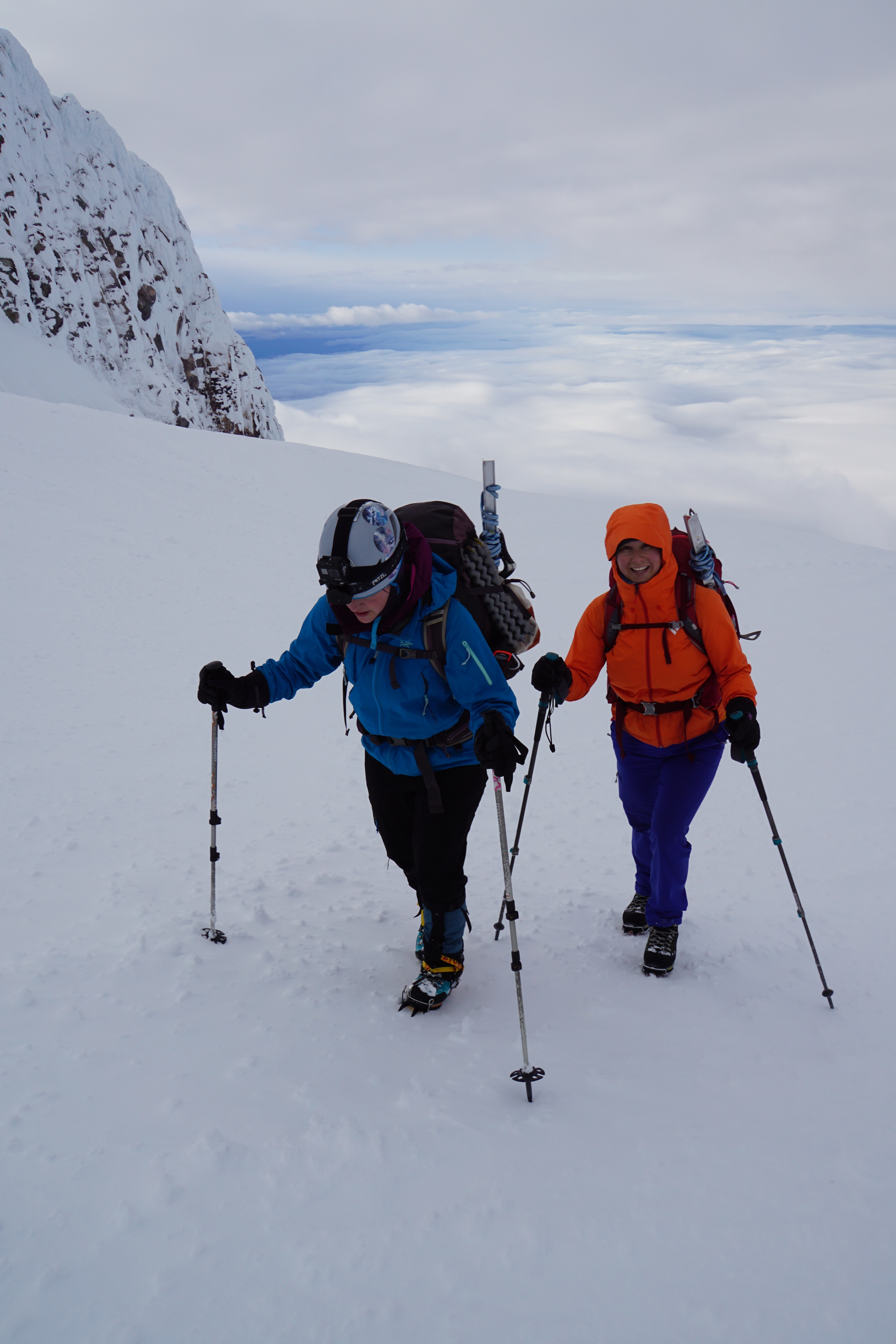
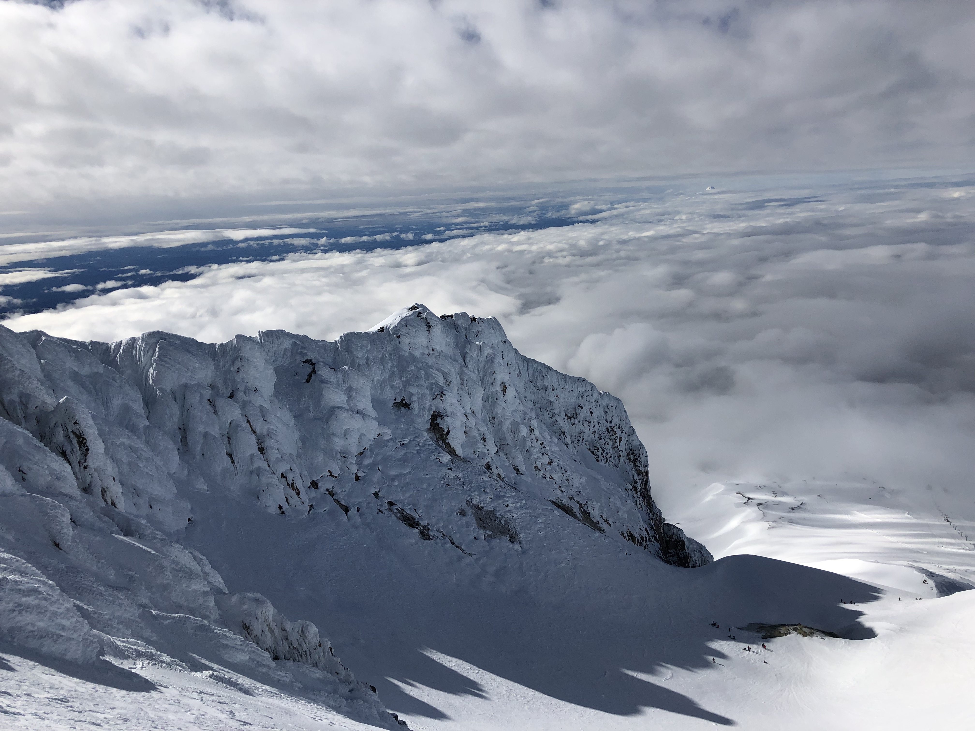
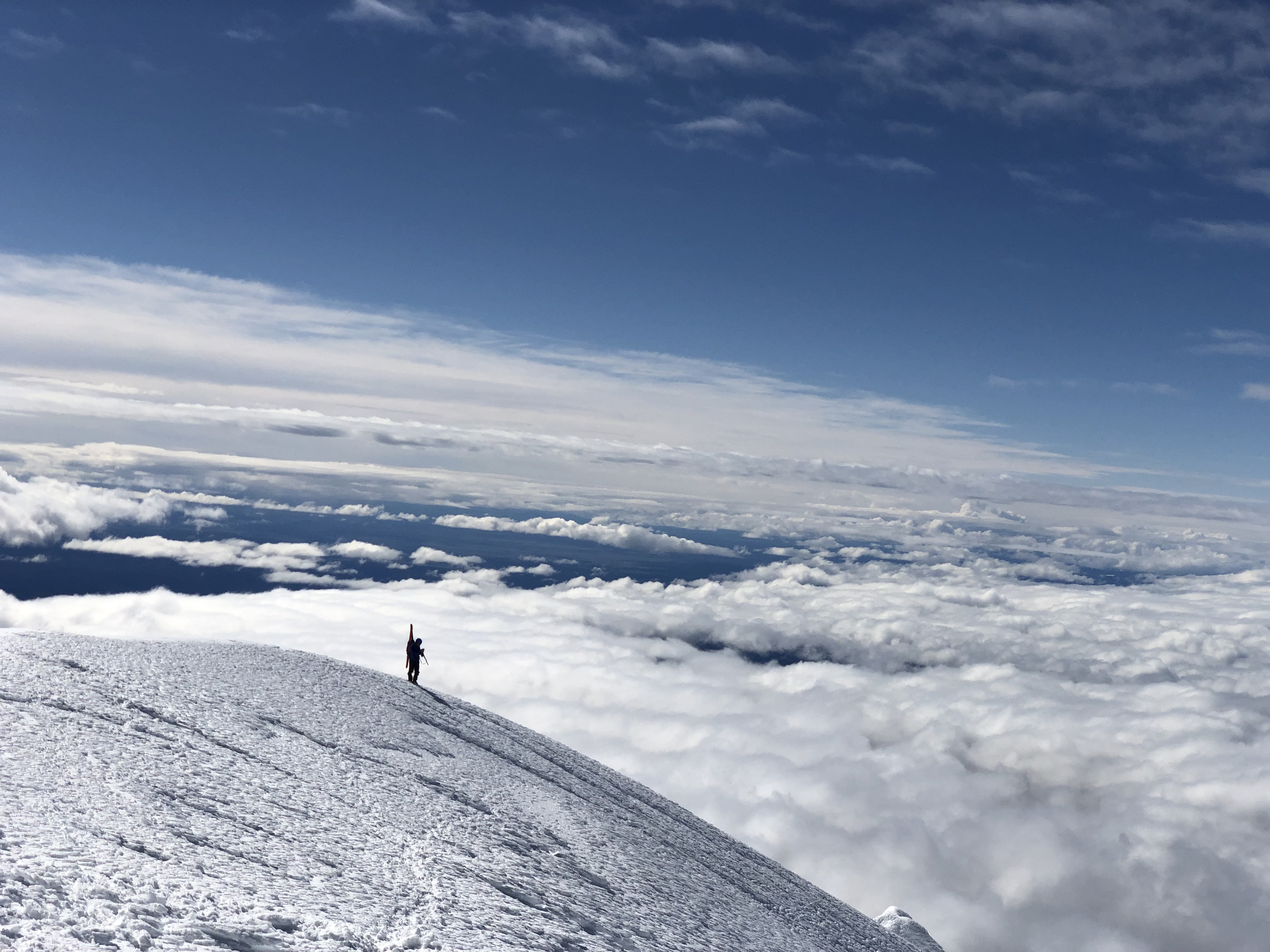
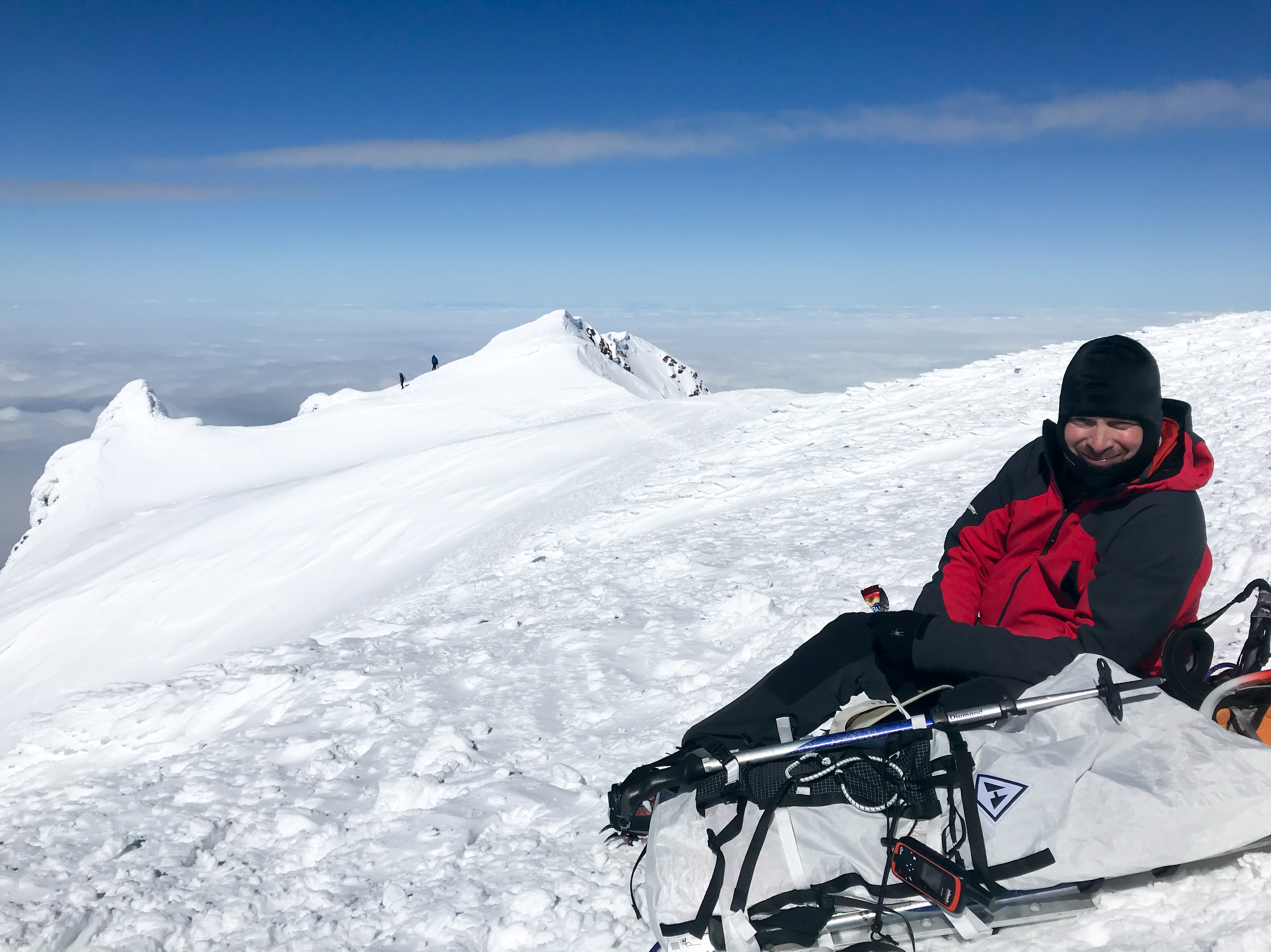
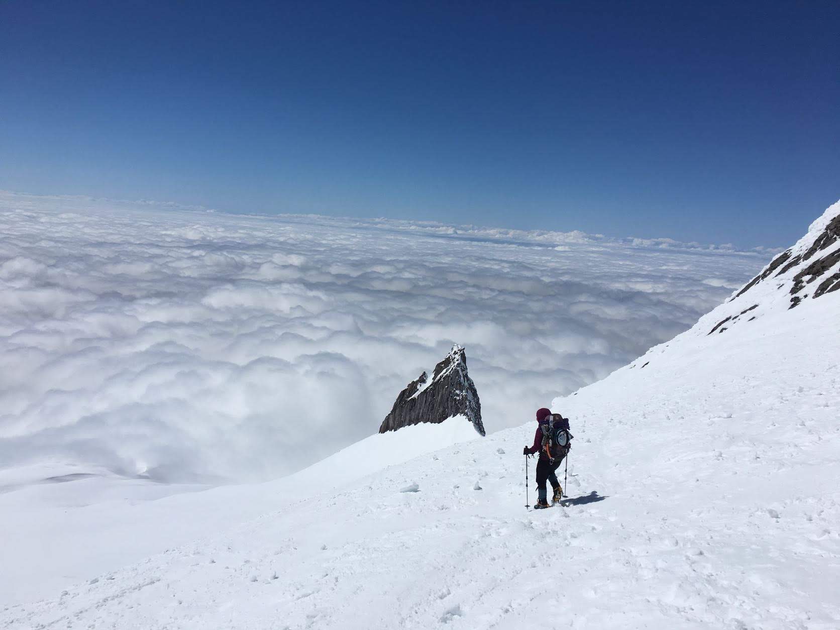
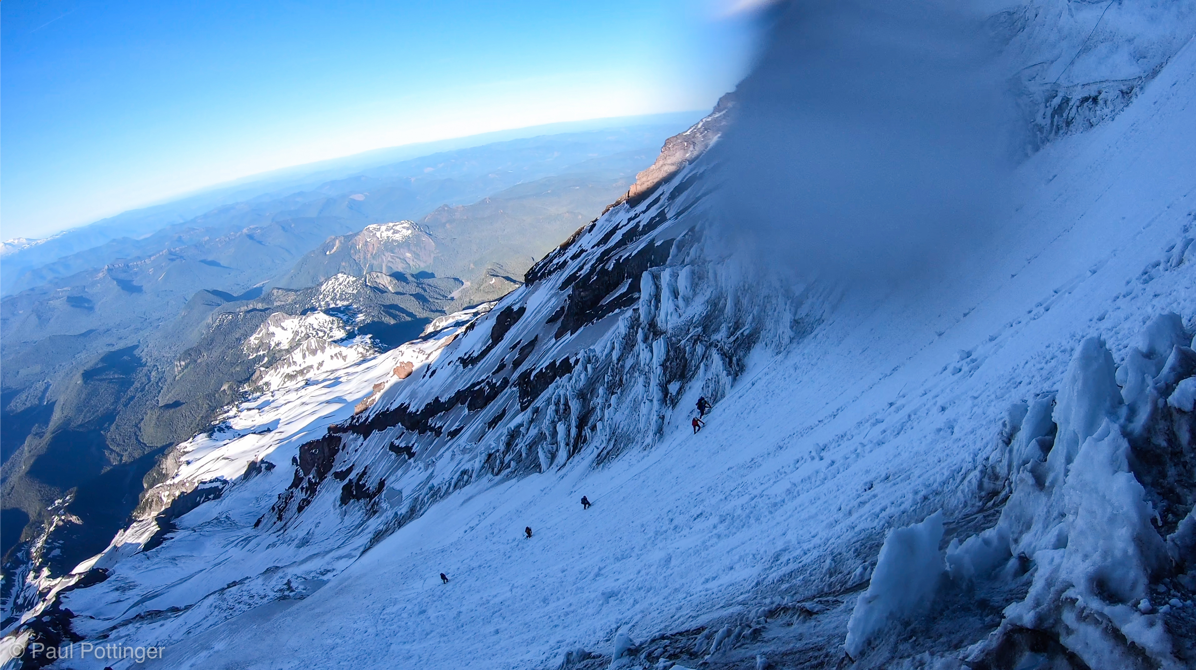
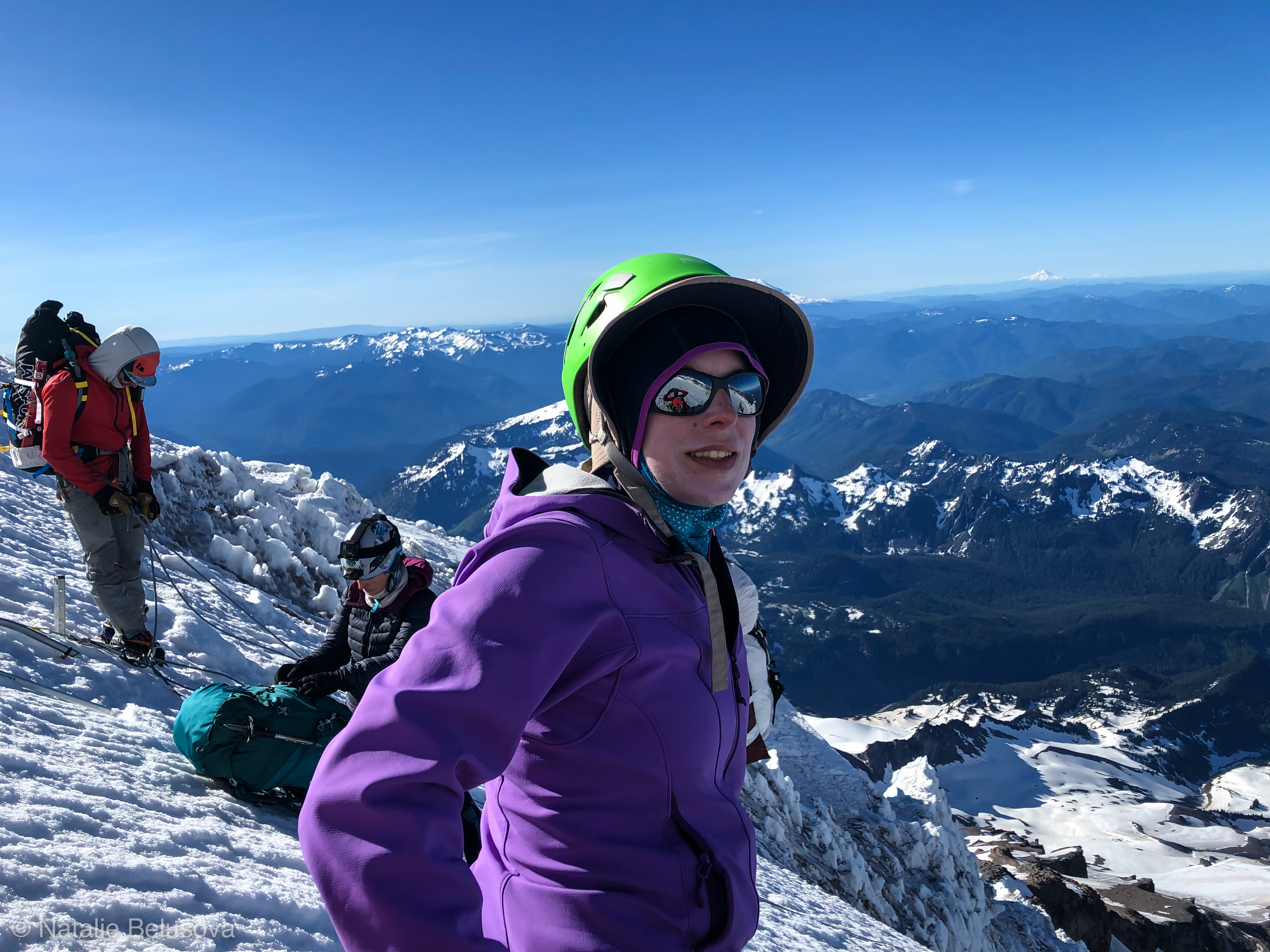
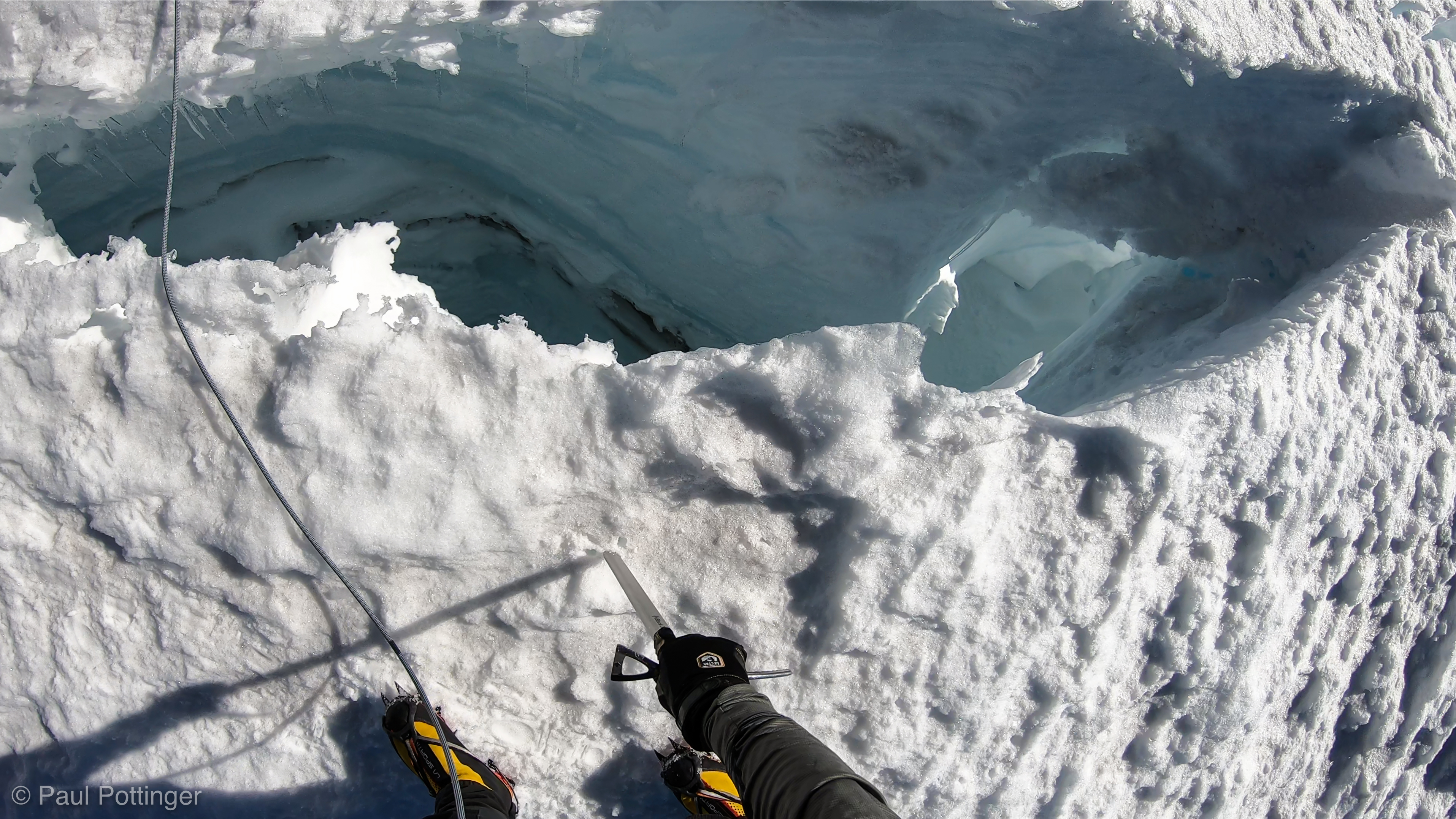
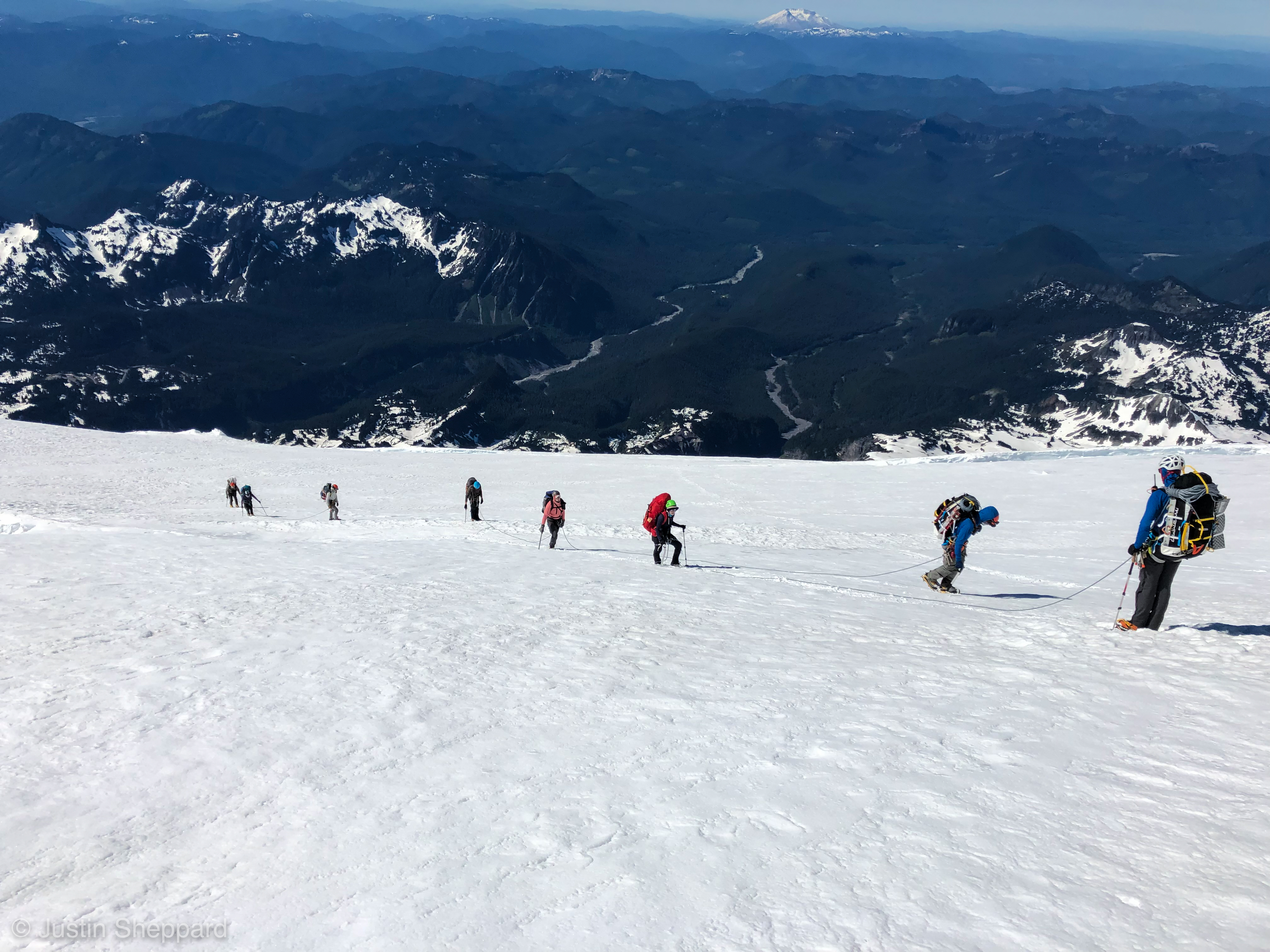
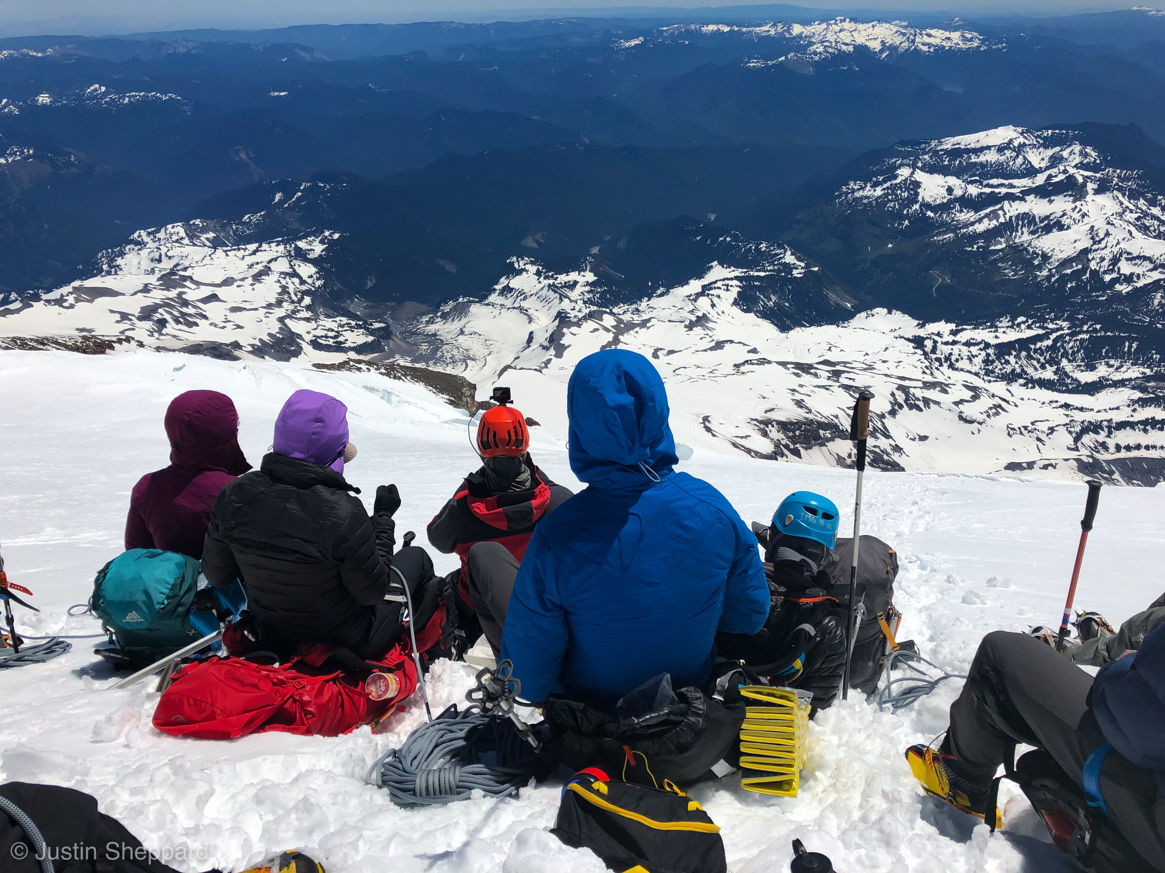
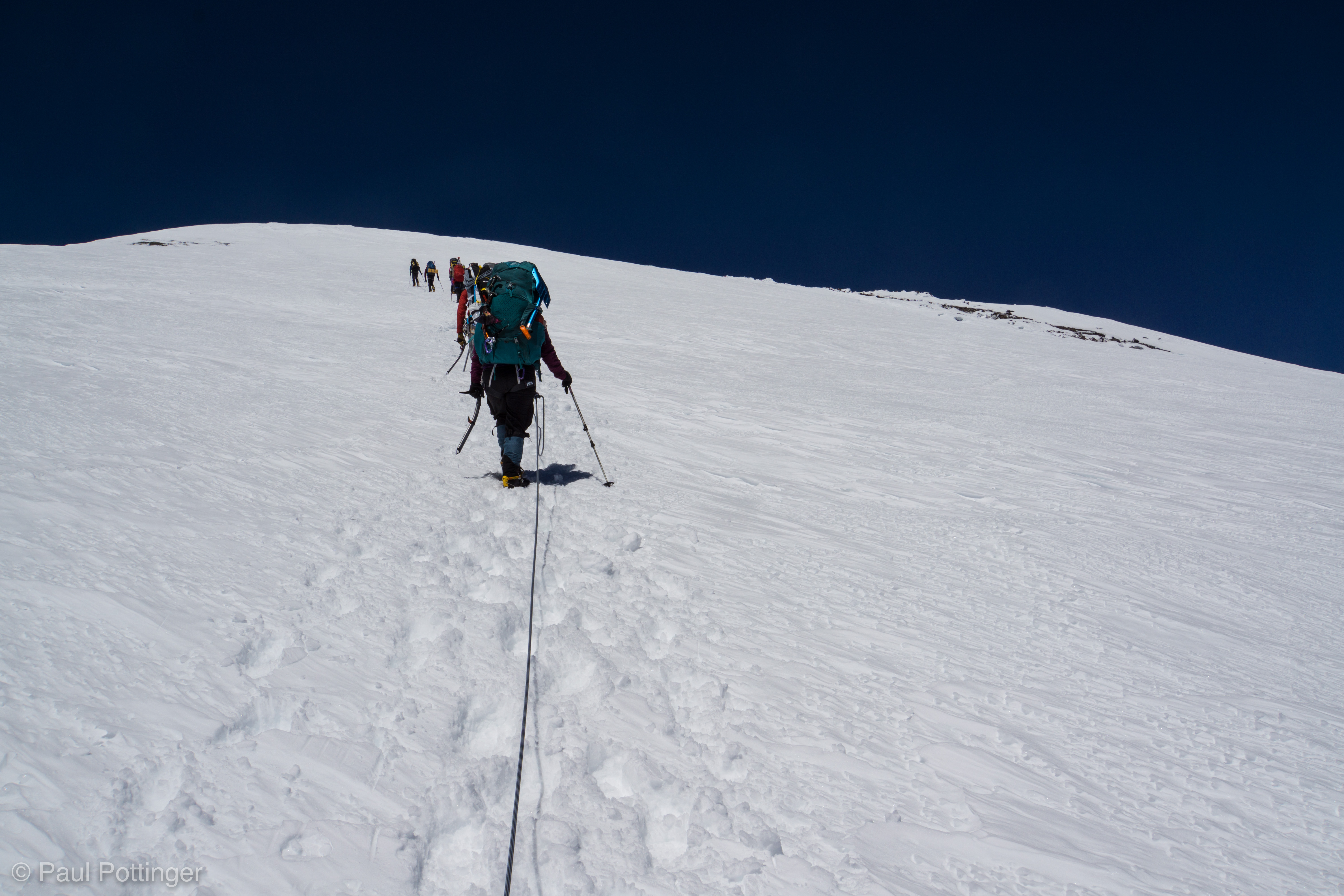
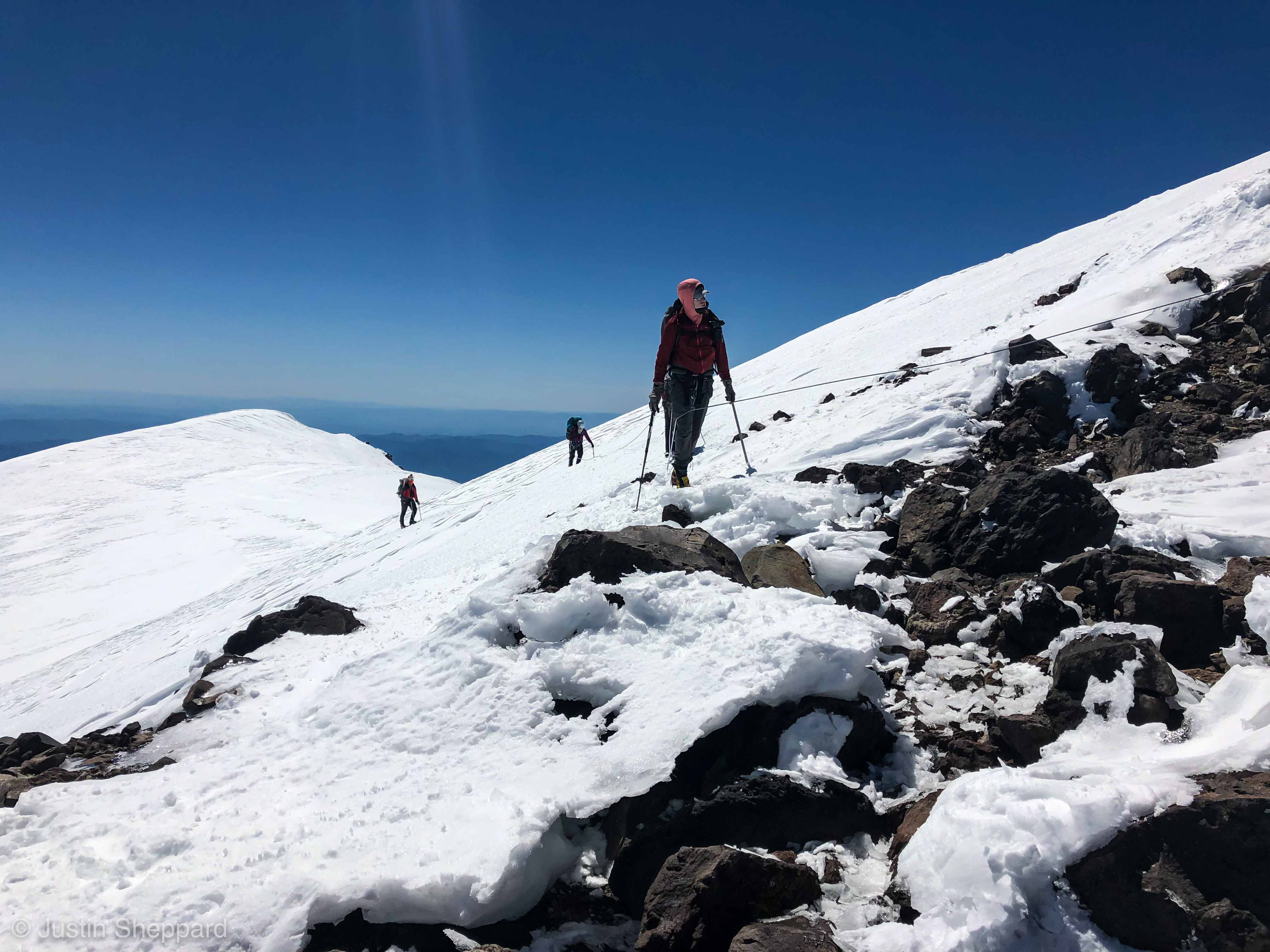
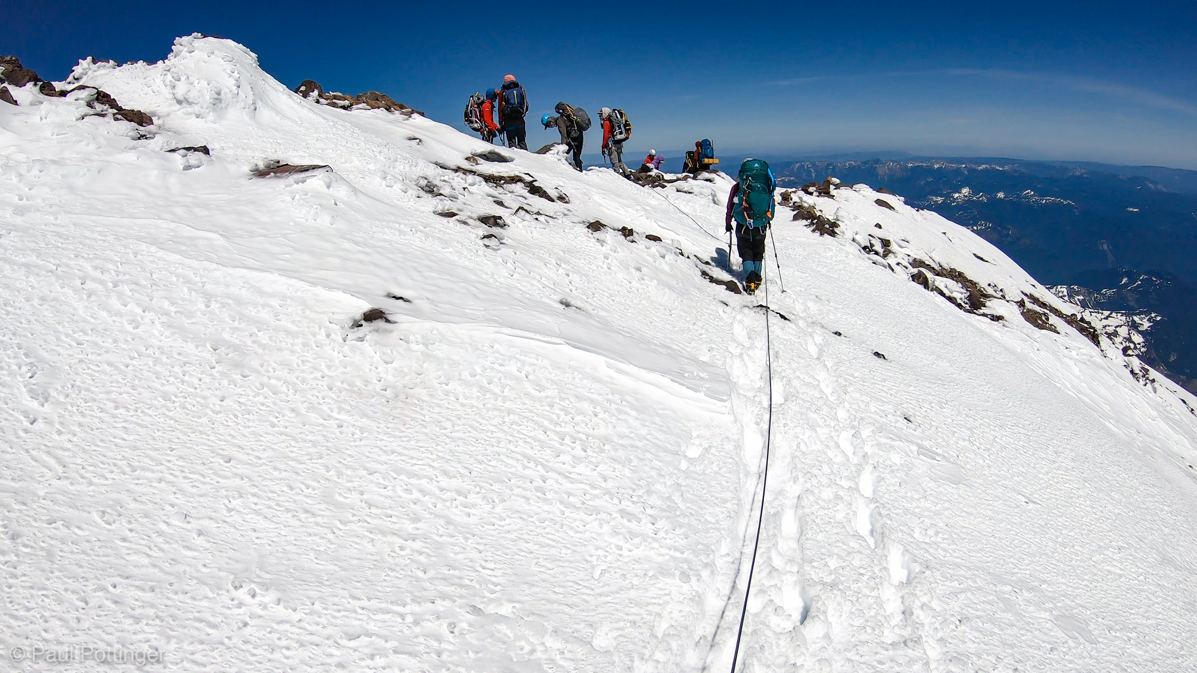
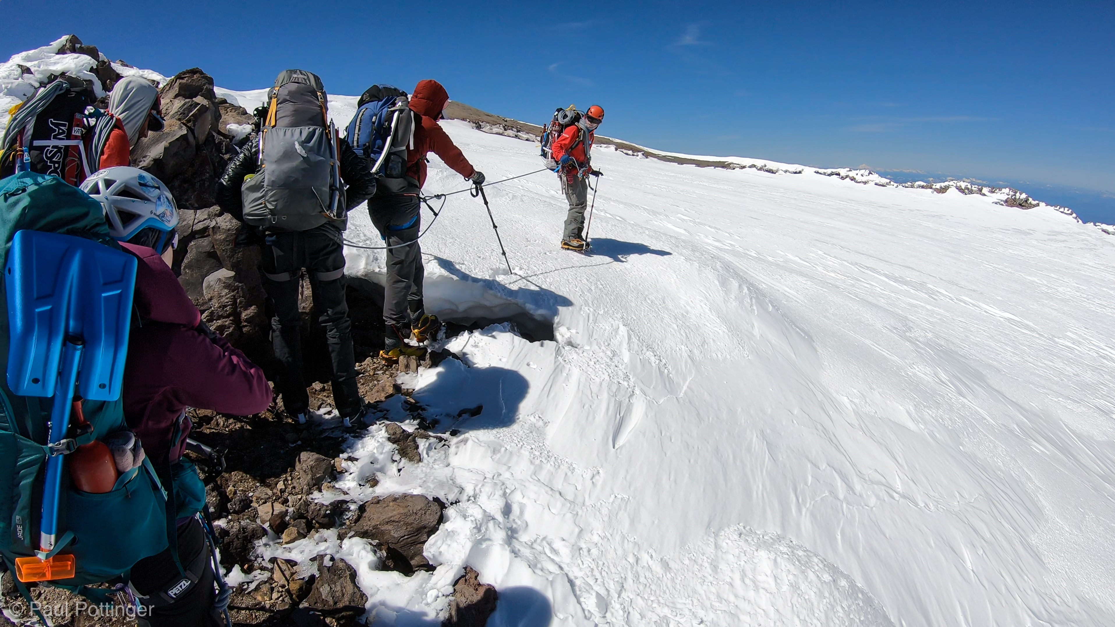
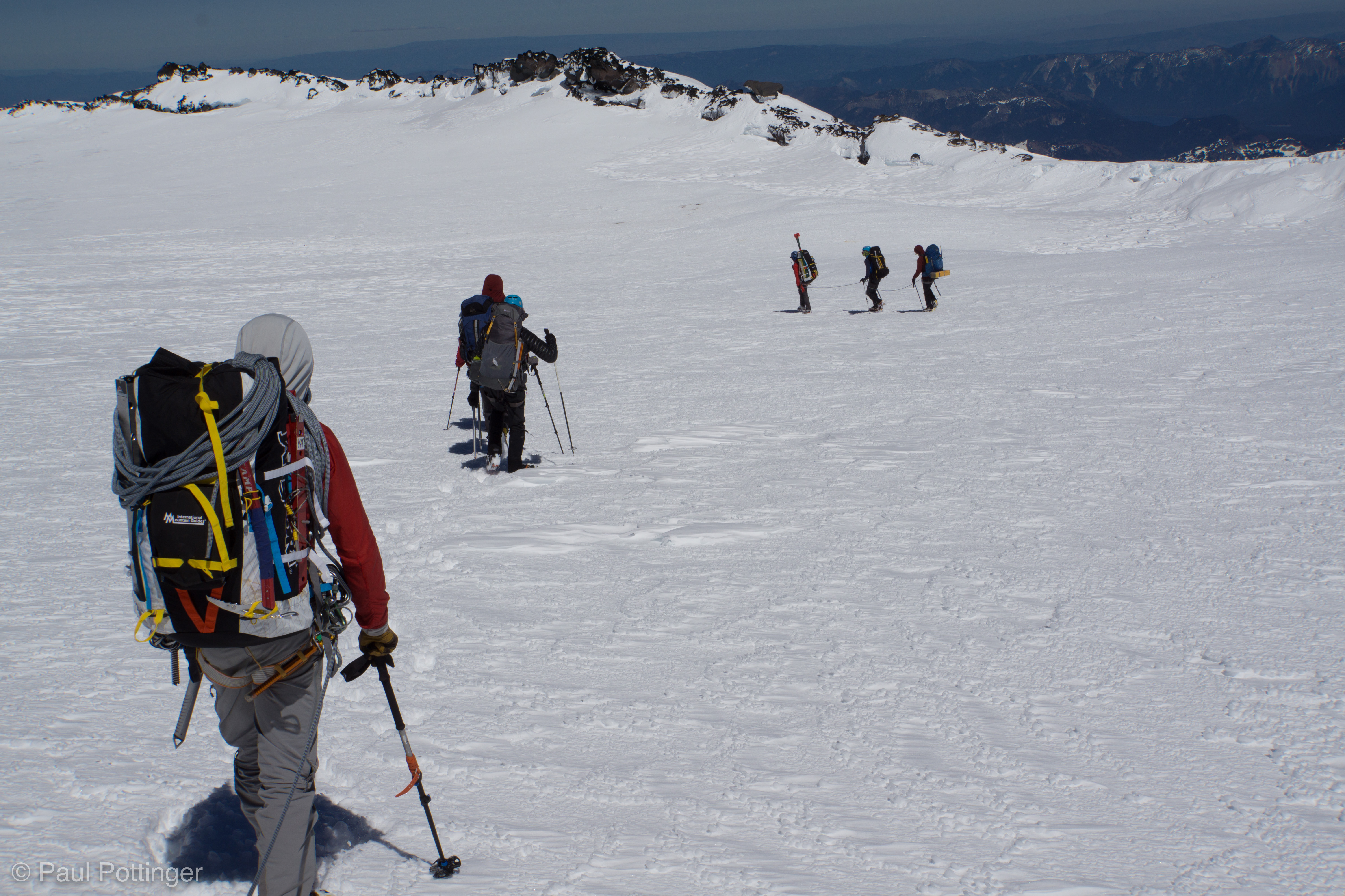
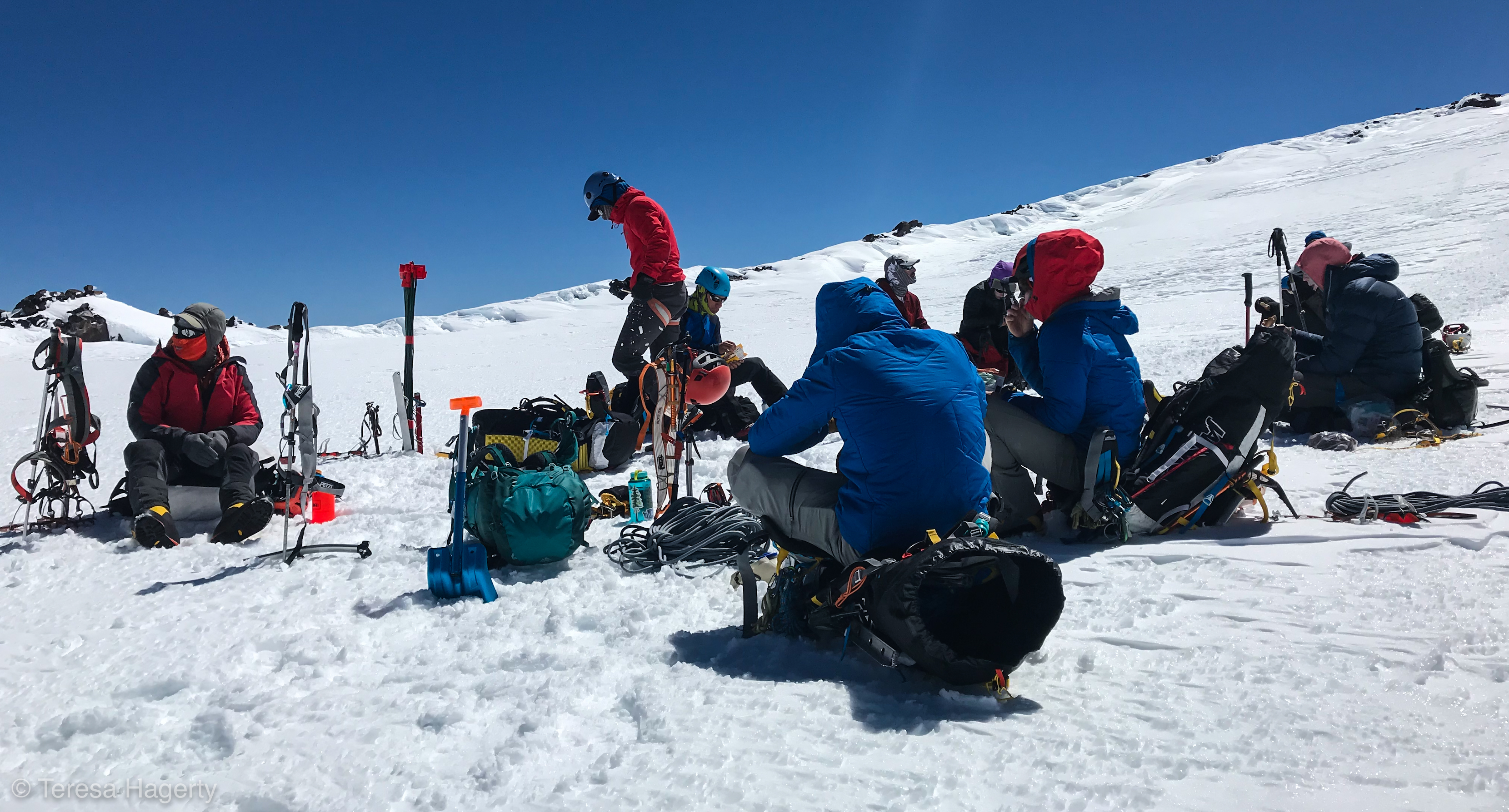
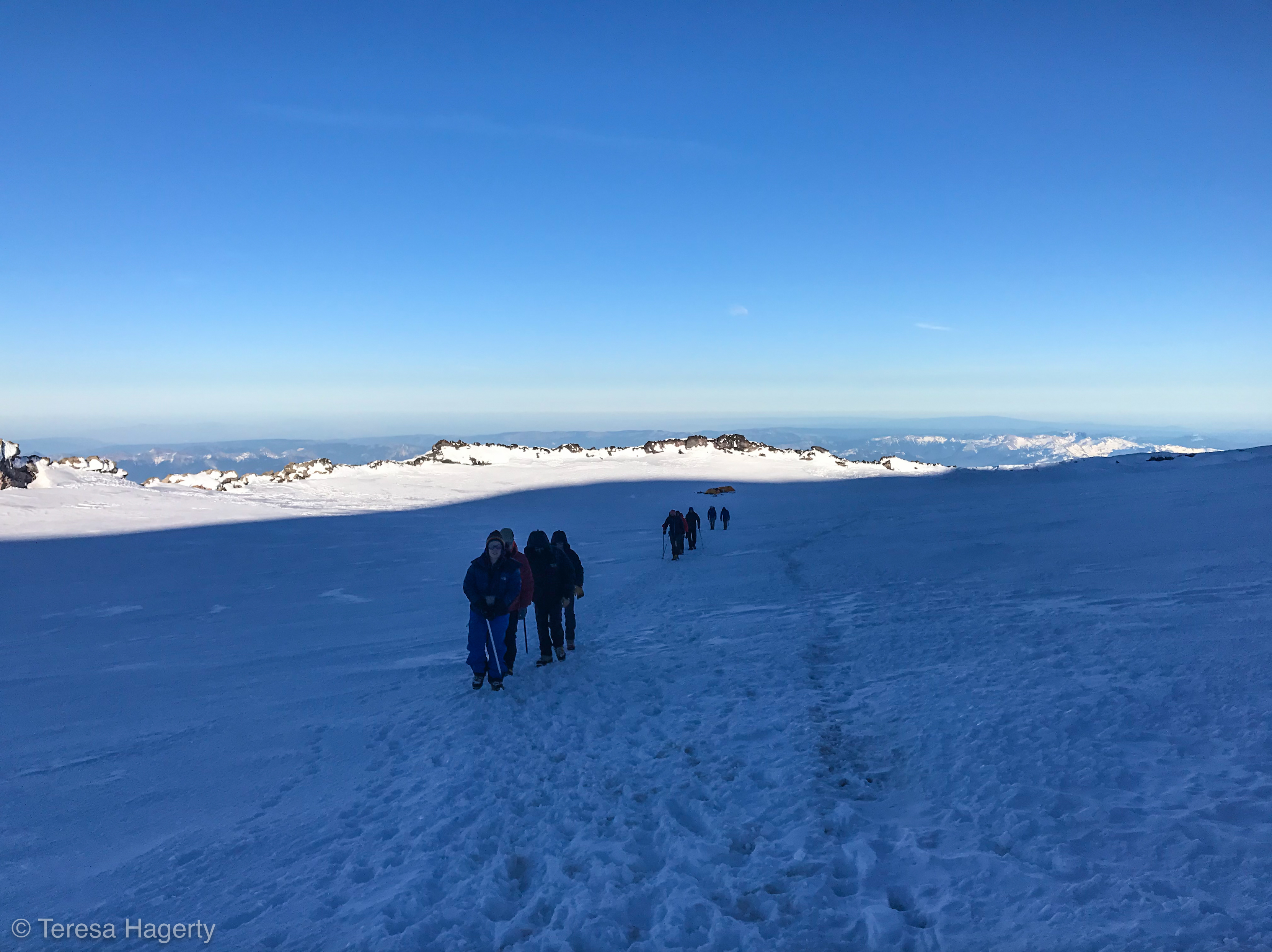
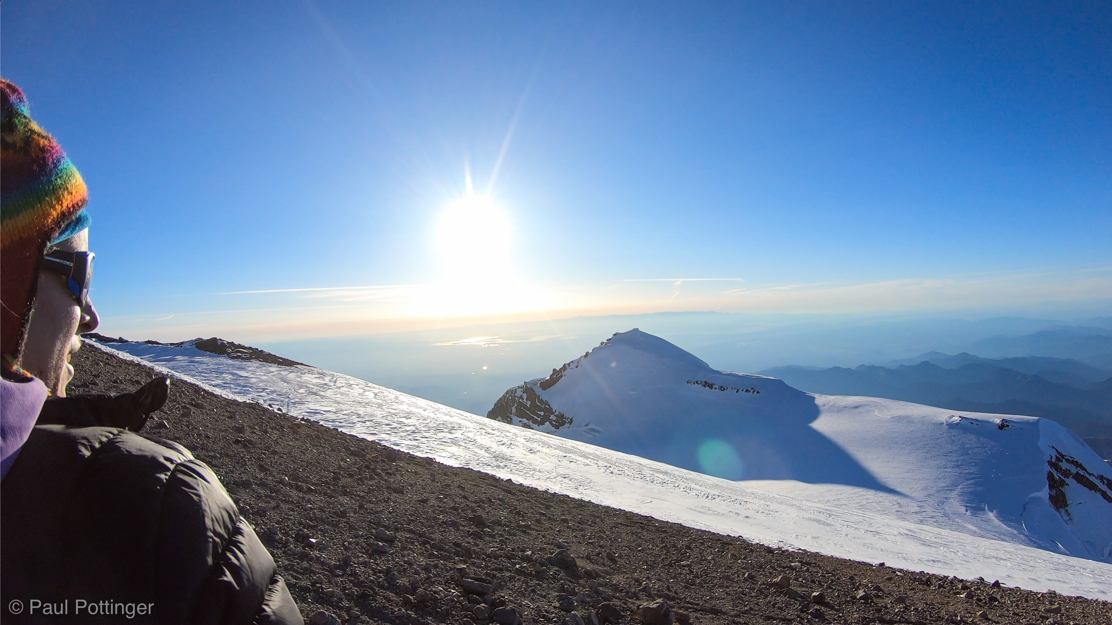
We were in the sun now, just perfect timing because the rest of the day promised to be steep glacier travel, no more ice climbing, which would make it easier to manage our temperature. The next objective sat in plain view: Camp Wapowety, a spot of snow atop a ridge of dark rock at the origin of the Wapowety Cleaver. That location meant lunch… and, if people felt baked, it could also be a spot to overnight. All we had to do was put one foot in front of the other, and we would make it. Beautiful, untrammeled snow on the upper Kautz greeted us, split periodically by crazy deep crevasses. The snow bridges seemed stout enough, and indeed they were. This section was incredibly beautiful, and very interesting because it brought a new view of the upper mountain into focus. Point Success, the false summit climbed by Kautz himself back in the day, grew closer and closer. The Kautz Headwall turned out to be just as steep as it had looked from below. The Cleaver seemed closer than it was… this is always the way up high, where terrain features provide precious little—or misleading—information about scale and distance. We made fine progress, and I guess it took us an hour or so to reach Camp Wapowety, which is just right.

Natalie likes the sunshine. A lot.
Natalie at the break after getting back onto the snow.
Scott, Justin, and Nickel nearing the top of the Chute.
Our teammates at a break atop the Ice Chute.
Rowers of Rohan at the top of the Chute.
Goonies during a break at the top of the Chute.
Welcome to the sunshine in Conrad’s belay spot.
Conrad enjoying the sunshine.
Conrad and T at the top of the Chute.
Selfie at the top of the Chute.
Getting ready to leave the Chute in our rear view mirror.
T$ is focused. Me, not so much.
Looking back at our route from the top of the Chute. Camp Hazard is nestled in the dark rocks atop the ridge at bottom center.
Looking back as we near the top of the Chute.
The Kautz Ice Chute deserves a shaka, for sure.
Looking back at the route we just climbed.
Rowers of Rohan ascend the top of the Chute.
Taking in the view from my position at anchor.
A whopper, seen from snowbridge crossing.
We head up towards Wapowety.
A big crevasse, and the nose of Wapowety Cleaver beyond.
Making progress on the snow slope above the Chute. Ken is about to cross a snow bridge in this view.
Threading our way between the crevasses.
Ascending above the Chute, Wapowety Cleaver in distance. Camp Wapowety on the ridge at center screen.

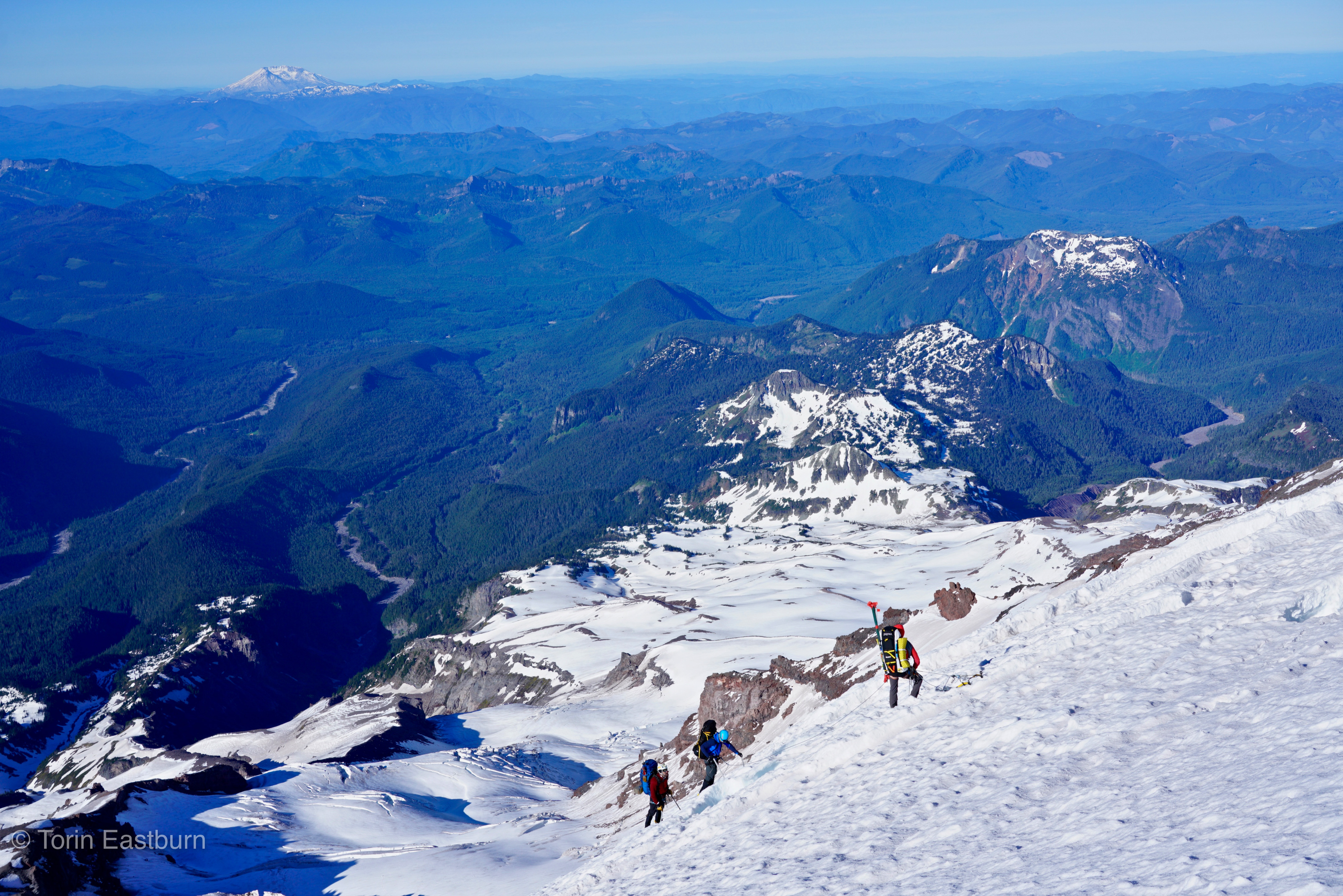
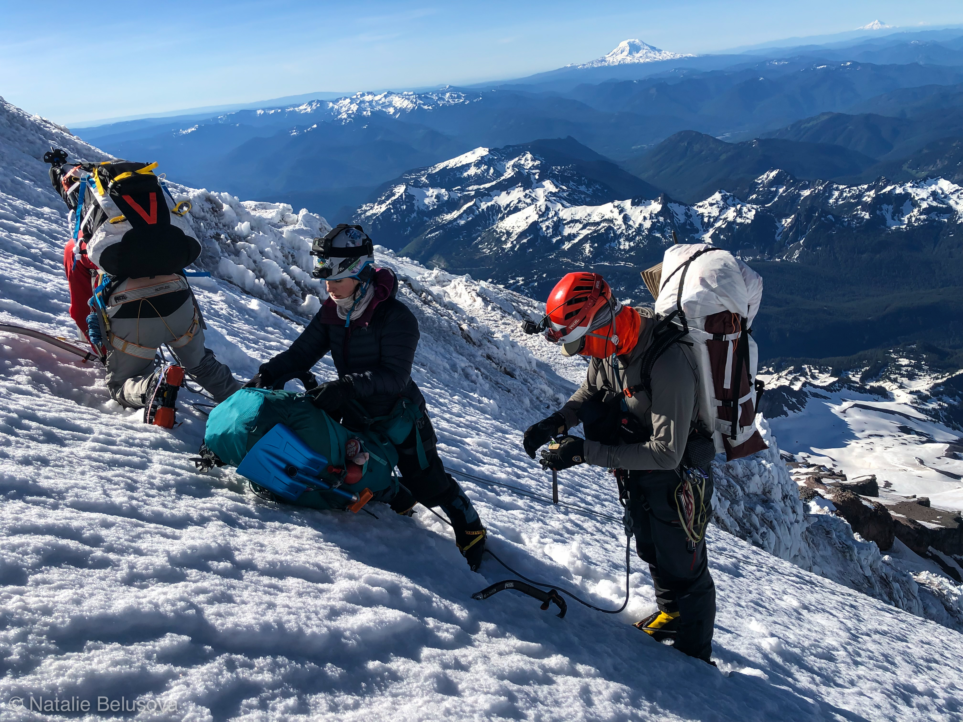
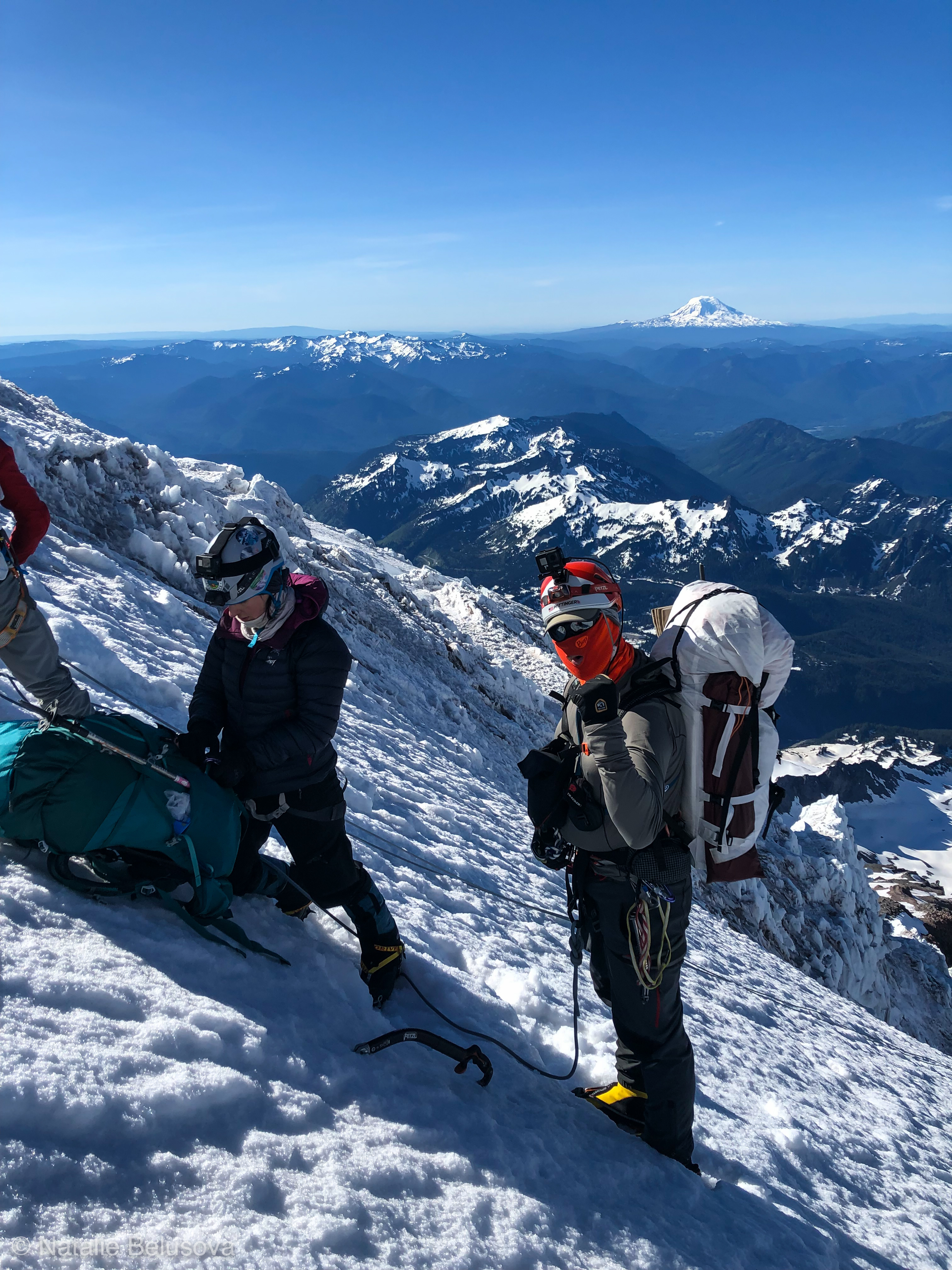
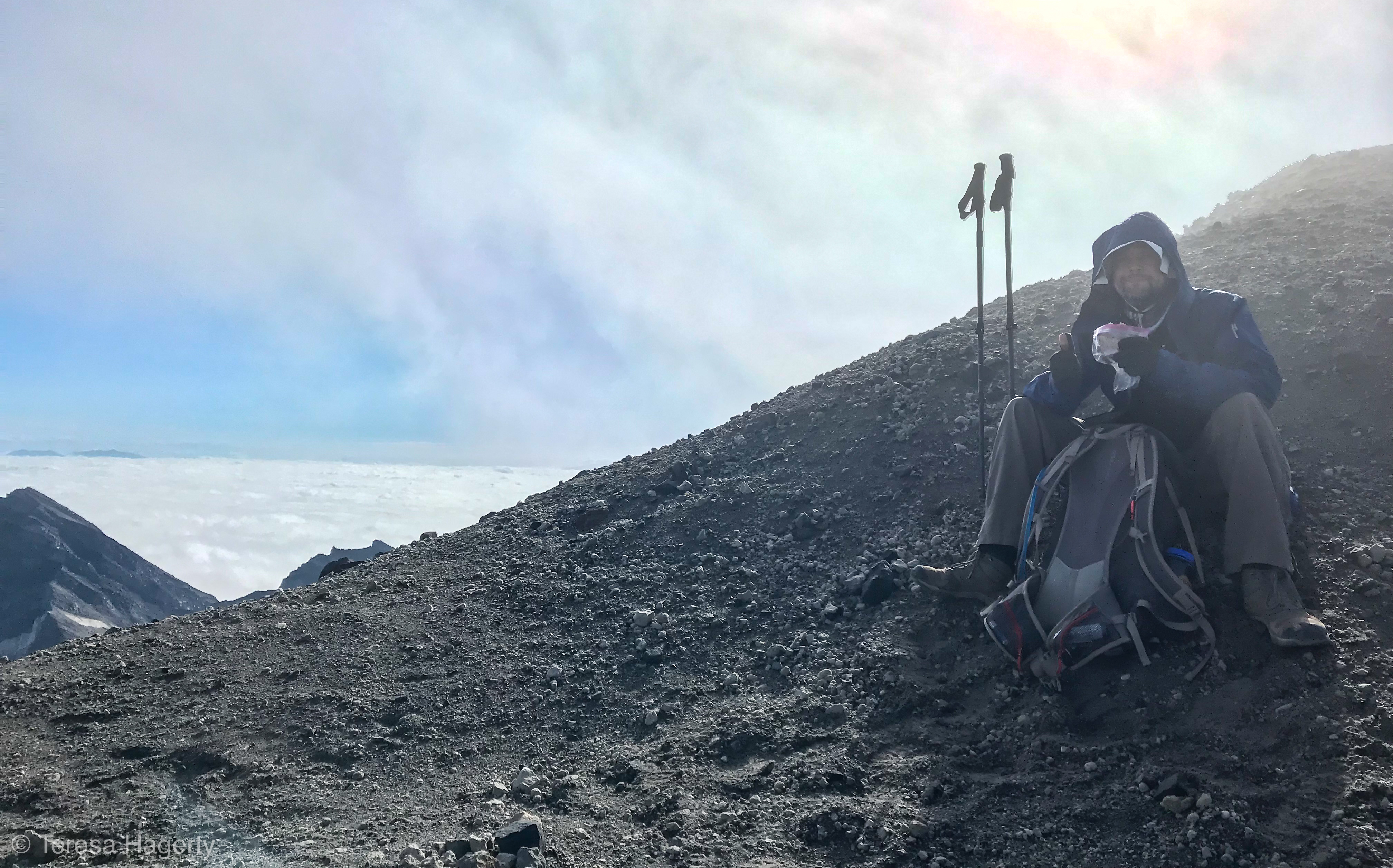
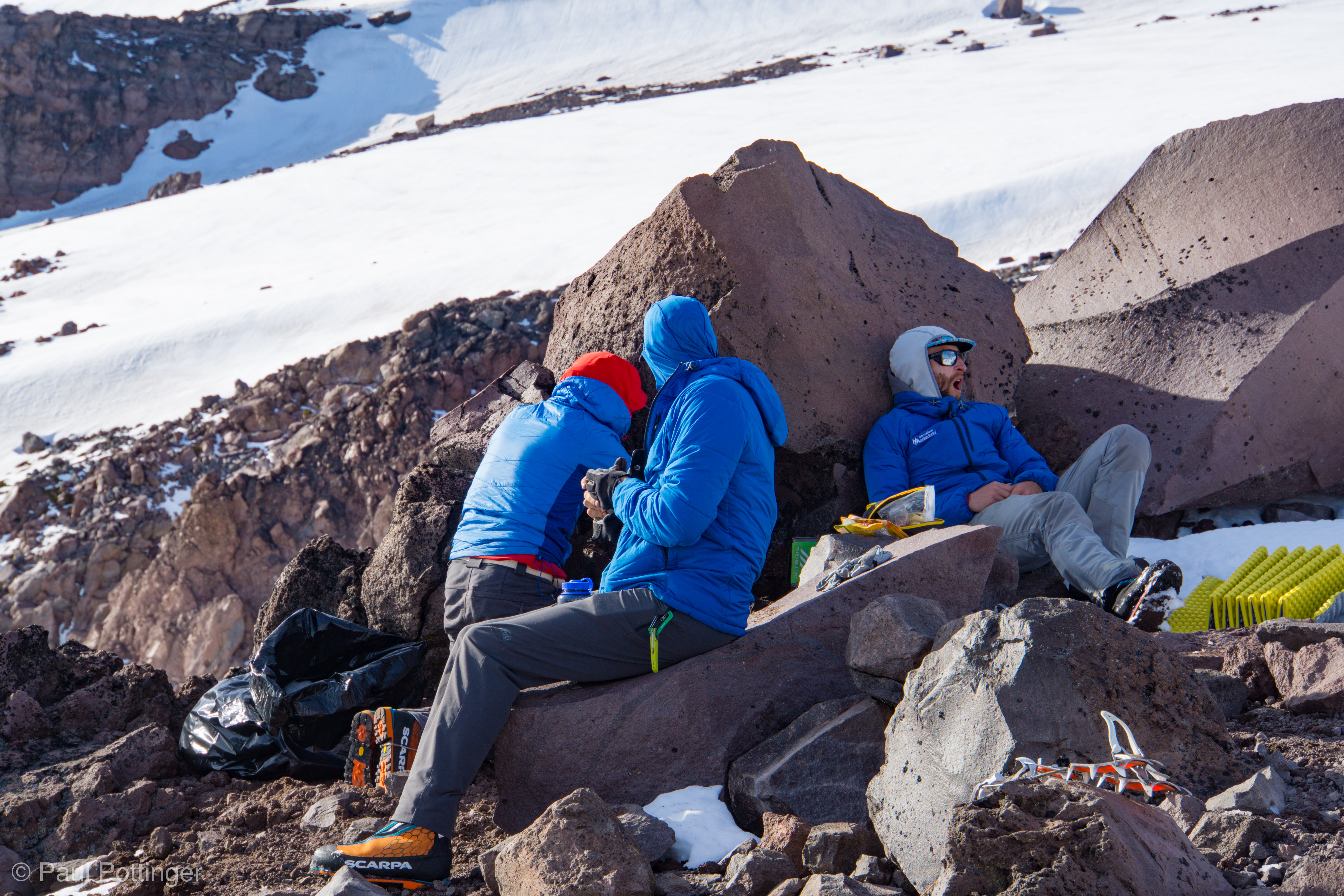
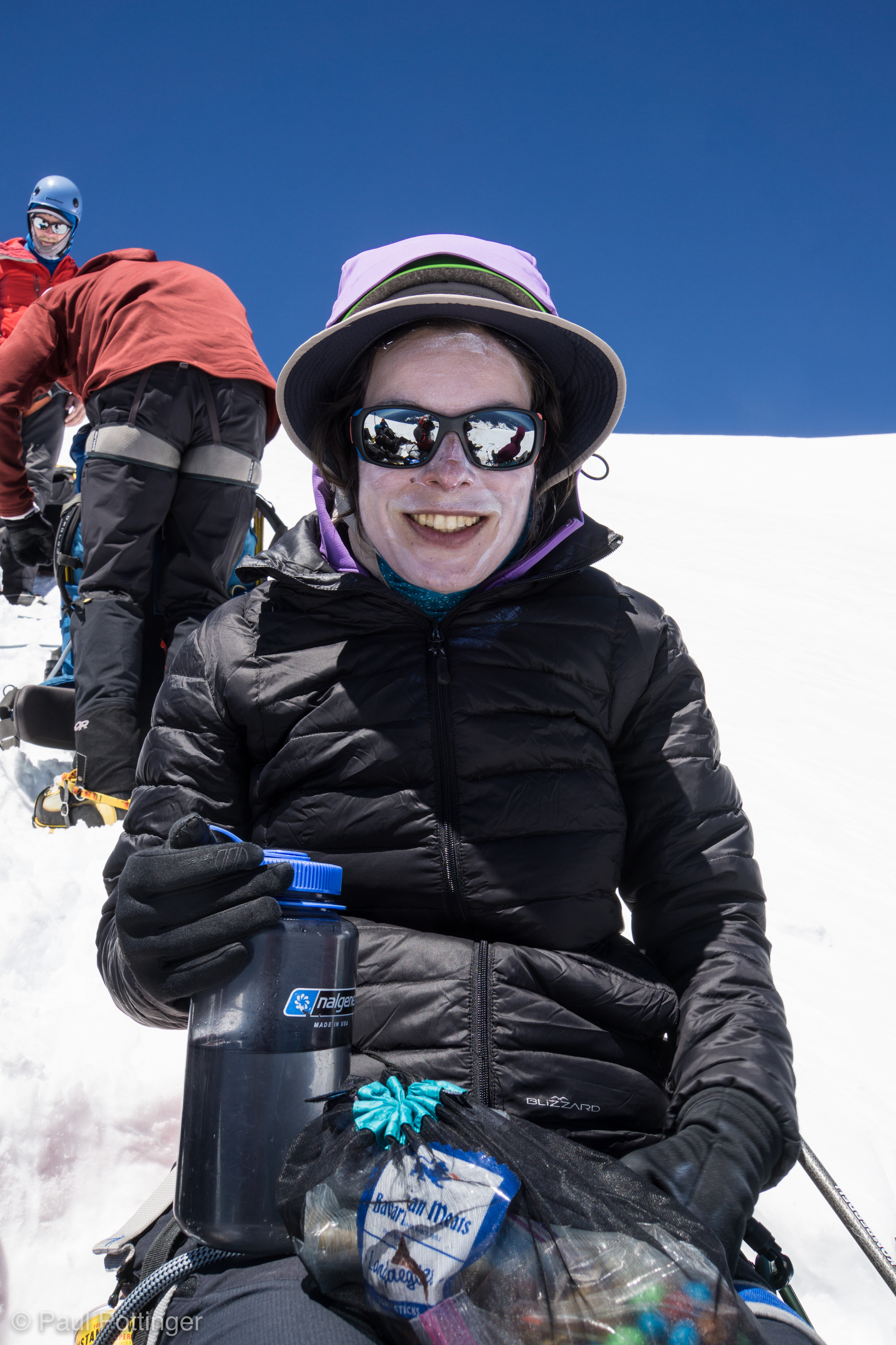
By the time we pulled in, the pack felt heavy and I was ready for a break. We had climbed 2,000 feet since leaving Hazard, and I was starting to feel it. Lovely spot for a break: Broad, unobstructed views for miles and miles, and plenty of room to stretch out and eat, drink, and rest. A rock band served as a makeshift latrine. It was a bit breezy, but just a bit, and in fact I was able to get my boots and socks off for about 10 minutes. By the time I got them back on, the socks were dry and my feet had begun to burn in the sunshine.

Keith enters Wapowety.
Natalie enters Wapowety, Rowan behind.
Ken walks into Wapowety.
Torin at Wapowety.
The team arrives at Camp Wapowety.
Teresa pounds with Conrad at Wapowety.
Fists of Power and Glory….
Break at Wapowety.
Our break at Wapowety, seen from the latrine.

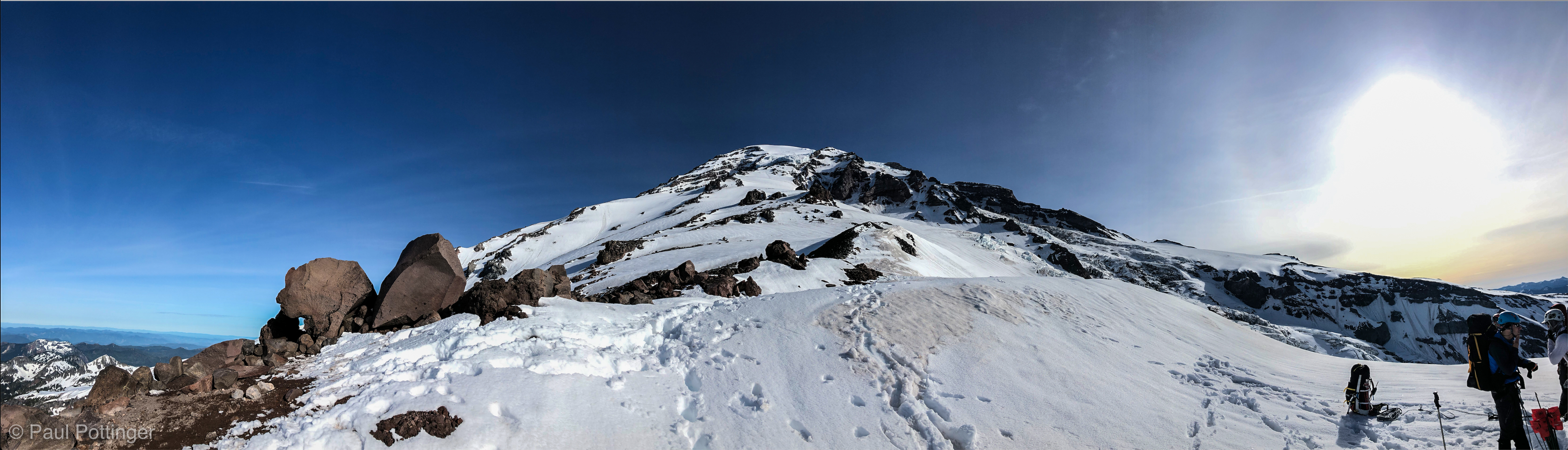
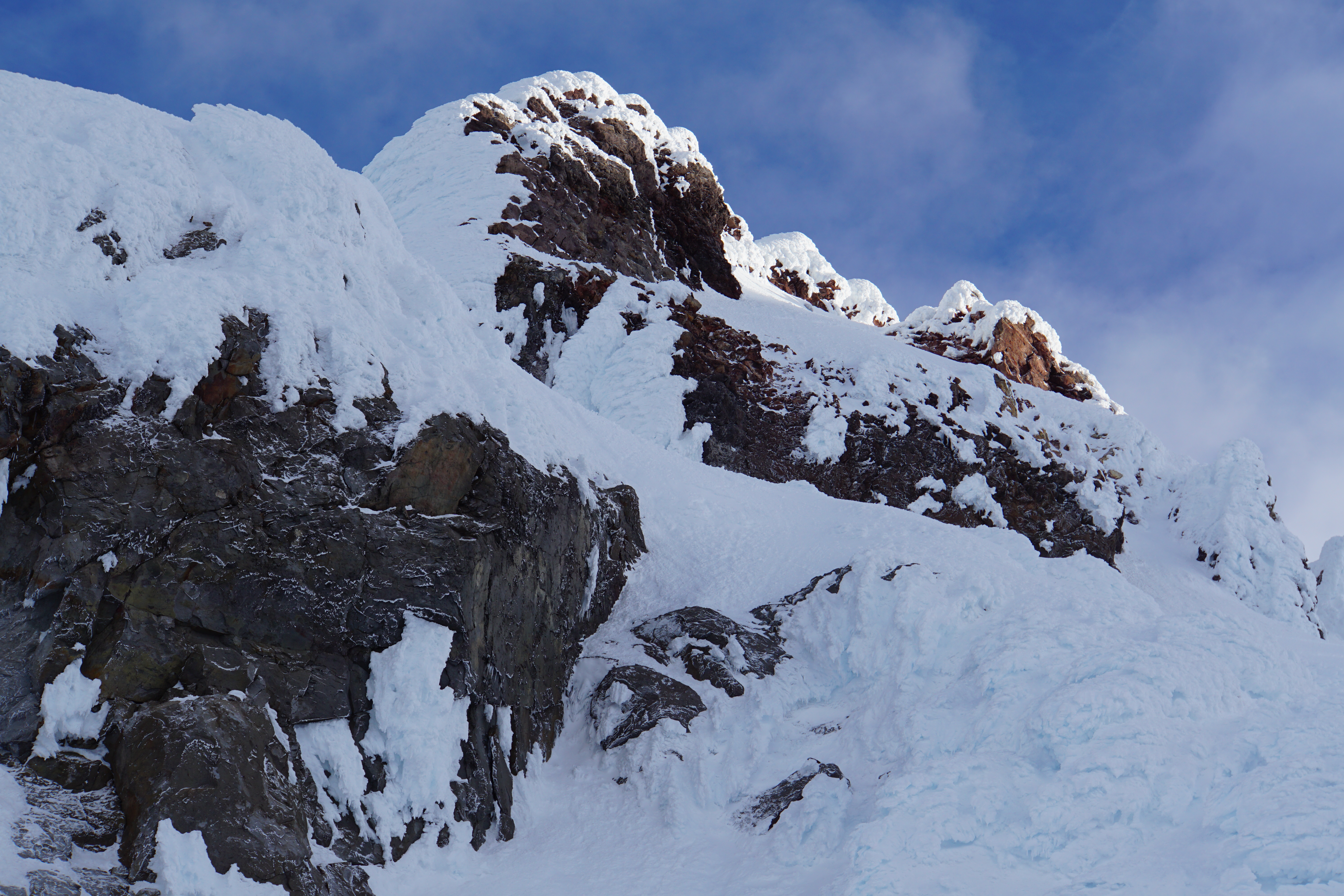
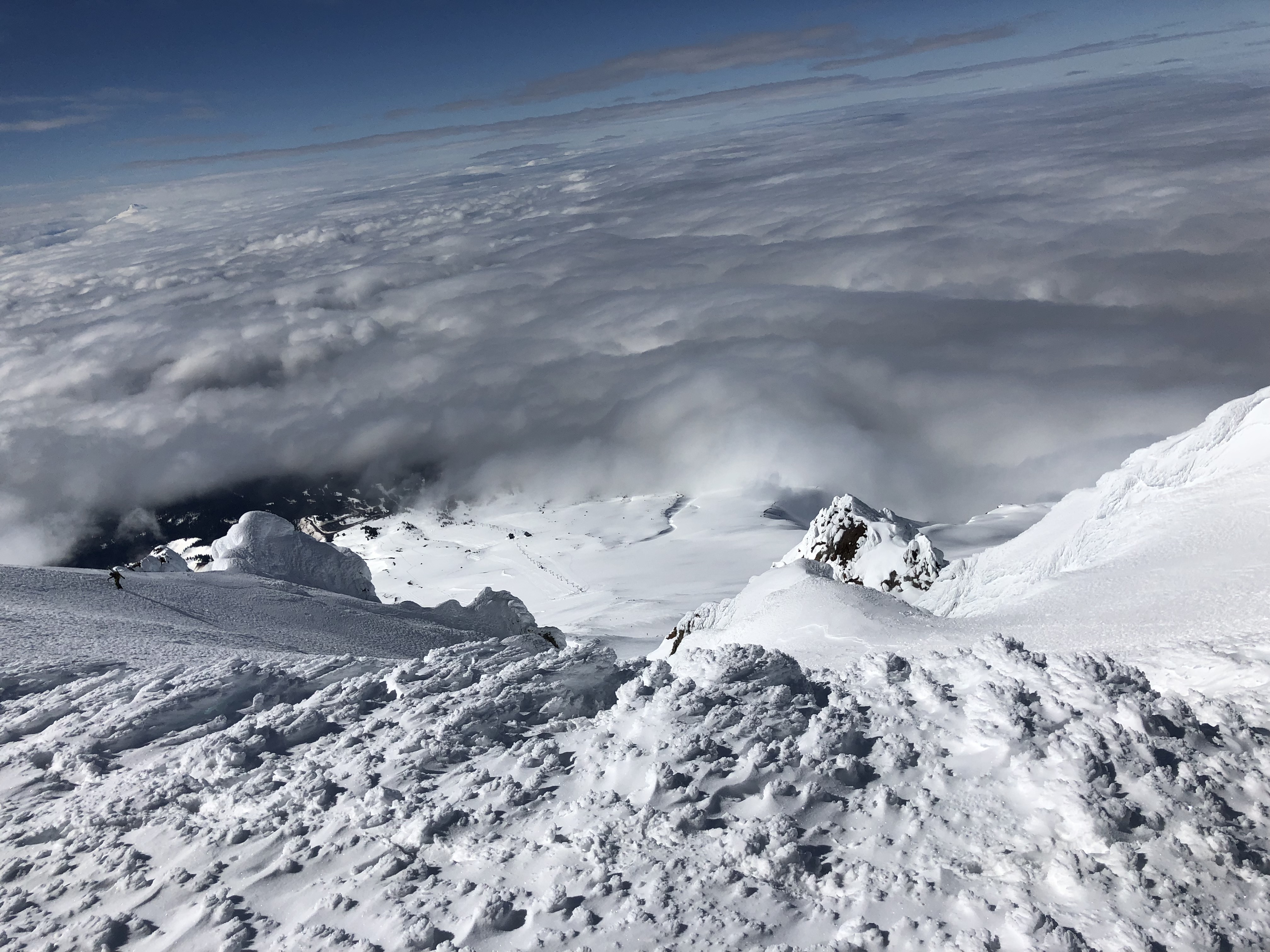
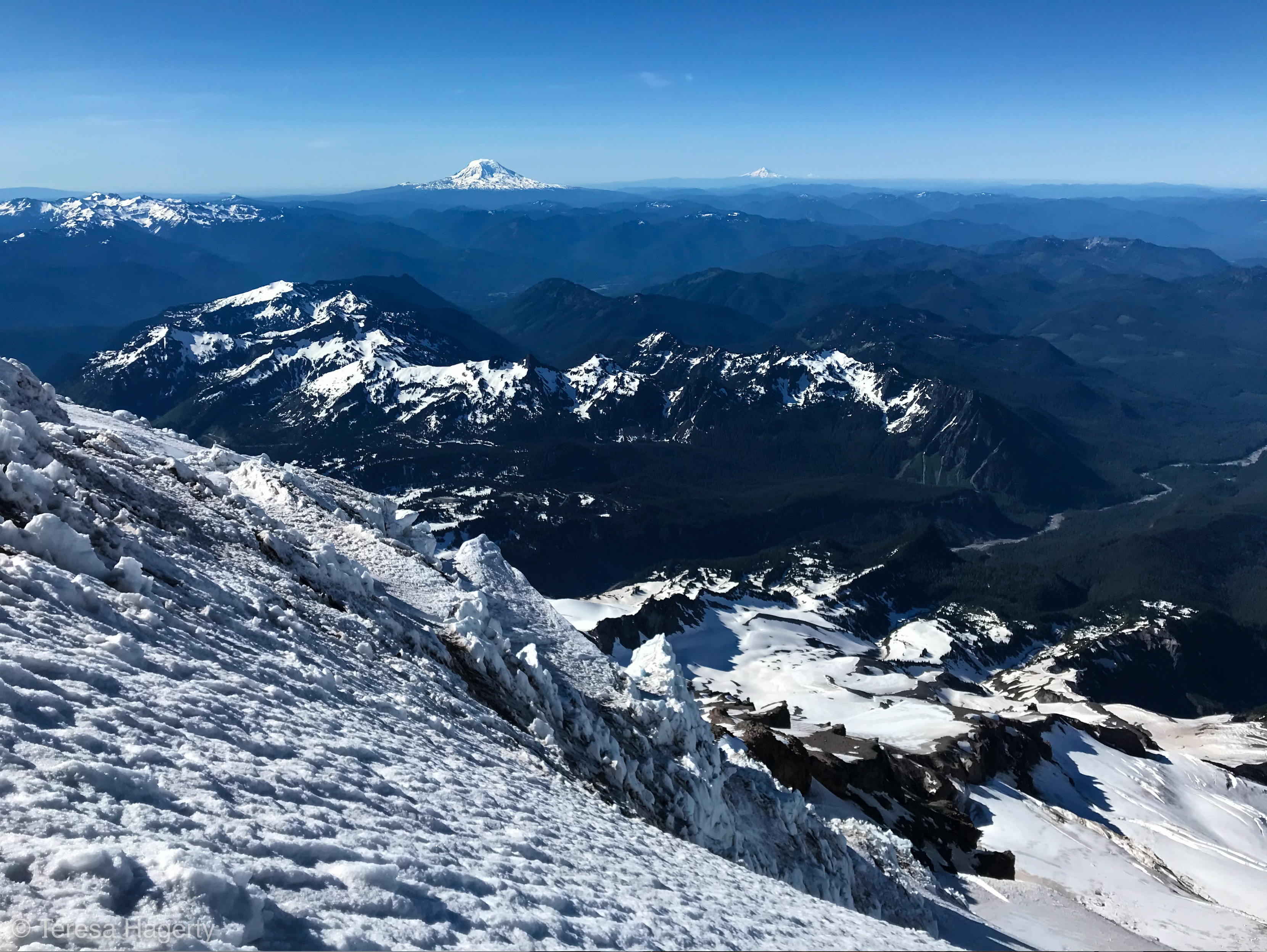
Behind us, the upper mountain awaited… we could see a rim of dark rock above, which must certainly be the crater rim. It looked close enough to touch, less than an hour away.

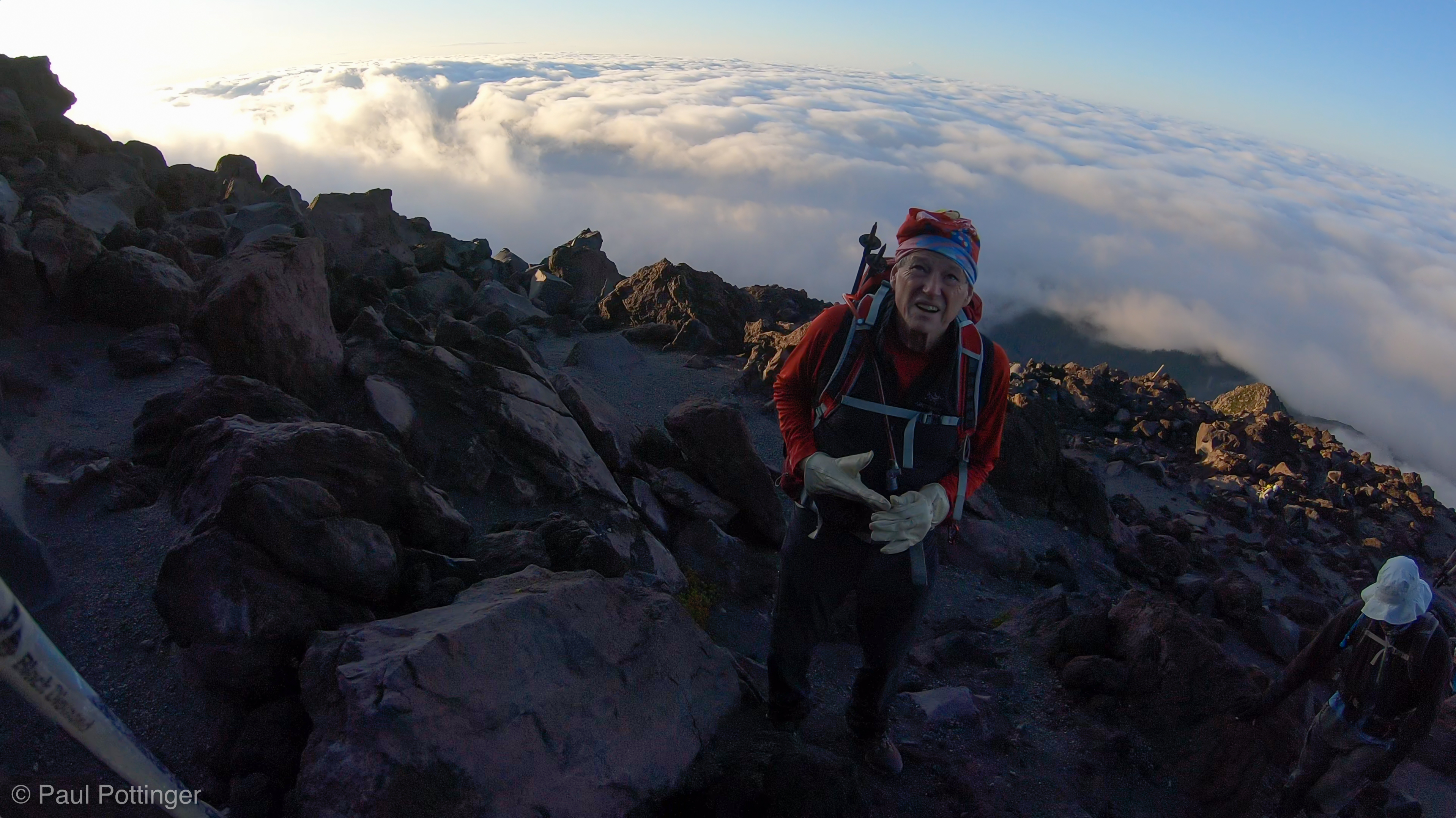
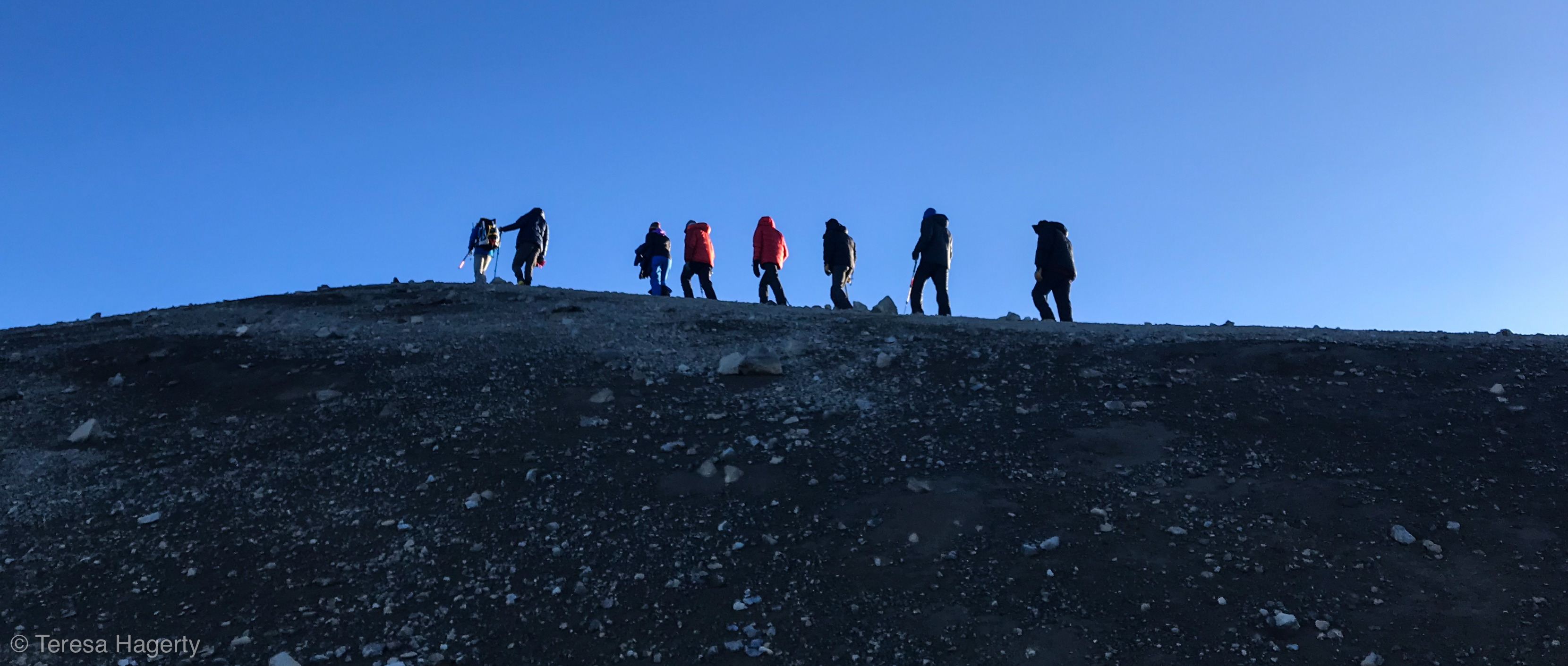
But, this was an illusion of course. Those last 1,200 feet are not easy. We navigated between seracs above Wapowety Cleaver, then began climbing the upper Nisqually Glacier. It felt familiar, so similar to my prior 5 climbs on this mountain… and, just like on the other two routes I have climbed, this one was deceptively long. When the guides called for a break after an hour, I was truly surprised. Food and water are always welcome, but I was eager to simply make the top. The crater’s just there…. Do we really need to take a break?

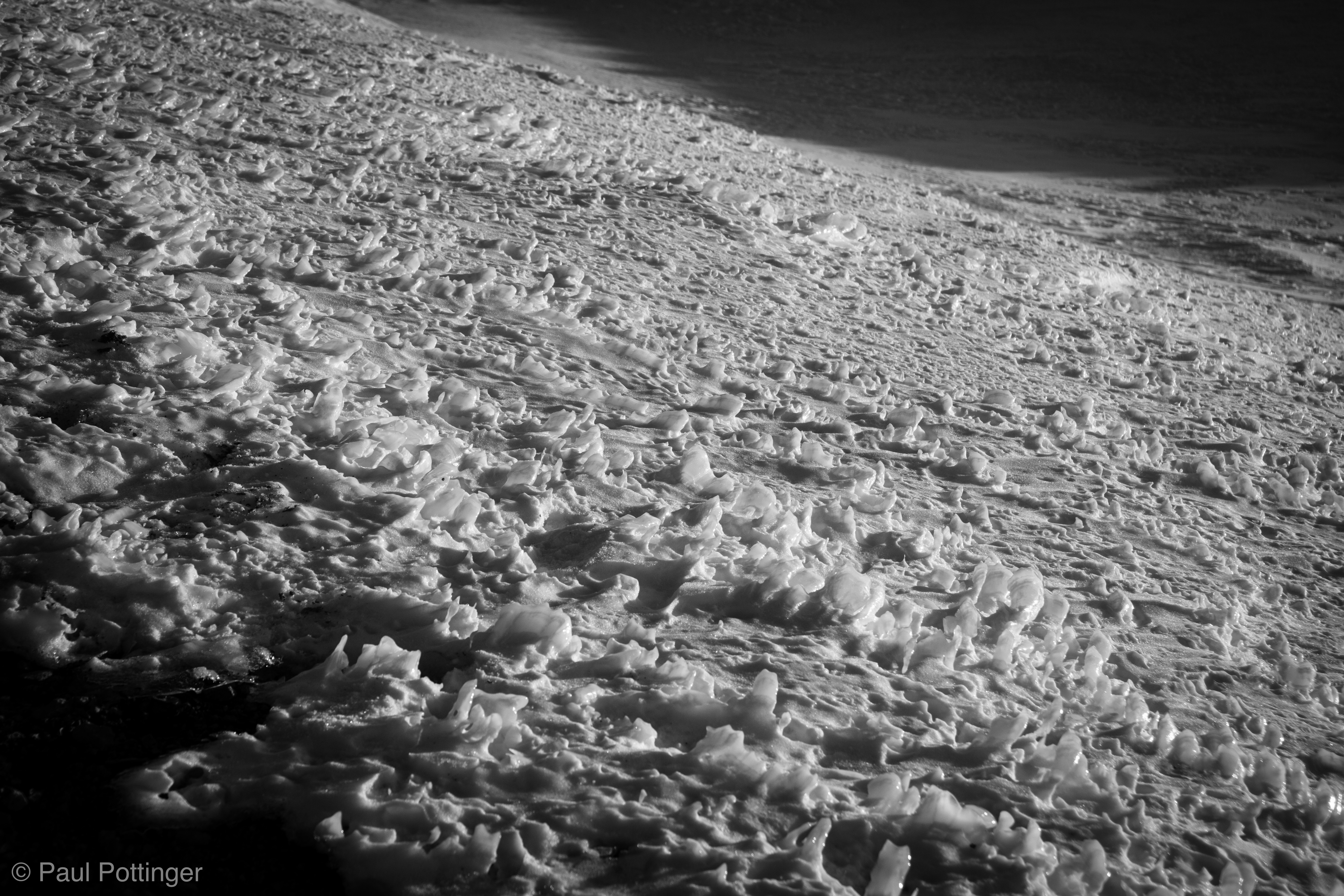
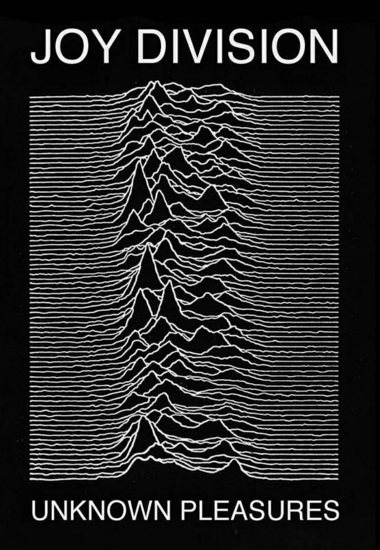
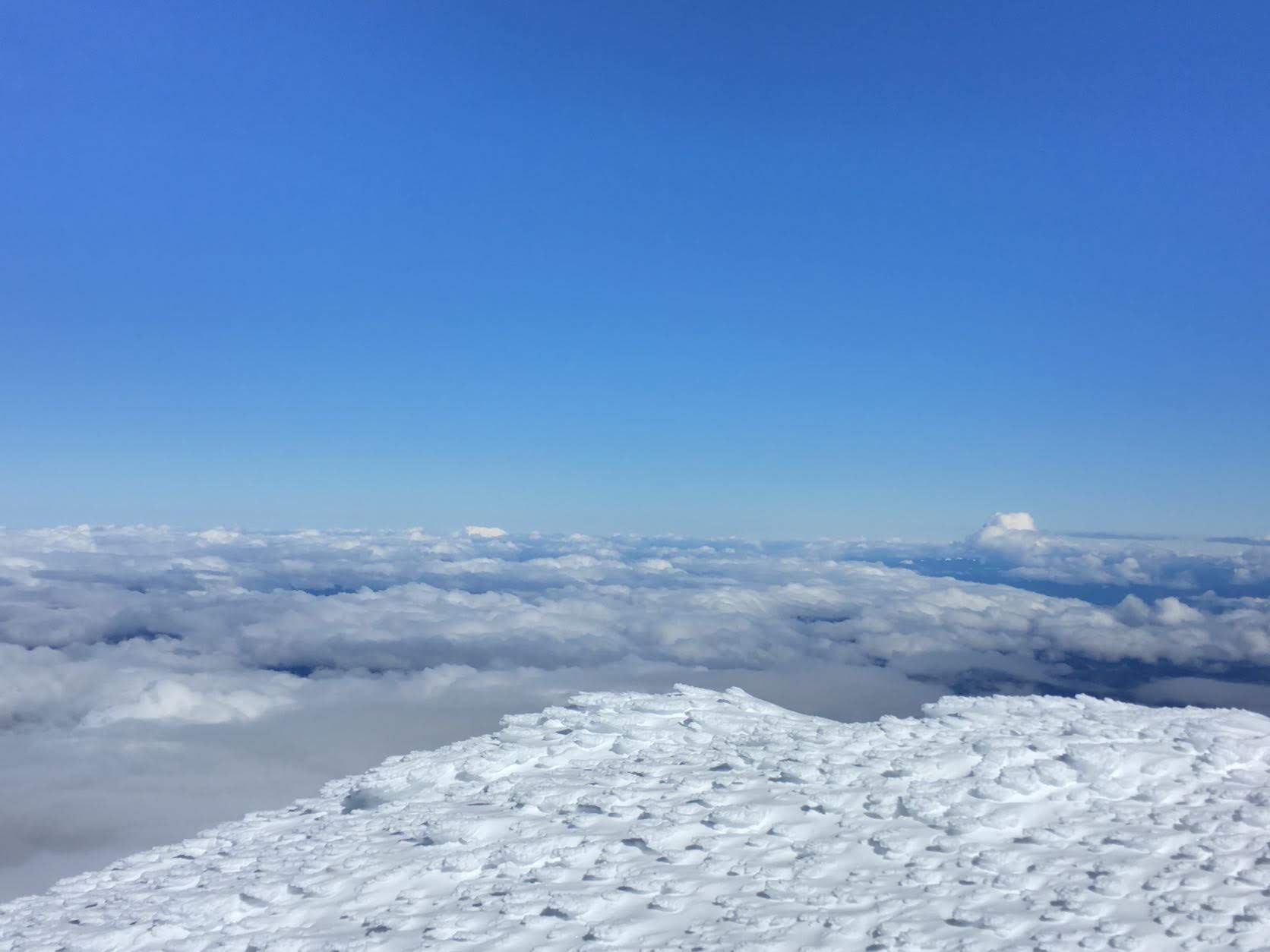
As it turned out, about an hour remained. During this final stage of the climb I allowed my mind to drift to a place it has gone before. As a child, perhaps 6 and 7 years old, I studied Barry Bishop’s photographs of Everest in National Geographic, and watched mountaineering documentaries on TV… I imagined the mountains as a foreign environment of snow, rock, cold, danger, oxygen cylinders, goggles, fear, joy, challenge, homesickness, and searing vividness—a vision so sharp and clear that it played like an Imax film in my mind. Often, in these visions, I was dying, or helping someone in trouble. All these decades later I sometimes have flashes of those early mountain impressions. They are not always disturbing, but… odd. And searing. When climbing Everest and other tall peaks, on occasion, I have seen myself from above, at oblique angles, revealing for a moment the context of our surroundings, and the audacity, even the madness—sheer, unbridled madness—of what we are doing. I usually shoo these visions away. Today, I allowed them to linger during the final steps to the crater rim. Mountaineering is joyful, but also painful, difficult, time-consuming… perhaps moments of introspection are part of the entire experience. The sastrugi were remarkably beautiful here—they looked exactly like the cover from Joy Division’s Unknown Pleasures. The sky was an unexpectedly deep, unbroken blue. We are just minutes away from the Crater. Take it in.

Looking up from the break at Wapowety. Point Success on the left, Crater Rim on the right.
First steps out of Wapowety.
Crevasses await us above Wapowety.
Ascending a large glacier above Wapowety.
Making upward progress above Wapowety.
Final break of the day. The brown rock near my head is the top of the Nisqually Cleaver.
Natalie at the final break.
T and Conrad at our final break before the Crater.
Last steps before the Crater rim.
Introspective on the final pitch before the Crater.

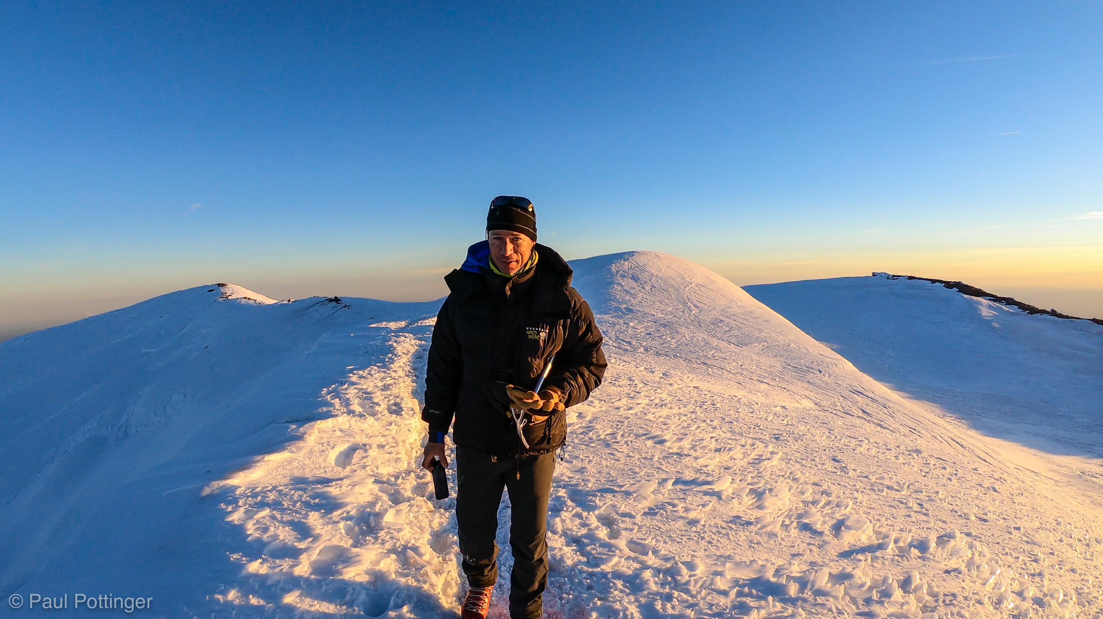
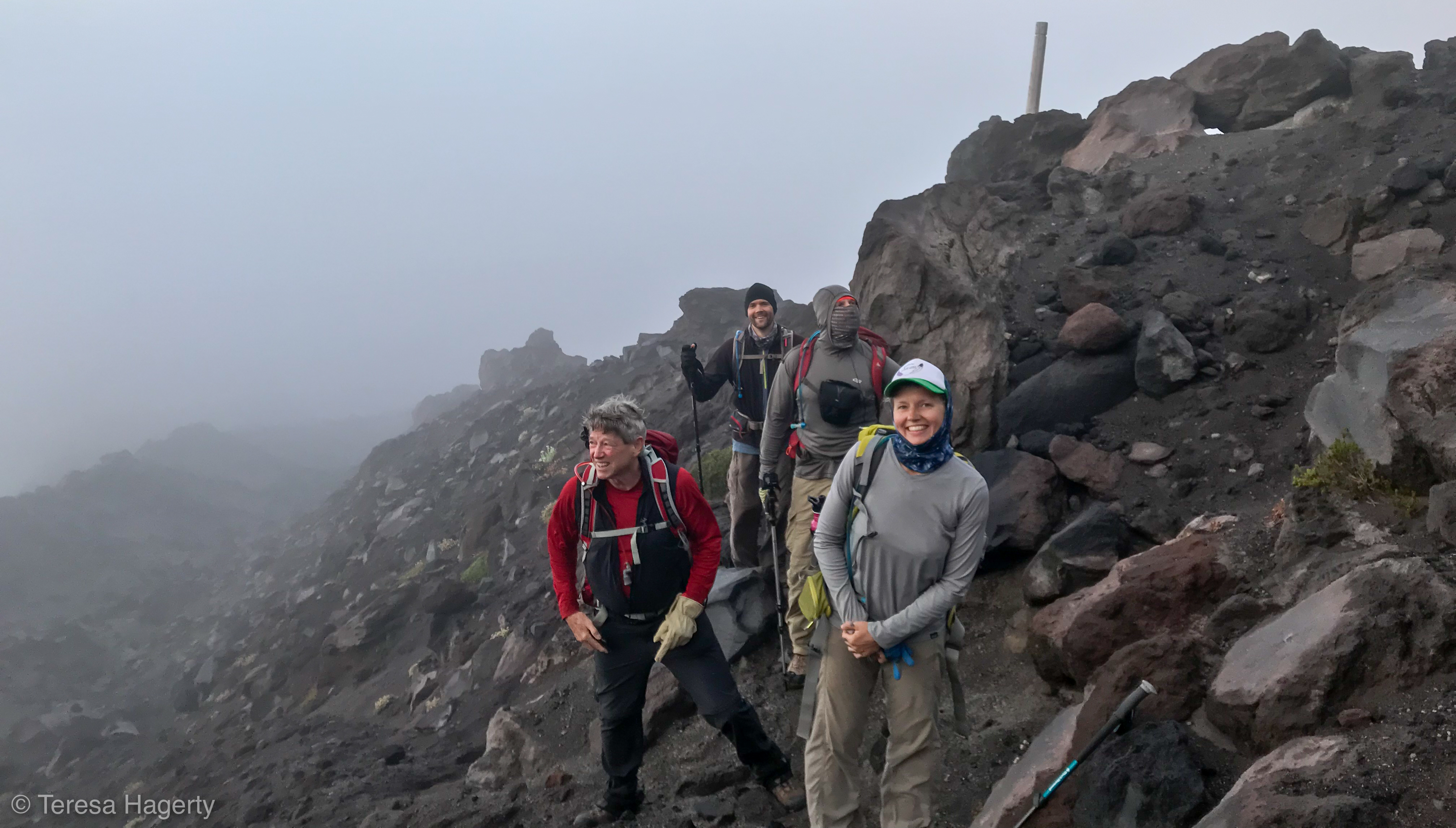
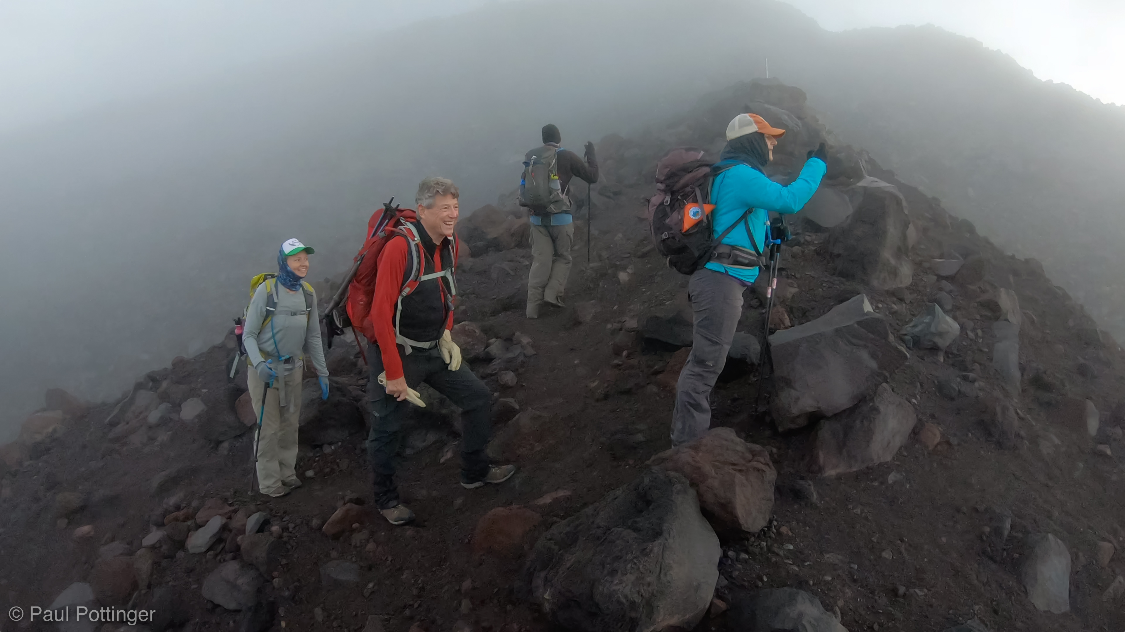
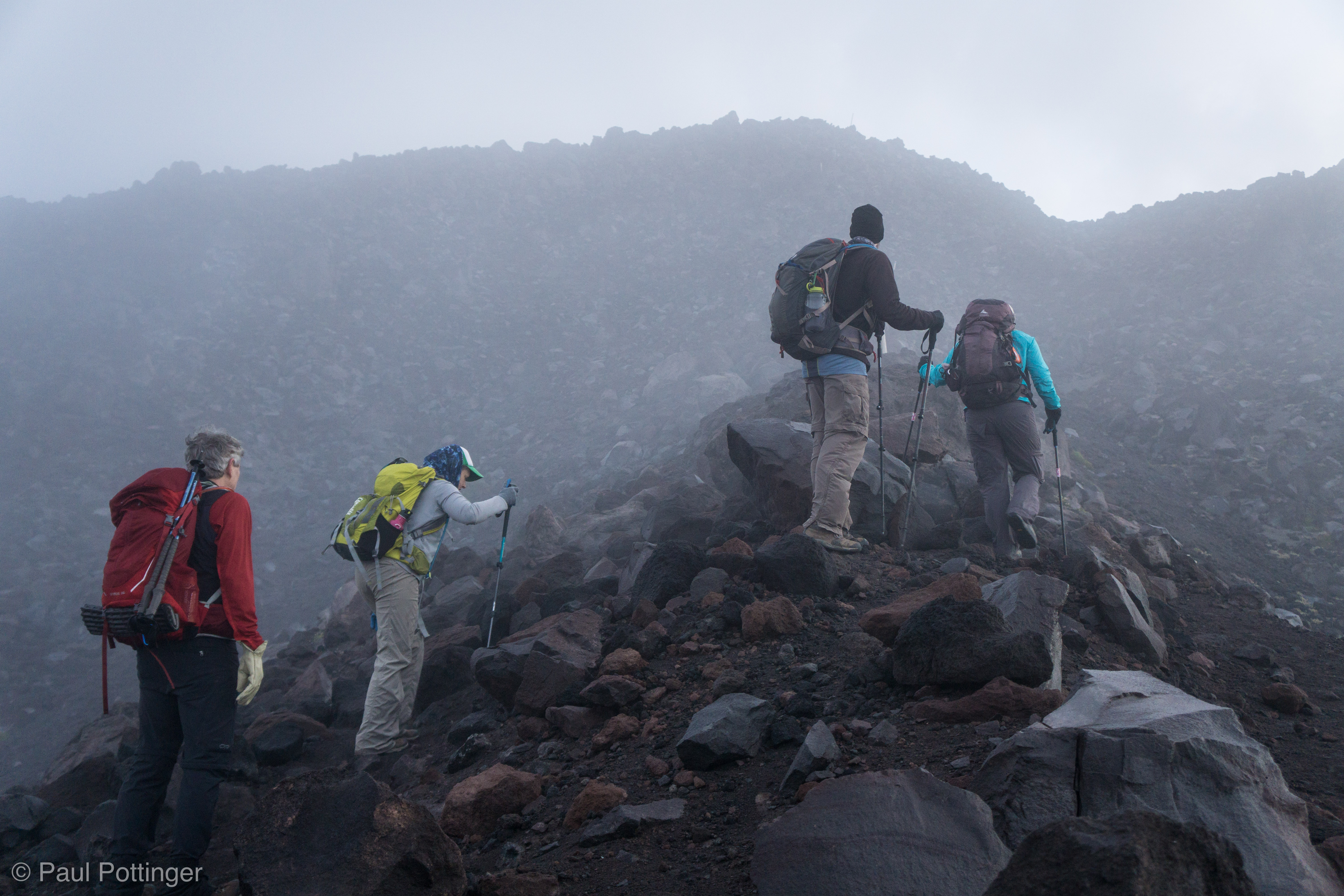
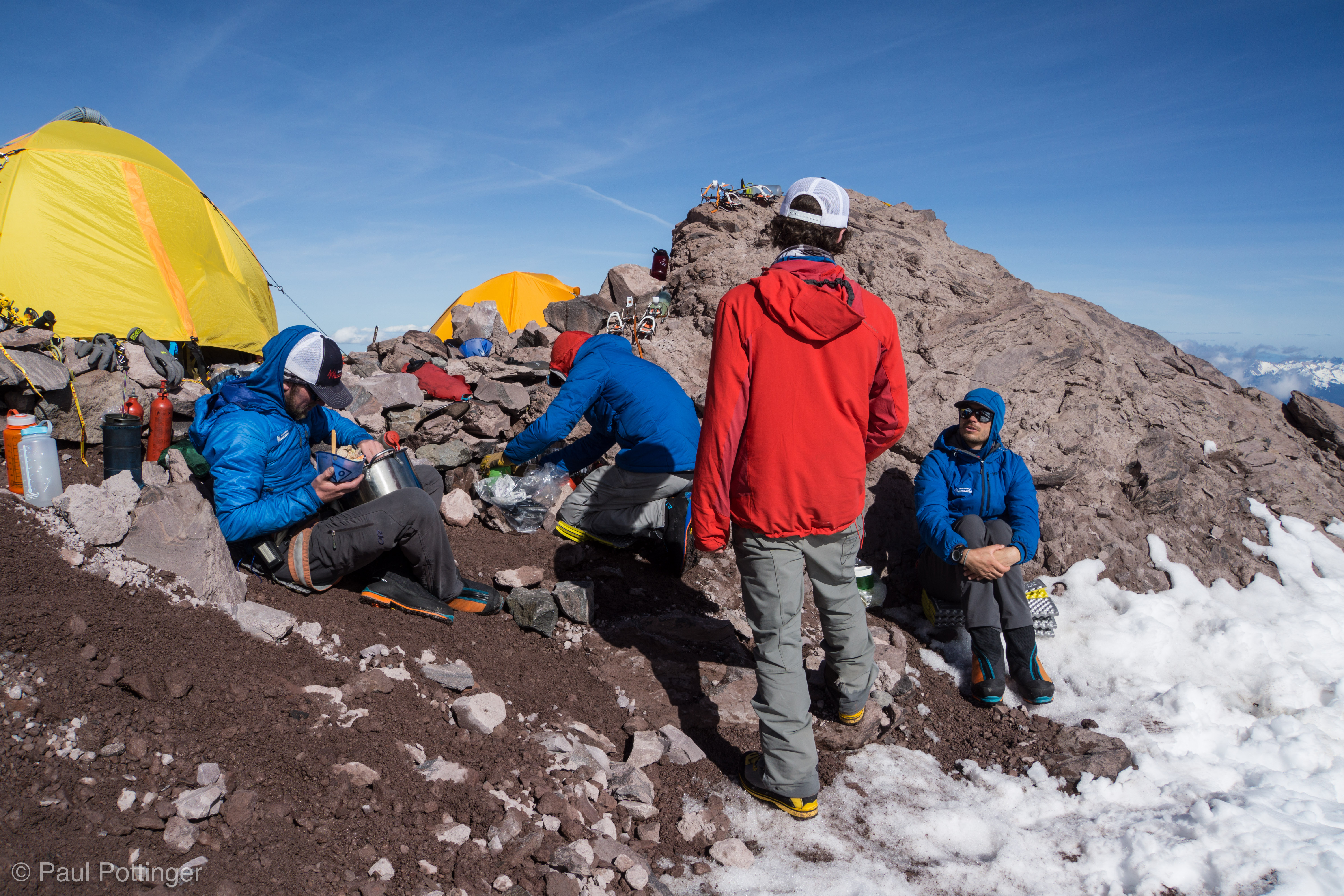
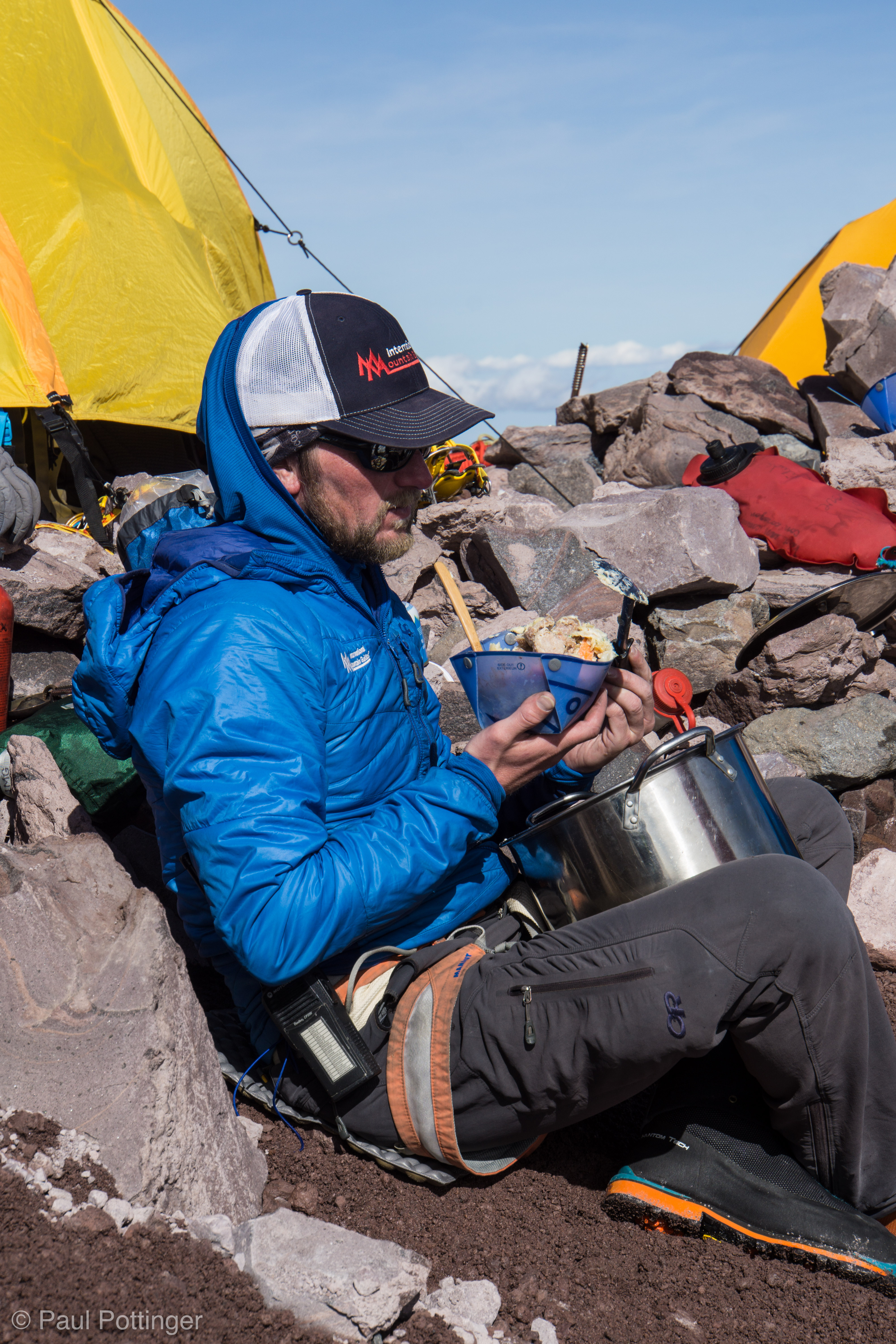
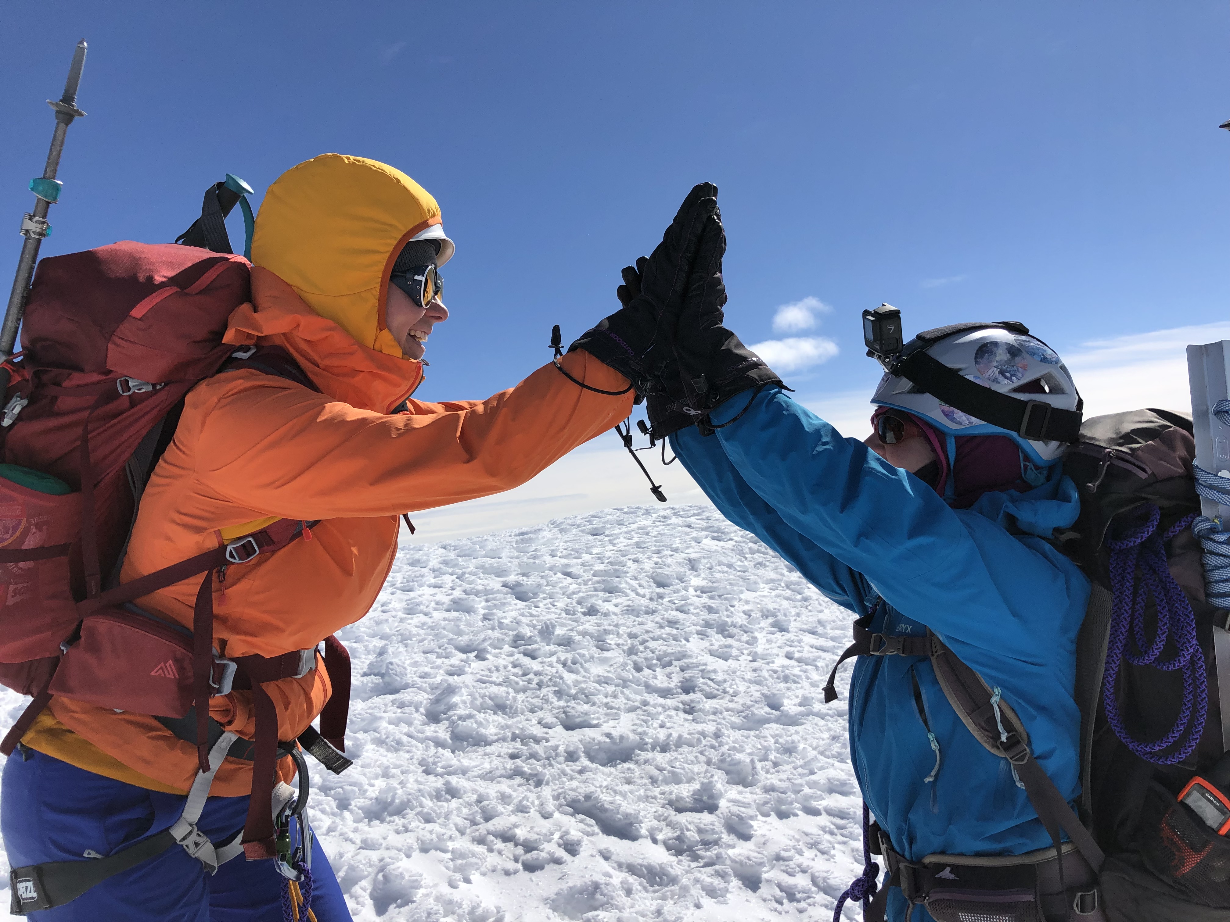
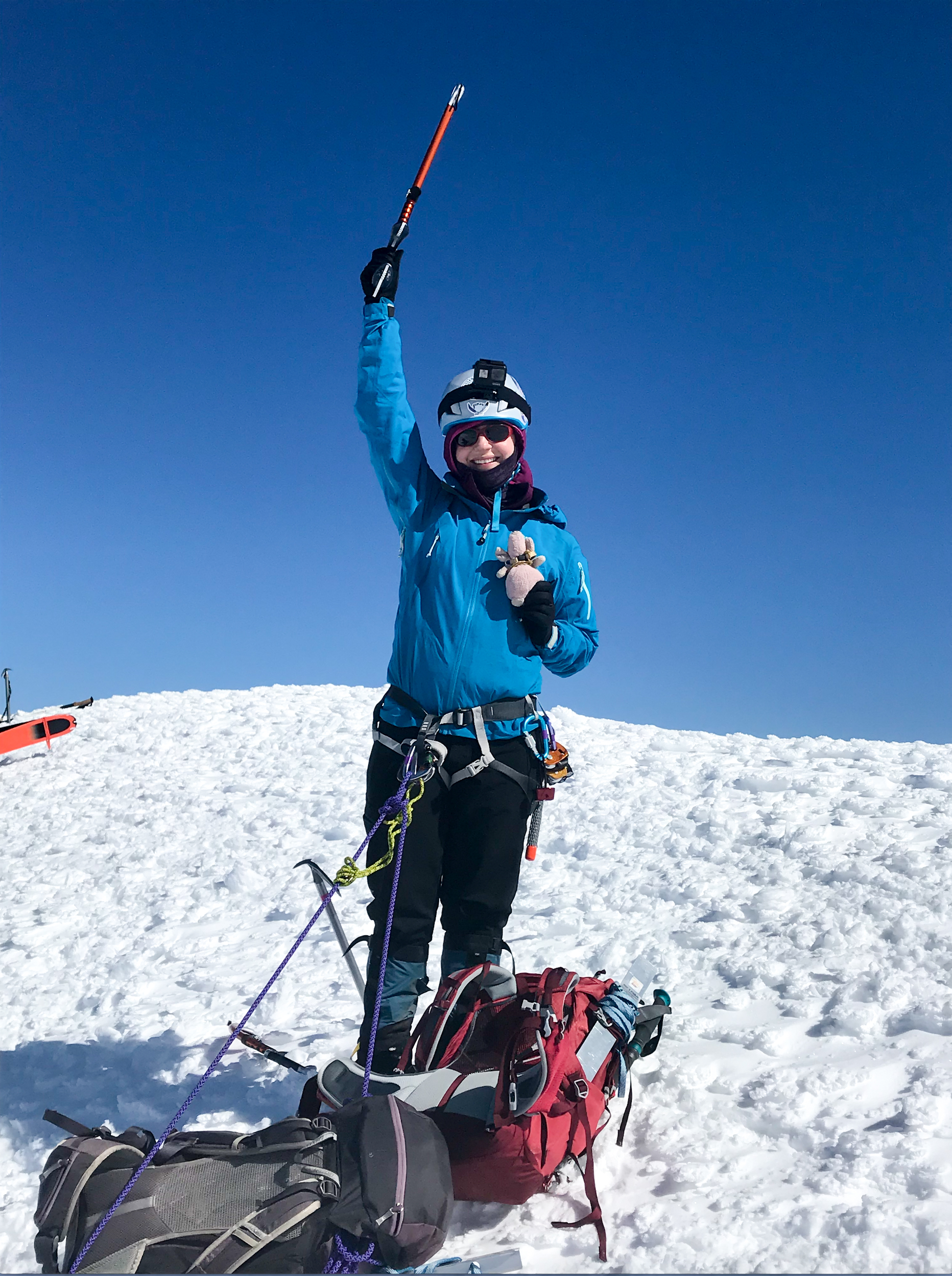
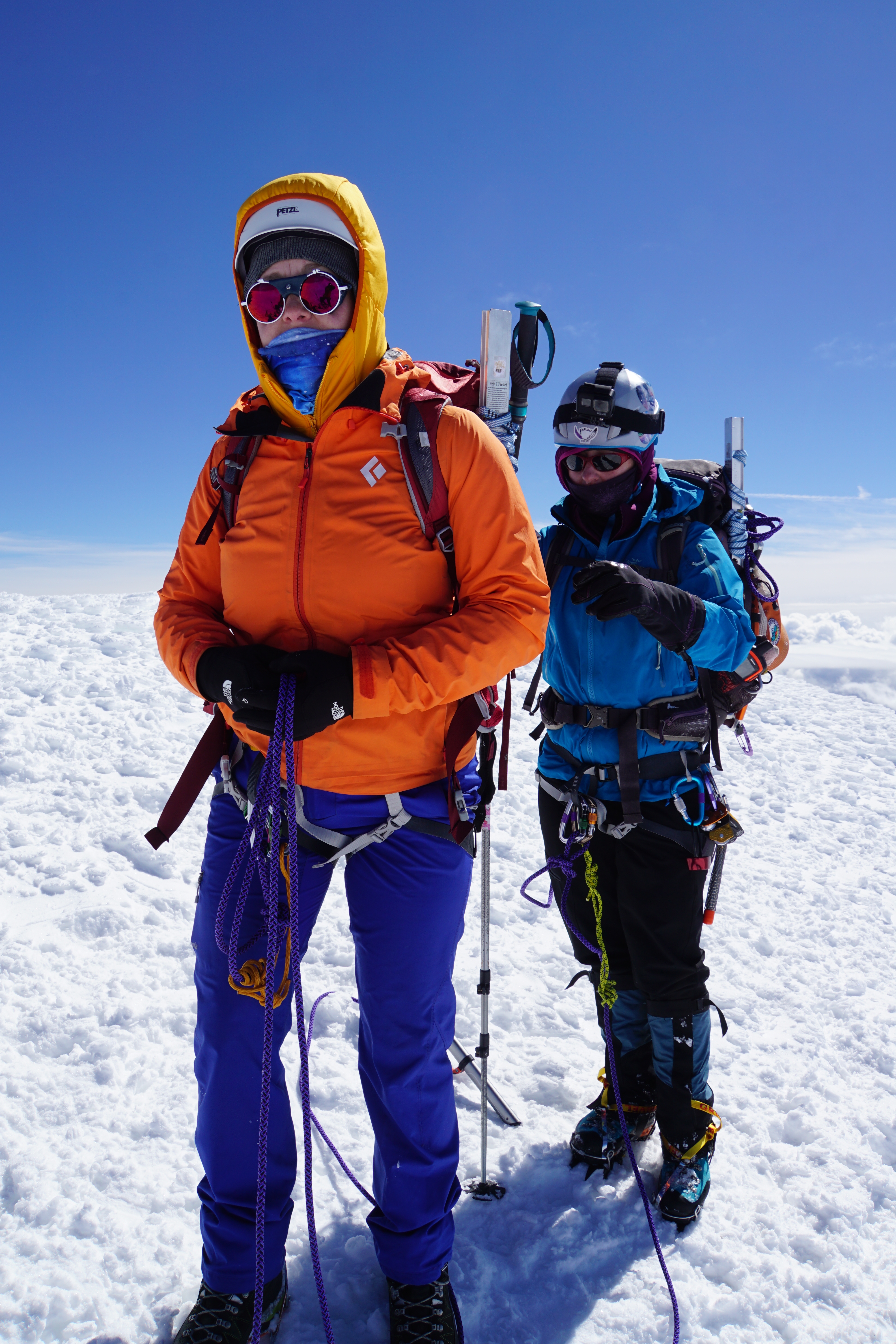
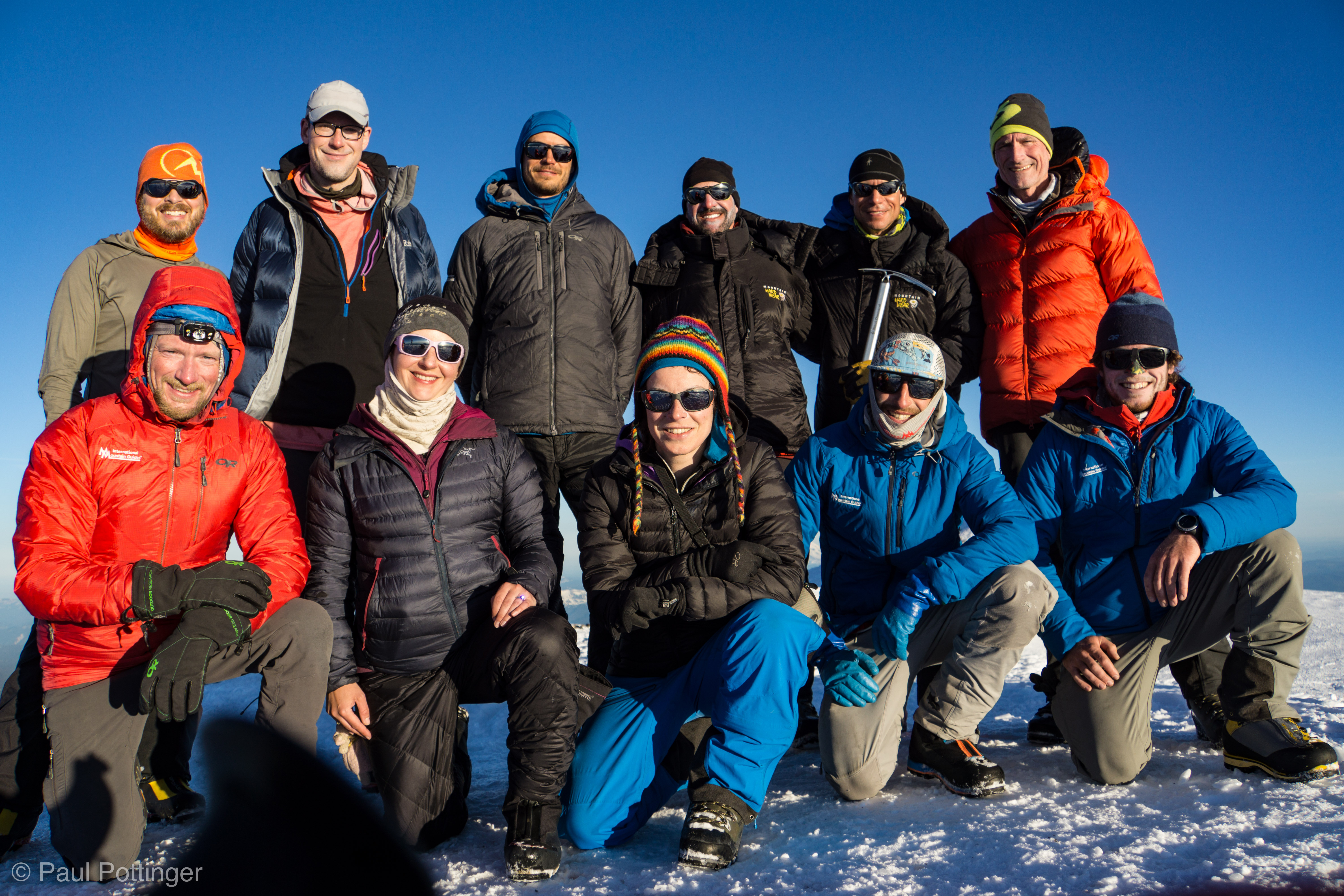
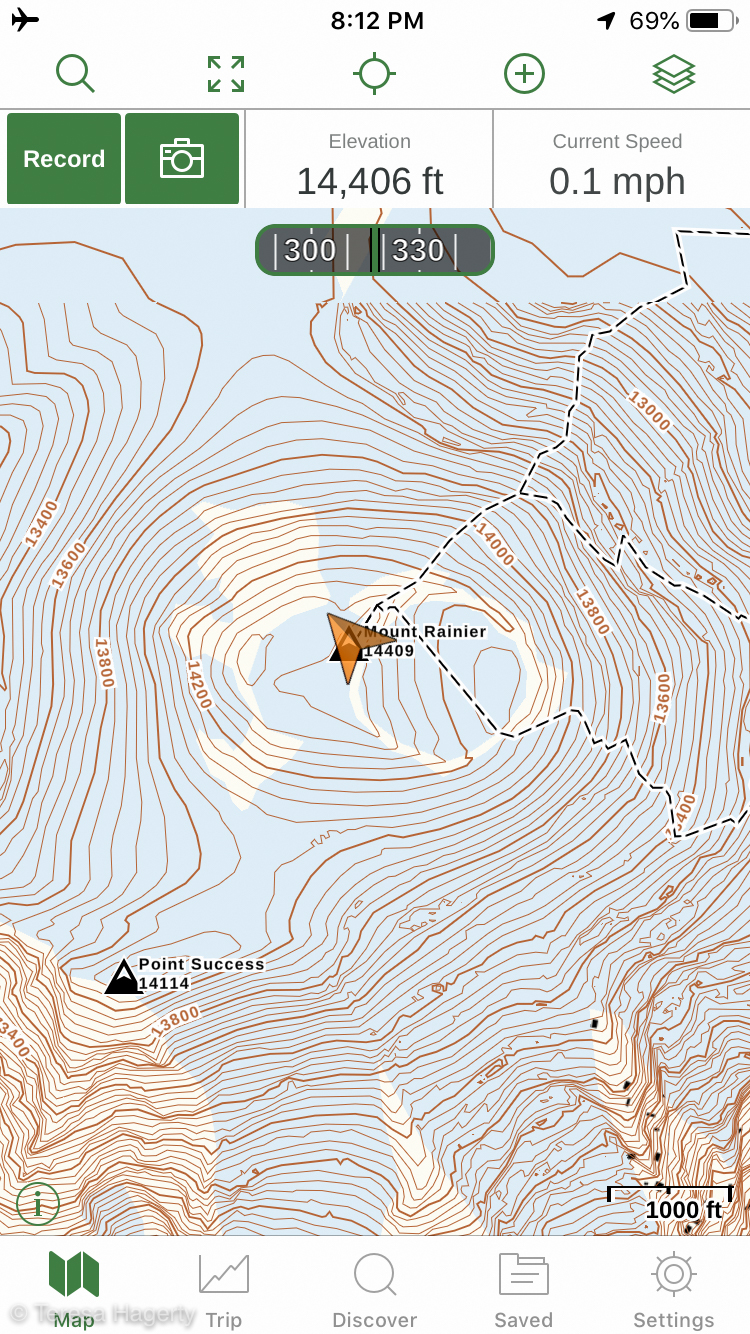
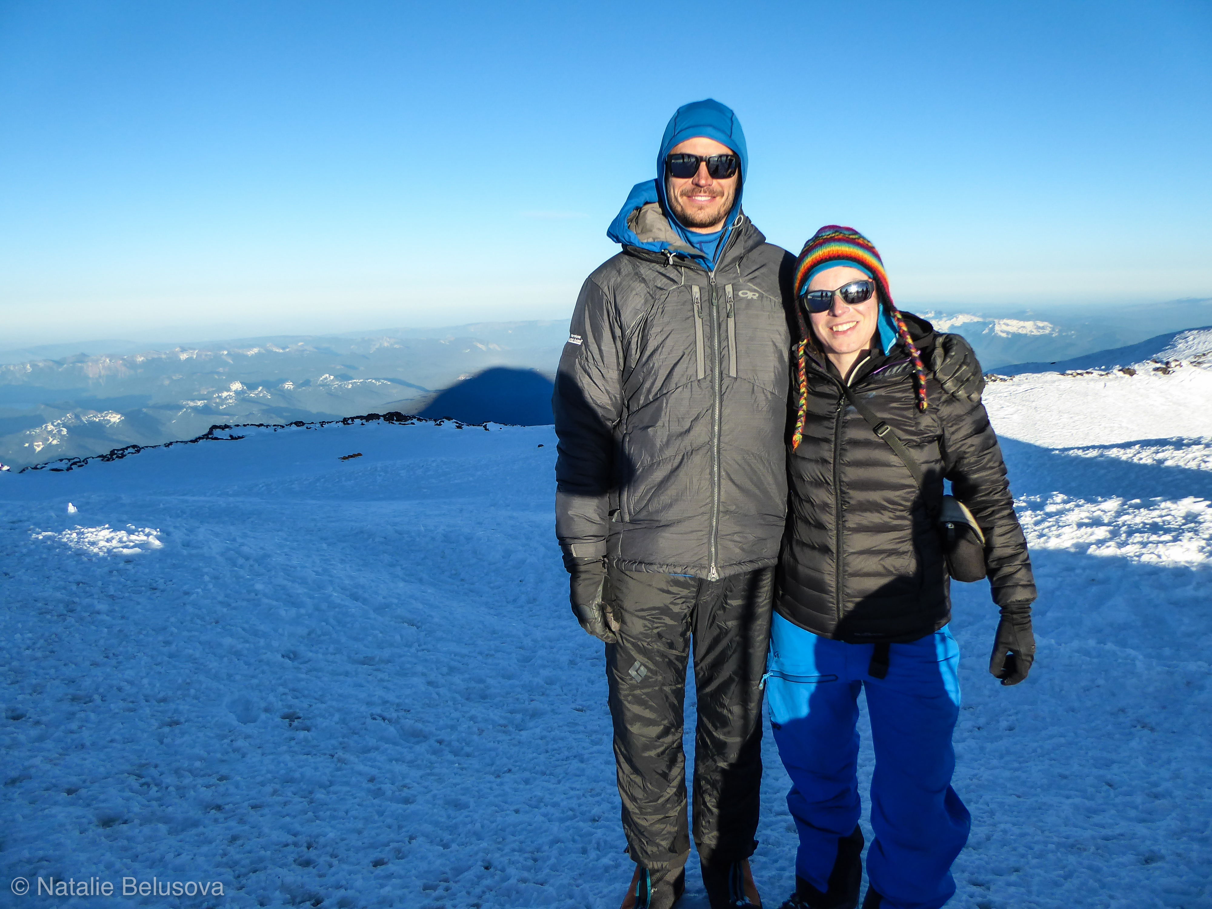
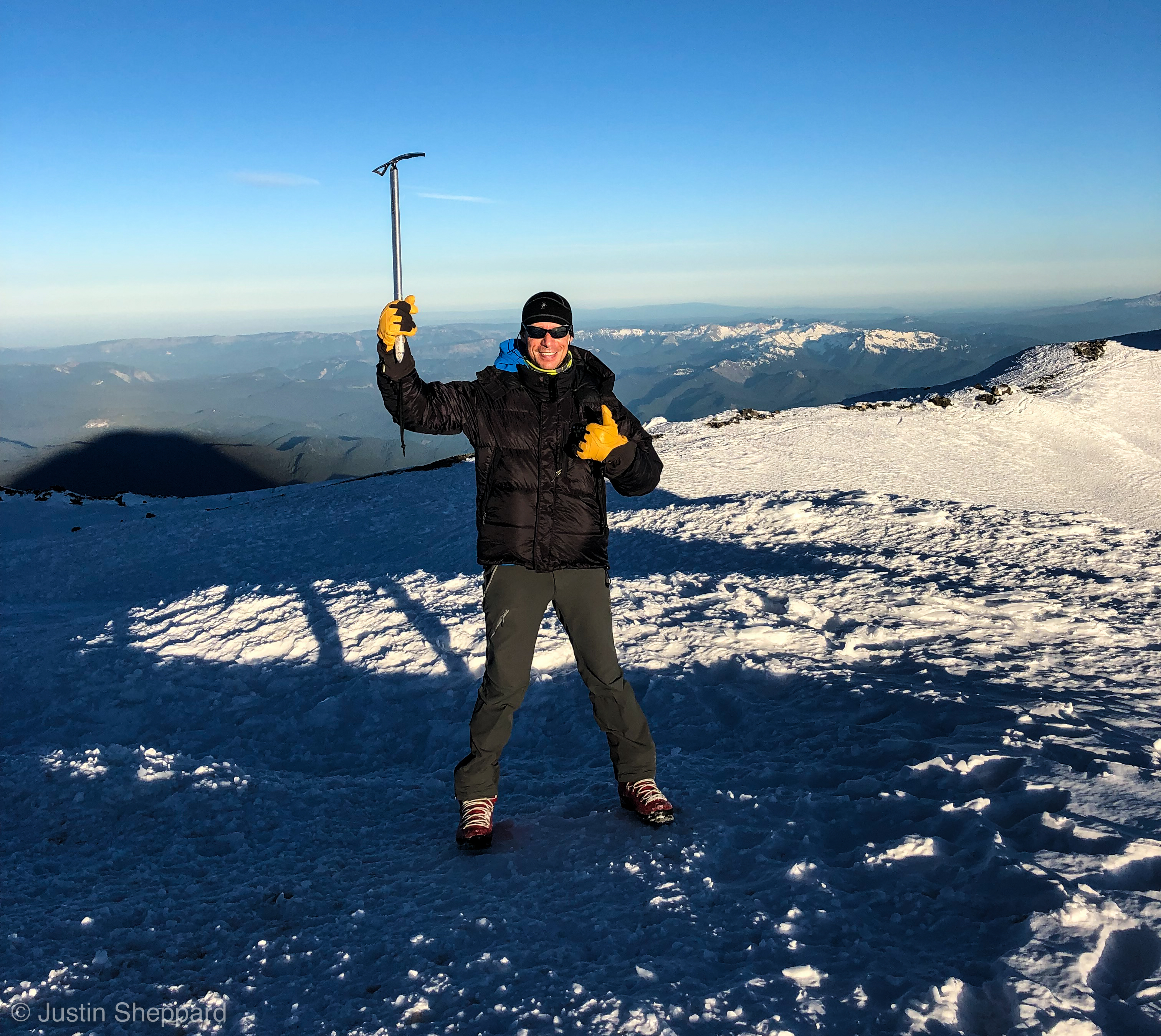
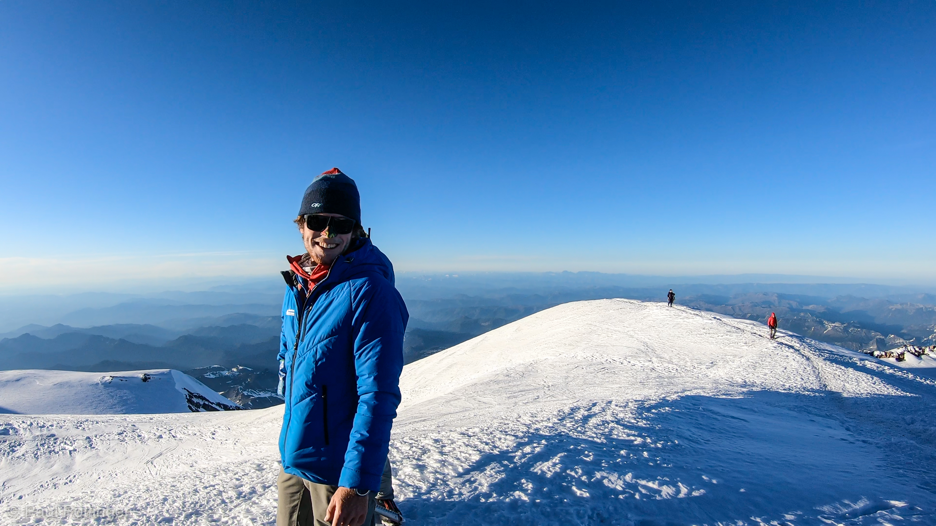
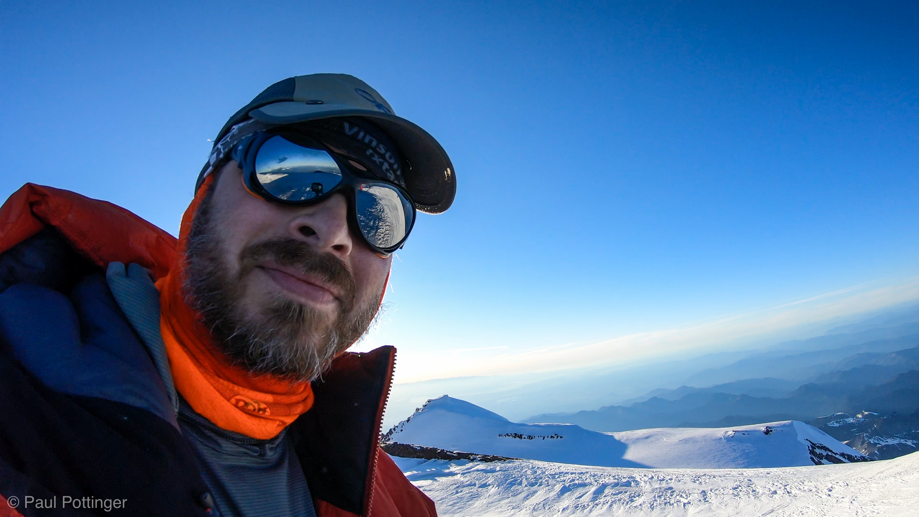
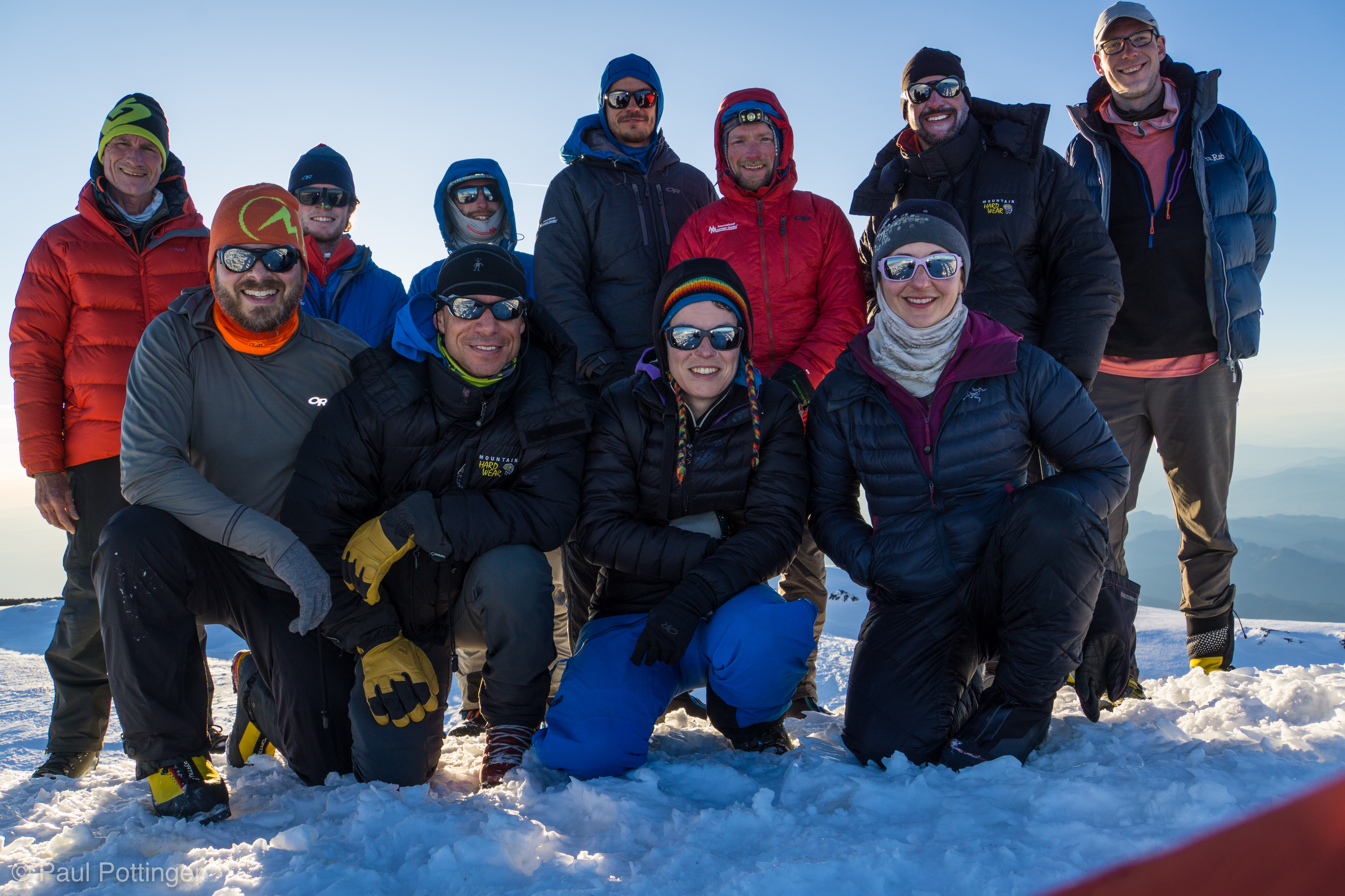
I was the last expedition member to reach the rim. Everyone greeted me warmly. It was a wonderful feeling for everyone… and a bit odd, because what we all really wanted to do was get to the center of the crater and drop those packs! And so we did, picking our entry route carefully, for fear of plunging into a steam cave where snow met rock. The snow up here was smooth, and looked like a milkshake that had spilled and then frozen in place while dribbling along the floor. This was probably exactly what had happened, when volcanic steam had partially thawed certain areas which then froze again in the cold of the night. Anyhow, we tested every step, and all were solid. In minutes we made it to the far eastern side of the crater, and we were home. We had done it.

Torin reaches the Crater rim. Behind, Conrad (out of view) then Teresa then me. Point Success behind us.
Last steps to the Crater Rim.
Pounding with Conrad at the Rim.
Teammates happy at the Rim.
Hugs at the Rim. #nothingbetter
Two rope teams walk a short distance South along the crater rim before entering.
Our teammates maneuver along the rim.
Stepping into the Crater proper.
Rocks at the far side of the crater.
Settling on a camp spot in the Crater.
Keith and Natalie make their way across the Crater.

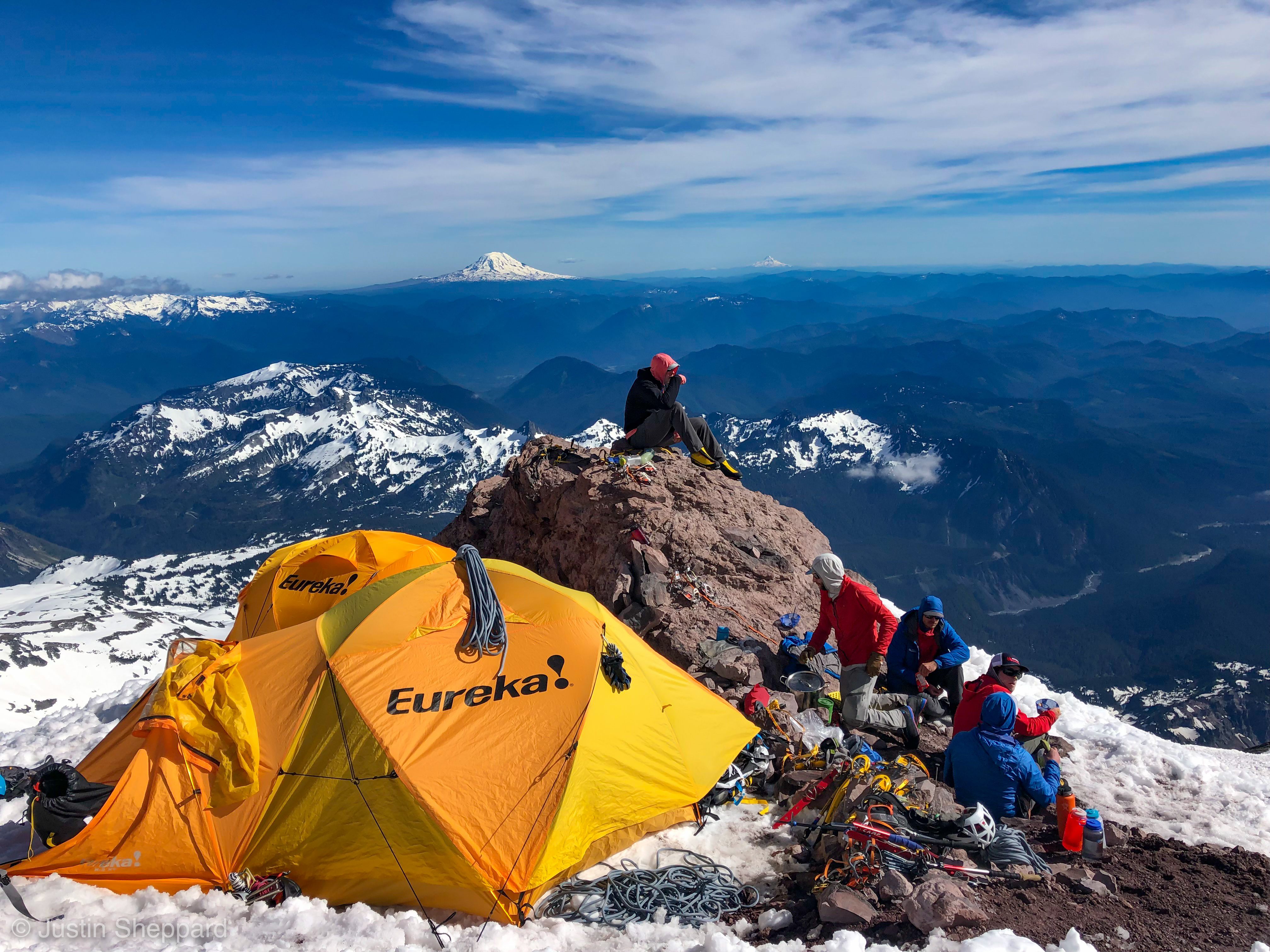
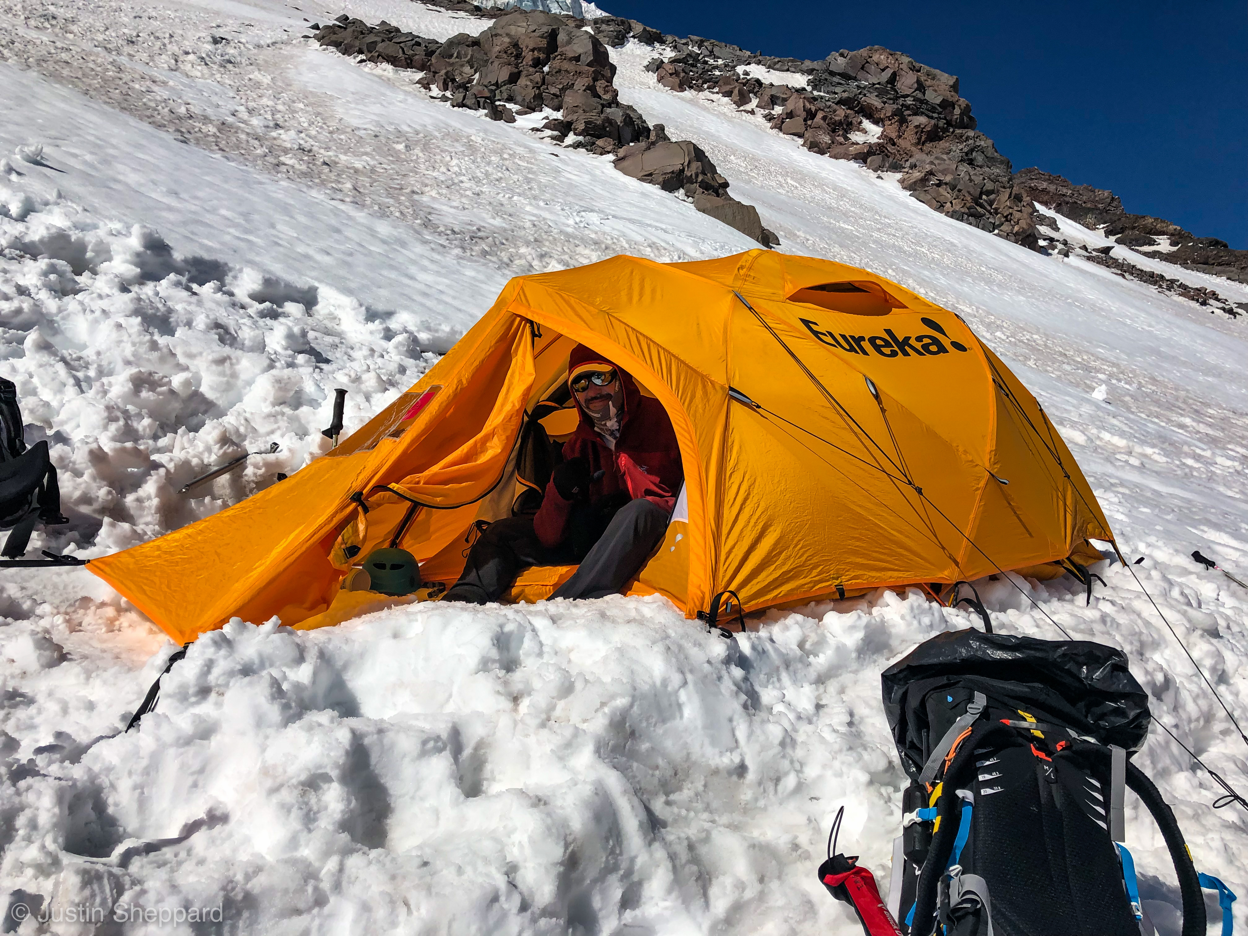
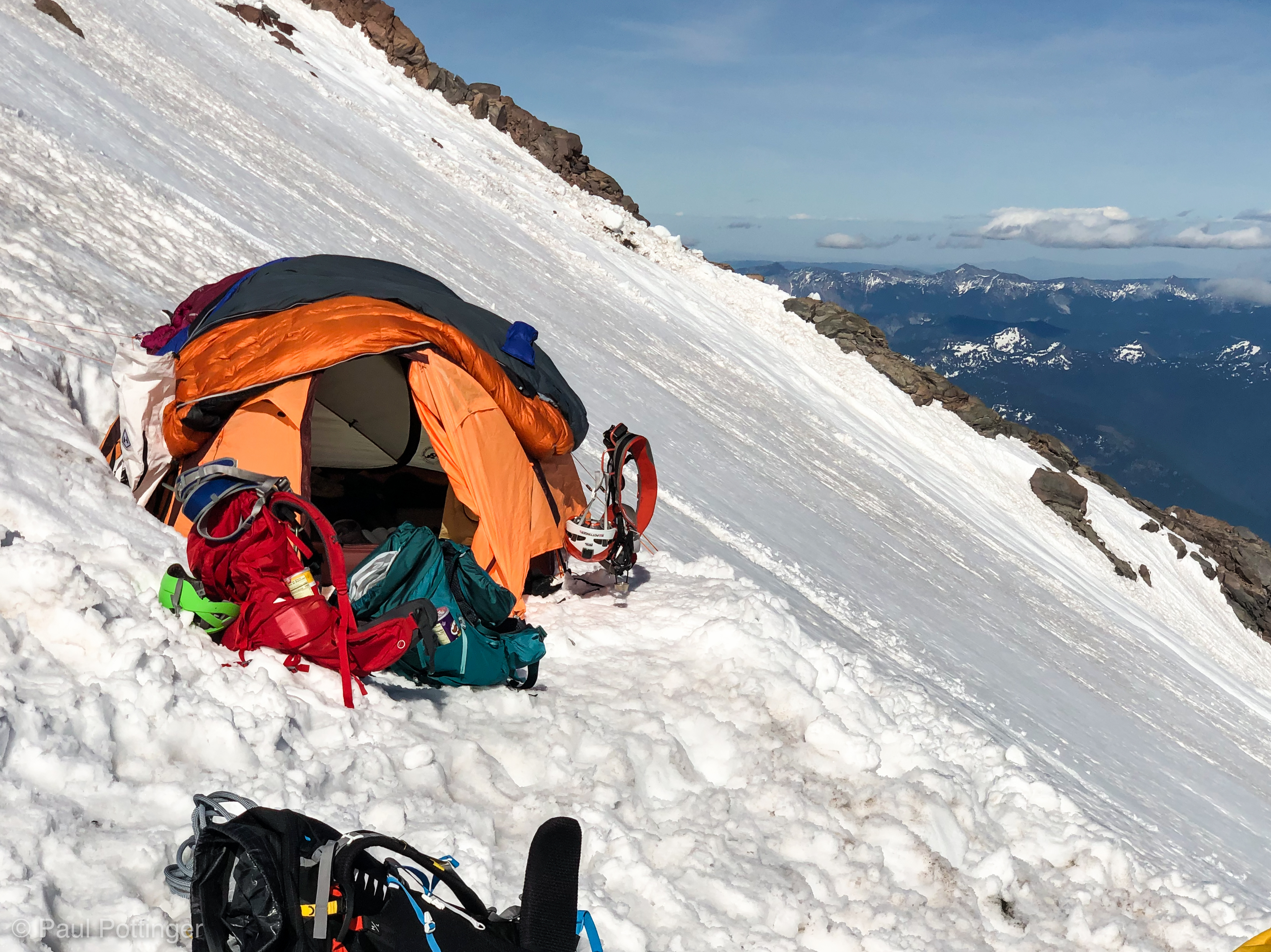
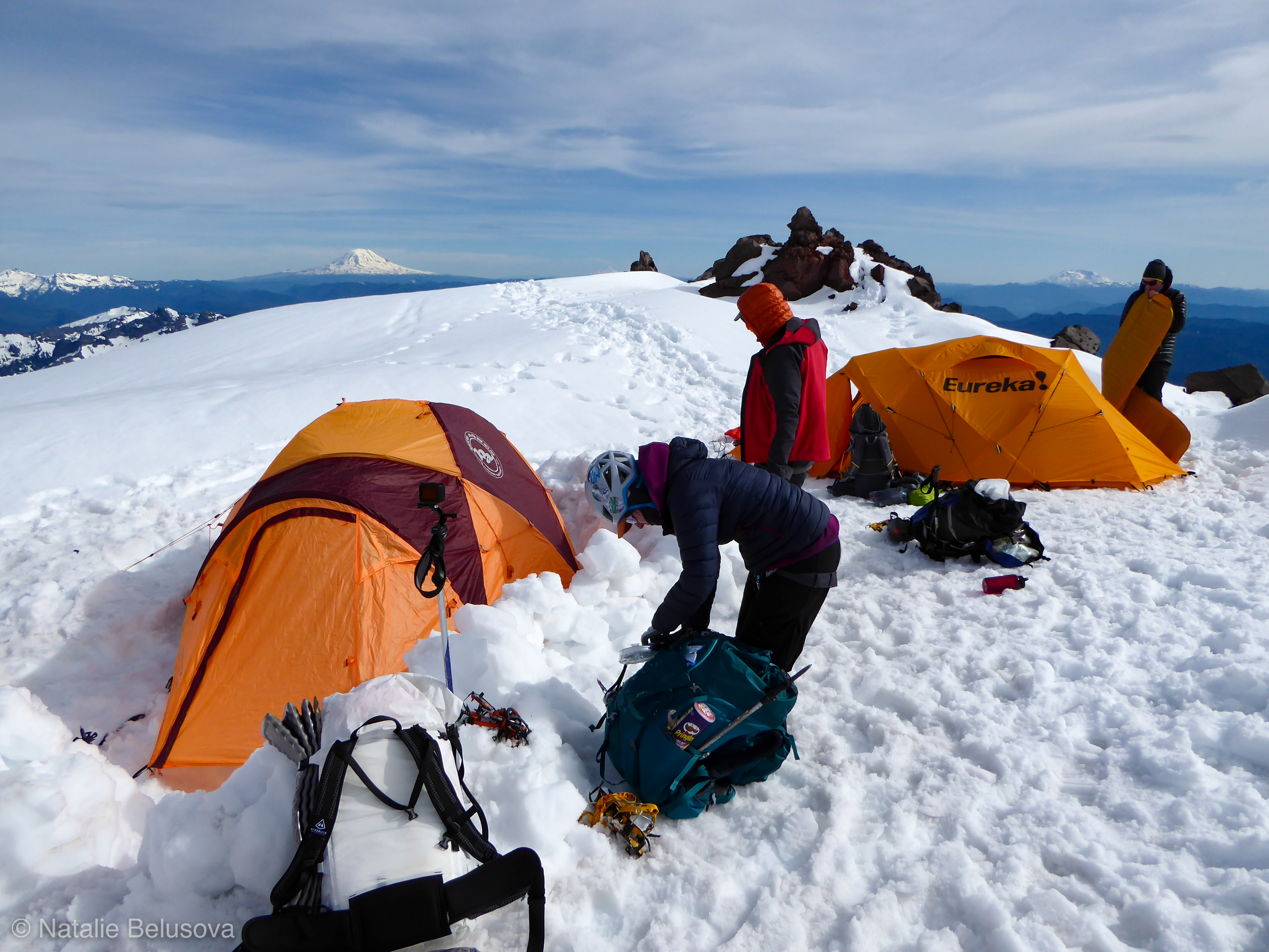
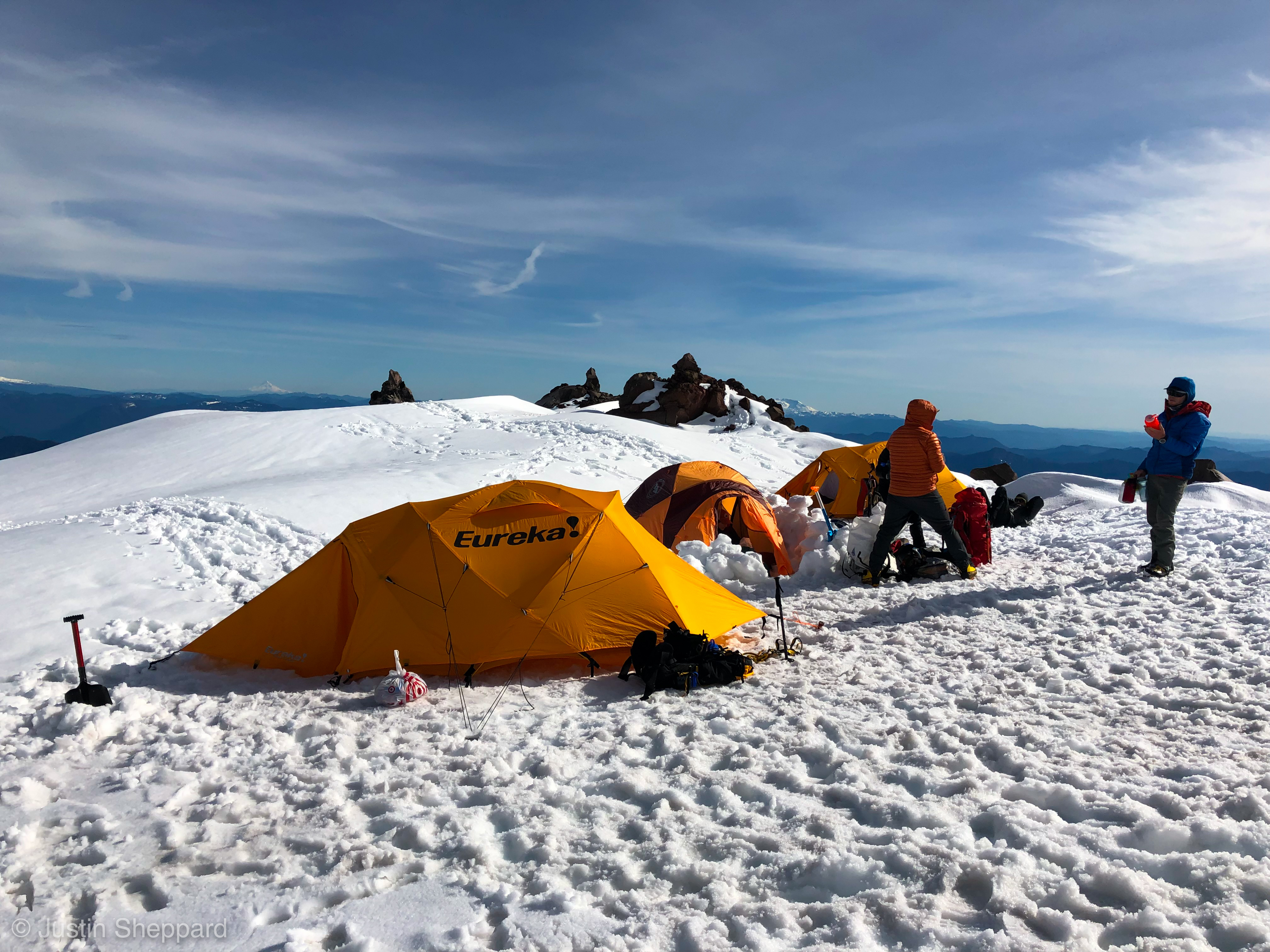
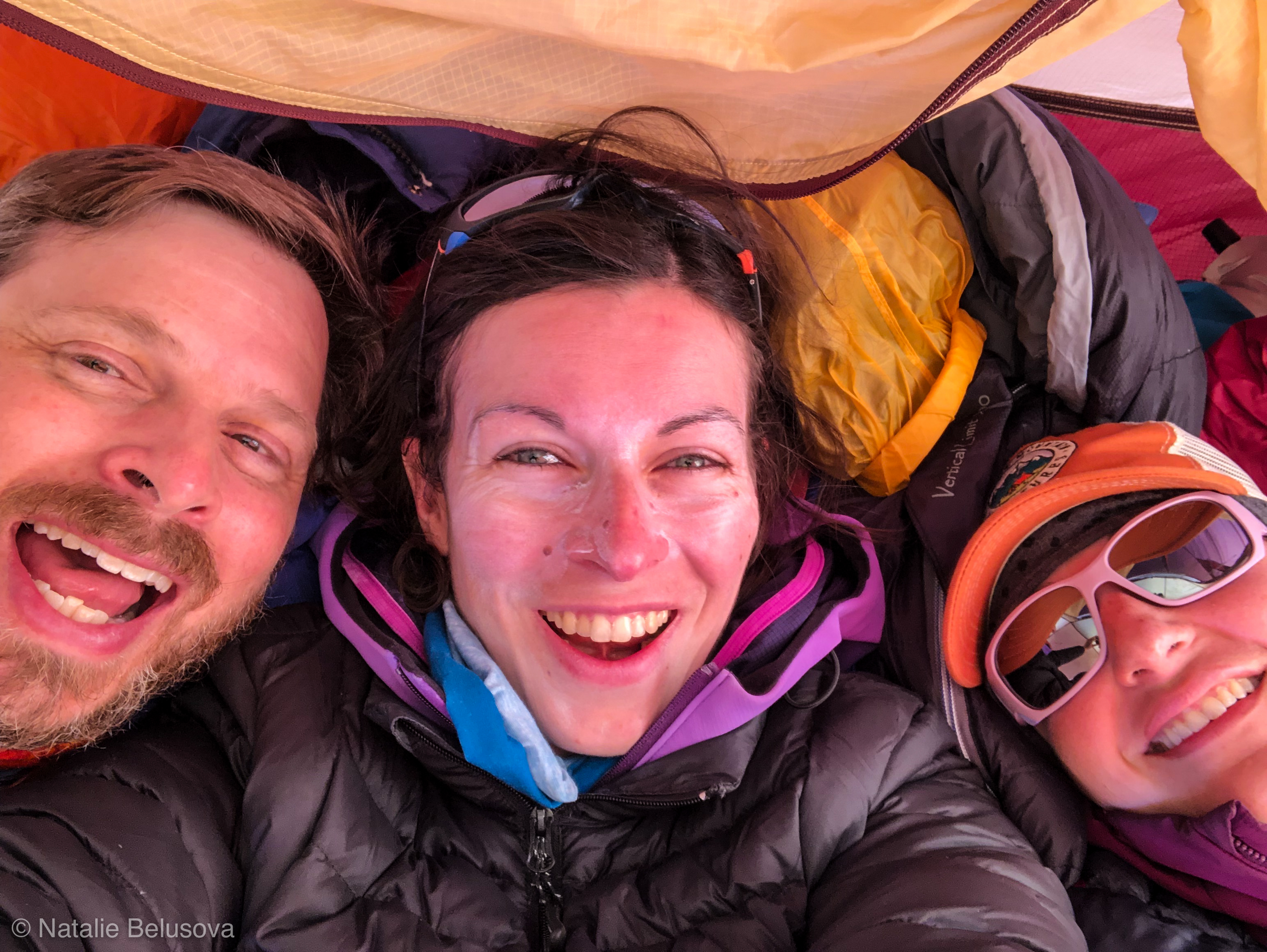
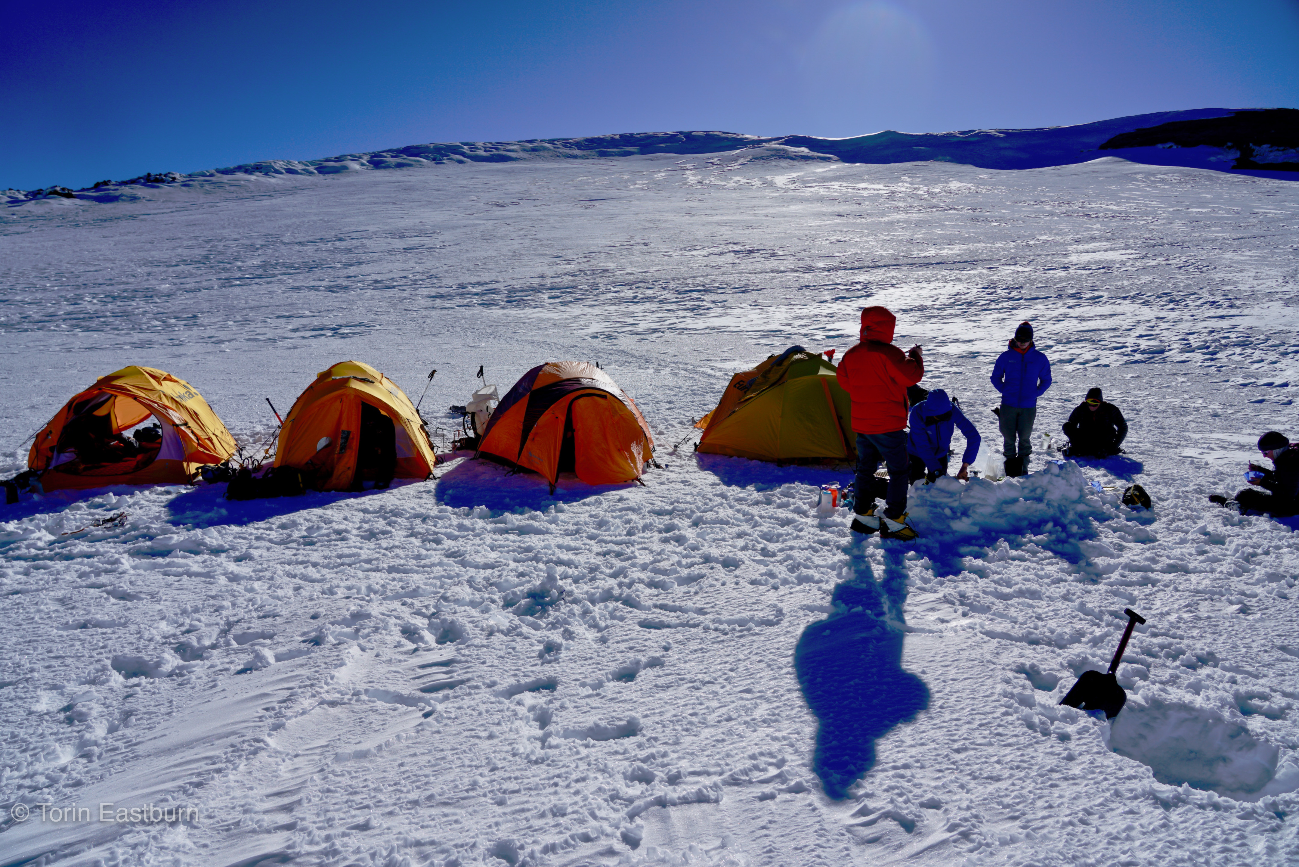
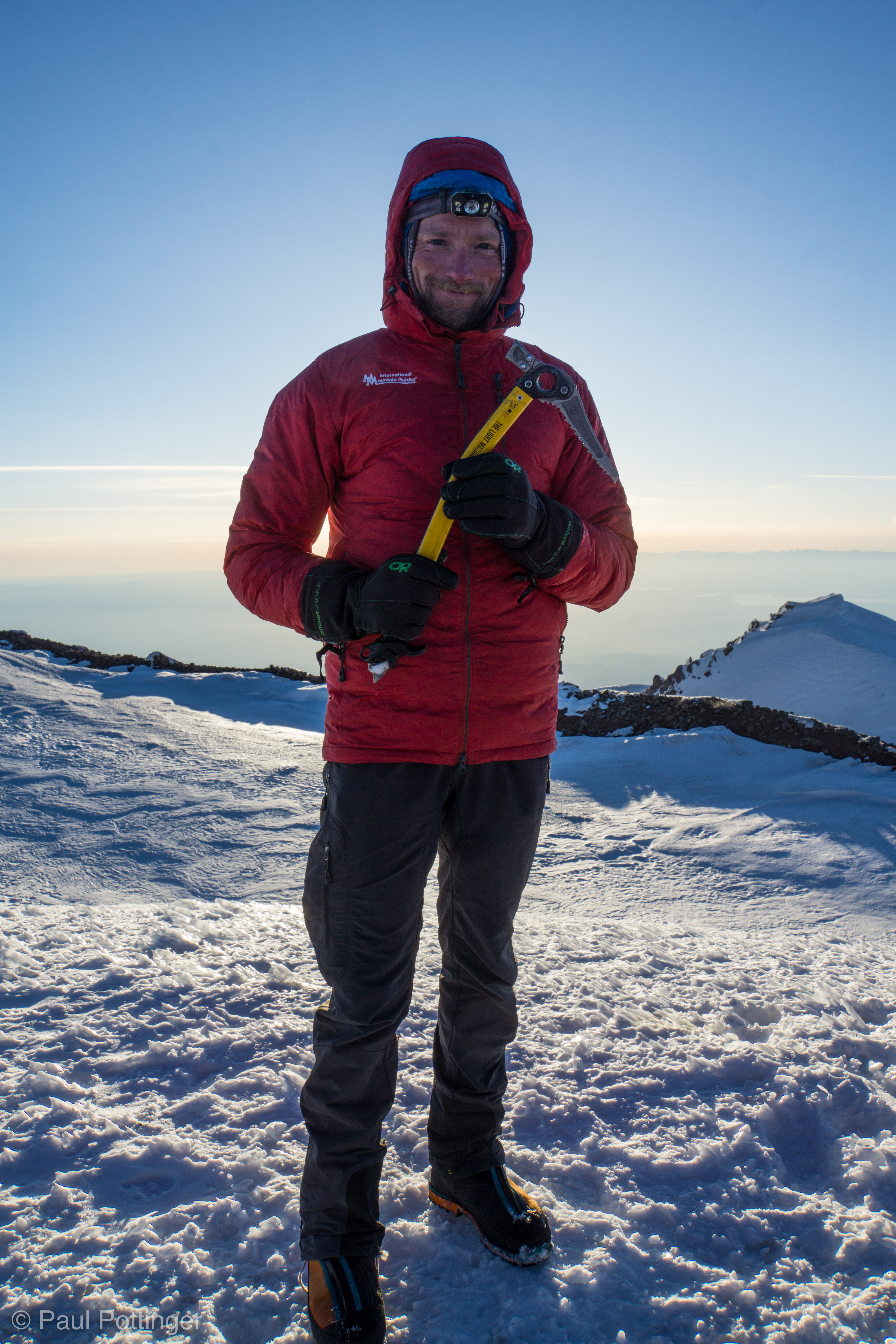
I was gassed. We took a short break in the sunshine, and I promptly fell asleep. This is a skill acquired during many years of medical training, and indeed is one of the cardinal rules of medicine: Sleep when you can. I snorted awake a few minutes later and realized that the guides were starting to build camp. In my haste to help I forgot to secure my foam pad, which a friend saved from blowing away. We stamped out a large rectangle, suitable for all 4 tents, and set to erecting them while the guides dug a kitchen and a latrine.

Pounding with Nickel at Crater Camp. #greatexpeditionleader
T$ feels the same way.
Natalie has done it.
Upness for these new friends.
Catching our breath in the Crater before building camp.
Crater Camp.

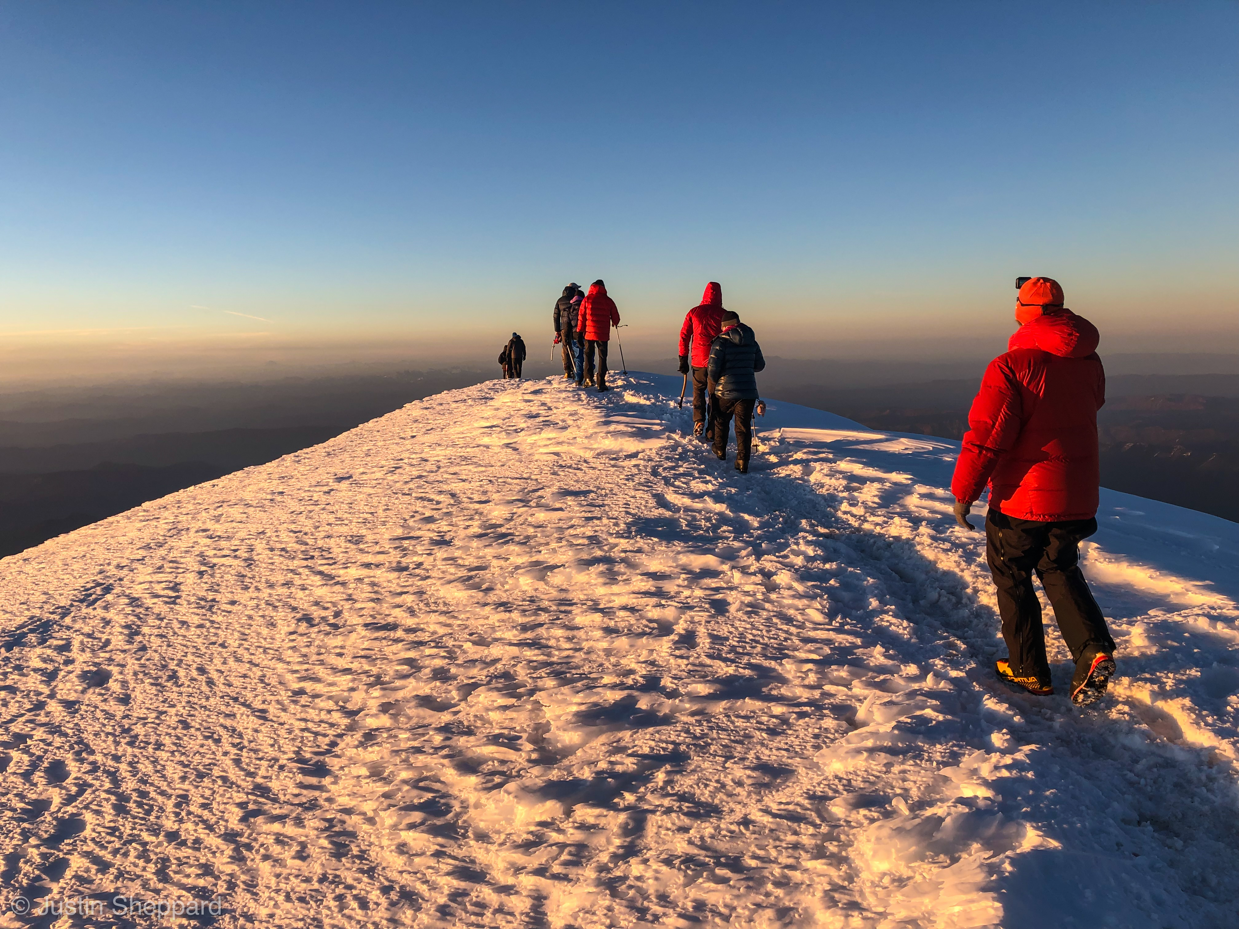
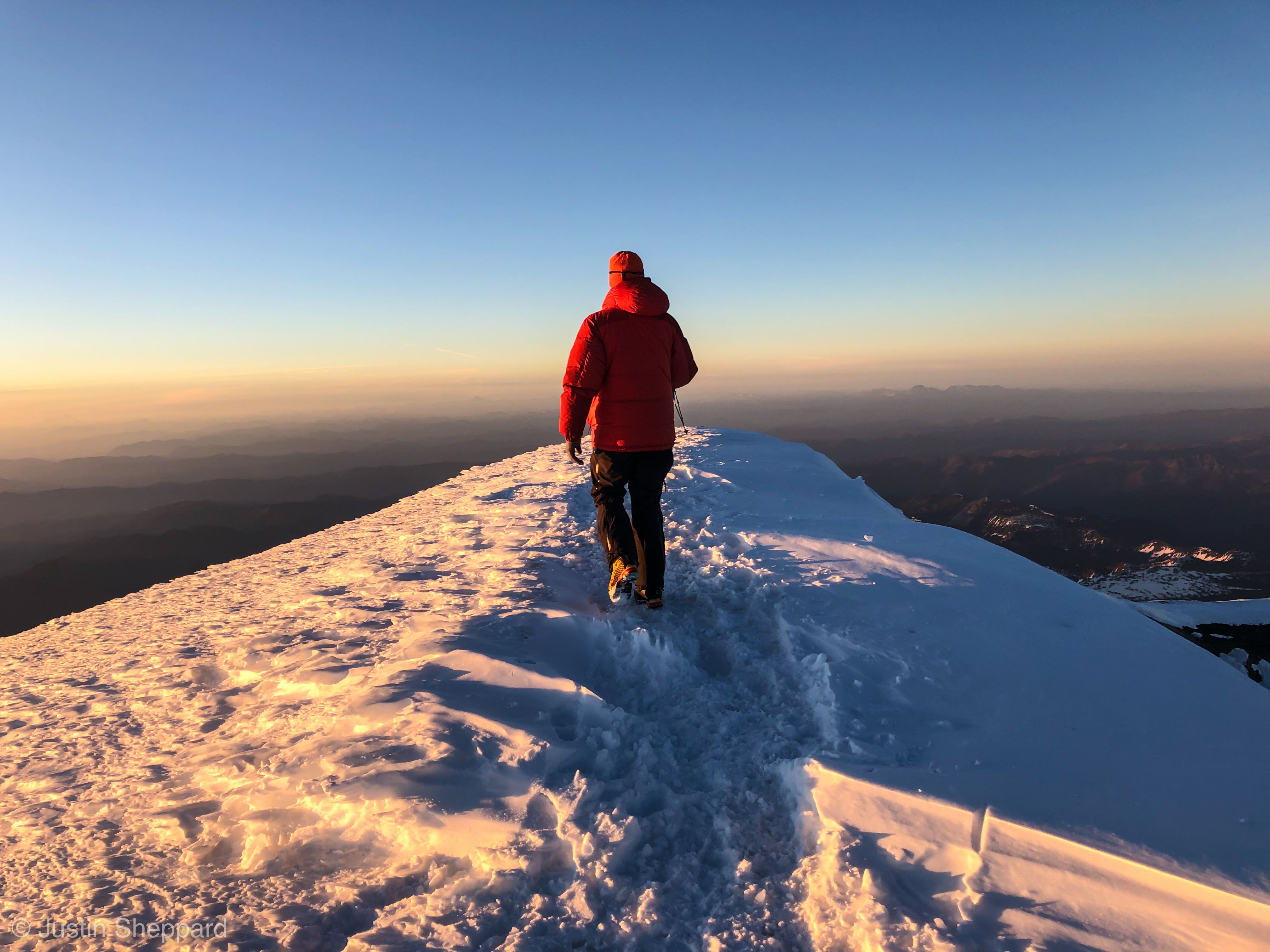
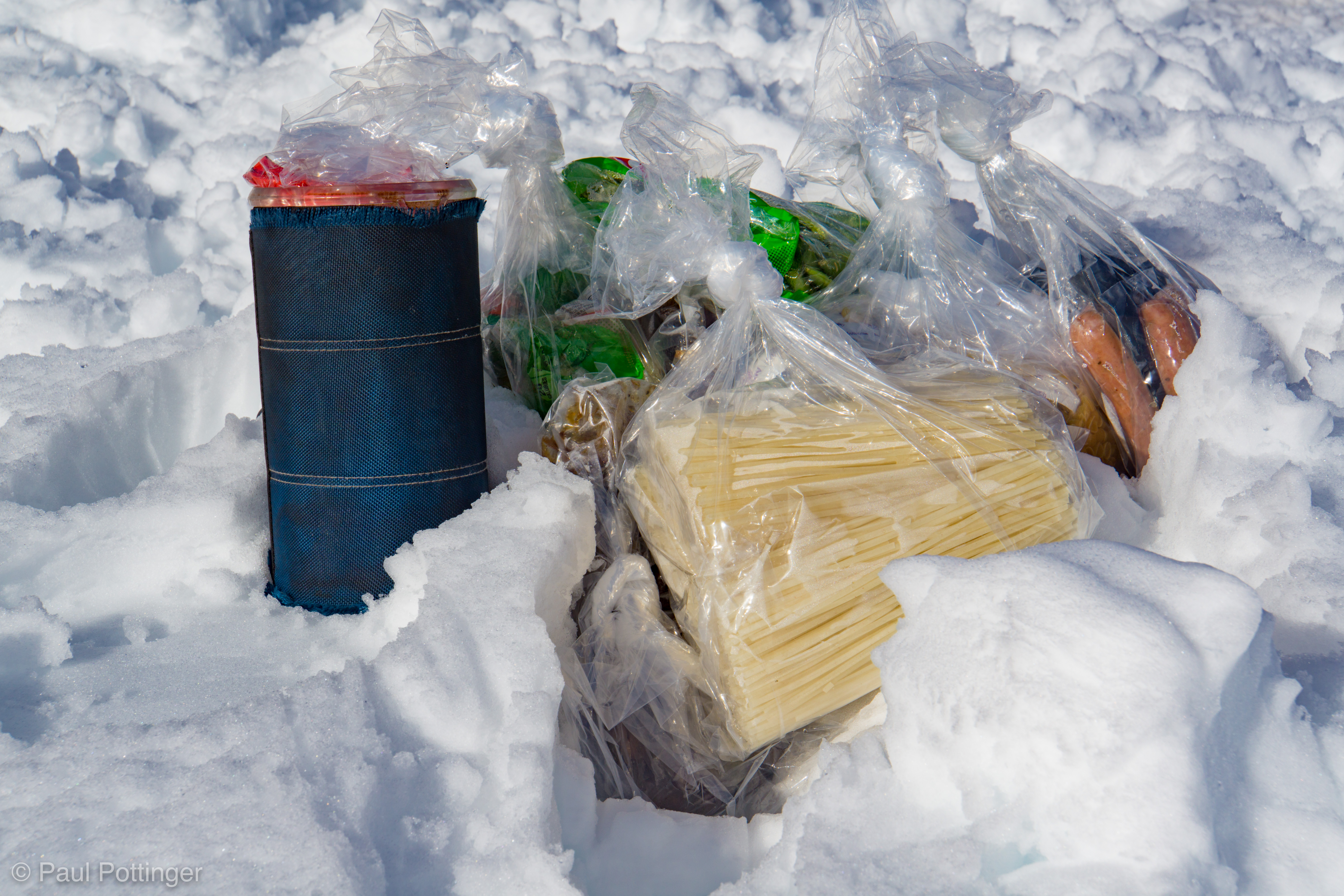
We had the crater and summit to ourselves that day. It was like a fabulous retreat, a private fortress in the sky. We enjoyed a delicious dinner of Thai noodles, and then lay down for a short time before heading to the summit, where we would watch the sun set.

Our kitchen at Crater Camp.
Dinner in the Crater
Team Big Agnes (AKA Team She-Wee) in Crater Camp.
Crater Camp.
Life at Crater Camp.

It was cold crossing the crater, and the snow was very uncompacted, loose powder underfoot. We reached the main trail which stood a foot above the surrounding snow, raised up because it contained so much compact snow ice after being stepped upon by hundreds of feet that season, making it slower to melt than the surrounding powder. We made it to the register and signed in, marveling again at the delightful lack of sulfur stink here, so different from Wy’East. And then we went up to the summit proper.

Heading to the Summit at sunset.
That sunshine will feel good at the summit.
First view West.
Natalie takes in Liberty Cap.
Team Crater Sleepers ascends the last steps to the summit of Tahoma (AKA Rainier).
Yes. Yes we did.
Goonies… Big Agnes… Rowers of Rohan… And the guides who enabled us to be here today.
Justin and Keith gain the summit ridge. Our camp seen in the crater below.
Our party on the Summit.

Below, in the distance, human society raged on, in all its beauty and horror, simultaneously inspiring and despicable. The forces of stupidity and darkness continued to disenfranchise us, to threaten our health, to spoil our world in every conceivable way. And yet… there was good there, too. I thought of a speech I had given two weeks earlier, the commencement address at UW Med School, a great honor for me. The students were so inspiring, such a bright light to the world. I hoped that my concluding comments encouraged and inspired them, too:

“And now, graduates, please close YOUR eyes too. And focus on each of those same moments: When you realized you were going to medical school… meeting your classmates on the first day… sitting for that first exam… interviewing and examining your first patient… presenting your first H&P… nailing that differential diagnosis for the first time… spending time with your patients, listening compassionately to them, making a genuine difference in their lives.

That darkness that you see behind your closed eyelids is not emptiness, it’s a world of infinite possibilities and accomplishments yet to come. When you close your eyes at bedtime—and yes, you will be allowed to sleep during residency—what will you choose to see? When I go to bed I see my family, accomplishing great things… I see the mountains, tall, austere, so alluring… I see my colleagues—and that includes all of you—brilliant, energetic, dedicated… and I see the faces of my patients—both the ones I have saved and the ones I have lost. Each a unique person whose life I have touched in some small way—and who in return has enriched my life exponentially more so. I hope you will choose to see your patients too, and your incredible, inspiring colleagues. Being a part of their lives is a doctor’s unique privilege, a privilege each of you has earned.”

Rowan high-5’s on the summit. Conrad and Torin there to greet us, too.
Hugs with Nat on the Summit.
Congratulating Ken on top.
Justin on the Summit.
Scott is psyched.
Keith and Natalie on the summit… Dynamic Duo!
Natalie on the summit of Mt Rainier. Awesome.
Justin on the Summit.
Rowan.
I’m happy to be up here.
View looking East from the summit.
Ken looks towards Tacoma and the Olympics beyond.
Here she comes, my friend and teammate T.
Very, very happy to be here.
Teresa was psyched.
Team Big Agnes on the Summit. We are so grateful to our amazing guide Conrad!
Nickel, a superb guide and expedition leader!
I’m getting the camera set up for our sunset team portrait.
The Crater Sleepers, backlit by sunset.
Crater Sleepers on the Summit.
Scott looks South from the Summit.

Above all else, I am a humanist. I believe that we can—and we must—do better. And no one, and nothing, will do that for us. I attended a Quaker grade school, and am now a devout atheist who is married to a non-observant Jew. And yet, I do think that some places are sacred, and I do have moments of spirituality. Perhaps MARS provides a more eloquent summary of these thoughts:

And I noticed…
I now know this:

In the end, there is no one…
There is no one to call your bluff.
In the end there is no one high above.

Who really can say there’s only one way to play the game?

In the end there is nothing…
There is nothing beyond the truth.
In the end there is only what we do.

Try, try as they may…
Running in circles with nothing to say.

See, only one thing’s for sure:
I’m not knocking on heaven’s door.
What’s up above, or underneath
Is not for man alone to breach.

Sometimes fail, and sometimes win…
With all the powers here within.

And I’ve noticed…
I now know this.

—Overwerk, MARS: Know

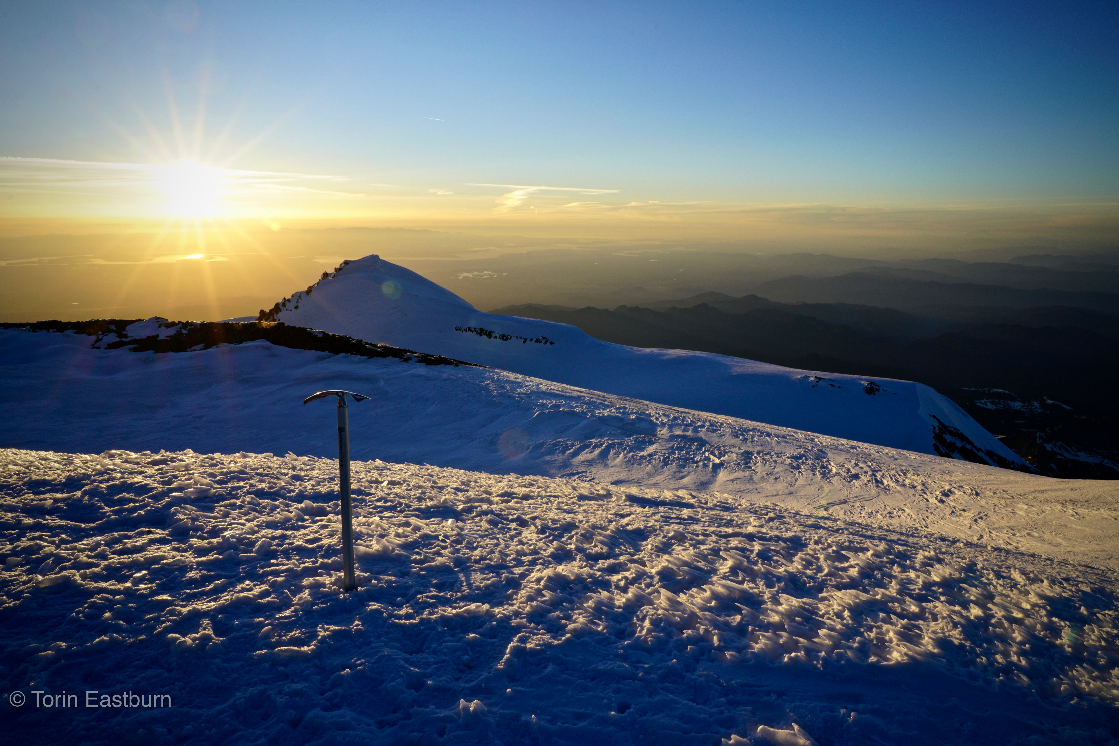
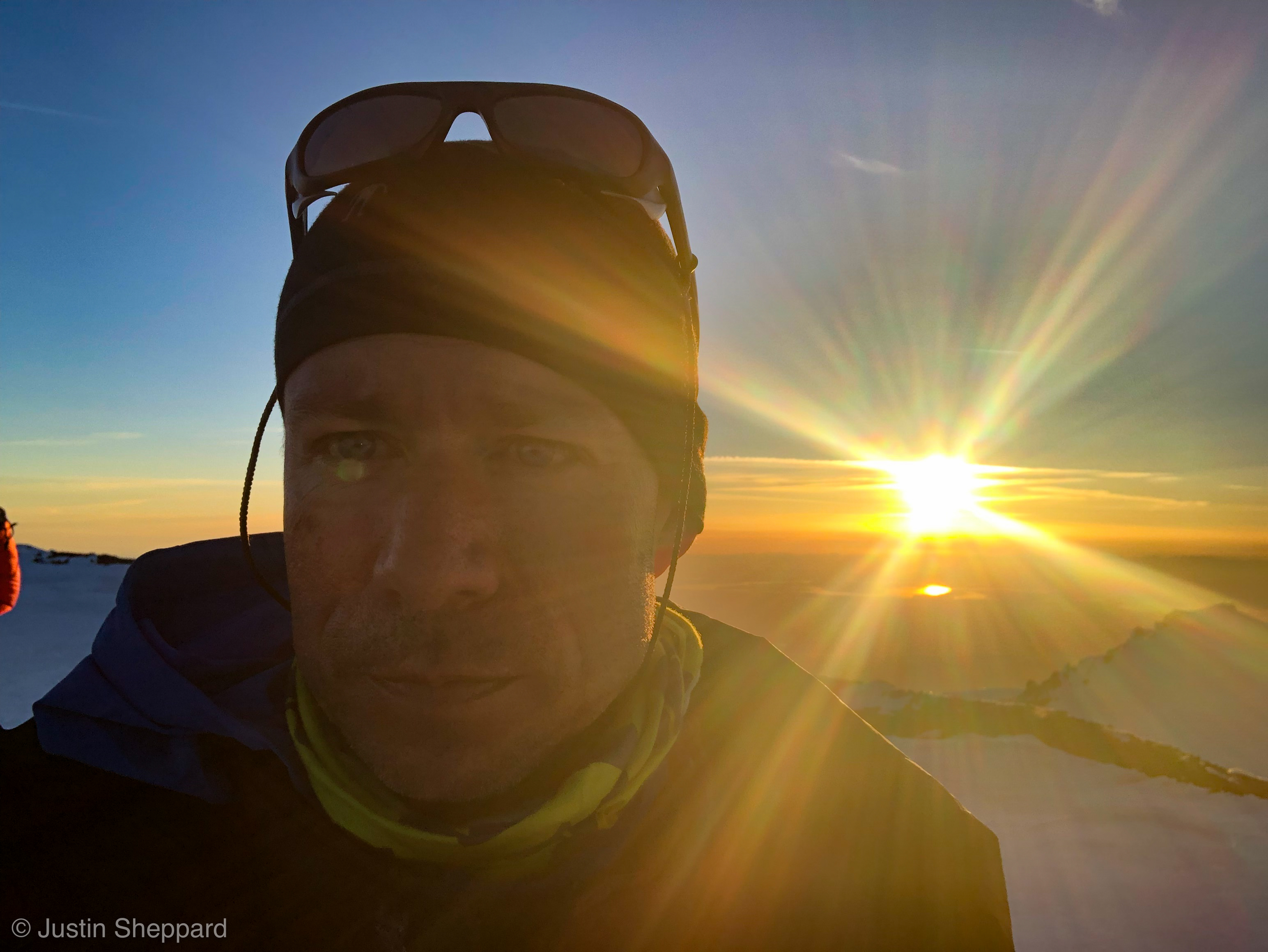
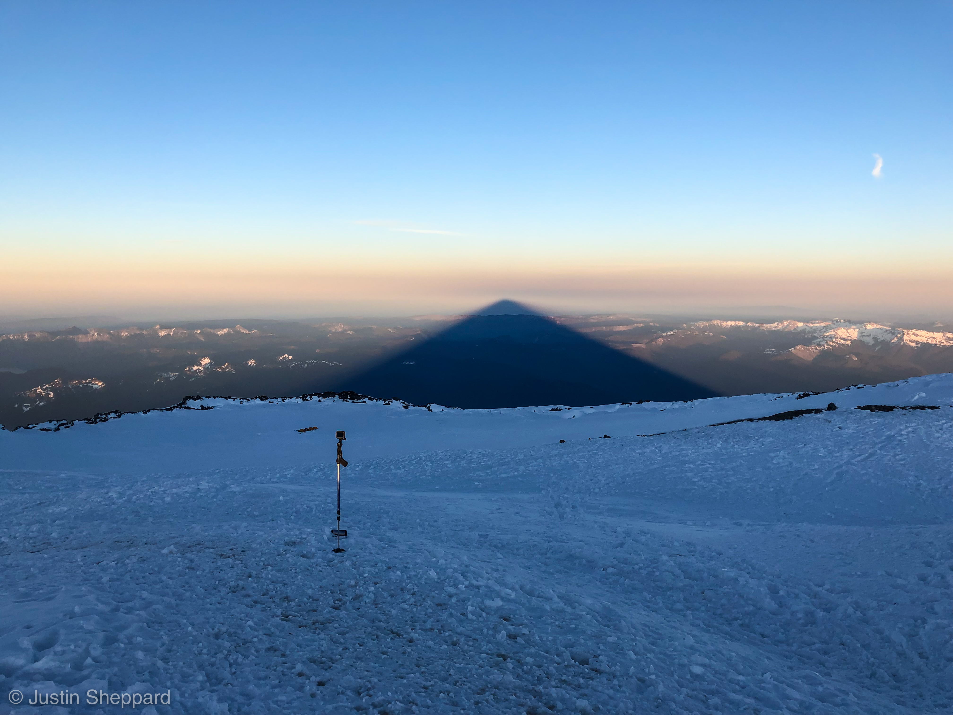
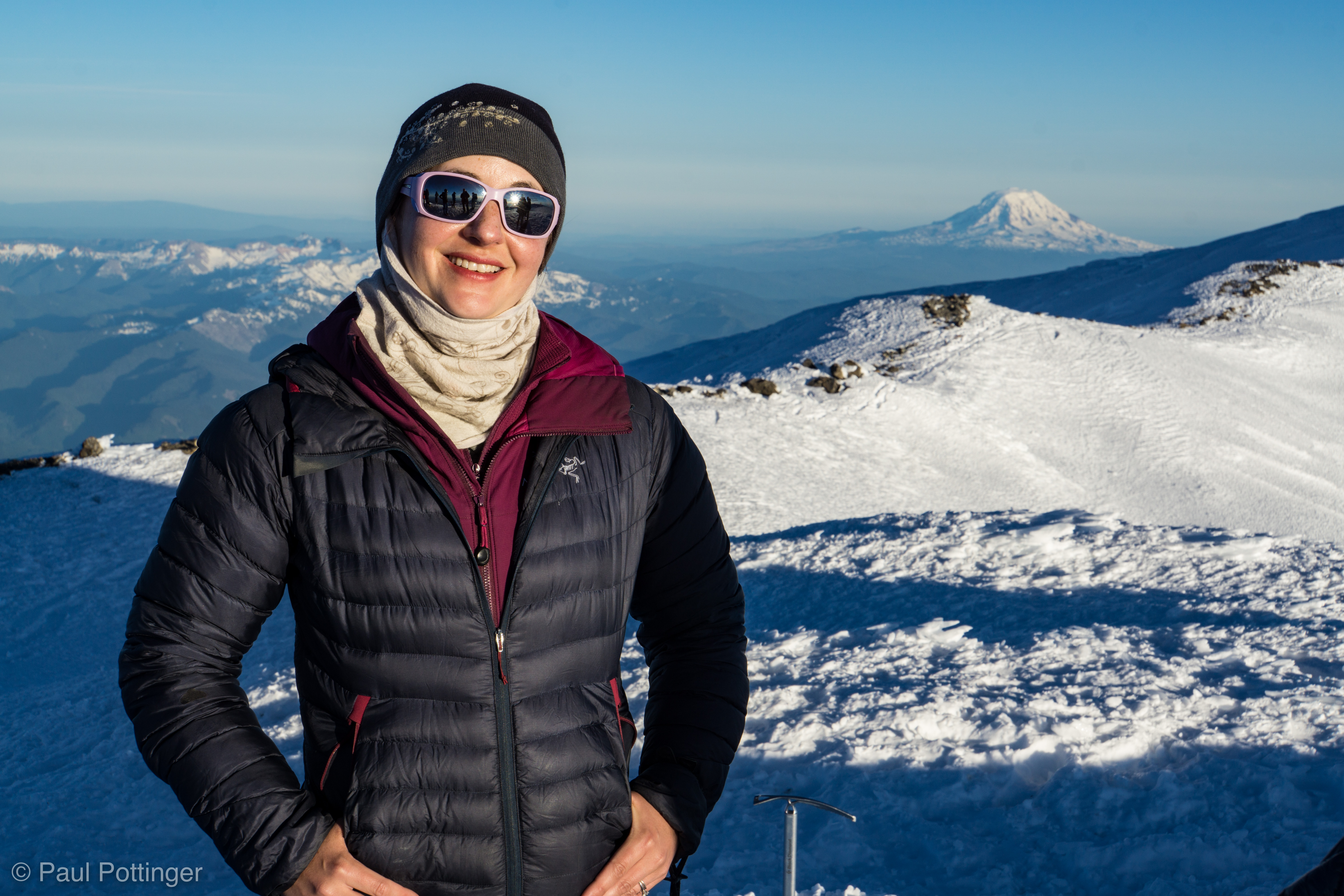
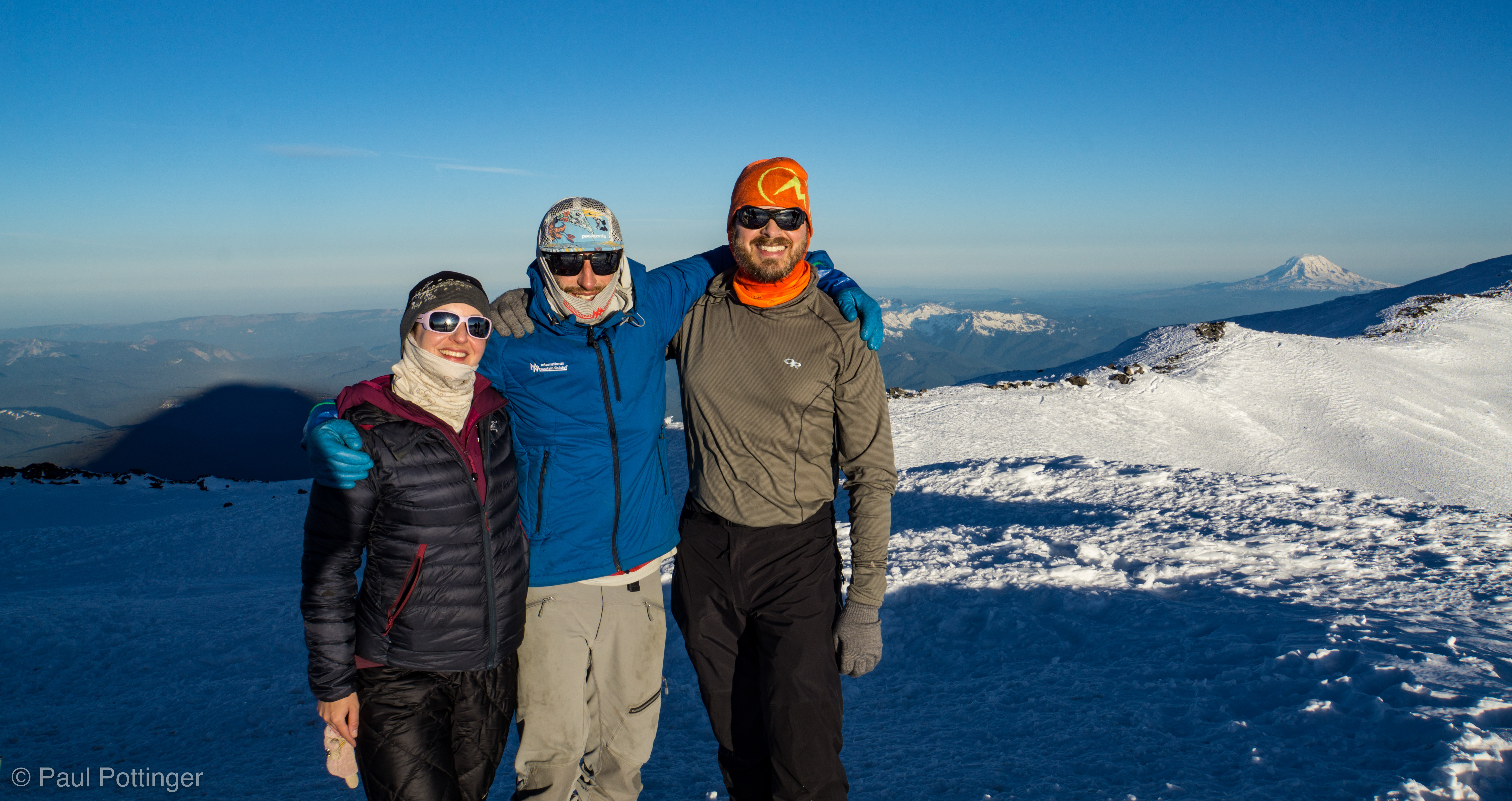
The sunset dazzled us in pure, golden light. Everything seemed to be lit from within: The tortured water ice underfoot, the shadows of sastrugi, Puget Sound in the distance, the strange cirrus clouds over the Olympics, even ourselves—we were glowing with happiness and pride at our accomplishment. We had climbed Tahoma via the Kautz, and now we had the summit as a reward. This was my 5th time on top of Tahoma, but never before at this time of day. I had seen this place at sunset so many times in my mind… and it had always looked this way. Precisely like this. In my mind, I’ve seen this before. The pain of the next day’s descent… the agony of driving home while exhausted… the challenge of seeing patients first thing after I got home… all could wait, out of mind, for another time. For now, we had the summit, and we had each other. This is why we do this.

Liberty Cap at sunset.
Tacoma.
A spectacular sunset.
Panorama from the Summit.
The Summit: A hard place to leave.
My axe on the summit.
Justin’s sunset selfie.
Liberty Cap at sunset.
A summit… a moon… a great big sky.
The mountains up there look pretty cool, too. Sorry I will never get a chance to climb them.
Justin at the summit.
Our camp… our shadow.
Our shadow at dusk.
My GoPro and iPhone attempt to capture the lengthening shadow, in time lapse.
We turn to head back to Crater Camp.
I’m capturing this with my GoPro.
Heading back to camp from the summit.
Our shadow lengthens towards Pahto / Klickitat.
Tortured ice figure on the Summit.
Twisted, otherworldly, beautiful.
Ice carved by wind, in alpenglow.
Chiaroscuro at the Summit.
Ya gotta admit, the resemblance is uncanny….
Row up on row of Cascades… Glacier Peak stands above the rest.
Just below the Summit.
Walking past steam vents near the summit register.
Our shadow at sunset.
Conrad takes in the steam vents.
I take a photo of T taking a photo of Nat taking a photo of our shadow. #meta
Basking in the warm steam vents below the register.
Camp Crater… and our shadow at sunset.
Crater Camp awaits us…
Almost back to camp. I’m tired.
Heading back to camp after our photo shoot on the summit.
Crater Camp at dusk.
Getting chilly out here… let’s get into those tents!

Loowit

In Puyallup mythology, Loowit (AKA Mt St Helens) was the object of affection from two god-brothers: Wy’East (AKA Mt Hood) and Klickitat  (AKA Mt Adams). When they could not stop their quarrels, their father Sahale struck them all down, and they formed into the volcanoes we see today.

In Cowlitz mythology, things are different: Tahoma (AKA Mt Rainier) had an argument with his two wives, Lavelatla (AKA MSH) and Pahto (AKA Adams). Lavelatla became jealous, blew her top, and knocked the head off Tahoma.

So, Loowit has always been a special place, long before 1980. Each of us had climed it before… for me, the last time was in the runup to Vinson, in November 2013. But we were all excited to be back. This day was a chance to explore a spectacular mountain with friends… to bask in the grandeur of one of nature’s most sacred places… to challenge ourselves with a brisk day hike… to be unplugged. And, to ensure the experience was not sullied by the exhaustion of work, we arranged to spend the nights before and after at a hotel nearby in Woodland. #posh

Jerry starts brewing coffee before we even get to sleep.
He takes this stuff very seriously.

Up at 1:00 AM… out the door at 2:00 AM. As we started out, it was obvious that this would not be ideal weather conditions: Misty, moody, wet, warm atmosphere. As we went higher, the soup became thicker. By the time we reached Climber’s Bivouac, it was a true dense fog, with about 20 foot visibility. Had we brought the right gear? Would we summit in a whiteout? Would we summit at all? There was only one way to find out.

Signing in for the day. 2 other parties already in today’s log… one of which is still asleep in their car.
And we have ours, thanks to the mad logistical skillz of T$.
“It’s Squatchin’ time!”
“We’re climbin’ a vol-CAY-no, Y’all!”
Ascending the first boulder field in the night. Note the Luci Light on T$’s back. #beaconofrighteousness
I remember this sign from last time!
November 2013: Same sign… different conditions.

Yeah, it was foggy and still… not cold, really, but certainly not comfortable climbing weather. We had the mountain to ourselves. We had each other. And there was nothing to stop us.

Ascending into the gloaming.
A beautiful… grody atmosphere for sure, but beautiful.
Teresa leads into the mist. #dauntless
Can you tell how happy I am to be here?
Somehow I was expecting it to look more like it had in 2013….
I think we’ll get on top of this soup!

Eventually we saw hints of sun, even blue sky above. As the sun rose, so did my confidence that we could get on top of the moody brew and into crystalline sunshine. And so we did.

Sunshine starting to show!
Snapping photos in case this is the last sun we will see all day….
Looking good above, let’s get there!
Big, bright blue!
Jerry, framed against the heavens.
The soup starts to break up at dawn!
Exploring our new digs above the clouds.
Jerry: Above the clouds.
No wonder Nell is smiling…
… this is how I looked taking the shot. #meta
Gentlemen mountaineers.
Jerry: Laser-focused on the route ahead.
T$ captures the cloudsea.
Here comes Nell!
The spectacular and fabulous women mountaineers of Team Adventure.
Teresa: Cascade Mountain Adventurer extraordinaire.
Looking for a sunny, auspicious break location.

Up we went, climbing rocky bench after bench. The basalt and pumice provided excellent handholds, and most of the boulders were very stable underfoot. We were doing this, and nothing could stop us. Nothing, except the spectacular cloud cap growing on the summit.

A legitimate cloud cap atop the summit. We watched it rip by, like water flowing over a stone in a river.
Our shadow at sunrise. The cloud cap truly looks like a cap here!
Dawn and cloudsea.
At our first properly sunny break.
Our neighbor, larger than life: Klickitat / Pahto.
Teresa reaches for her camera.
The monitor is still in great shape.
Topping out on a boulder pile.
A bit windy here… that OR Helium really did the trick.
Teresa climbs above the clouds.
We really like it up here.
Nearing the top of a boulder heap.
Here’s how the rocks looked last time I was here.
The cap grows bigger and descends towards us as we rush to meet it….
Up we go….
Clear sky, sandwiched between deck below and cap above.
Yeah, the wind is picking up here.
Clouds shredding in the lee of the summit.

I was surprised to see persistent snowfields near the top, which sported young suncups and even some creavasses ~20 feet deep. Snowfield with cracks? Legit glacier? You decide. Chris used his eagle eye to spot a piece of fabric flapping in the wind below the trail, near one of the snowfields. We agreed to get it on the way down.

Check the cap on Klickitat / Pahto. We are not alone in the wind here!
Teresa forges onwards and upwards.
Are we doing this? Yes, we are!
Jerry and Klickitat / Pahto.
Snapping Jerry’s photo at our last break before the top.
Chris girds up his loins for the final push.

The wind grew, and although it was never ferocious it was legit. I thought, Loowit is coming and She is Pissed. Once again my GoPro 7 stuttered and froze just at the wrong moment, precisely as it had on Olympus a couple weeks earlier. I need a new camera!  As we approached the top, I thought of the last time I had been here. It was a totally different experience in winter, intentionally so: I was preparing for Vinson, thus climbed with a heavy pack, in Olympus Mons boots. At this location I had felt whipped with exhaustion, really struggled to make the last steps in snowshoes, with the heel stops all the way up. Getting to the rim was a big deal for me, and I was elated to have made it with my brother and buddies John and Doug. I was sorry only that we could not creep to the edge to peer straight down, for fear of breaking a cornice. Today I felt fine, just perfectly fine and dandy. Older… lighter… warmer… more experienced… wiser. The Seven were under my belt, and I had nothing to prove to anyone, not even to myself. This was all about enjoyment. And we enjoyed the hell out of it.

And now we enter endgame.
Tail of the cloud cap appears as gossamer, jetting away towards Klickitat / Pahto.
Nell cruises towards the top, Wy’East in the distance.
An epic selfie, with the whole team in frame.
Reaching the crater rim.
Panorama from the rim.
Pano from the same location, November 2013.
Closeup of the crater dome… steam rising from numerous vents at center. Tahoma in the distance.
True summit hidden in cloudcap. A dirty glacier snakes downwards around the center dome.
Klickitat / Pahto seems close enough to reach out and touch…
Chris on top.
Here come Teresa and Nell!
I’m looking for trash I thought I saw from below. Turned out to be a bright red pumice stone.
Summit selfie.
Last time I took a selfie on top of Loowit.
Approaching our spot for the summit shot.
Jerry captures me shooting the crater dome.
We wander towards the true summit, in hopes it might emerge from the clouds.
Jerry is lord over all he surveys.
Yeah, the cap will take longer to clear than we are willing to wait up here.
Team adventure atop Loowit.
Getting our act together after the summit victory shot.
What is Teresa doing so close to the edge?
Teresa gets the Pig of Adventure ready for a closeup.


Pig of Adventure atop Loowit.
Chris at the summit break.

We had the mountain totally to ourselves for some time up there. We found refuge from the wind in a small valley and took in the scene. Again, as always, I was amazed and grateful to realize that this is my state, my home. We live here. Some fun folks came up behind us. Then some folks who seemed less prepared but still had a great time. Then I fell flat asleep on my back, snoring and dreaming deeply of the volcano. I recalled the final minutes of Fantasia 2000… I urge you see it in full HD. We ate and rested and chatted. And then, inevitably, we had to descend.

Starting down, clouds still unsettled around us.
This view is really worth it.
Other climbers approach from below while we prepare to descend.
Wy’East beckons us onwards.
Nell makes great progress during the windy descent.
Selfie screenshot as we drop down.
Probing the trash Chris spotted near the upper glacier. It turned out to be some sort of  trash bag, which I carried down. No feculent origins were apparent….
It was so much fun climbing Wy’East with T$ and Marjorie earlier this year. It looks amazing from here.
Nell at a quick break.
Jerry looks back at the upper mountain.
Chris is correct: Definitely a double-shaka day.
I feel good after dropping the shell. It’s getting warm up here!
That cloud deck we had so eagerly sought to escape a few hours ago now looks so inviting in the daytime heat!
Downscrambing one of many rocky steps.
OK, the clouds really are dropping just ahead of us!
The amazing couple nears the cloud deck, upper mountain visible in the distance.
Chris waits for us in the gloaming, a proper Squatch’ substitute.
Still in the clouds at the lower boulder field.
Nell is right, this looks like a forest of model trees.
Last few steps on boulders… the sand below feels most welcome underfoot.
At our last break, re-entering the enchanted forest.
Chris stares down his nemesis, a Robber Jay.
Things start to get weird with just a couple miles left!
Huckles!
Yes. Yes we did.
Can I trust my eyes? Ice cream at the trailhead?
Ice cream and beer…?
Ice cream and beer floats? Yessssssssssssssssssss! Moments later, a Robber Jay defecated all over Chris, in apparent retribution for his lack of generosity with trail mix an hour earlier. #talesofthecloaca
Team Adventure… powered by Hedgehog Love.
And also powered by celebratory EtOH.

A beautiful, relaxing, inspiring, fun climb. Is there any other kind?

Tahoma via Kautz Ice Chute: Day 2

Here is a video summary of the day’s climb. This version without soundtrack, so you can hear the snow and the wind, and our chatter….

This version with the soundtrack that hummed in my mind during the ascent…

I slept fine that night. For the most part. An odd feature of being guided is that I’m not in charge of our start time each day. Nickel wanted to be sure that everyone got a solid night’s sleep, and apparently some climbers get stressed out by watching their watches all night, counting down the hours until the appointed time. For me, the opposite was true: I wondered when we would get a start so that I could head to the latrine before the morning rush. I guess there are benefits both ways… for me, relinquishing control was strange and a pleasure overall. Remember, you are on vacation this time!

A very chatty party did come through our camp before dawn, hooting and hollering, and waking me in spite of my foam earplugs. Alpine starts do that to you: It is so cold and miserable that gossiping helps to soothe the senses. I have been there. But… please, folks, shut the fuck up when walking through camp in the middle of the night.

Nickel got us up around 6:00 AM, as I had predicted. Perfect time for a run to the latrine, which was established a short walk down the ridge. A secluded and auspicious location for sure. For all these years of defecating into blue bags, I have shouted “Point Success!” every time. Now, for the first time ever, I was doing it right under the real Point Success. This has to be a good omen.

Quick breakfast of instant oatmeal and Trader Joe’s instant coffee (it’s actually pretty good) and we set to breaking camp. It went fine… 2 hours from the wakeup call to being ready to walk. This was very reminiscent of the timing for our first camp-breaking on Denali. We figured it would probably go a bit quicker the next time, but not by much.

The conditions were exactly as predicted: a bright, cloudless sky… no wind… it would be hot. In fact, as we left Camp 1 circa 8:00 AM there was just one small cloud in the sky, and it served to partially shade us for the first half hour or so. Every scrap of shade was a blessing. Again, a good omen for today.

Packing up Camp 1, getting ready to move out.
Pahto / Klickitat (AKA Mt Adams) takes in the morning light.
Loowit (AKA Mt St Helens) still clad in plenty of snow.
T$ is psyched.
Getting myself psyched up for the day’s climb.
Panorama of Camp 1 as we prepare to move out.
Pano looking uphill from Camp 1 before we depart.

Crevasses were predicted to be scarce for most of the day, but we roped up again, not only because of the risk of crevasses but also because there would be some steep sections with long runouts, meaning a risk of falling and sliding. Besides, with such warm temperatures avalanches were possible, too. In fact, there was evidence of recent slides on the slopes above Camp 1, and also towards the top of the Turtle Snowfield. This was the rationale for wearing beacons, which we were glad to do… although the entire aspect seemed quite consolidated after several hot days. Besides, this gave us an opportunity to rehearse our technique for climbing the chute in short-rope style. Conrad led out, followed by Teresa and then me. Having her on a cow’s tail knot helped to reduce the tug-of-war from above and below, but it also meant that her trailing section tended to fall below

The snow felt good underfoot. But man, it was hot. And the pack felt heavy. Just like the day before, I tended to get a cramp in my right trapezius muscle, especially when traversing to the right, which has never happened to me before. I really like the Hyperlite 4400 Ice Pack, although there must be some axis of evil with the way its shoulder straps fit me, and it could use some low-profile side pockets to stash gear lashed to the sides. I suppose I just need to train harder and get stronger.

In spite of the heat, we left Camp 1 with less than 2 full liters; this was intentional, because it saved weight and the guides anticipated finding meltwater at the High Castle. I knew we would have enough to drink… especially because Conrad set a deliberate, sustainable pace.

It is hot today.
Teresa is clipped in and ready to go….
Heading out of Camp 1. Next mission: Grab water at the High Castle.
Here we go….
Heading out of Camp 1. Fuhrer Finger is the left-hand branch of the Y-shaped snowfield directly above Torin in this view.
Keith and Natalie leaving Camp 1.
This little cloud was our friend for the first half hour. Only cloud in the sky… our personal parasol!
Keith leads Natalie out of Camp 1.

We passed the rocky ridge above camp, then turned left to traverse below the Low Castle. This is a rock formation beneath the toe of the Wilson Headwall, in effect a vestigial remnant of the Wapowety Cleaver, analogous to the relationship between Little Tahoma and the DC. The route pitched up steeply to the West side of the Low Castle, and we pulled in briefly for a break in the shade. It was a steep, awkward snow formation that was essentially the top of a moat, so packs stayed on… but it felt so good to be in the shade, even for a few minutes.

Selfie as we prepare to move out from the Low Castle. Fuhrer’s Finger and Thumb visible in the distance over my left shoulder.

We saw the upper castle, perhaps 300 vertical feet above, and angled for it. I was tired and thirsty by the time we arrived there shortly before 10 AM. It was time for a proper 20-minute break in the shade. The overhanging rock was a bit manky, but I did not care. I had to cool off in the shade.

Nickel moved ahead on his own to scout out prospects for running water at a spot which had served him well before. Sure enough, he contacted us by radio a few minutes later with good news: Water was indeed running. We saddled up and ascended a snowfield on the left, skirting the Castle’s West wall, until we go on top of it and clambered onto its gently sloping roof of talus and scree. The guides took our empty bottles and walked downhill a bit until they found the trickle of snowmelt and filled them for us.

Pulling into our break at the High Castle.
Rock face of the High Castle. Striations from ancient lava flows are obvious, and reminder that were are climbing an ancient volcano.
At our High Castle break.
The team approaches the top of the High Castle.
Scree + Crampons + Heavy Pack = Fun.
Pulling into the rocks atop the High Castle.
Rowan bringing our bottles at the break above the High Castle, newly filled with fresh snowmelt. #amazingguides

Above the Castle, only the Turtle separated us from Camp Hazard. This is a huge, steep snowfield that pitches up towards the Kautz Ice Cliff. The West side of the Turtle is a rocky ridge that tops a wall that drops down to the Kautz Glacier beyond it. Camp Hazard sits near the uppermost section of this ridge. (NB: It’s named for Hazard Stevens, one of the first people to attempt to climb Rainier.)

Up the Turtle we went. For me this was beautiful terrain, but it was also hot, exhausting work. The pace was perfect, and we followed the best line… and still I felt it. I thought of Suzanne Sundfør’s lyrics in White Foxes:

Poses, poses… that’s all you are to me.
Roses, roses… that’s all you’re offering me.

Hunger, hunger… is the purest sin
It is an empty church in a crowded bin

I’ve whipped and I’ve stumbled, I’ve fought and I’ve prayed
For the gravy of your soul…

But all I want to do now is walk along the barren trees and fields of snow.

Breathe….

My eye is my sanctuary.

We climbed safely, smoothly, and securely. It took about 2 hours for us to reach “lower” Camp Hazard, our last break spot for the day. By the time we reached it, I was tired and dehydrated for sure. We could have stayed there, on this steep slope of scree and choss, but a more comfortable and auspicious site lay a couple hundred feet higher up the route. As we mounted up from that last break, a cold wind started, and we looked upwards at spindrift whirling violently above the Headwall, thousands of feet higher. Today, winds near the summit were forecast for 35 MPH, and it looked like that was spot-on. Down at 11,000 feet where we were, it was really just a breeze—just enough to send a chill over my sweat-soaked body, that felt still and weak as we regained the Turtle for the last few steps into camp.

Steps in great shape here.
Pano of the final break.
View ain’t bad from here.
Scott at the break.
Justin at the final break below Camp Hazard.
Looking up the Turtle towards Camp Hazard from our last break of the day… just a few minutes away……
Looking up the last bit of Turtle between our break and Camp Hazard. Spindrift up top suggests the wind we have anticipated is indeed there… just higher than we are today.

It felt great to pull into Hazard at 2:30 PM and get the pack off. GPS indicated 11,167 Feet AMSL… meaning it had taken us 6.5 hours to ascend approximately 3,000 vertical feet. That is about half the pace I would usually shoot for on a day hike, but this was no day hike. We were heavy, it was hot, the altitude was adding up, we were traveling roped on short interval, and the snow was a bit squishy. Meaning, our pace had been perfect.

While we got our proverbial shit together, the guides started to improve camp. Several abandoned platforms could be revitalized, and one had to be cut anew from the slope. Nickel was clear that we were NOT to help during this process: By taking care of ourselves, and thus improving our energy for the summit later that night, we were helping in the most important way. He was right of course… still, it felt lame to have the guides do all this work on their own. Just get that tent pitched and take care of yourself.

The team approaches Camp Hazard.
Last steps pulling into Camp Hazard. Note the Kautz Ice Cliff at top right… looks gnarly, but we seem to be mostly out of its fall line.
Pounding with Conrad at Camp Hazard.
Fists of Power & Glory….
Welcome to Camp Hazard. We are knackered….
Nickel: Lord over all her surveys.
Getting organized for the build at Camp Hazard.
Natalie’s epic Camp Hazard selfie.
Guides earning their pay–and then some–at Camp Hazard.
Nickel and the other guides laboring to build a tent platform in the slope at Camp Hazard. Exhausting work. The Kautz Ice Cliff is visible above, in the distance.

While preparing the kitchen, we realized that Camp Hazard does indeed harbor its own special kind of hazard: human stool. Prior parties had left a series of fecal bombs littered around camp, just below the snow surface. Inexplicably, some of these were entombed in blue bags. Why the hell anyone would defecate and leave it there (explicitly against MRNP regulations) is unclear; why they would shit in a plastic bag and leave THAT there is even more vexing. I mean, this way there’s really no way to expect the waste to ever biodegrade. Our team agreed at the outset that we would carry down any trash we found, but only after the summit. This was just… nasty. Rowan cursed the situation and shoveled the raw feces out into the void, where it caught the sunlight during its flight to the glacier below.

Rowan shovels shit left by prior climbers into the void far below.

The guides cooked a great meal of pasta and fresh broccoli. The food on this trip was excellent… and yet, I had to fill a second blue bag myself that evening. This is unusual for me… very unusual in the mountains. Did it portend a GI catastrophe? Only time would tell.

Camp Hazard, featuring the Mud Kitchen and Sittin’ Rock. Note the rope atop the tent, where the guides have placed it to dry out.
Scott chills at Camp Hazard.
Camp Hazard. We have attached our sleeping bags to the roof, which drops the temperature inside by at least 20 F.
Our tent at Camp Hazard. This view provides a sense of the slope angle of the Turtle Snowfield.
Drying the crampon straps in the sun, one of many pro-tips from our amazing guides.
Natalie at Camp Hazard.
Our amazing guides at the kitchen at Camp Hazard.
You can see snow being farmed into meltwater here at Camp Hazard. Anything to reduce fuel consumption is welcome, and we take advantage of the sun when we can.
Airing our feet and struggling to stay cool in the tent.
p-squared… NB… T$… Pig of Adventure.
Conrad takes in the view from Camp Hazard.
Keith takes a breather at the Camp Hazard kitchen.
Nickel refuels at Camp Hazard.
Teresa at Camp Hazard. “There is no secret. Keep going.”
The Kautz Ice Cliff in telephoto from Camp 1.
Camp Hazard at sunset. Everyone tucked in, and thinking about the next day’s climb.

I sipped water that night, bit by bit, and waited for my system to catch up. Although I did add to the “pee-squared” bottle that night, it was not as full as I would have liked. The tent was warm, and my teammates were lovely. I felt more or less as ready as possible for the alpine start… although, again, we did not know when that would happen. I guessed 2:00 AM, meaning there would be about 6 hours of “sleep” that night. It would be enough. It would have to be.

As I drifted off, I imagined the route. It was so mysterious to me… In my mind, it looked like a wide, tall version of the Pearly Gates. T and I had climbed the Gates in April, and it went fine. We had nailed it. And we will nail this, too.

Tahoma via Kautz Ice Chute: Day 1

Tahoma (AKA Mt. Rainier) is one of my favorite mountains…  I am fortunate to be 4 for 5 up there, twice on the Emmons and thrice on the DC, most recently as a team leader in July 2017. It is a sacred place for me, actually, and always provides that unique combination of challenge and beauty and proximity to home.

Climbing via the Kautz Ice Chute would be a different kind of challenge:  A new aspect of the mountain… steeper terrain, including vertical ice… a full traverse of the mountain, meaning heavy loads all the way over the summit. Teresa invited me to join the expedition… what could I say but “YES!”

One of the great things about mountaineering is the way it allows us to make new friends. In this case, there would be 4 new guides and 5 new climbers to meet, which is great. Natalie was the first I got to know: She is a doctor moving from Australia to Canada, and decided to bag Rainier on the way. How cool is that? We were glad to give her a place to stay before and following the expedition.

Rainier, shot by Torin as he flew in for the expedition.
Leaving home: We are on vacation. WE ARE ON VACATION!

The first afternoon at IMG was spent in orientation with Nickel, our lead guide for the trip. Every detail was covered, every aspect of the trip discussed clearly. It was such a pleasure to relax while he prepared us for the expedition… all the stress and details I would usually have to cover on my own were being laid out for us in a lovely, reassuring fashion. Based on the incredibly warm forecast (with no precip, freezing levels predicted at 16,000 feet on our summit day, and the only possibility of winds at 30 MPH on our second day), my kit could be trimmed a bit. I still came in just > 45 lbs at the start, but every piece of gear was carefully considered. I have never been guided on a Rainier summit attempt, so this was going to be a new experience for me. I know IMG very well, and was excited to learn some new techniques and see a new part of the mountain with them. The first thing that kicked me in the head was how little crevasse gear they wanted us to bring: Just a harness and a few ‘biners. No prusiks, no cordelettes, no tiblocks, no pulleys…. I ended up carrying an ATC at their request, but as anticipated we never needed it.

Everyone on the team was fun and experienced. And I thought, This will be a blast, and it will be posh!

Welcome to the verdant and quiet world of IMG HQ.
Nickel gives a very comprehensive orientation the day before we depart.
My kit gets inspected, trimmed, rearranged, and repacked.
Nickel demonstrates best technique for use of the blue bags. Yes… we carry all solid waste up and over. Only urine and footprints will be left behind.
Mt. Rainier brought to you by the caloric bounty of burgers and beer.

After everything was arranged for the following morning, we took time to visit the guides’ memorial in Ashford. It was a quiet, sobering reminder of the price others have paid in supporting us in our pursuit of high places around the world. Each a unique individual, a brilliant life lost much too soon. I thought of the chortens of Thokla, and the catharsis and heartbreak that had overwhelmed me leaving EBC for the last time in 2016. The PTSD welled up briefly. But, not today. Today was about moving forward. And hamburgers. And Rainier beer.

Quotation by Rene Daumal. Moving… and true.
Heartbreaking… sobering… humbling.
Our accommodations the night before departure. Posh!

The next morning we put finishing touches on our kits, loaded up, and drove up the mountain. At one point, near the Kautz Creek trailhead, we caught a glimpse of the Ice Chute: A white stripe of snow surrounded by dirty blue ice, thousands of feet above. Dude… this ain’t the DC.

The weather was perfect. Our spirits were high. The parking lot was jammed—positively jammed—with every stripe of humanity. Young, old, domestic, foreign, fit, flabby, you name it… everyone was making the pilgrimage to see this most majestic of mountains. Rainier is in my back yard, and it’s easy to take it for granted. But up close, there’s nothing ho-hum about this peak. It was soothing to see so many people who love and respect her the way we do, people flocking in from far and wide to bask in her glory. But, we were not there to bask. We had come to climb.

The trail from Paradise… how many times have I walked it? Today it was a pleasure, but HOT. I worried—as always—about sun exposure’s effect on my skin, and on my kidneys. The new OR sun shirt seemed to work perfectly, and I was reassured by the guides wearing the same shirt who said they had never been burned through it, despite the “SPF 15” label. Besides, my double-buff-plus-beko system was in order. Still, it was hot, and the thought in the back of my mind remained constant: When will some clouds roll in?

Last moments in the parking lot before saddling up with the pack.
I think the mountain looks welcoming today.
Sweet, delicious tree shade….
Conrad and I savor the last shreds of tree cover for the rest of the expedition.
Selfie as the trees fade away…. this will be a trial by sunshine!
Conrad, Keith, and our objective above.

Just before the trail pitches up to Panorama Point there is a small rocky outcrop that overlooks the snow field spilling down below the Nisqually glacier. I have stood there many times, looking out at the untouched terrain, wondering about the best way to negotiate it. This was our first break spot… and the place where we would leave the beaten path and start making our way towards the Kautz.

Ken at the first break.
Natalie. Enough said.
Conrad: Lord over all he surveys.
Conrad and Nickel scout today’s route, photographed by Torin. Note the three climbers inset… they have chosen the Path of Pain, taking a direct line up from the Wilson Bench. We will trend left then switch back to the right. Camp 1 is on the ridge directly above them.

After passing a marmot grazing on the trail, we dropped down to a long descending traverse in soft snow. We then curved along a large, snowy basin, paralleling the Muir snowfield ridge from below, for a short time before stopping on a gently sloping area for another short break. Crevasses lurked ahead, and from here forward we would always travel roped up.

Saddling up after our first break. This rock turned out to be home to a marmot.
Marmot seems unimpressed with us as we pass by….
That marmot’s shade looks mighty tempting from out here.
Conrad leads us onto the lower Nisqually snowfield, below the Nisqually Glacier.
Scott & Co. dropping down to the Nisqually Snow Field after the break.
Rowan keeps a close eye on us.
Almost to our first break on the lower Nisqually snowfield.
Conrad and Rowan arrive at a break spot on the snowfield.
Rowan.
The team arrives at a break spot where we will rope up for proper glacier travel.
T$. Powered by trail mix.

We could see the objective hazard clearly from here: a bottleneck feature, with a vertical cliff above on climber’s left, and rotten icefall above on climber’s right. Our route would thread between these features, up a steep snow field that would trend left, to a broad bench above the cliff. Our guides were clear: This would be difficult, because we needed to get through quickly, and there would be no stopping. Damn right.

Heading out of the first break. Toe of the Nisqually icefall dead ahead… we will turn left and sneak up that snow tongue at left, a bottleneck between the cliff at far left and icefall below a horseshoe formation to its right.
Approaching the bottleneck below Wilson Bench. Keith on my 6.
The team approaches the bottleneck.
Keith is happy. Natalie is VERY happy.

Such a beautiful section, with our first look at icefall up close as we hustled past: Dirty blue seracs jumbled together, bridged by fresh snowfall, leaning awkwardly like a pile of bayonets. It reminded me of the Khumbu… except that is 10,000 feet higher, and we would be walking straight into it. Underfoot, a single crevasse stretched across our path, easy to cross via an oblique snow bridge… this one was DEEP, with a second chamber below the first drop, a spooky room big enough to fit a school bus, lit by dark blue colors, too dark in fact for my GoPro sensor to pick them up. This is why we do this. Aside from the clatter of a few small rocks being spit out by the icefall, it was still and quiet, and the section passed by quickly.

The column approaches the bottleneck.
Icefall just before the bottleneck.
Closeup of some icefall just before the bottleneck.
Nickel, Justin, and Scott lead towards the bottleneck section. Conrad and Teresa and I go next.
Up the bottleneck.
Conrad adds a gasket knot to our rope, shortening the interval for our ascent past the bottleneck.
First bridge of the day….
View from a snow bridge. This crevasse was deep… GoPro chip unable to capture images from that dark hole, but it went at least as far down again, I estimate 75 feet in total.
The mashed potato snow packed down so nicely by my teammates ahead.
Looking back at the horseshoe formation we have safely passed on our way to the Wilson Bench.

Atop the cliff we found a broad, beautiful flat area, the Wilson Bench. Magnificent spot to camp, so long as tents are situated well away from possible slides from the bowl uphill. There was a single party camped there, including a dude who had just climbed Denali with IMG! They were kind enough to bring us some peanut butter cups while we took a break, which was super kind of him.

I was feeling it a bit now: the load was heavy, I was dehydrated, and some high clouds began to scoot in—precisely what I had prayed for, but now threatening to chill me. And yet, the snow remained soft underfoot. We could see the location of camp, so seductively close… but in fact an hour away.

Up we went, traversing up along a steep face, then cutting back to the right along a gentle ridge, punctuated by some beautiful dark rocks. On several occasions my downhill foot slid away in the soft snow; cheating steps uphill a bit seemed to help, but it was still like slogging through mashed potatoes. When we reached a flat spot on the route I was ready for a break; we thought camp would be another half hour above, and that would have been totally fine, but the guides decided to call it here, because the location was so great and the route seemed to be in good condition above.

Welcome to Wilson Bench.
Nickel, Justin, and Scott chill out on the Bench.
Nickel provides a guided tour of what’s to come from our break spot at the bench.
Leaving our mark on the Wilson Bench.
Heading out for the last section before Camp 1. We elected to follow (more or less) the bootpath that rises gradually left to the ridge and then cuts back right along the ridgeline. That path at center screen just looked too steep to be justified… not so much an avvy concern (though this was a bit slidey) but it smacked of unnecessary effort.

Camp 1 was a beautiful, relaxing place. Dinner was delicious (curried veggies and rice). We even had flickers of 3G coverage. The next day’s route was plainly visible, and it looked very doable. We looked West towards the sunset and hydrated while waiting for the temperature to drop. Day 1 had been a success, by any measure. This is why we do this.

Taking a quick break atop the traverse above the Bench… turns out this would be Camp 1!
Settling into Camp 1.
We were lucky to pitch into a preexisting walled platform. However, it turned out to be a windless night.
Torin moves into Camp 1.
Looking South from Camp 1. Adams… Hood… MSH… and even Jefferson in the distance.
Camp 1, photographed by Torin.
Justin with Camp 1 and the route beyond.
Torin captures Justin watching the route above Camp 1.
Yeah, I was in good spirits.
Natalie was VERY happy to be here.
Ken chills with the best of them.
T$ taking care of business. Amazing that we still had reception here….
Our guides really seem to like it up here.
#tentlyfe #warmandcozy
Battle Mountain tent being put to the test. Dry feet are happy feet!
Airing out the doggs.
Taking in the view from Camp 1.
Our supplies for the last dinner of Pad Thai chill in the snow at Camp 1.
The routes on Rainier are put in and maintained by the professional guiding services, including IMG.
A guide’s work is never done.
T$ in her element.
This little lenticular is parked above the Muir Snowfield, seen across the Nisqually. It usually portends ripping winds aloft, but we felt none of that here.
Our view of sunset from Camp 1.
Appropriate spot for a shaka sign if ever there was one.
Our plan for tomorrow: Climb to the large rock at center, next to its smaller sibling (the High Castle) and get water there if available… then up the snowfield beyond (the Turtle) to Camp Hazard, on a rocky ridge that appears above the High Castle in this view.

Wy’East (Mt Hood)

The plan: Climb Mt Hood via the standard route, south side.

The crew: Teresa, Marjorie, and me.

The timing: A weekend in April… Because of work, I really wanted to climb Saturday, getting home Sunday to be ready for work the next day.

The issue: Weather was rotten on Saturday night. 2 inches of snow and 25 MPH winds forecast… until 2-3 AM, when it was predicted to dry up and calm down. This time of year, it gets plenty warm during the day, and the mountain turns to mashed potatoes… so an early summit is mandatory. This meant starting in the rain.

And so we did.

But first, we spent a day taking in the lovely scene at Mt Hood.

Laurel Hill marker. Impressive that so many people negotiated this steep, wooded, wild route in covered wagons.
I am all about conflict reduction….
Will the Pearly Gates look like this?
Paved toll road, abandoned decades ago.
This route is in excellent condition.
Lots of precip, even this high, nourishes the land.
The road really is getting consumed by the forest.
Yep.
The Oregon Trail
This is crazy. It’s a forest. On a steep hill.
Covered wagons still allowed, right…?
Spring just beginning here.
We found it this way, I promise.
Looking over the highway at our objective.
Cloud cap tells the story: it is RIPPING up there today. Only question is: When will it calm down?

After a grueling 0.5 mile flat loop on a paved road, we were ready for some R&R at the Lodge. On the way, we checked out the ski basin.

The bowl’s magic carpet… looking a bit sad today.
No stopping us now…
Timberline Lodge.
Our objective. (Photo: Marjorie Clark Houk)
Heidi…. (Photo: Marjorie Clark Houk)
Best climbing prep, ever.
Same spot… 10 years earlier.
10 years ago… hard to believe she is now in college.
Looking over to Mt Jefferson at dusk. (Photo: Marjorie Clark Houk)

That evening was spent tinkering with gear, gazing at the forecast, and pretending to sleep while we waited for the appointed hour to arrive. Originally, we wanted to start walking at 1 AM… but the forecast suggested that the storm would pass up high closer to 2 AM, so we agreed to delay the start until 1:30.

We did not realize it at the time, but this turned out to be a brilliant idea.

BRRRRRRILLIANT! Because it meant that hours later, while everyone else was running down the mountain, nursing their frostbite, we were the first ones headed UP, into a storm that cleared for us. But, we had no way of knowing that would happen as we got ready for the climb.

Teresa sorts gear like a pro. I am actively engaged in this process. (Photo: Marjorie Clark Houk)

Driving up to the parking lot was a stark experience: such nasty-ass weather! Microflakes of freezing rain / spitting snow and a steady breeze (not too fast, I would say 10 MPH, but with that cold precip it was CHILLY). Occasionally we had a hint of the full moon, but mostly it was a dank, dark start. A couple other parties were there, doing strange dances to stay warm while packing up, just like us. We chatted amicably–there is something bonding about doing stupid things like this outside that brings strangers together. It’s one of the best parts of mountaineering.

And then we had to pee.

And the lav in the Day Lodge was padlocked closed.

Which meant trudging up the parking lot to Timberline. I was mindful of the moisture saturation point of my shell, which was probably getting closer by the minute. Another party approached us, headed down the parking lot towards the trailhead. “You guys climbing by a different route?” They sounded concerned.

“Nah, gotta take a leak.” That put things to right.

The lodge door had been locked since 11 PM, but we followed the protocol by announcing ourselves and our room number (we were staying at the Gov’t Camp facility, meaning we had full access up here). The night watchman let us in, then admonished us to keep quiet that he had done so with other climbers. Dude, we are guests here….

It was great being indoors for those minutes: Warm, dry, quiet, still, smoky air… we were surrounded by mountaineering artifacts from a bygone age, standing among the spectacular timbers, stone, and ironwork construction of a century ago. Timberline was built in the WPA, mandated by FDR himself. Trump says no one will remember you unless you put your name on what you build. What a complete effing douche. He can’t even build a wall that no one wants… this is what presidents are supposed to build, you deplorable turdmonkey.

The mountain would not climb itself. We had to go back out there and get started. It was 2:00 AM.

Although the air felt cold, the snow was SOFT. A hot mess of mashed potatoes! This is great on the way down, but NOT what you want during the ascent! I should not over-emphasize this, except to say that it was concerning that it might get so warm as to turn into a full morass.

It did not. Initially we dropped a layer each, which is customary after 20 minutes on the move. But then I started to miss the merino under my Ansilta softshell. In fact, it got downright COLD up there, thanks to the wind and the wet. Teresa led out strongly, and we made very nice progress, in spite of conditions that were genuinely adverse. We could just barely see the ski lift on our left, illuminated by the headlights of the Snow Cats grooming the trail. We talked about taking a break each hour, but it was just too cold to take more than a quick stop once on the way to Palmer (above the lifts). I recalled the last time I was here, precisely 10 years earlier (April 18, 2009), with Doug Black. That night had been clear and so very, very cold and windy. If we had not been ushered into the bullwheel bunker to warm up, we surely would have had to spin that night. This is miserable, but at least it’s not as cold as it was then.

Our start. Yeah… it was like that.

At one point we realized that the snow had stopped falling, and that the upper mountain was illuminated by a full moon. Had we beaten the storm?

And then we saw them: The mountaineers who had left the parking lot before us, while we were urinating in Timberline. All of them. Heading towards us… down the mountain. All of them told the same story:  A huge wind event above Palmer had raked the mountain. No one was able to tolerate it, and some worried that they would have suffered frostbite if they had pressed on.

I kept thinking of the forecast graph, showing summit winds dropping off between 2:00 and 3:00 AM. The wind should stop any minute!  We discussed it briefly, and all agreed: Press on, slowly, and hope that the forecasts turn out to be correct.

And, dear reader: Correct they were!

As we climbed higher and higher, we waited for the fierce blast to hit us. But it never did. Now, it was breezy and COLD that night, and my fingers were numb much of the time. However, there was nothing close to the roaring storm that had turned back so many before us.

For approximately an hour on the lower mountain I struggled to stay awake. I was not fatigued, just intensely sleepy. My eyes simply would not remain open, and I slipped in and out of dreams. Many were short, just a step or two long, others seemed to last much longer. I spoke with old friends, some of whom I could not quite identify, in a strange guttural language. I thought of my warm bed and warm wife at home. I saw medical charts flip past, smelled hand sanitizer in the hospital, tasted cafe latte, felt beach sand between my toes, fed Jinx (our pet axolotl)… I rarely left my body, like I had on Everest, but in summary I lost my flipping mind due to sleepiness. And I never fell over. Must have looked like a creepy, frozen zombie up there.

Teresa and Marjorie climbed very well, and pulled ahead. I forced myself to take some photos.

Looking down the route from Palmer.
We are above the clouds now. That full moon lent a bit of cheer to the very cold night.
Dawn! Teresa and Marjorie making good progress above Palmer.

Somehow my limbic cortex rattled awake soon after dawn. I am not sure why. Was it the searing cold? I did develop early screaming barfies in the right hand, but just early and not full-on agony. That may have helped wake me up. Or perhaps it was the sight of Crater Rock looming so close that we could literally touch it–and be squashed by falling rime if we dared try. Or perhaps it was just the desire to help my friends fulfill their ambition that day. This was Marjorie’s first shot at Hood, and I really wanted to help her make it. At least, that is what I was thinking of when my vision became confocal again and I realized where we were: We are almost at the crater! Smell those rotten eggs? “Hey guys! It smells like victory!”

“Hell yeah!” said Teresa.

Crater Rock and the summit rim beyond.
Just… a few… more… steps… to the… break….. (photo: Teresa Hagerty)
Marjorie Rising (photo: Teresa Hagerty)
So very, very cold….
Crater Rock seen from immediately below.
Trudging the last few steep, painful steps into the crater. Crater Rock on the left.
Cold? Check. Psyched? DOUBLE check.
Almost to our break spot in the crater.
Looking down from the bottom of the crater. You’ve come a long way, baby.
T$ and I enter the crater. (Photo: Marjorie Clark Houk)
Pulling into the crater… cloudsea below.
Eastern side of the crater just after sunrise.
T$ is all business here. Marjorie… not so much.

We pulled up to the Hot Rock for a break. The mountain opened up before us, clear and still and very cold. The clouds had parted. It was going to be a splitter day. SPLITTER. And for a few minutes we were the only people up there (except for a single dude who skied down from the Gates soon after we reached the crater). We could not believe how fortunate we were. I was amazed to see the great quality of snow on the rampart, with no sign of slides and a friendlier appearance than I had remembered in 2009. There was absolutely no sign of the bergschrund–none at all, even knowing exactly where to look for it. “Guys,” said Marjorie, “I’m so happy. I can’t believe this is happening!”

The Hot Rock.
Upper mountain in pale dawn light.
Selfie in the crater, summit ridge behind. Those goggles were clear during the night, and have darkened in the daylight. Technology… it’s a good thing. Thank you, Zee Goggles!

But, damn, it was cold.

We had lots to do in the transition, getting the rope arranged and harnesses on. I brought my BD Alpine Bod–I know, impossible to manipulate in the cold, but I had been seduced by its lightness! Now, I paid the price: I could not feel my fingers, and there was no way to get the friction plates apart except by using my skeletool. I anticipated that, and brought it for this very purpose, crazy though that may seem. Bottom line: It took longer than I had wanted, and my teammates had to wait in the cold while I prepared. Putting it on loosely was not an option, and I recited the mantra like every other time, “No Marty Hoeys, rest her hot amazing soul.”

By the time I was ready to go, several teams had arrived and moved ahead of us, not surprising as none of them were roped. It was decided that I would lead this portion, which I was happy to do. I have always wanted to climb the Pearly Gates, and this was my chance. The sun had risen above the crater rim, and I walked directly towards it, out of shadow. And DAMN that UV felt good!

Hogsback Glacier bends upwards towards the bergschrund–totally covered in snow bridge–and Pearly Gates on at center… Old Chute on the left.
Closeup of the Pearly Gates. We chose to climb via the gully on the right (partially obscured in this view.)

I tried to find the right pace on our way up. It was so cold that I wanted to push it, but that would just make us break a sweat, and my legs are longer than my teammates. Soon I found the right stride and pace. And we gained the Hogsback ridge easily. Last time I was here, the ridge was very sharp, just one boot wide, then dropped down sharply to both sides. This day it was gentle, broad, and welcoming.

The Pearly Gates are two couloirs separated by a building-sized outcrop. You have to choose: go left, or go right? This day, the parties ahead of us went right, which was my preference too, because it was in shadow. But, that also meant that we needed to wait for traffic to clear. At least that gave us an opportunity to shoot some photos of the amazing scenery.

Looking back at the Hogsback, Marjorie and Teresa on my six.
Looking up the Hogsback, several parties ahead of us. Pearly Gates still in shadow, just right of center.
Up the Hogsback, from T$’s POV. (photo: Teresa Hagerty)
T$ delivers the goods. (Photo: Marjorie Clark Houk)
Now I remember why we went up the Old Chute in 2009… not too much ice, but too much SNOW in the Gates!
Looking left from the upper Hogsback.
Looking right form the upper Hogsback.
Looking up at the Gates as we begin traverse-ascending right from the Hogsback ridge. Nice steps for us in fresh powder.
Looking back from the upper Hogsback.
My better side… we are paused here waiting for traffic to clear from the Gates. (Photo: Marjorie Clark Houk)
Quick selfie while waiting for traffic to clear in the Gates.
Teresa and Marjorie rocking the Hogsback, just below the Gates.
Pretty excited to be at the mouth of the Pearly Gates. (Photo: Marjorie Clark Houk)
An epic ussie. (Photo: Marjorie Clark Houk)

When traffic cleared it became our turn, and the climbing was just perfect: Plenty of snow underfoot, but no concern for slides. Having the second tool in hand felt like a luxury. We moved well as a team.

The Gates opened up to a broad snowfield, covered in fancy hoarfrost feathers, glinting in the sun. The sky was perfectly blue. The wind was minimal. The route was clear. We were steps from the summit, nothing to do but put one foot in front of the other.

A highlight: Another team descended past us, and stopped to ask whether we were a professionally guided group. I set them straight. Then they said, “You just look so professional and so safe using that rope.” Teresa advised them to turn around and descend the Old Chute because it had looked less spicy from below (it turned out to be plenty spicy, more on that later). They thanked us and wished us well.

As we approached the summit I turned around to shoot the scene with my iPhone (the GoPro7 failed to work AGAIN, in spite of being attached to an auxiliary battery… I truly want to thrash the weenie who invented it against the snow when this happens. Why…. WHY!). Marjorie came up first, really excited to be topping out, as was Teresa. Such a fabulous team: careful, supportive, strong, delightful.

There was time to enjoy the view from the summit, and to get ourselves straightened out for the descent. It was a good vibe. The last time I was here, 10 years earlier, it was also spectacular… and more stressful. Now, I am more experienced and more relaxed on high terrain. This was a moment to savor.

Climbers ascend the final broad summit ramp after exiting the Pearly Gates.
Climber behind us, just topping out from the Gates.
Looking down from the summit. I can see our car from here…
Summit Selfie.
Summit selfie, sans goggles.
Summit of Hood, 10 years and 2 days ago.
Wondertwin powers… ACTIVATE!
Summit cornice bends down towards the Eilot Glacier, 2000 feet below.
Hoarfrost fingers on the summit. The entire upper mountain is adorned in beautiful formations like this.
I’m chillin’ (photo: Teresa Hagerty)
T$ on top. (photo: Teresa Hagerty)
Looking North from the summit. (Photo: Marjorie Clark Houk)
Getting ready to descend.

Our descent first took us west along the summit ridge, over a tight spot with full exposure on the right, 2,000 feet down to the Eliot Glacier. Felt almost like the Southeast Ridge on E… except that is 10,000 feet down the Kangshung to Tibet.

A climber heads west along the summit ridge, towards the drop-in spot for the Old Chute.
The traverse to the top of the Old Chute. Drop on the right is pretty spiffy… check that cornice. (Photo: Marjorie Clark Houk)

Then, there was nothing to do but drop in. The upper portion is wide, steep, and exposed to the fumaroles a few hundred feet below. I did not like that the sun had been working on this aspect for a couple hours, but the ambient temperature was so cold, and the snow so very fine and powdery, that it seemed quite safe. Teresa led out, and in some cases had to kick steps multiple times to establish a firm footing, that’s how powdery it was. Again I tried to record this, and again the camera failed.

Some skiers decided to drop in above us, but mostly stayed to our left. Mostly….

The route cut a dogleg left and began a long traverse back towards the Hogsback. Initially this was fine, but soon the snow became quite firm and it was impossible to kick steps, meaning our ankles were bent to the side at painful angles. Proper technique here is to just face down the slope–or even to face up–but this made the traverse less appetizing than simply dropping down towards the fumaroles. We decided to turn in and downclimb. I protected the others with a simple axe belay, and then they did the same for me. In this way we inchwormed our way down the face. It took an hour, but was exceedingly safe and perfectly fun (although I eventually got plenty hot under that unfiltered sunshine). I constantly thought about the threat of icefall from above, as the rime warmed up and spit tiny shards down on us. It was a precarious position by any measure, but we were handling it very safely. I recited the mantra: Slow is smooth, and smooth is fast.

Marjorie during the downclimb of the Old Chute.
Teresa just about to gain the Hogsback ridgeline during our descent.
Climbing the Old Chute in 2009. We entered the right-hand gully to avoid traffic on the left.

Back at the Hot Rock we took a break, and I stripped off my layers in the sun. How good does it feel to get that balaclava off… am I right? There was nothing left to do but to make the long, slow trudge back to Timberline. We all agreed: Never, ever again without skis! I glissaded on my keyster twice, which felt pretty good, but not half as good as skis would have been.

See those little dots in the snow, top left of the image? Climbers…
Zoomed-in on climbers near the top of the Hogsback.
My sun avoidance system on the descent. Works well… except for my lips.
Eastern side of the crater rim.
Looking back at the crater rim on our way down.
Teresa drops down towards the clouds. (Photo: Marjorie Clark Houk)

We encountered lots of colorful characters on the way down: The woman who kept glissading down 50 meters and running back up to slide down again, joyously… the dudes who were planning to climb Wy’East at midnight that day, having a super time while sweating under the hot sun… the woman who hollered to her boyfriend right in front of me that she only enjoyed cunnilingus while sitting in a chair (“I TOLD you, only when I’m SITTING in a CHAIR!”)… and the super nice person who shot our portrait at the bottom of the trail.

Fabulous teammates… fabulous day!

I was terribly dehydrated, and found it surprisingly difficult to buy a soda. Seriously, it took me 10 minutes to get a can of grapefruit soda water. The issue: Everyone was busy tending to a catered event. The main level was occupied by a wedding reception. I loved the stark contrast between the dapper guests and us stinky mountaineers. We listened to the peppy quartet and marveled at those hand-hewn timbers, each carved from a single tree. A single tree! The entire structure is wood, except for the central chimney stone core. If this place catches fire… I thought of the catastrophe at Notre Dame, fresh on everyone’s mind, and was relieved to see sprinklers dotting the ceiling of Timberline. I want my kids to bring their kids here. 

The jacuzzi was a wonderful way to recuperate, and we met some great people. Food, drink, and blessed REST awaited us… no need to drive home apres summit and prepare for work. This was true luxury.

And this happened. Pretzel… sausage… molten cheese… Yes… Yes we did.

So delighted to have made this climb with my friends… we were thinking about our many other friends who could not be there that day… and planned for the next adventure together!