Paul Pottinger’s Adventures from the Top of the World

Jump to helpful navigation →

Archives

Forbidden Peak via North Ridge Day 3

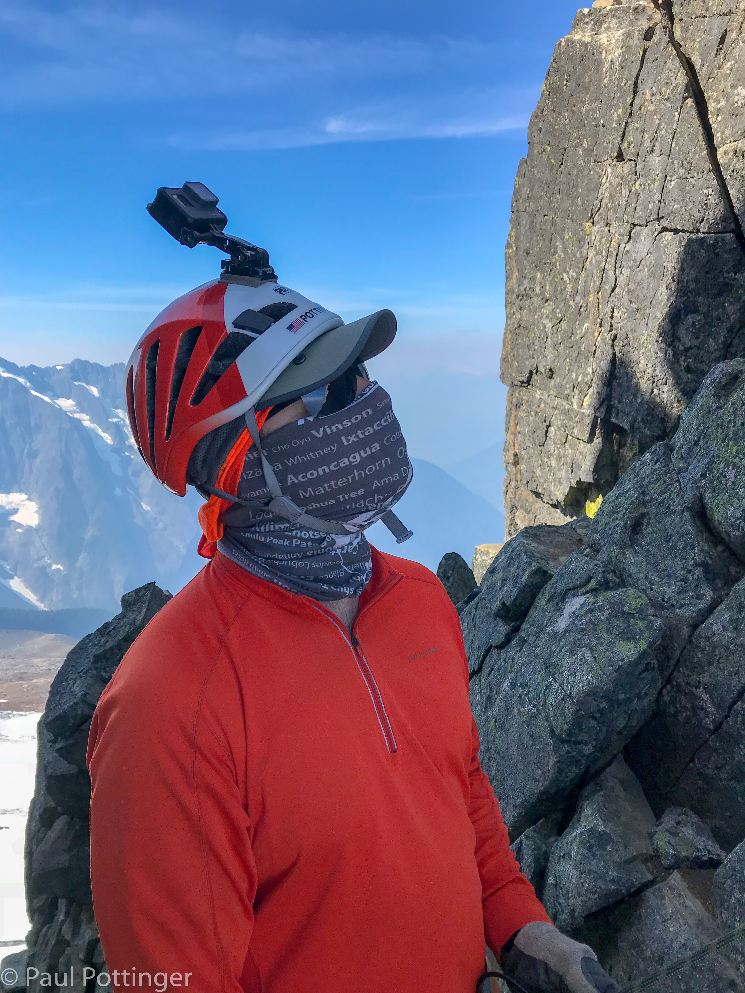
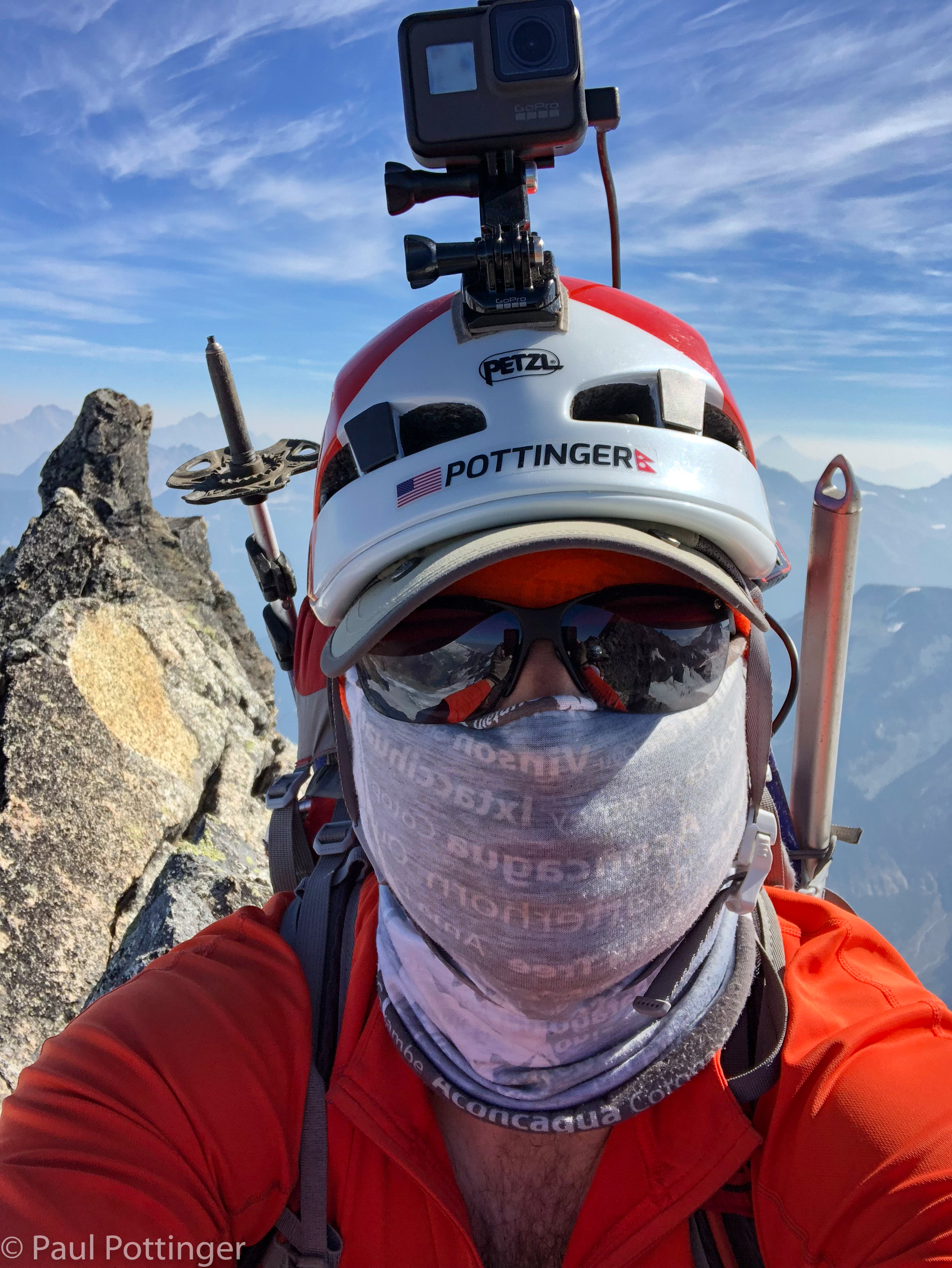
The day’s climb, condensed to 13 minutes. My favorite segments are at 3:44, 5:00, and 9:42.

For those who want to see all the footage I shot that day, about 2 hours of our 14 hour day, here it is. Language cleaned up, otherwise raw footage:

Here’s the blog.

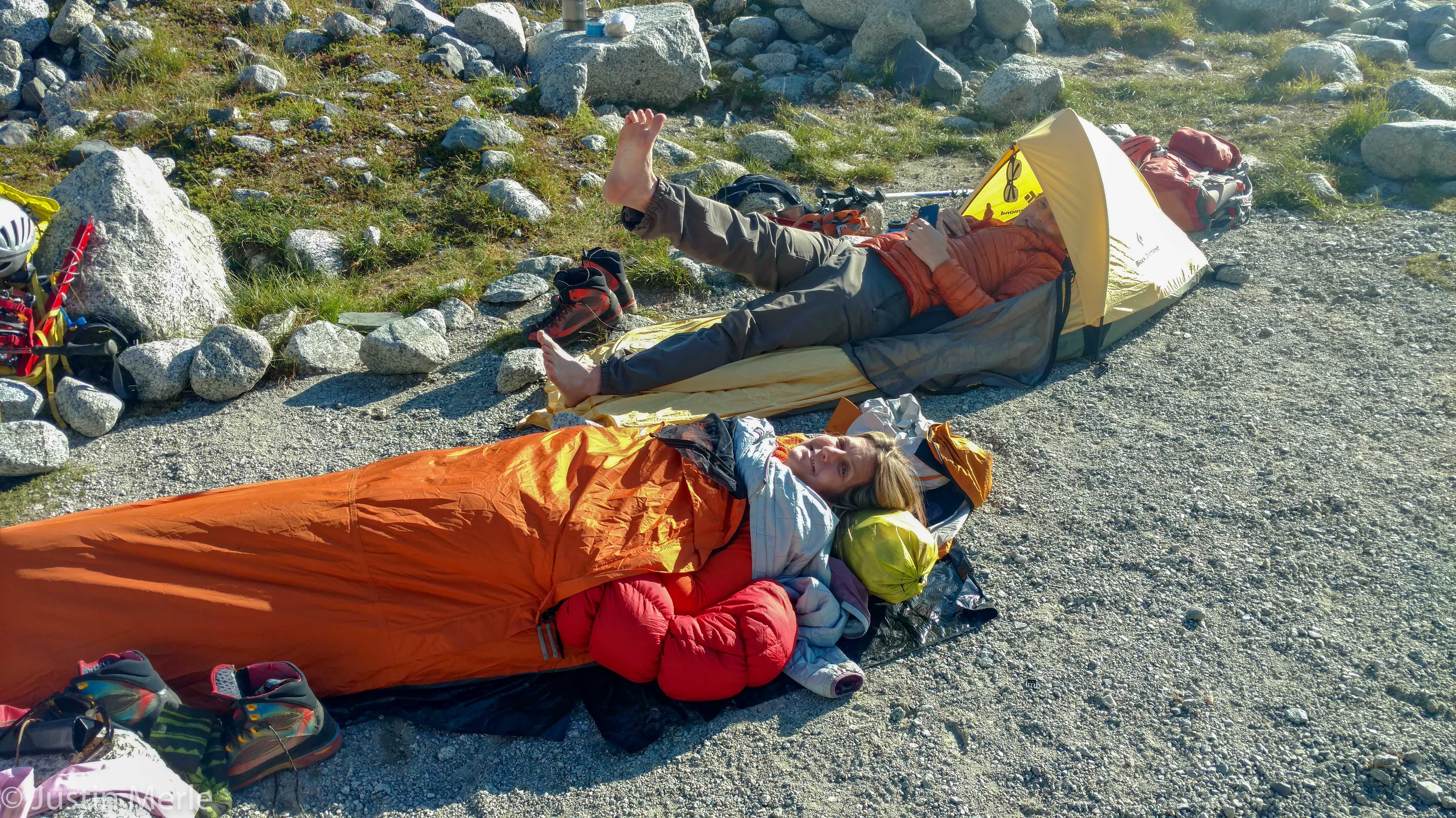
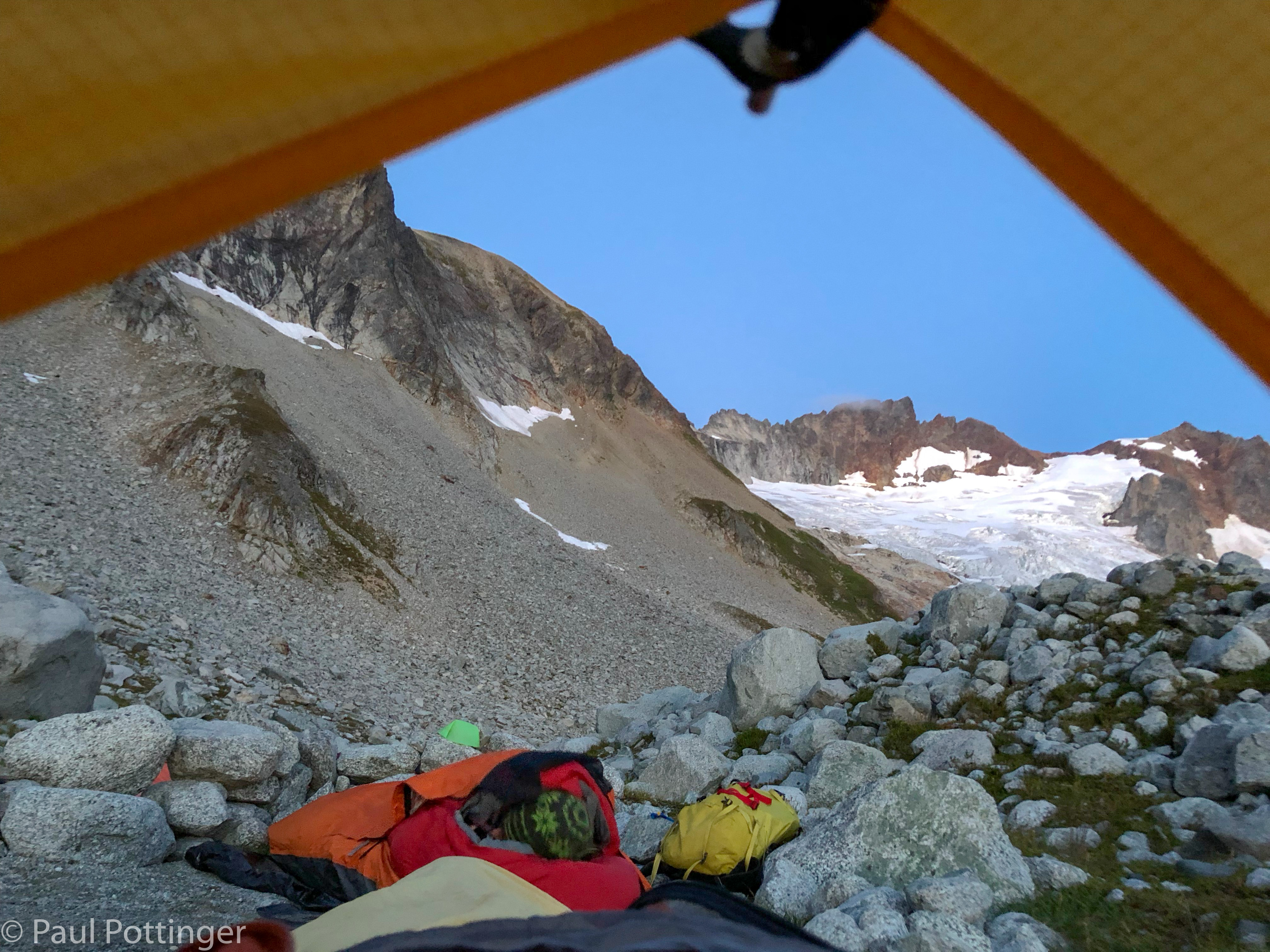
I slept well on the bivvy ledge. The sheer drop to my right focused my attention as I got situated in the bag at bedtime, because a row of stones several inches high separated me from the void. But, I’m not a roller / thrasher at nighttime, and I knew I’d be fine. I surrendered to dreams of work piling up in the hospital… then the faces of my family… then the steep ramparts of Forbidden… then the crevasses we had passed on our way to the ridge. I was walking on the ice, threading my way between the dark, bottomless cracks… then the ice became gyri of a giant brain, and the crevasses were sulci separating them. I felt the electrical activity of thoughts coursing through the massive tissue, rocketing silently to and fro, carrying messages I could not understand. I often get freaky dreams in the mountains..

Good morning. Moonrise over the North Cascades.
Looking over my feet in the bivvy bag. Ann still tucked in below me.
Our objective for today: Forbidden Peak.
Justin boiling water for breakfast.
Now we can see some of the features surrounding the bivvy that were hidden last night.
Rise and shine….

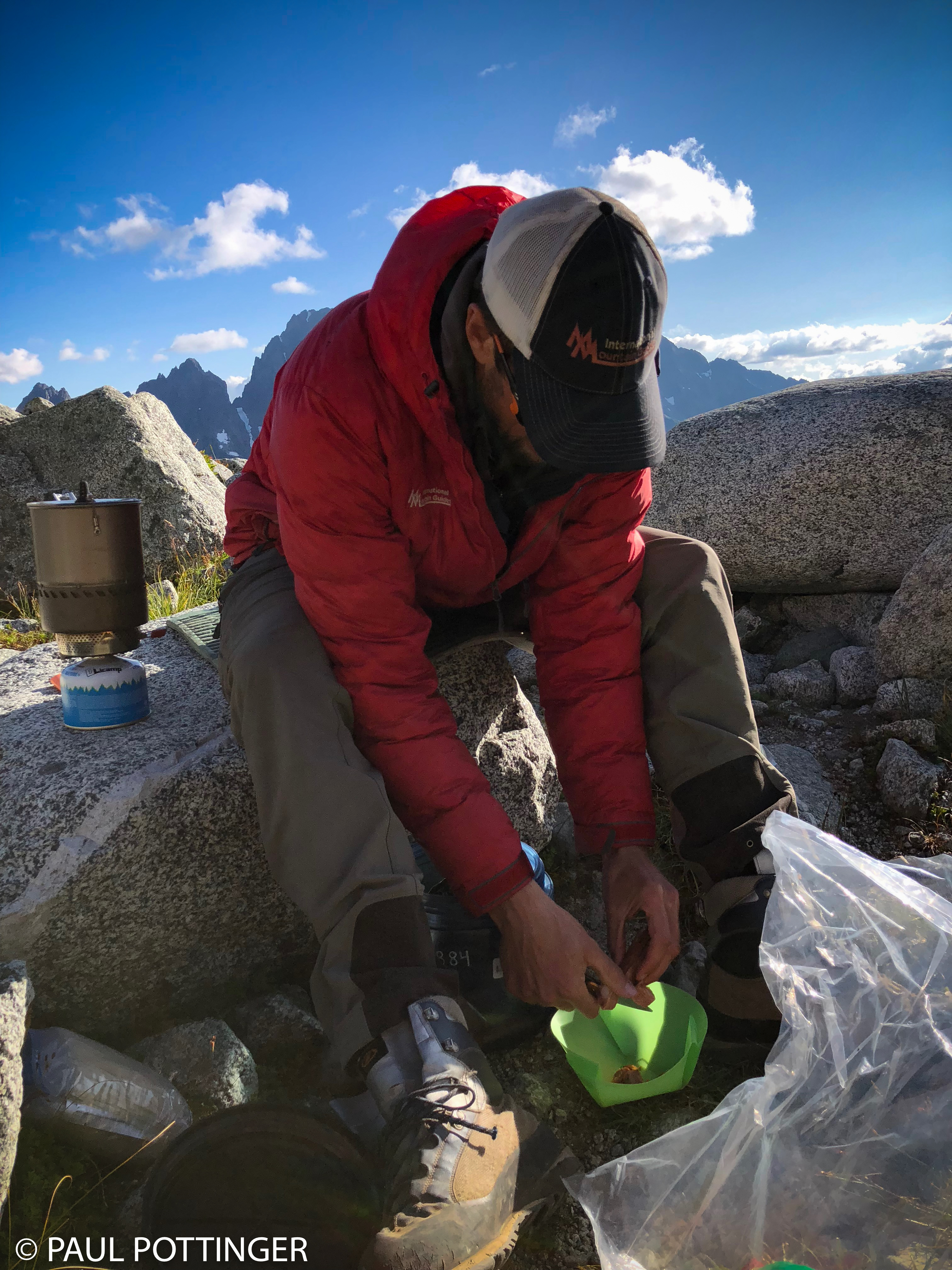
Several times during the night I heard scurrying around my head…. Mice? Rats? Pika? Snafflehounds! Justin had told us of the presence of these marauding miscreants, alpine mischief-makers that love to eat anything and everything available. We had left our bear canisters at low camp—no bears up here!—and this meant that only plastic and fabric separated our food from the hungry rodents hiding among the bivvy stones. I kept my food in the sleeping bag with me, where it was totally safe. But, circle my bag they did, and several times I shooed them away. Nothing to eat here!

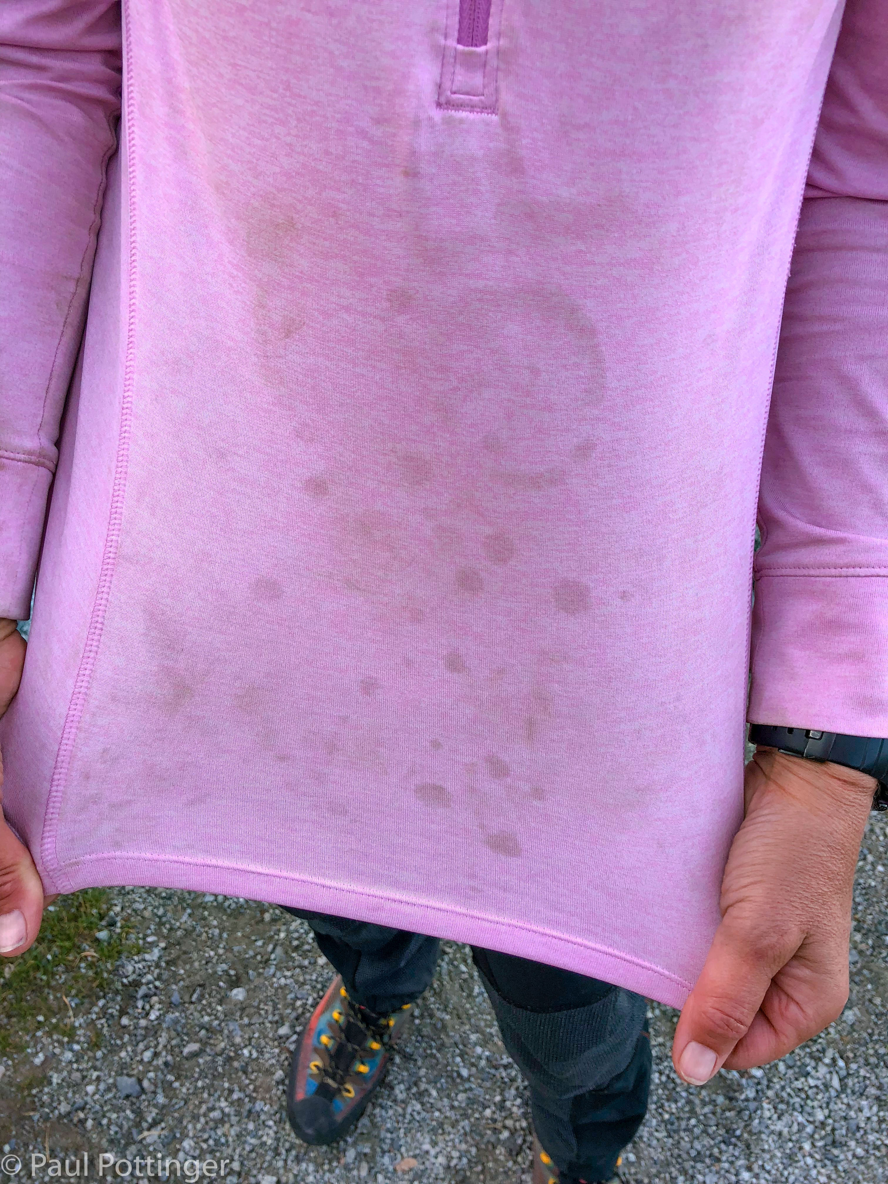
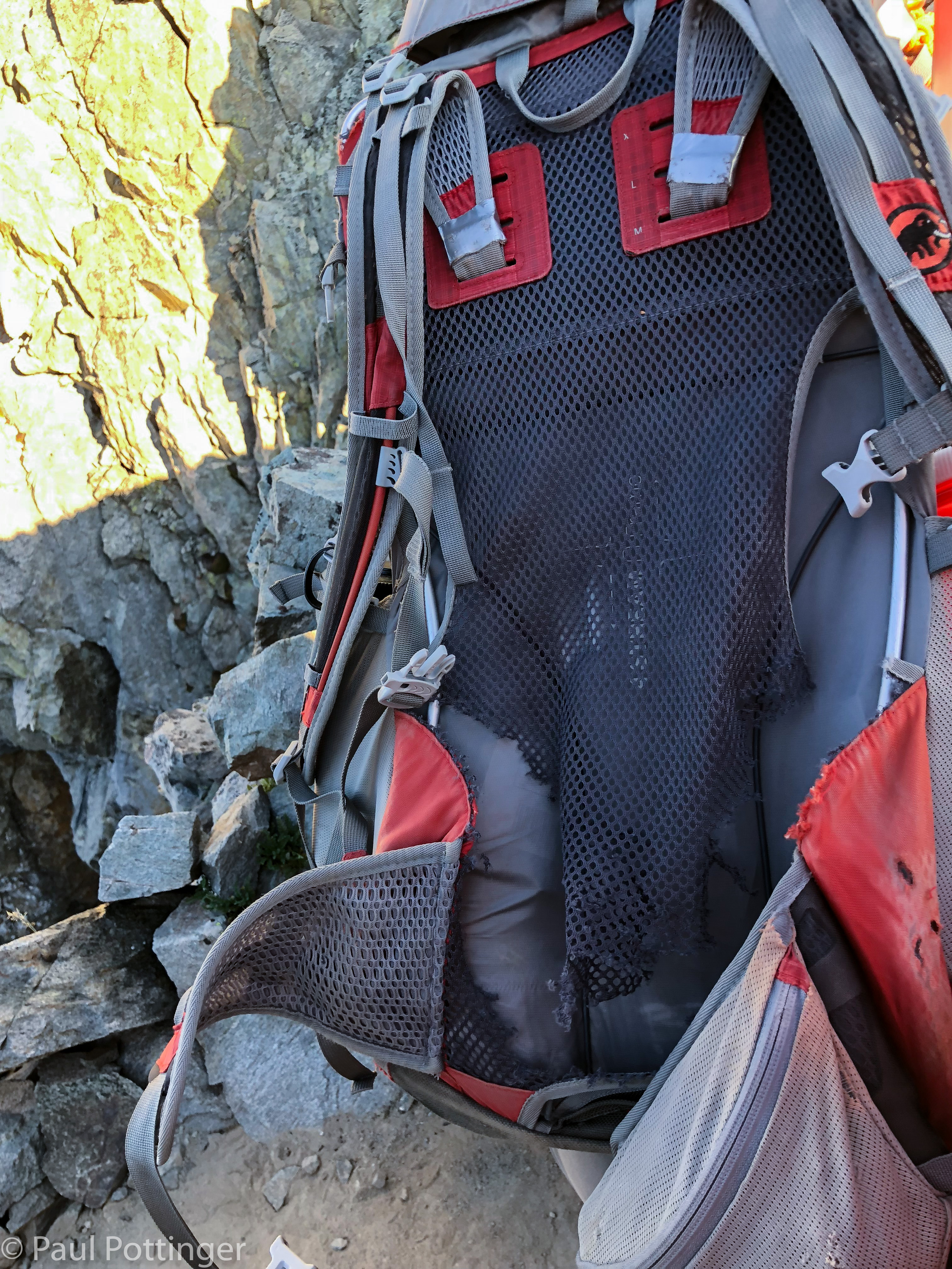
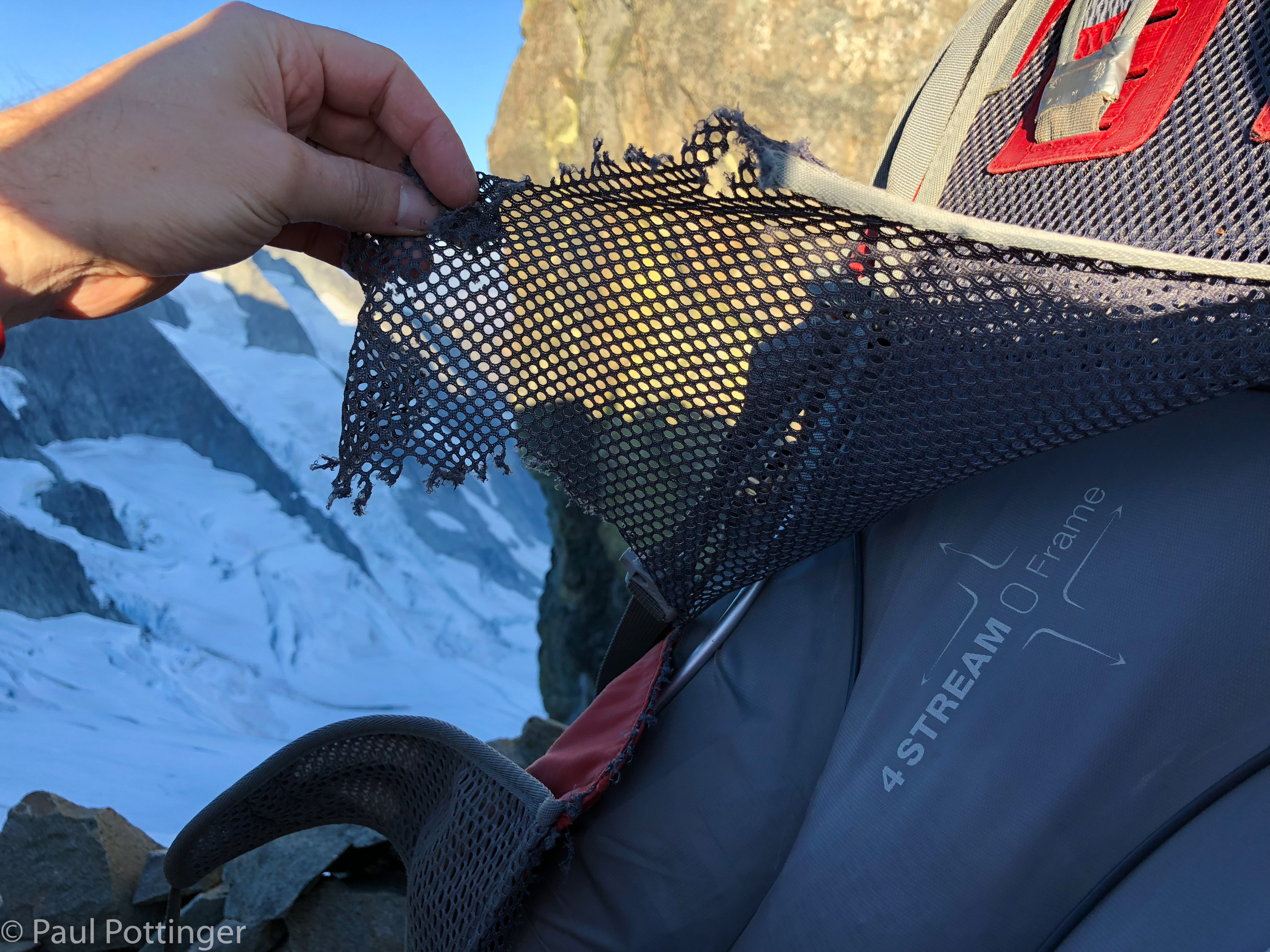
Morning revealed the toll these scallywags had taken: My trusty Creon Light 45 pack was destroyed. Tiny teeth had chewed the back ventilation mesh away from its anchor points on both sides, leaving it to hang uselessly. Dammit! Snafflehounds! Whether they were actually rats or mice I will never know. They must have been after the salt from my perspiration that had caked there yesterday. The pack would still work, but it was seeing its last expedition. I thought about the first time I had taken it up high, to the top of Mont Blanc with Matt and JR, 7 years earlier. I had beaten it up badly since then, and had sewn rips closed so many times that it started to look like Frankenstein’s monster. Now, this was the last straw. Farewell, sweet Creon, you served me well….

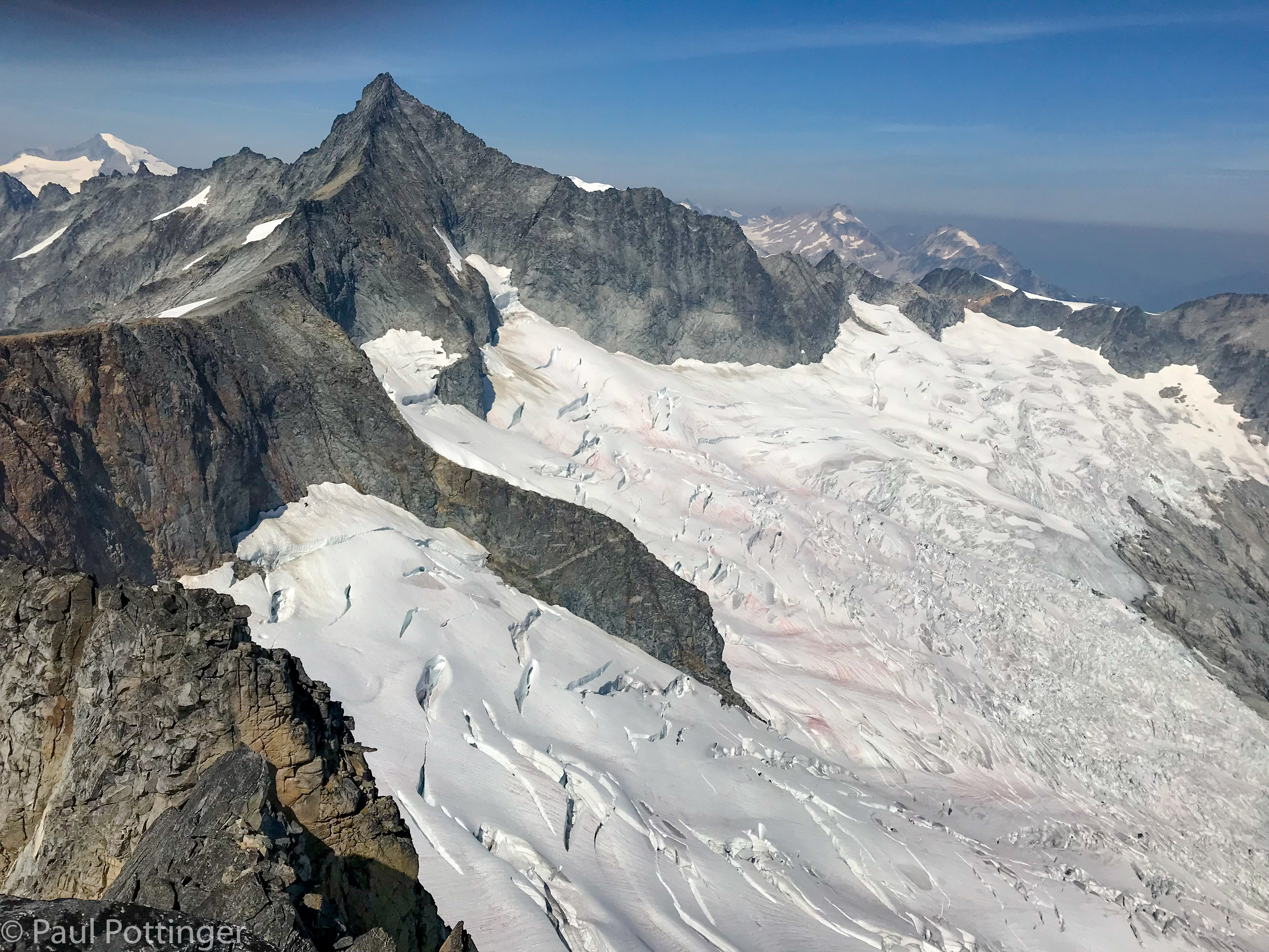
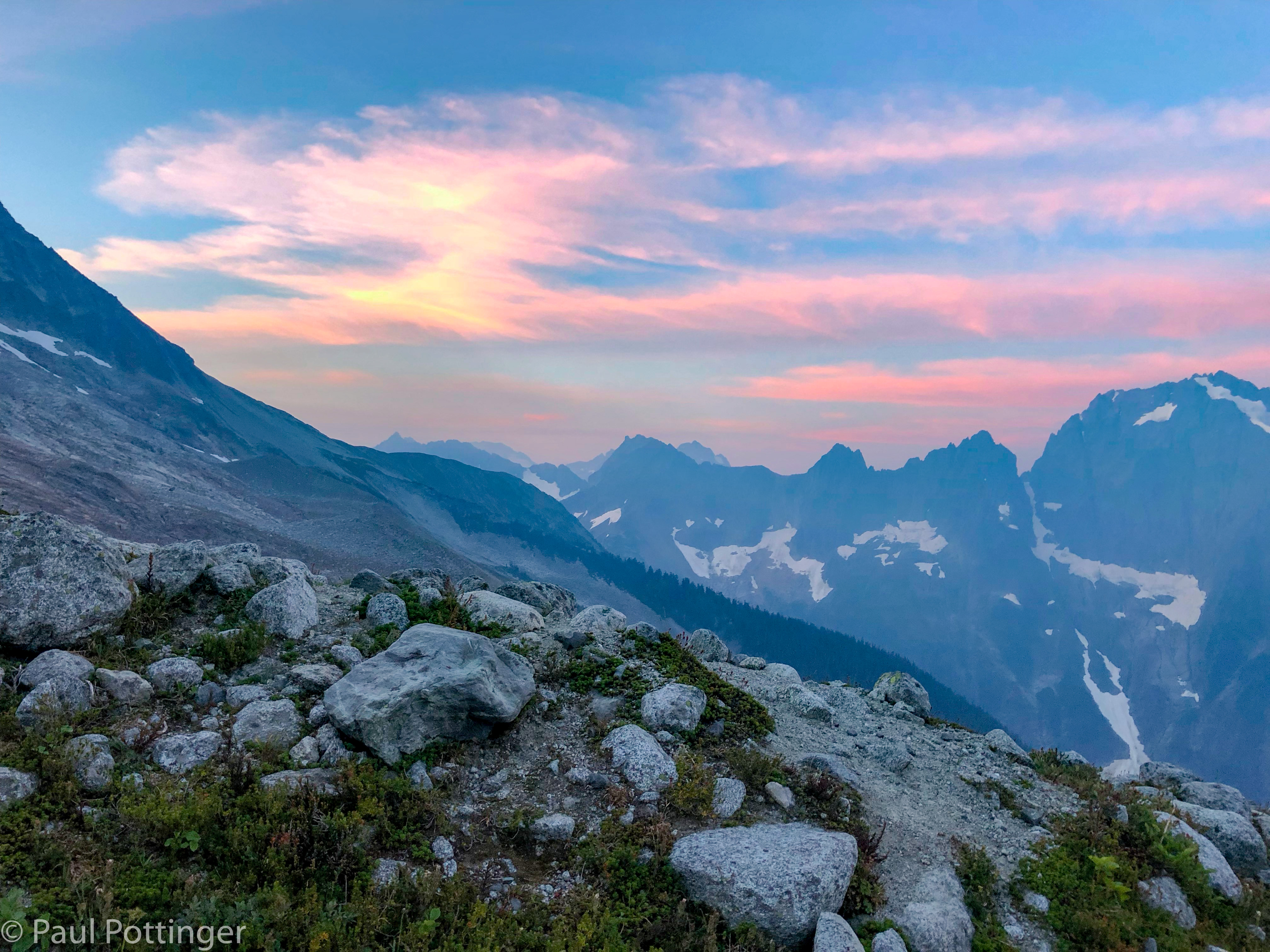
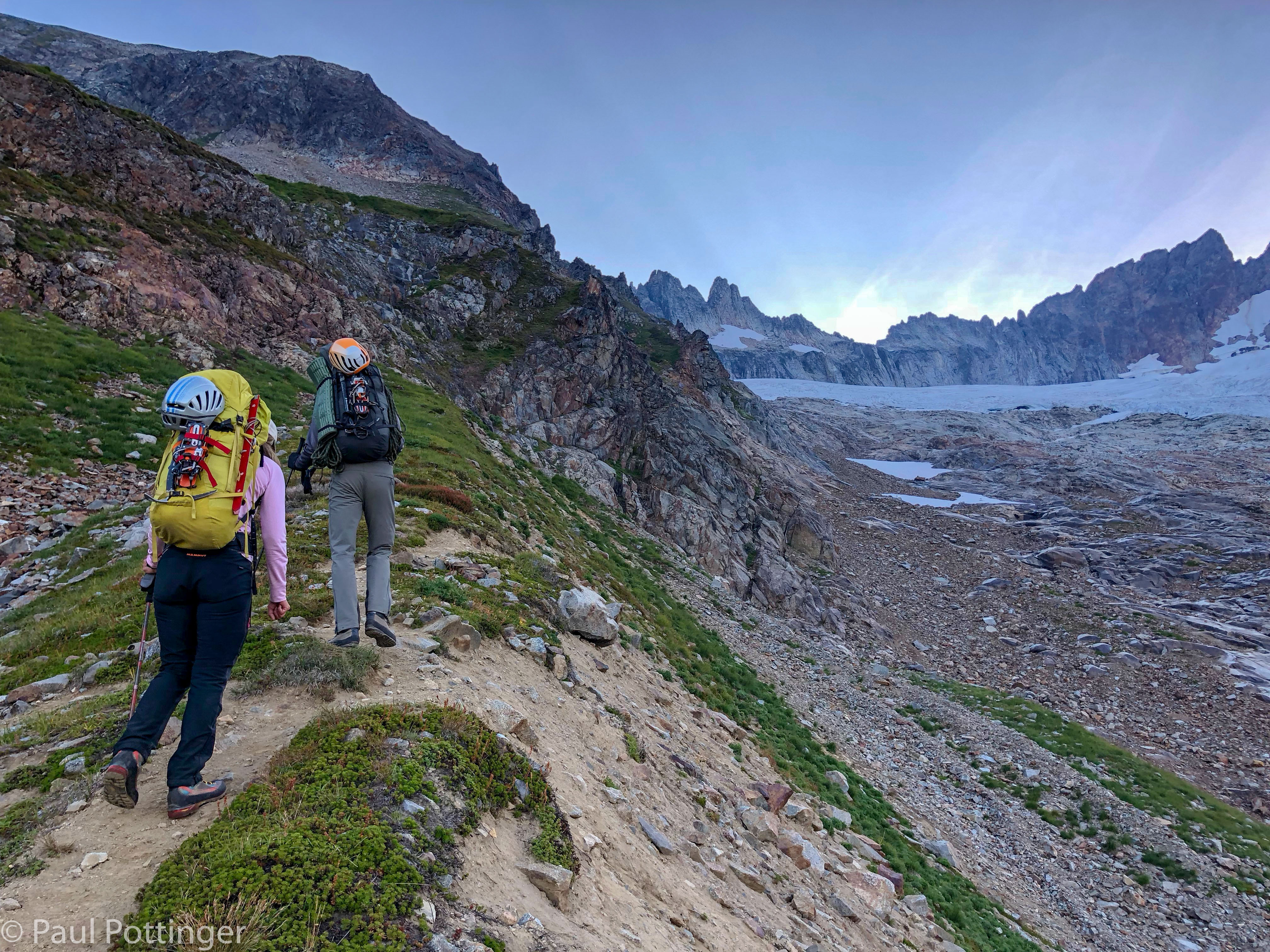
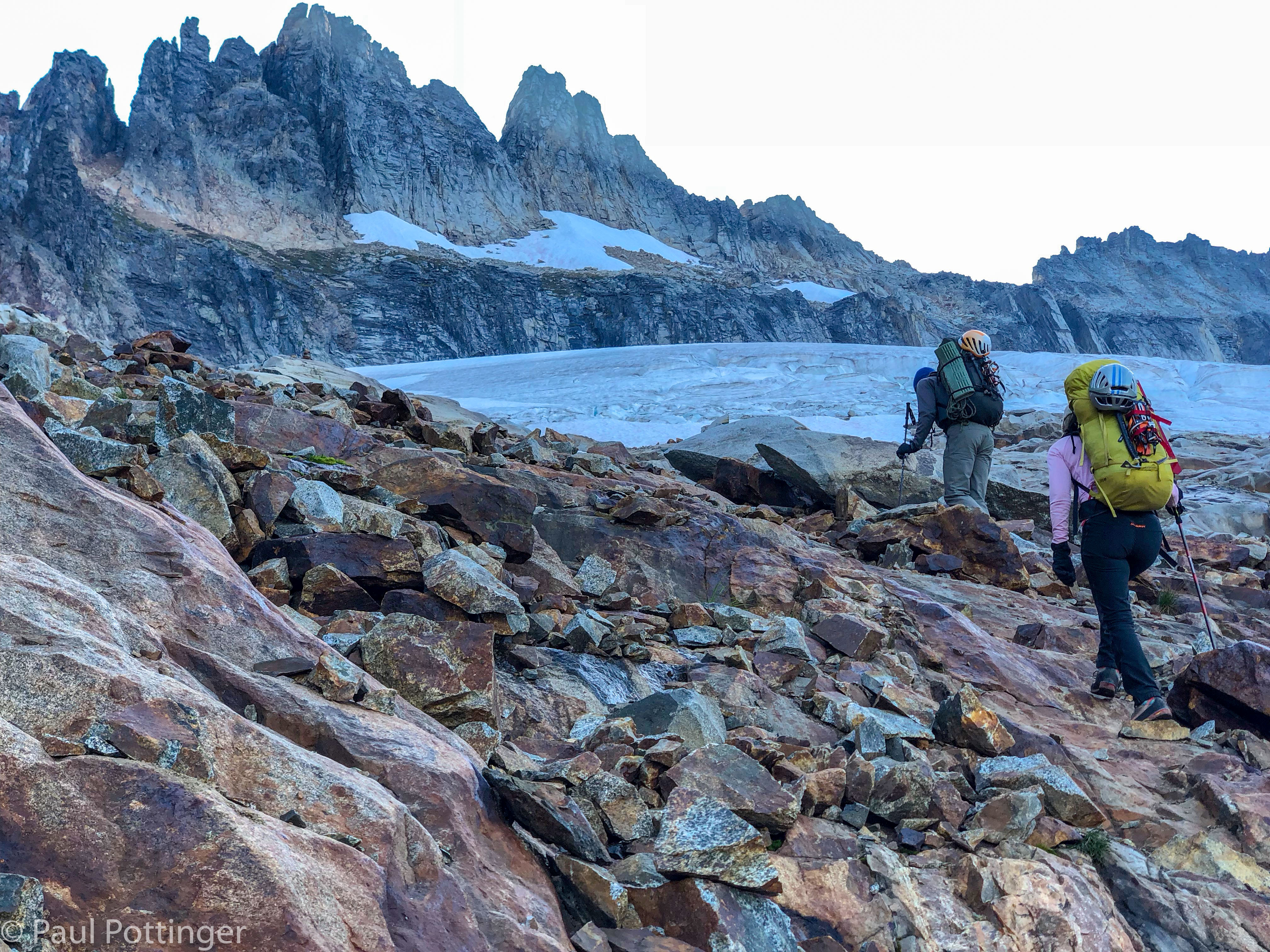
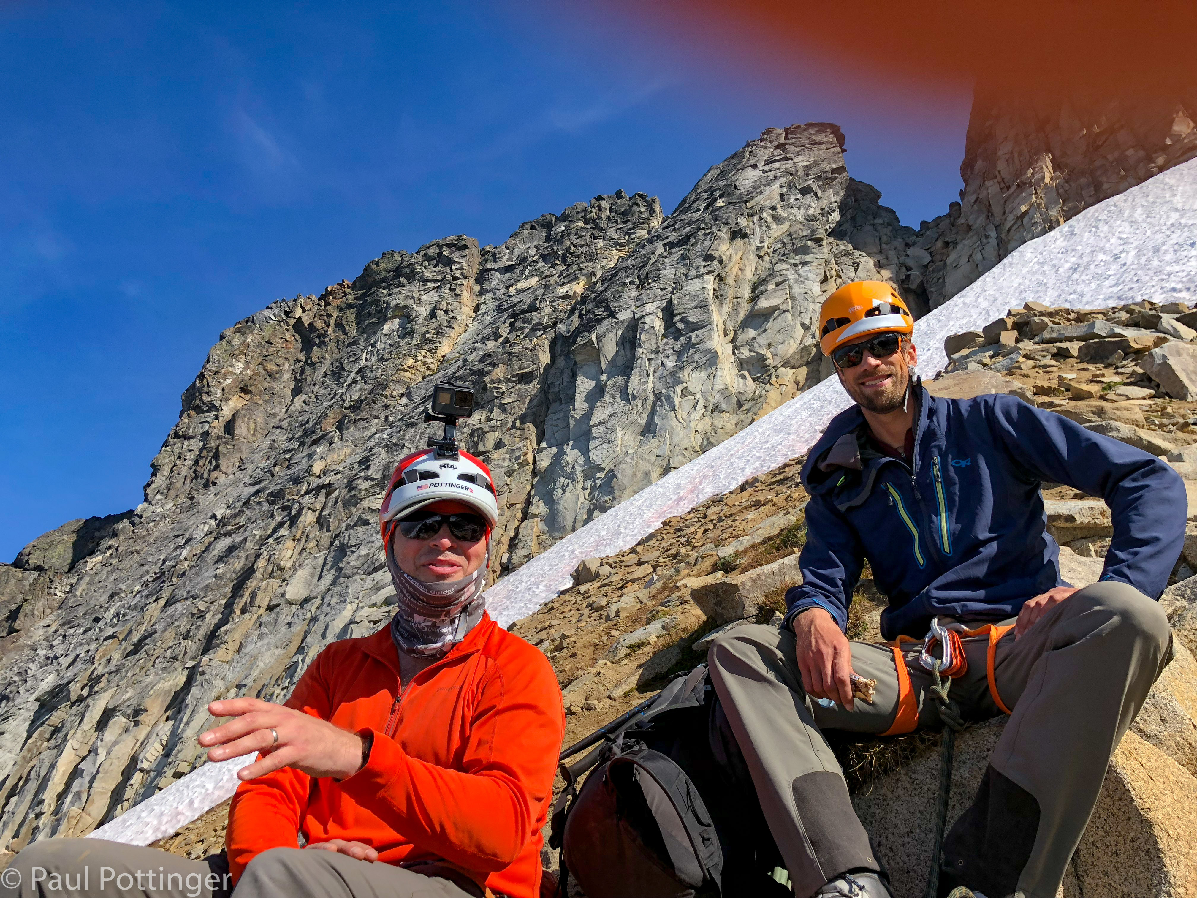
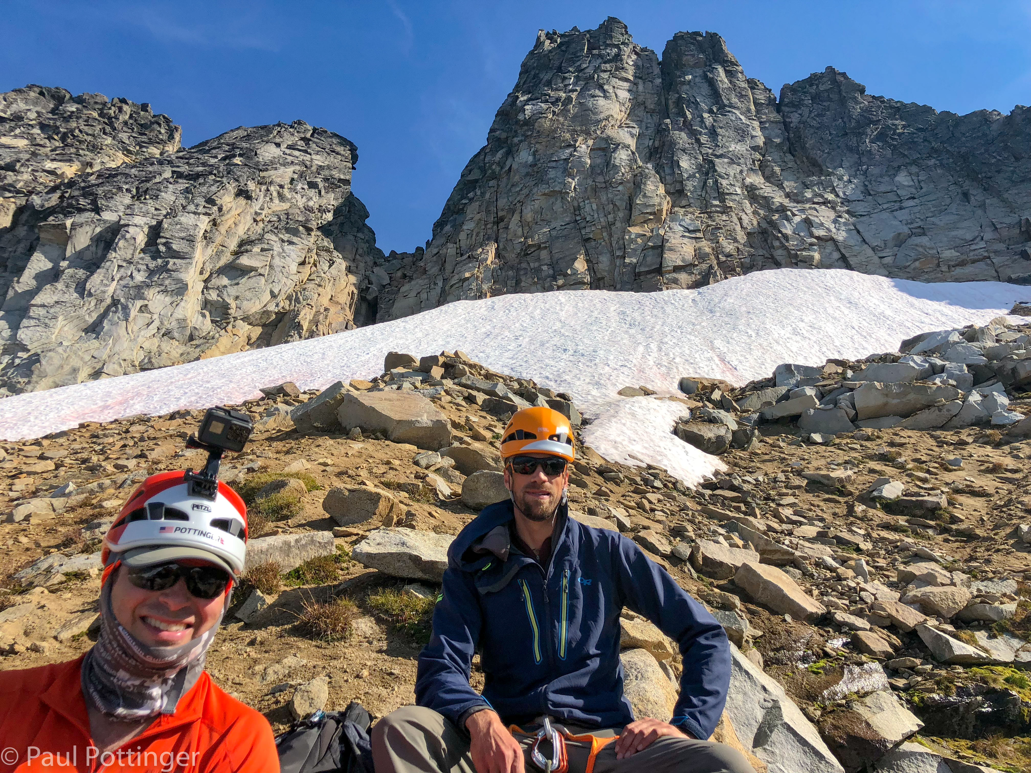
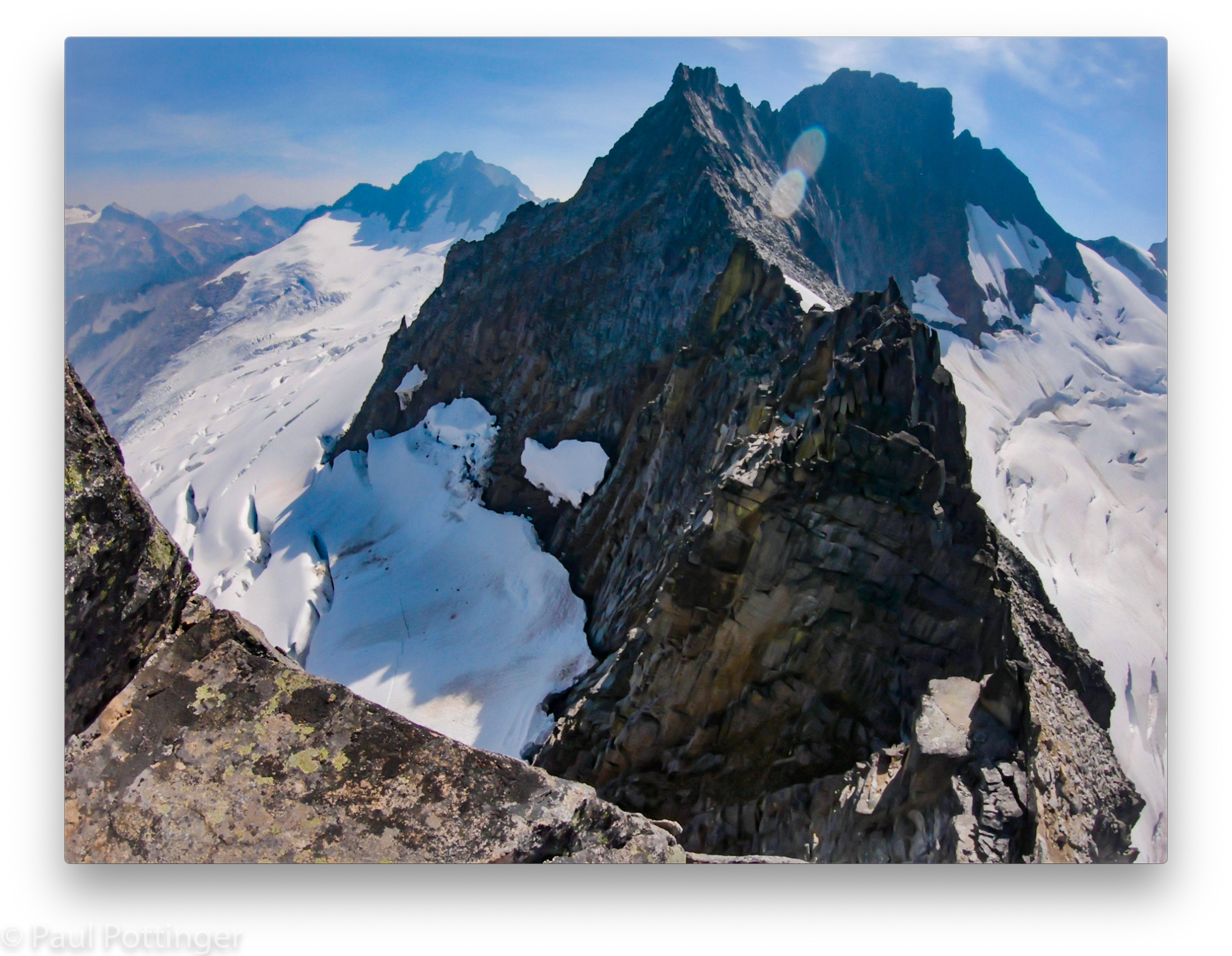
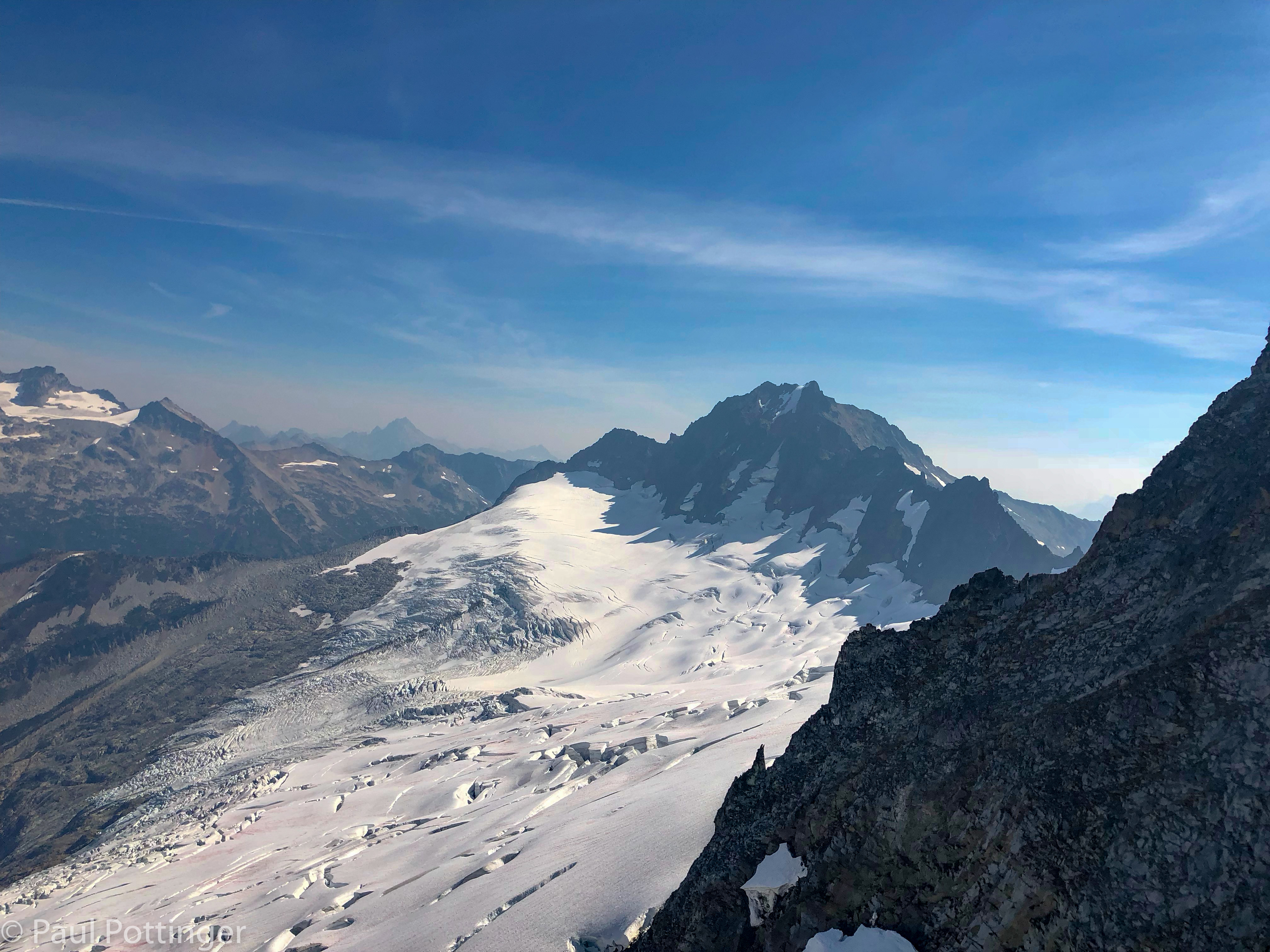
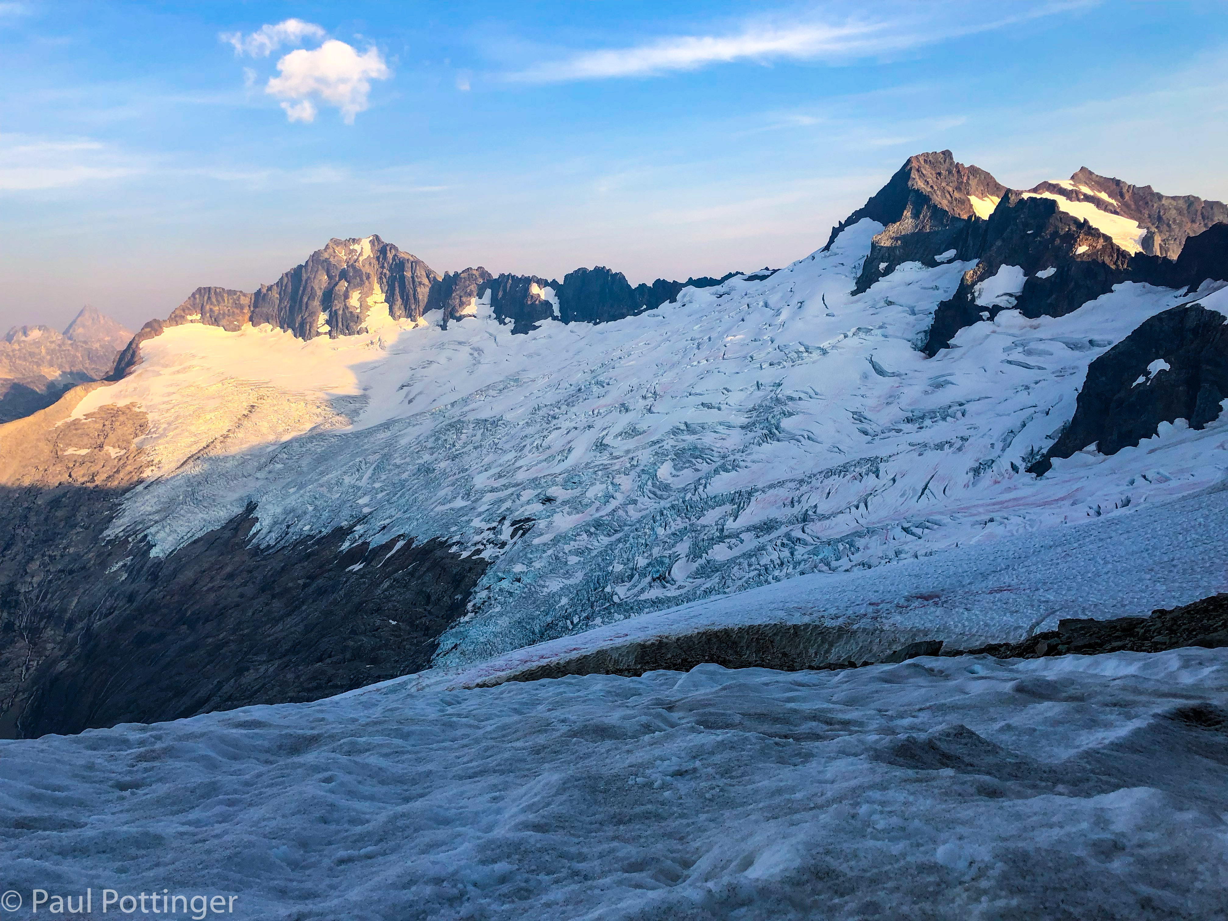
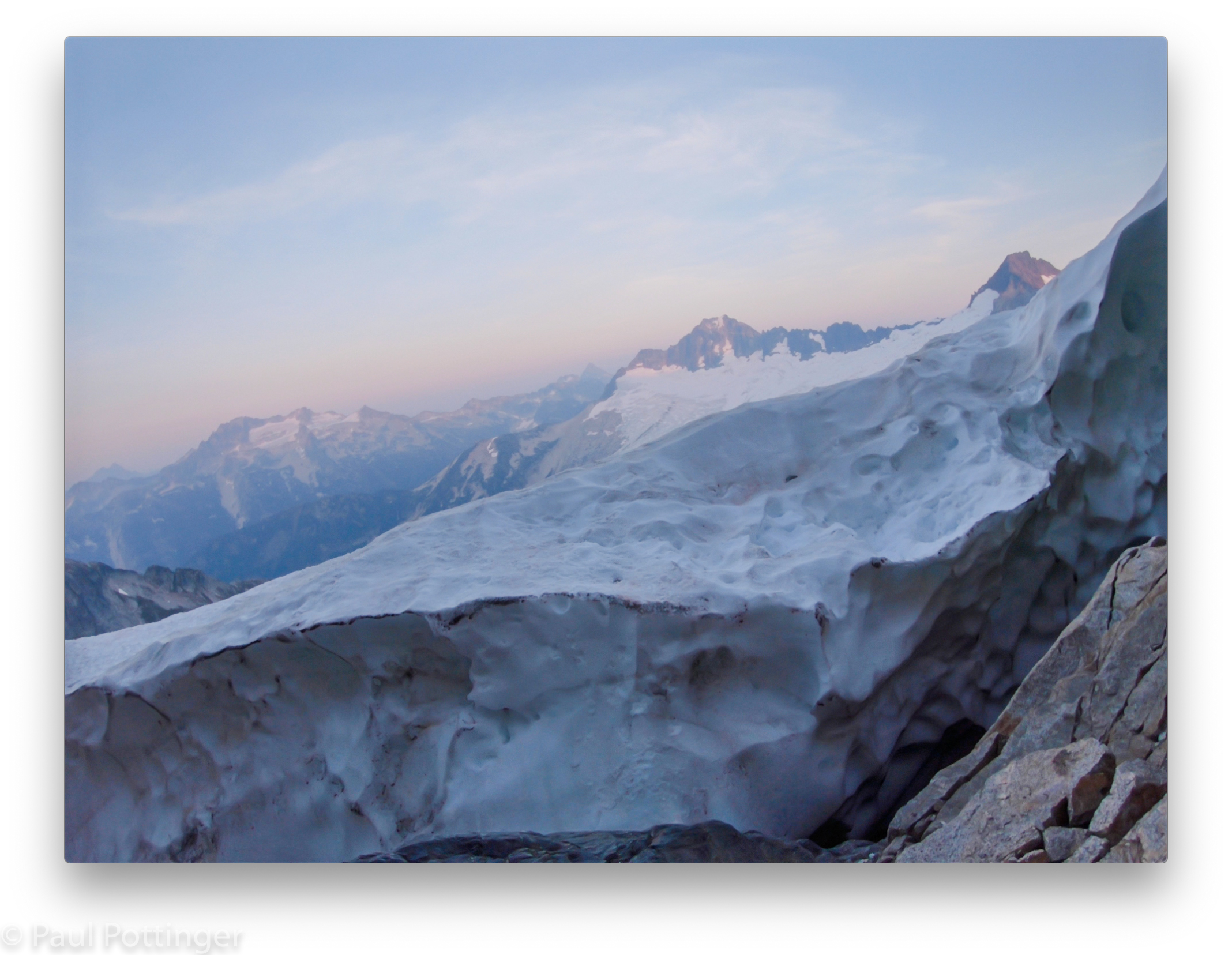
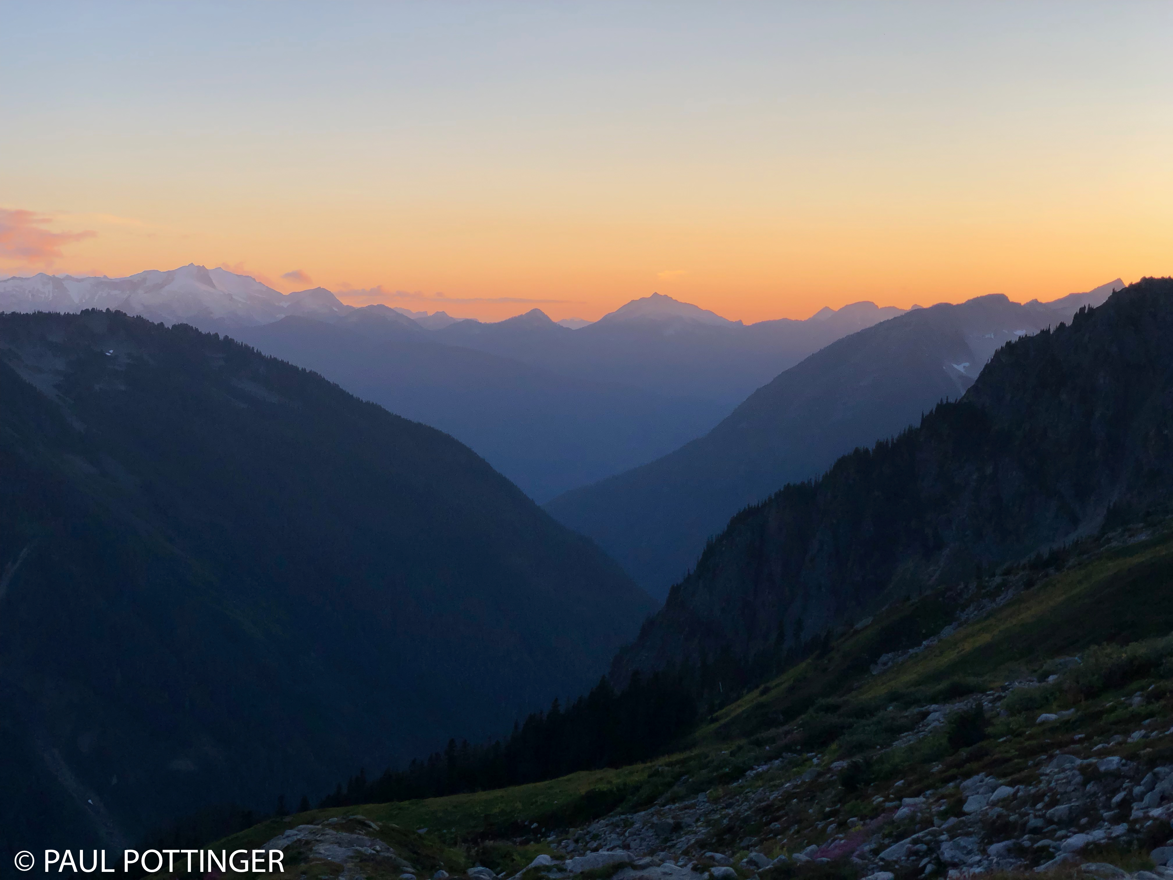
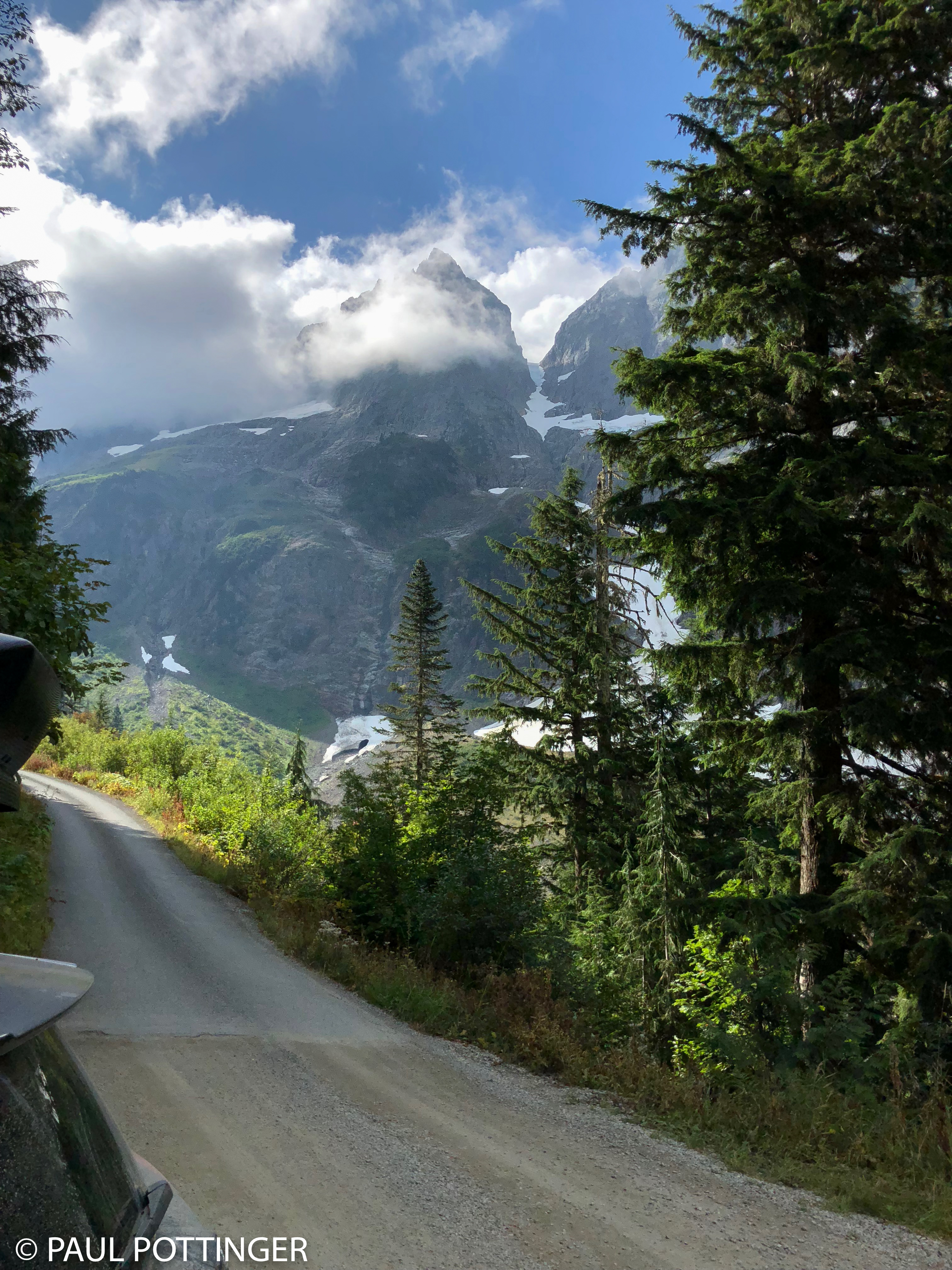
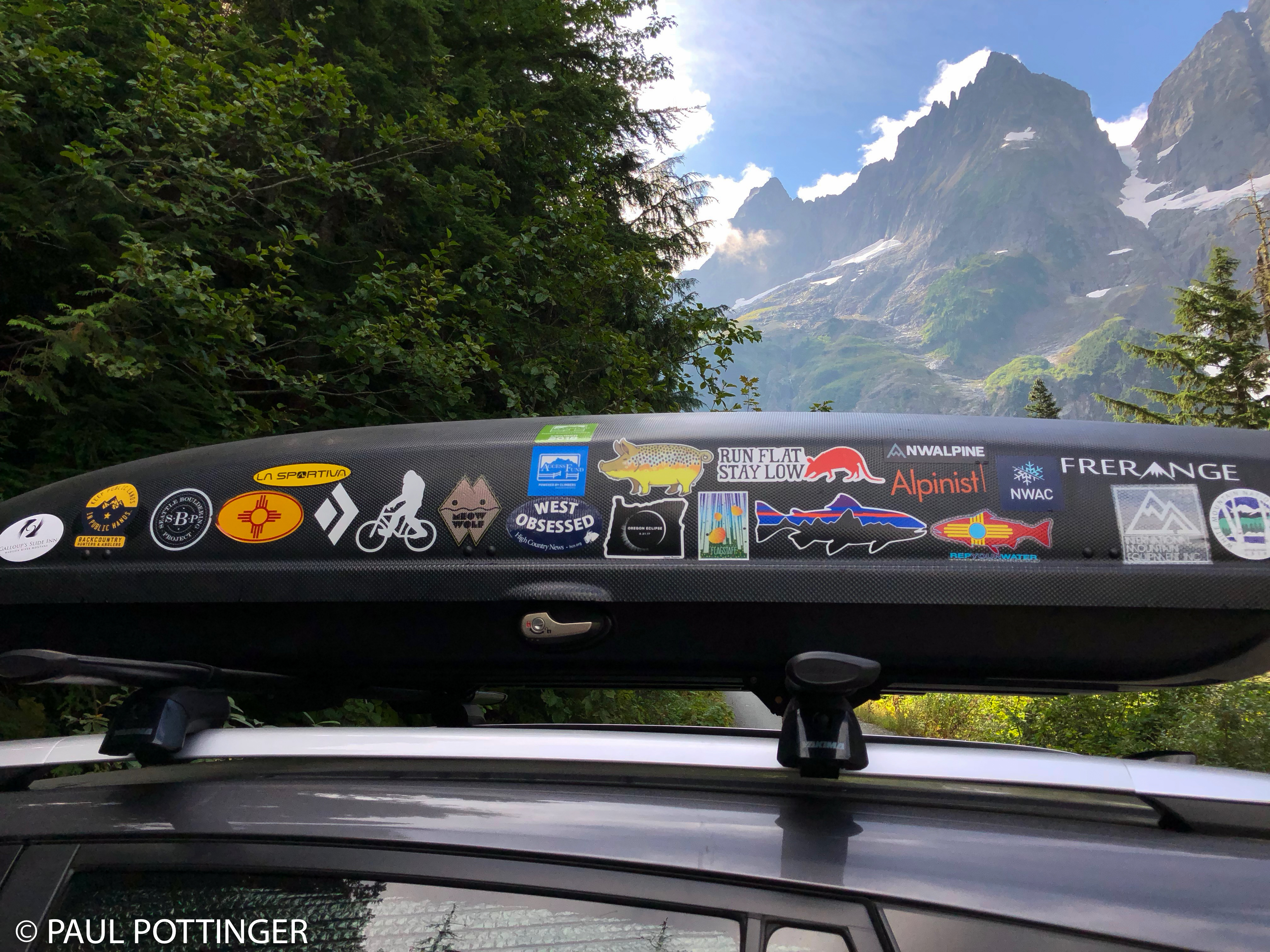
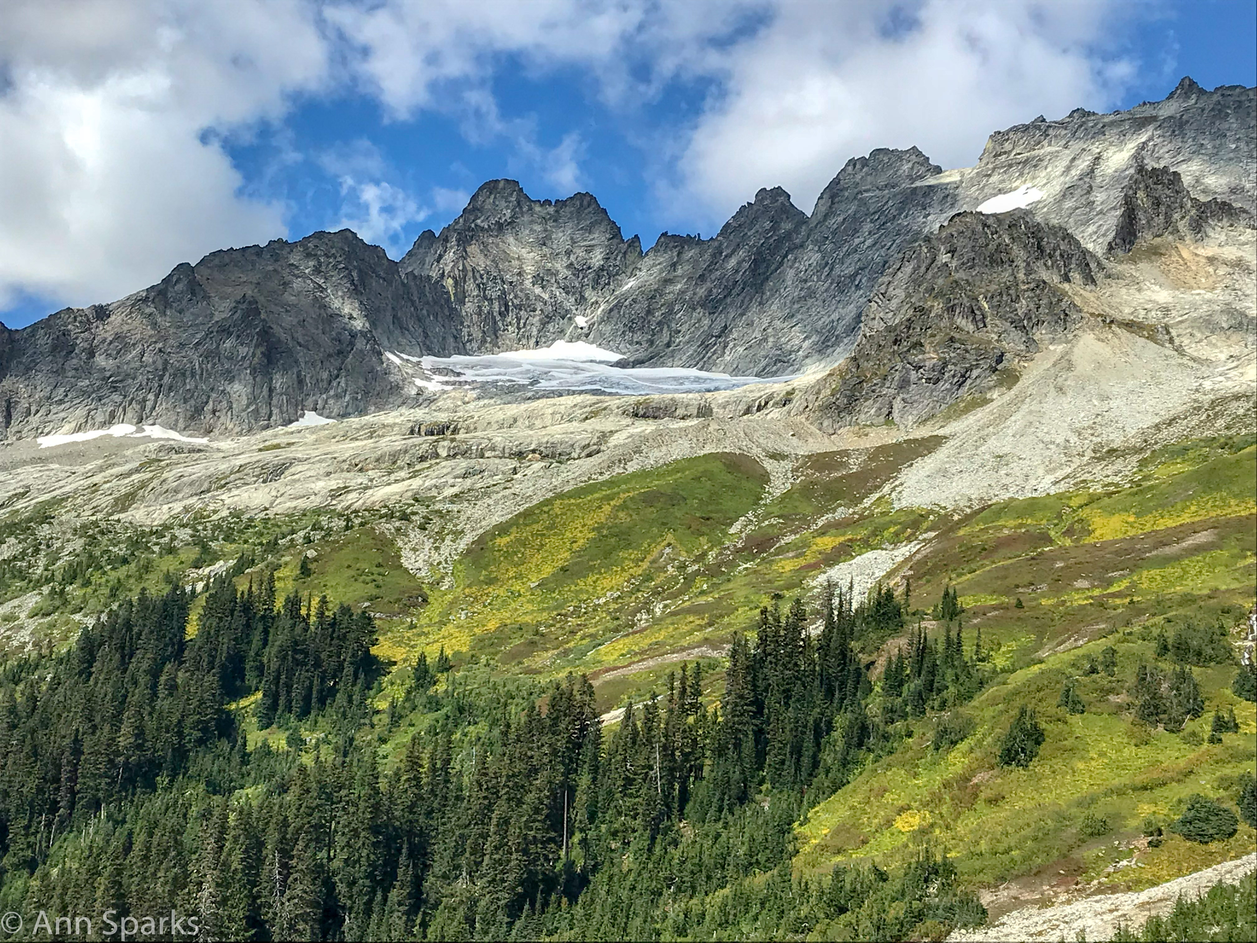
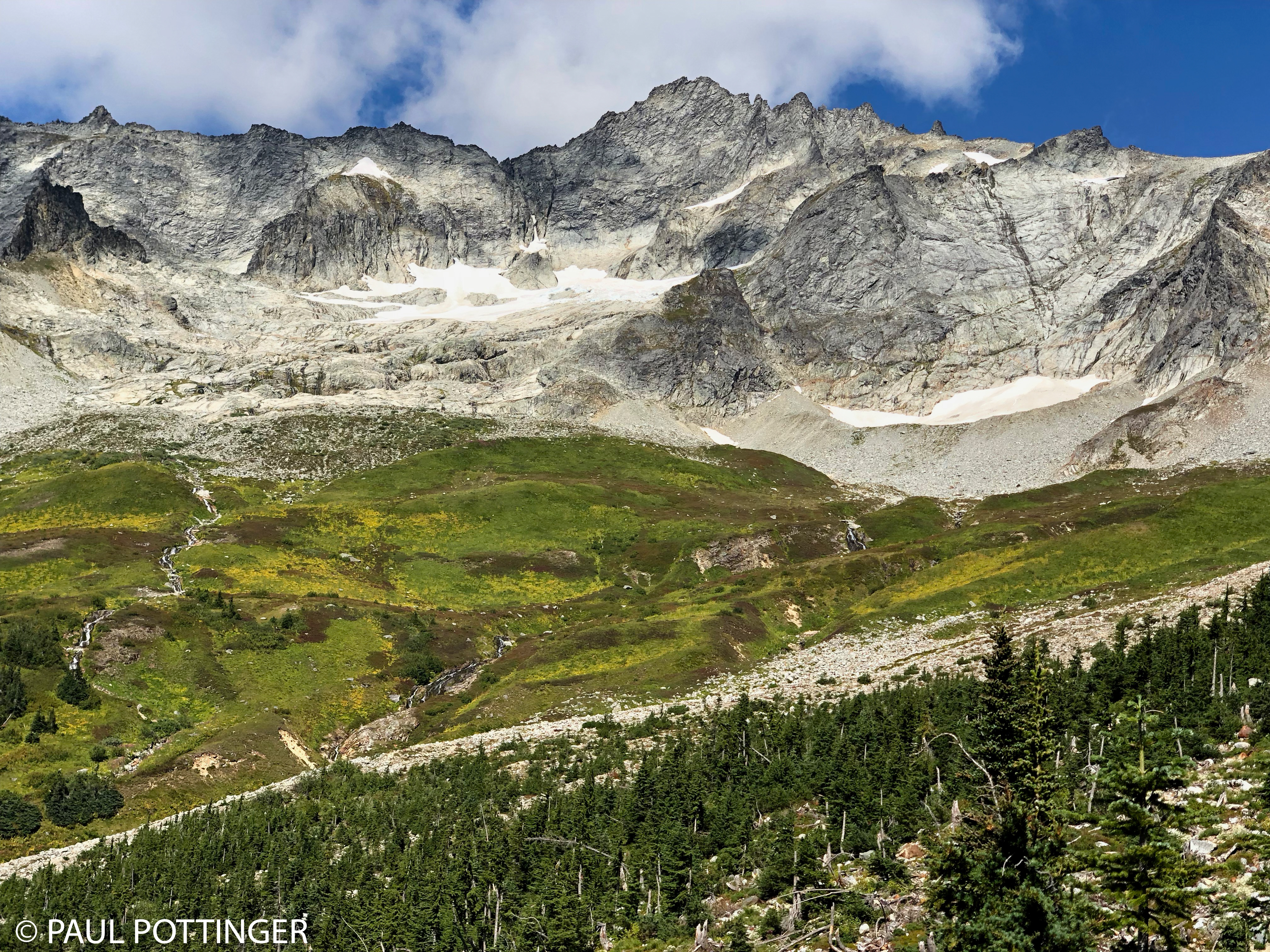
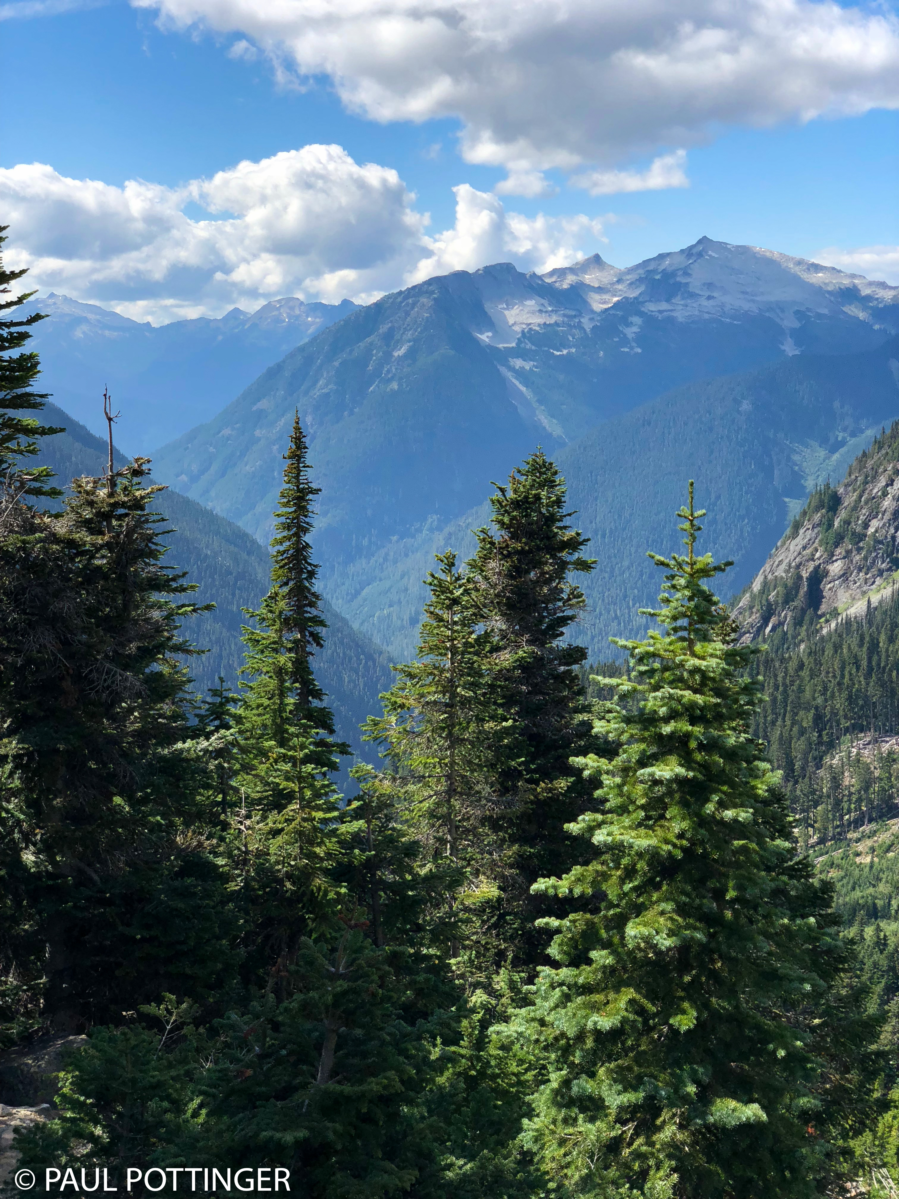
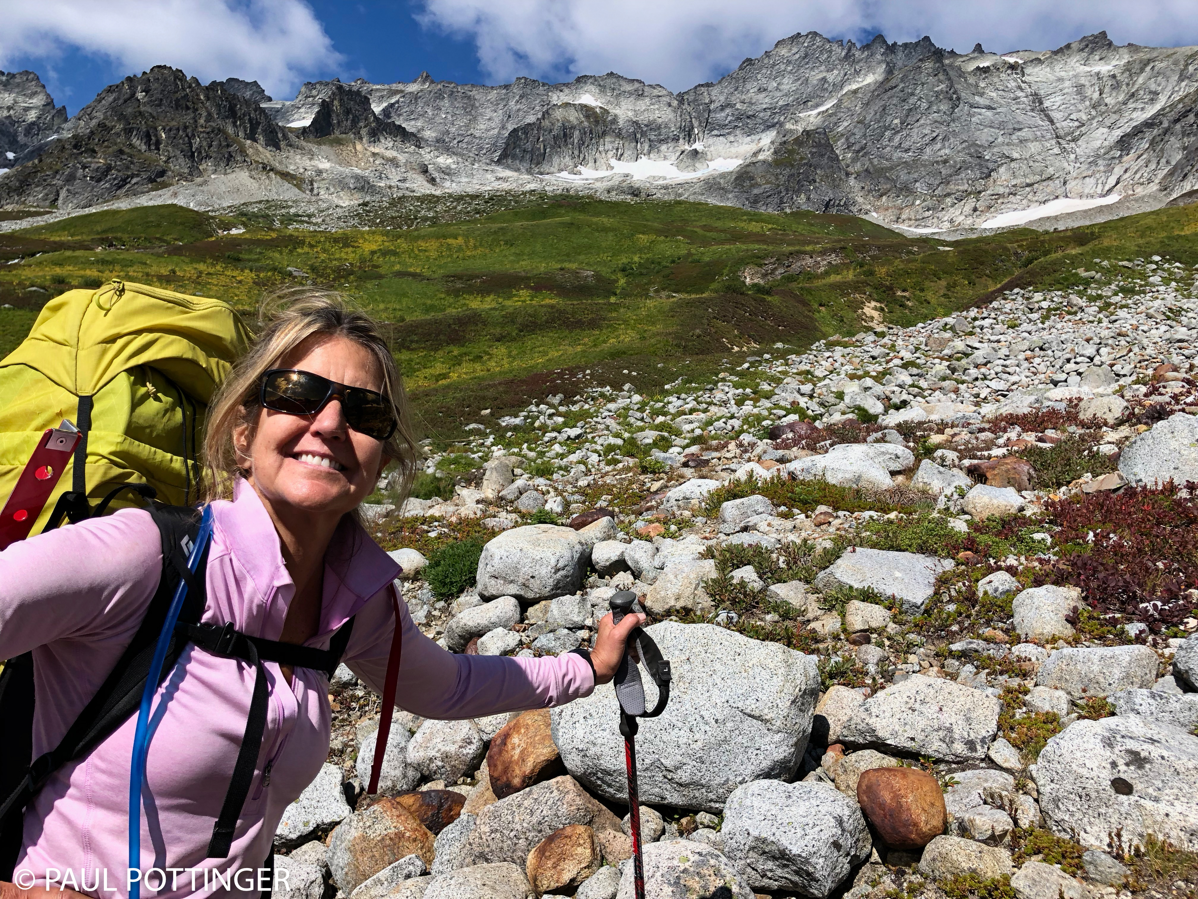
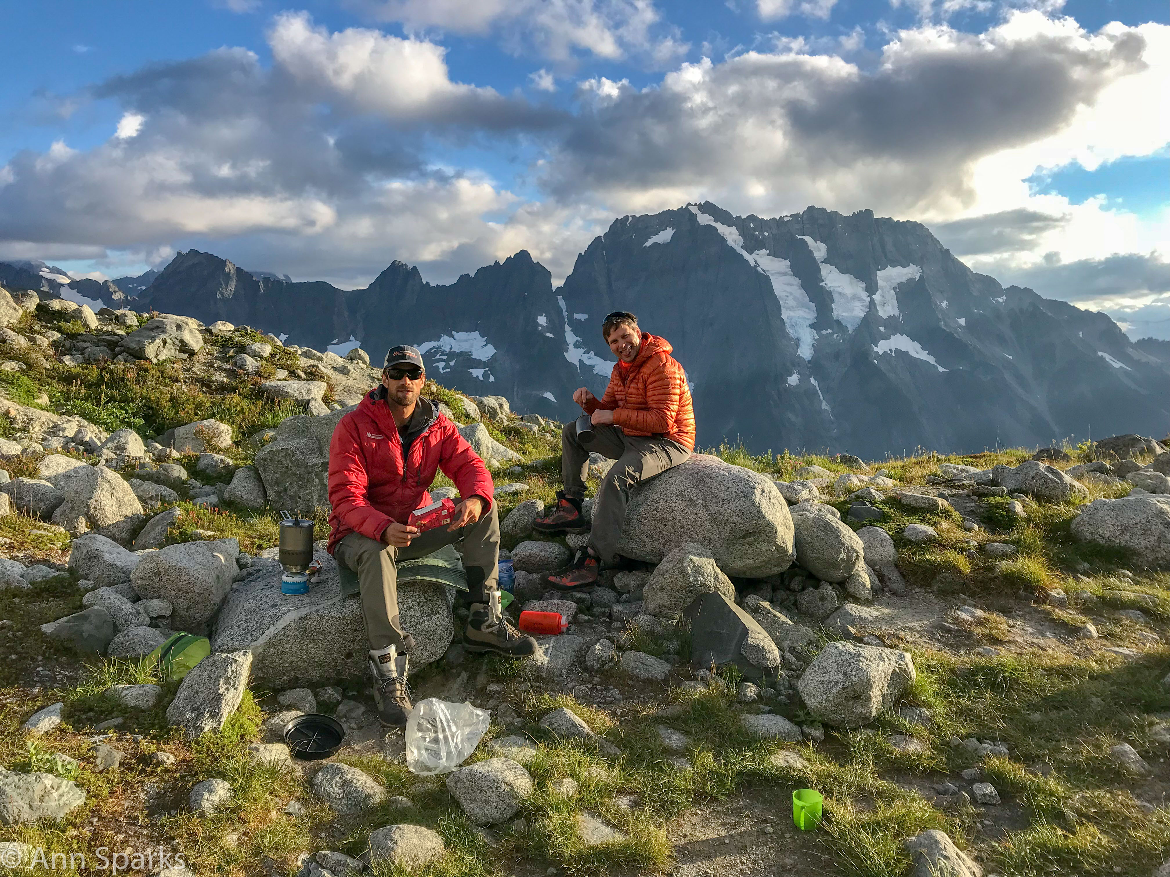
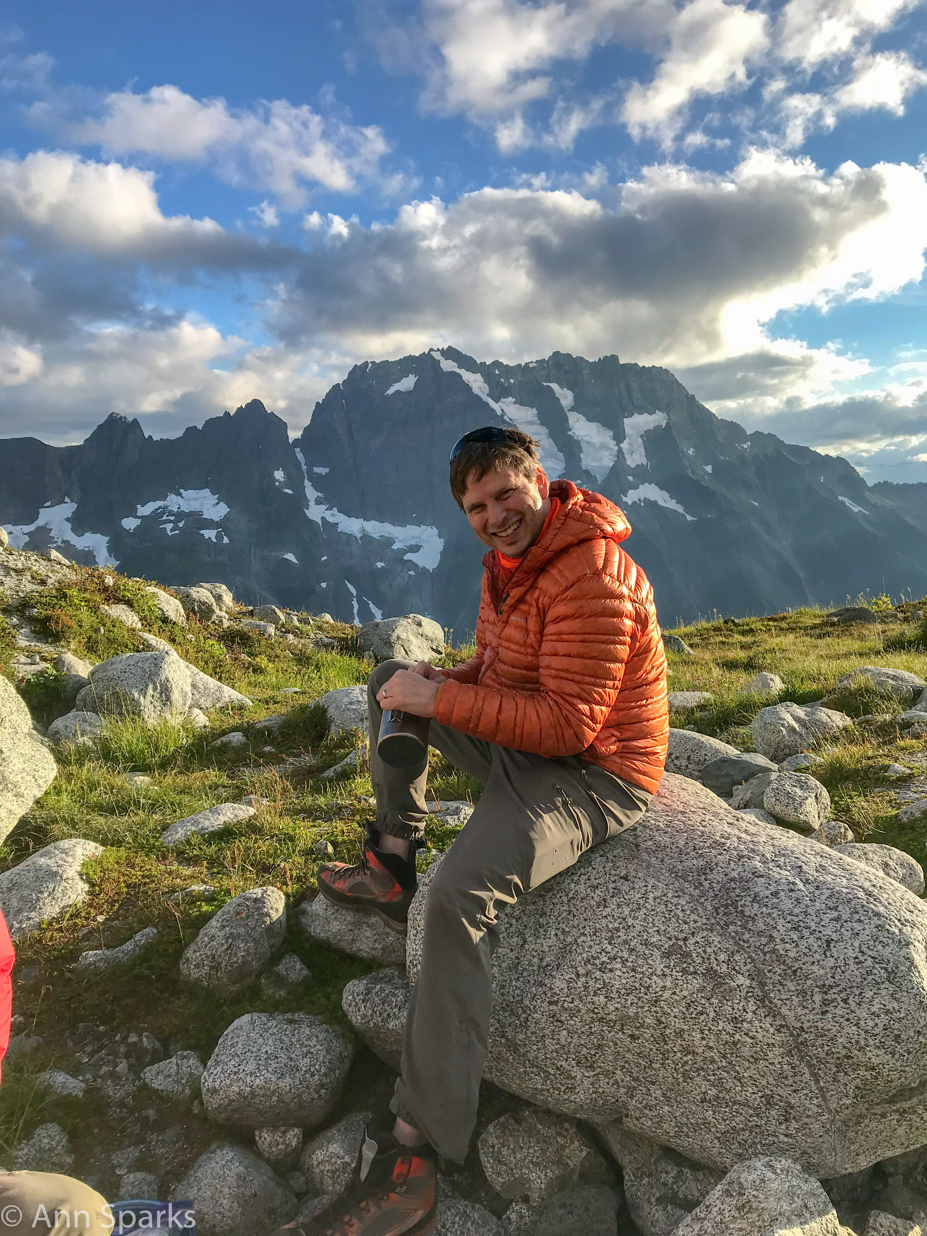
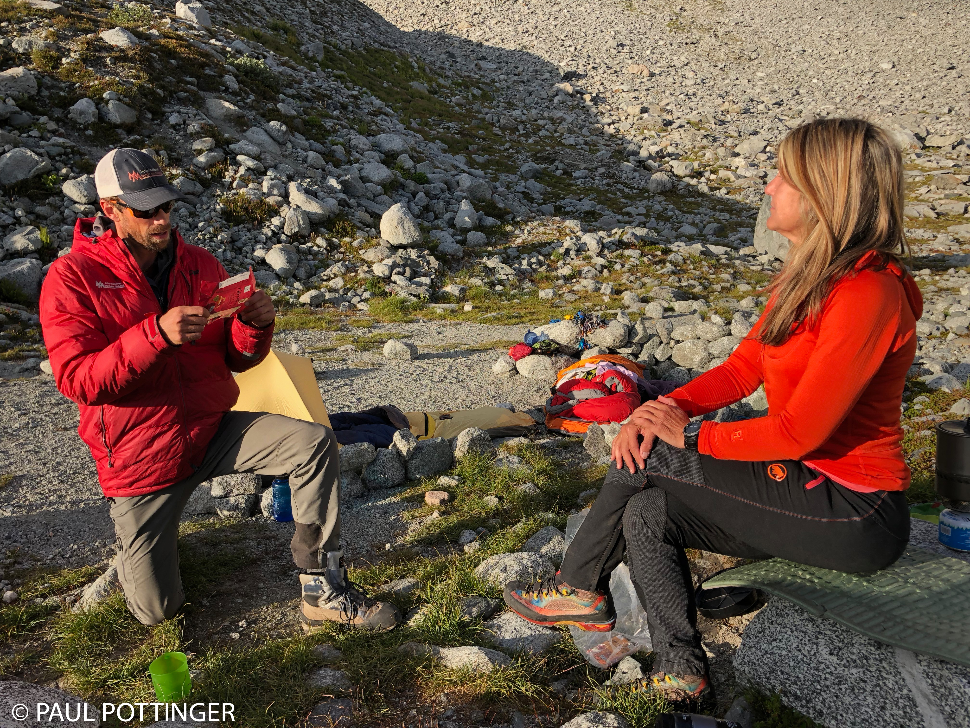
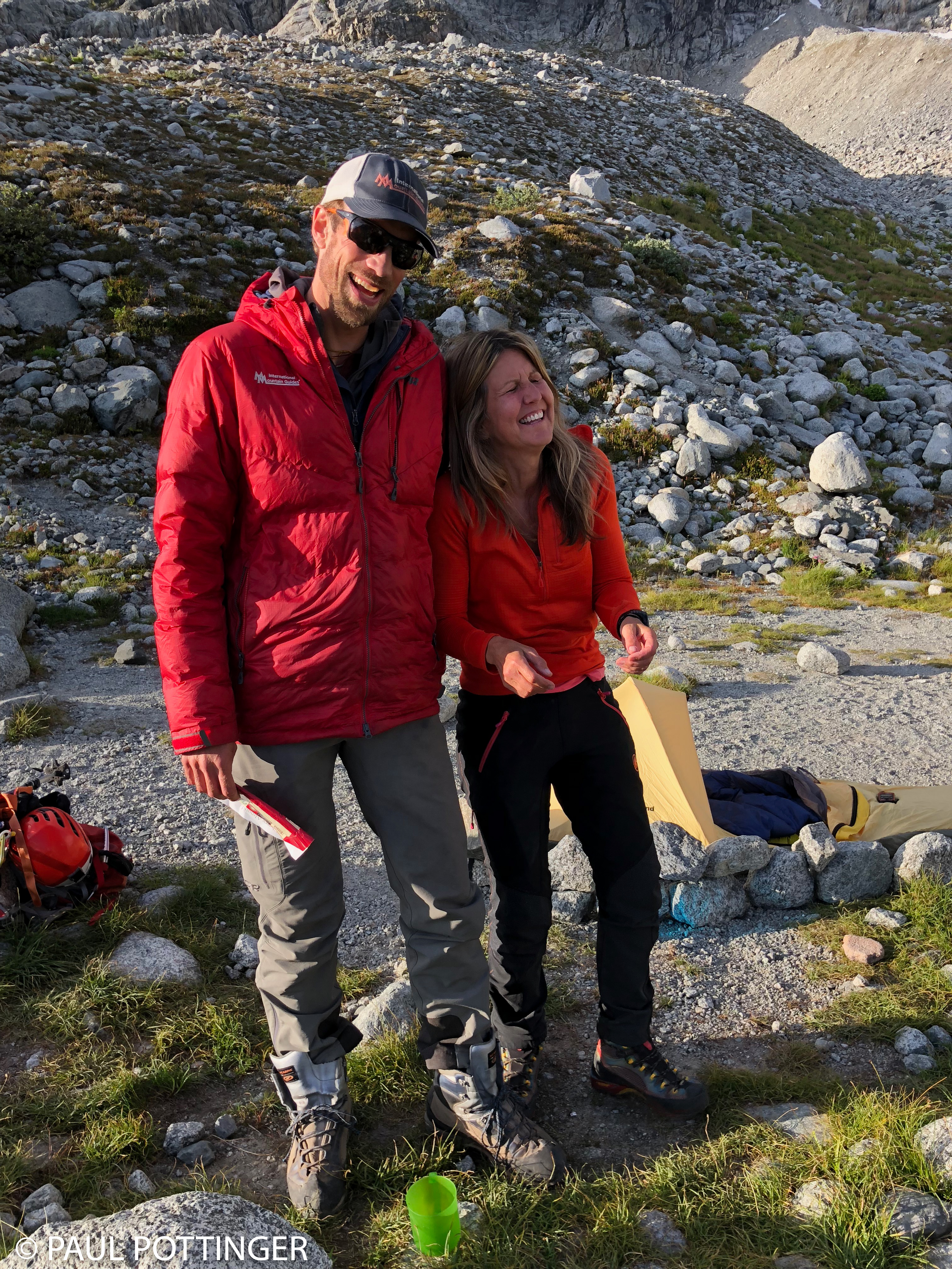
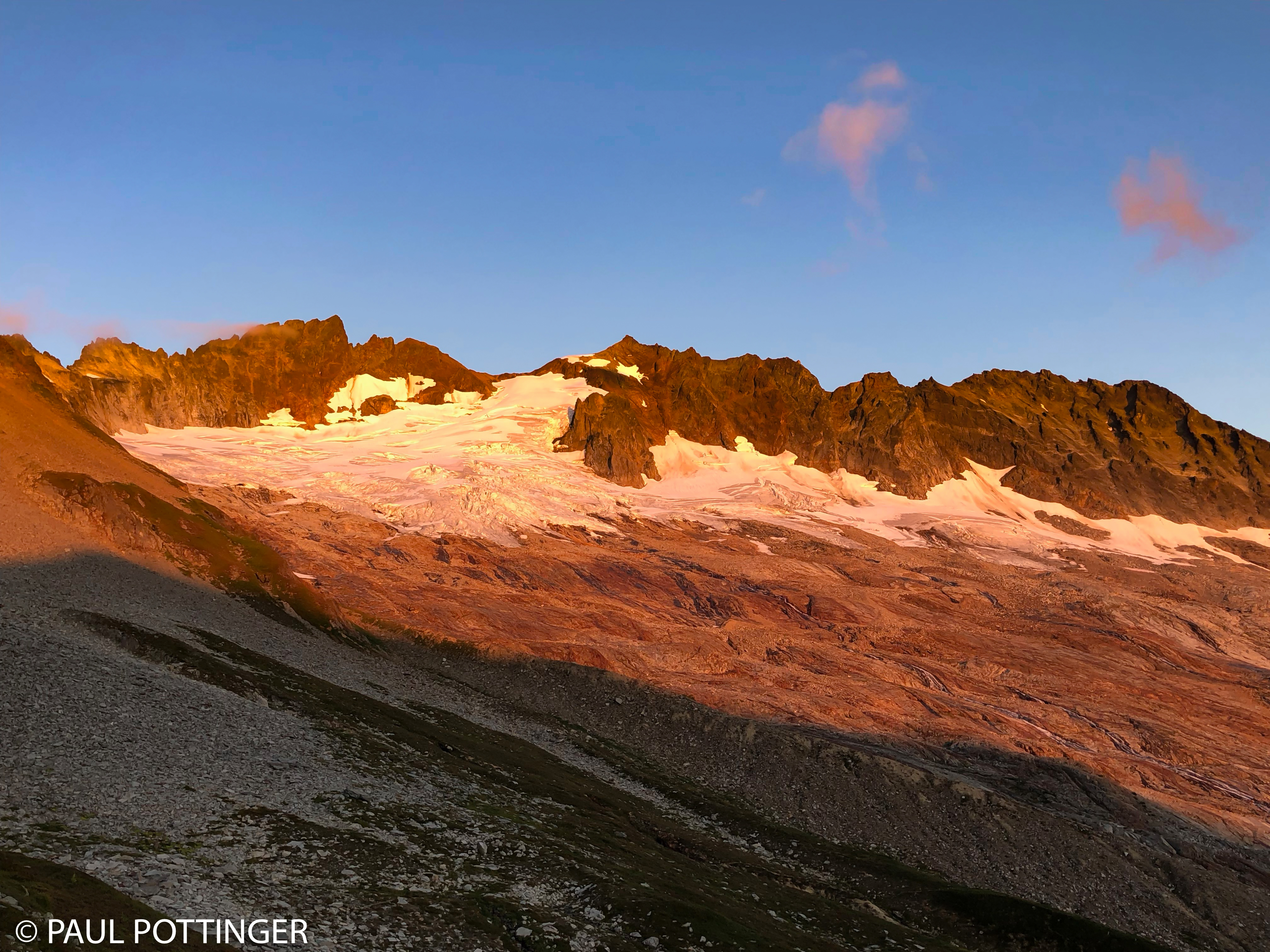
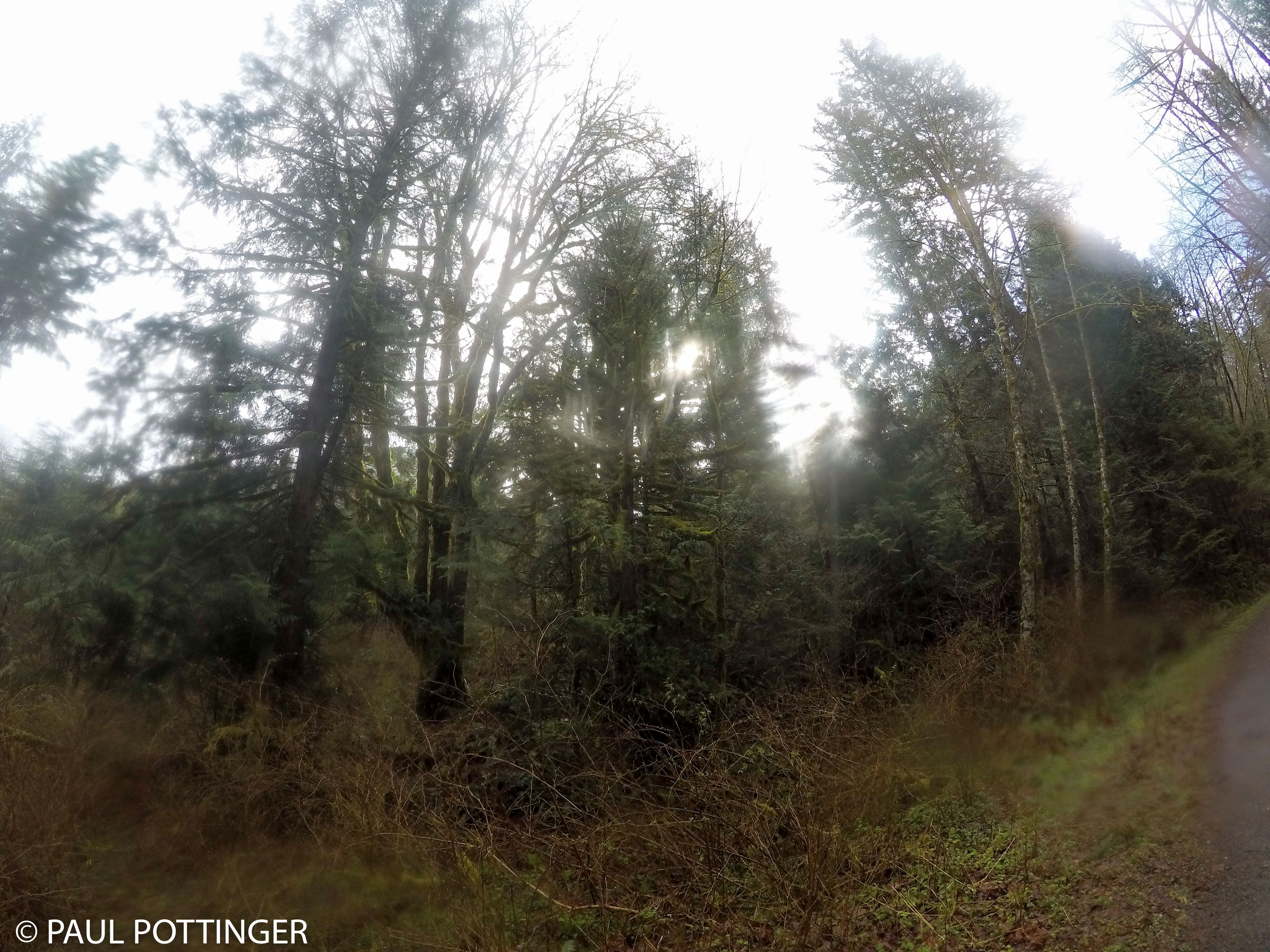
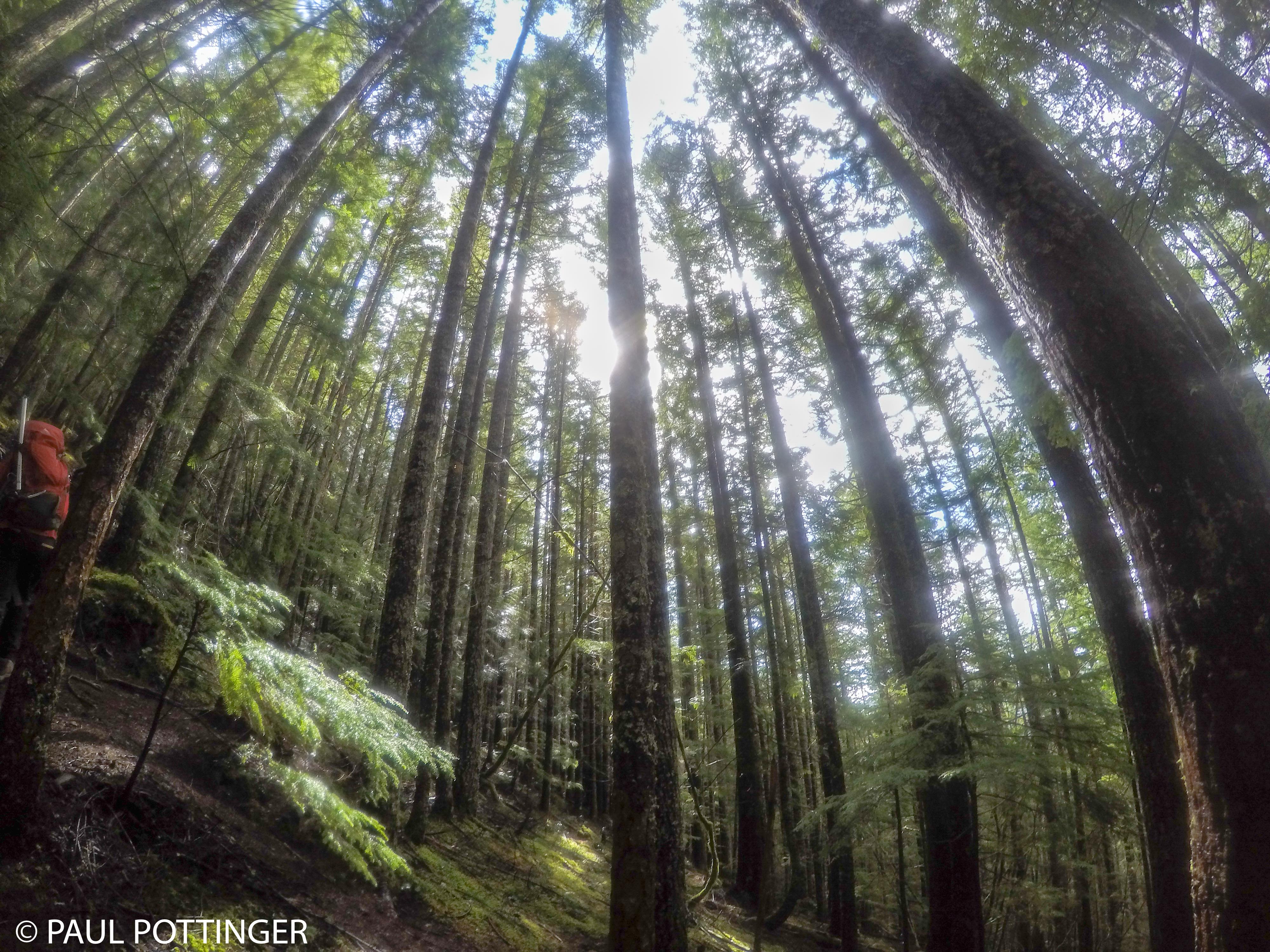
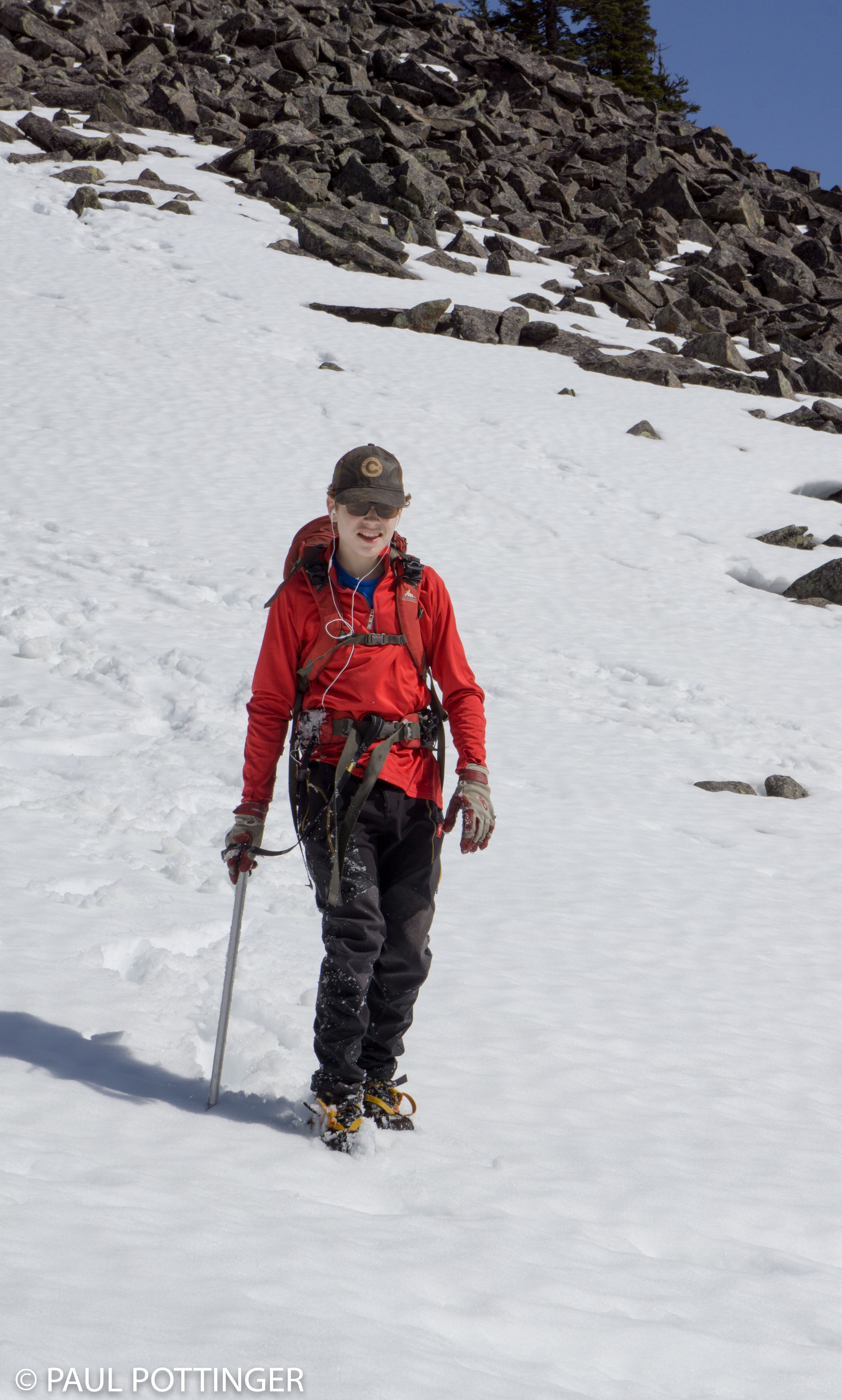
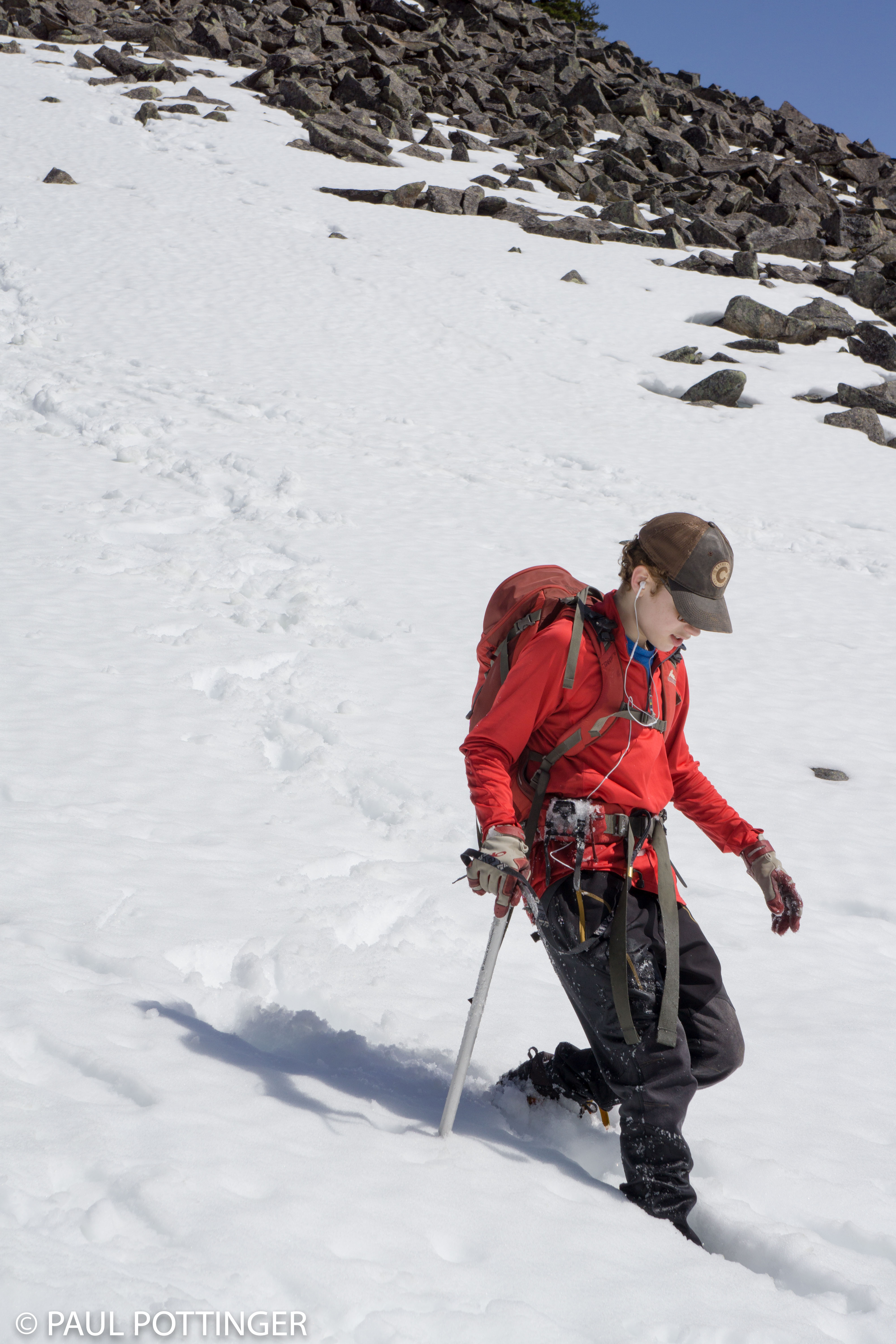
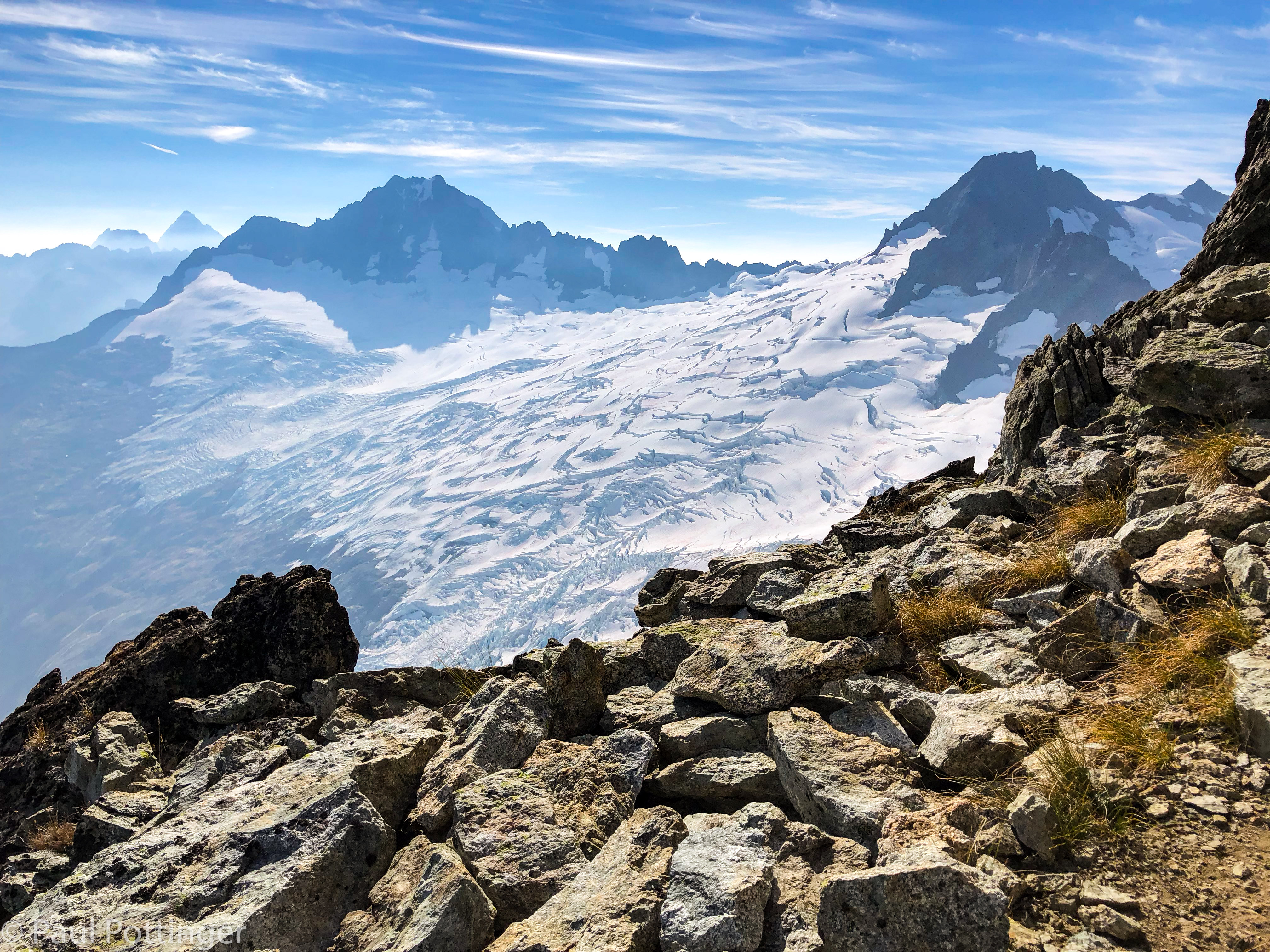
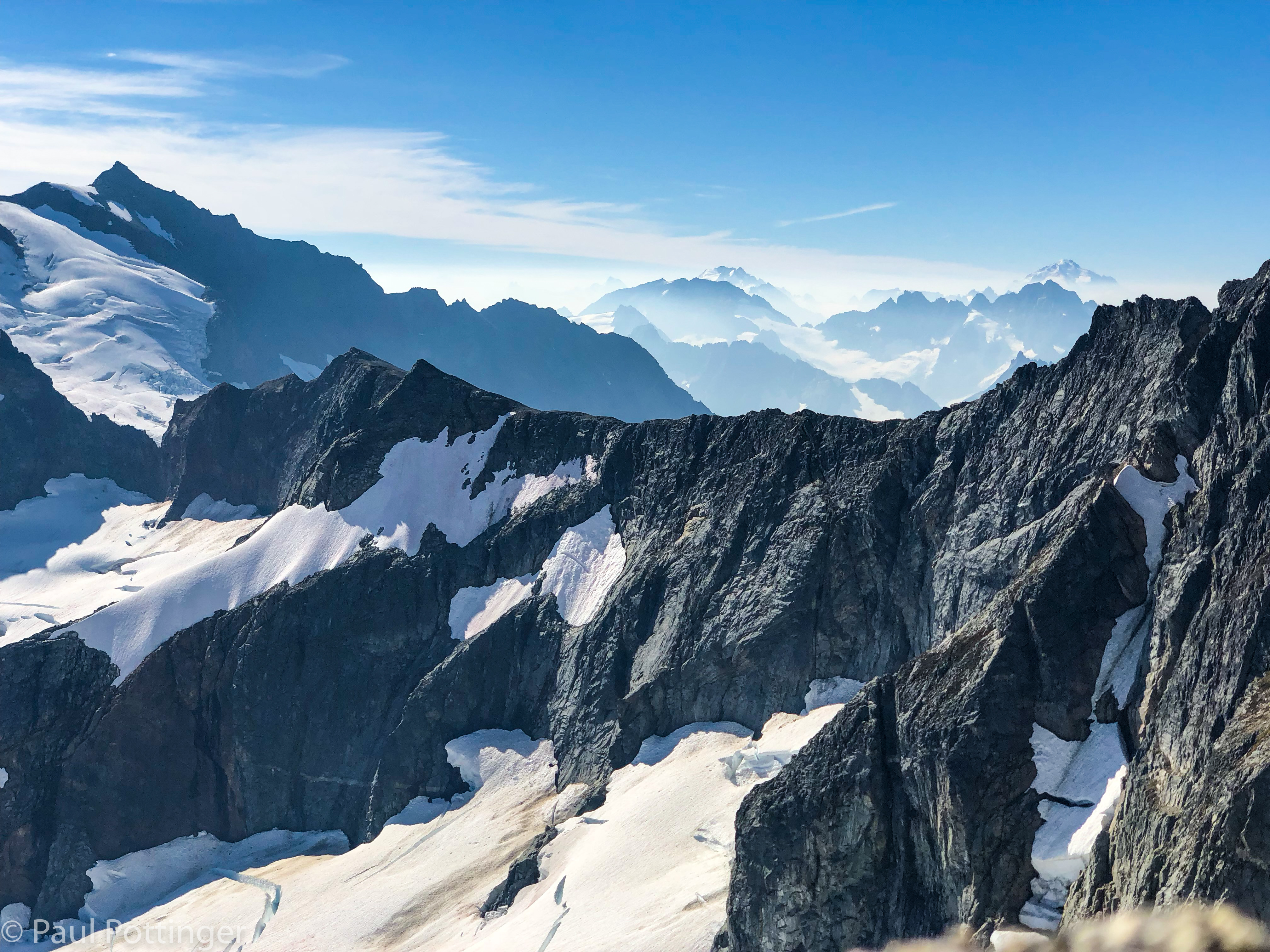
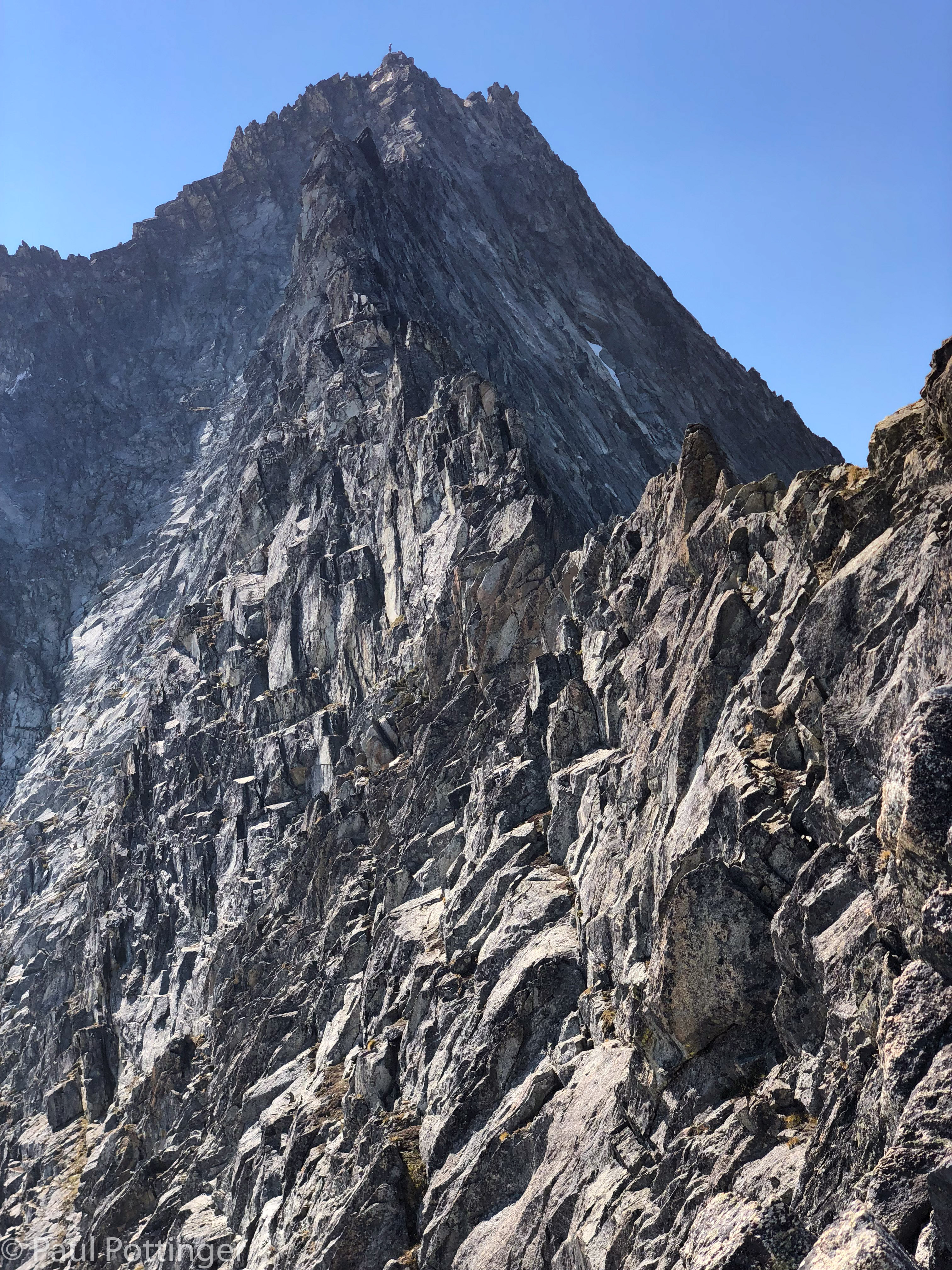
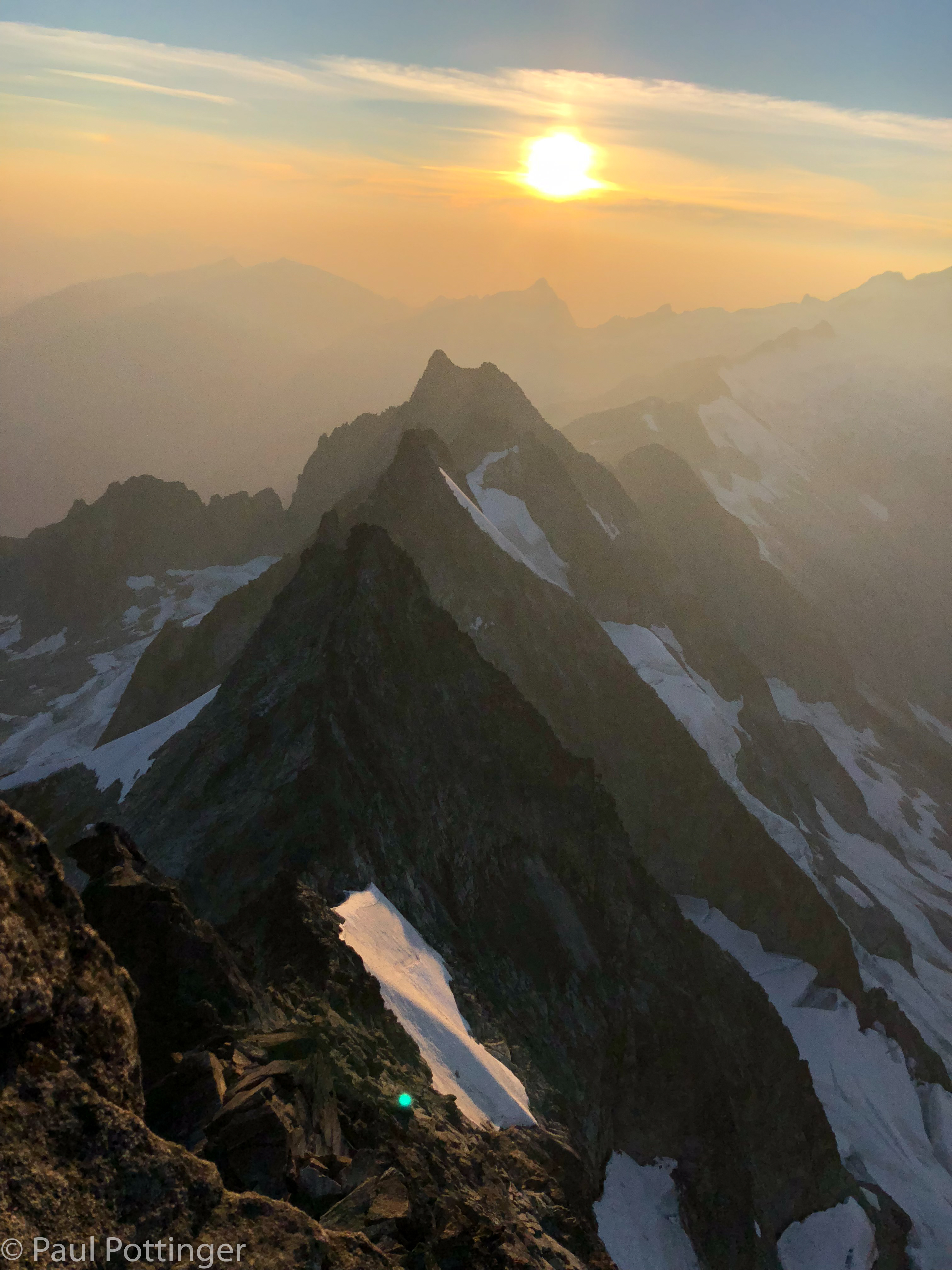
We were up at 6:30 AM, and the dawn revealed a spectacular, still world. The smoke was not too thick, but it turned the East into a band of rich orange light. The North Cascades stood in sensational blue and purple tones. A white crescent moon added to the dramatic look. The North Ridge stretched away towards the summit block, which looked impossibly far away, and so high above us. And, the vast emptiness of Forbidden Basin was revealed for the first time. All of this had been hidden in the darkness when we arrived the night before. I have never overnighted on a big wall, but I suspect waking up on a portaledge feels something like this.

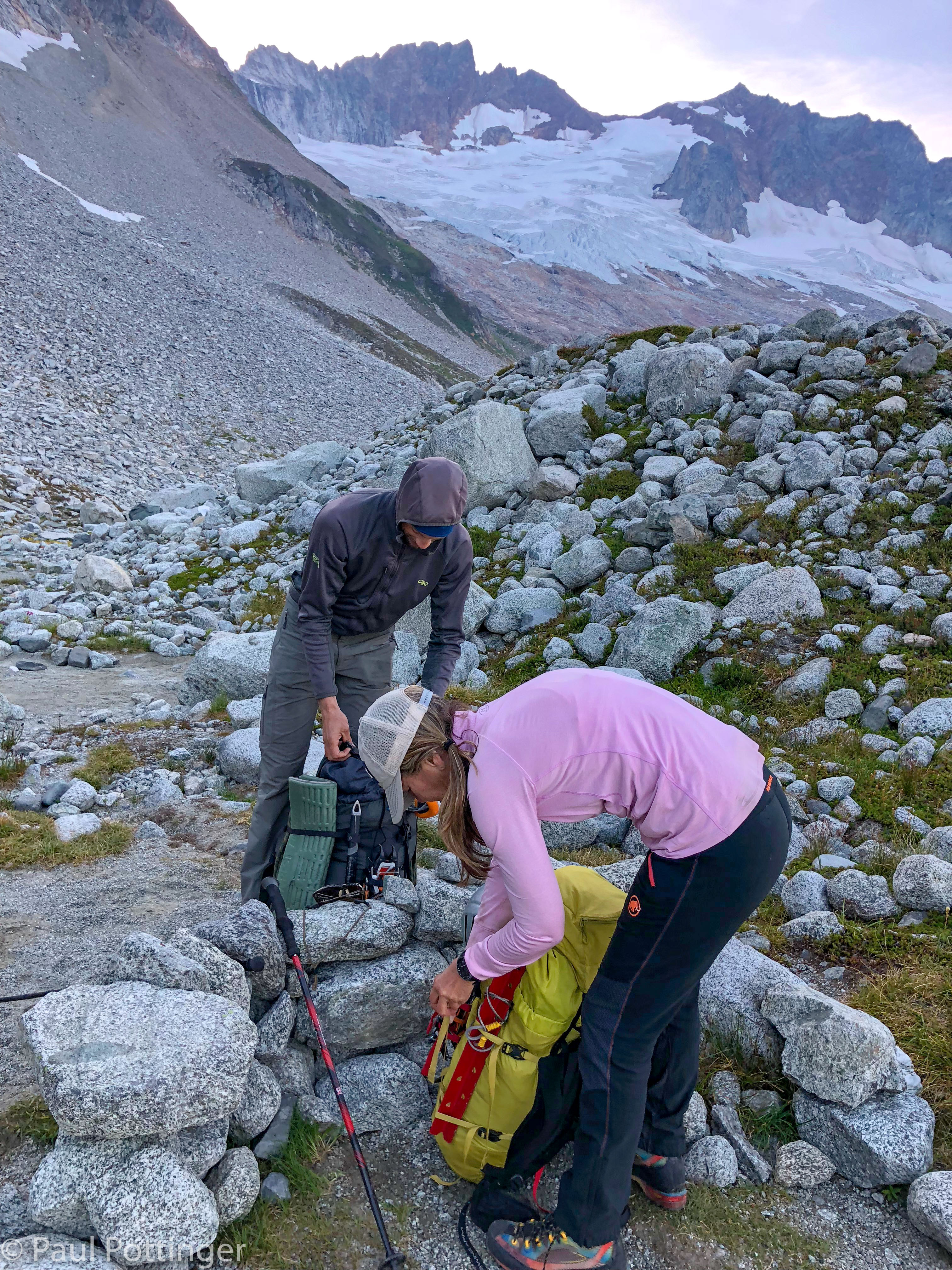
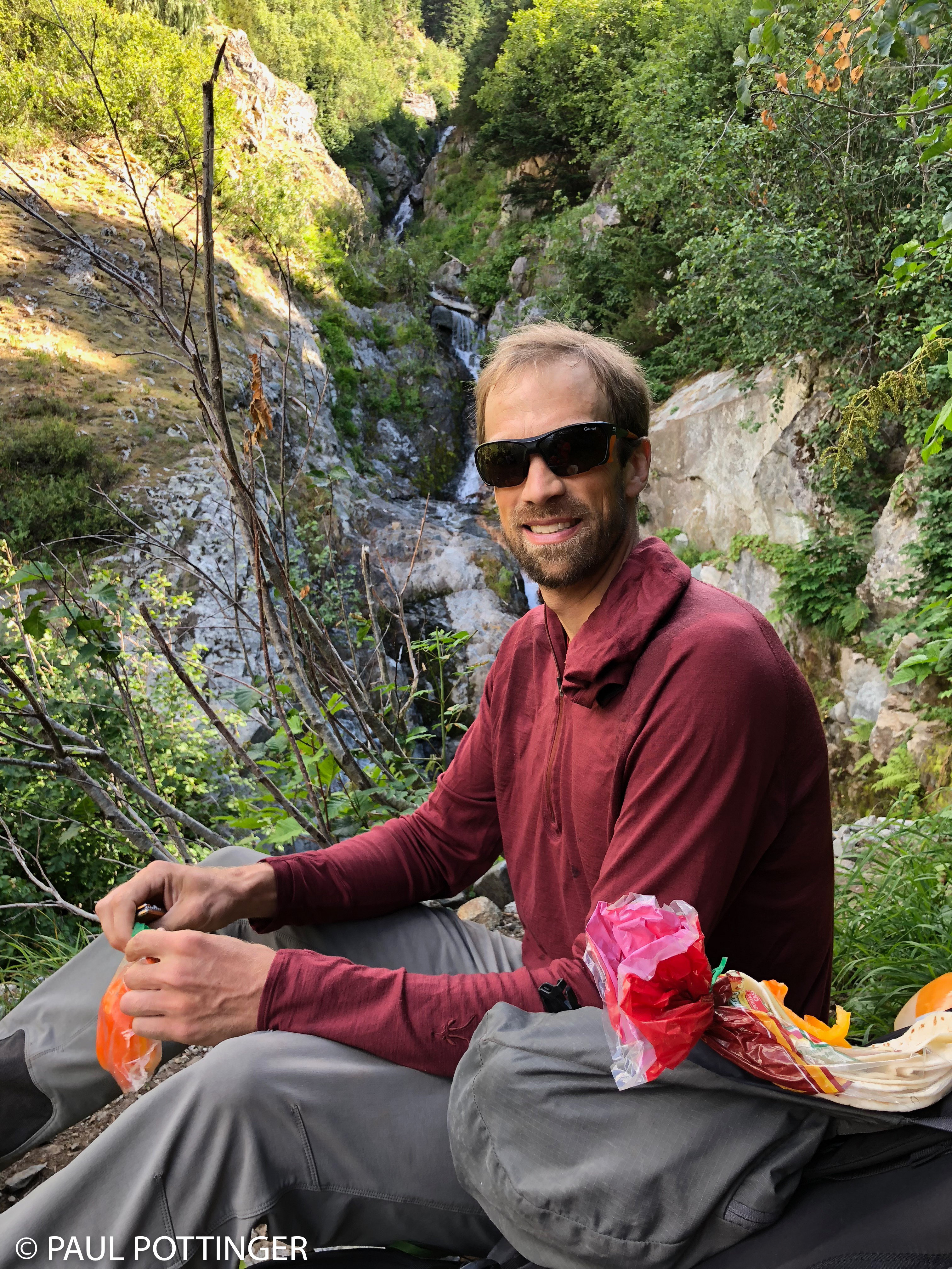
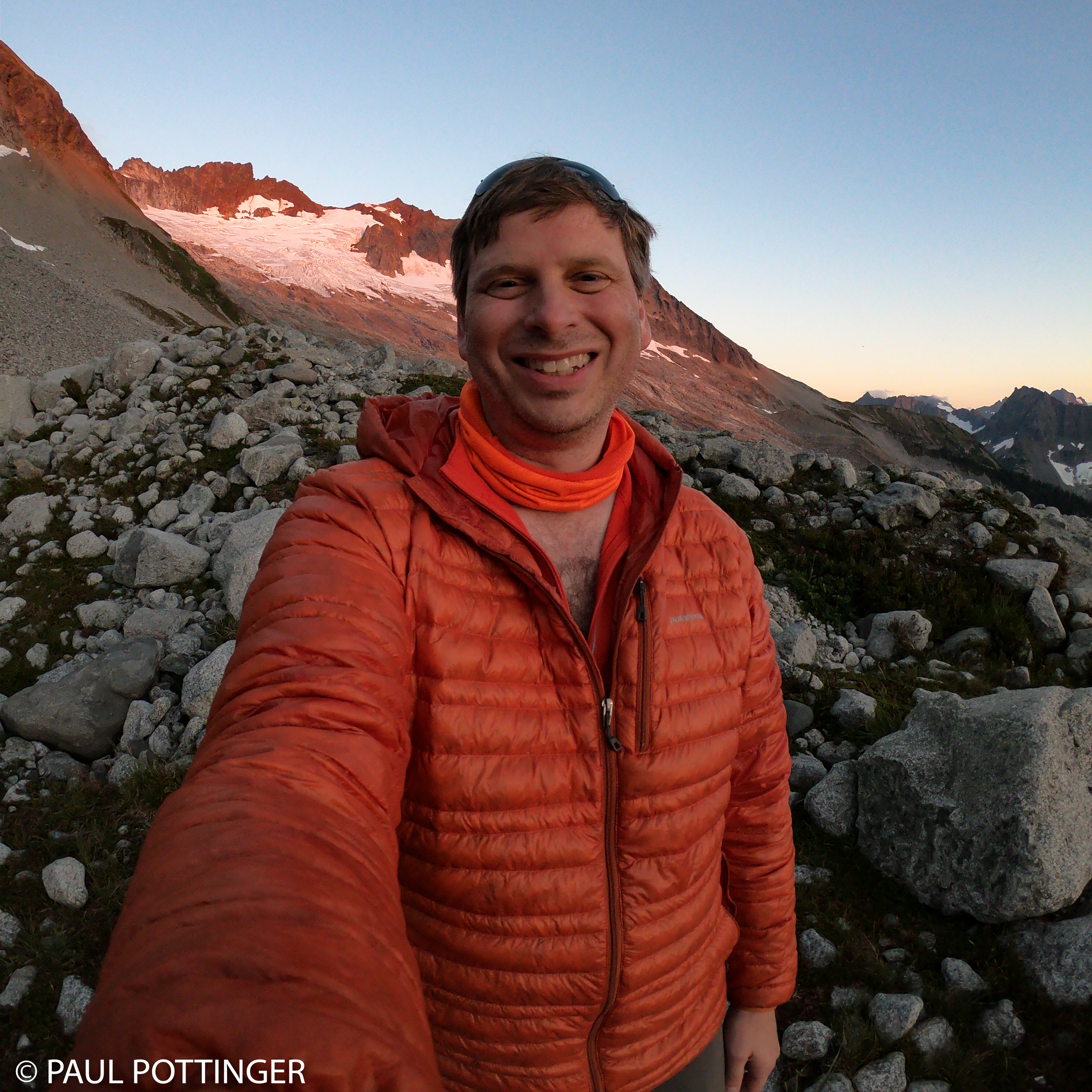
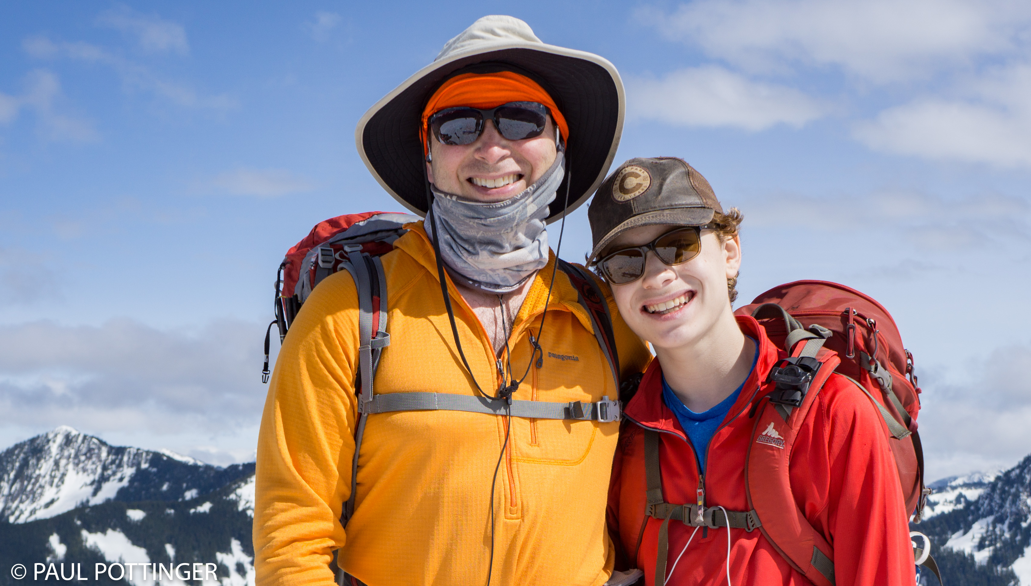
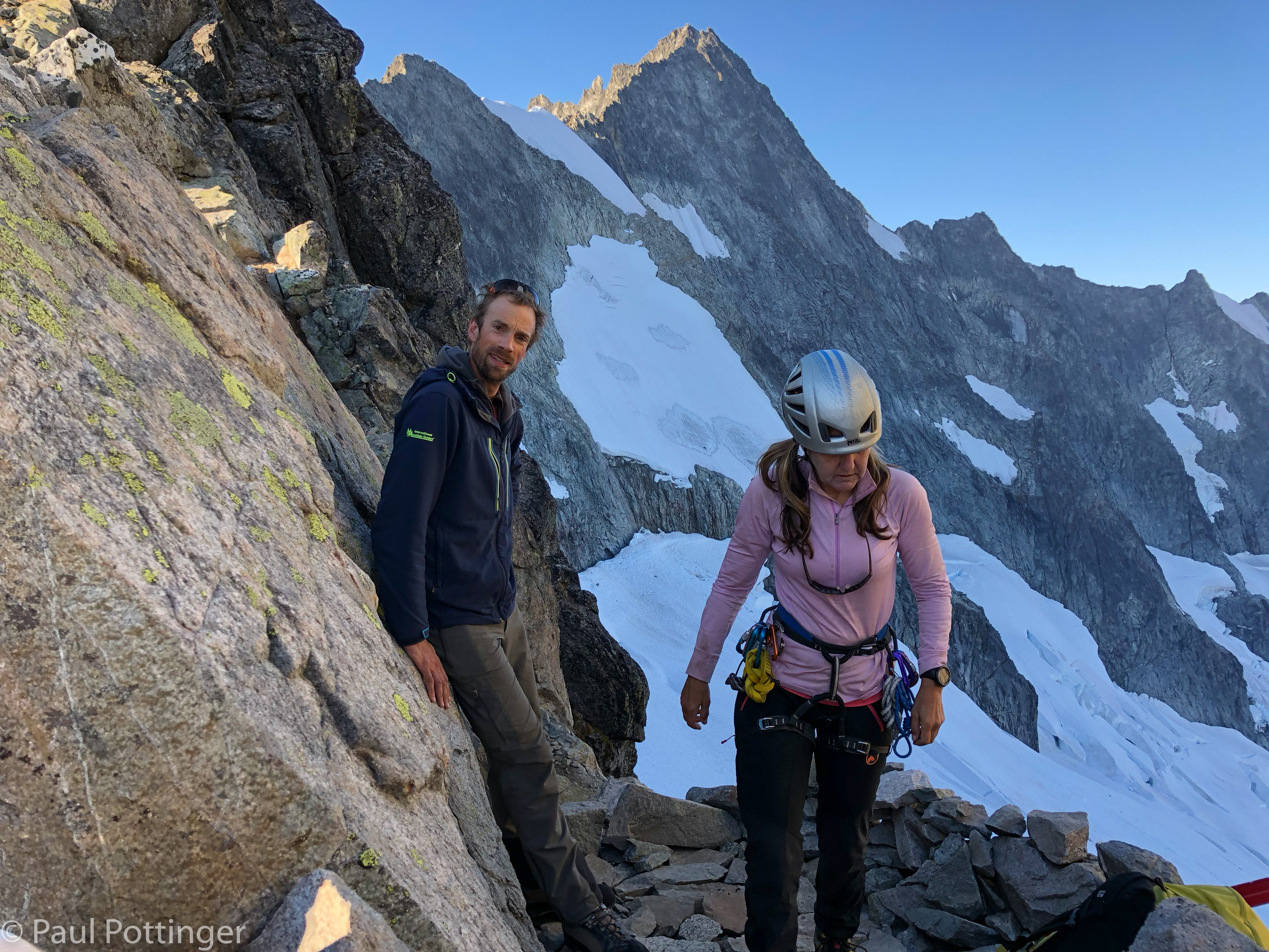
Justin started boiling water while Ann and I got ourselves together. Sleep had restored my energy. Everyone felt good. We marveled at the world around us. There was even time and space for a bowel movement. Posh, indeed. We were ready to get moving by 8 AM, right on schedule.

Attack of the snafflehounds!
My venerable Creon Pack will not recover from this.
Aiguille du Tour, August 2011. First time the Creon pack saw the light of day, on my brother’s back. Farewell, sweet pack…
Check out our shadows on the wall across from camp.
The debris field, seen from above.
Looking across Boston Glacier.
View below my bivvy platform.
Getting geared up.
Wrangling the rope.
Yep, we are good to go now.

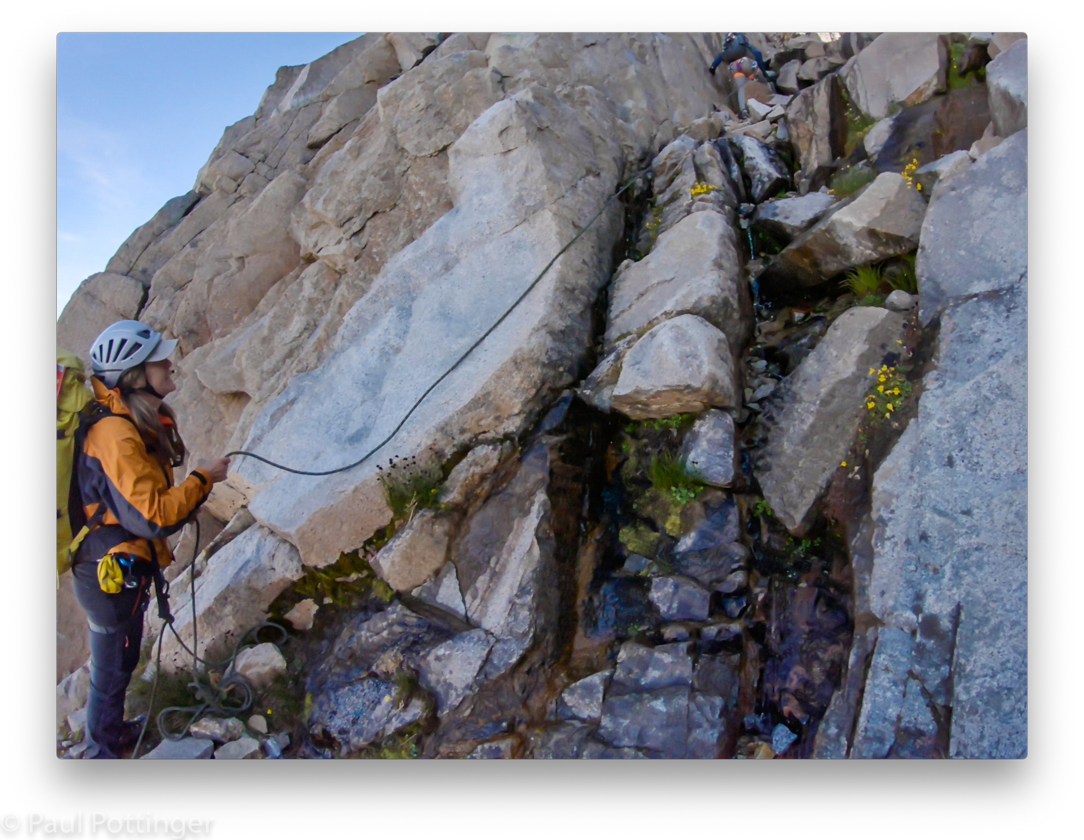
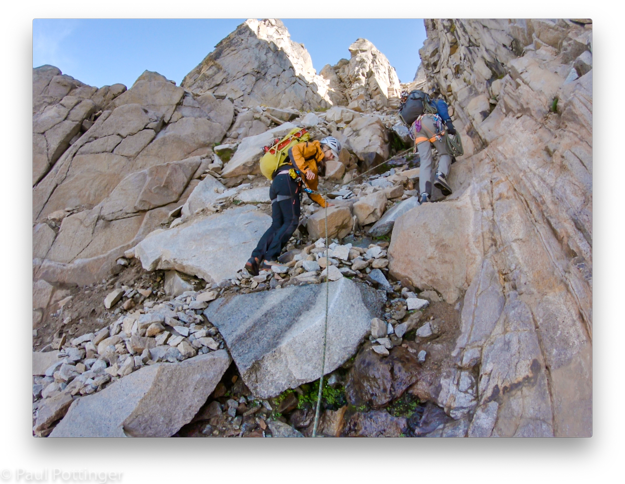
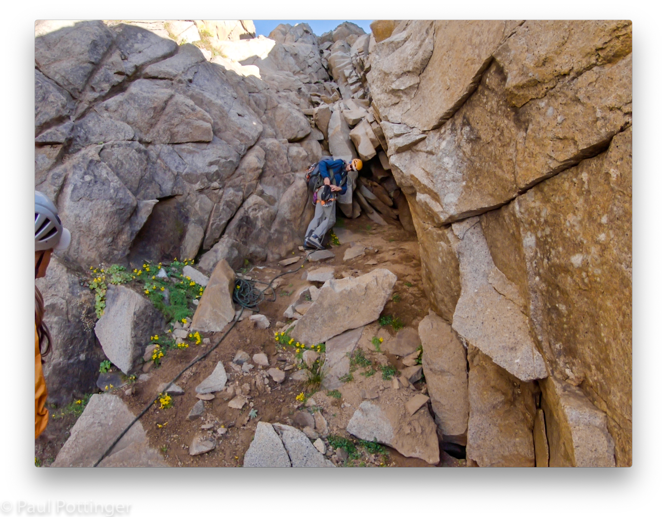
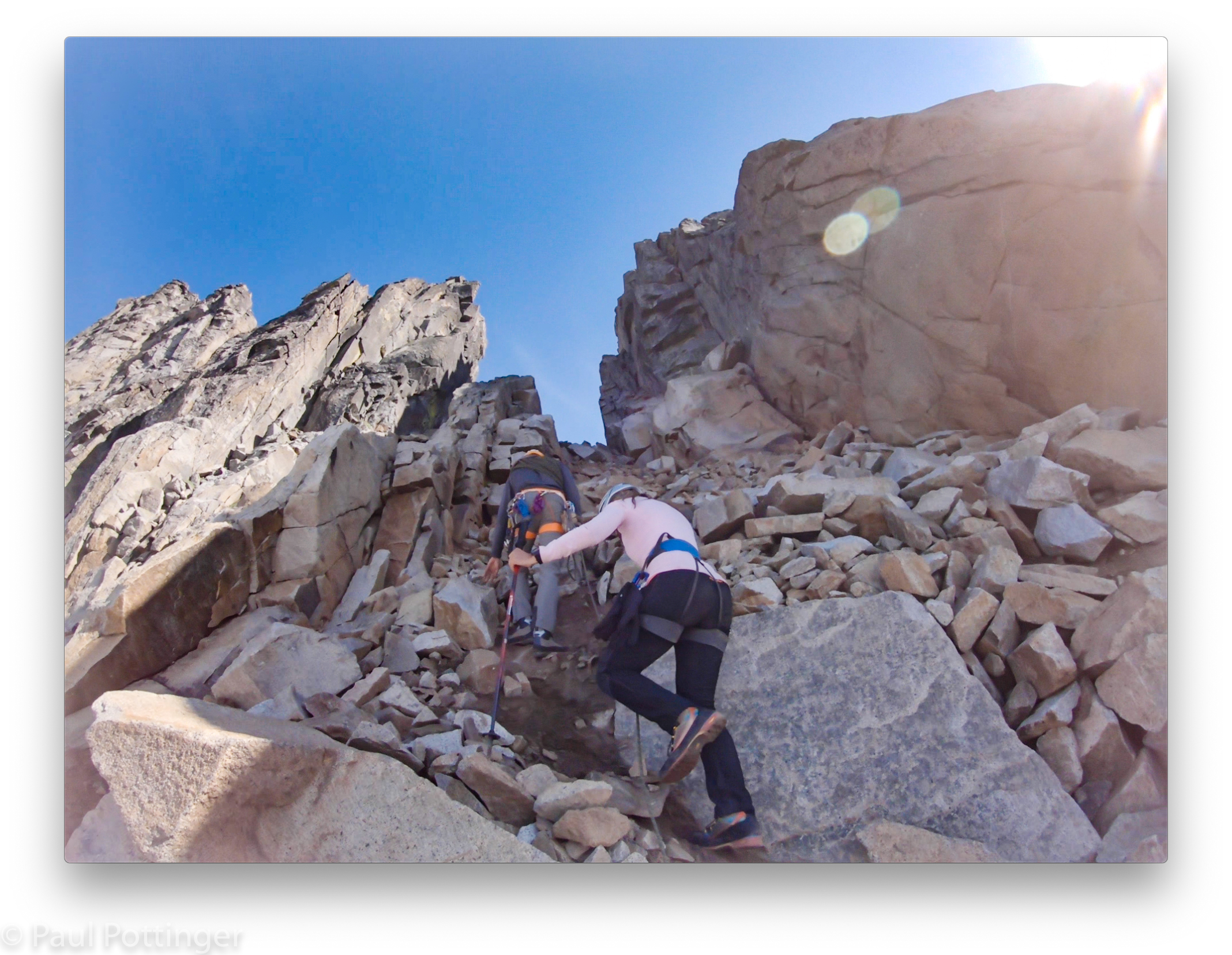
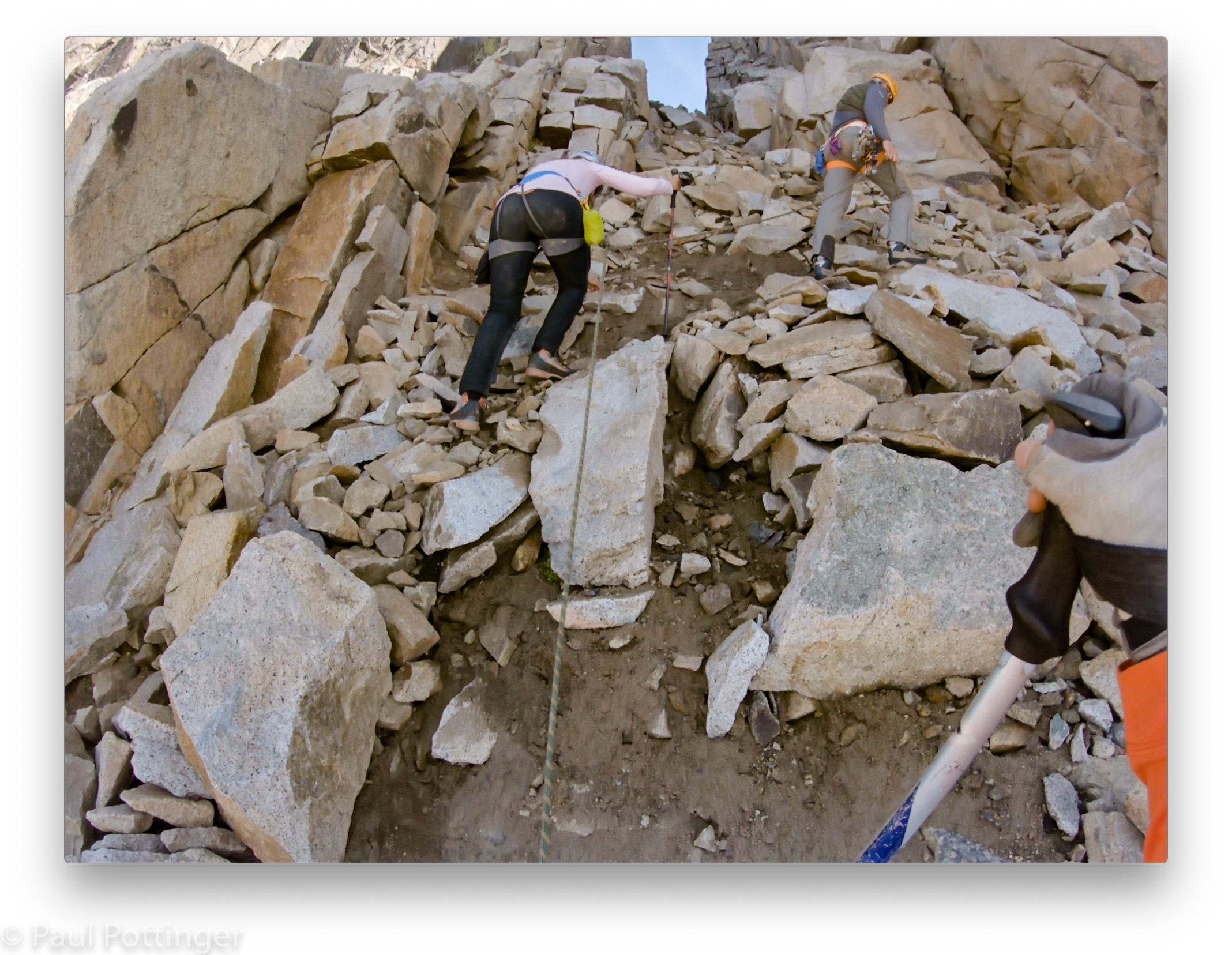
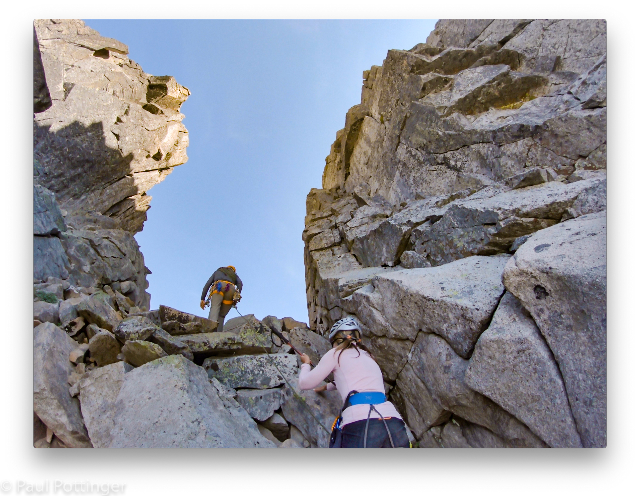
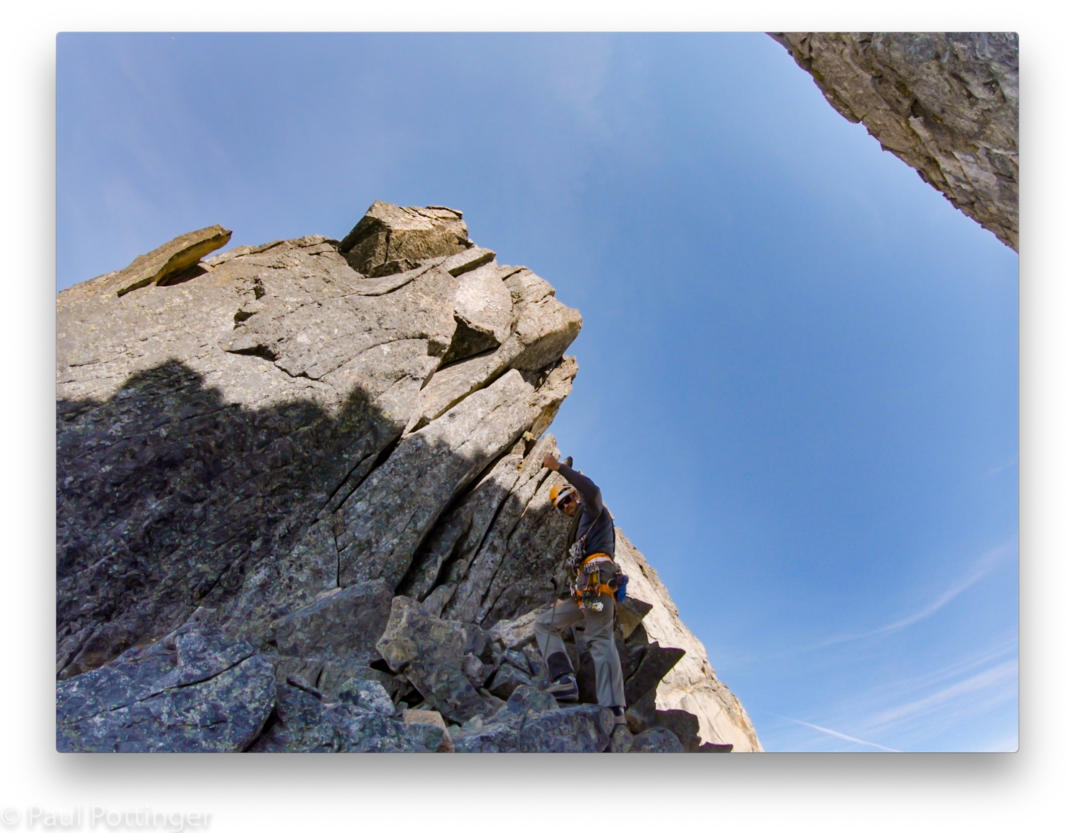
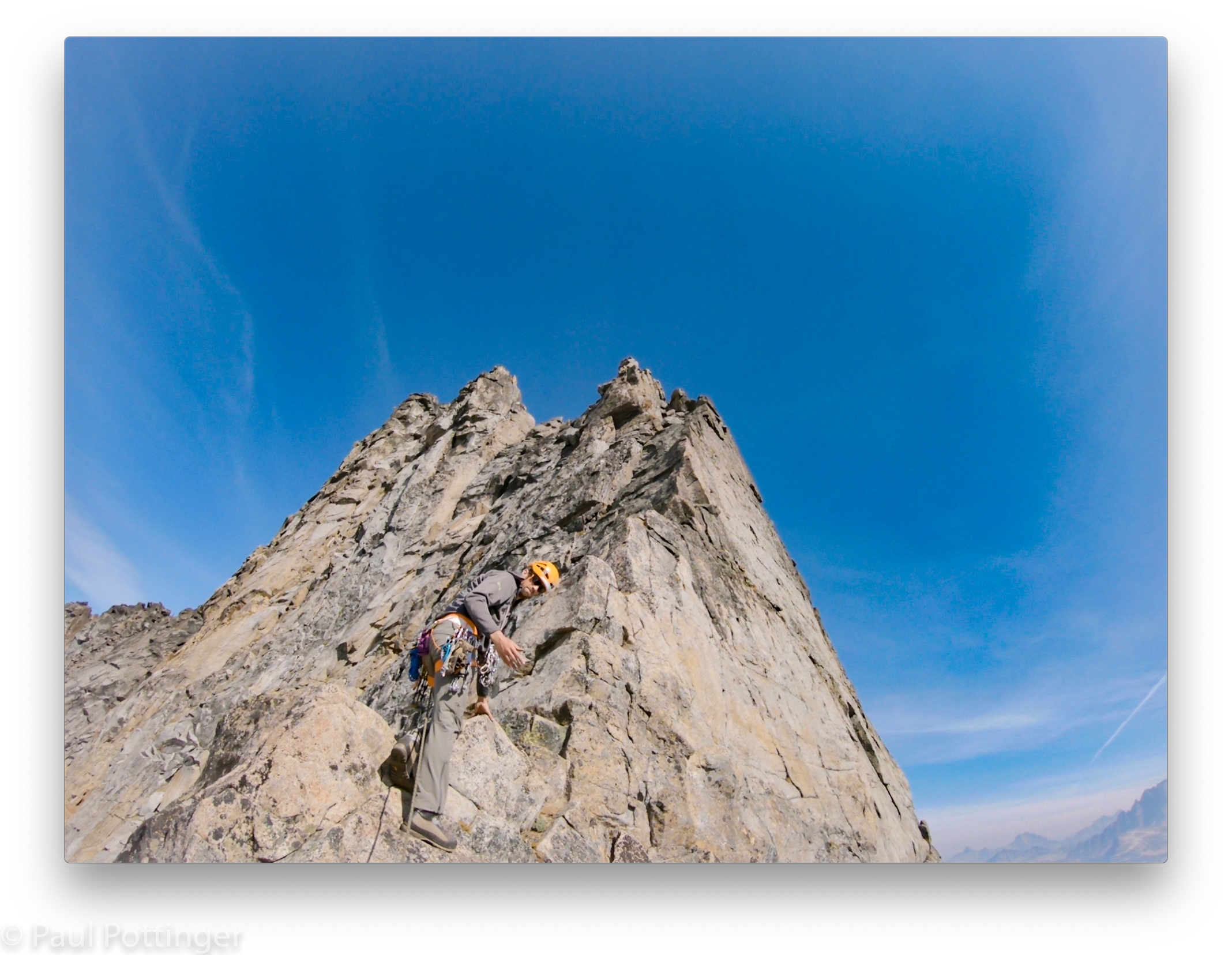
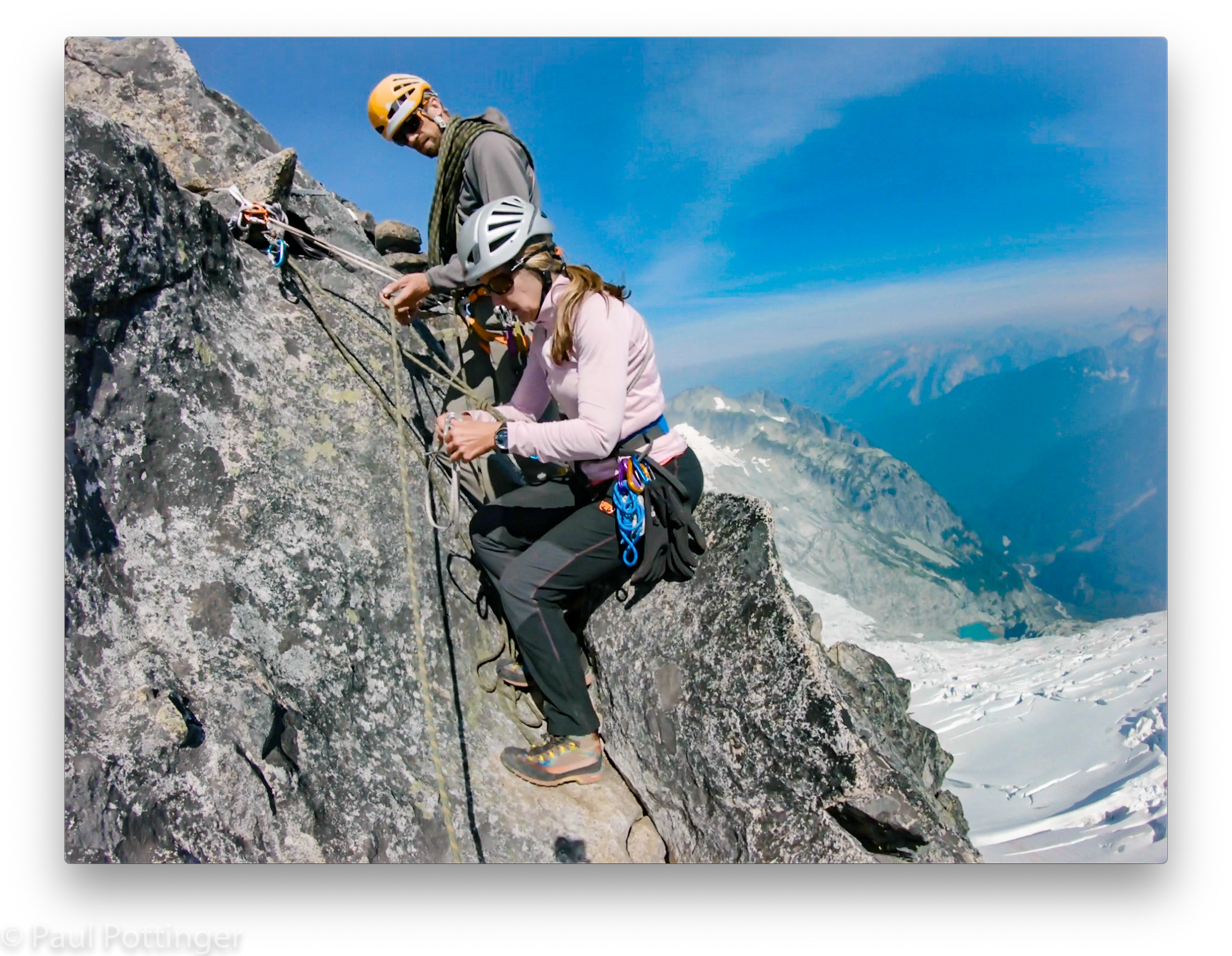
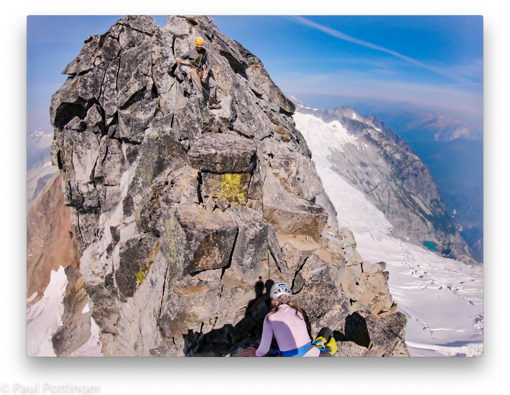
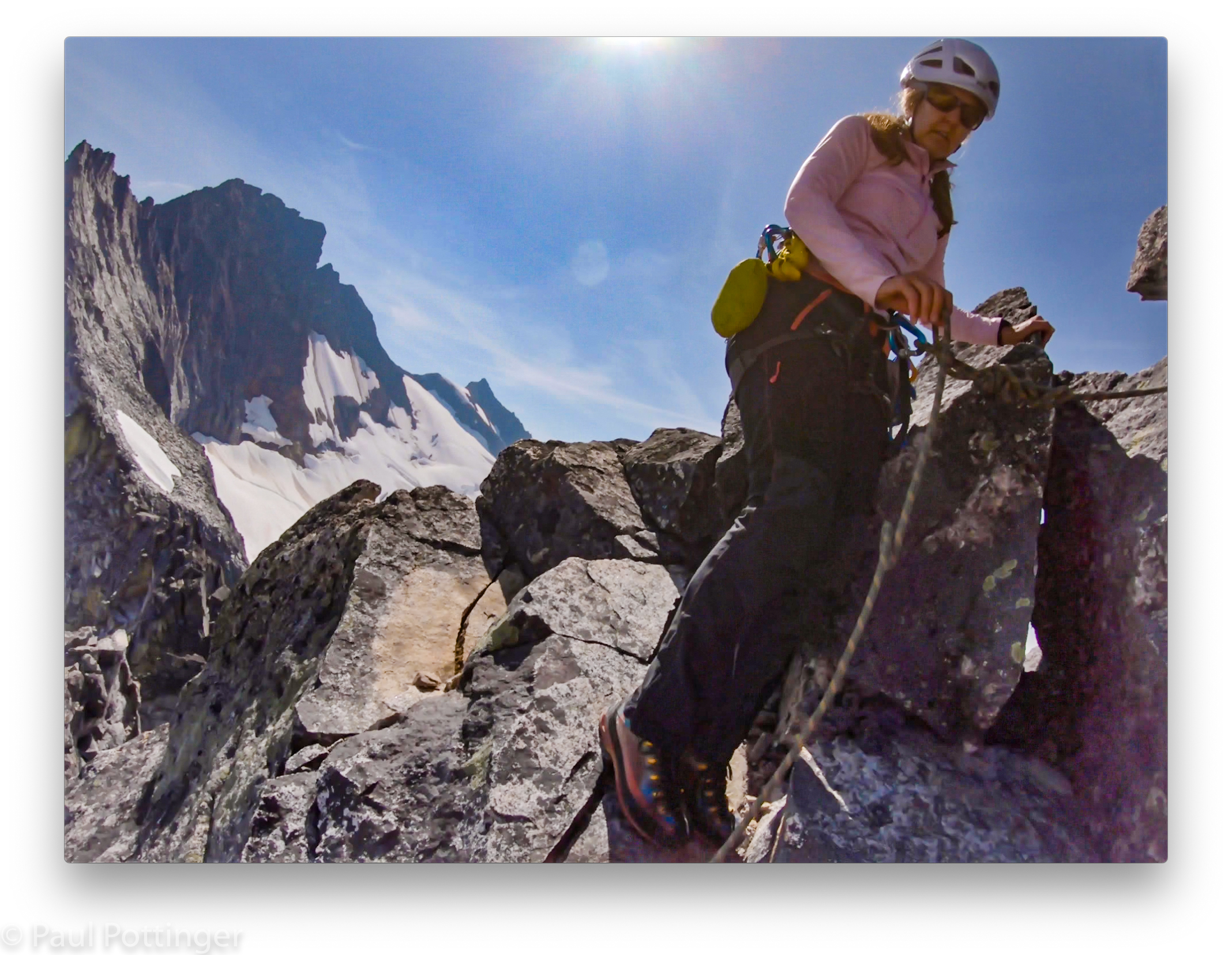
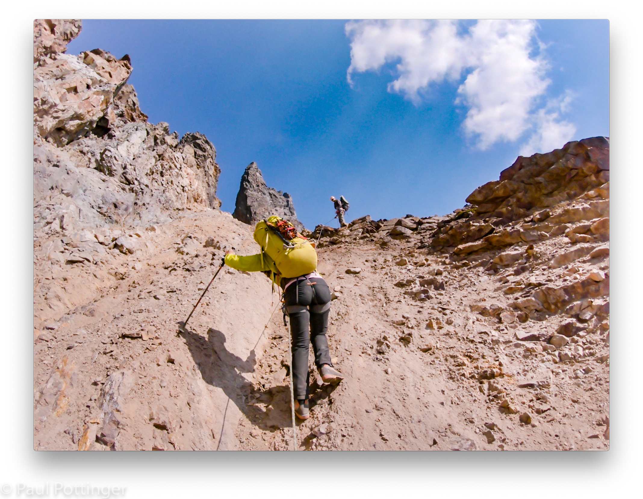
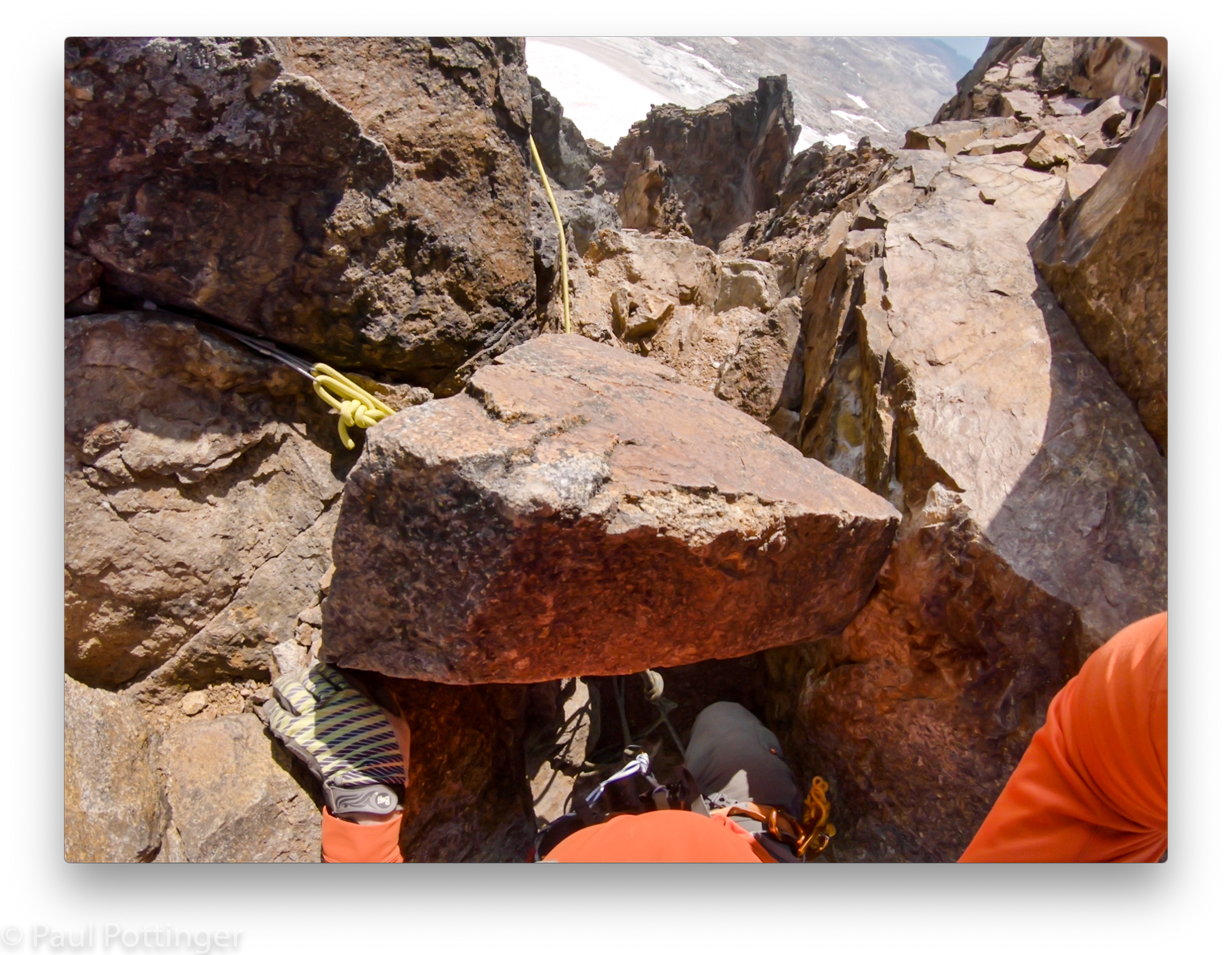
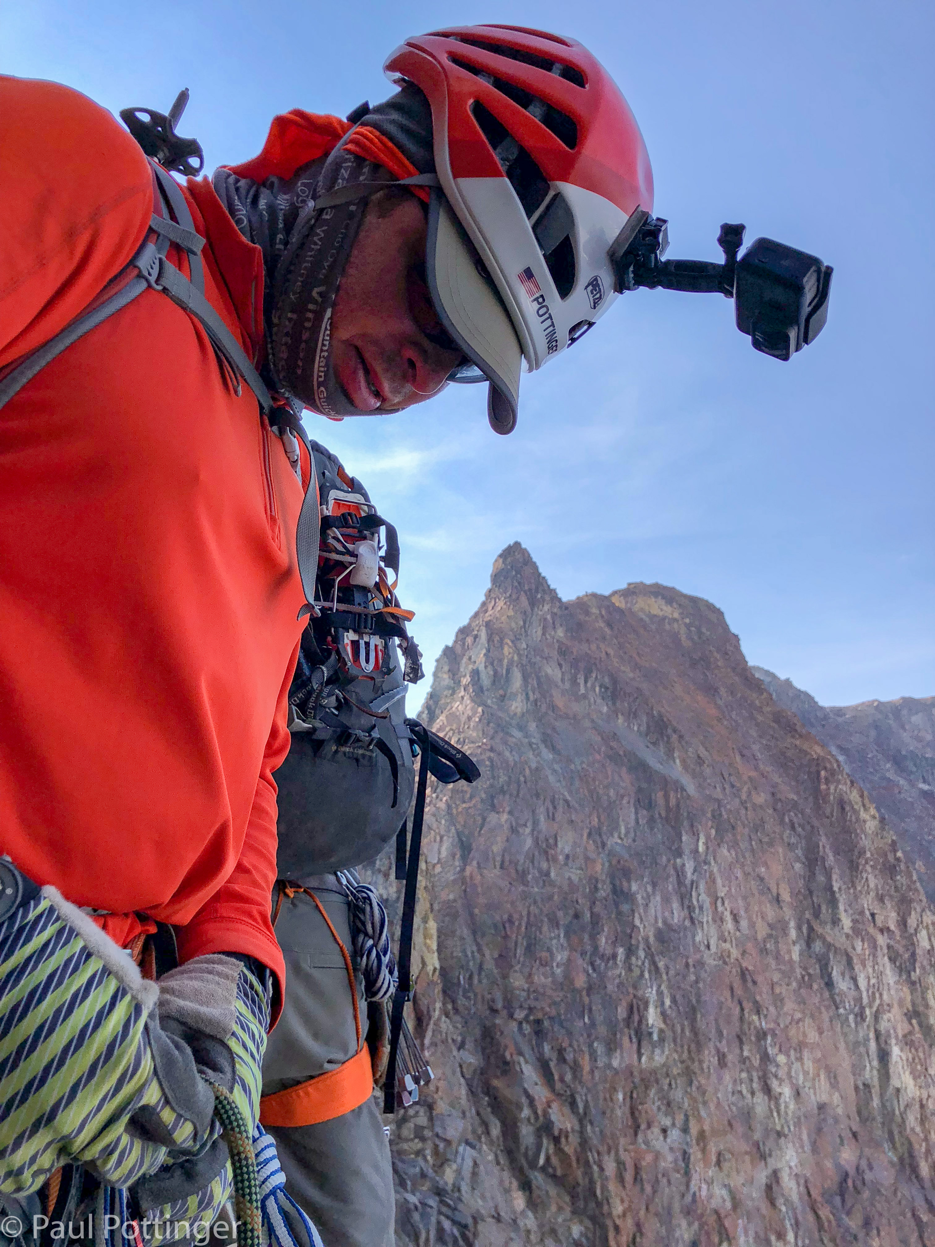
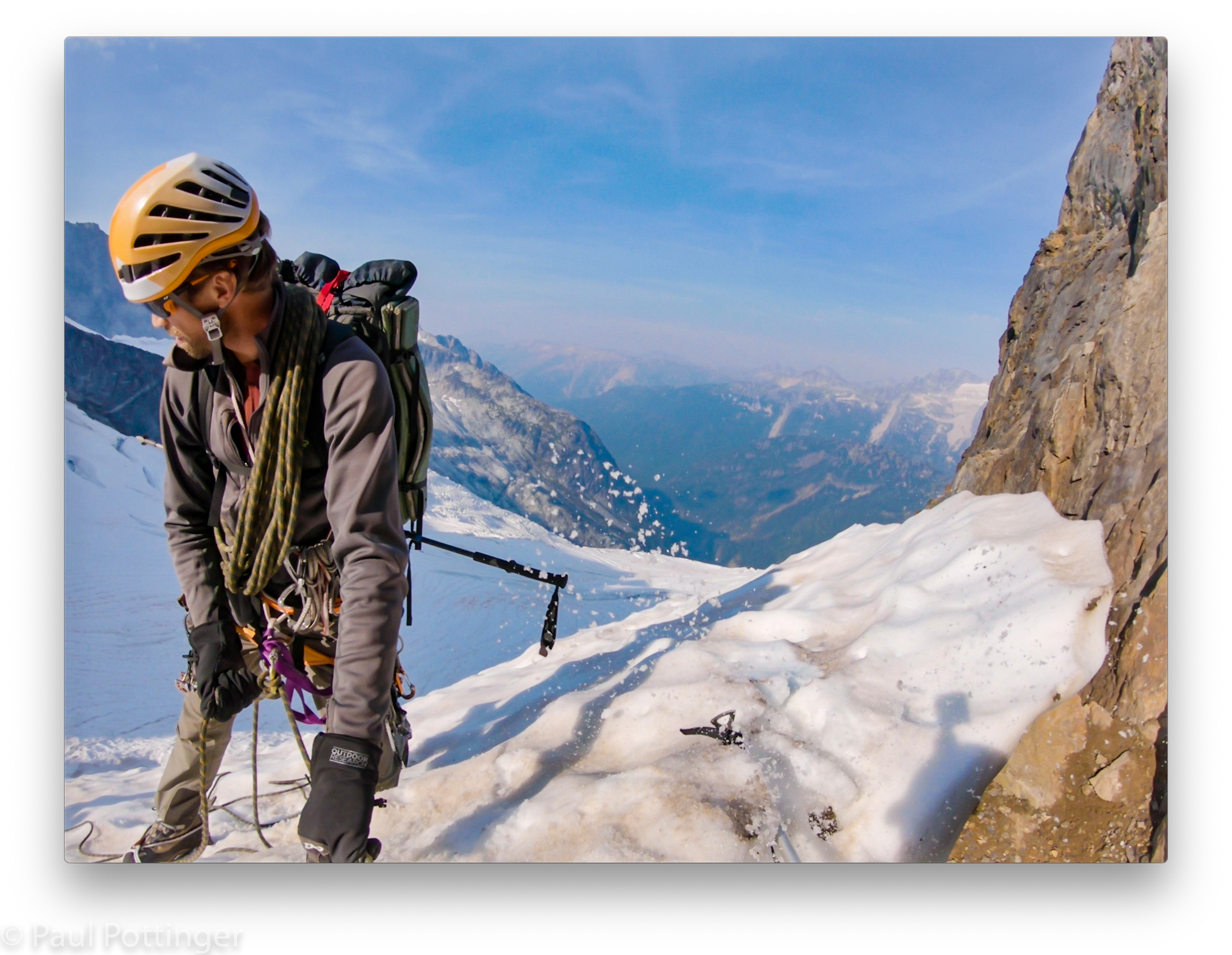
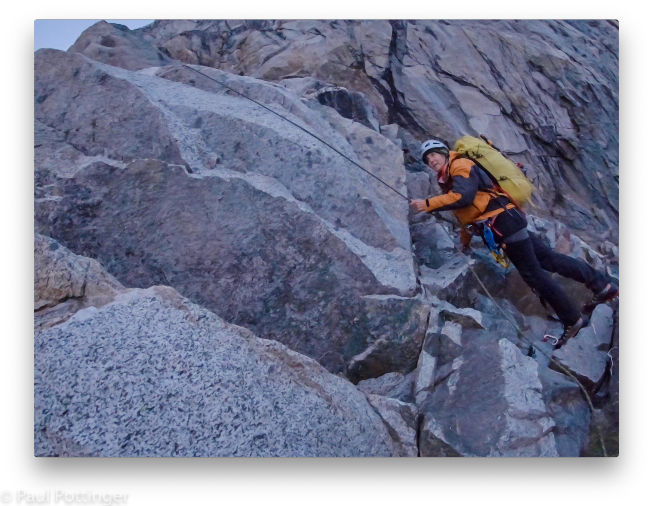
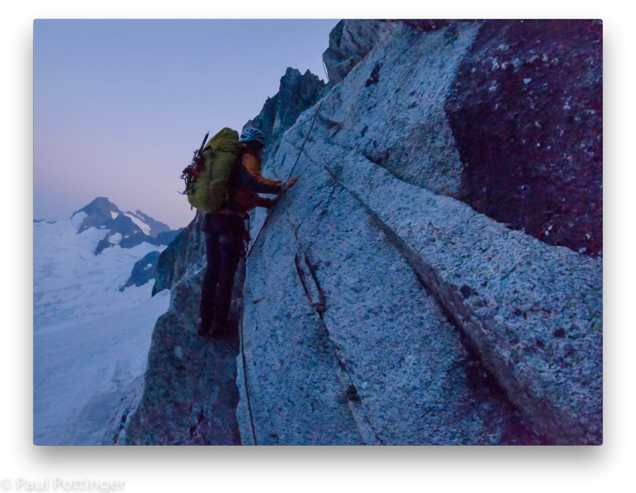
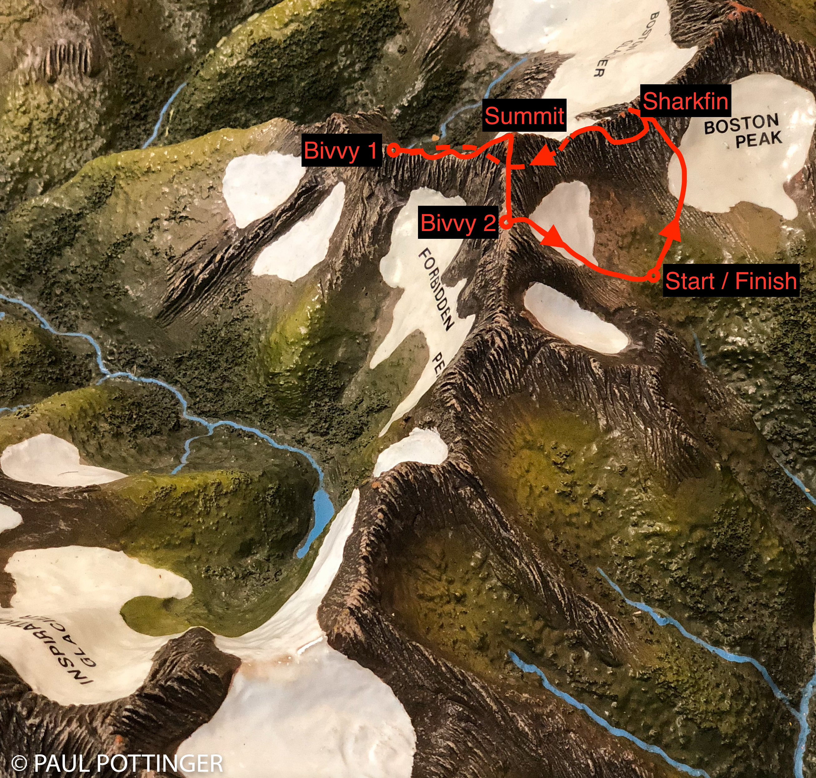
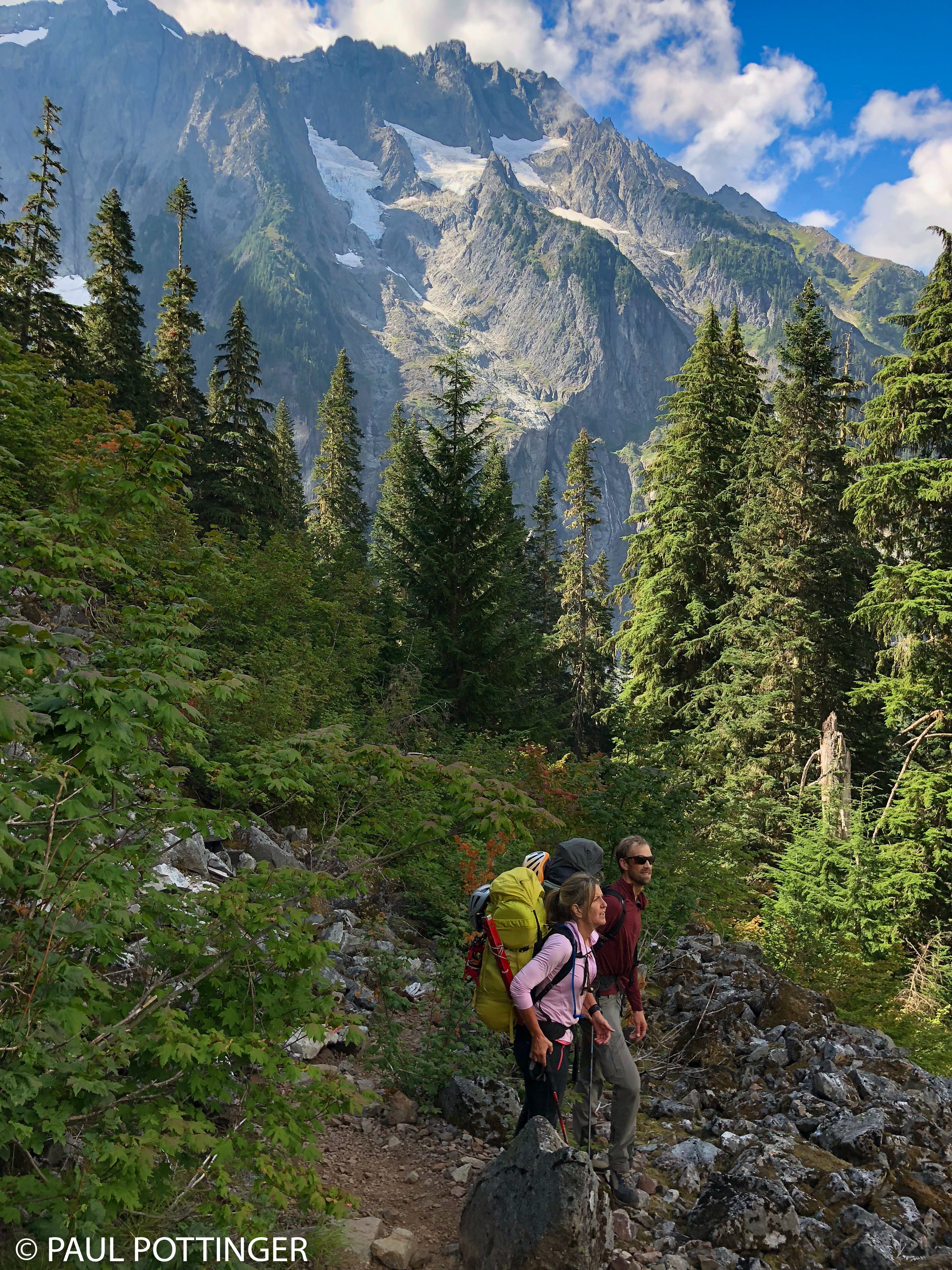
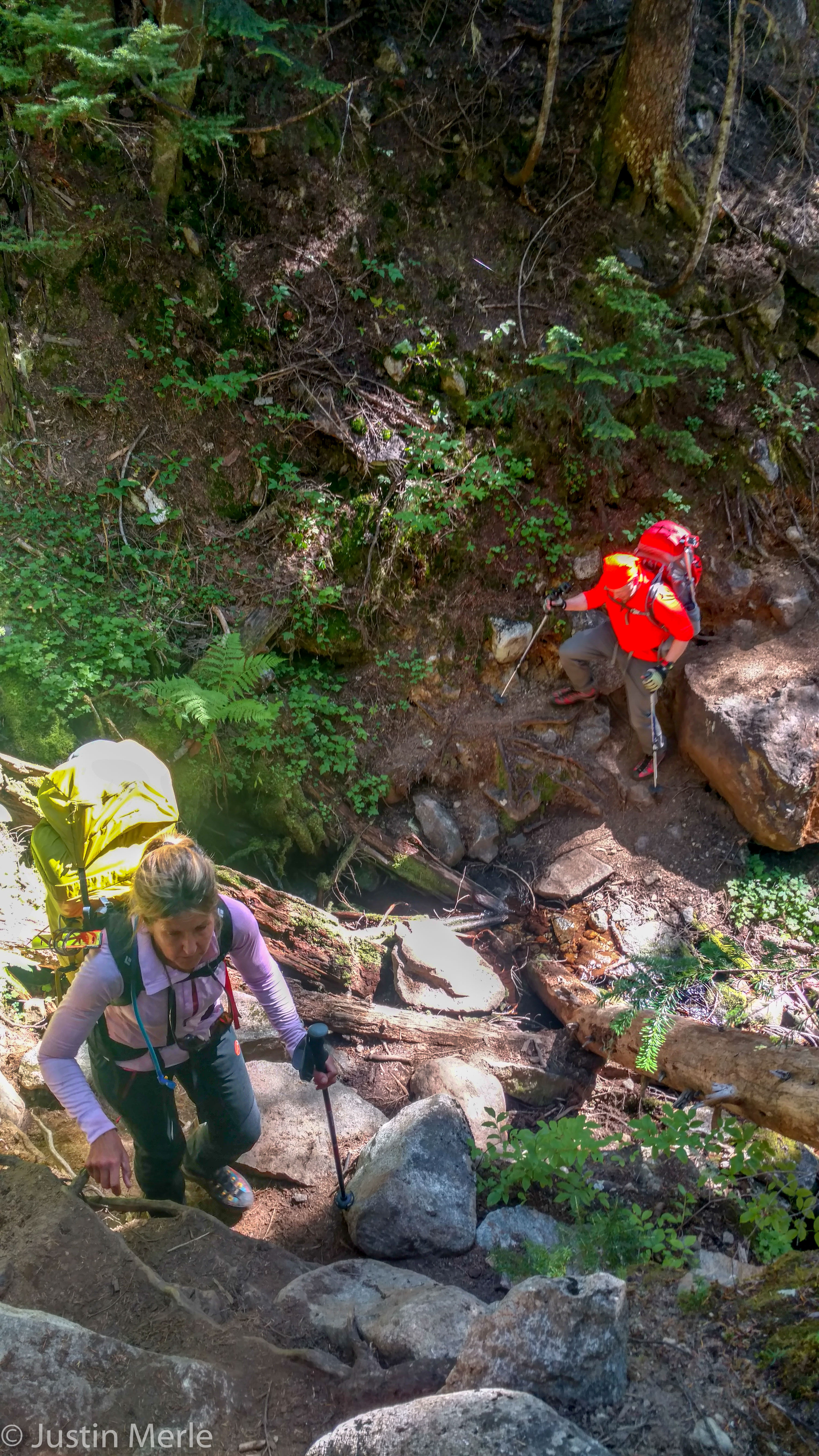
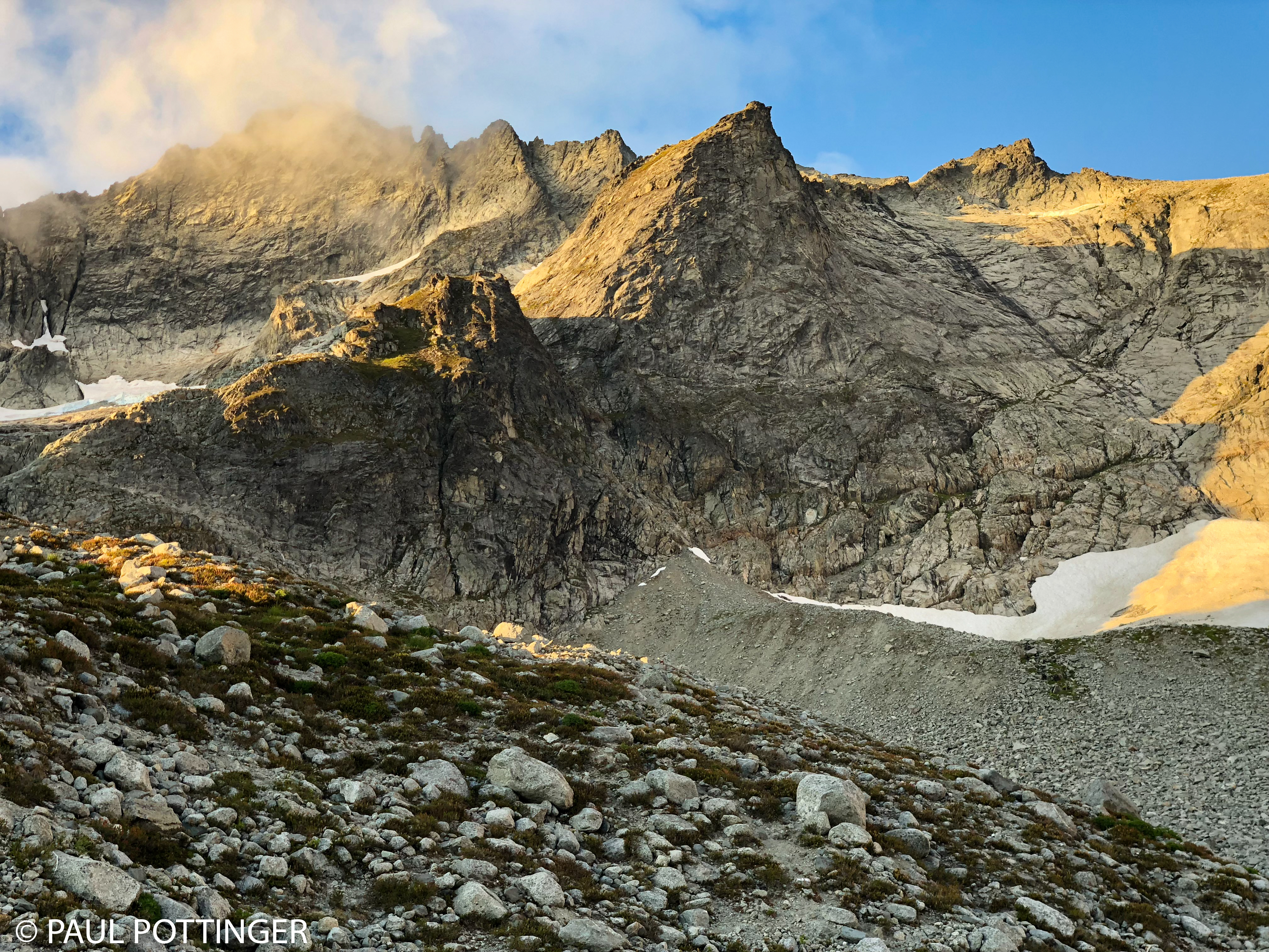
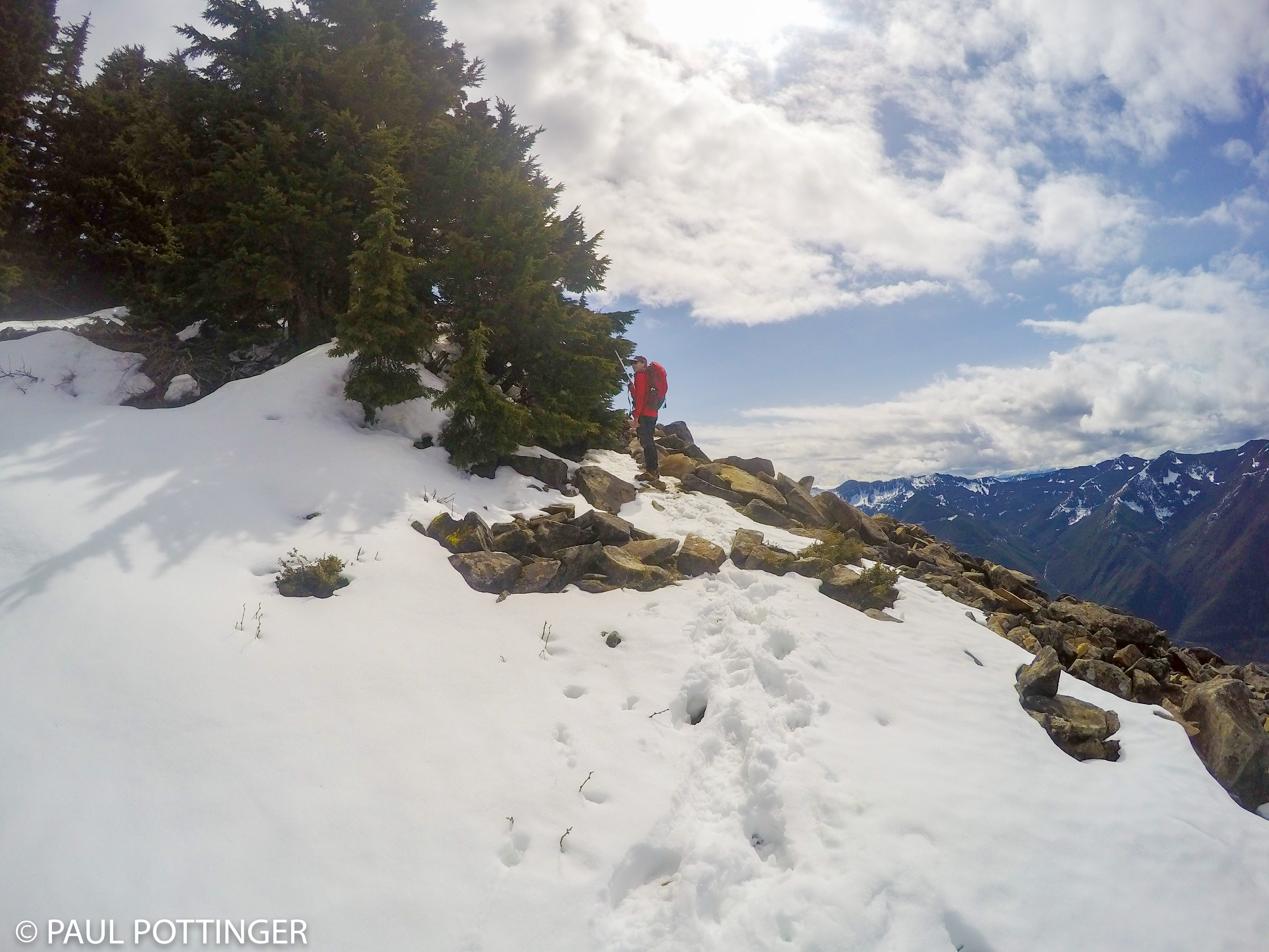
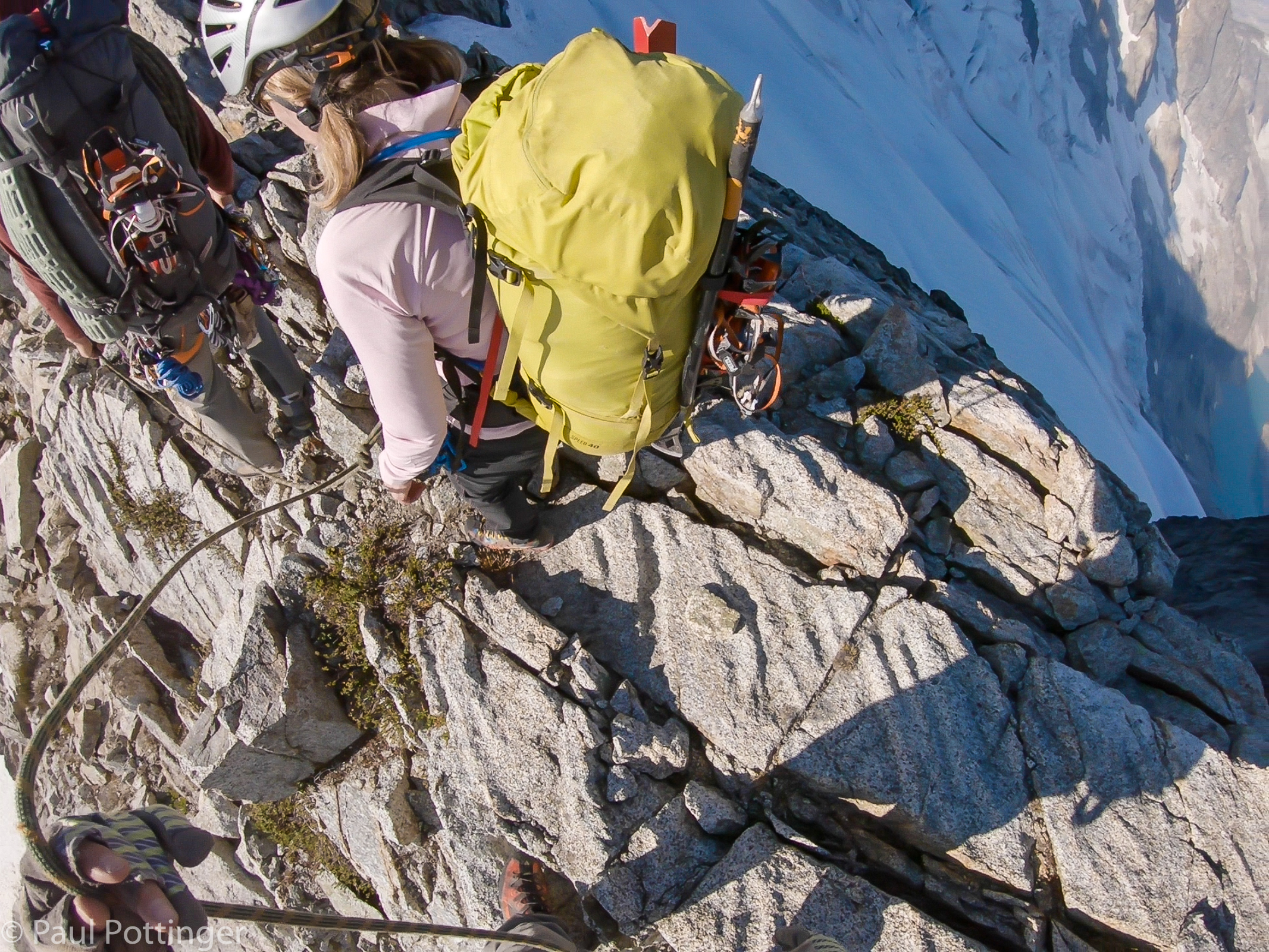
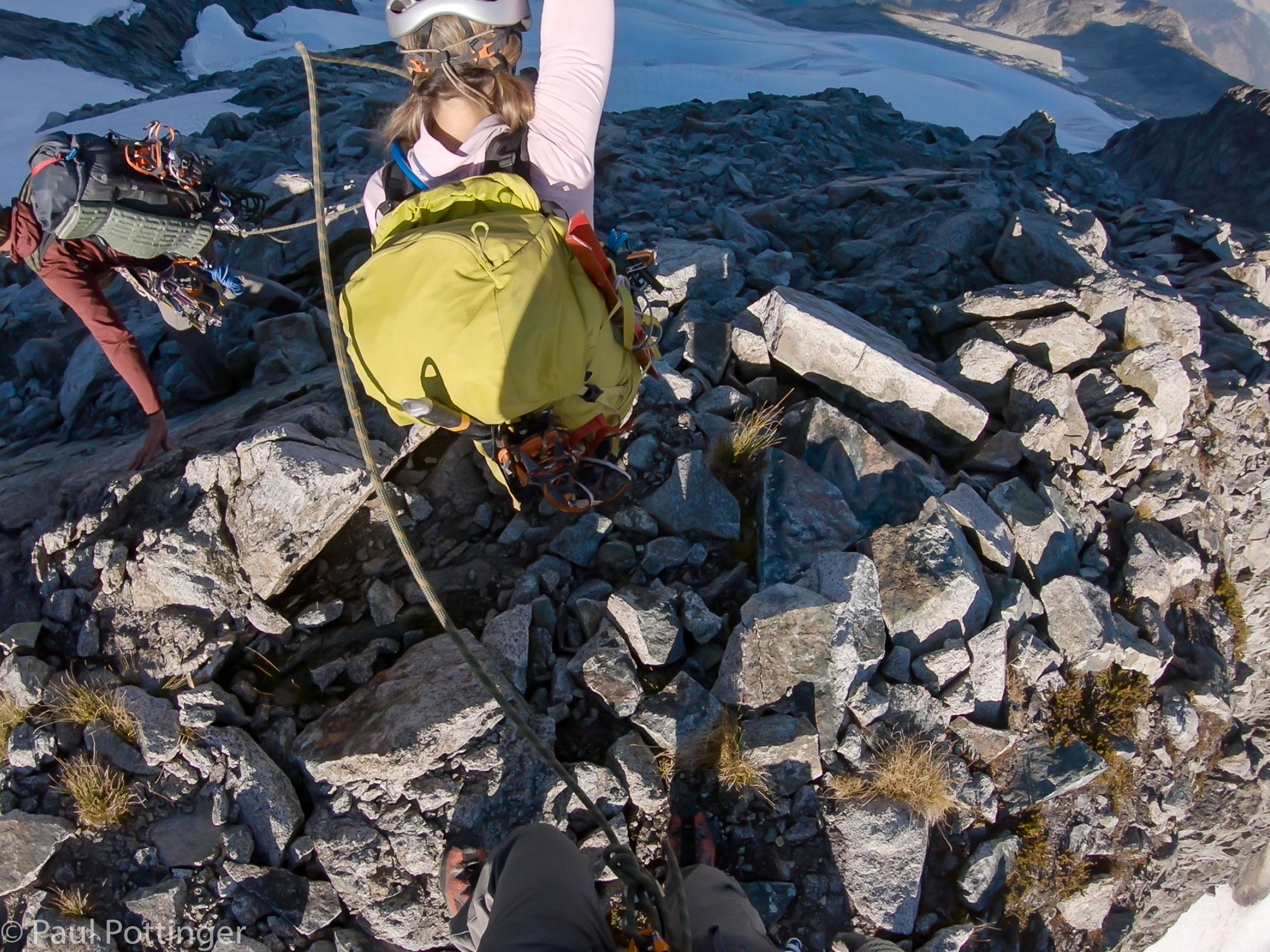
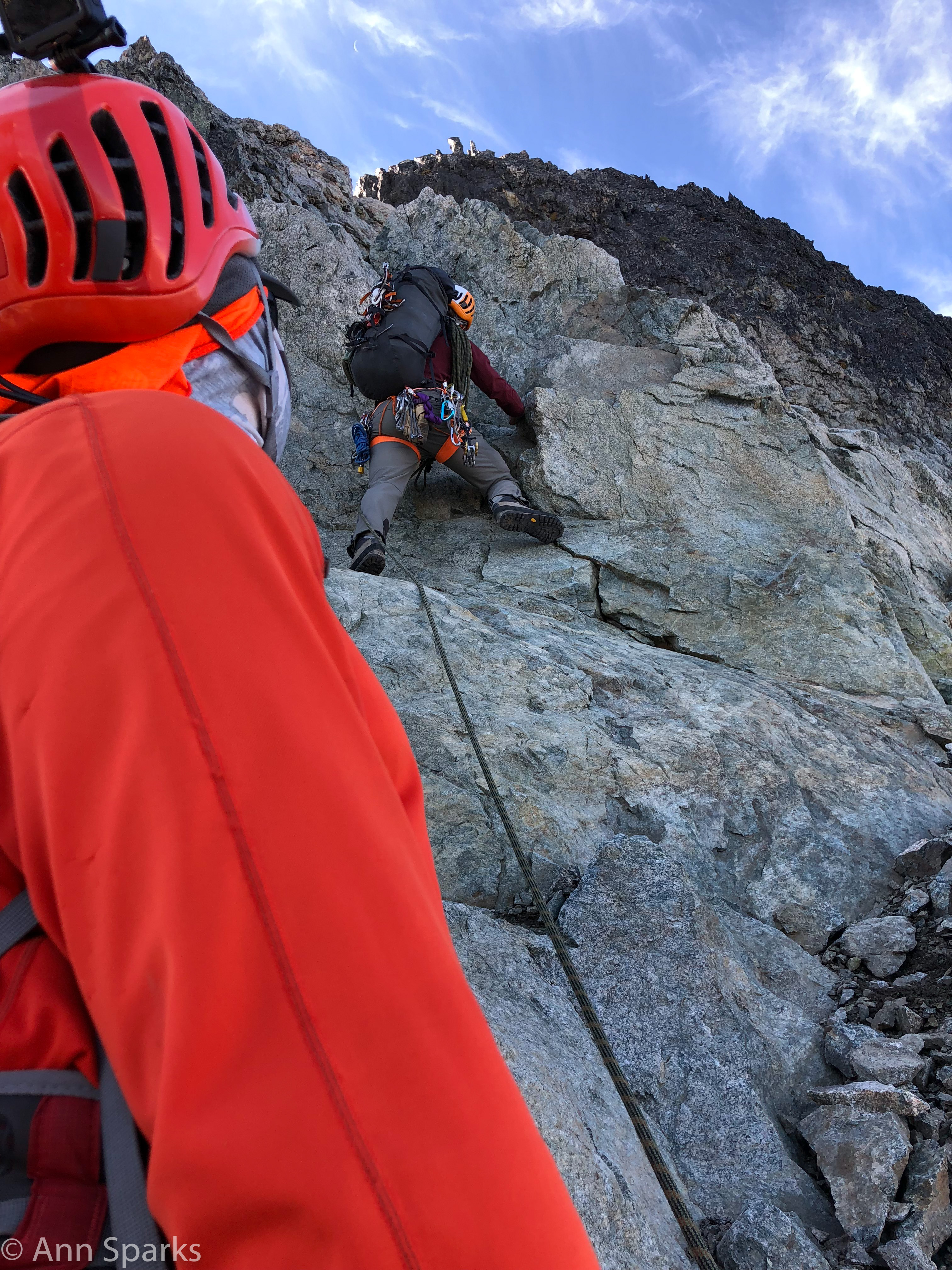
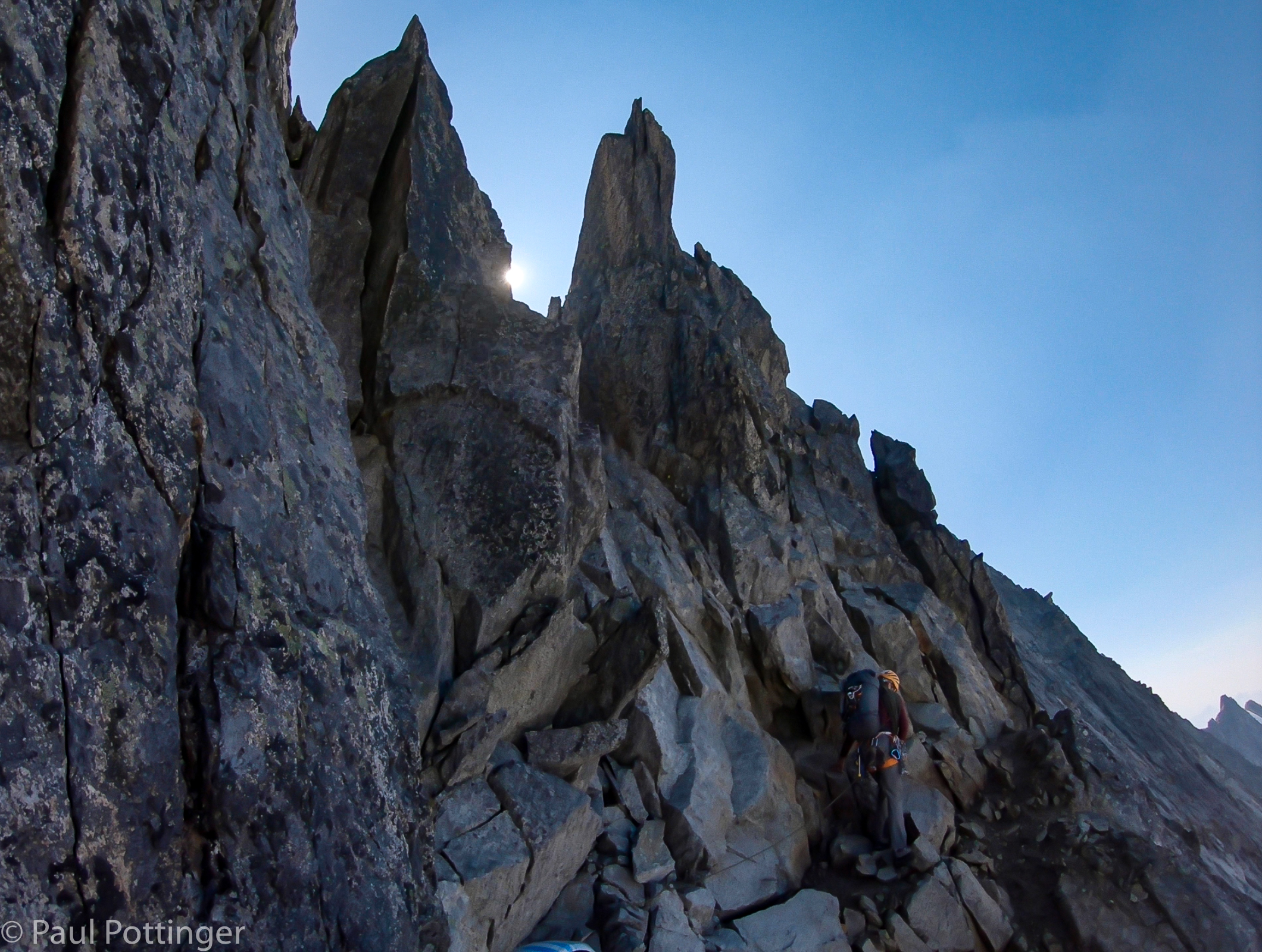
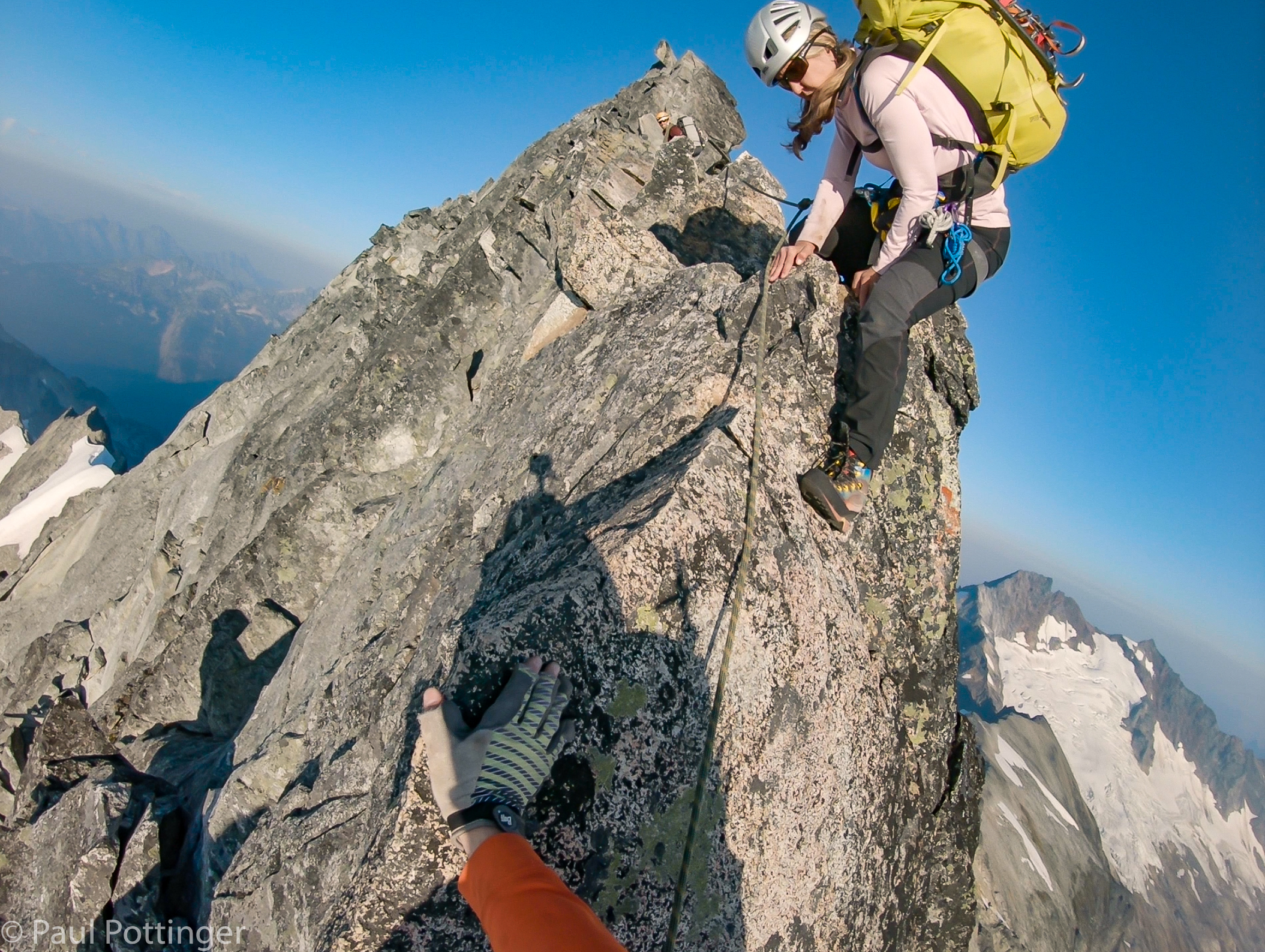
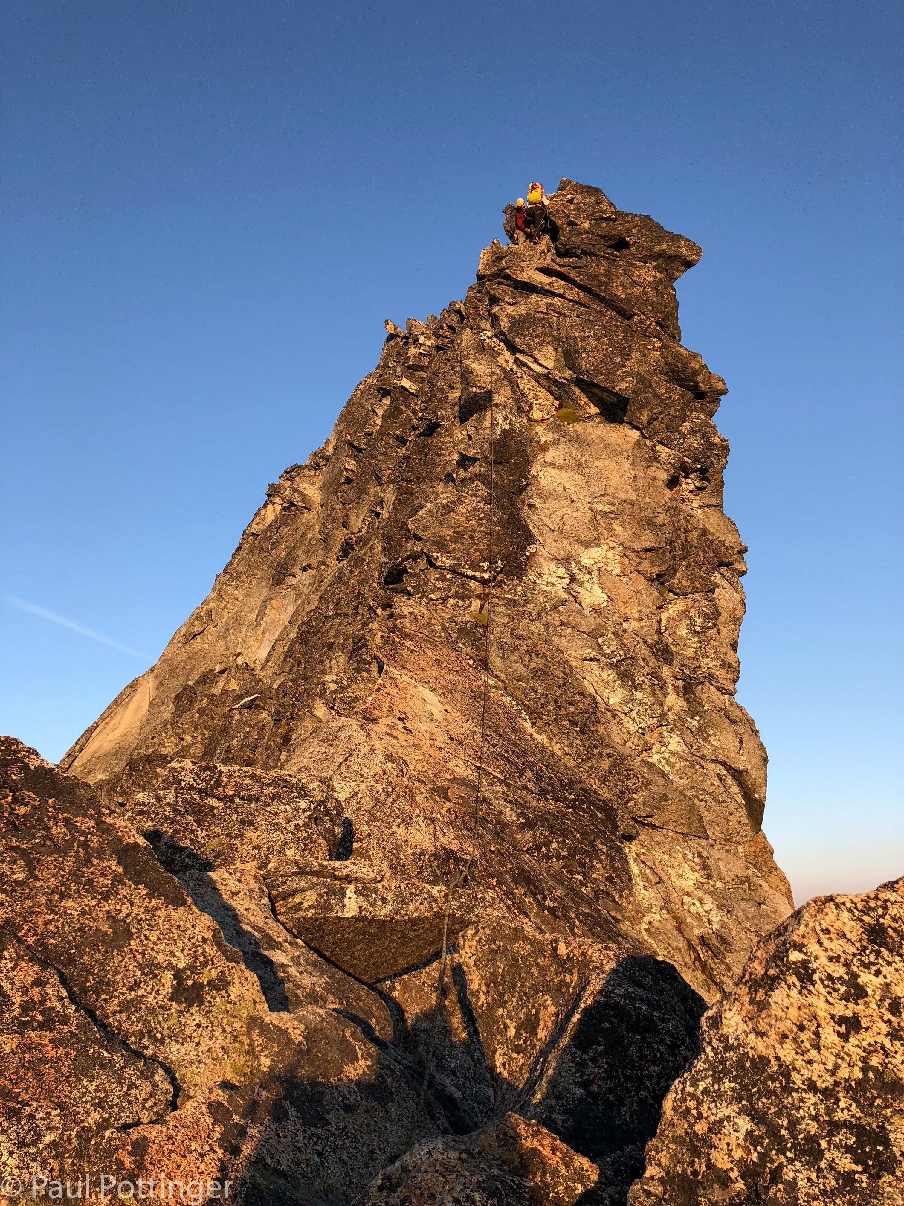
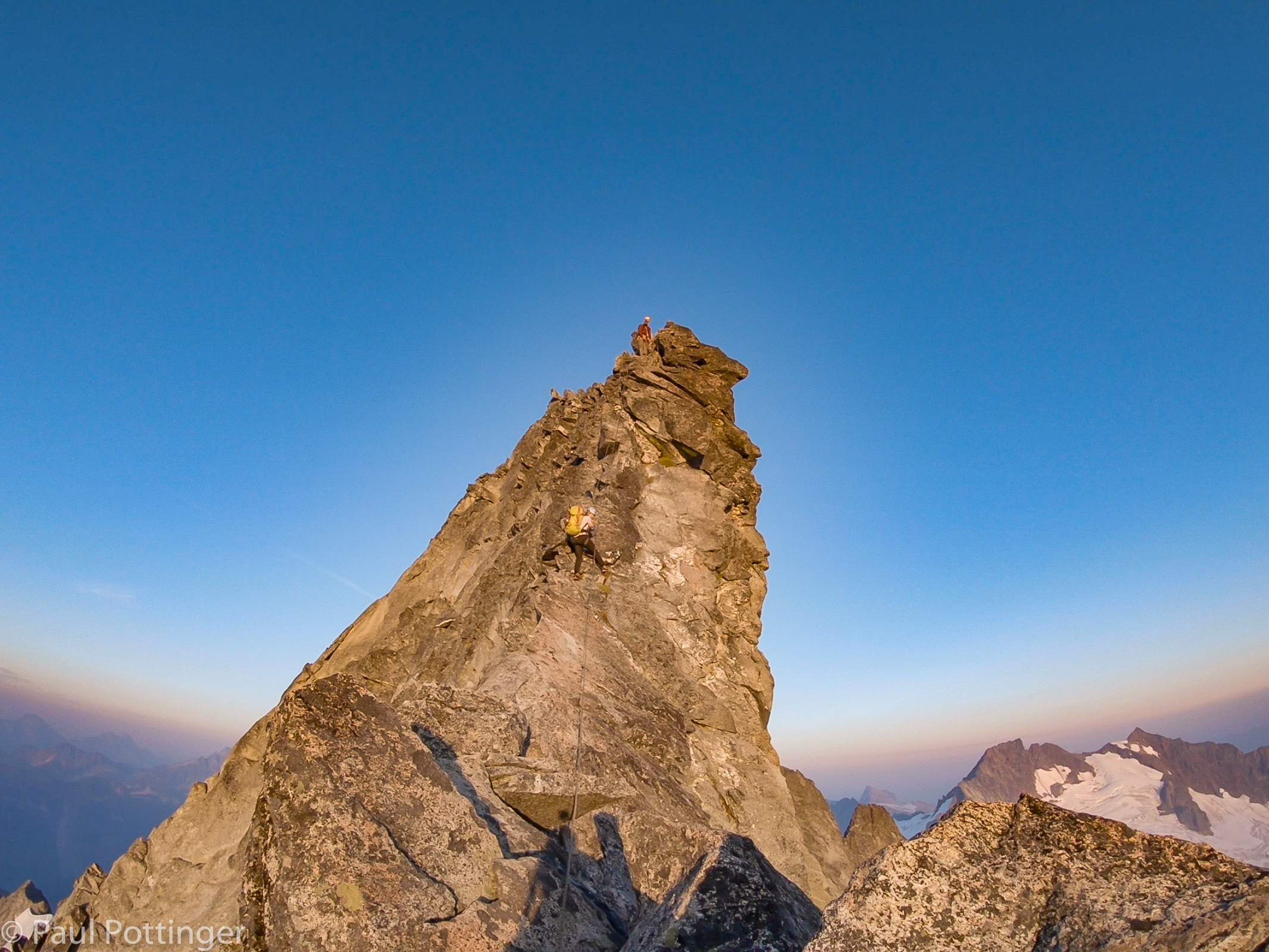
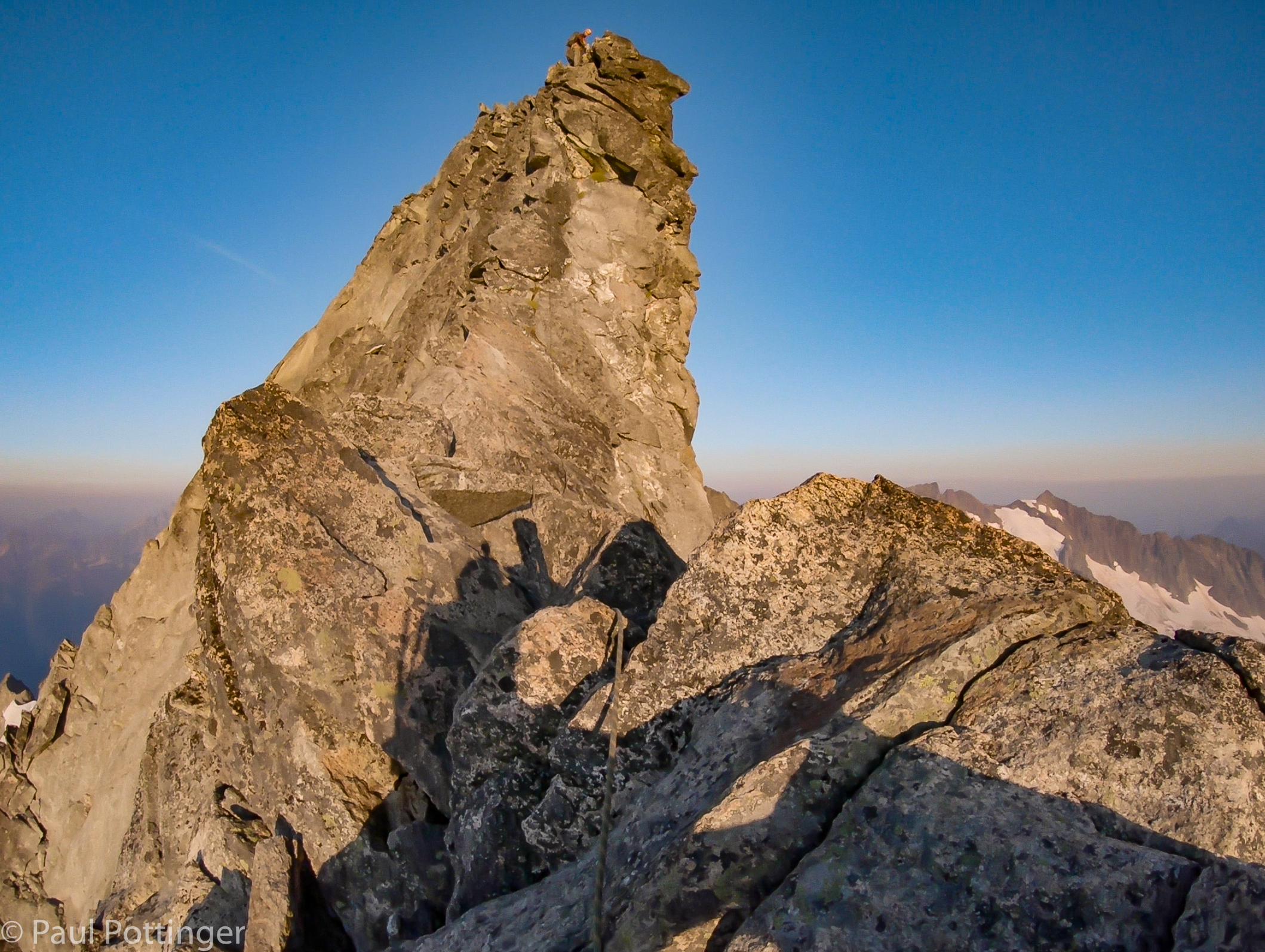
One of the more objectively challenging obstacles presents itself minutes after leaving camp: A gendarme tower rises steeply from the gentle slope of the ridge. There is no way around it, on either side. It must be surmounted. We watched Justin as he led the pitch up a half-chimney, which involved finding hidden footholds, stemming, and mantle moves.

“How does he do that?” asked Ann.

“Piece of cake.” Because this was the steepest section of the ascent, Justin belayed us up one at a time (much of the day would involve simul-climbing.) Parts of the pitch seemed devoid of reliable handholds, but of course they were there. I was out of sight from Justin and Ann, but they could holler down advice at just the right moment. “Reach up with your right hand and feel to the right, there’s a good hold there.” Son of a… there it is. Getting this obstacle out of the way early was a relief.

Up we go.
Okayyyy… so, the ridge will be narrow in places.
Approaching our first obstacle, a gendarme on the ridge.
Ann approaches the gendarme. I help keep the rope out of her way.
Looking down at the debris field.
Ann follows Justin up the Gendarme.
My turn. Great handholds… nothing below but air.
Looking up the cruxy part of the Gendarme. Awkward but not too difficult.
At the first anchor station.
Cleaning the anchor.

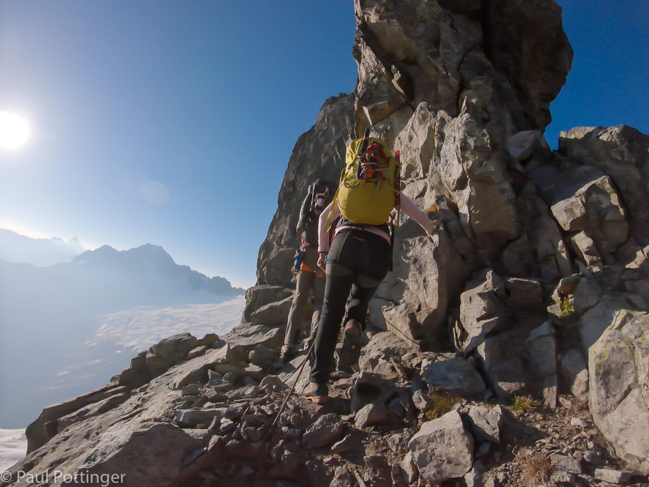
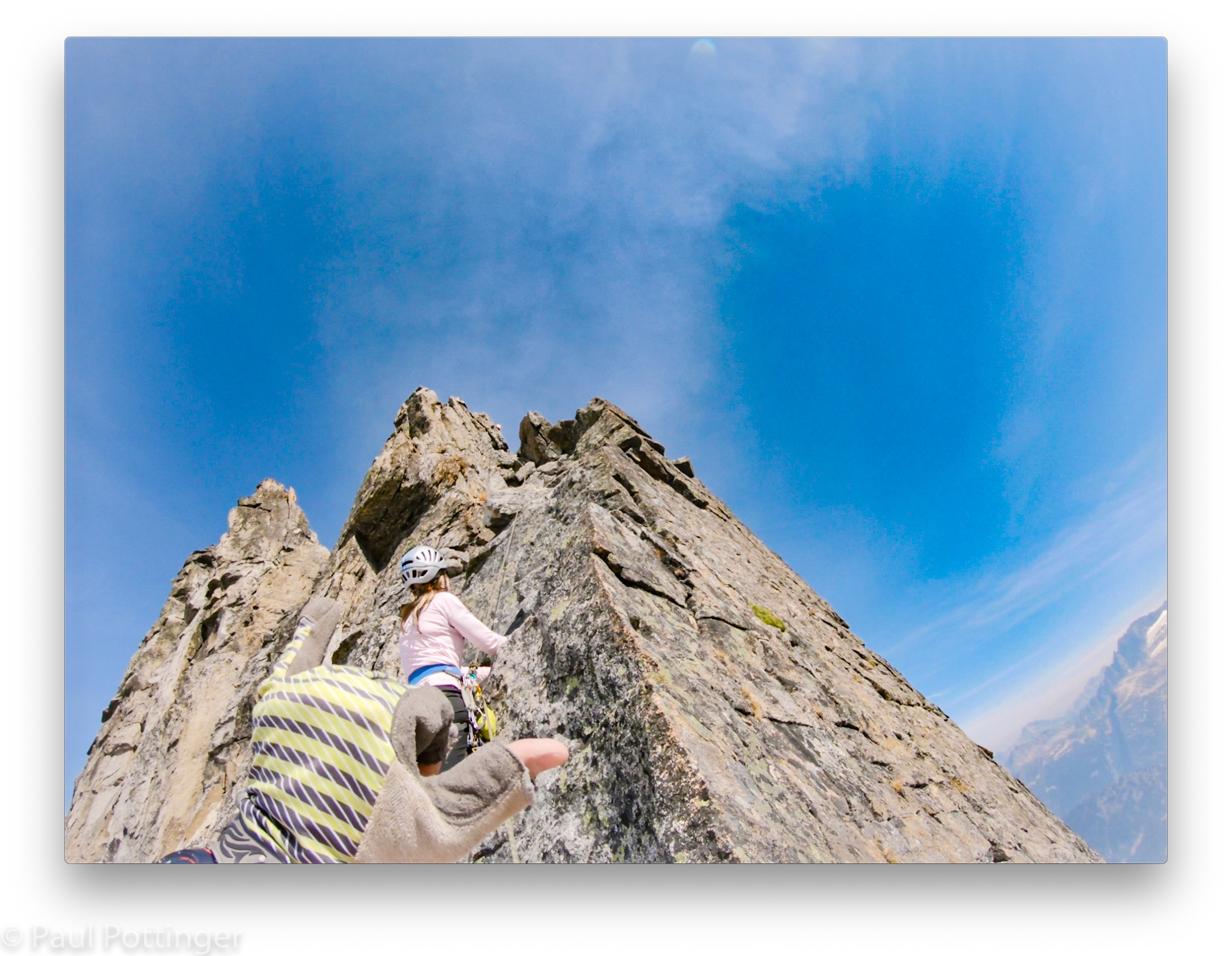
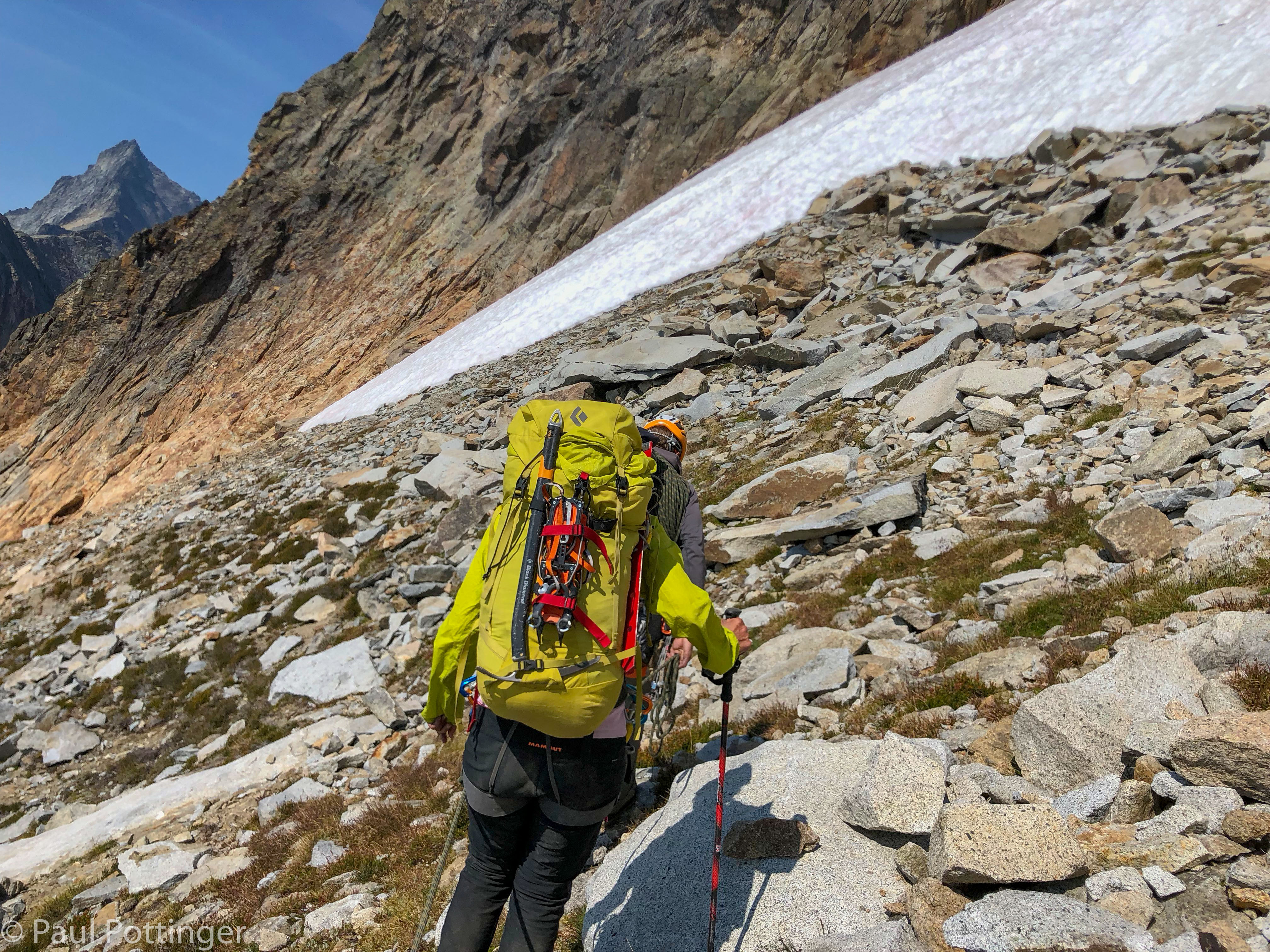
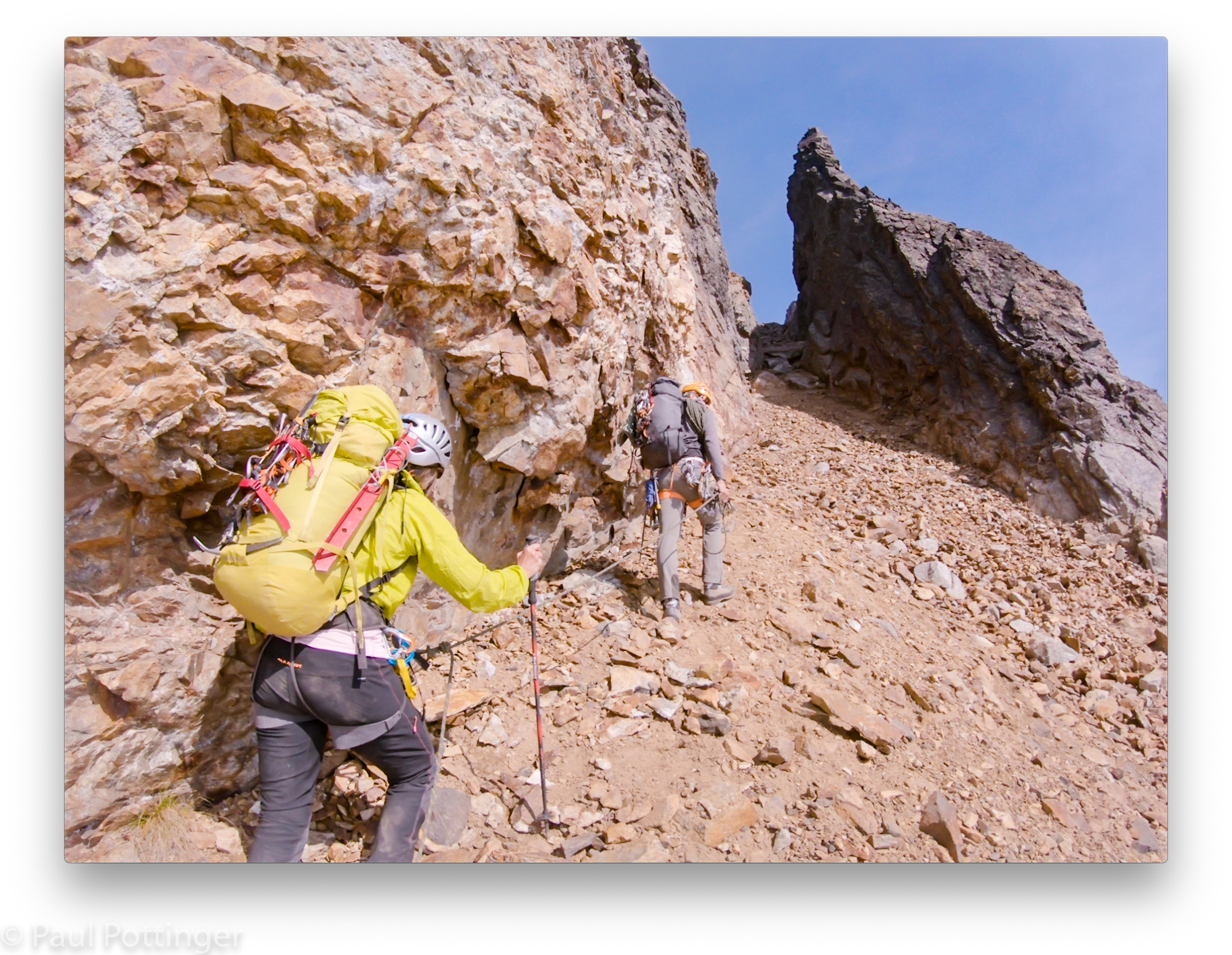
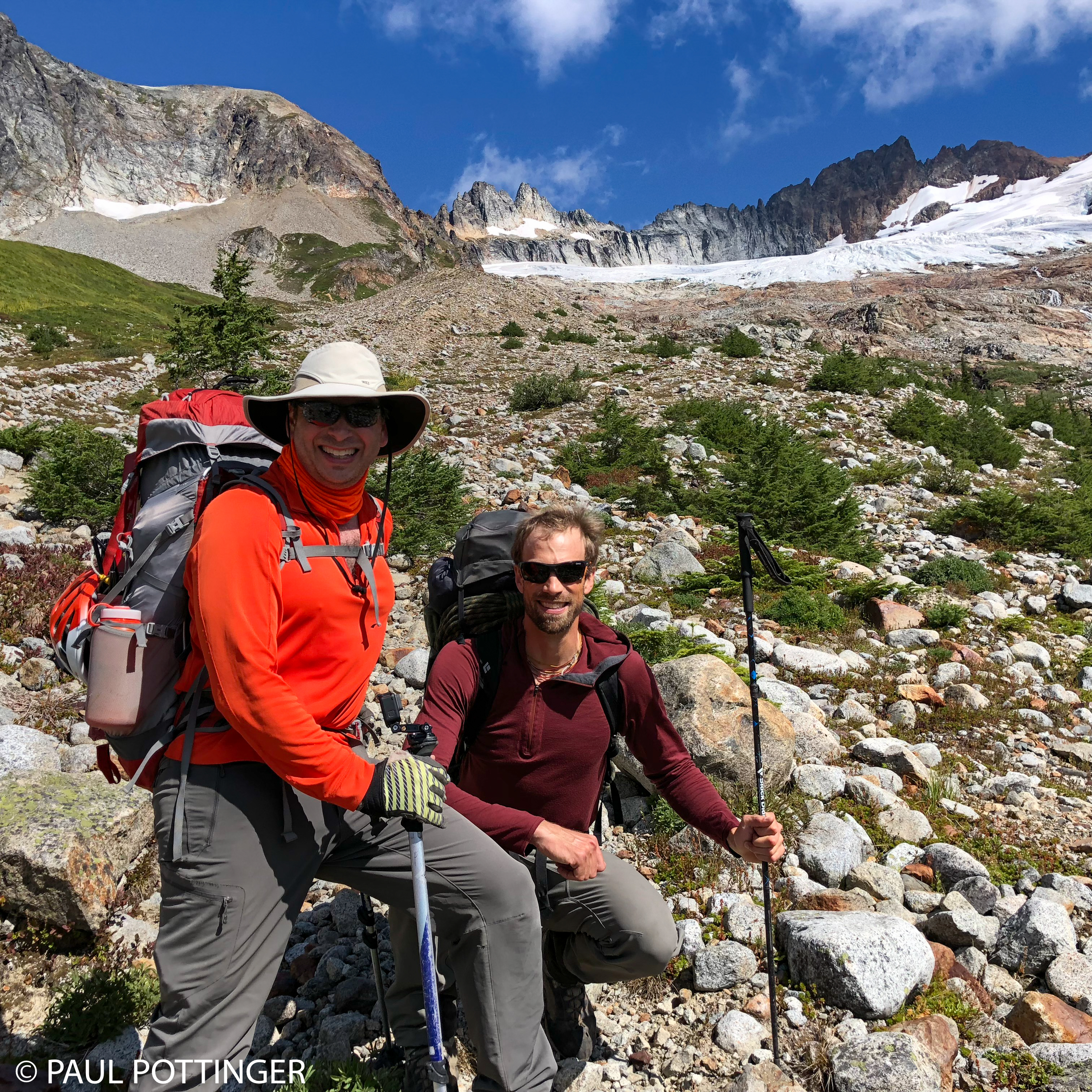
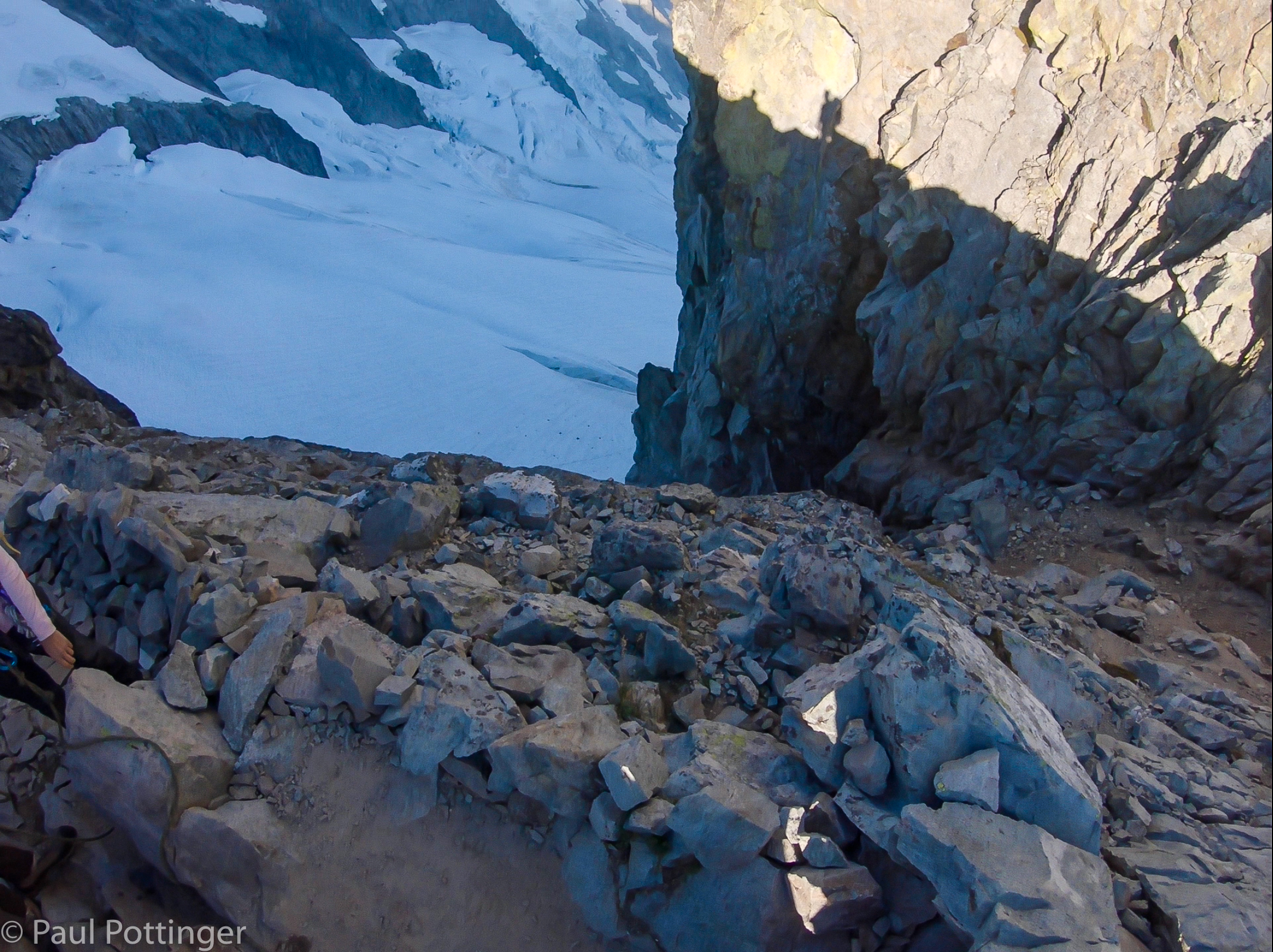
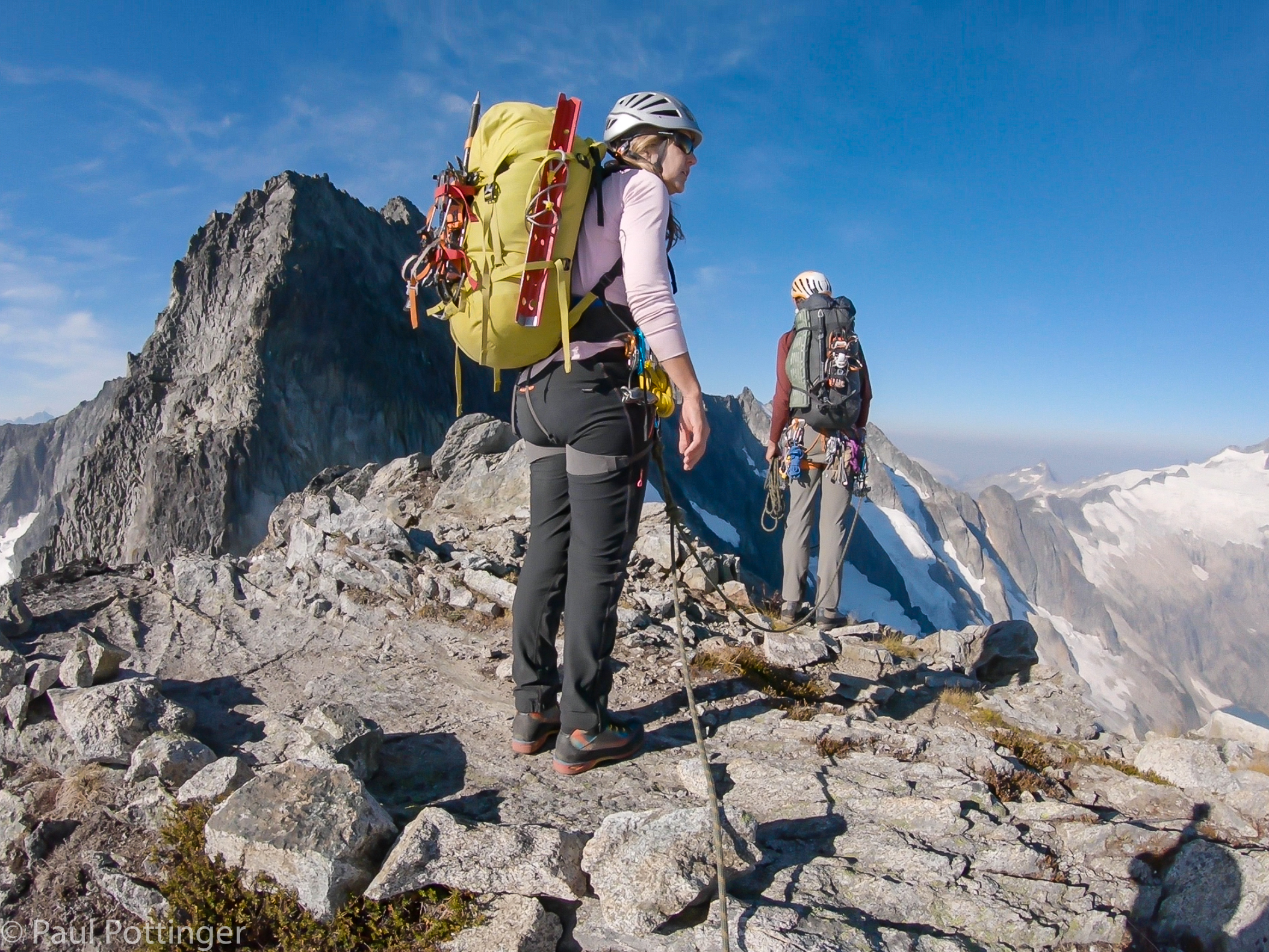
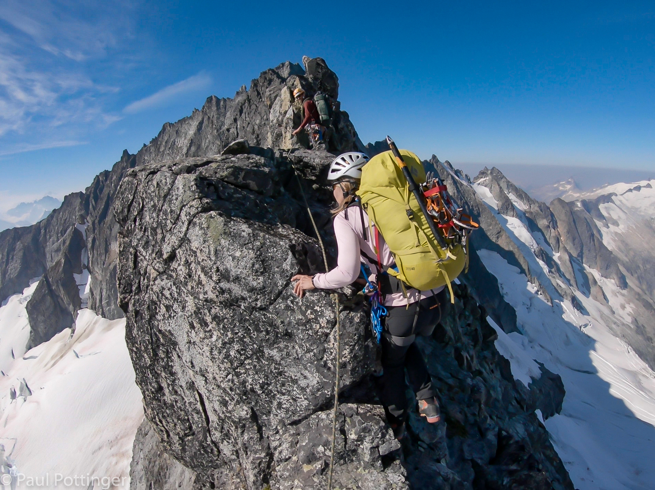
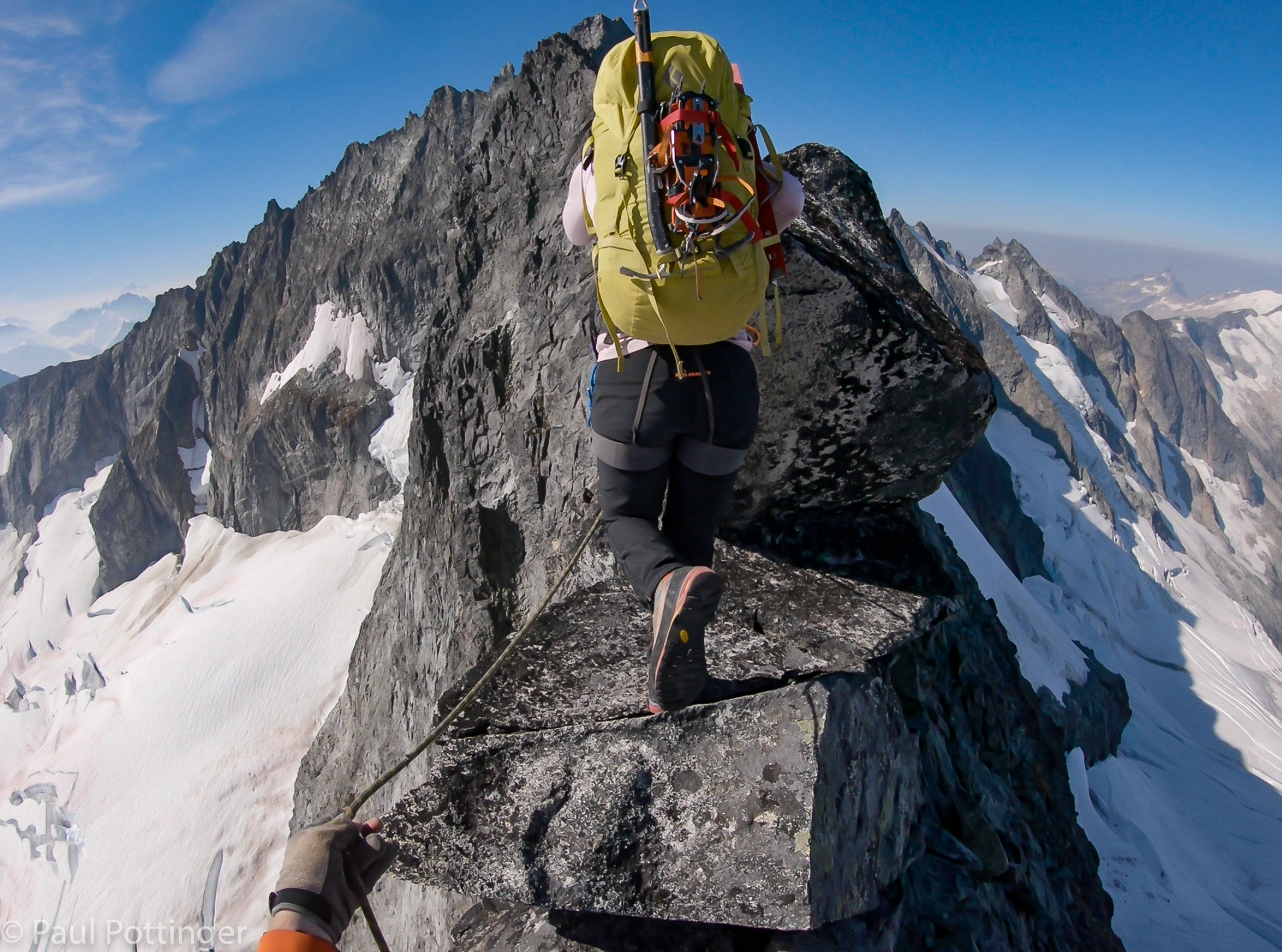
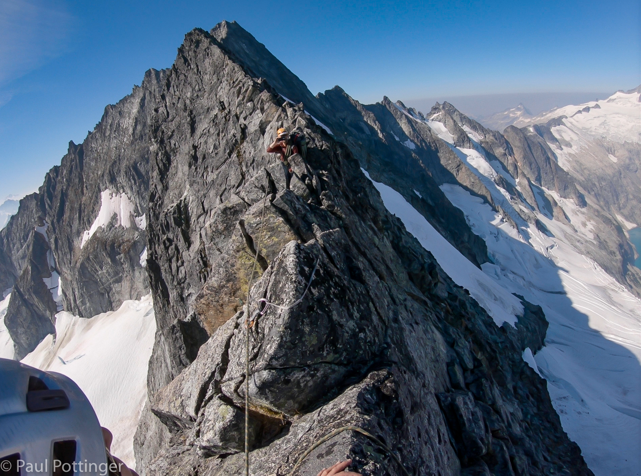
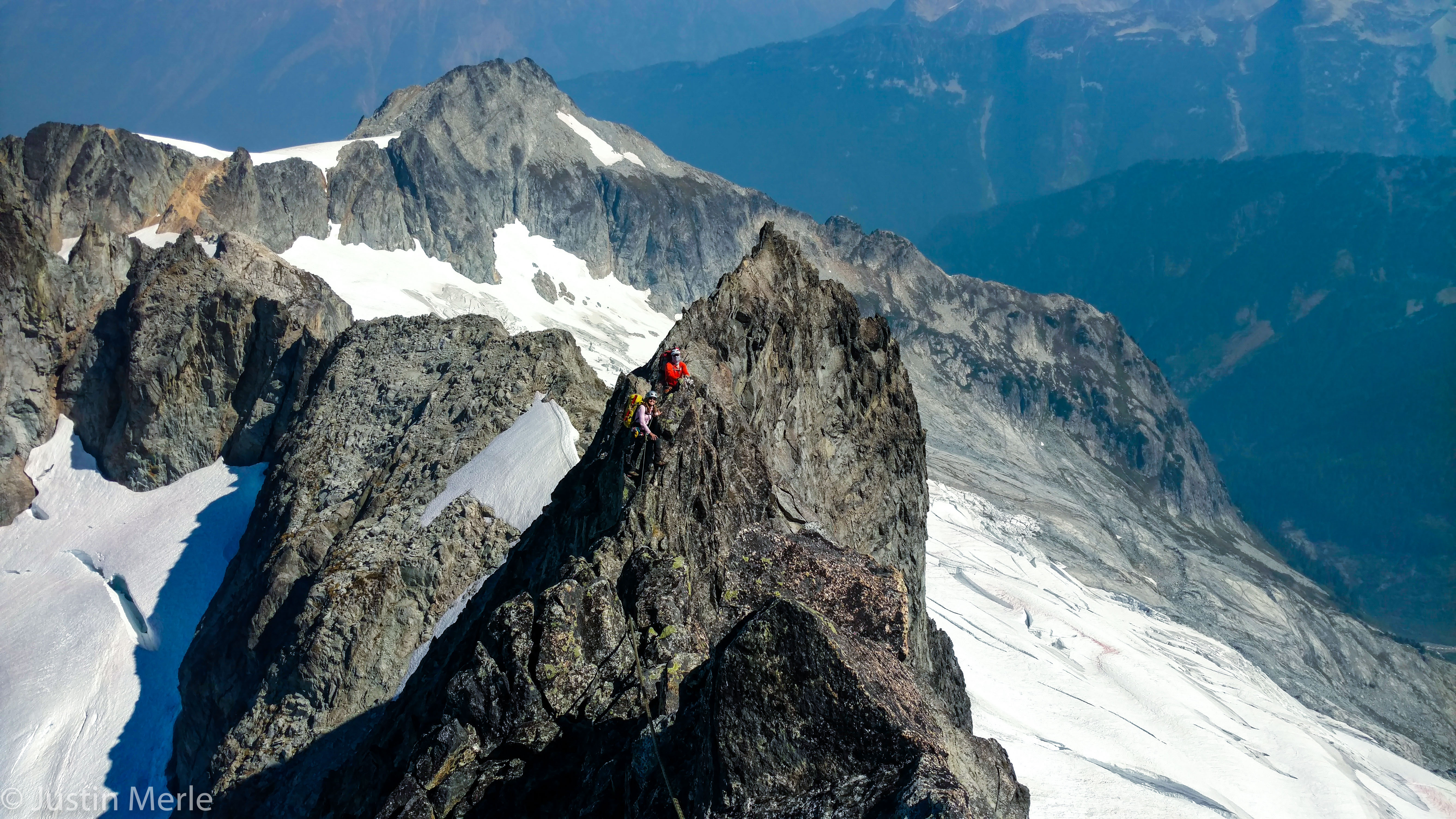
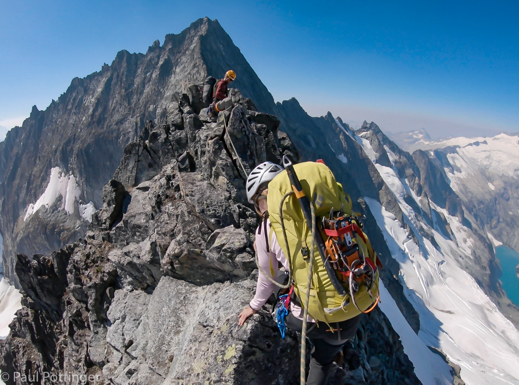
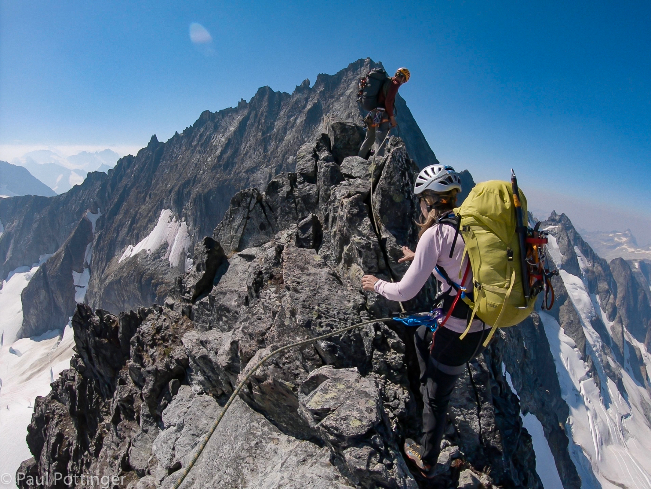
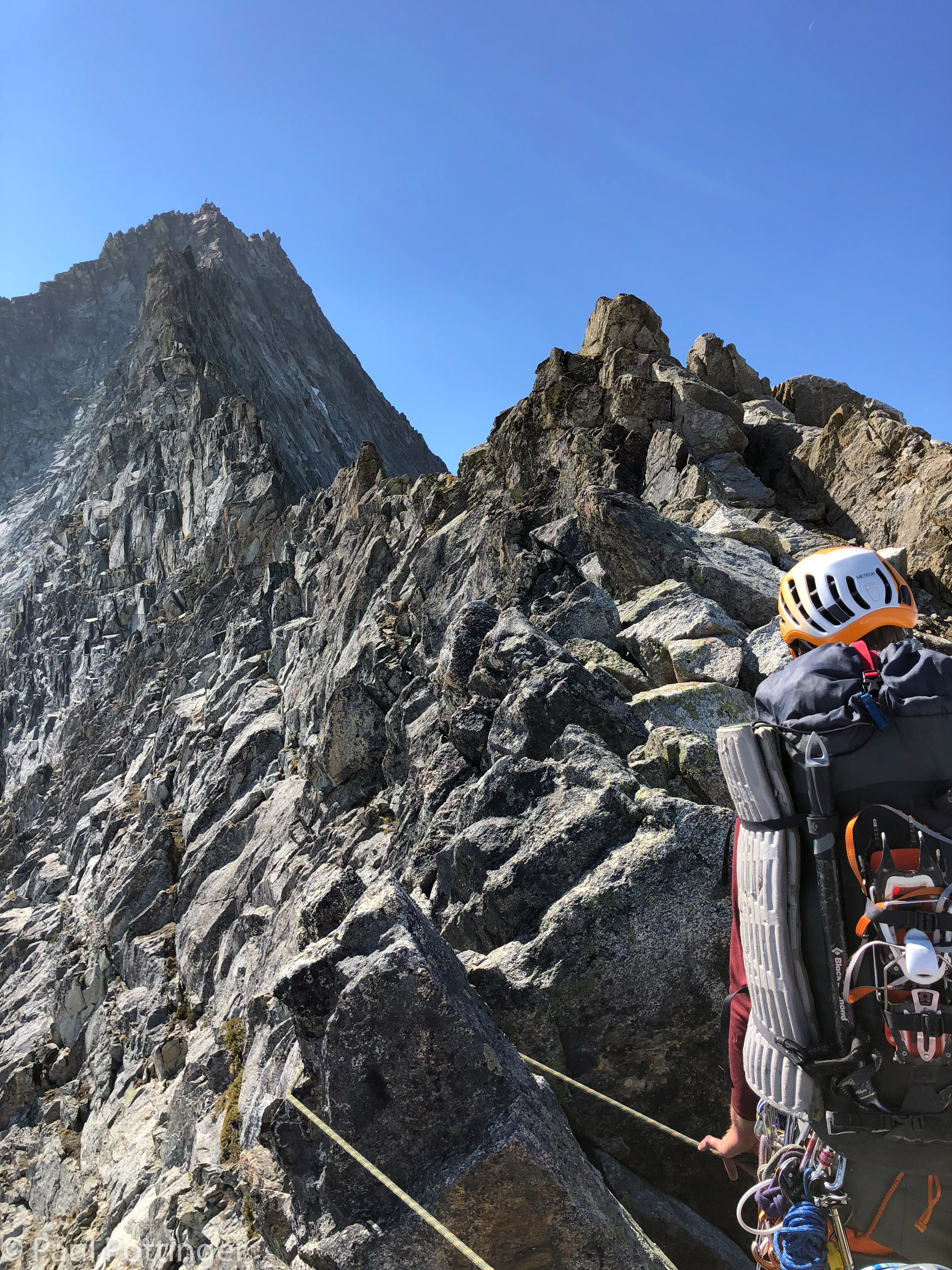
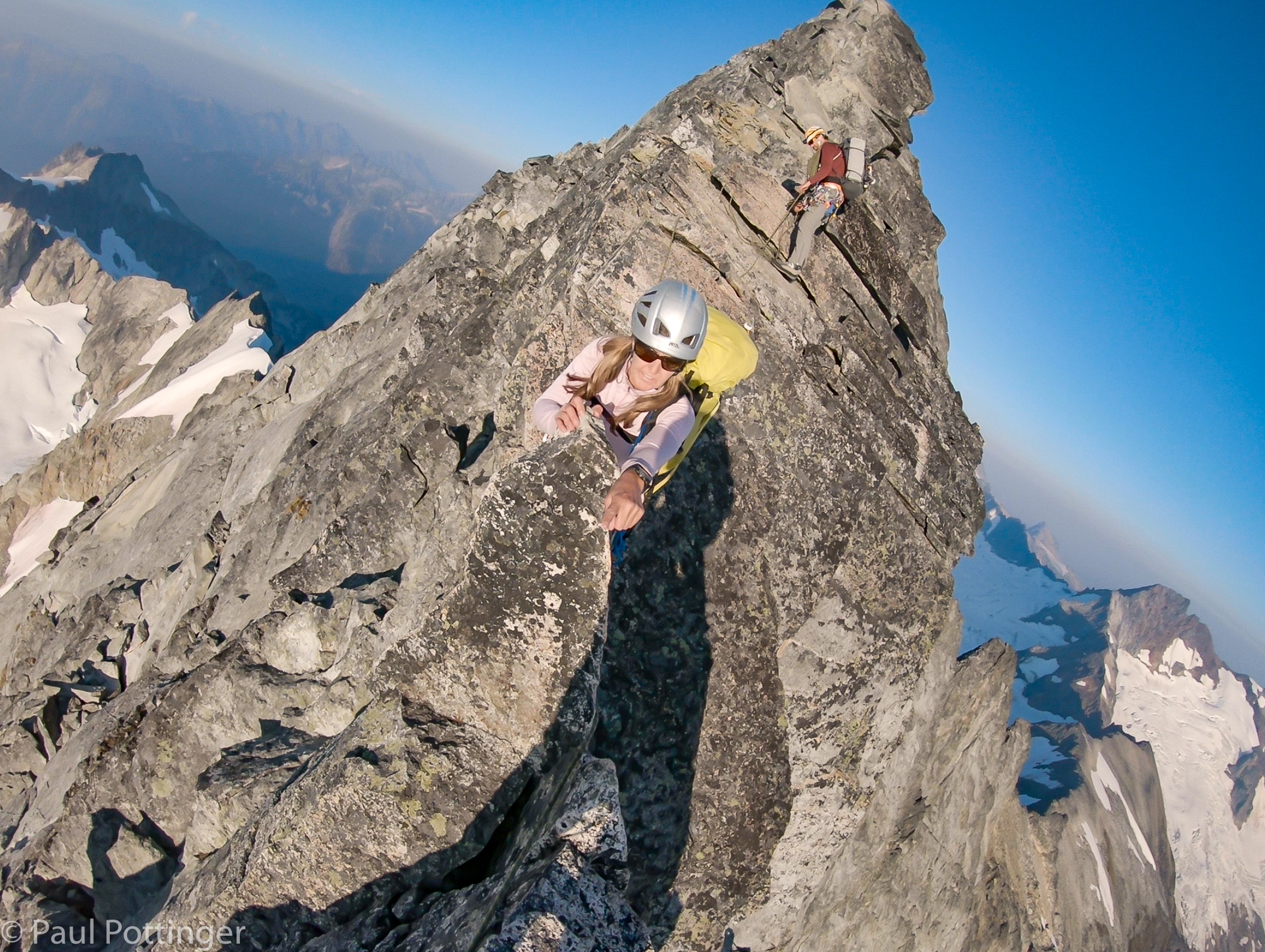
The North Ridge is punctuated by a series of towers, or more precisely by steep sections several hundred feet high, intermixed with low-angle terrain. The entire climb seemed unthinkably immense, so these steep aretes made natural sub-goals to focus on. As the crow flies, the whole day was probably under a mile in distance, although my GPS ended up logging 1.3 miles. Just a mile… how hard could this be?

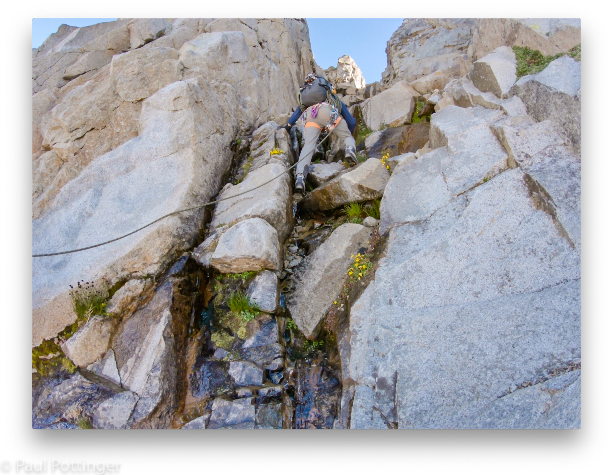
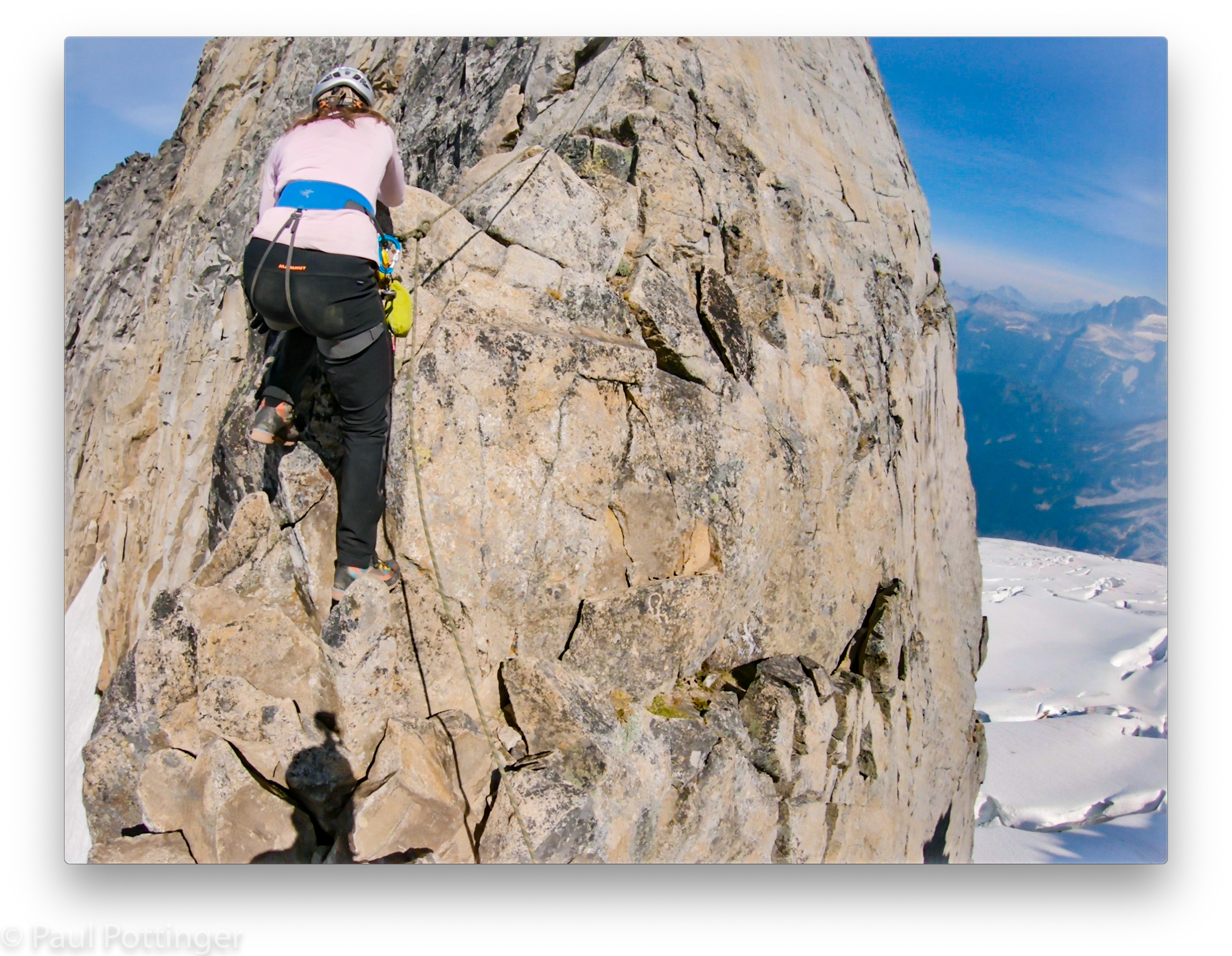
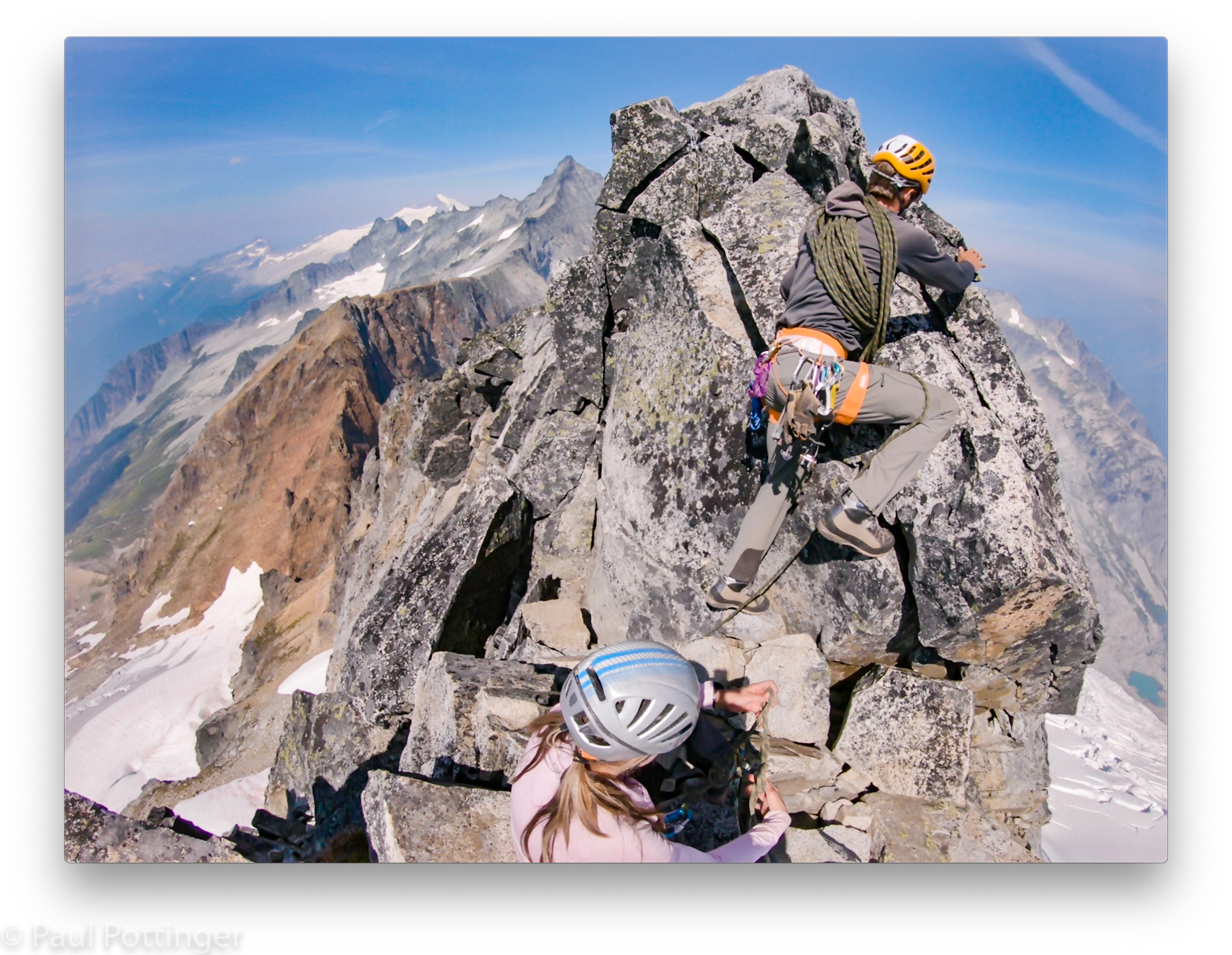
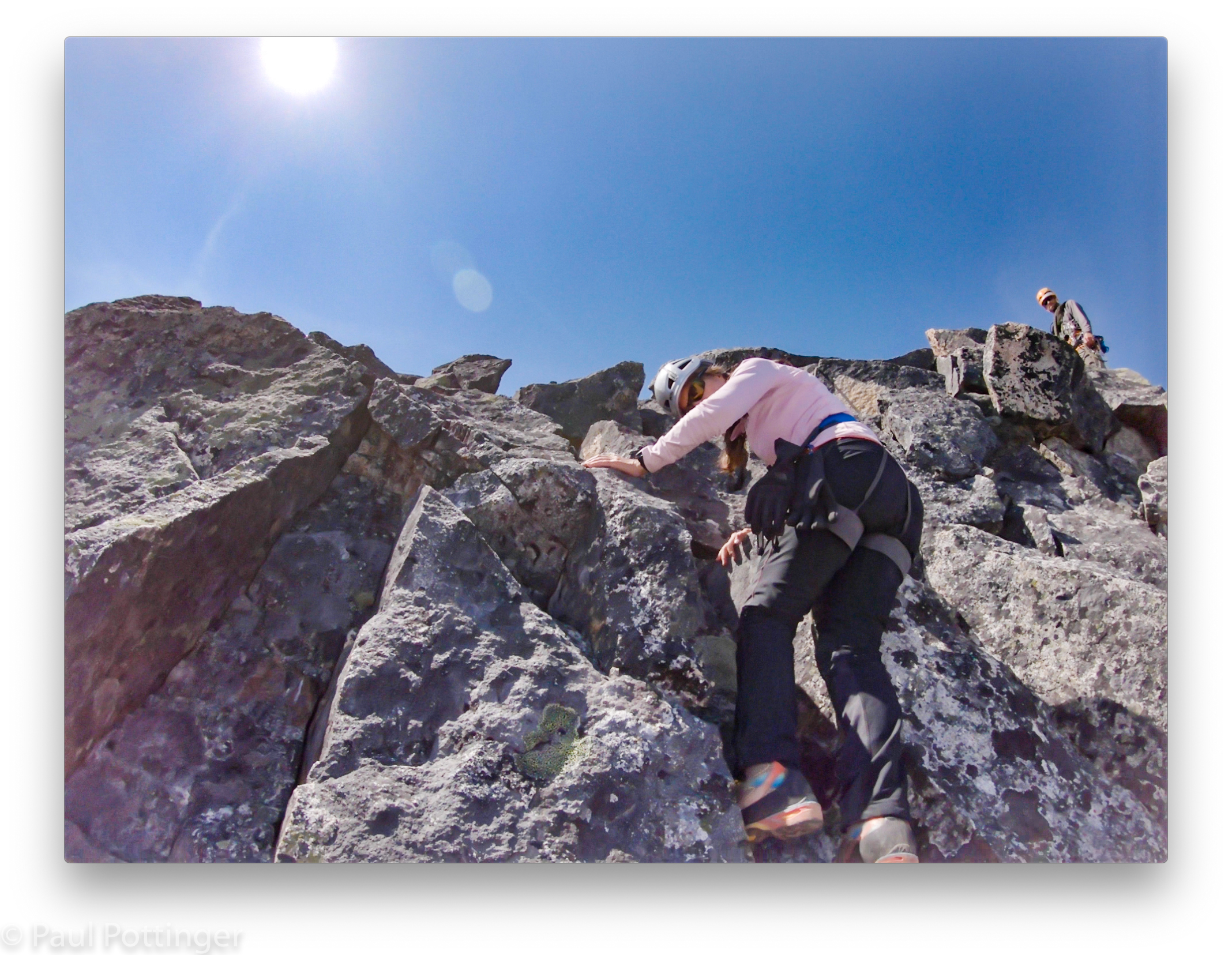
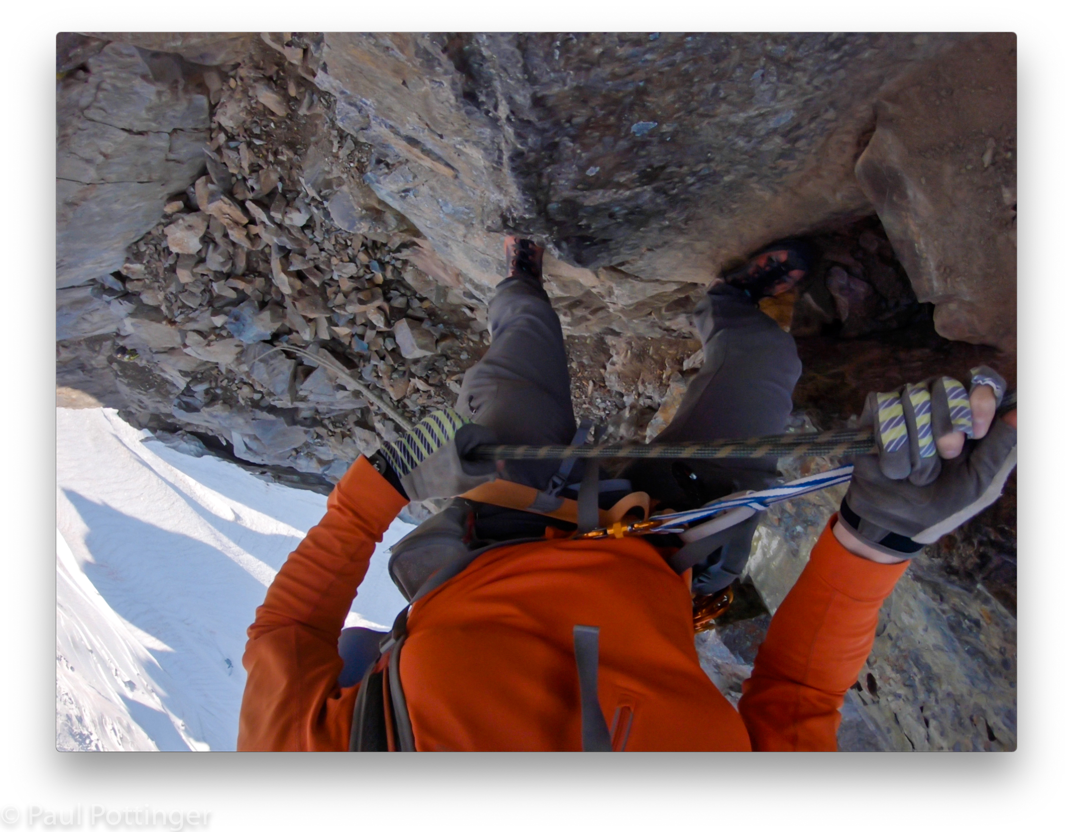
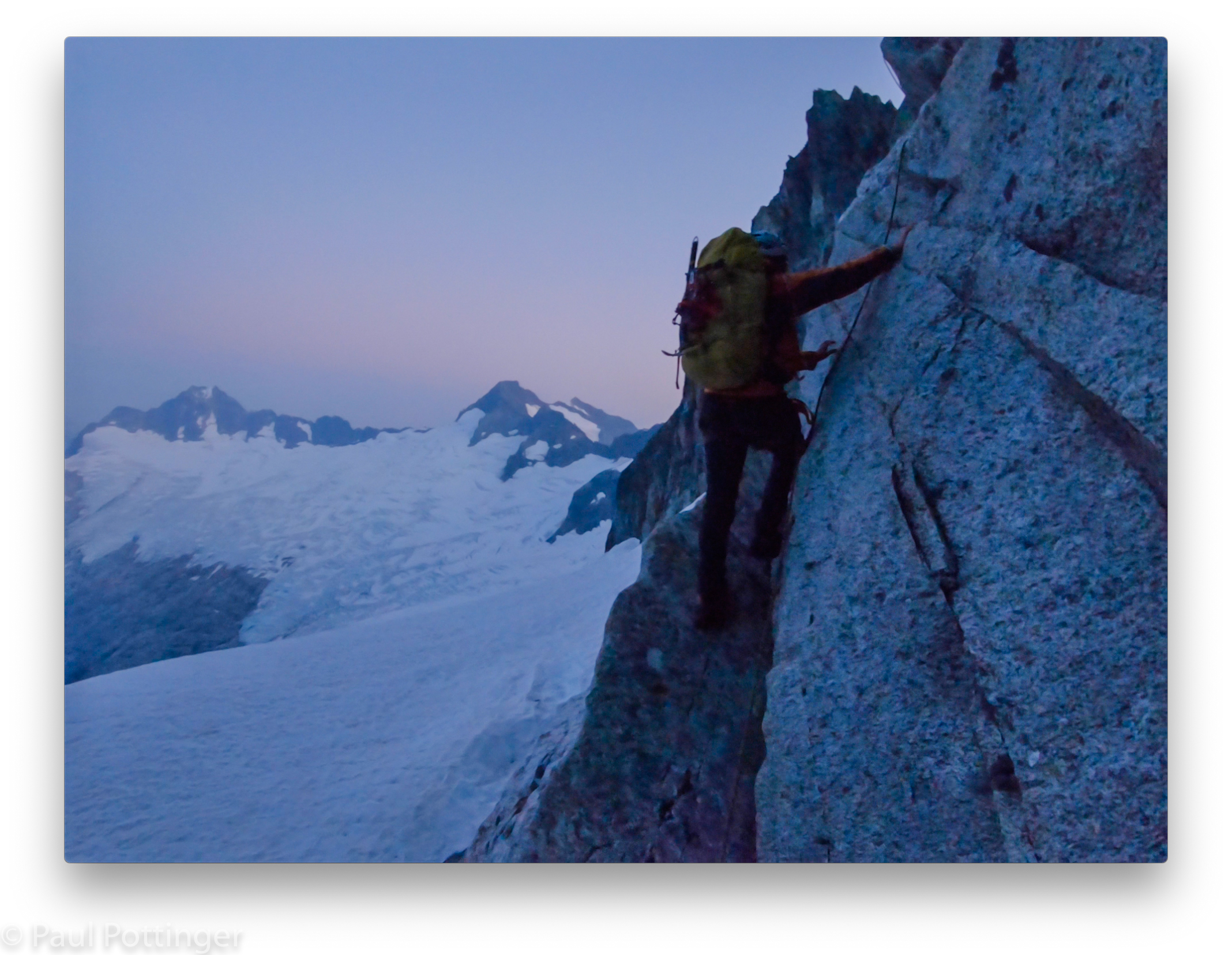
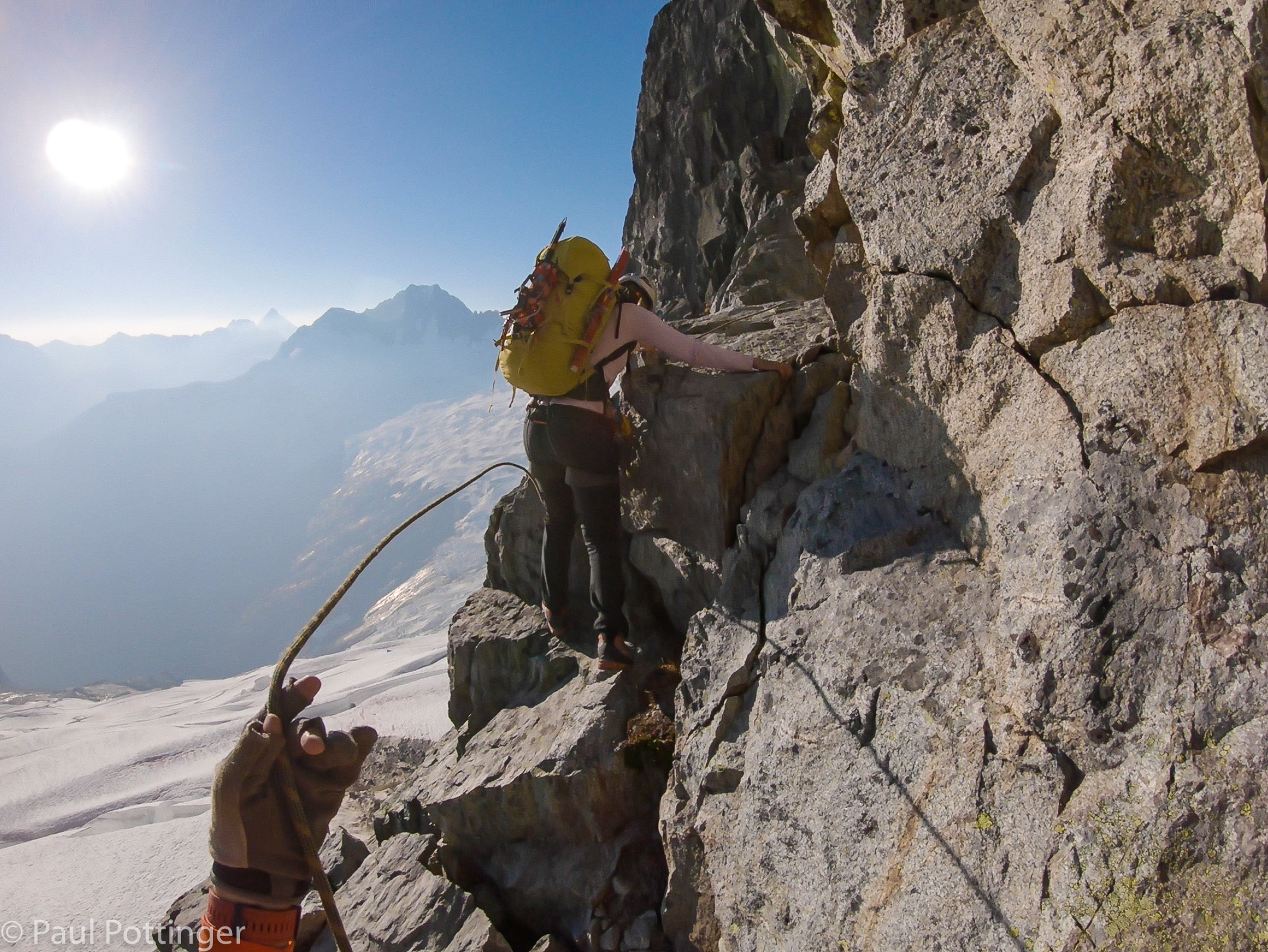
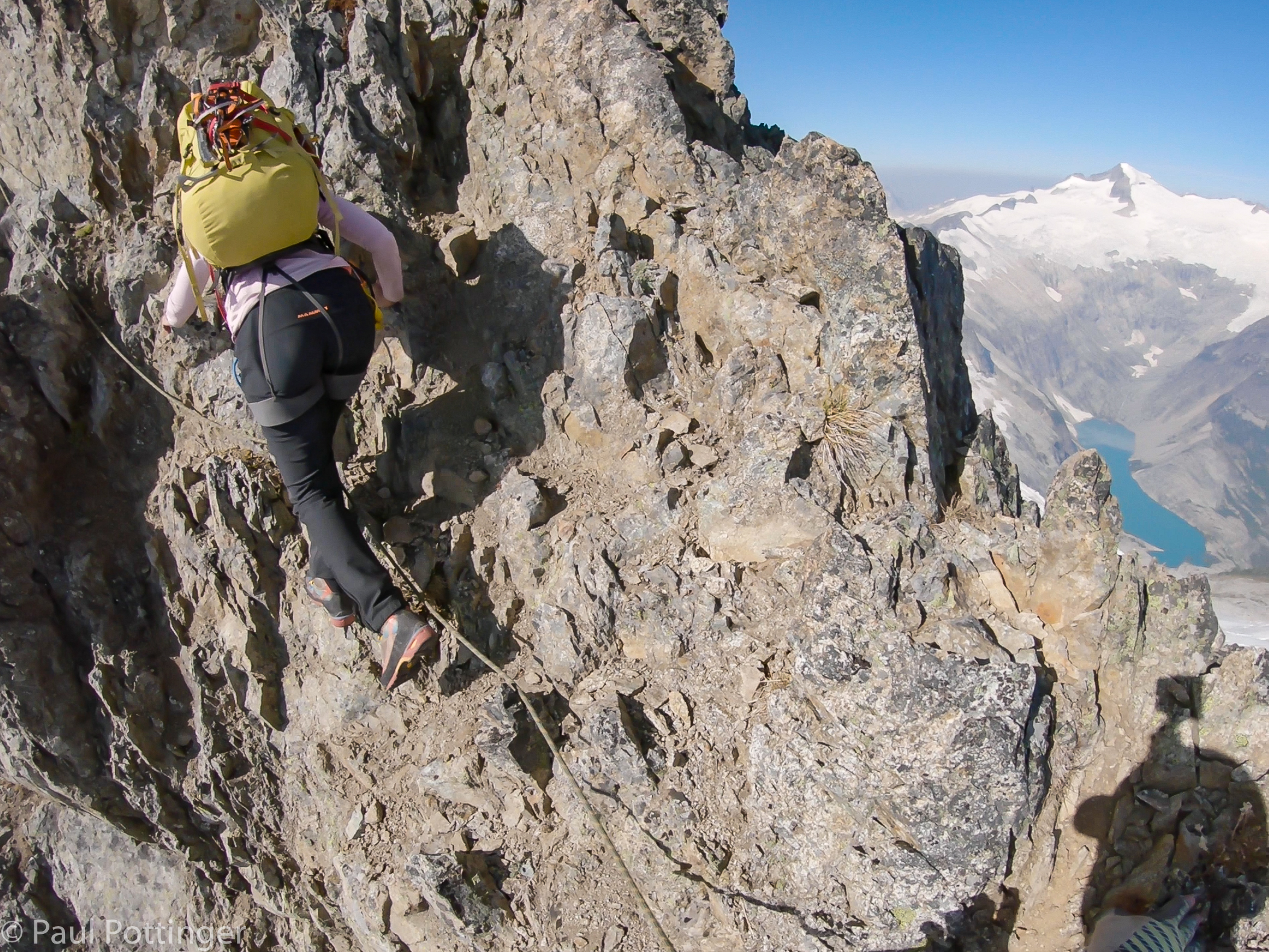
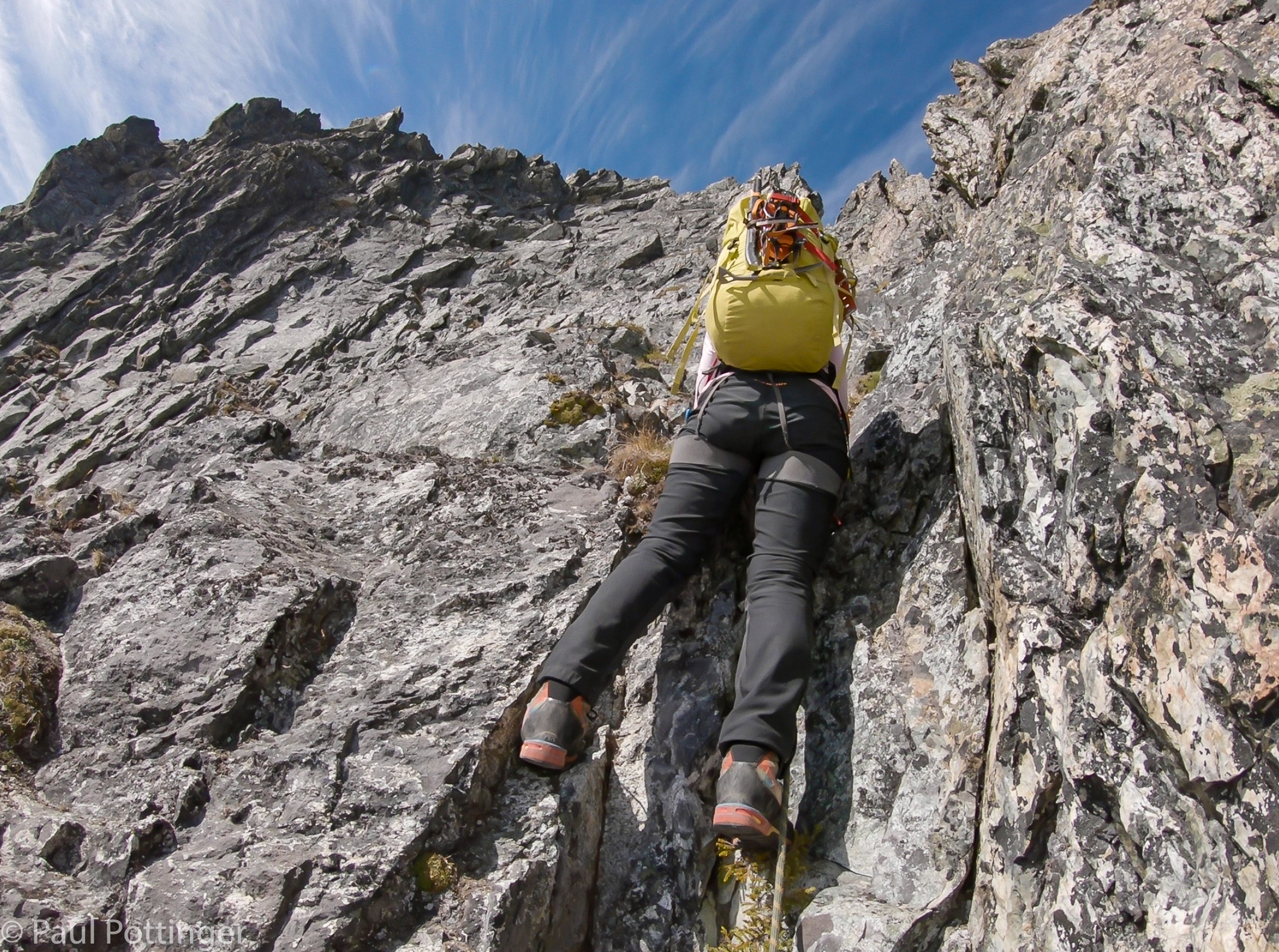
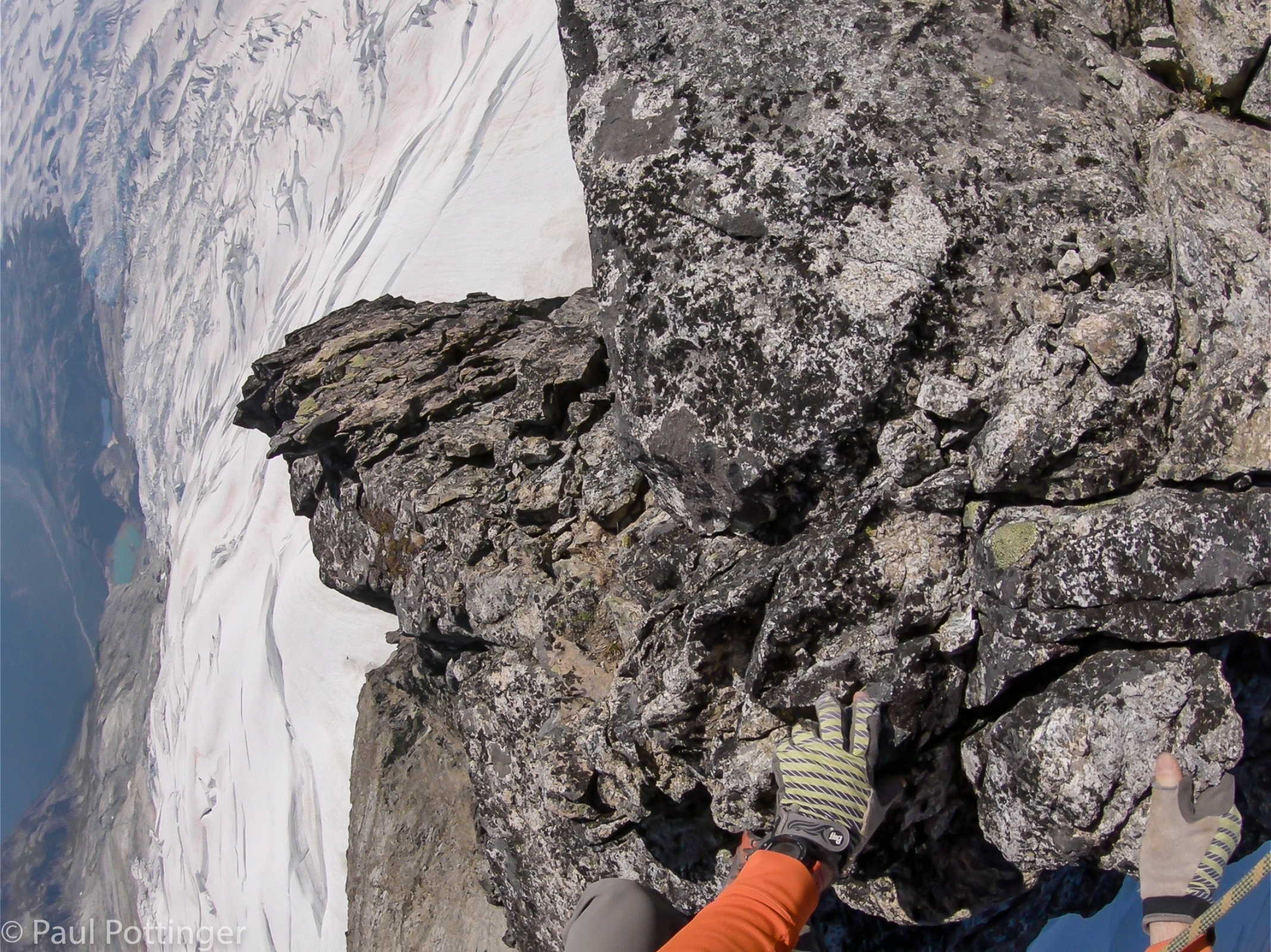
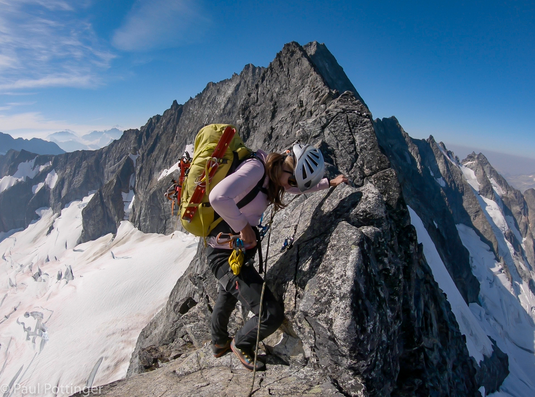
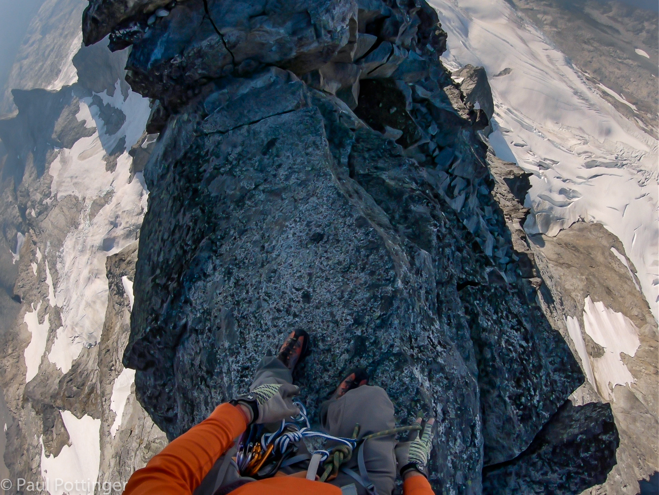
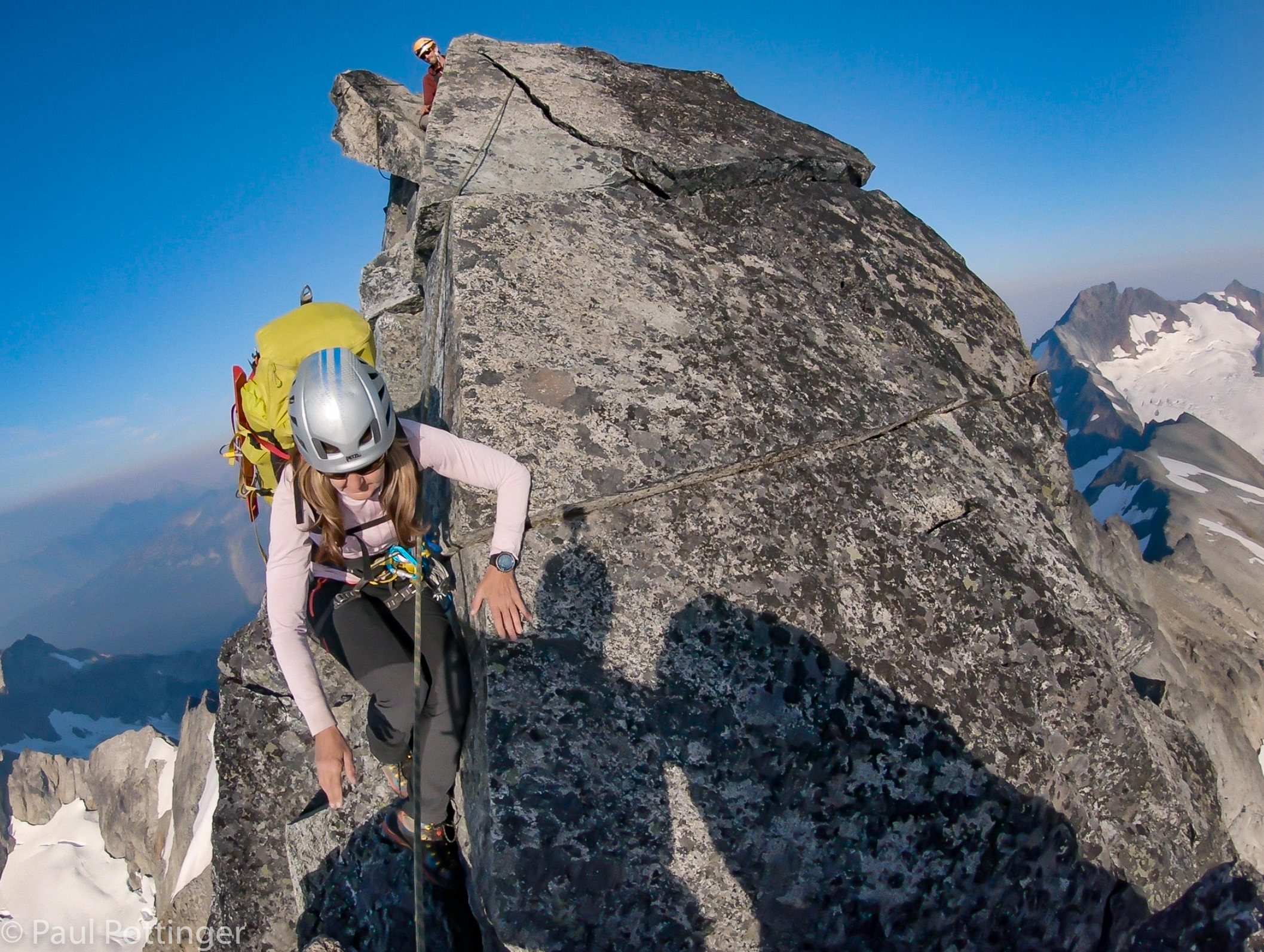
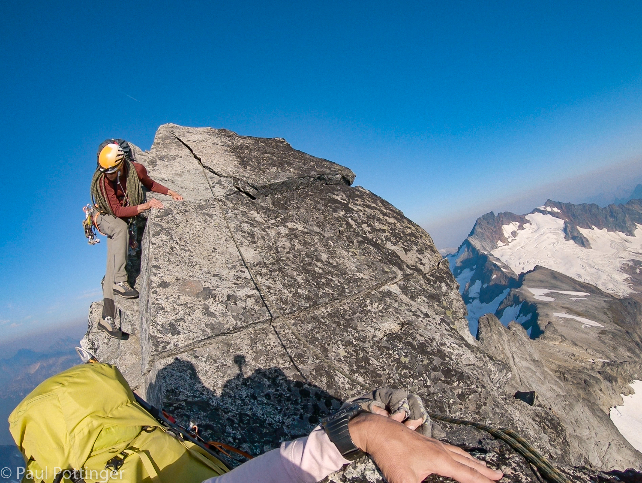
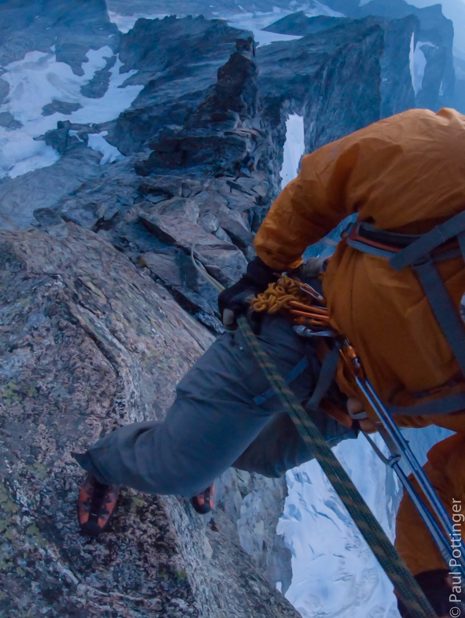
The climbing was spectacular. Not too difficult, but requiring full focus. Coordination of hands and feet, stepping and reaching in sequence, minding the rope between us all the way.

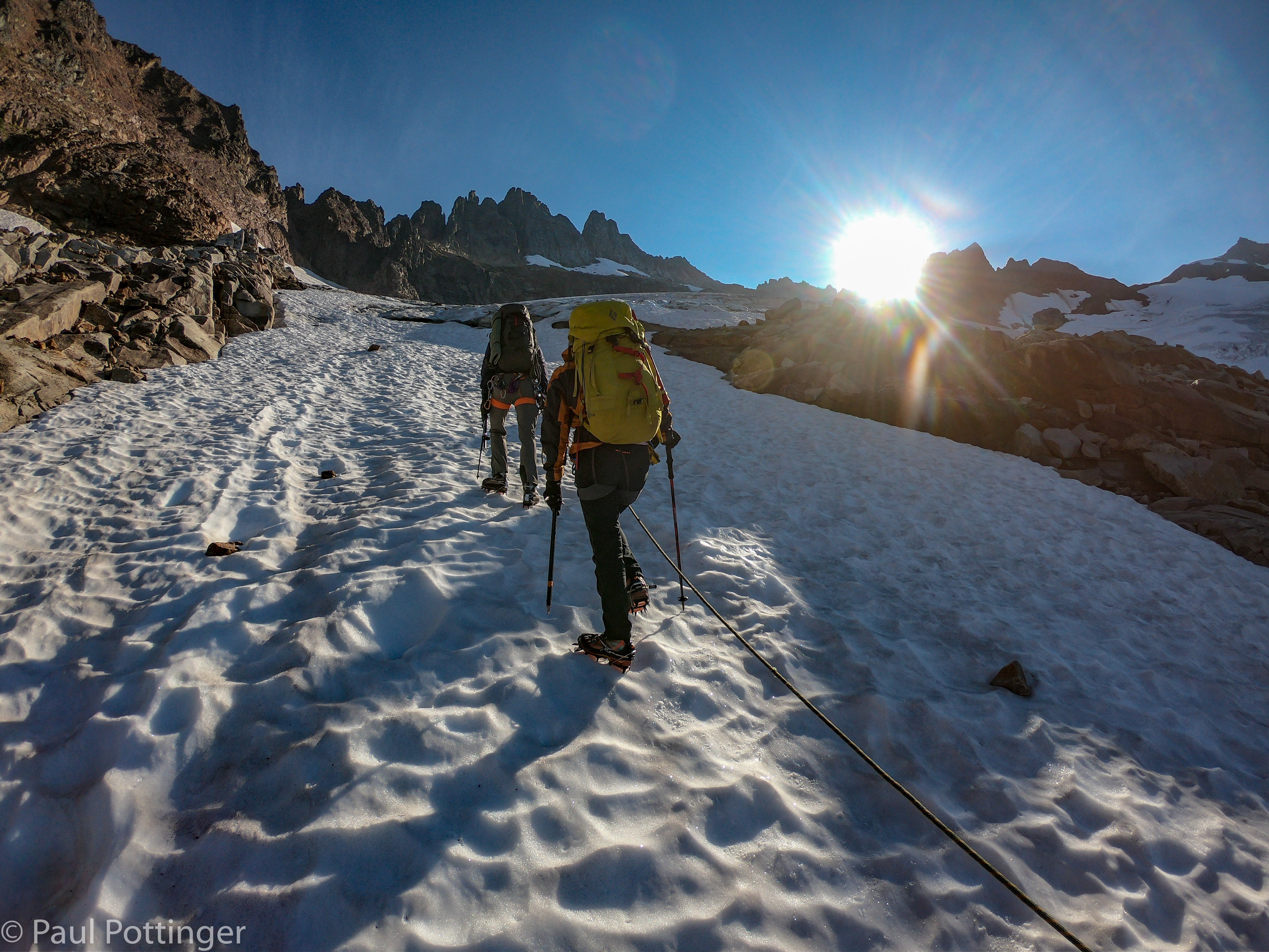
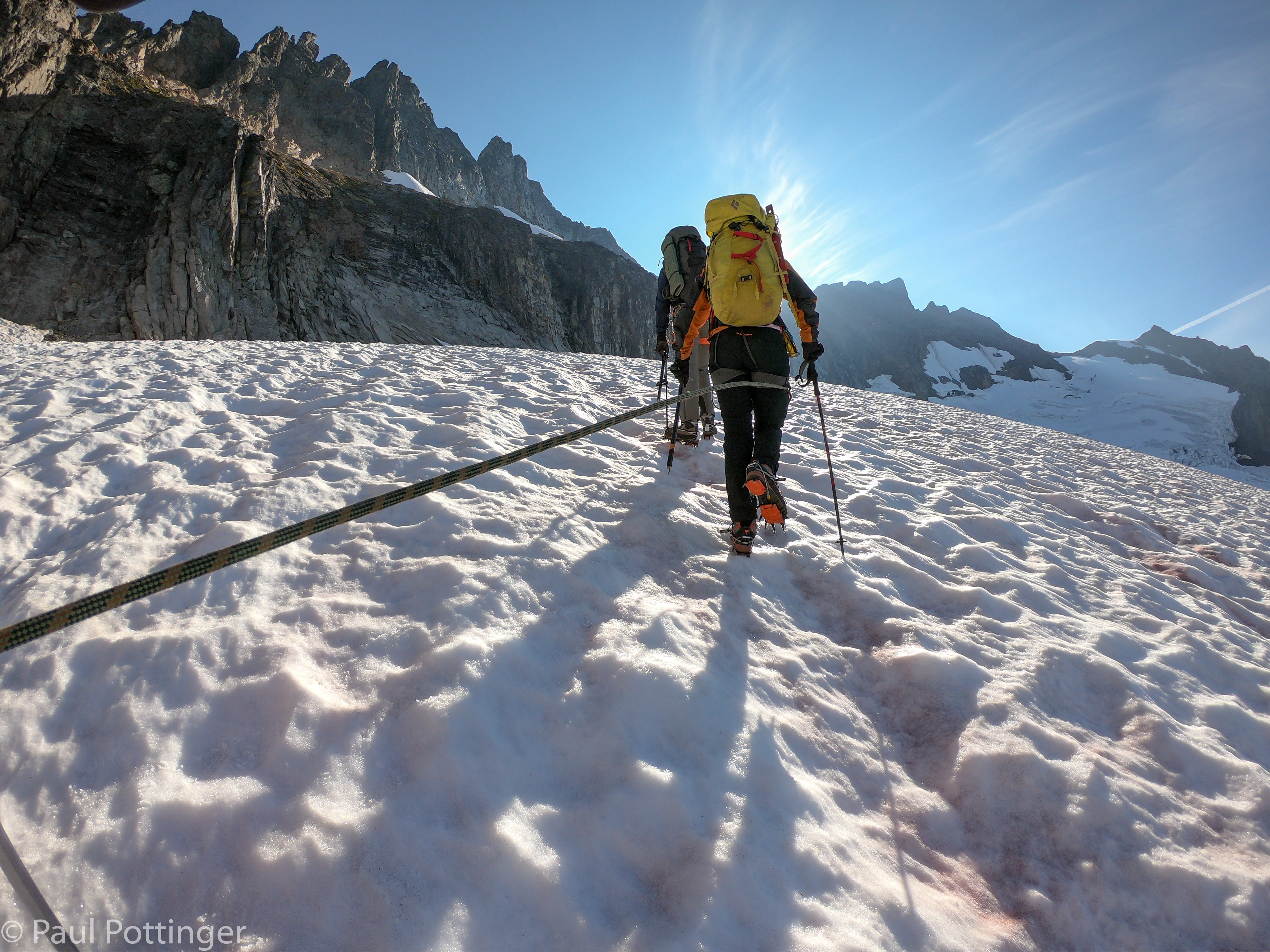
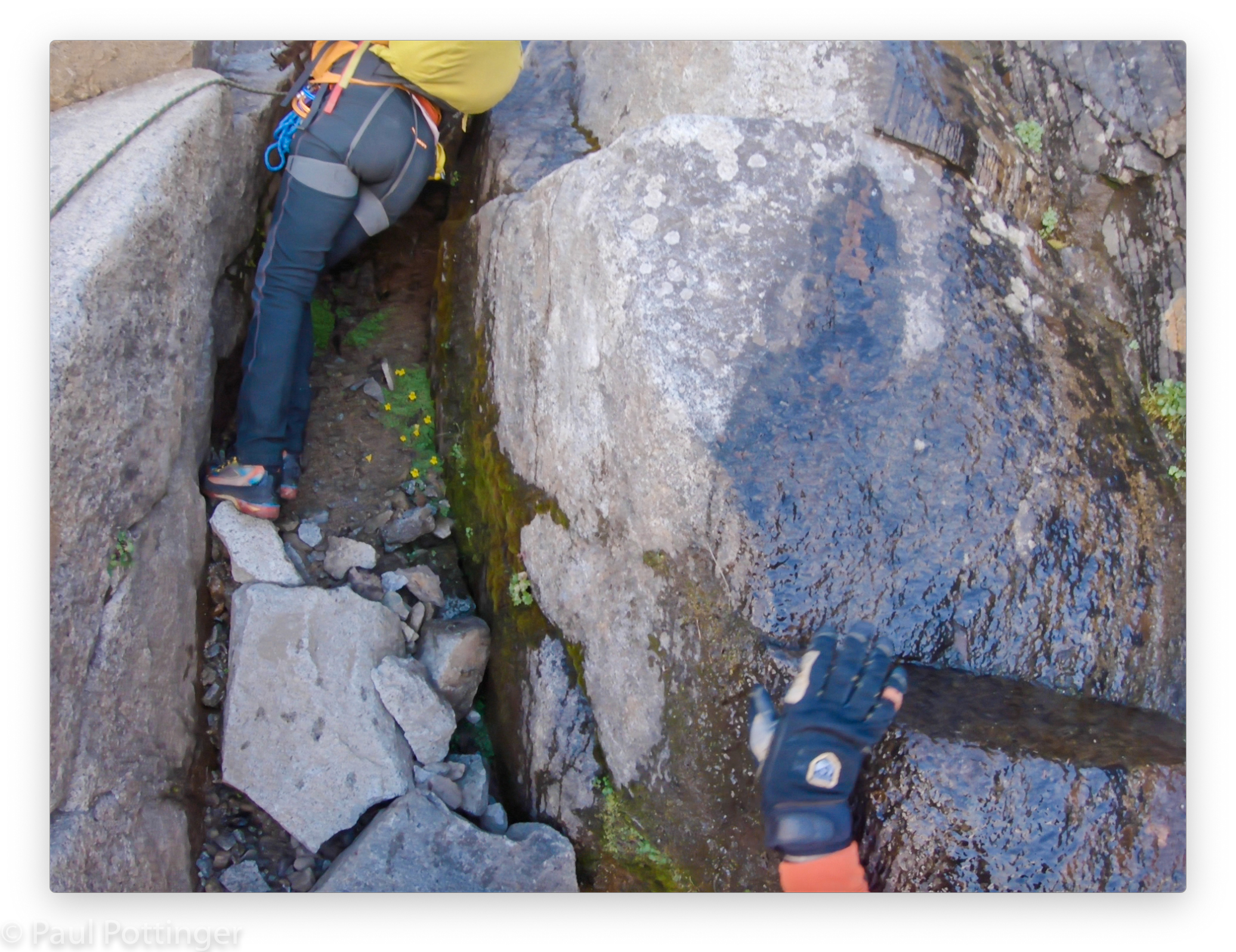
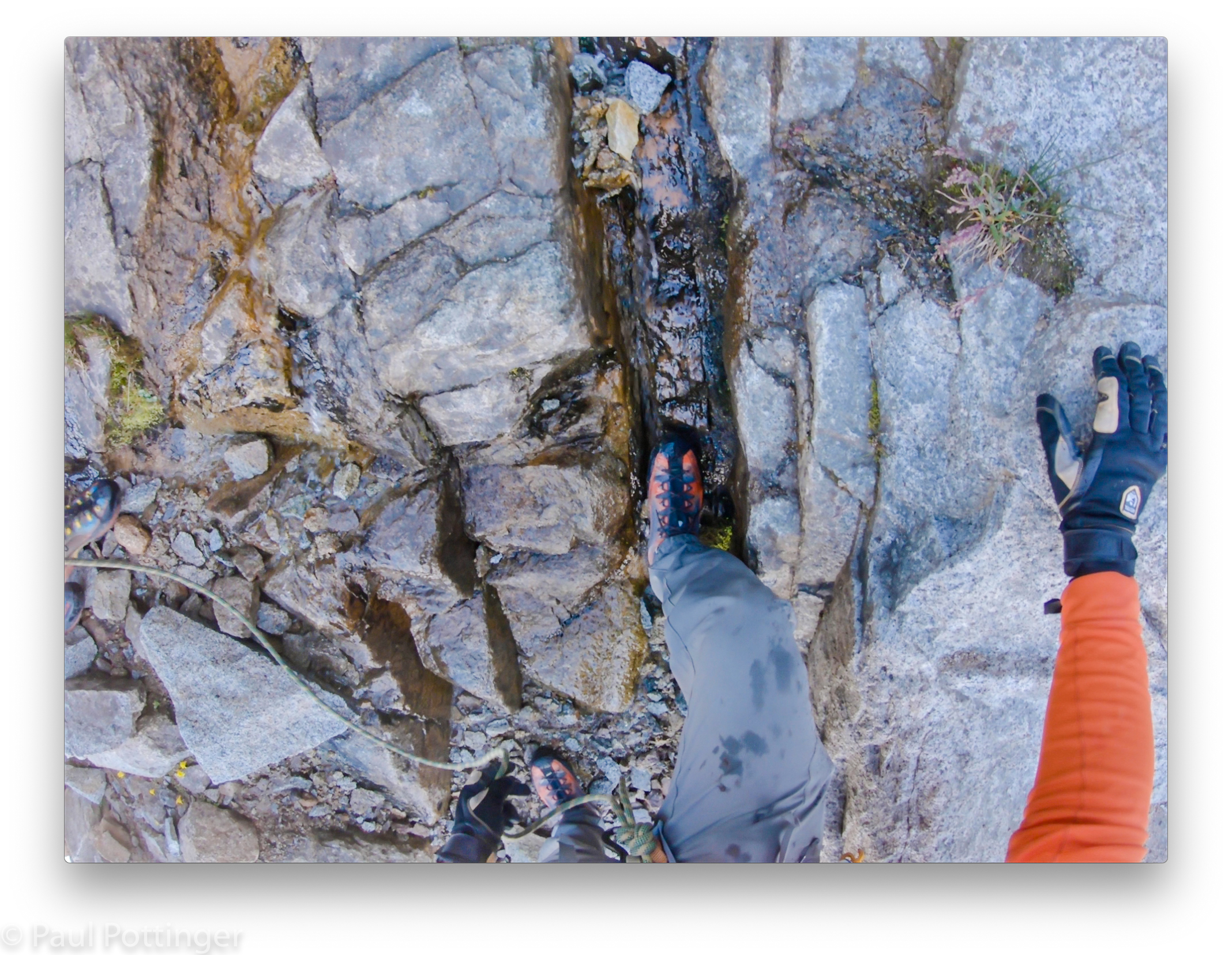
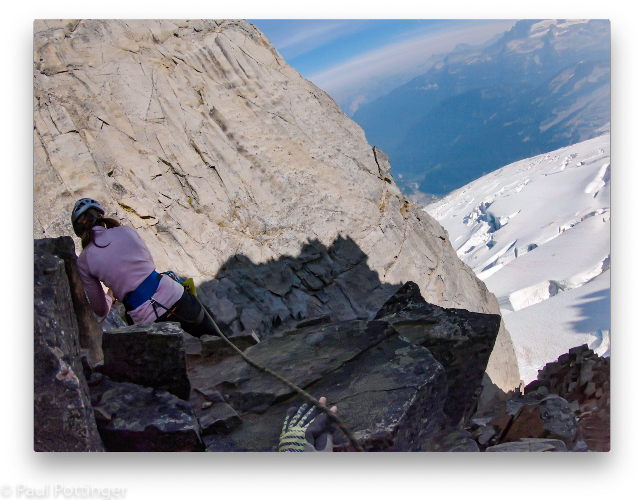
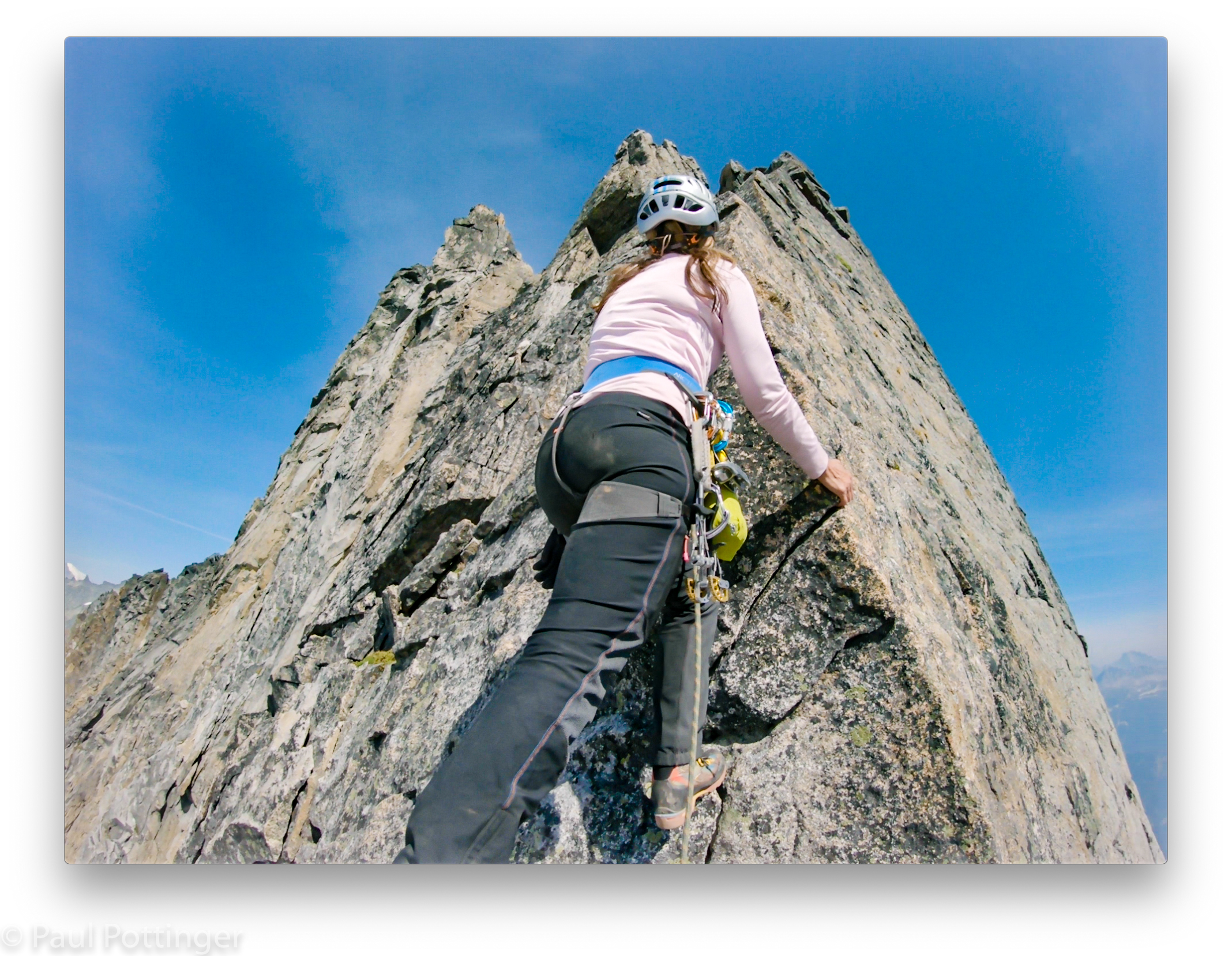
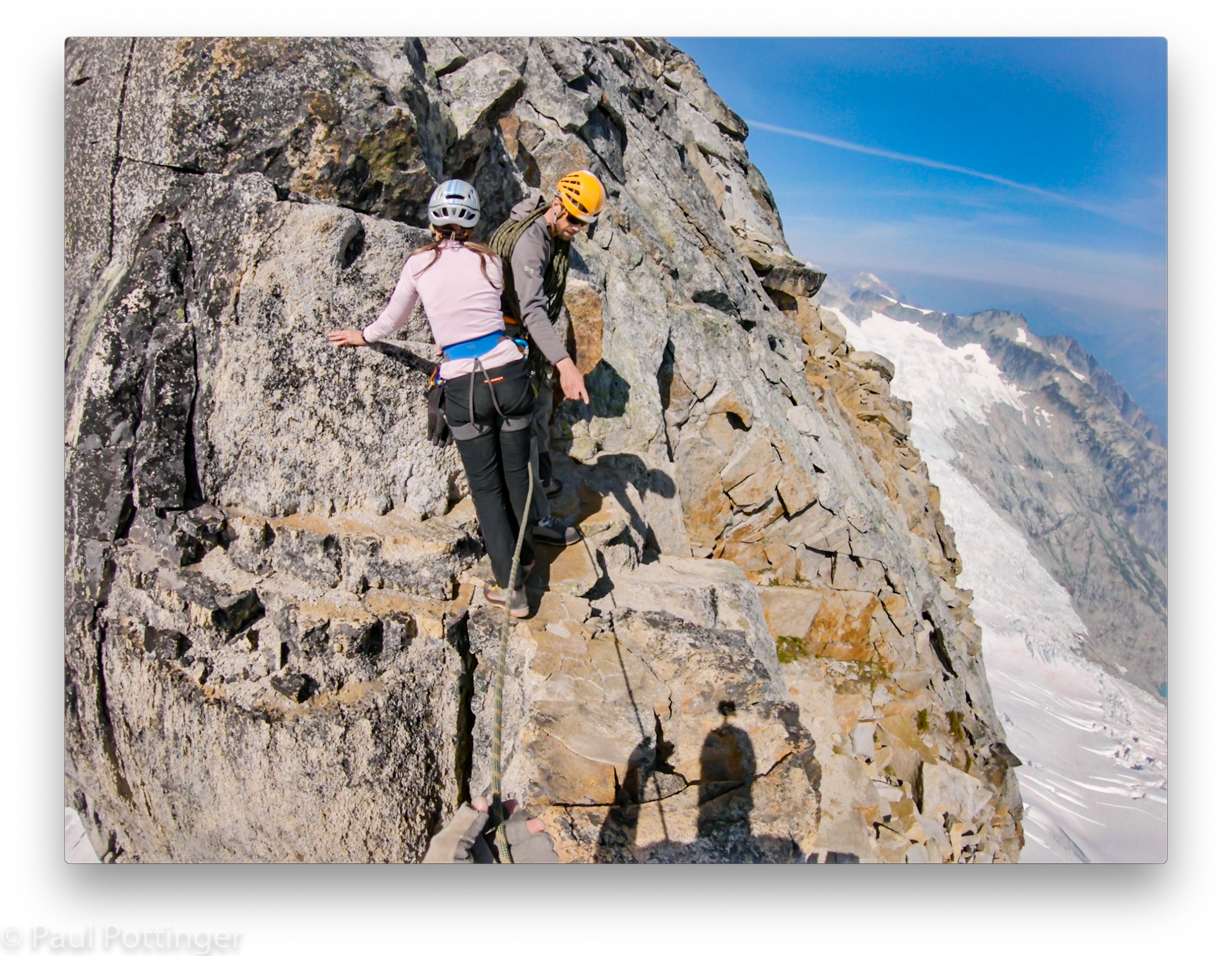
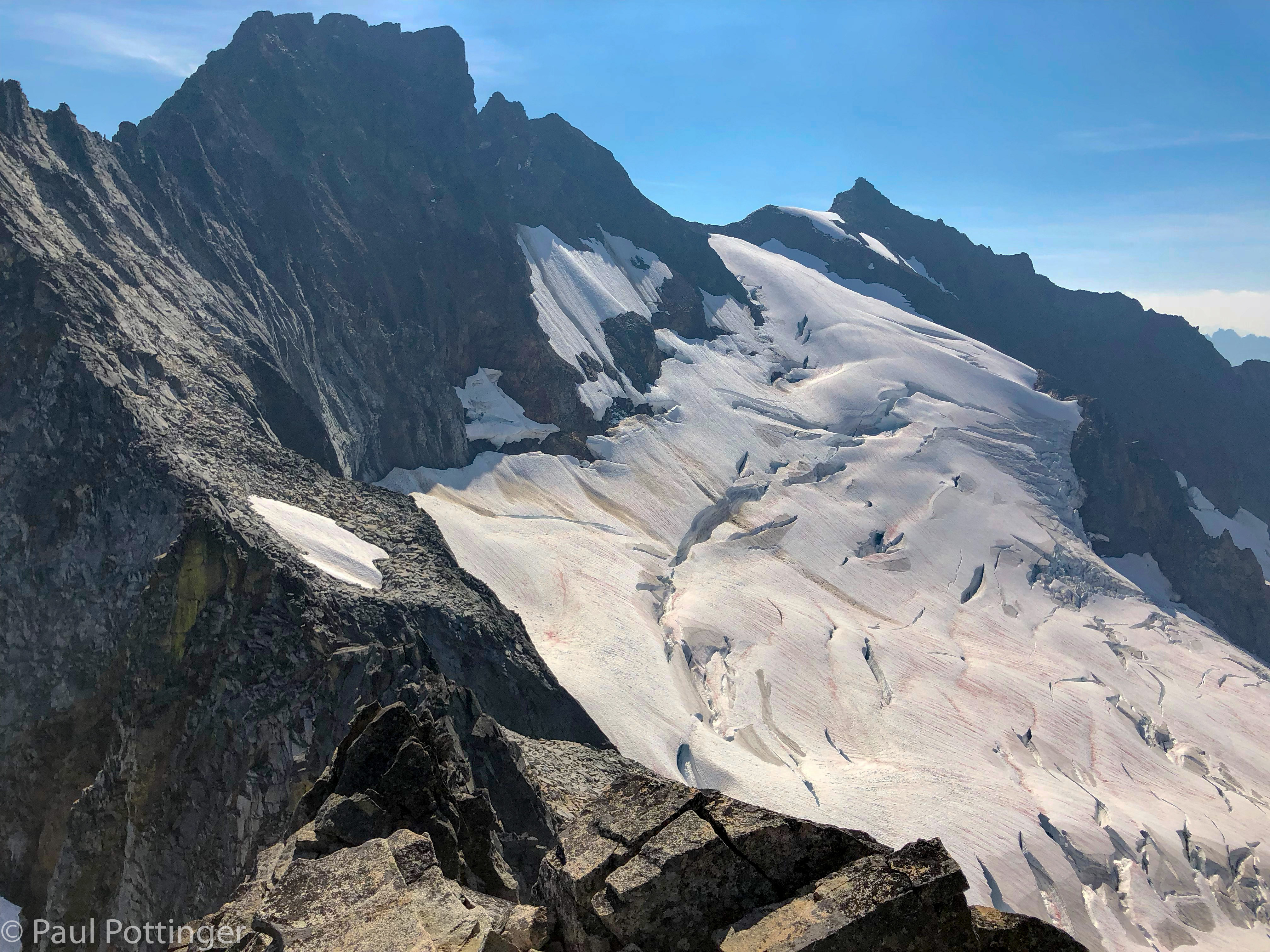
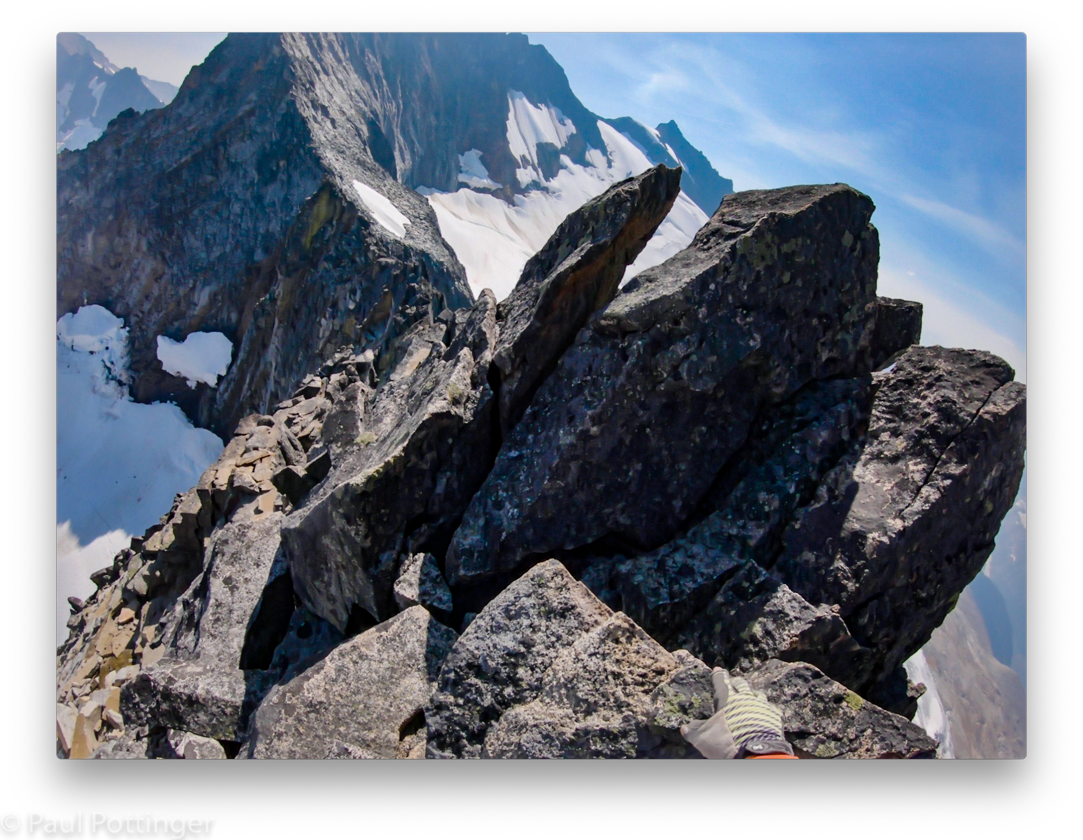
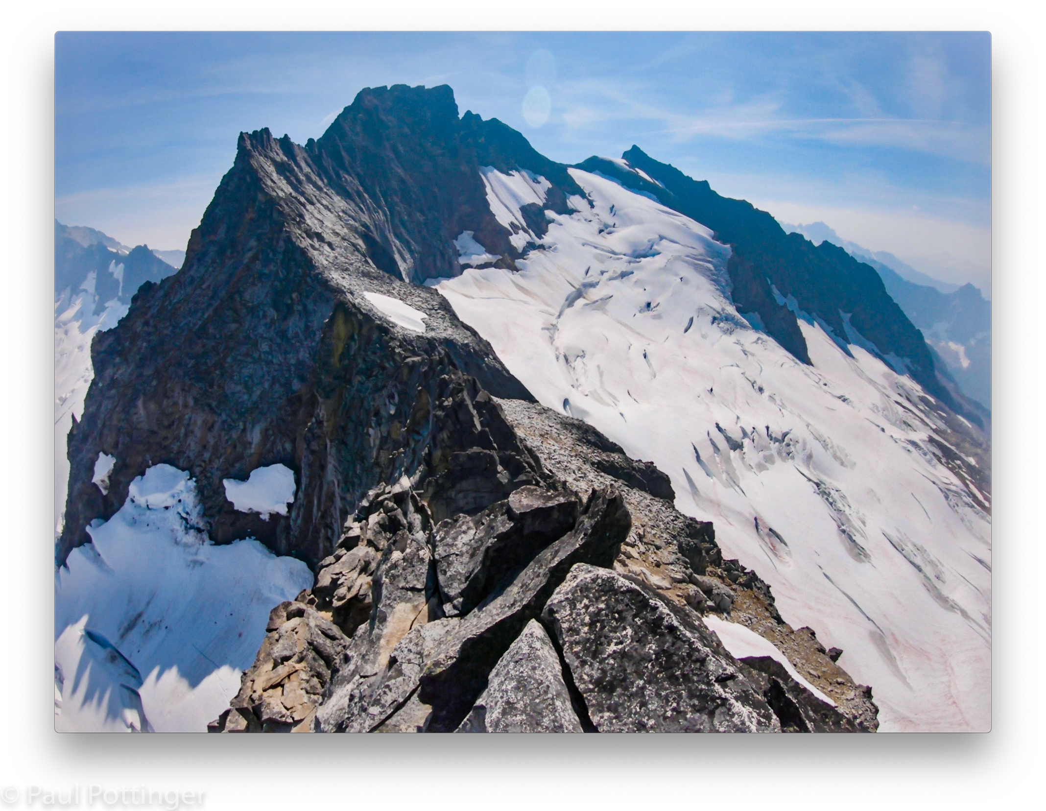
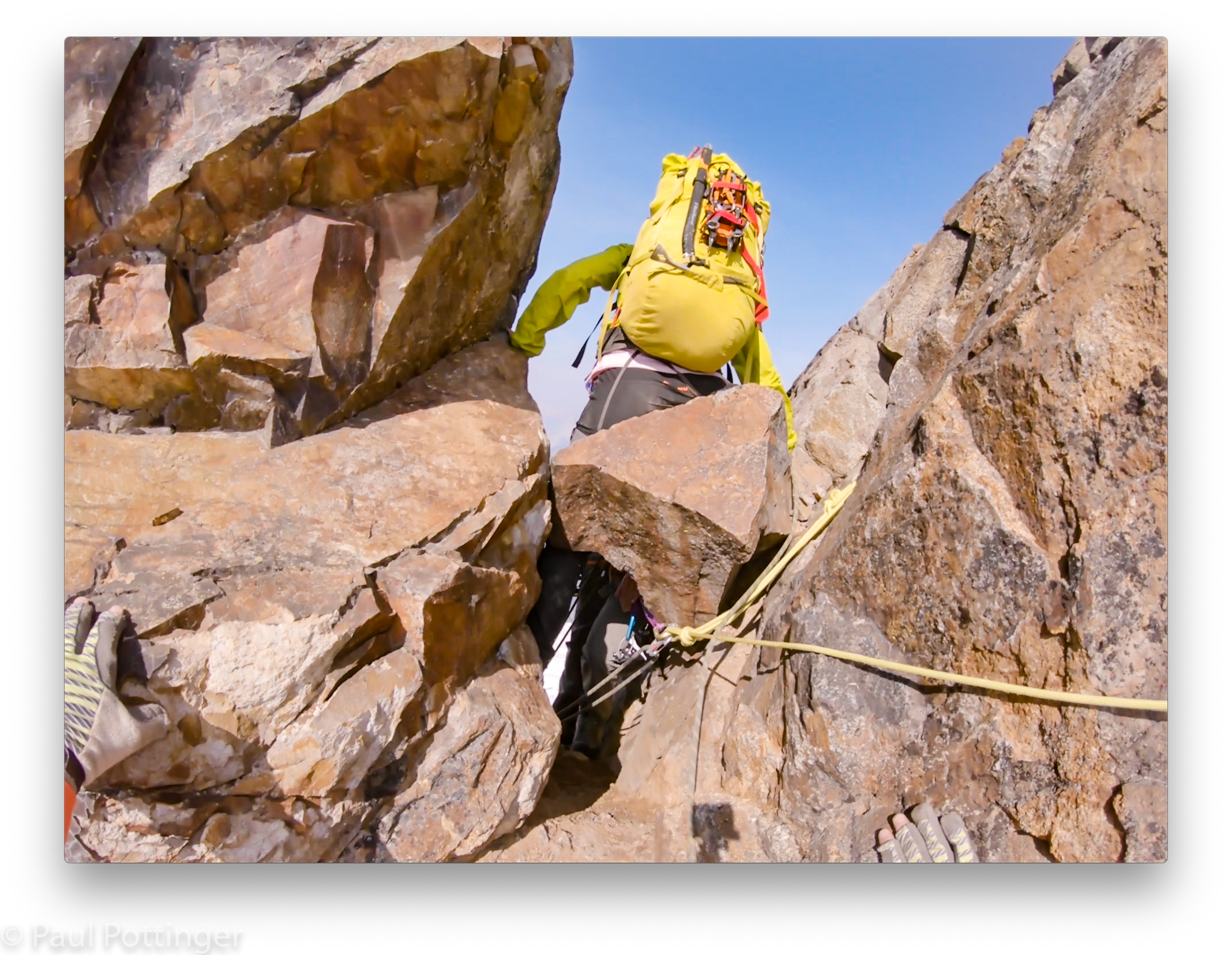
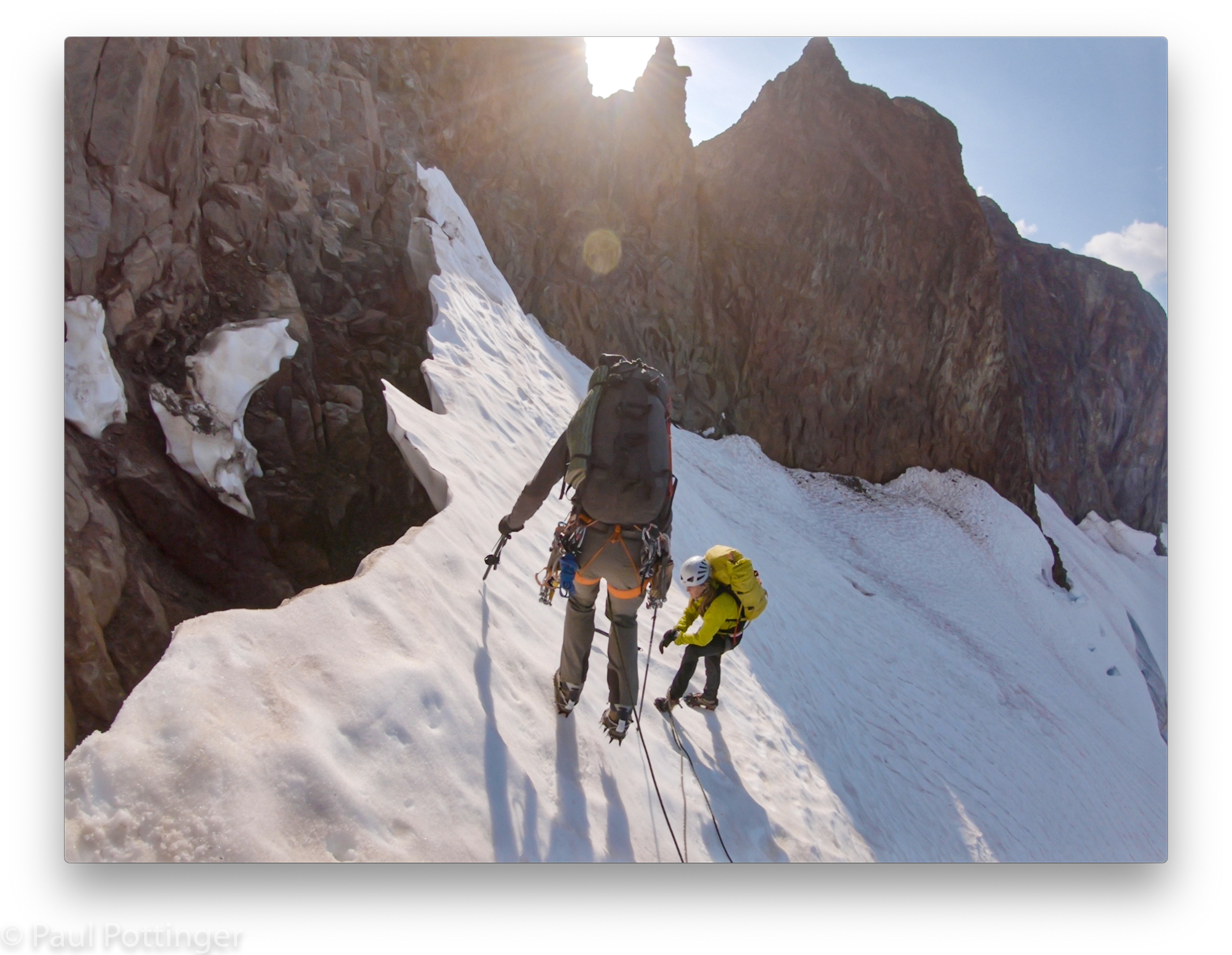
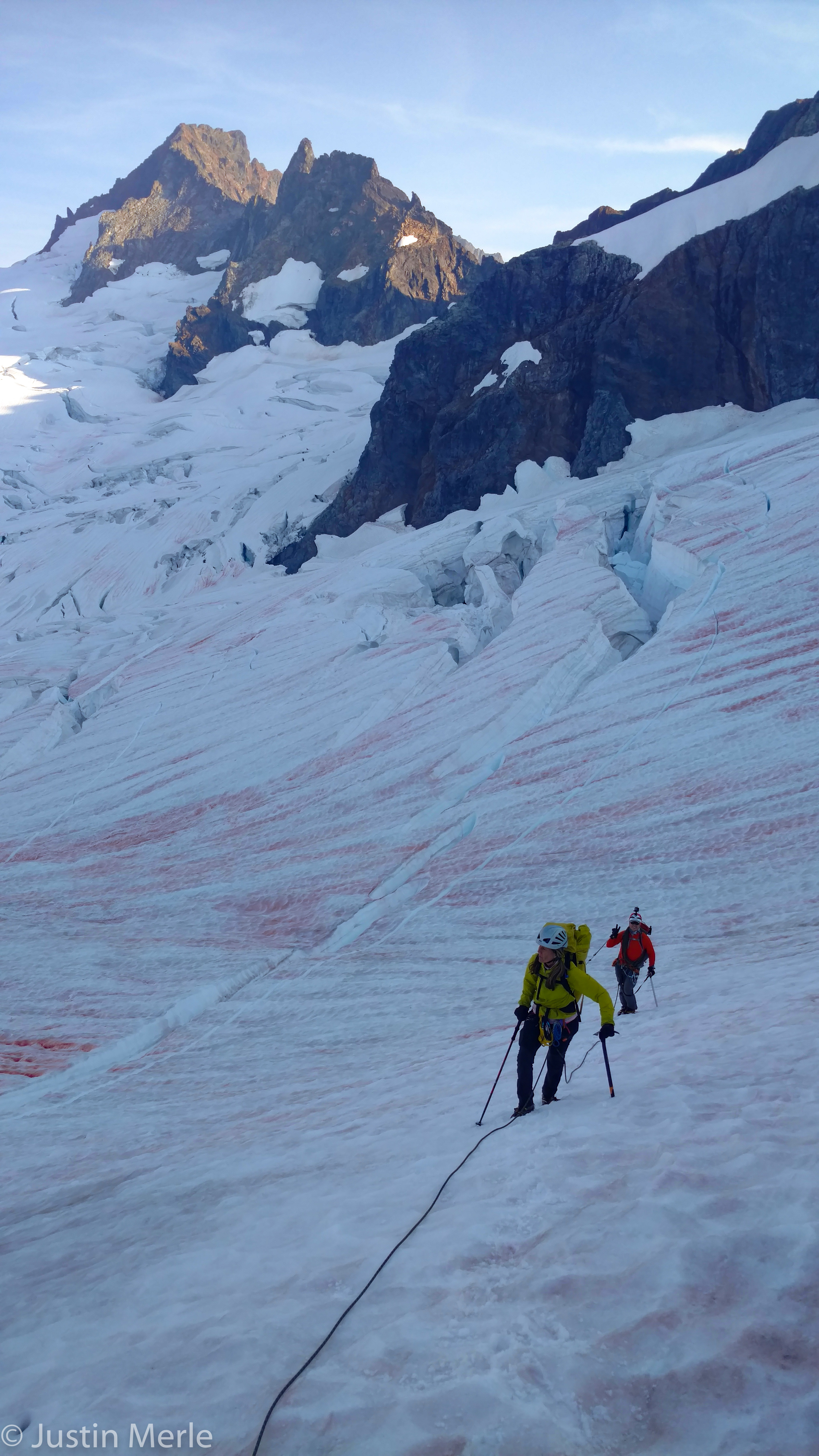
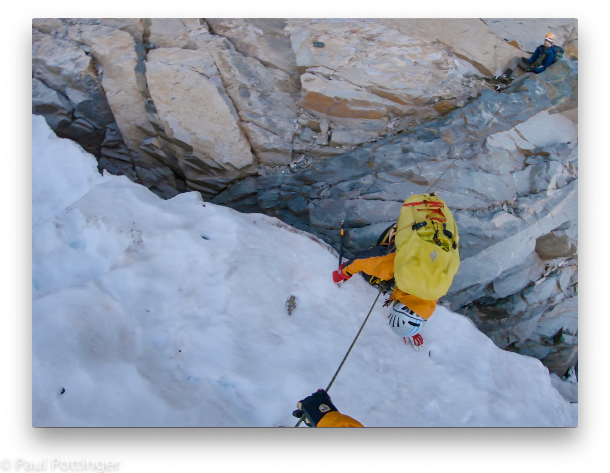
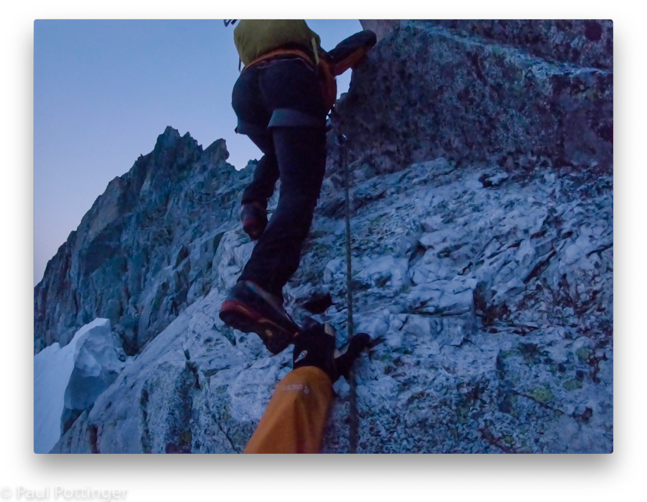
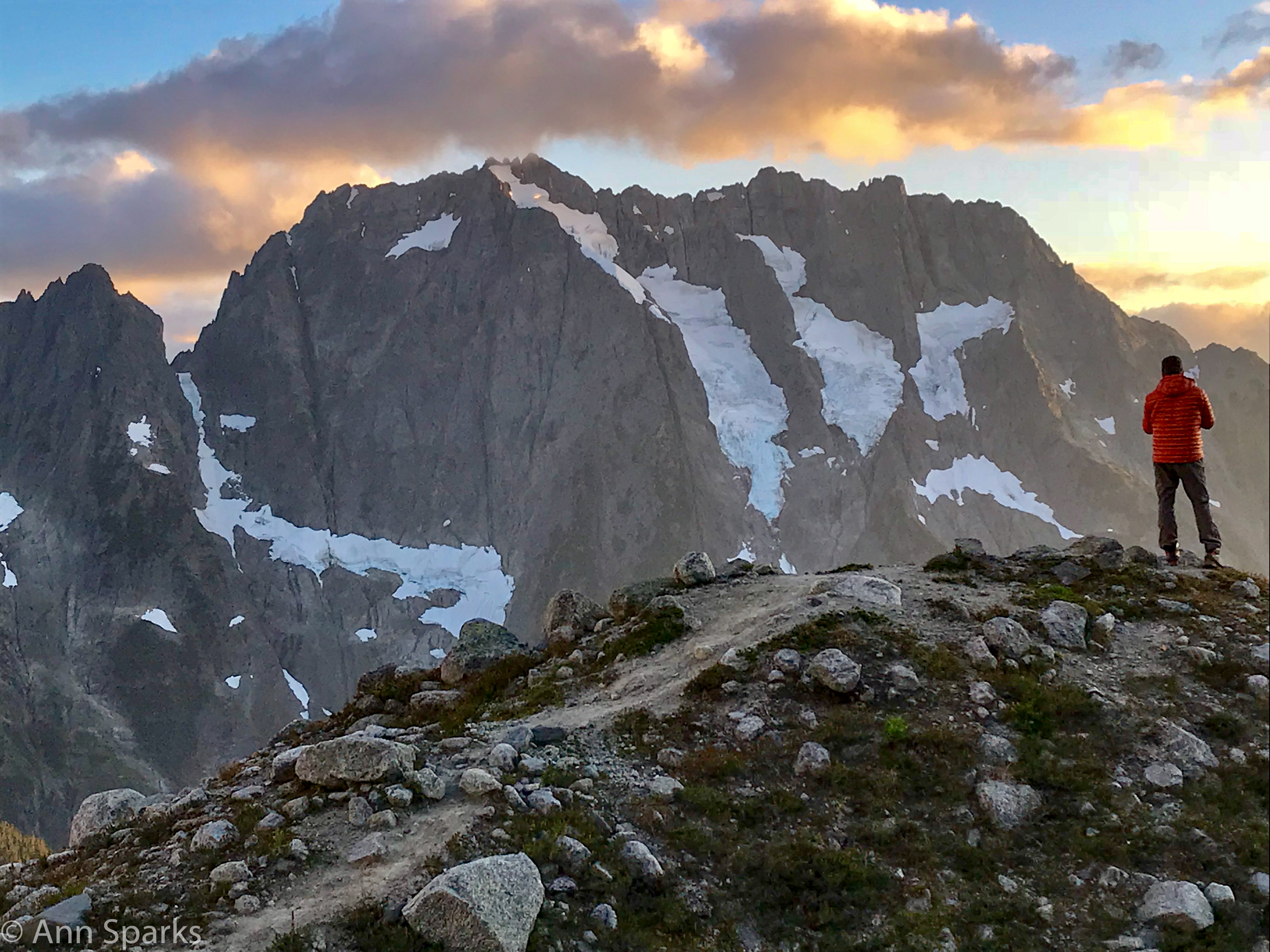
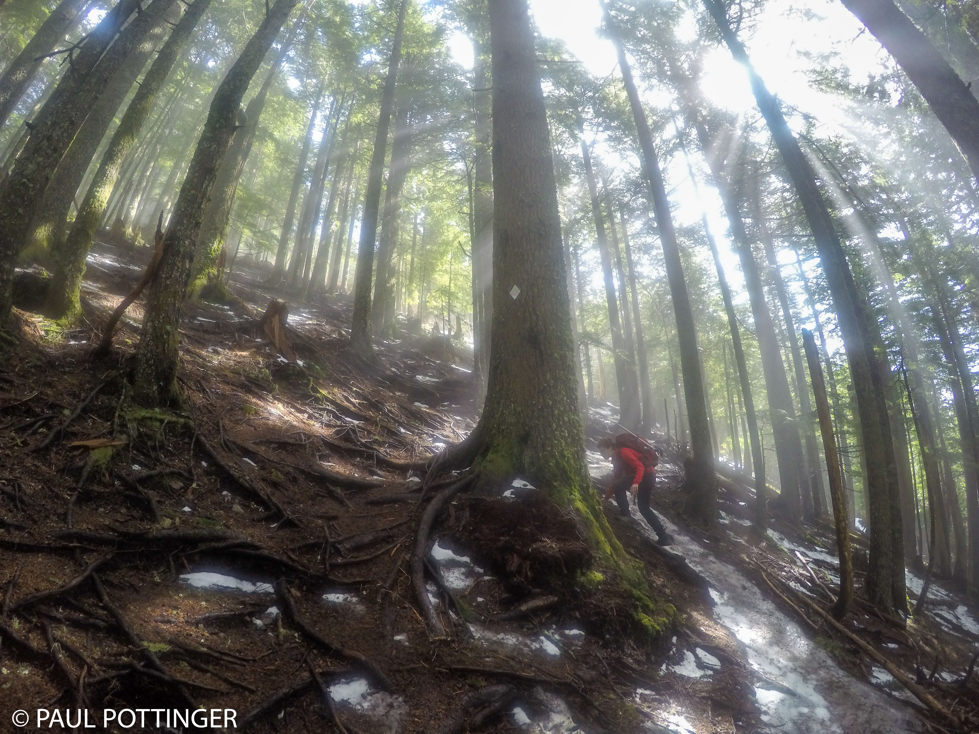
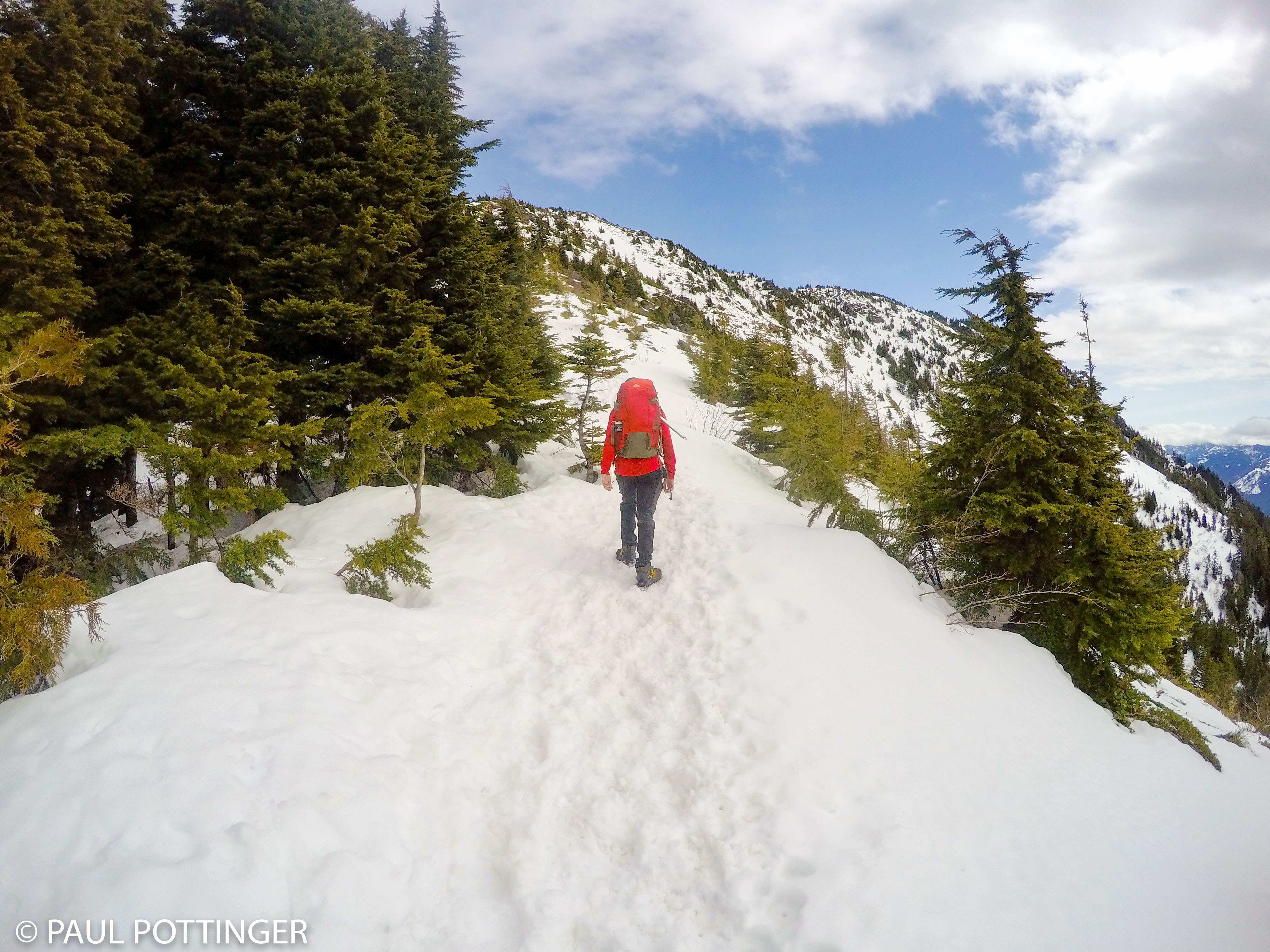
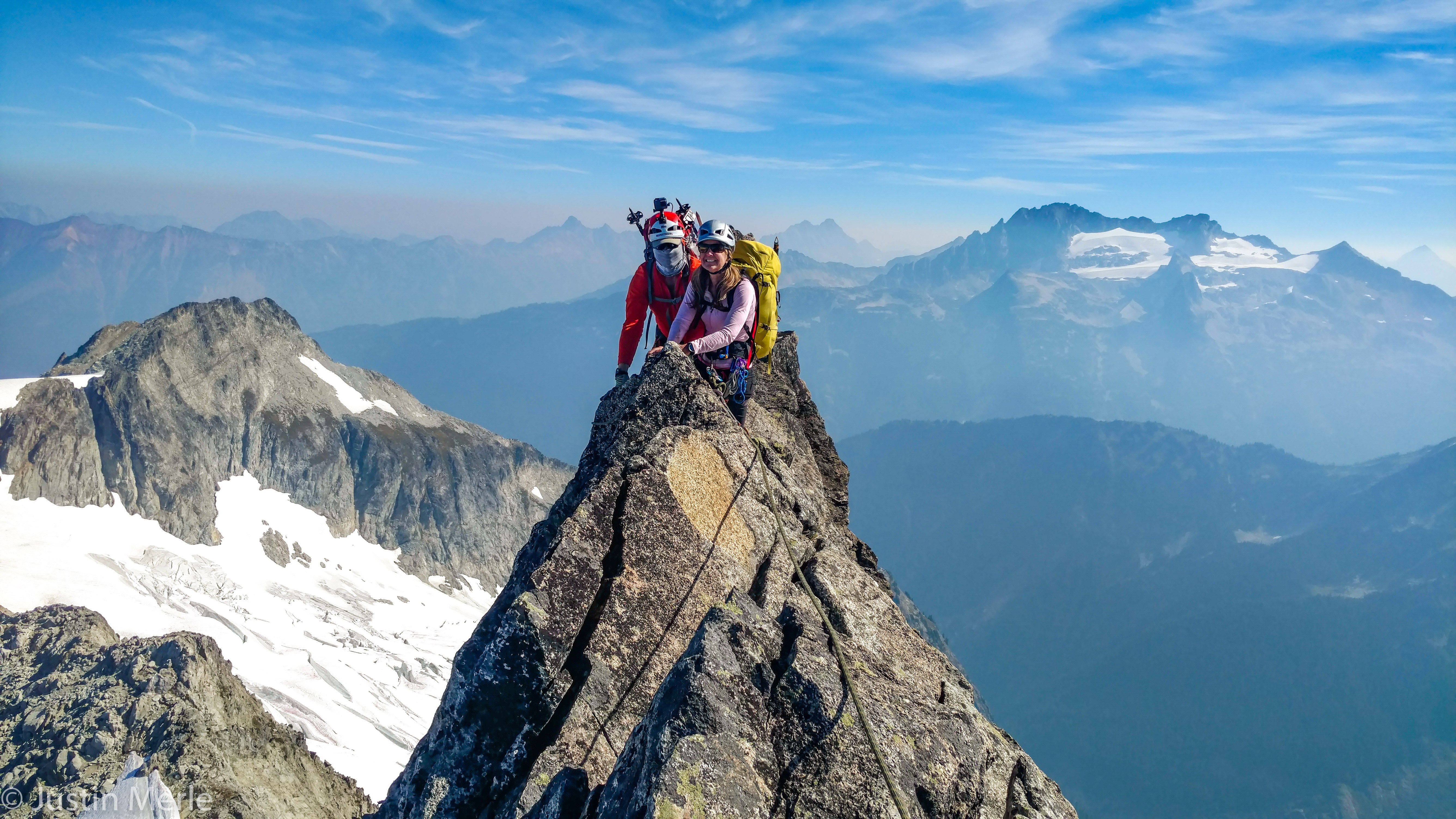
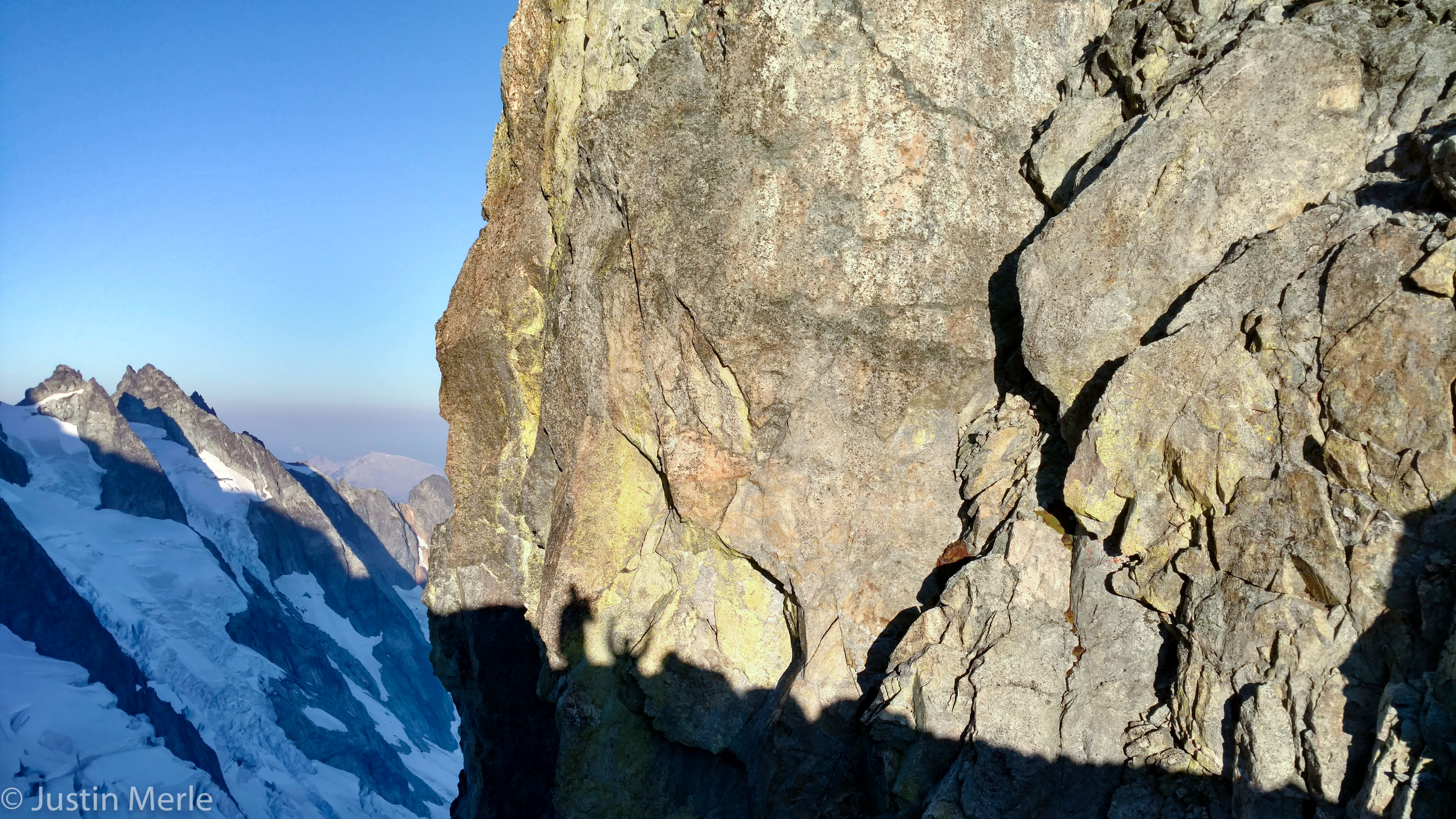
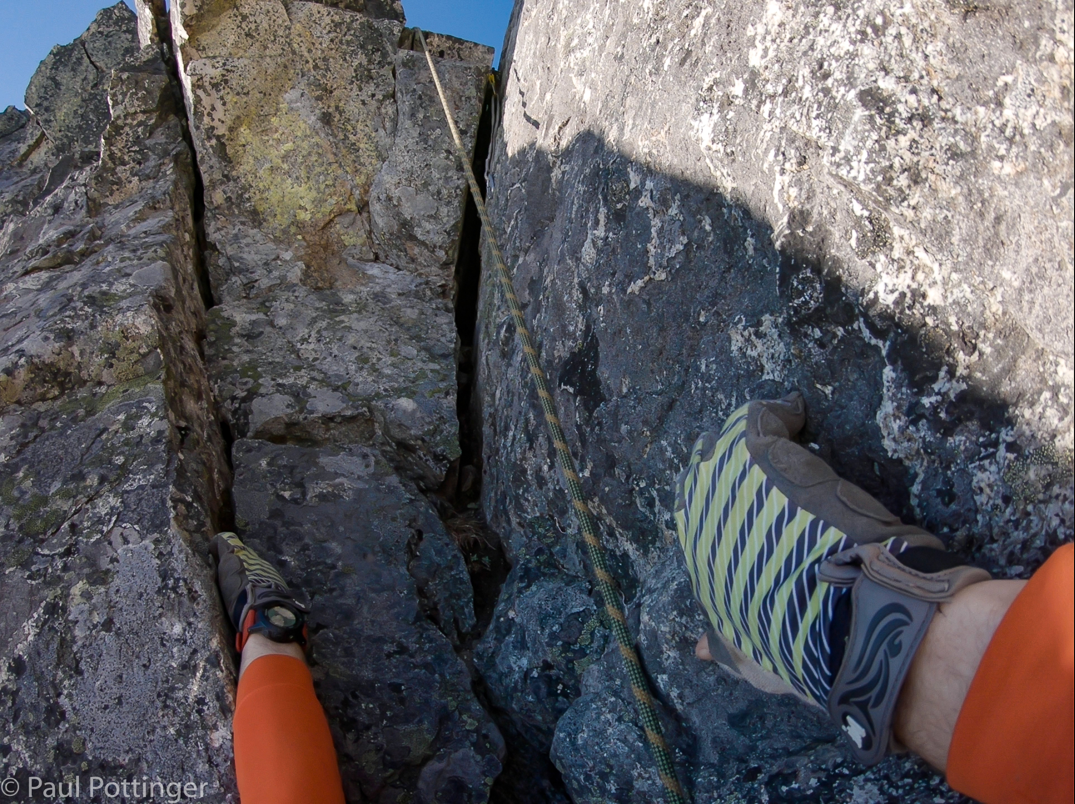
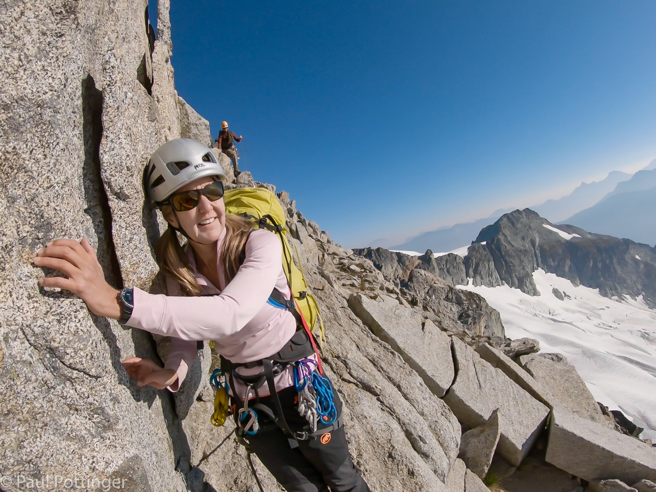
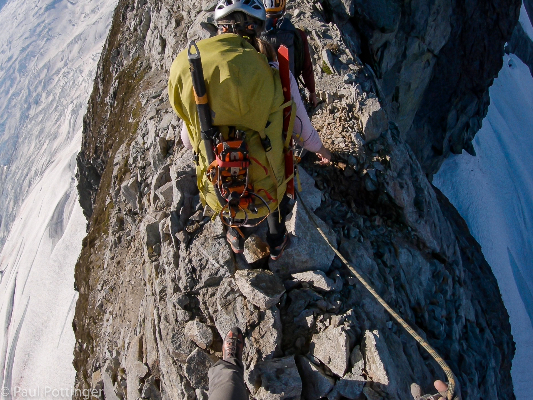
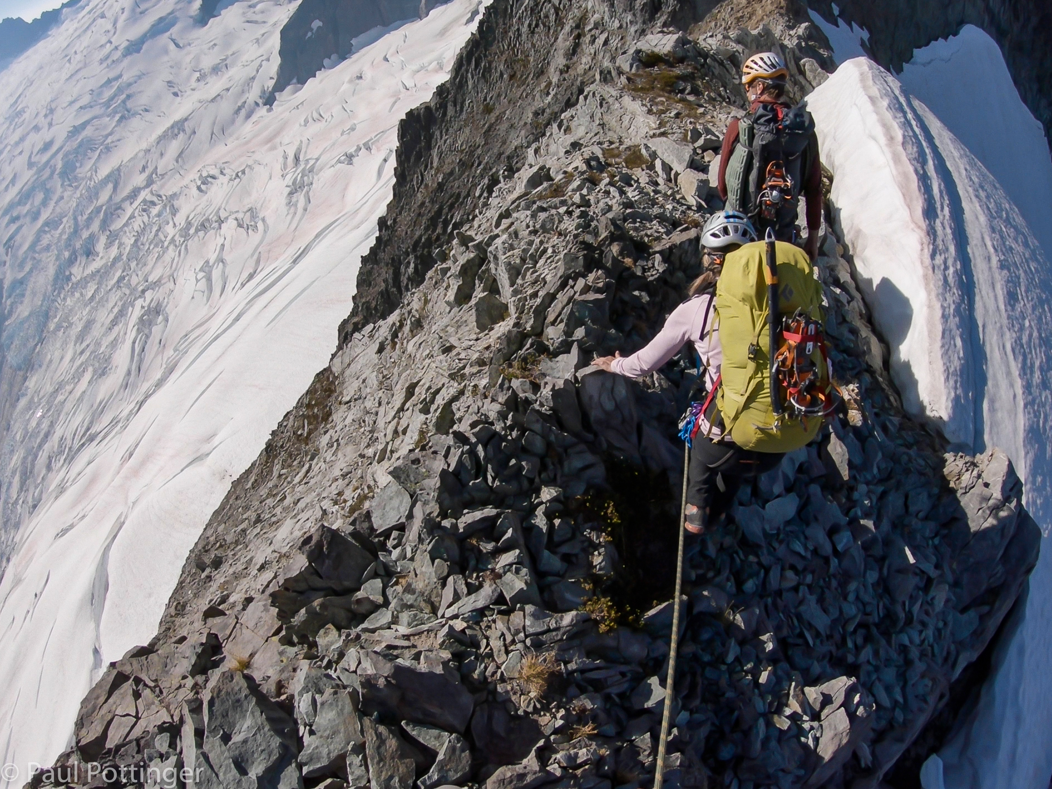
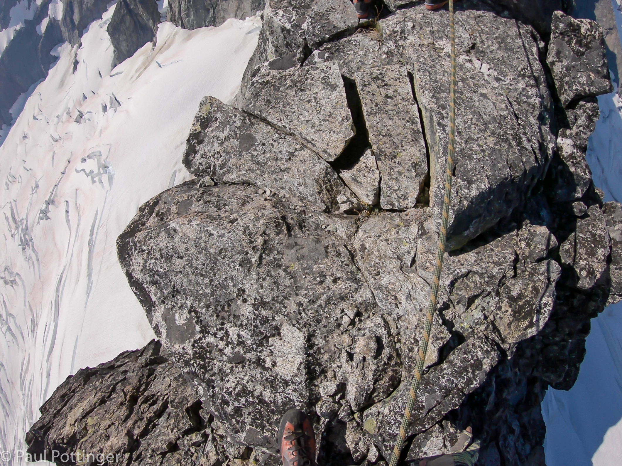
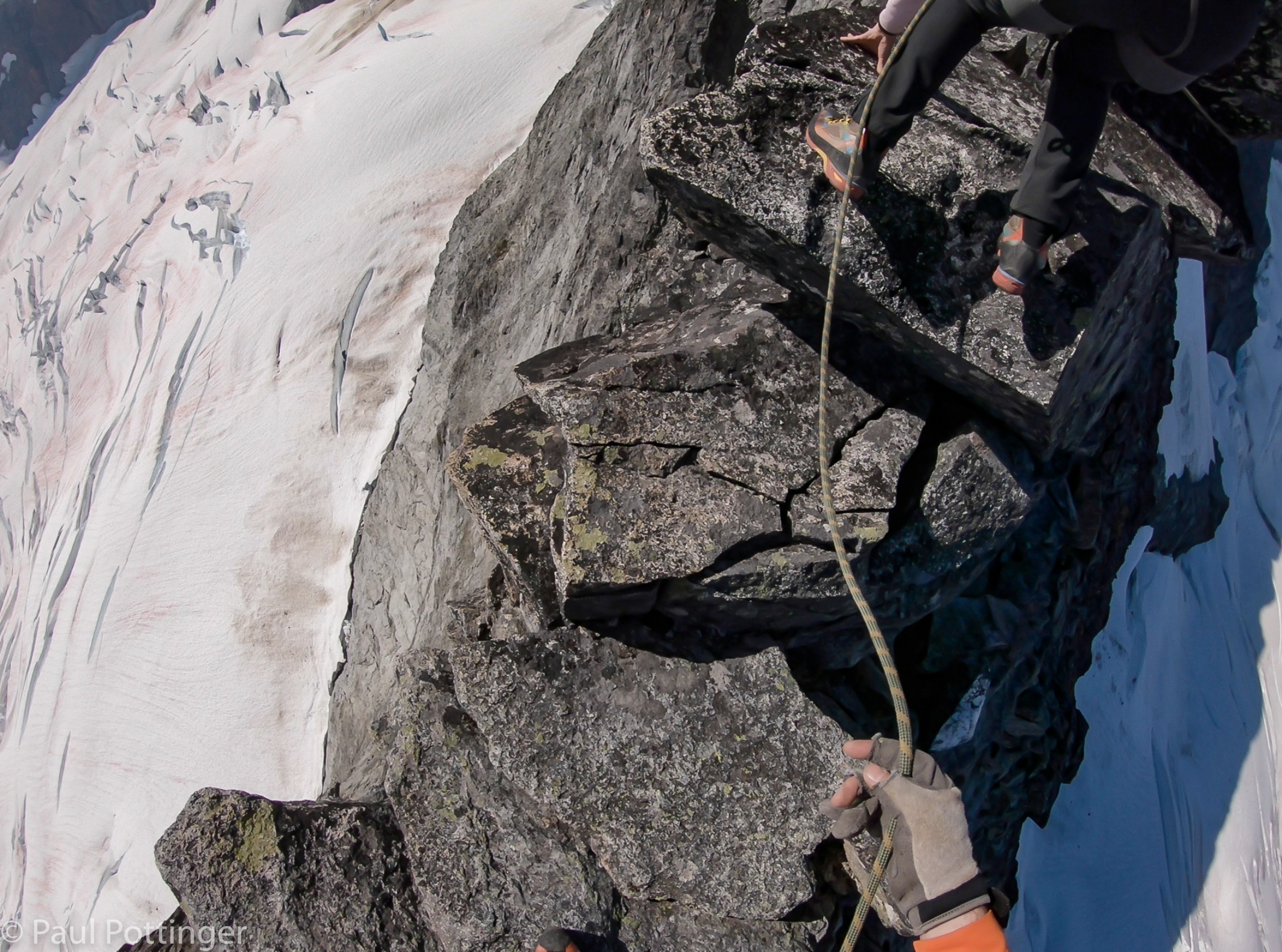
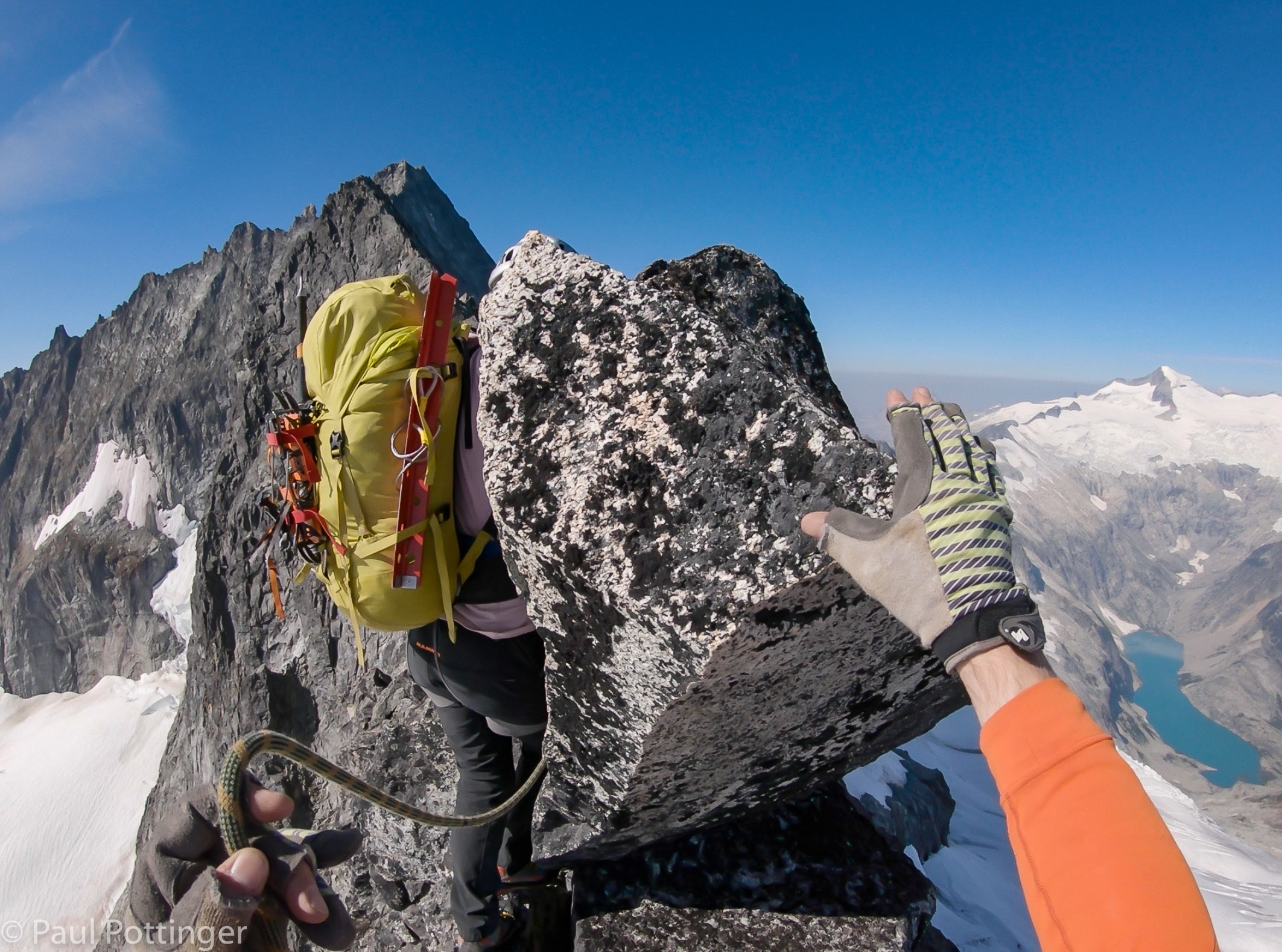
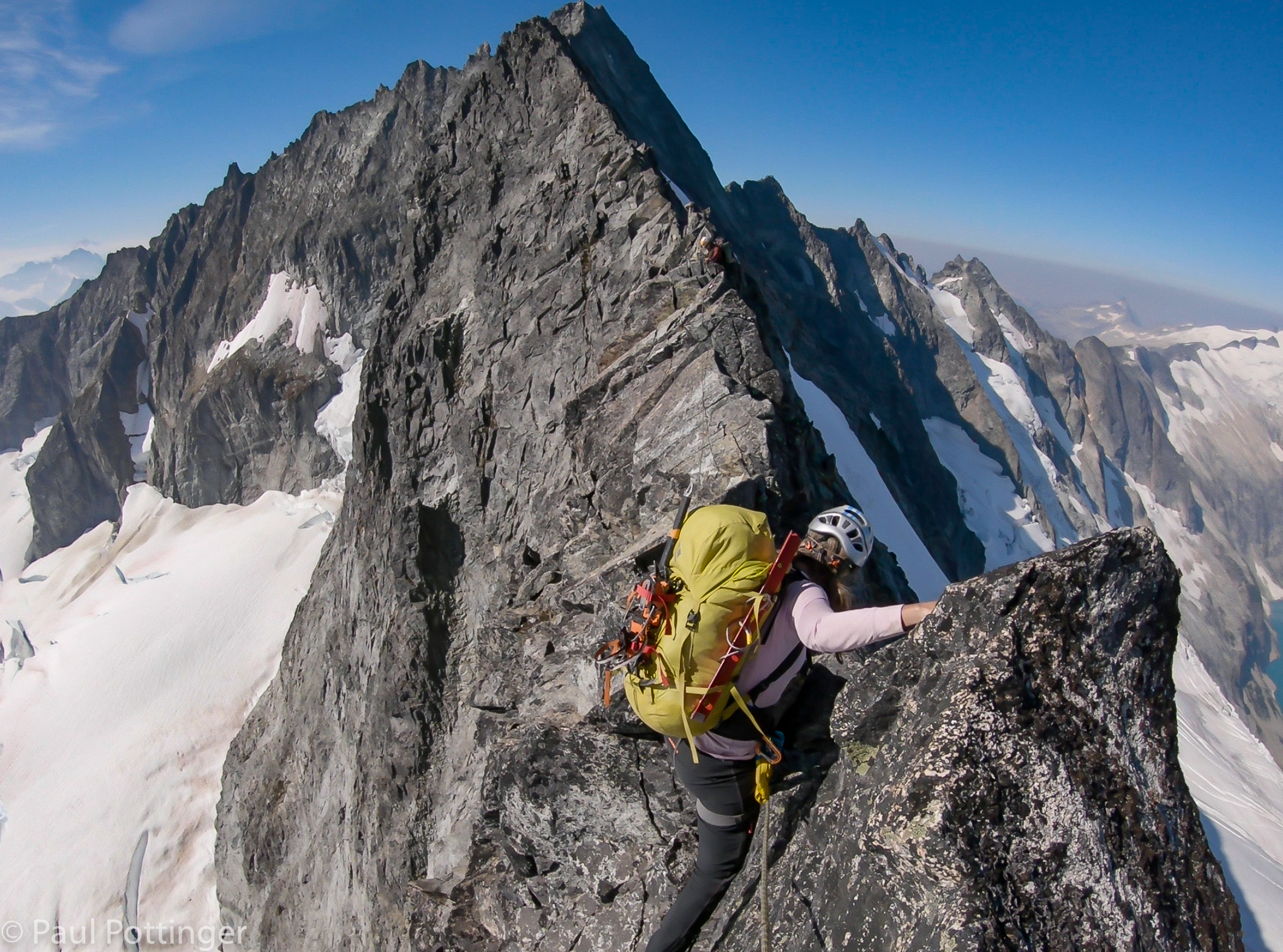
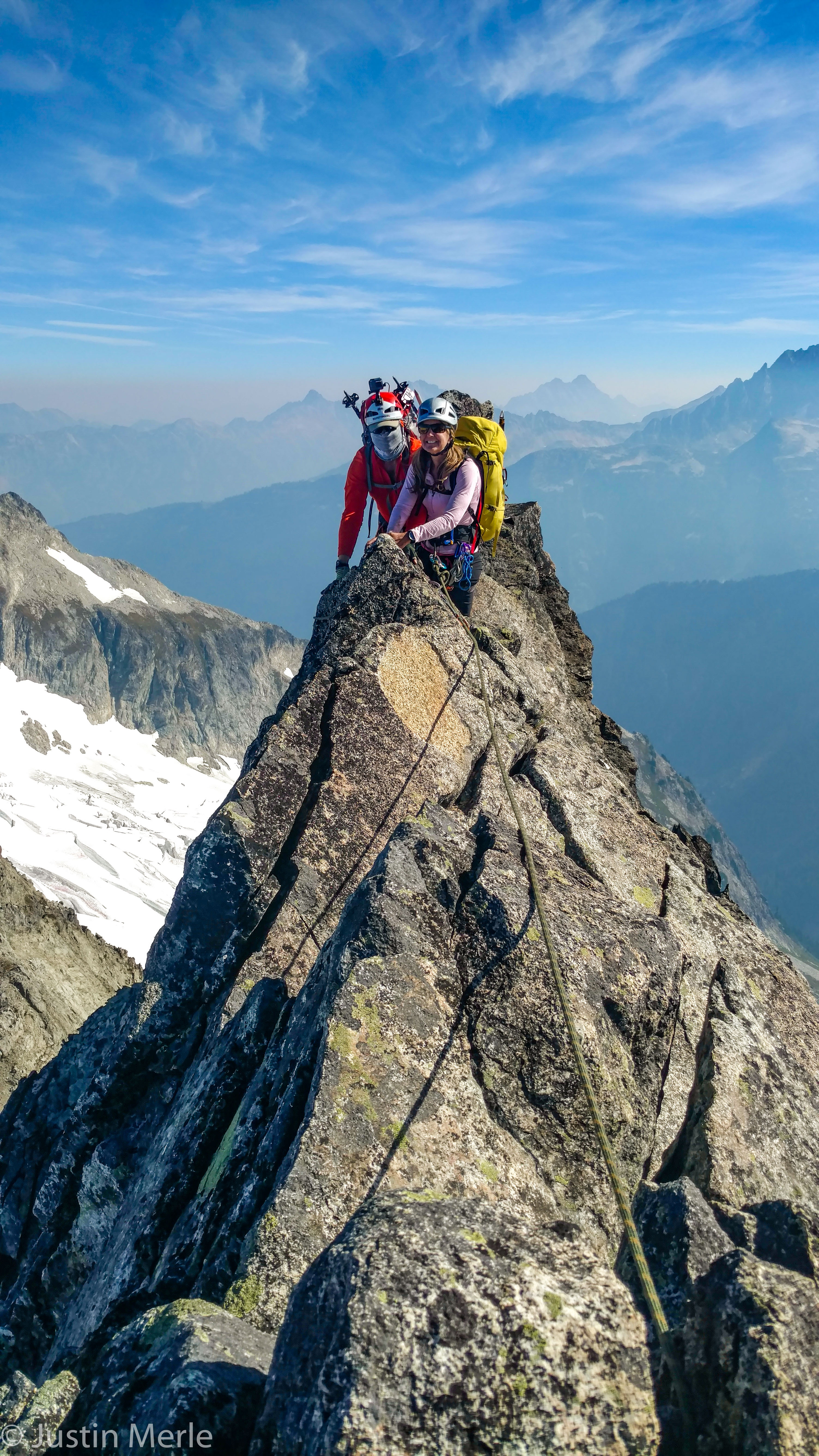
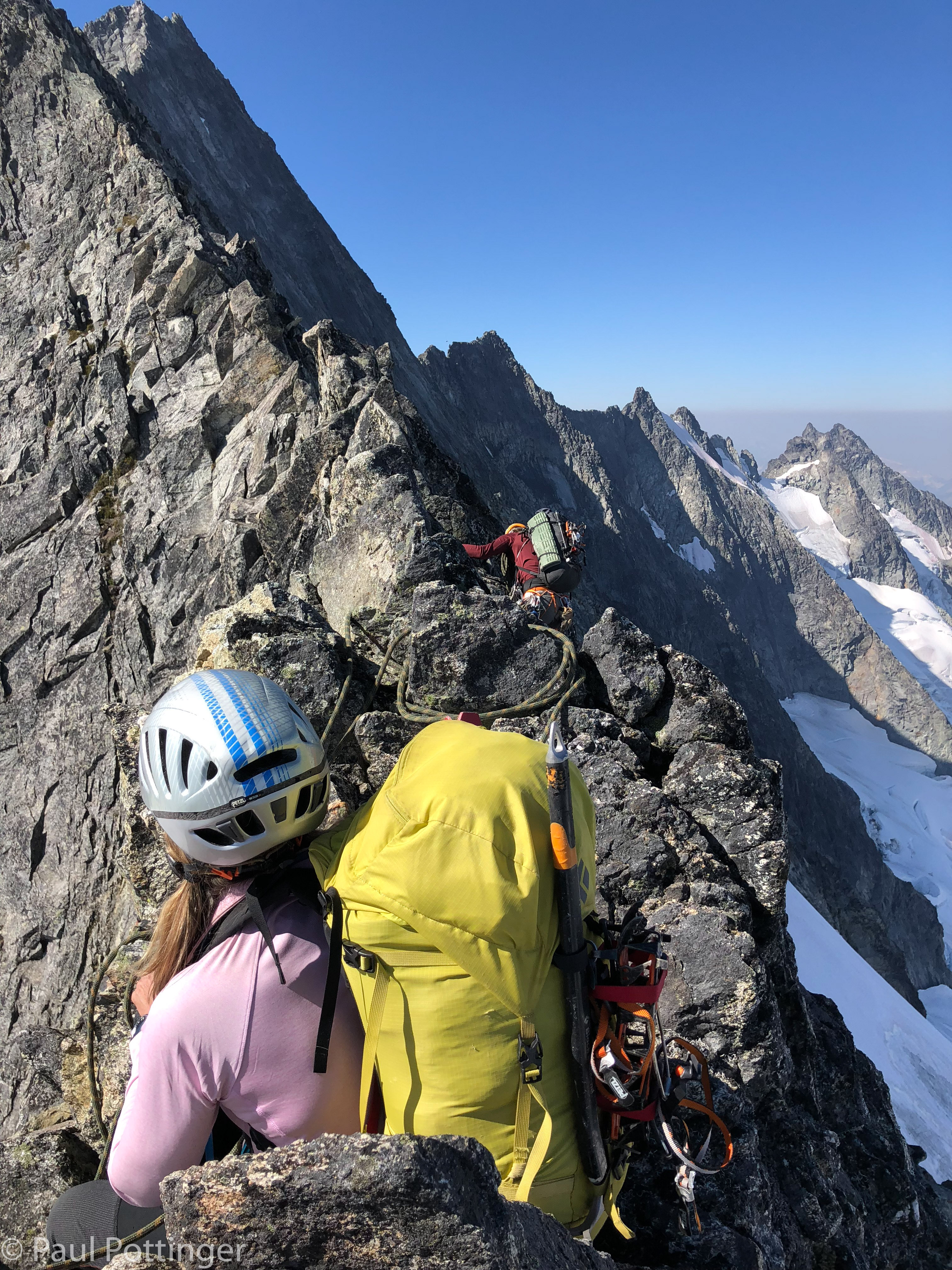
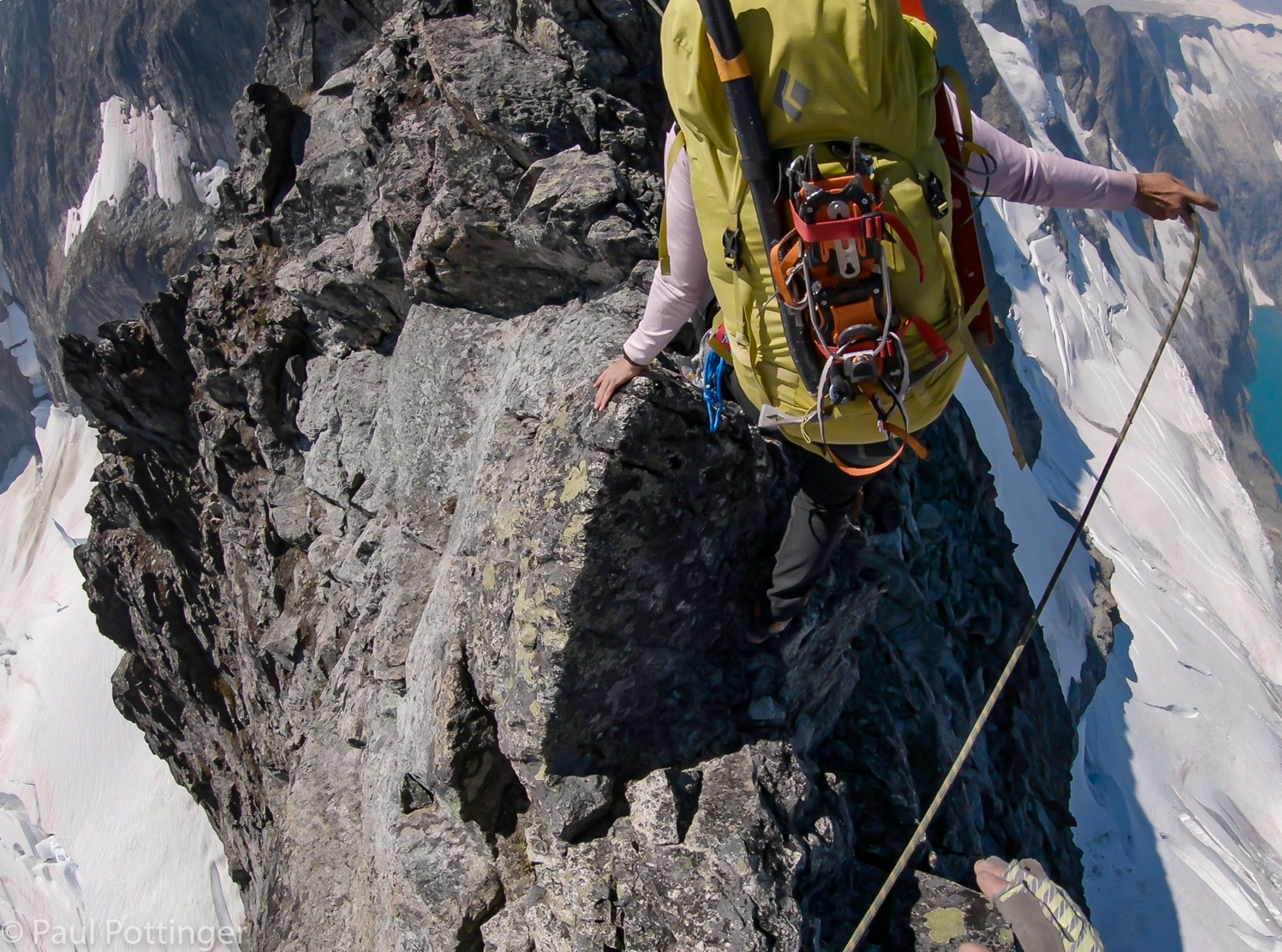
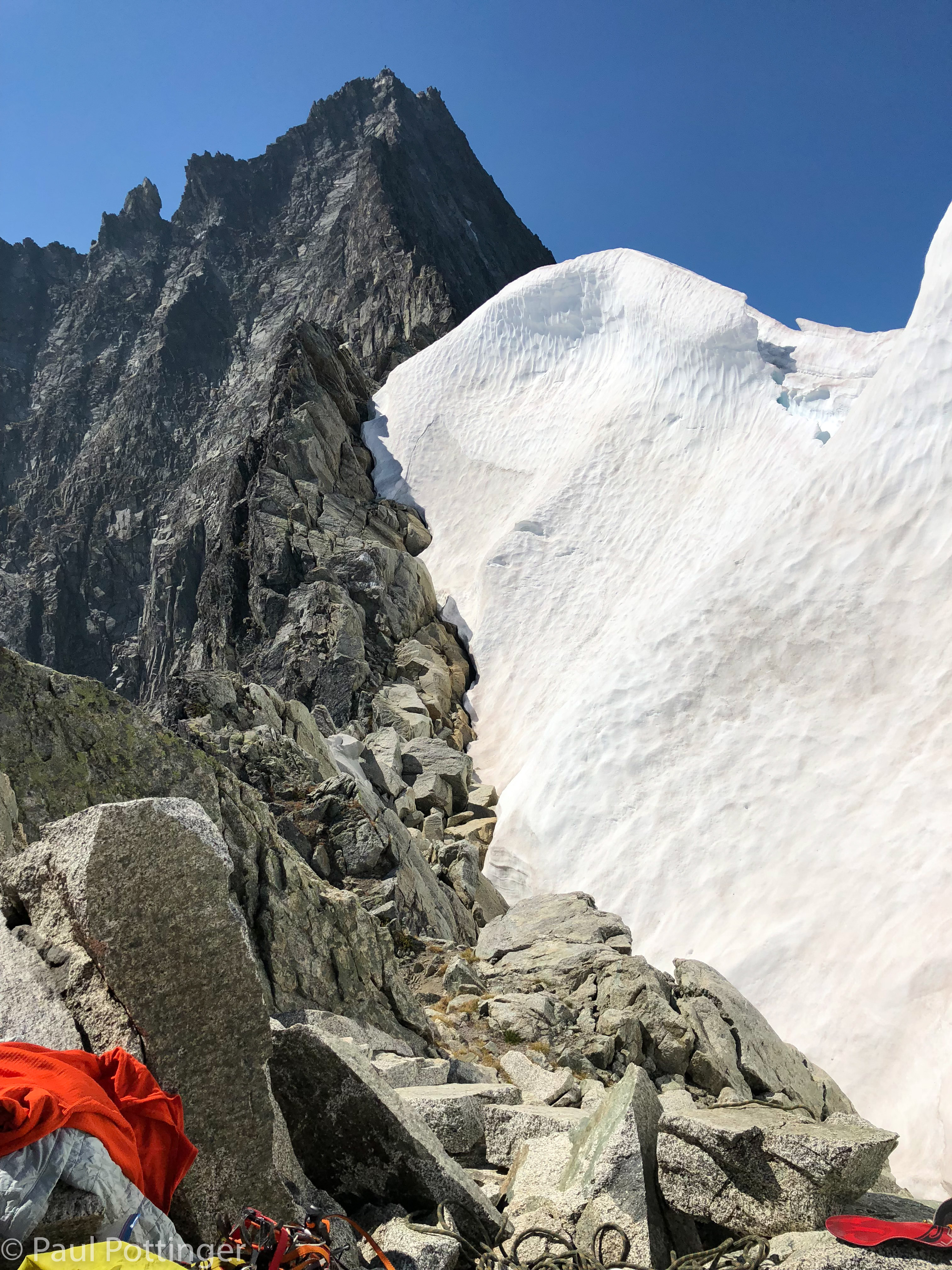
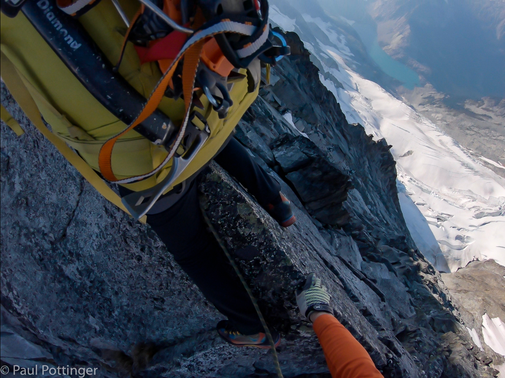
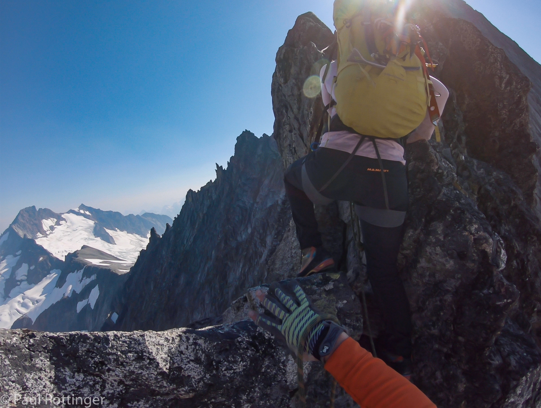
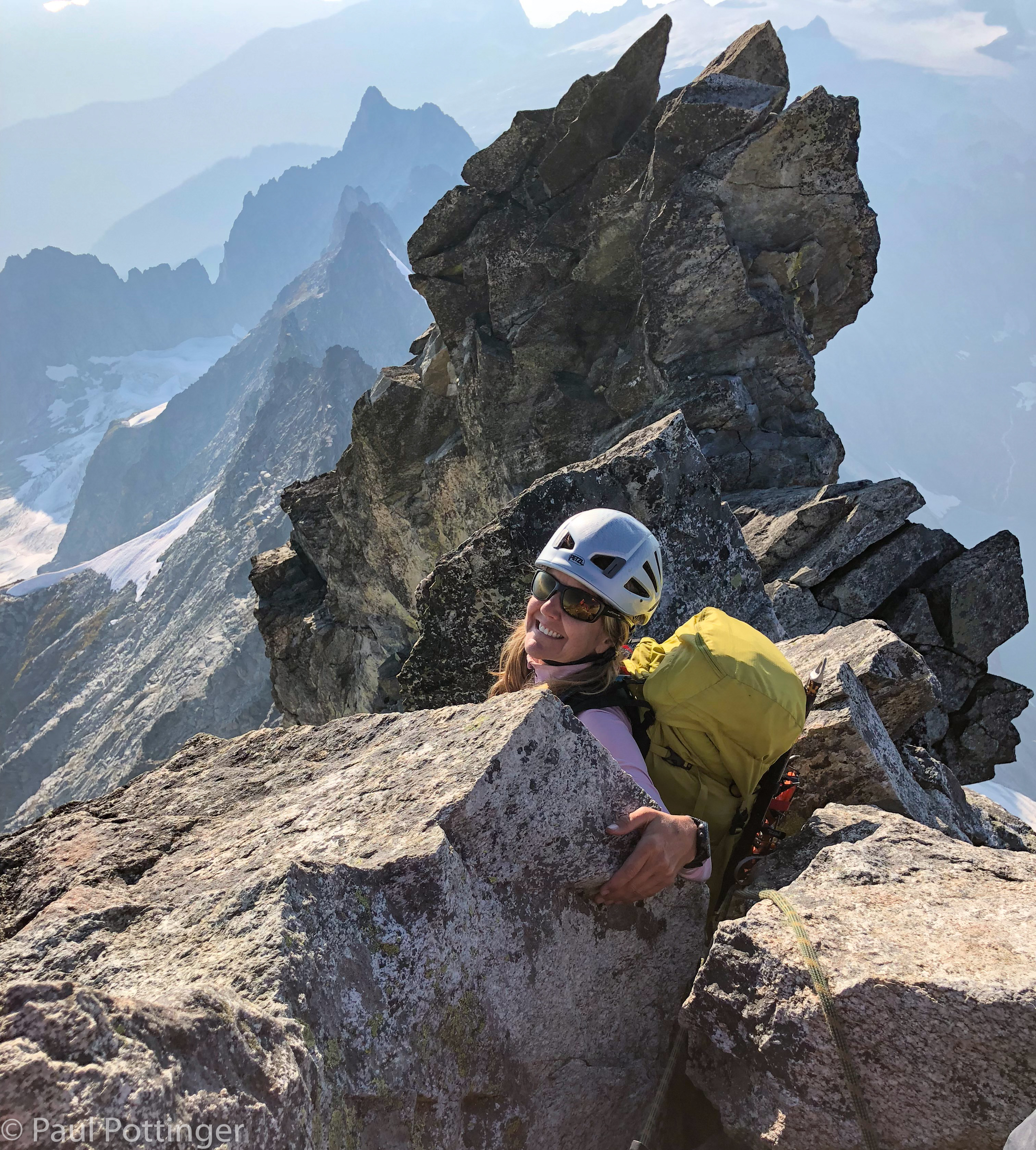
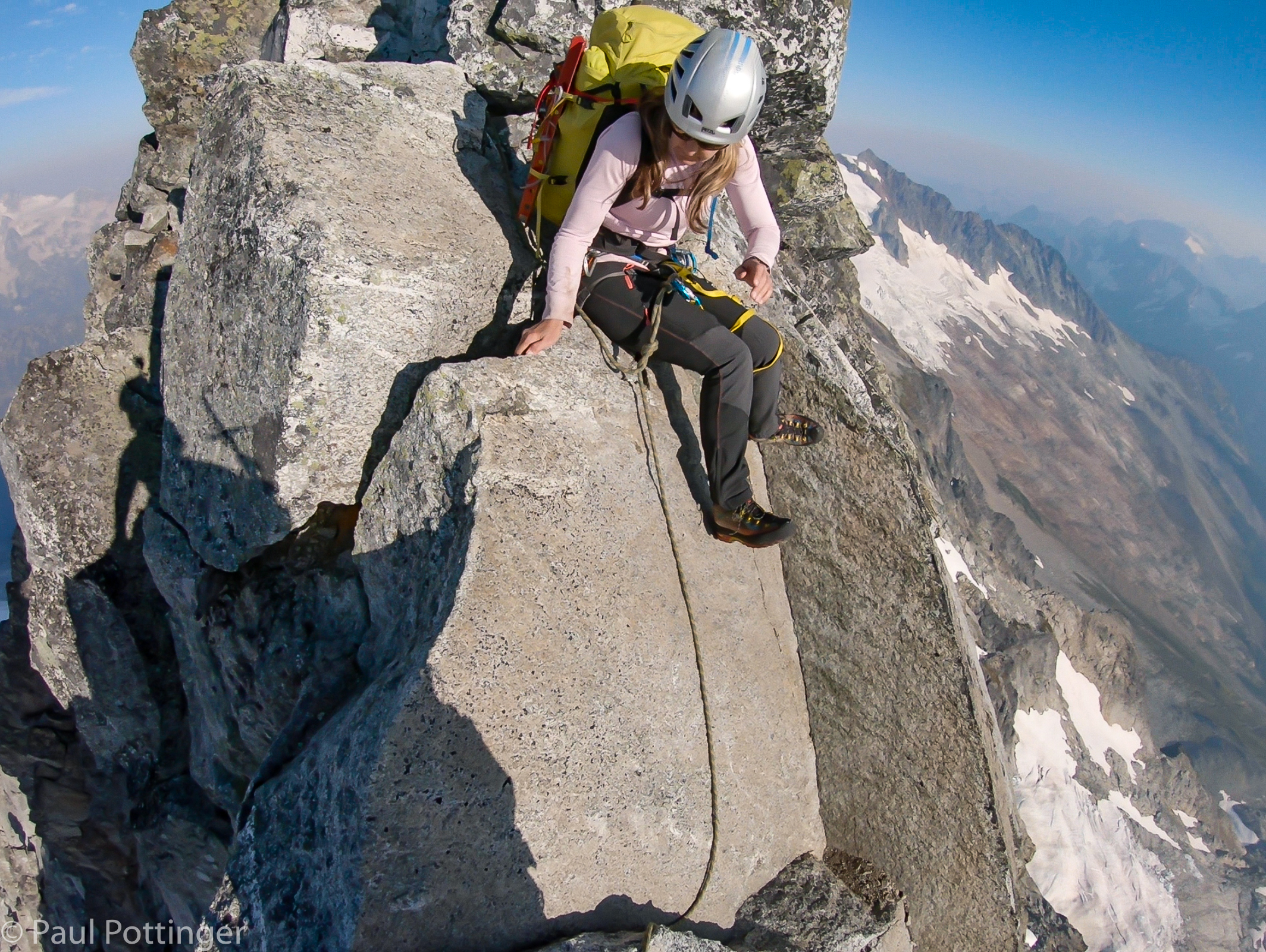
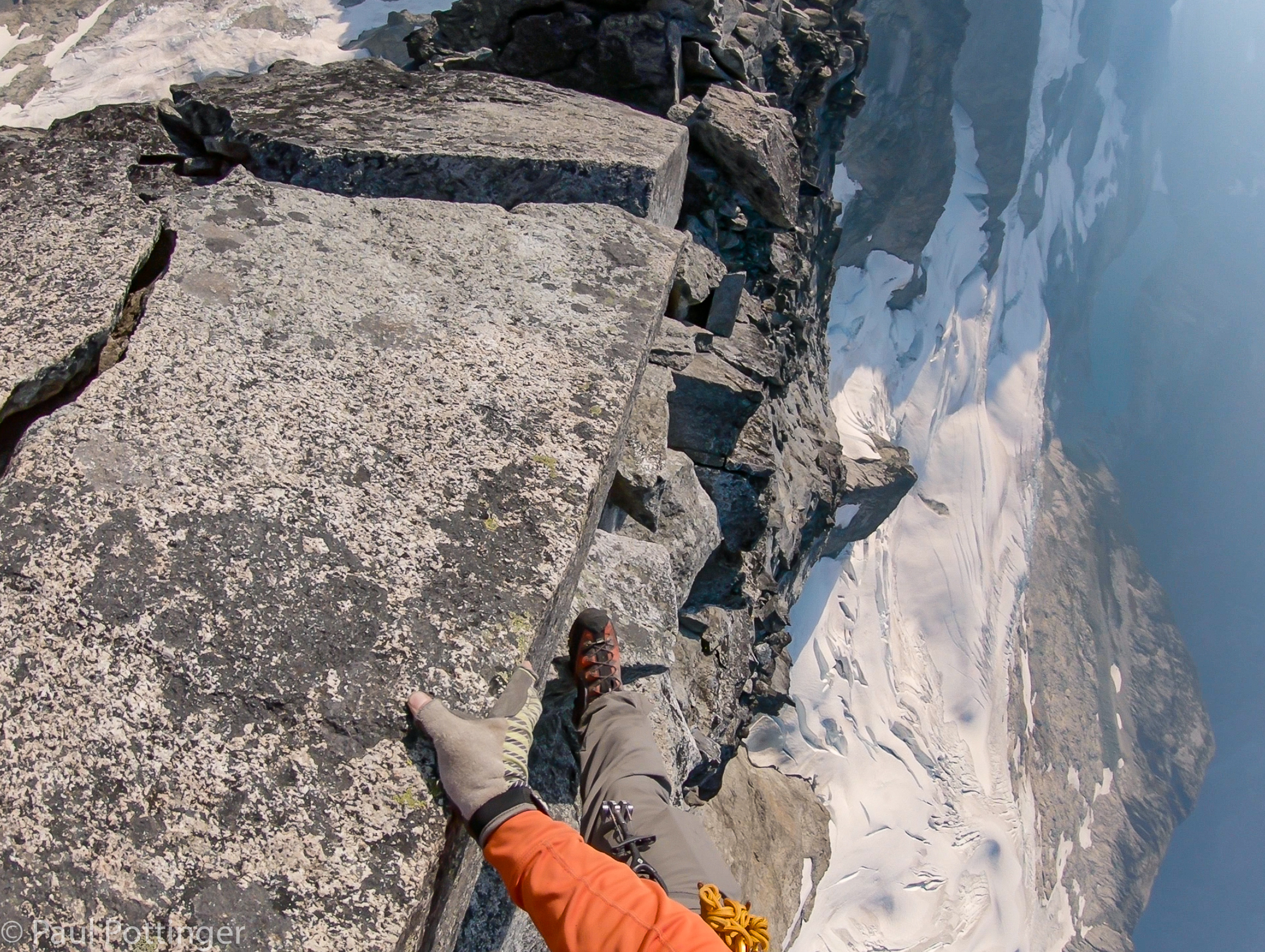
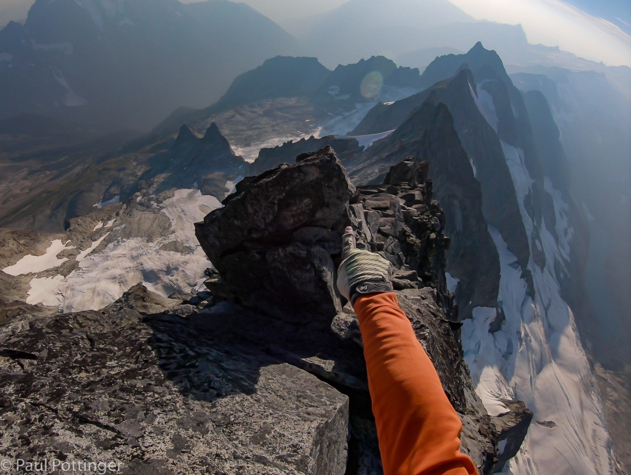
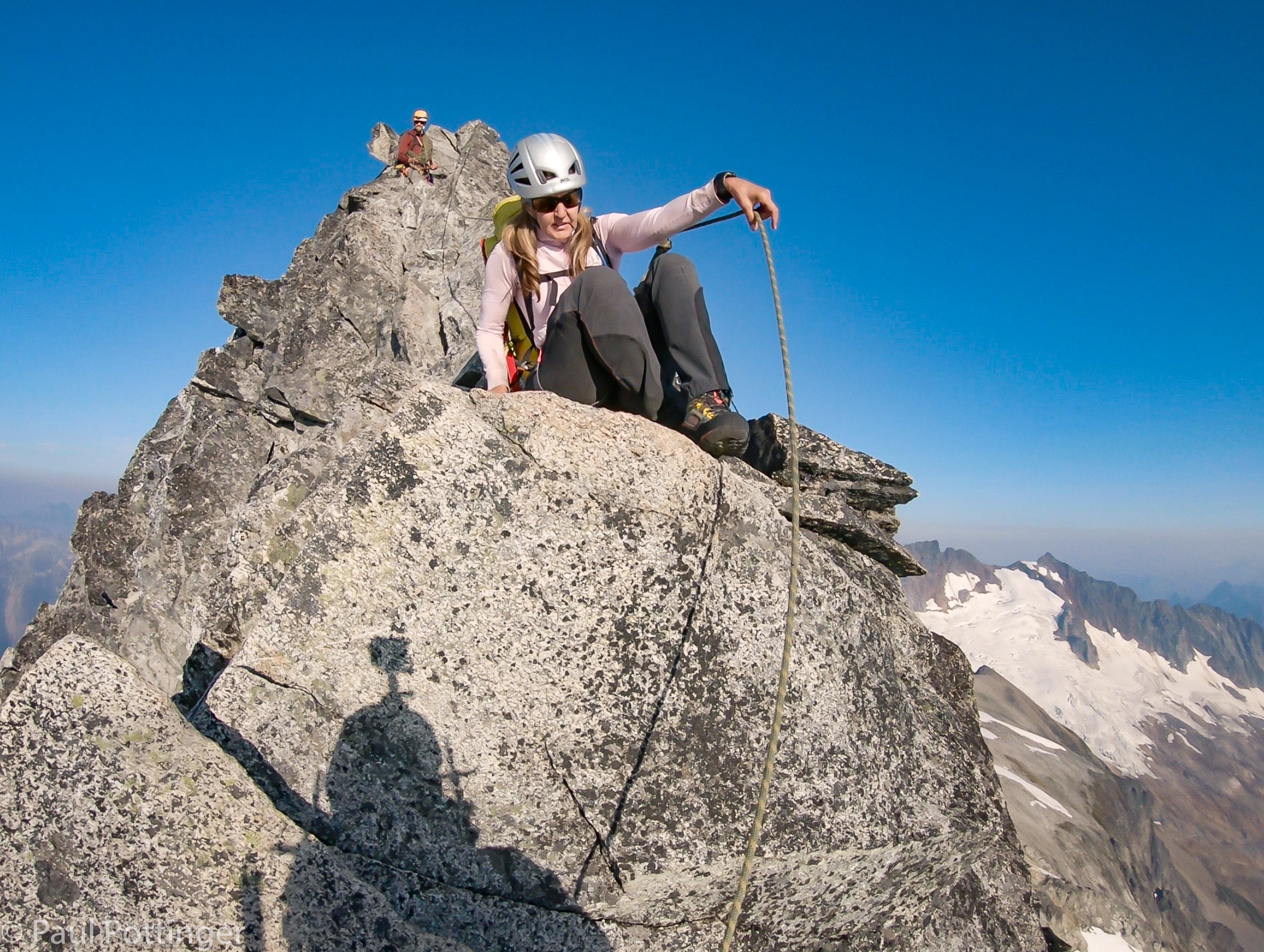
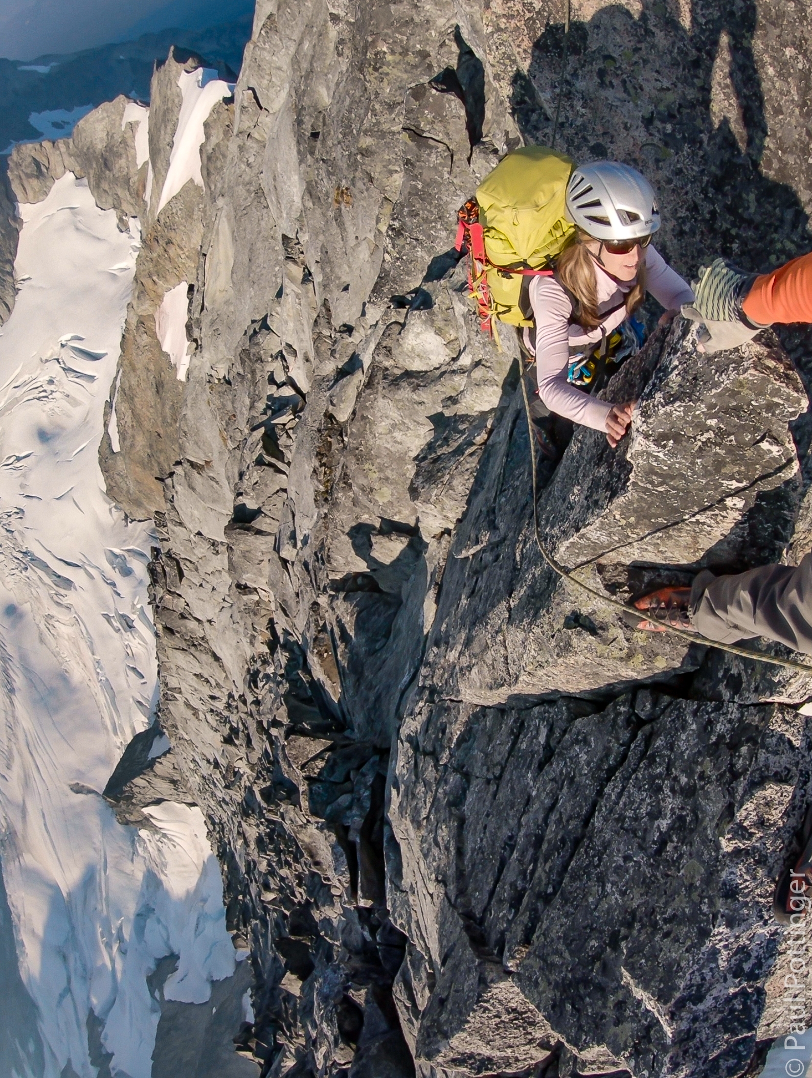
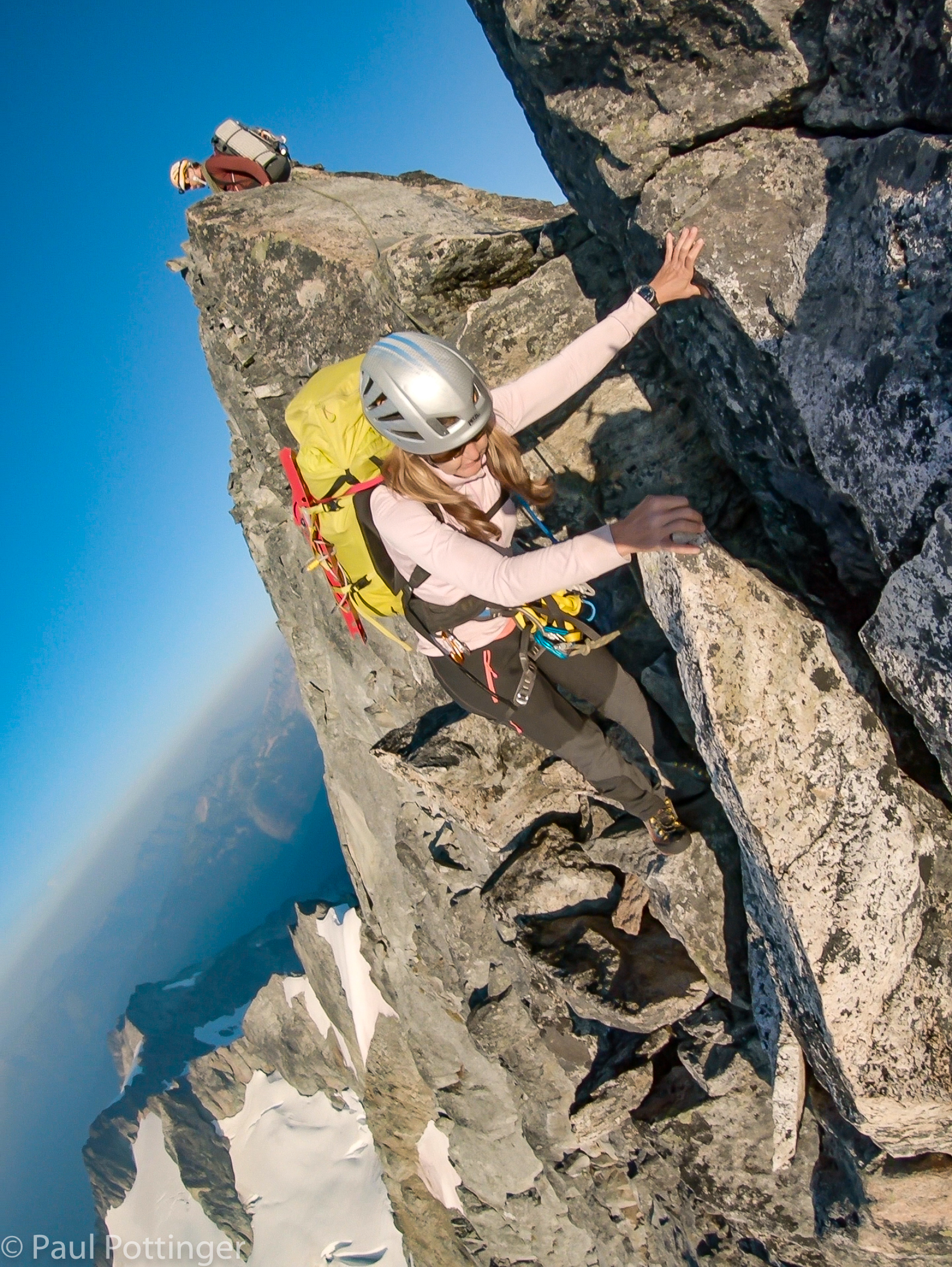
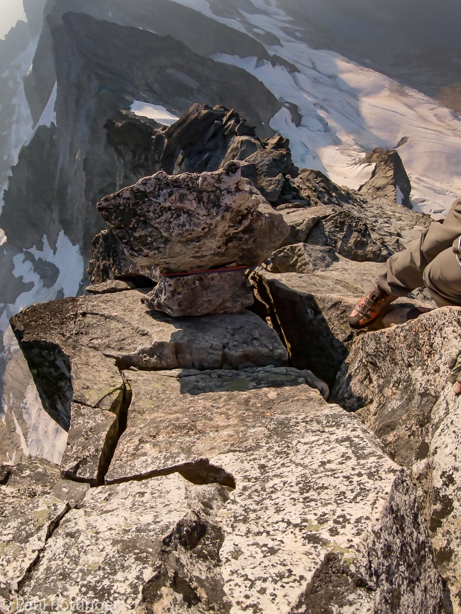
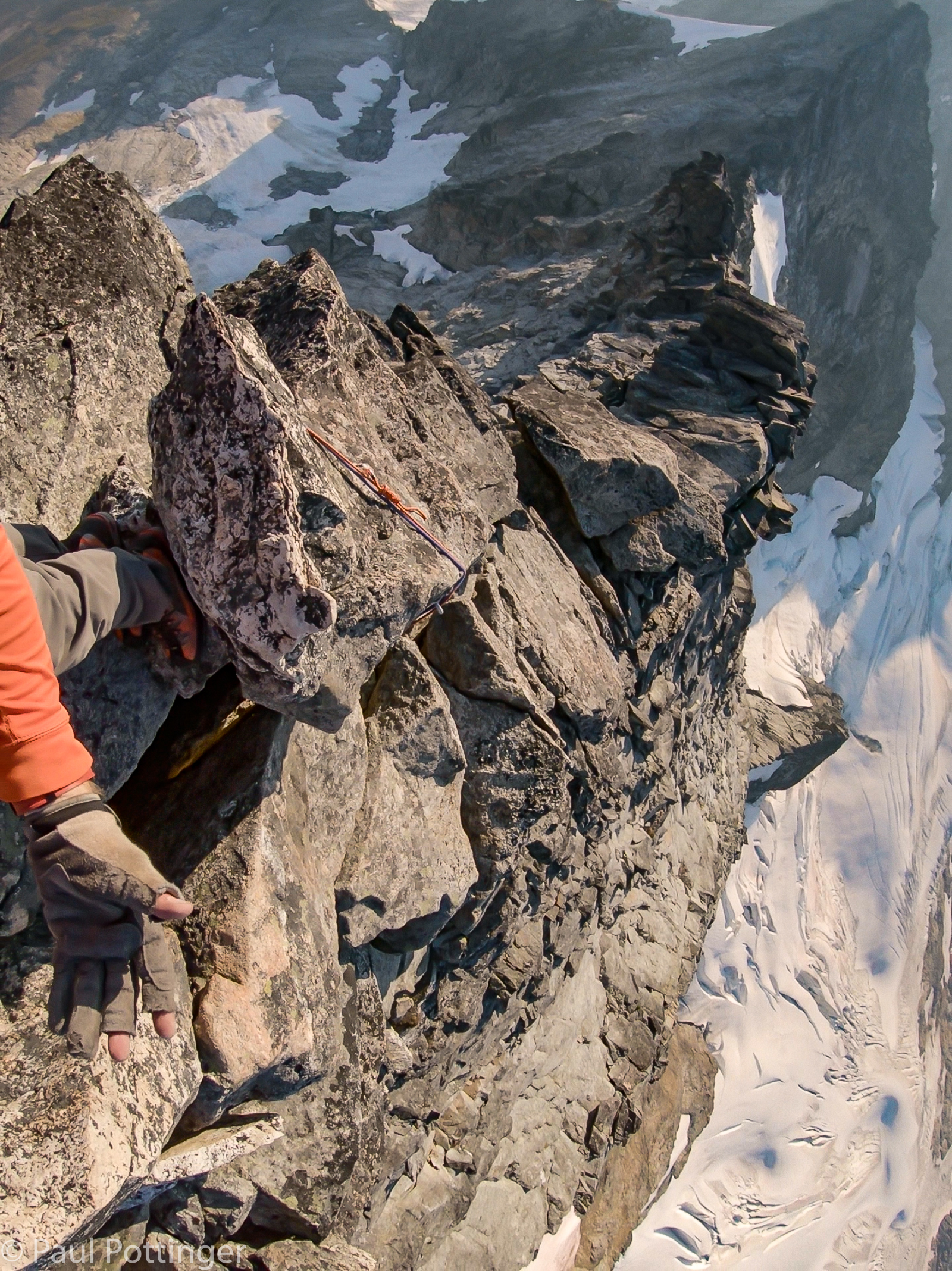
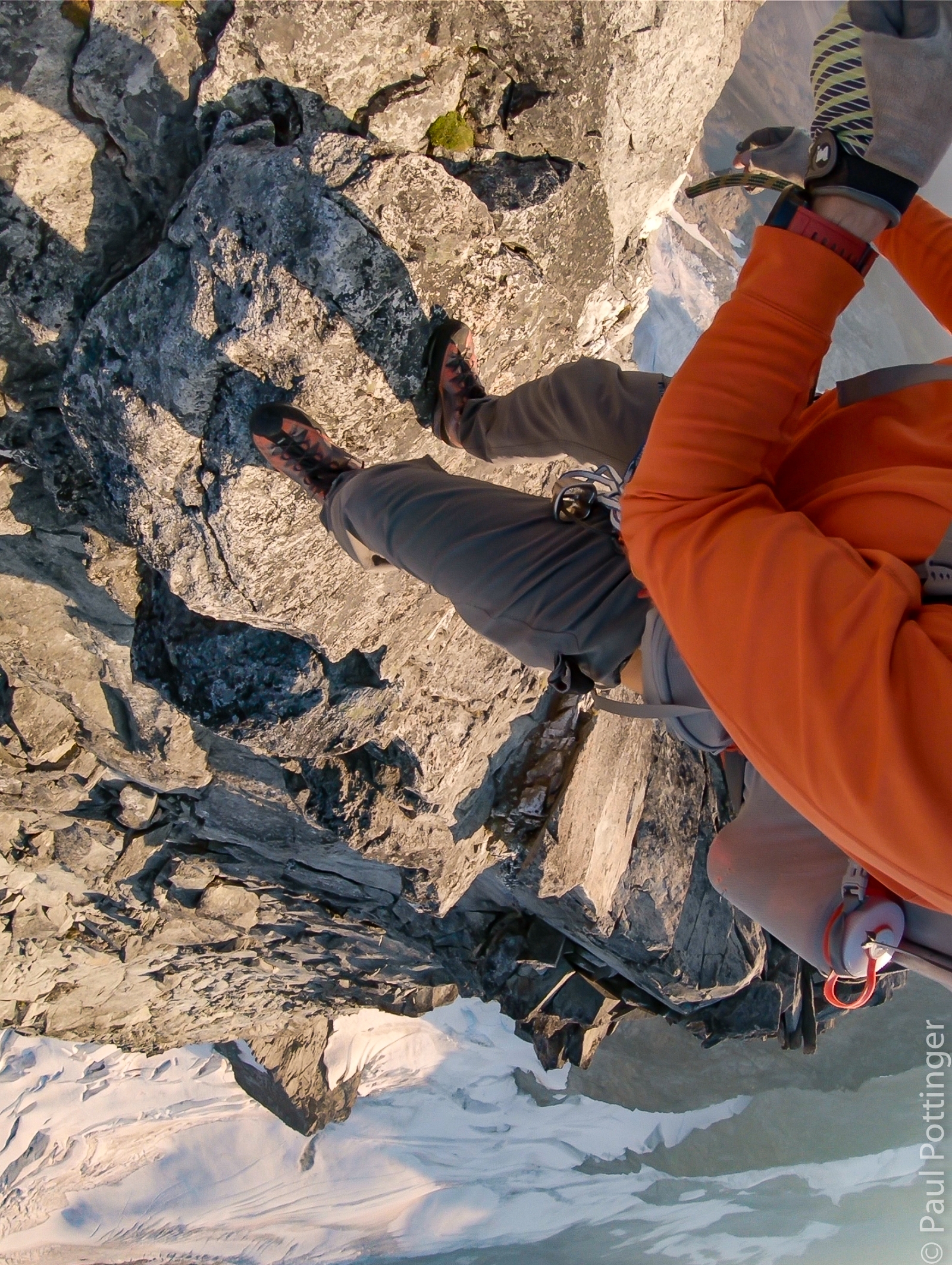
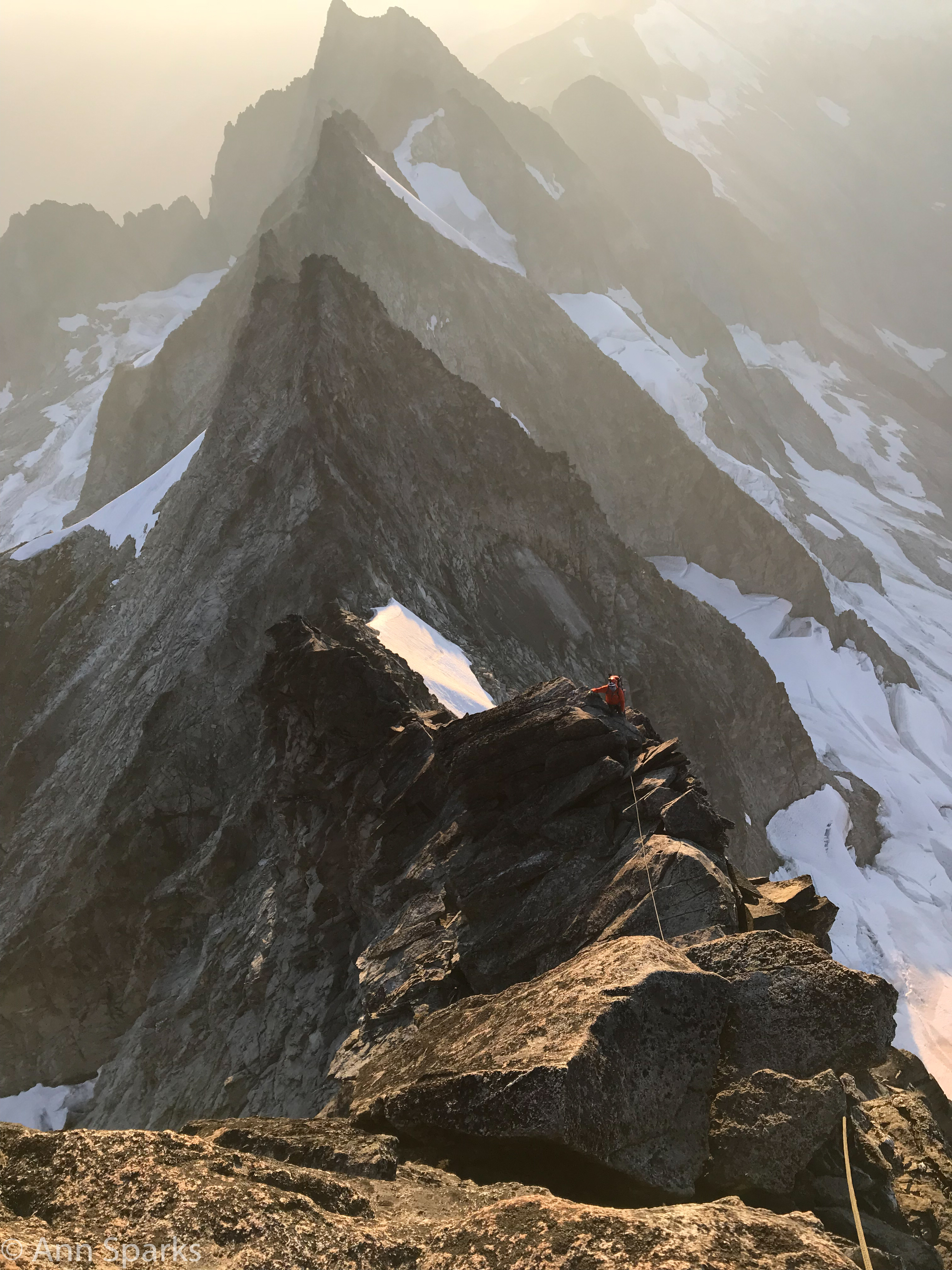
Initially, for the first several hours, the ridge was relatively wide, and we often climbed to one side or the other, in effect traversing. In some places the terrain sloped gently down to either side. But as we gained elevation it became much narrower, often several feet across at most, and the drops were very exposed. In other places the ridge was simply a thin fin of rock that we gripped at eye level while traversing, like the peak of an impossibly tall A-frame house. At one point the ridgetop was genuinely sharp for about 12 feet, like a giant flint knapped into a blade. Justin was able to scootch along it resting on his perineum, which worked for me too. Ann, not so much. She tried to rest her weight on the ridge for about half a second before stopping. “Nope. No way. That’s not happening.”

“You could ride side saddle—“ I offered.

“Nope. We’re done.” Ann stepped out over the void and shimmied along, using the ridge like a railing. Exposed, but dignified, and definitely better for her anatomy.

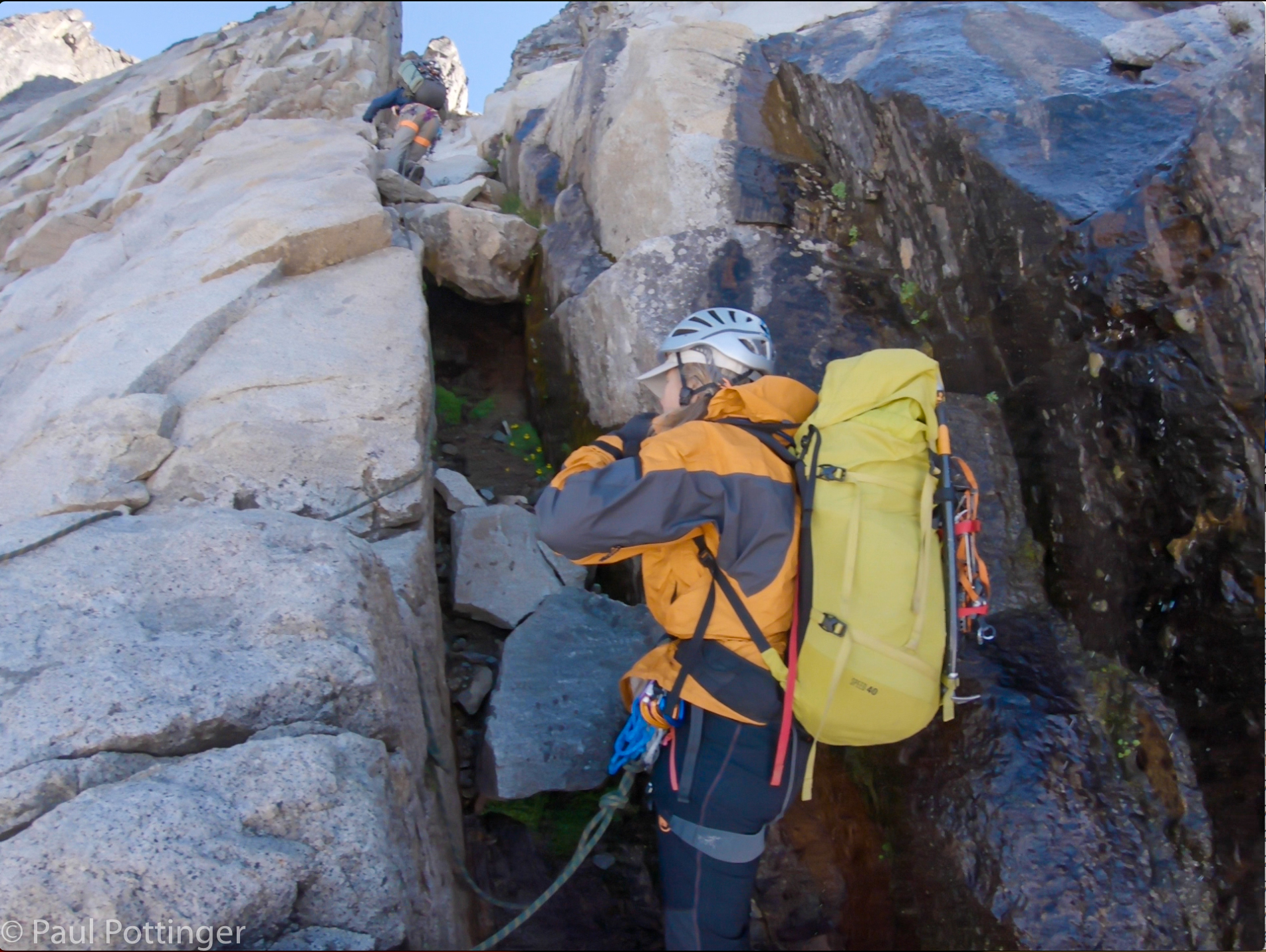
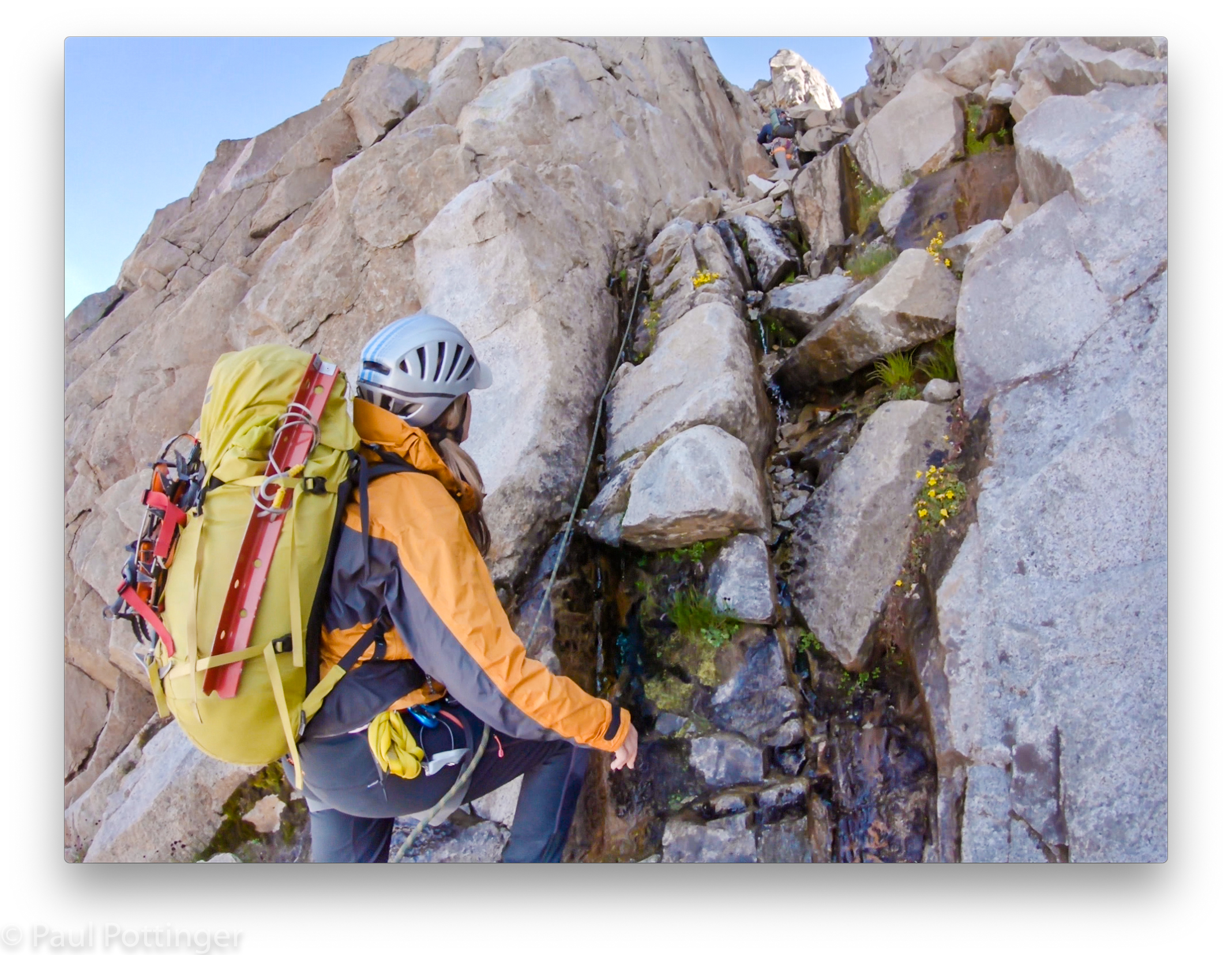
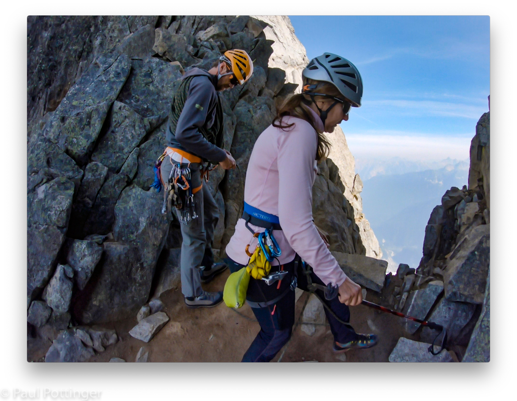
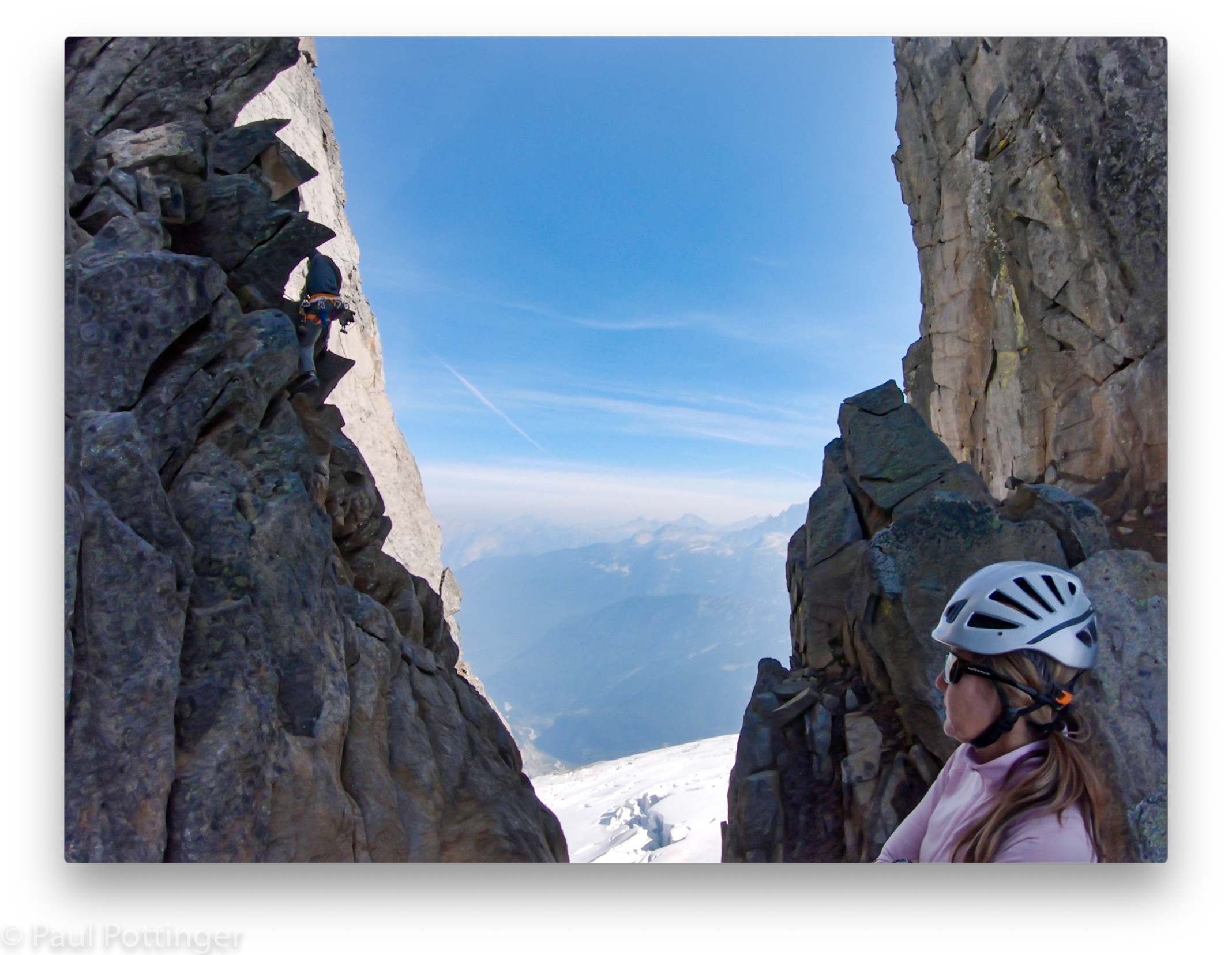
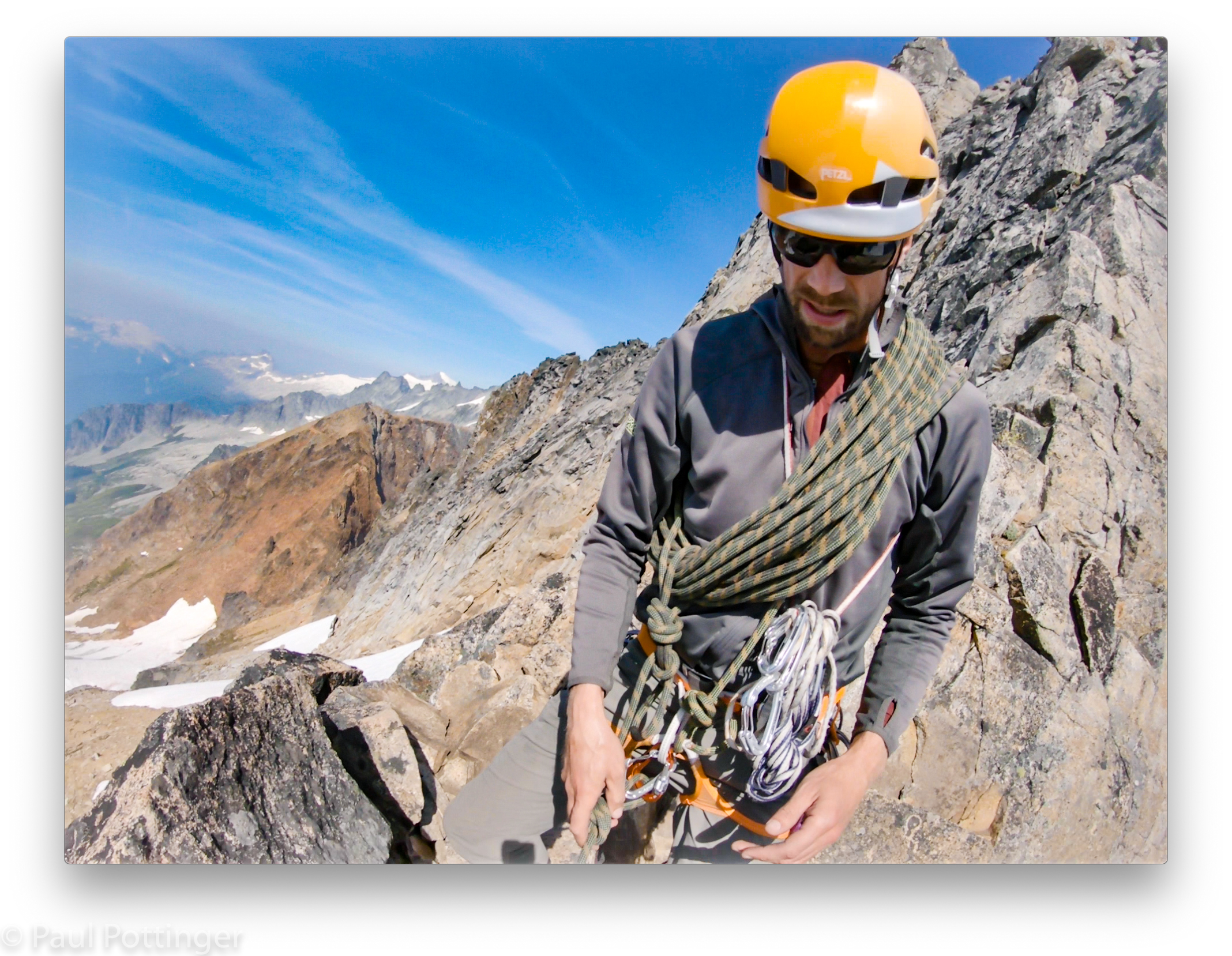
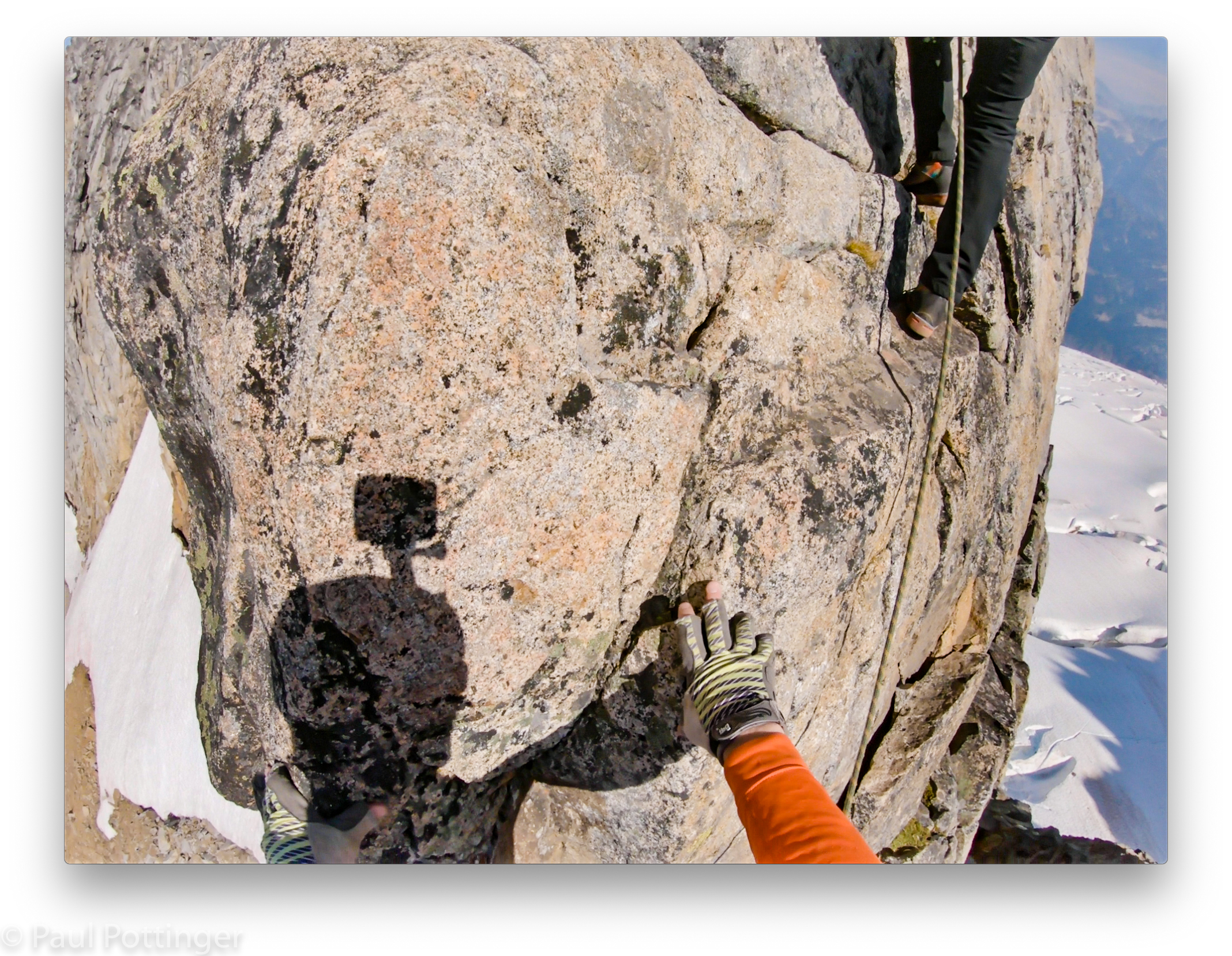
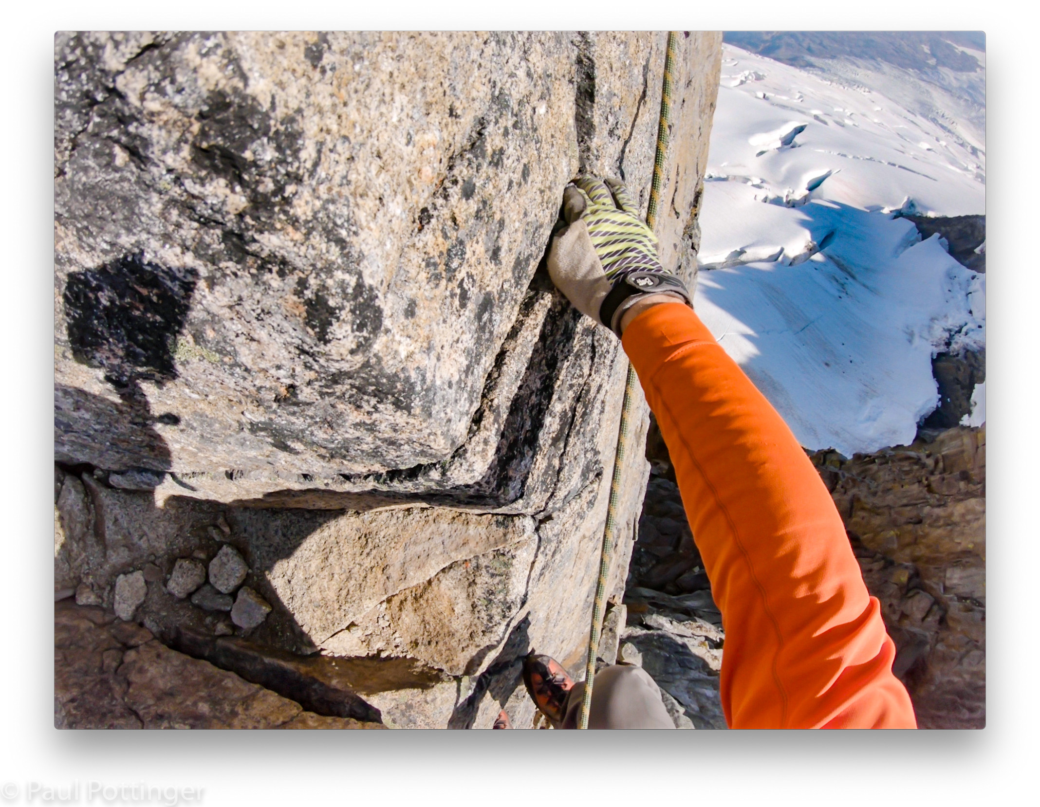
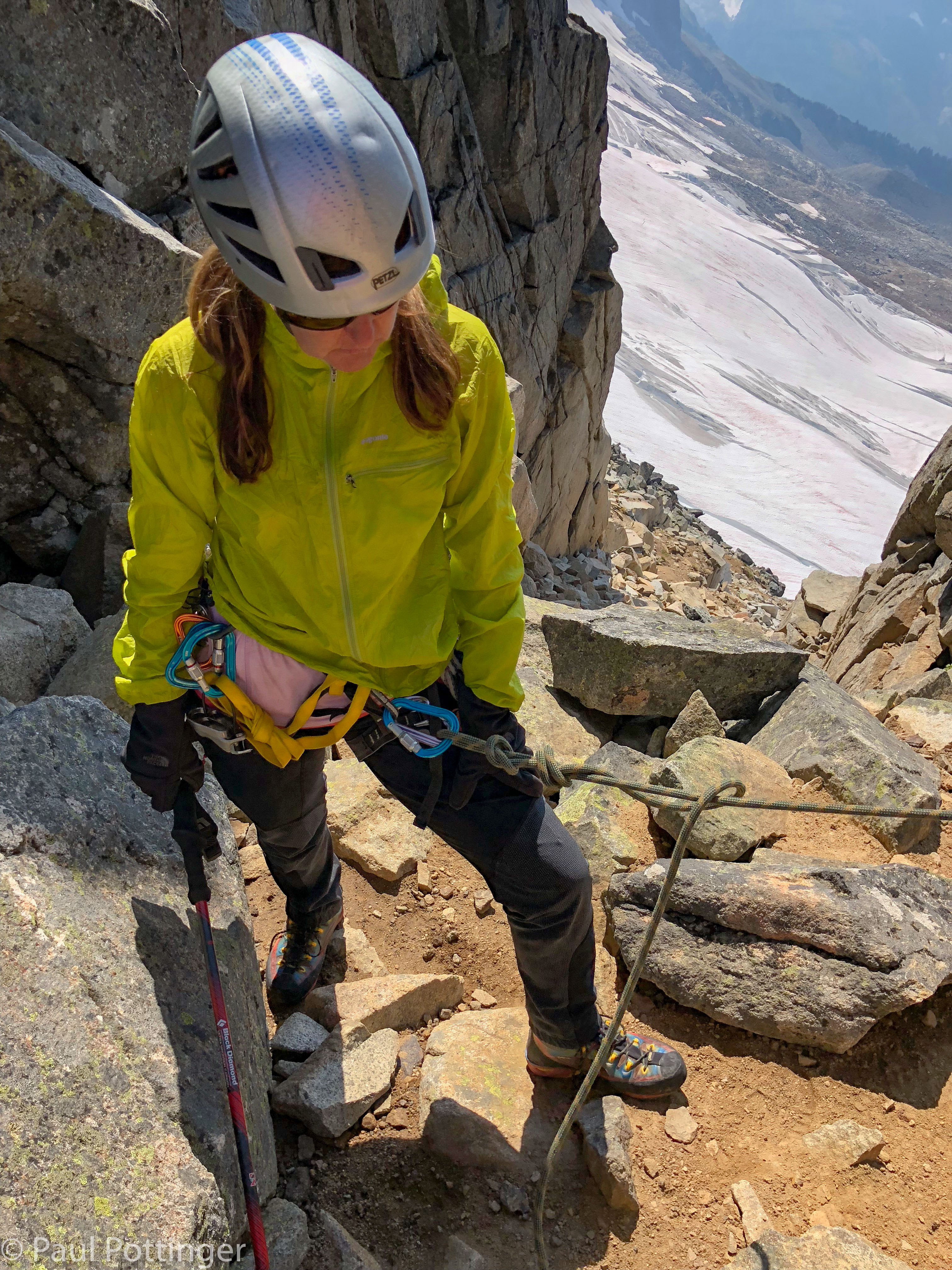
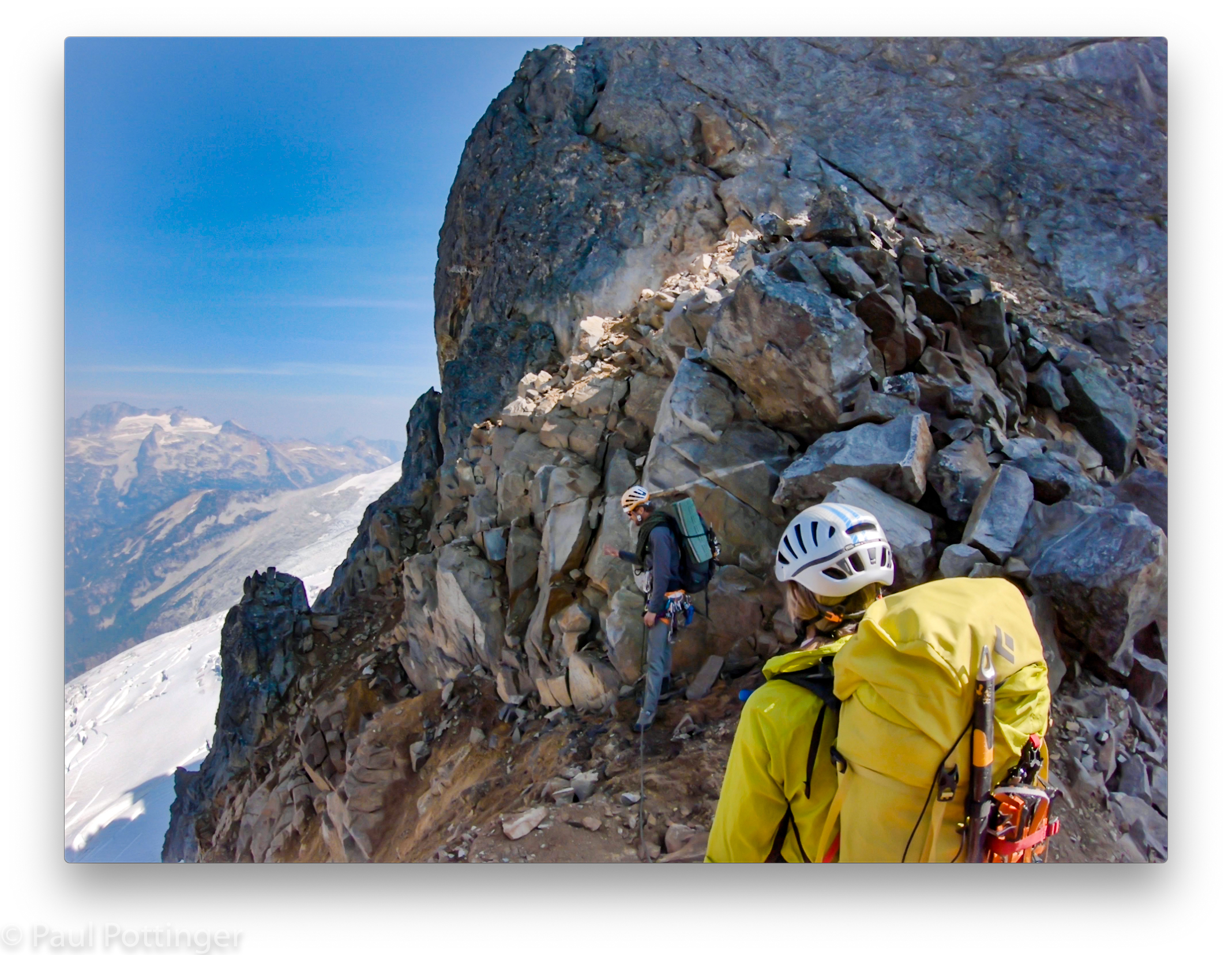
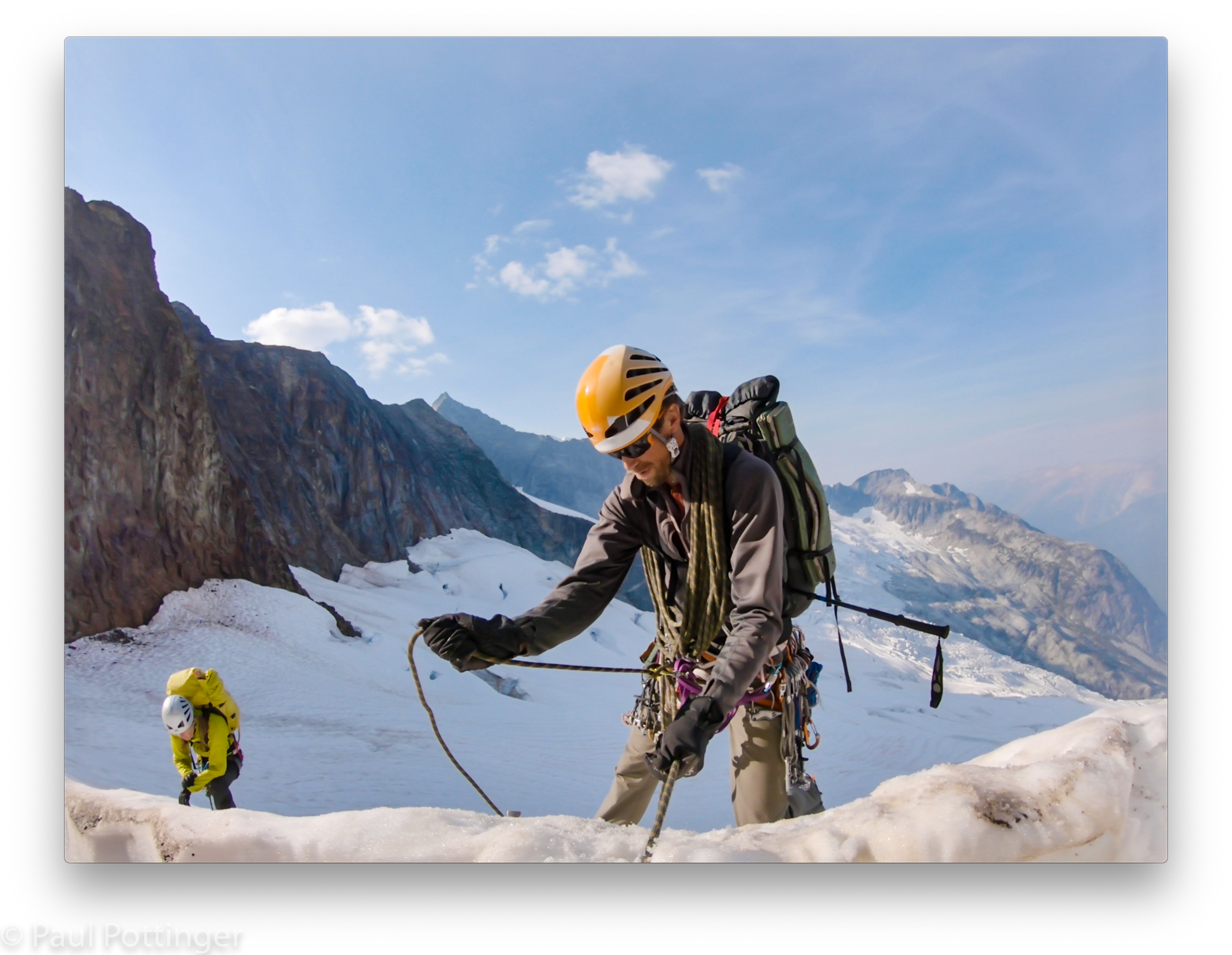
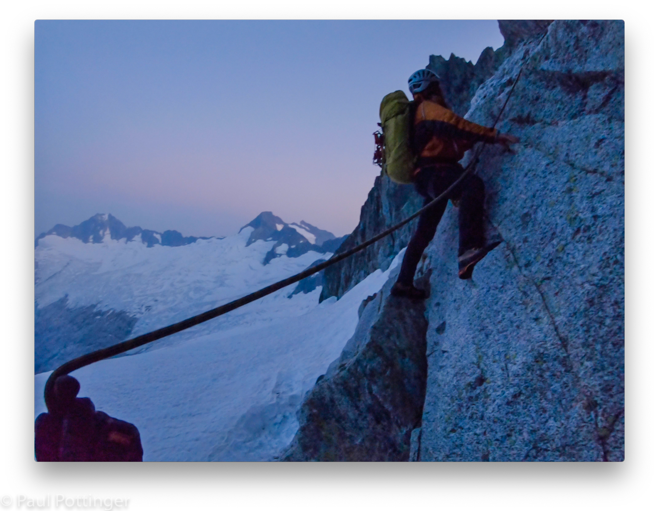
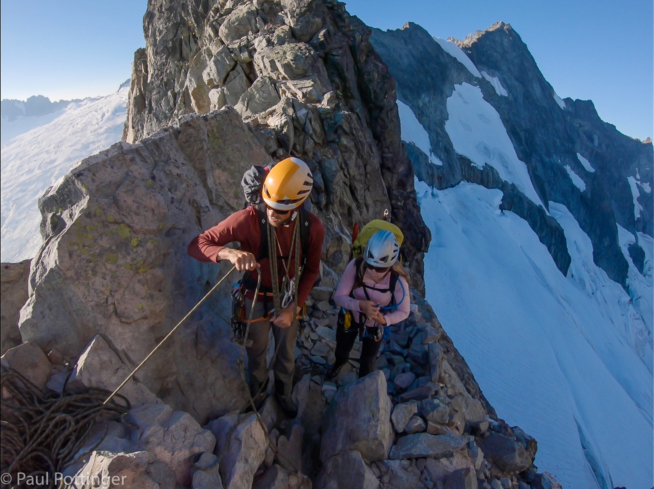
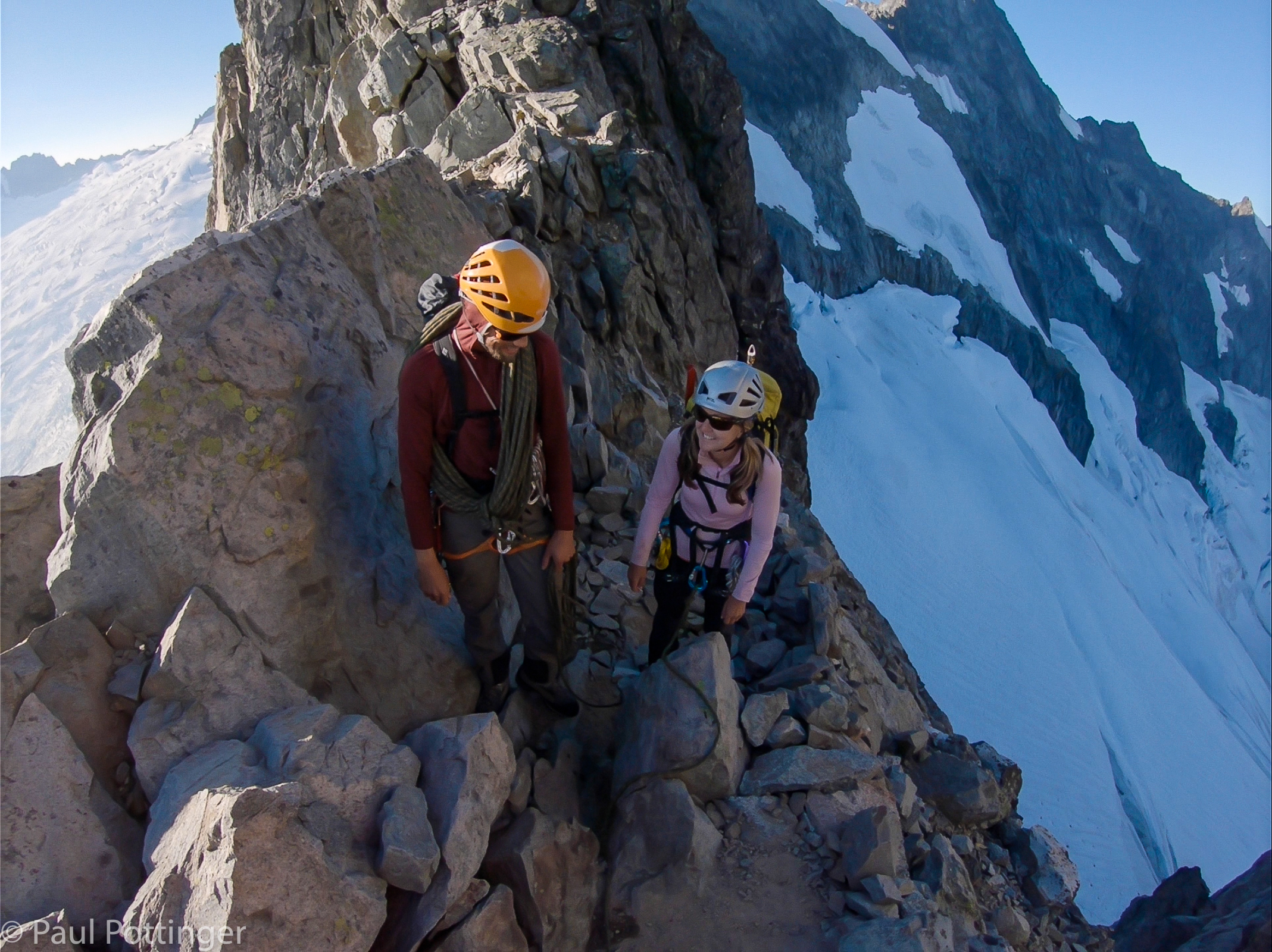
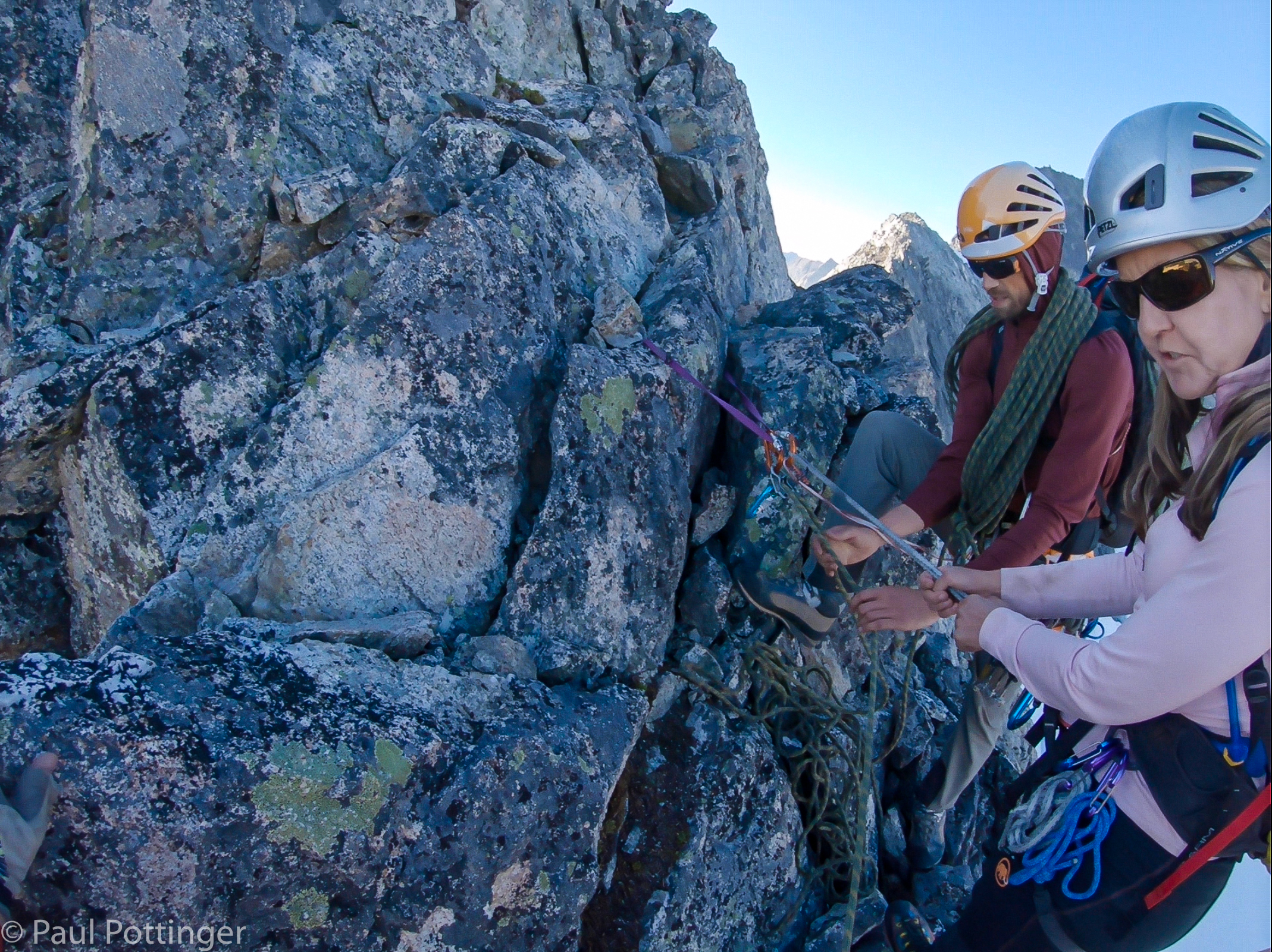
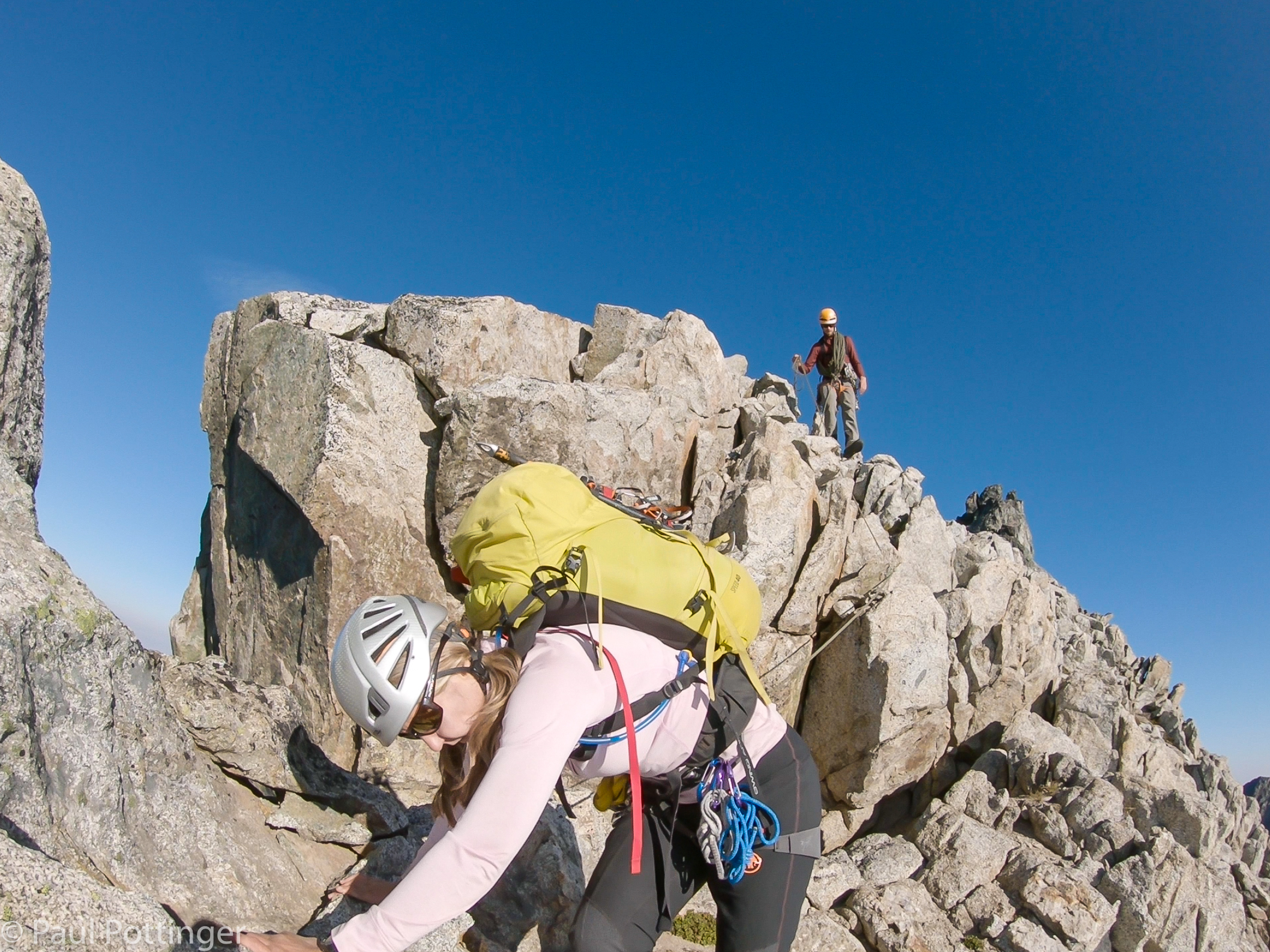
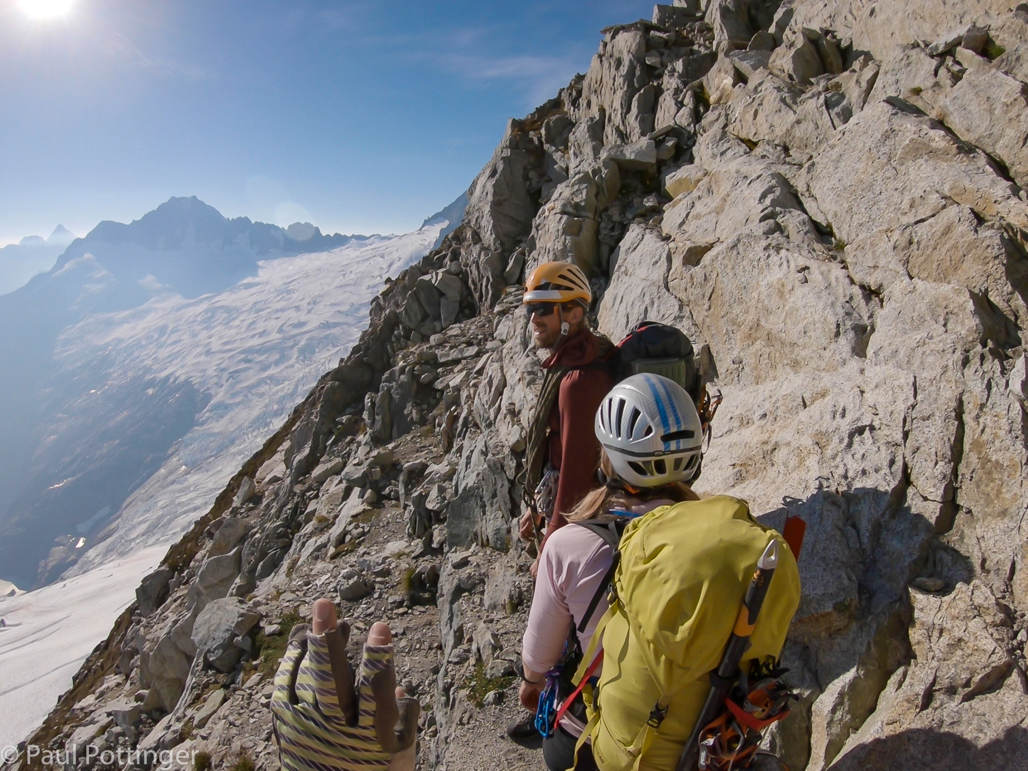
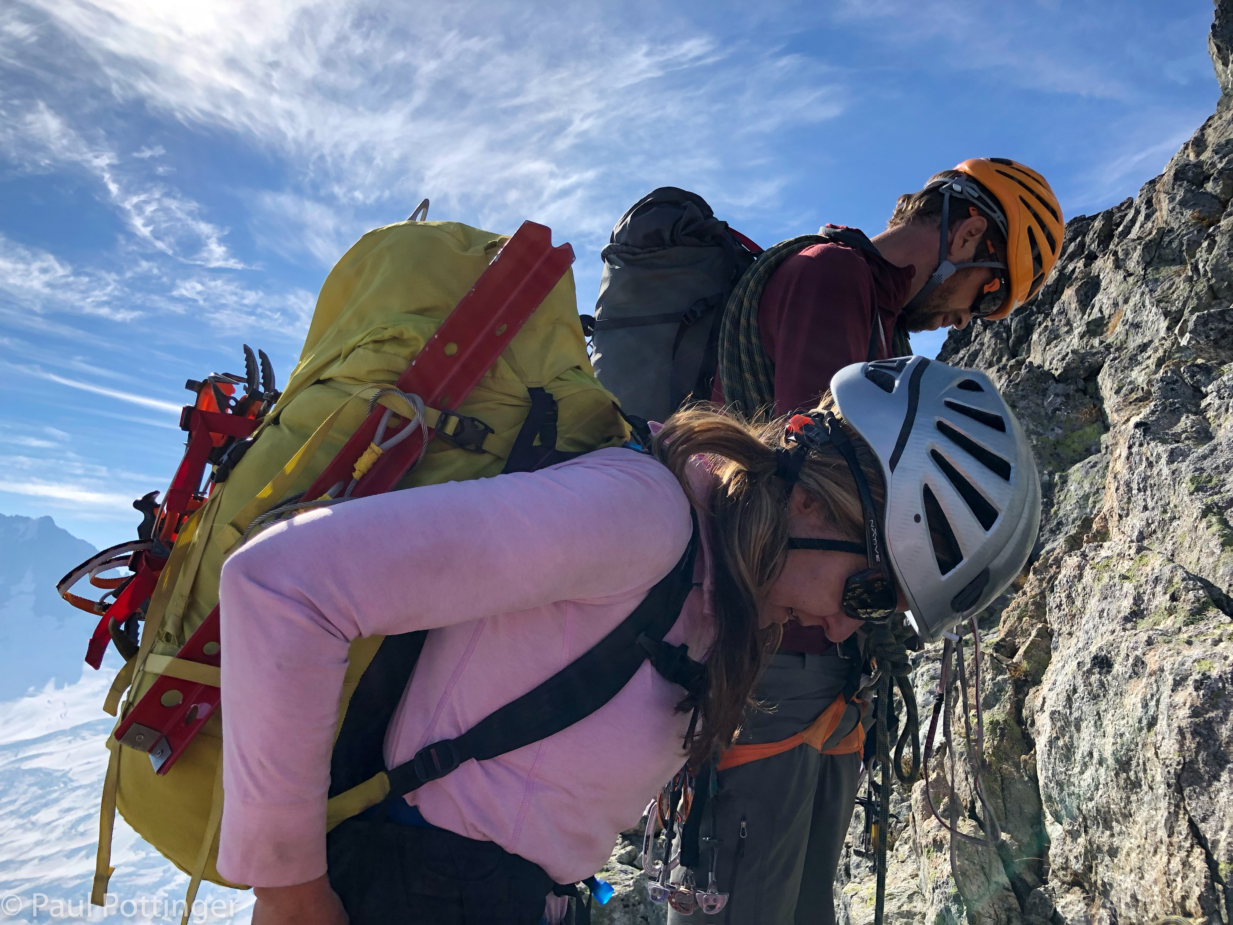
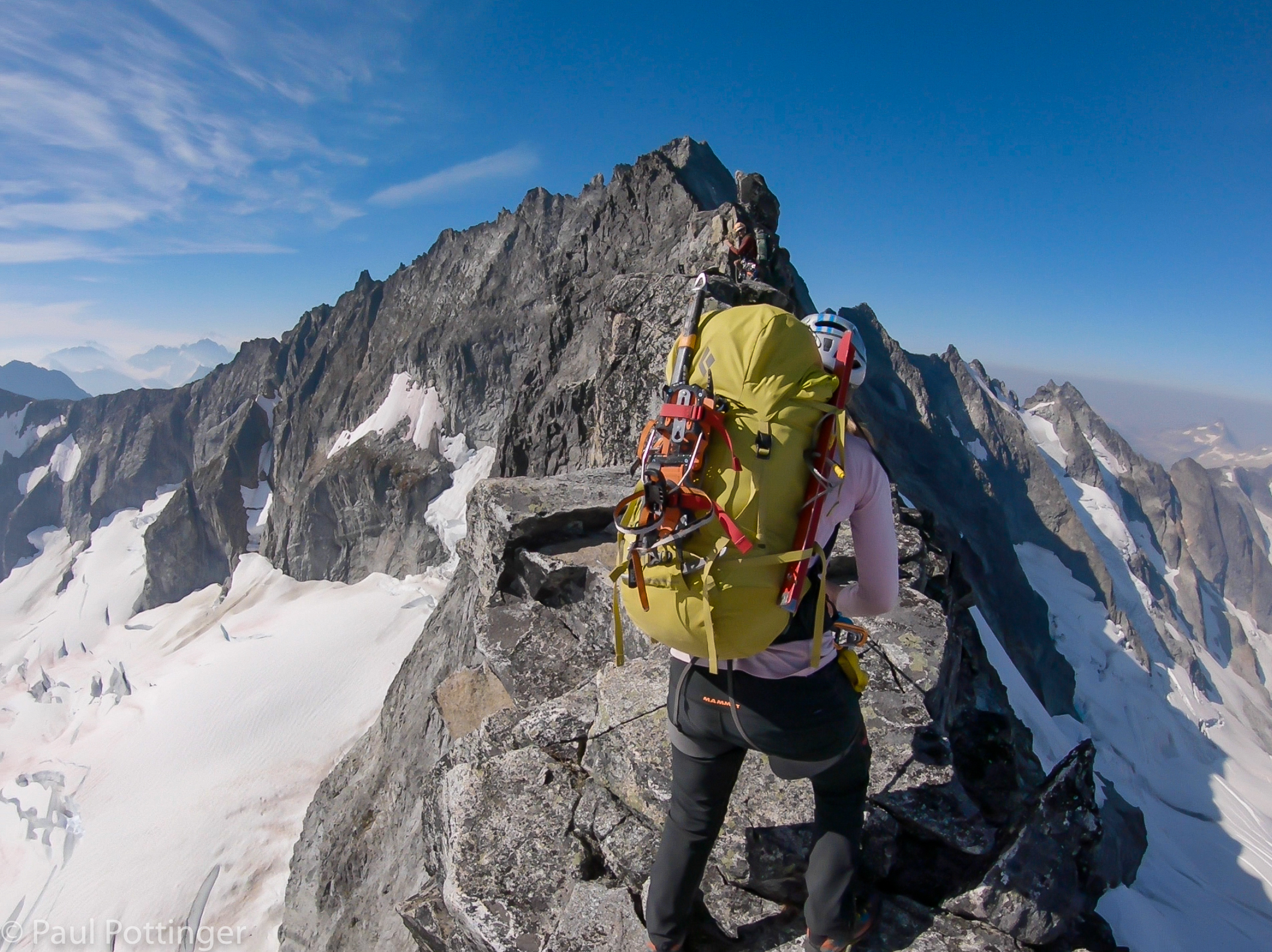
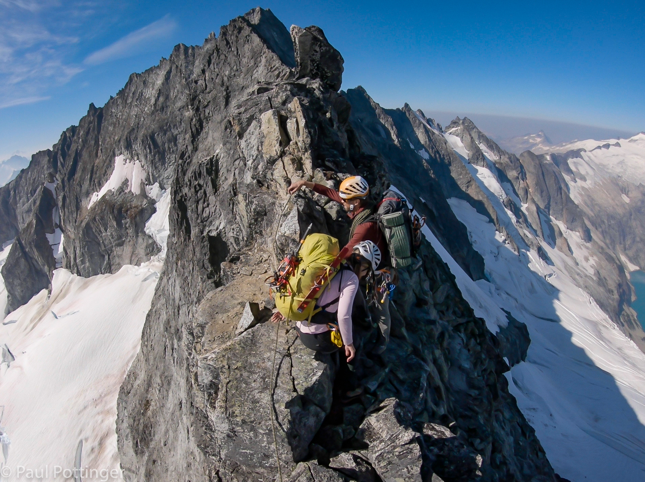
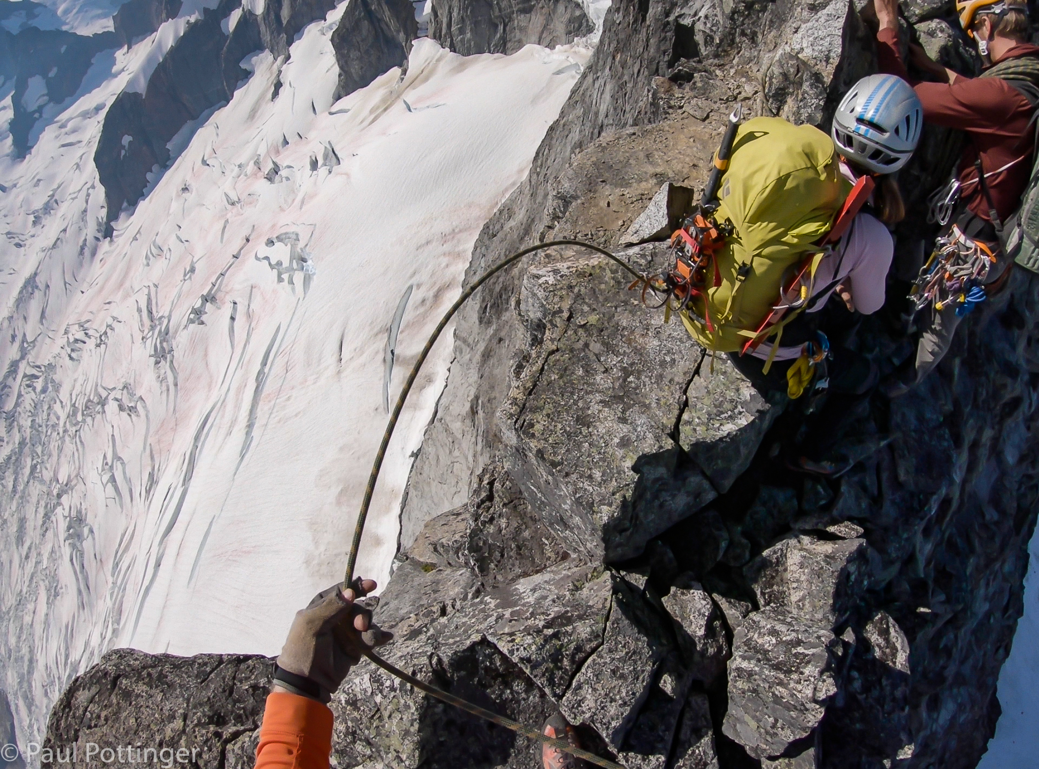
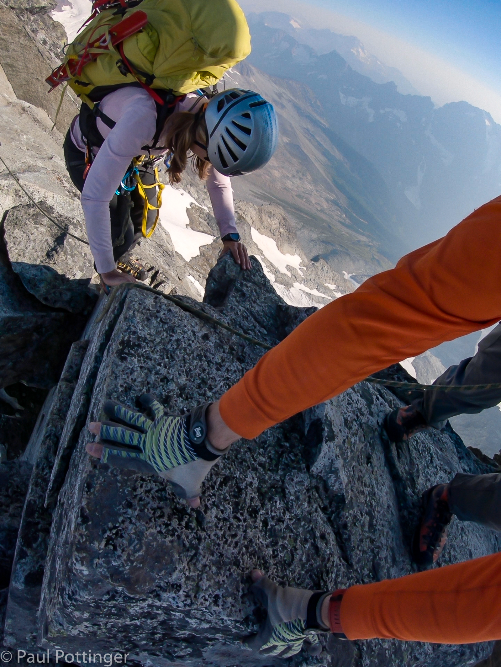
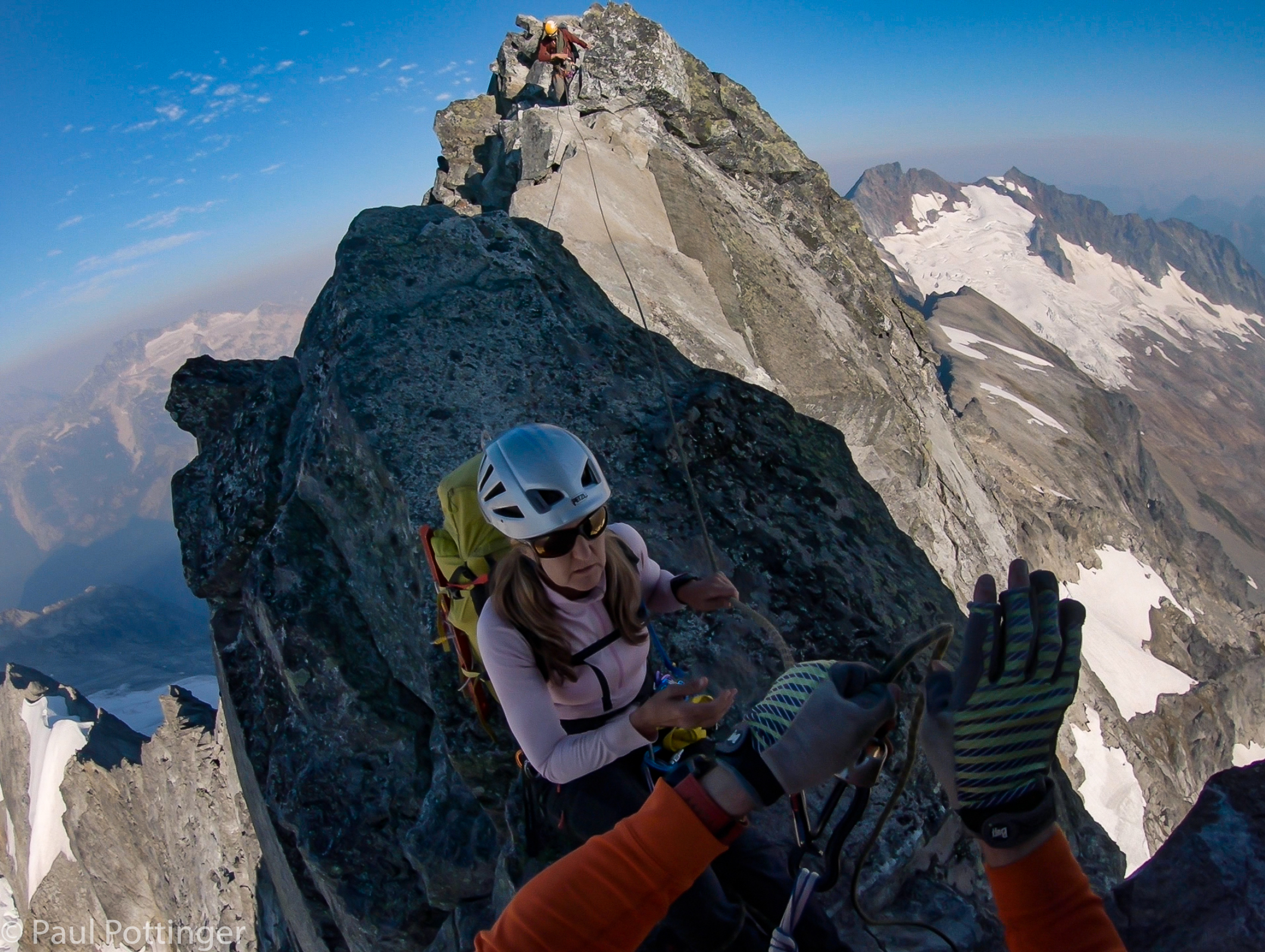
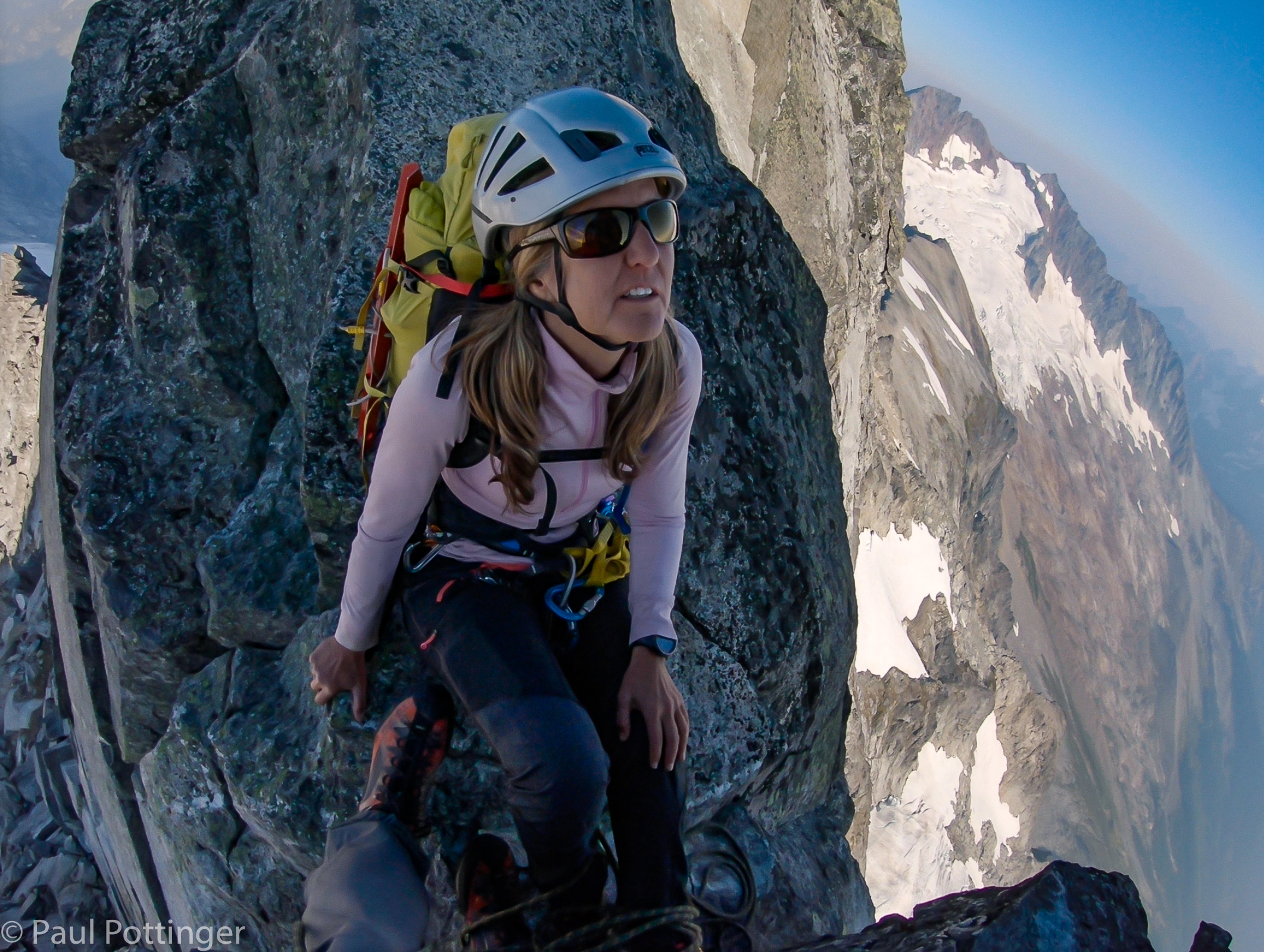
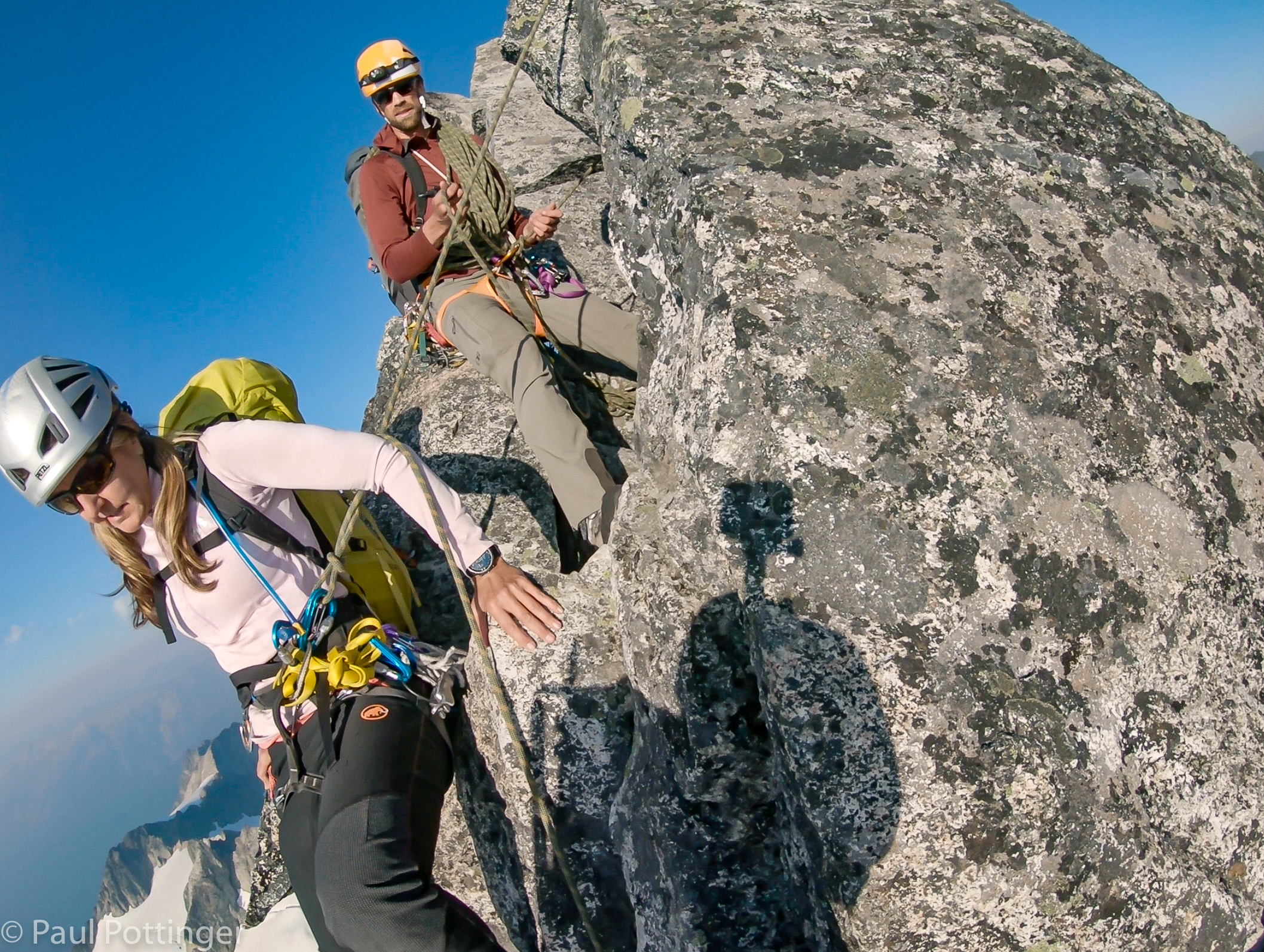
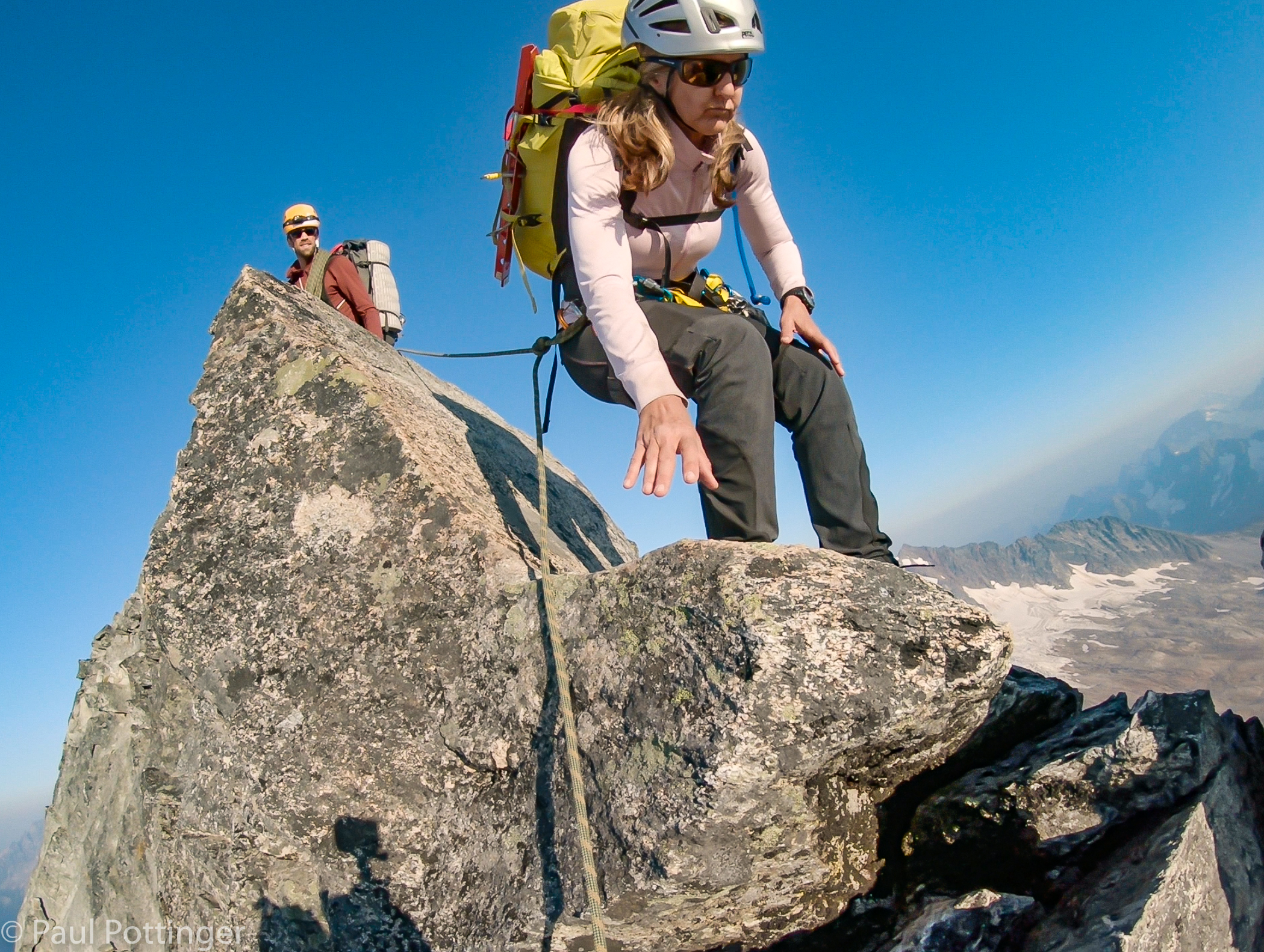
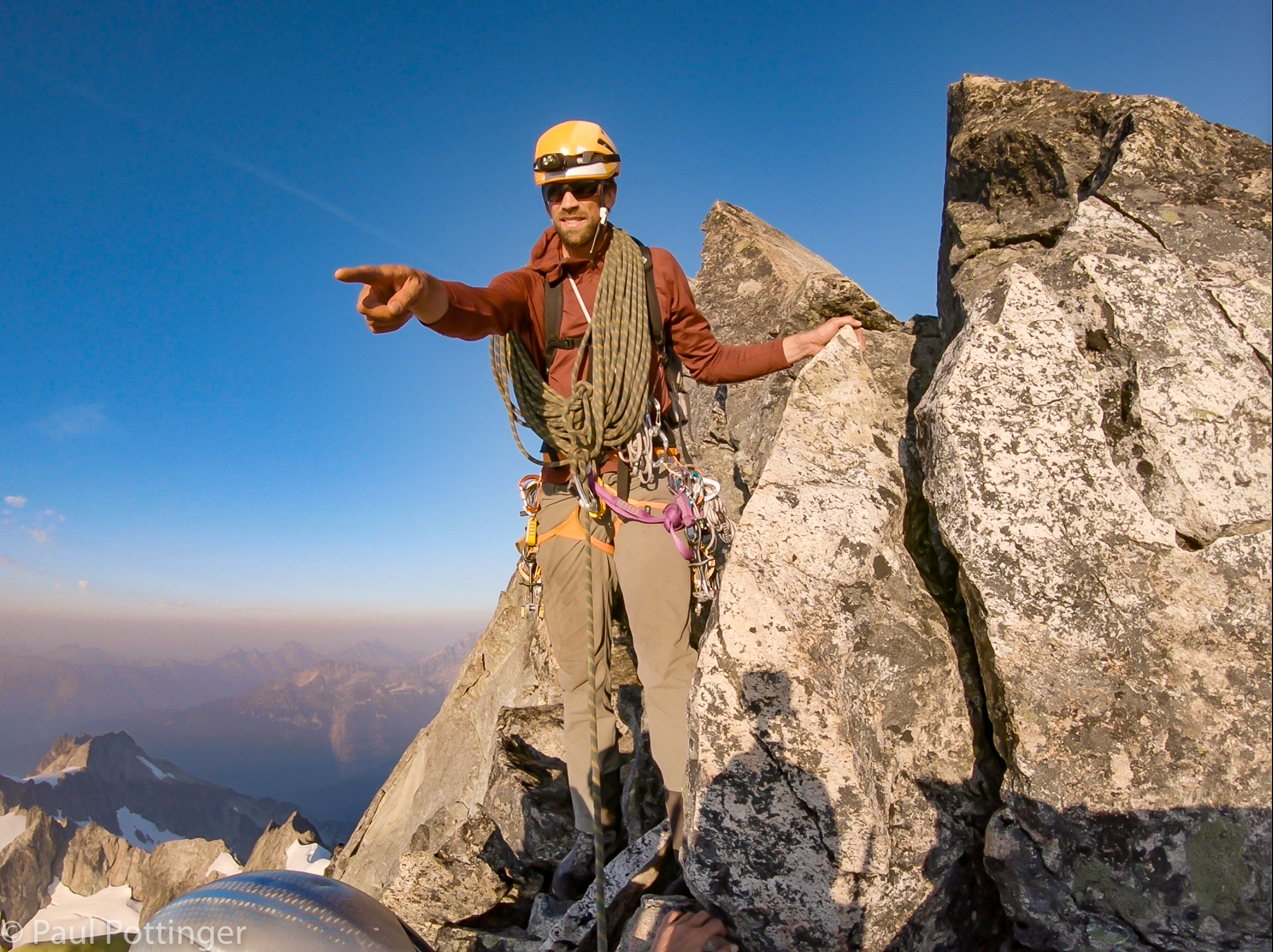
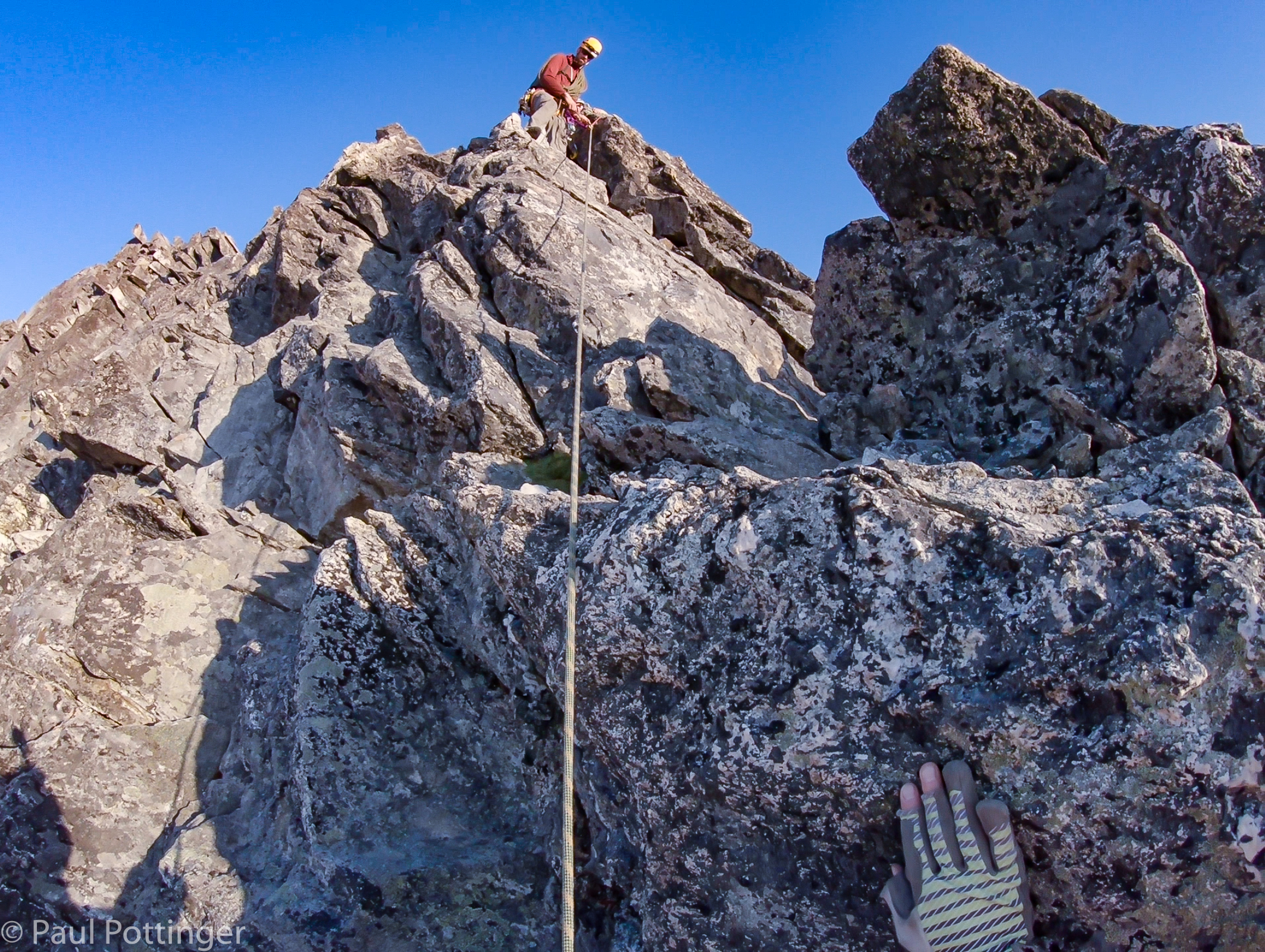
Of course, Justin always had us on belay. When the terrain was modest we moved as a team, protected by the rope threaded between horns. But, this was not always possible. The ridge rises unevenly towards the summit, in a series of towers, each higher than the last. Some of them take minutes to climb, others closer to an hour, or longer. Justin would usually lead out while we kept him on belay, then he would return the favor while Ann and I climbed together to him, separated by about three meters of rope.

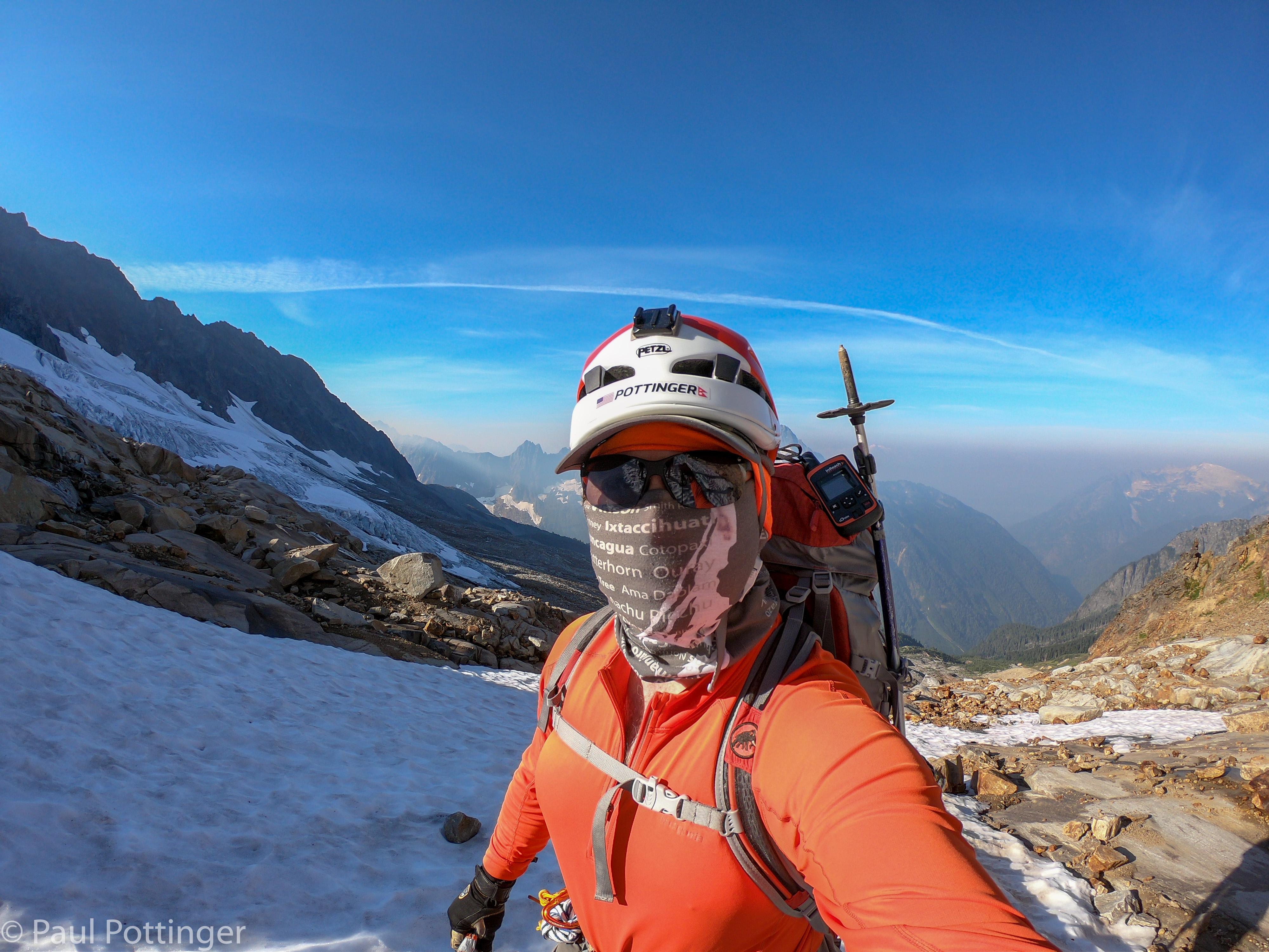
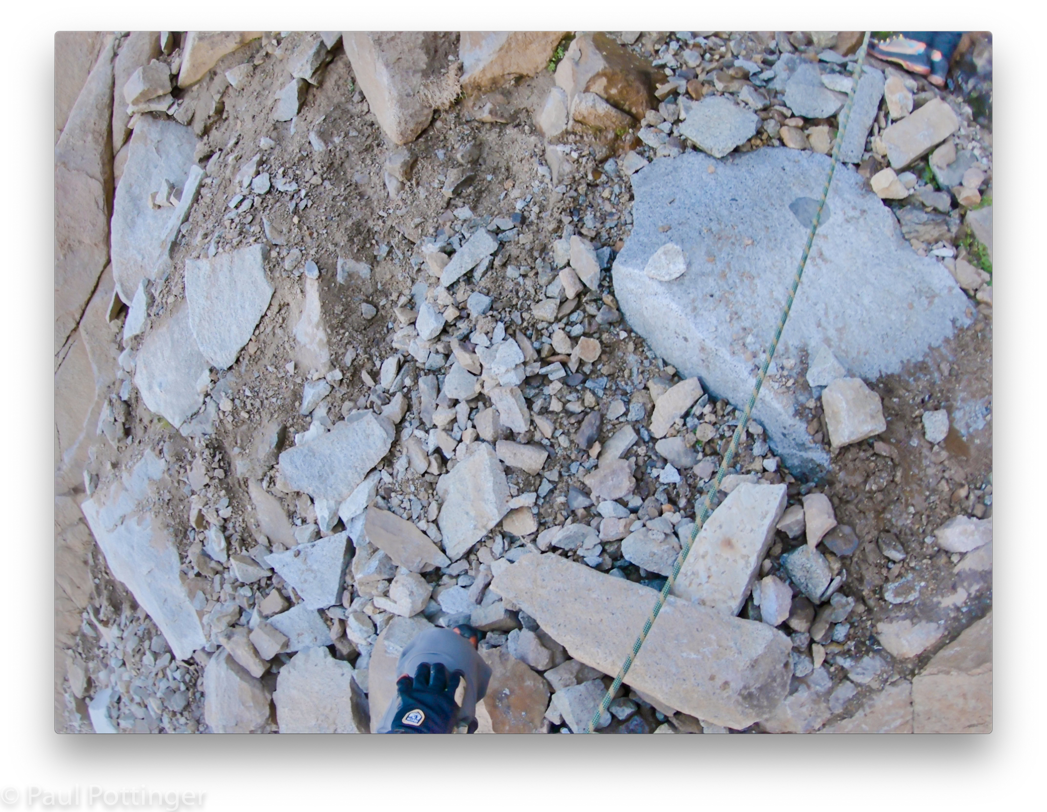
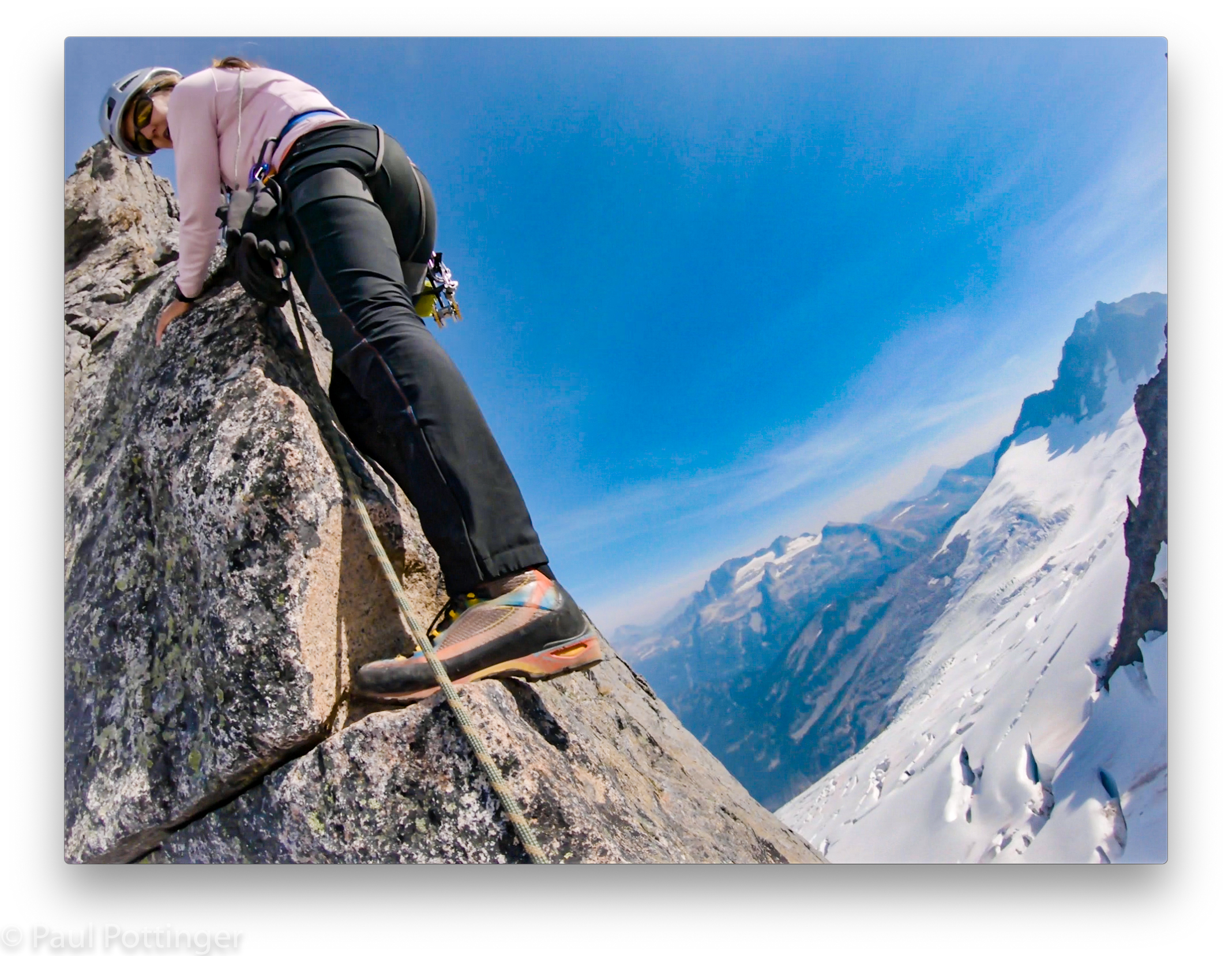
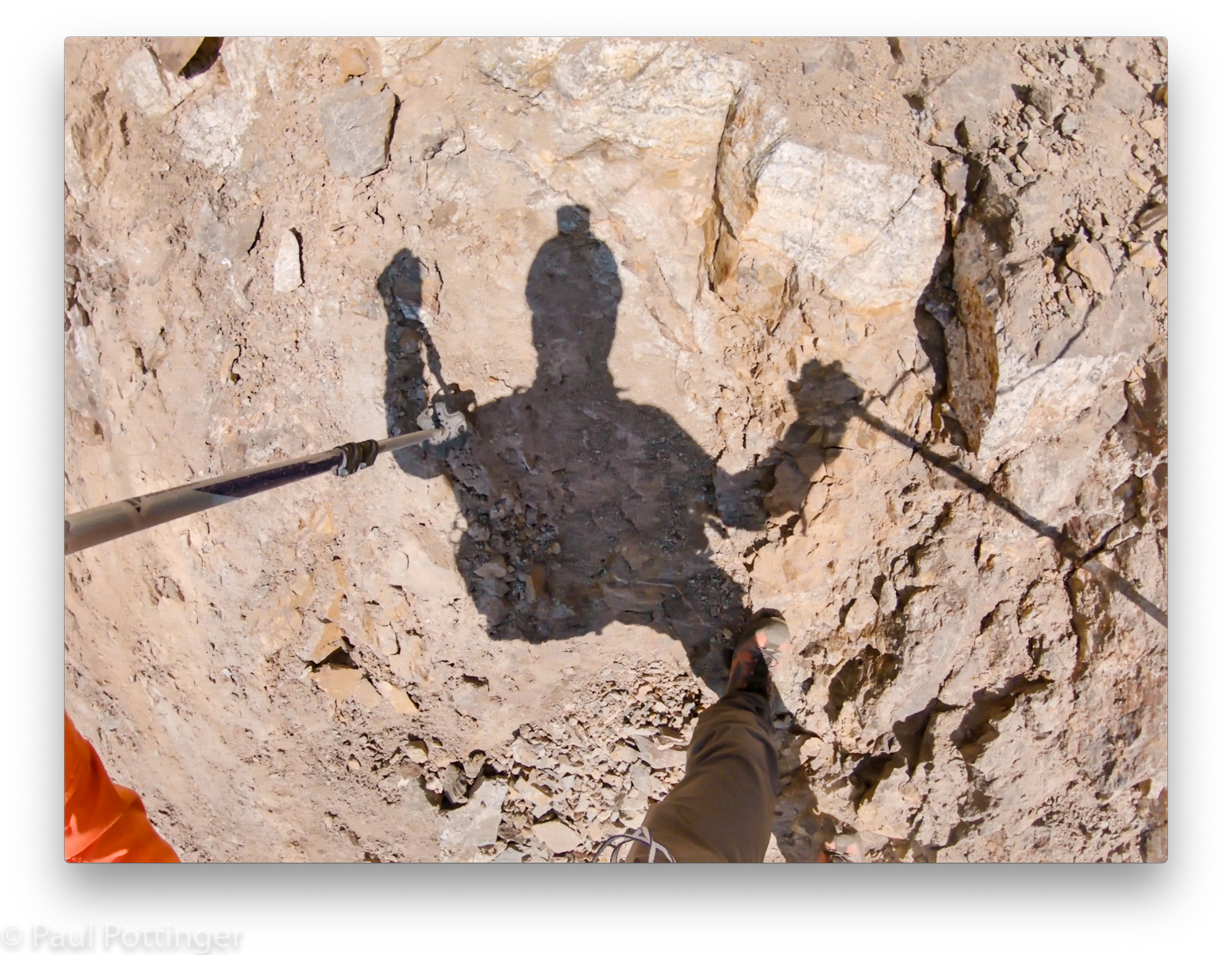
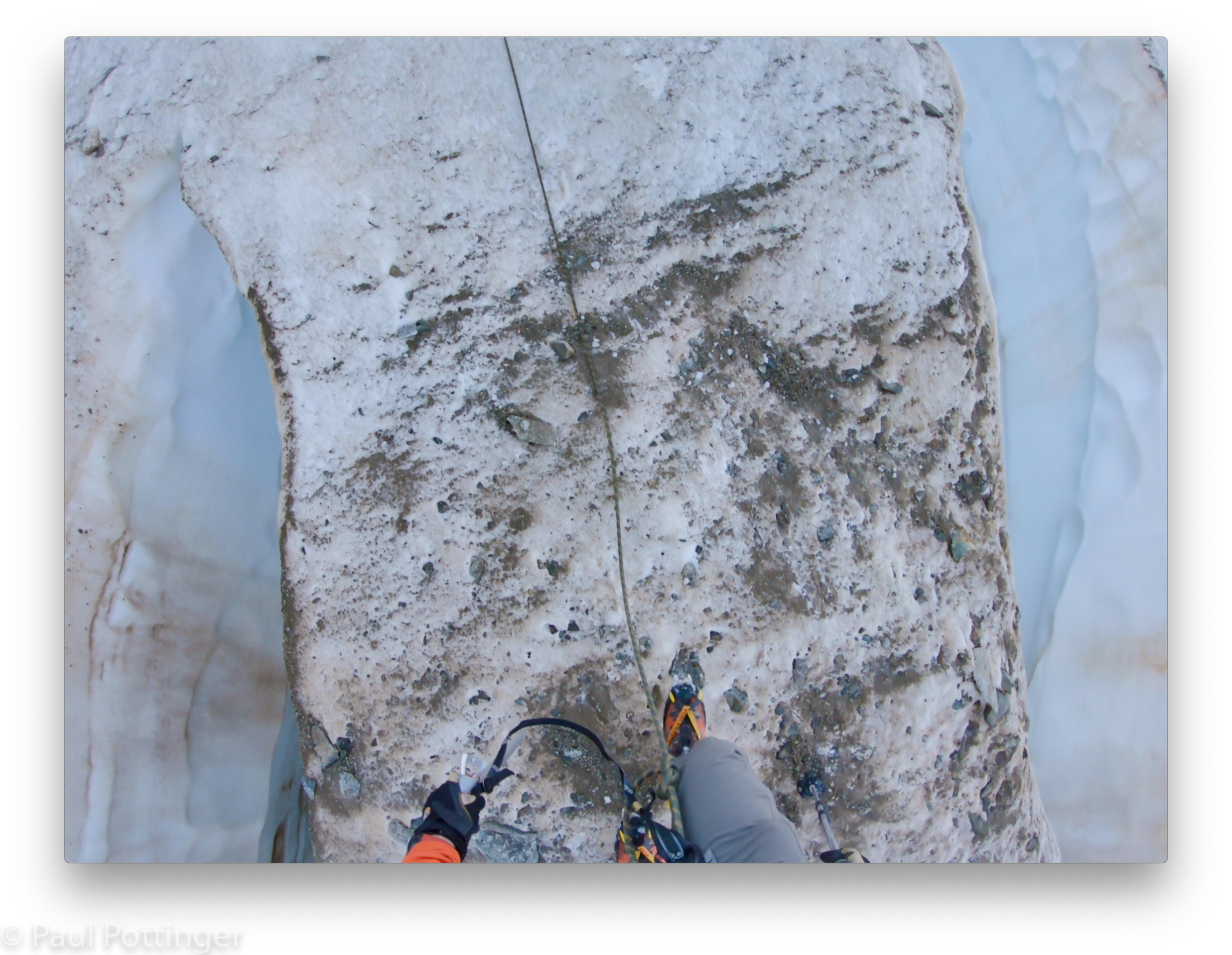
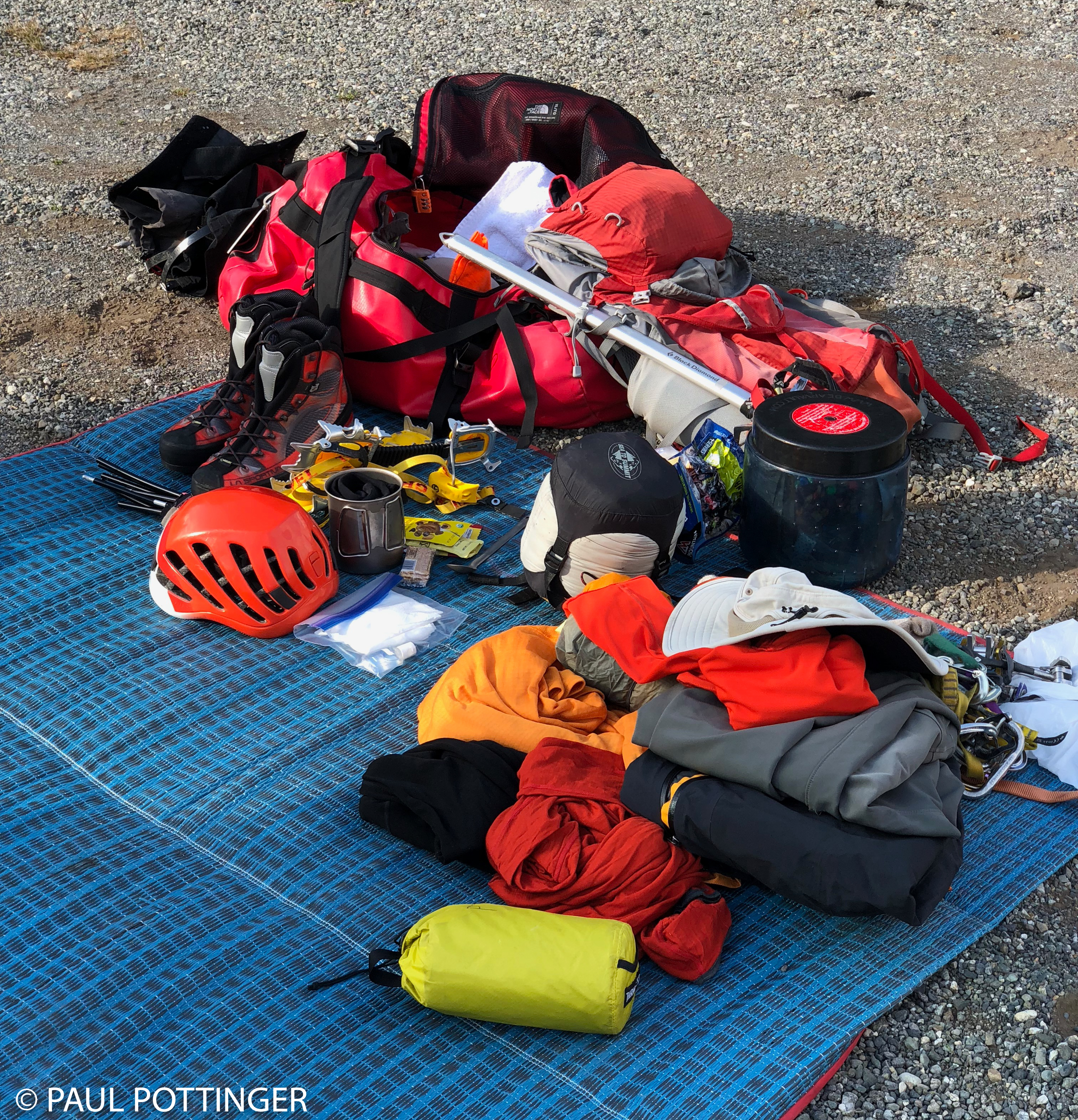
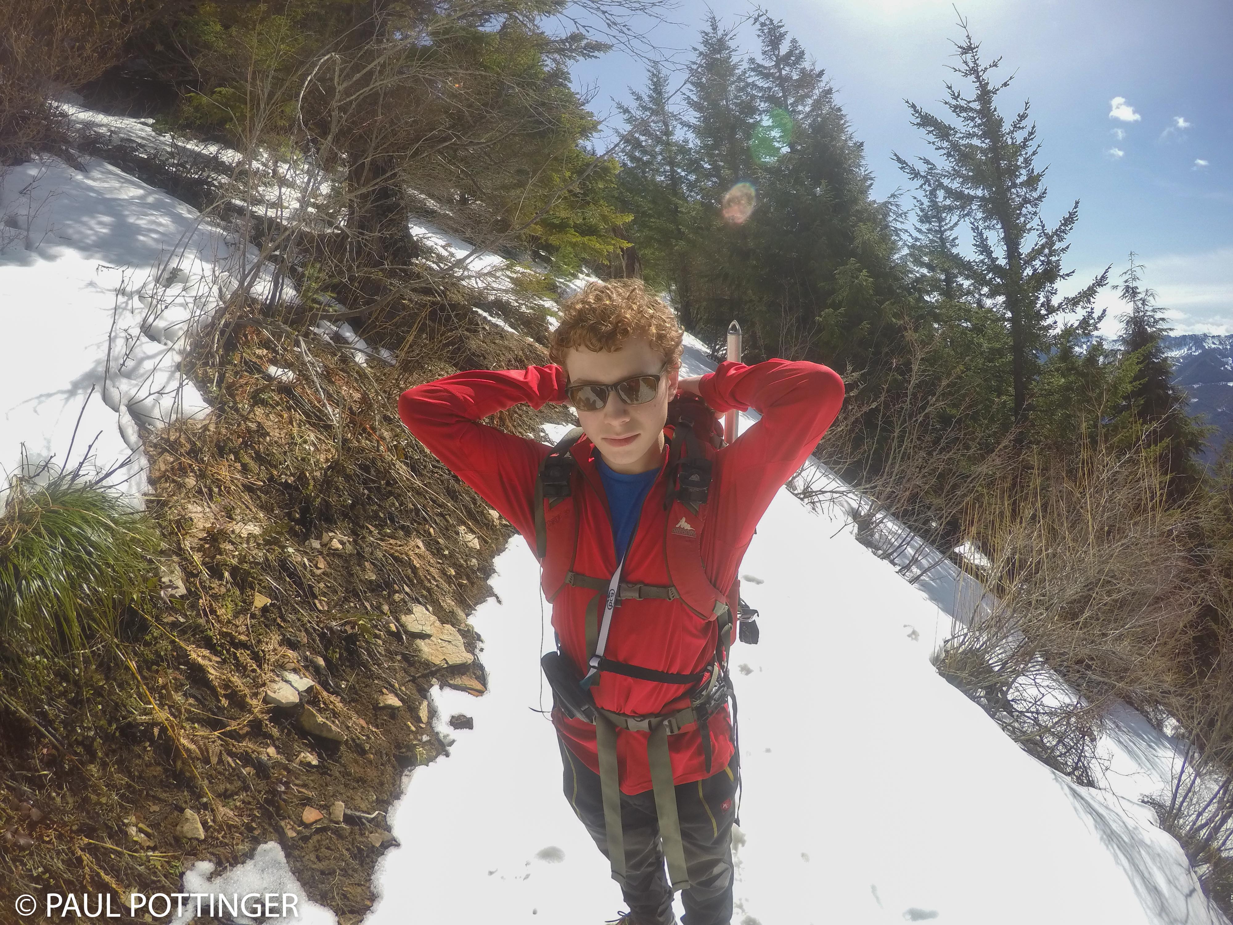
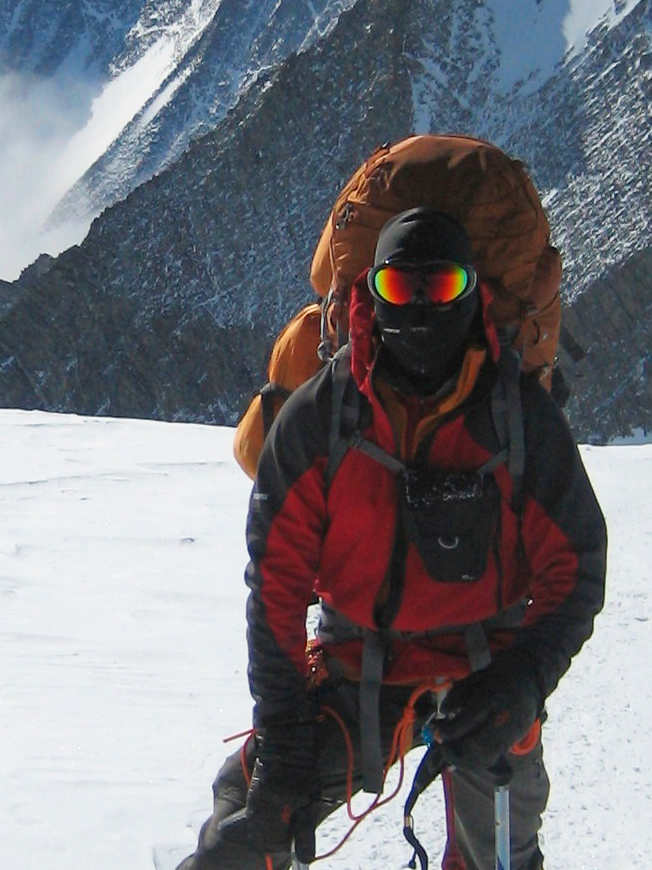
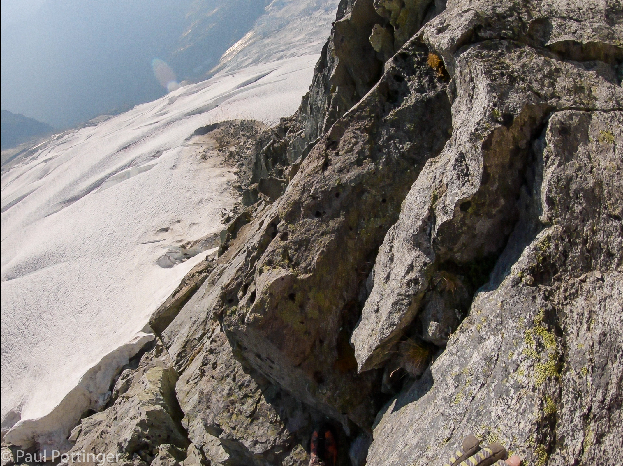
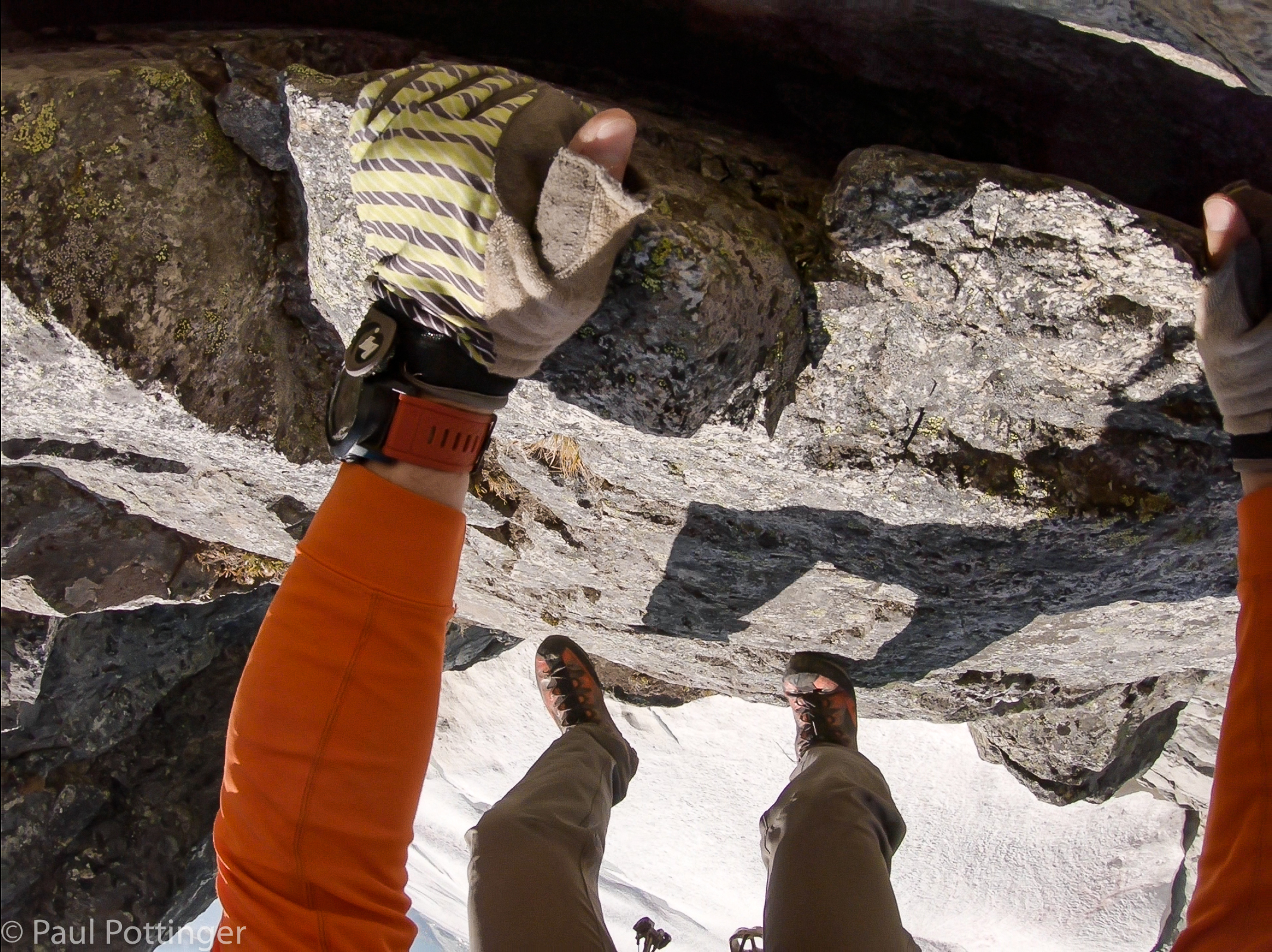
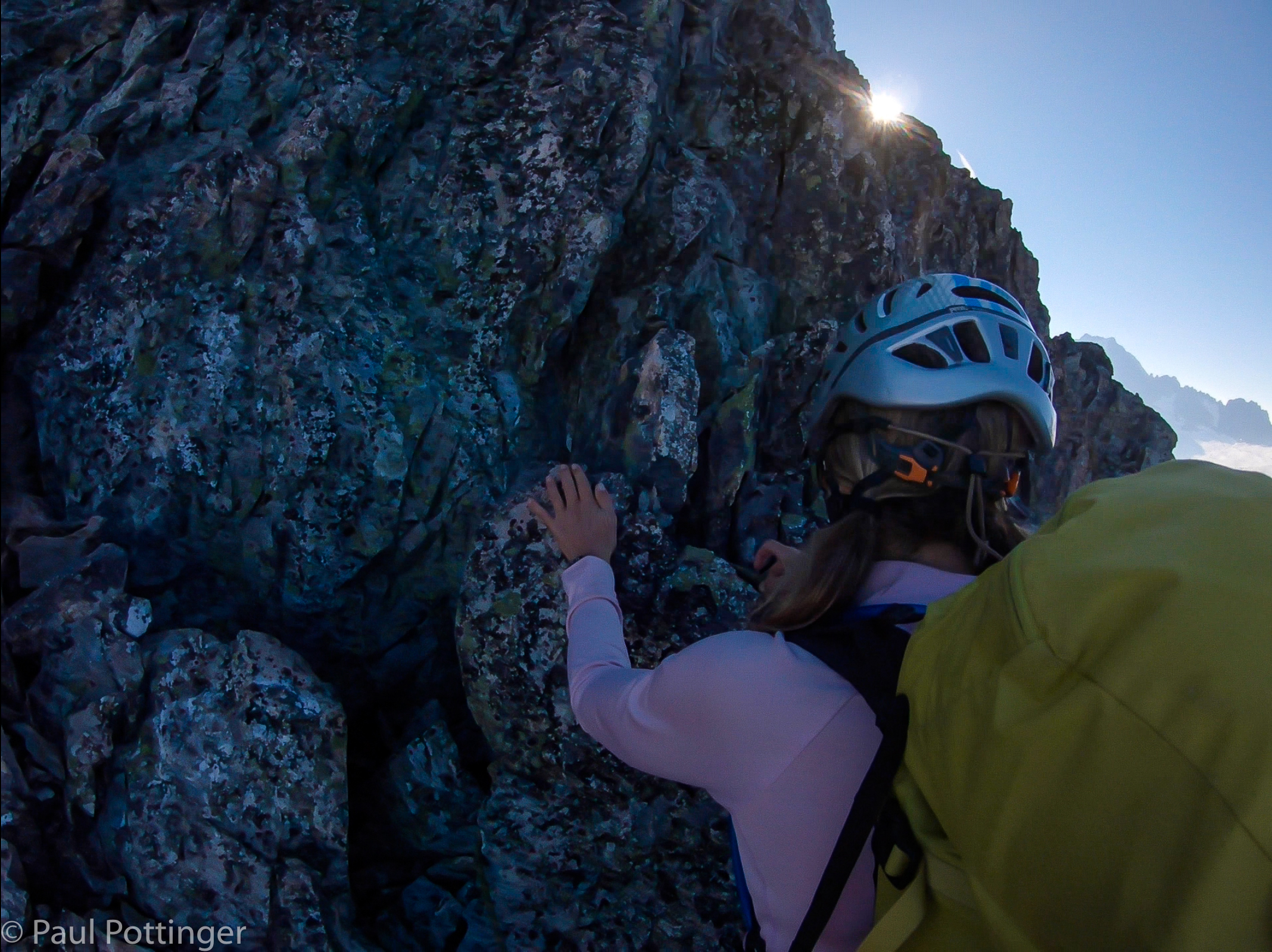
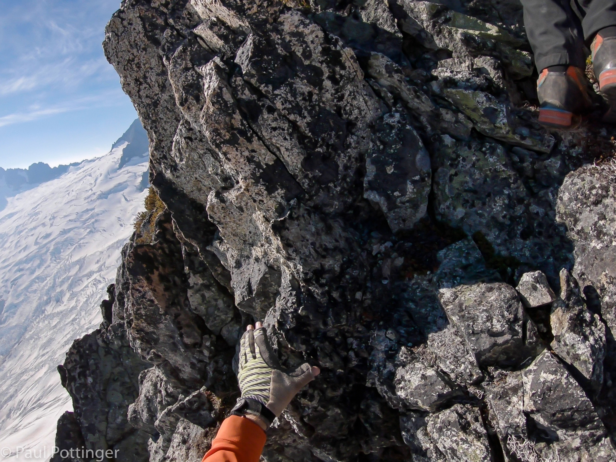
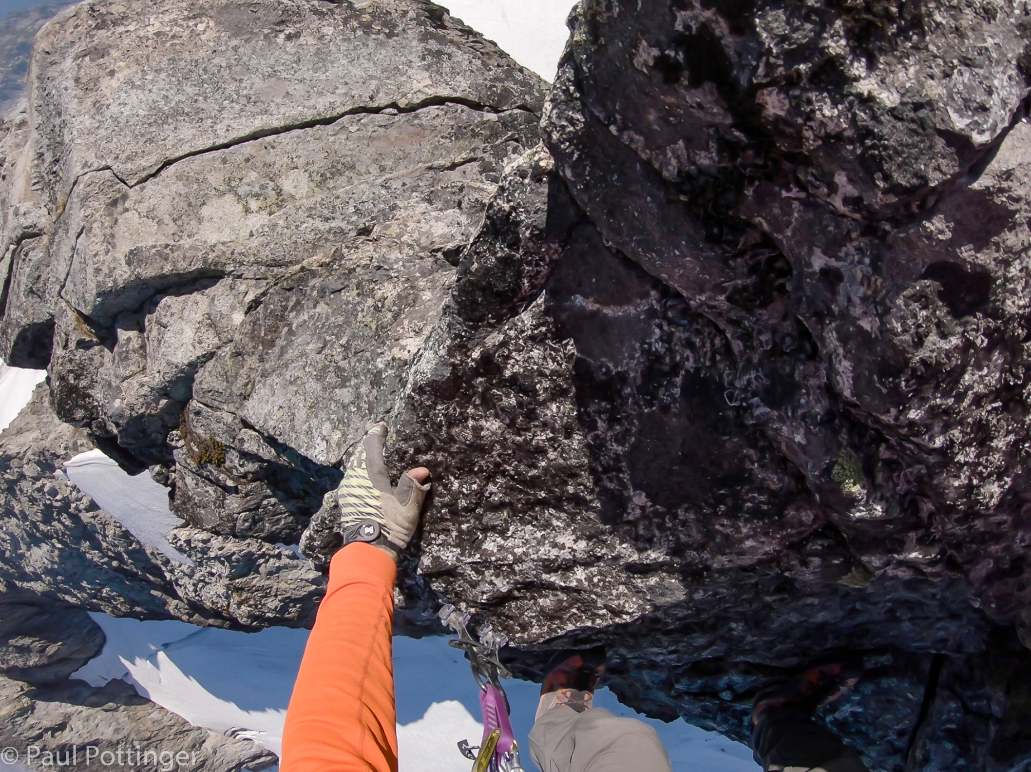
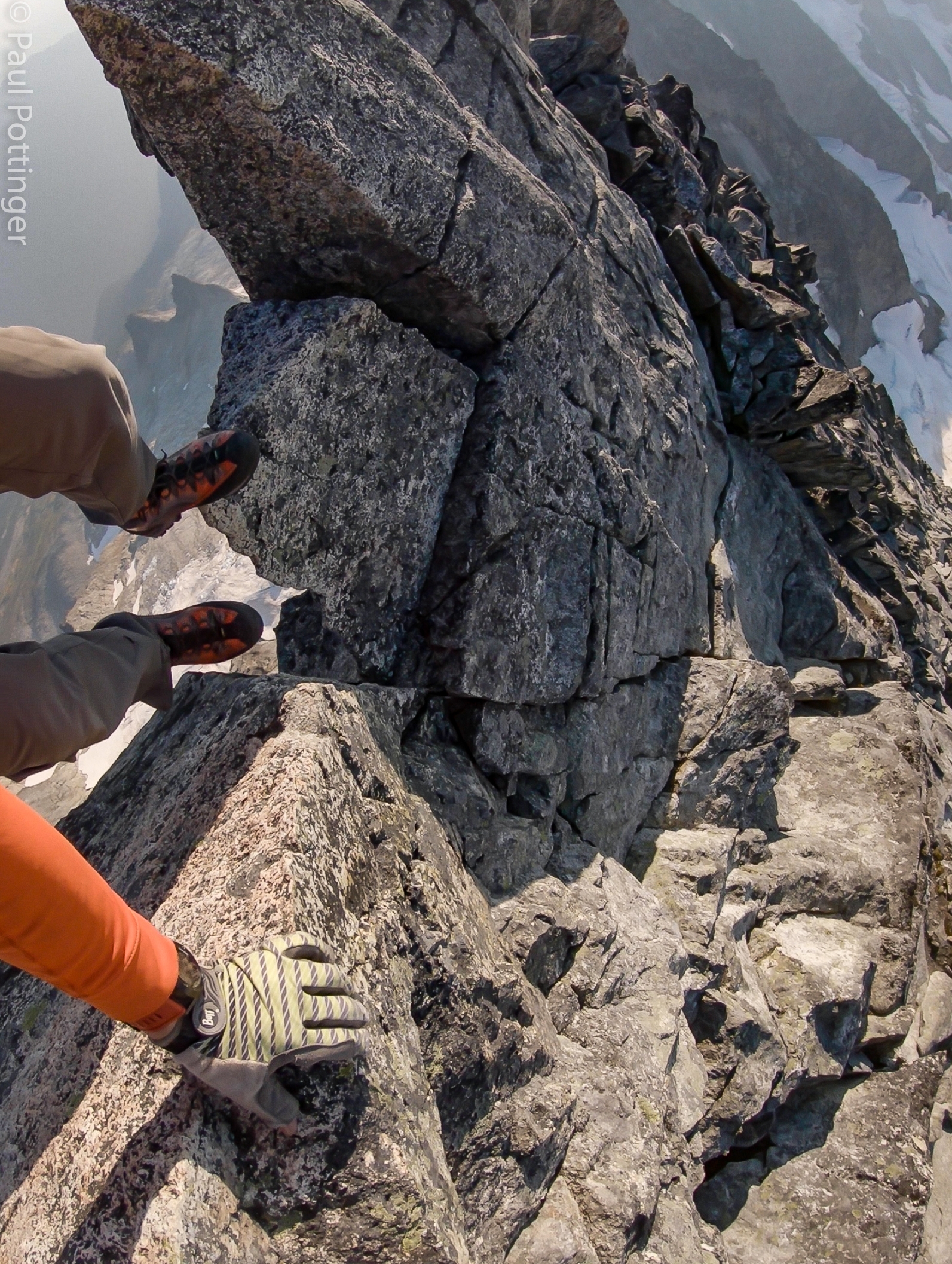
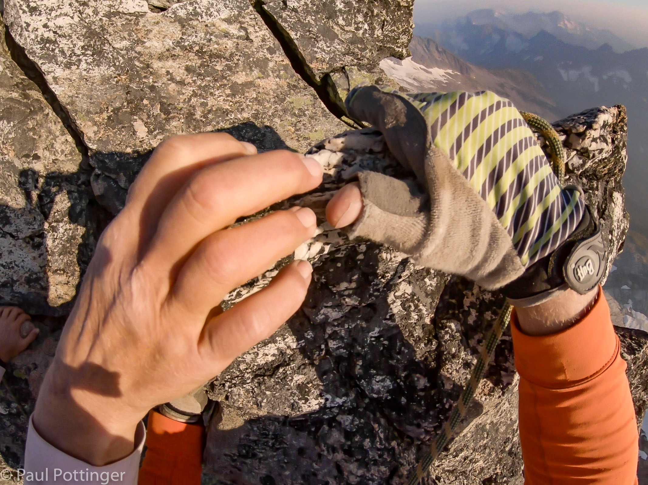
Objectively, none of these moves was very hard. But the overall experience was indeed challenging. Synchronizing our moves while simul-climbing was just part of the difficulty. We carried packs weighing about 40 pounds. The rock’s stability was unreliable, and every hold had to be tested. This route is rarely climbed, so nothing is worn smooth or tramped down. Feeling for small features in the rock through my mountaineering boots was totally different than in rock shoes. The sun blasted down, casting harsh glare and throwing deep shadows. Sunscreen tended to run into my eyes where it stung. Or, was that the wildfire smoke, which was also triggering post-nasal drip? And the exposure was spicy… hundreds of feet (or more) to the glaciers below. No, the moves were not that difficult, but the overall experience of alpine climbing was so far from climbing in a gym as to be almost unrecognizable. Don’t get me wrong: gym climbing is amazing, I love watching it and aspire to get better at it. About damn time it is becoming an Olympic sport. Still… this ain’t no climbing gym.

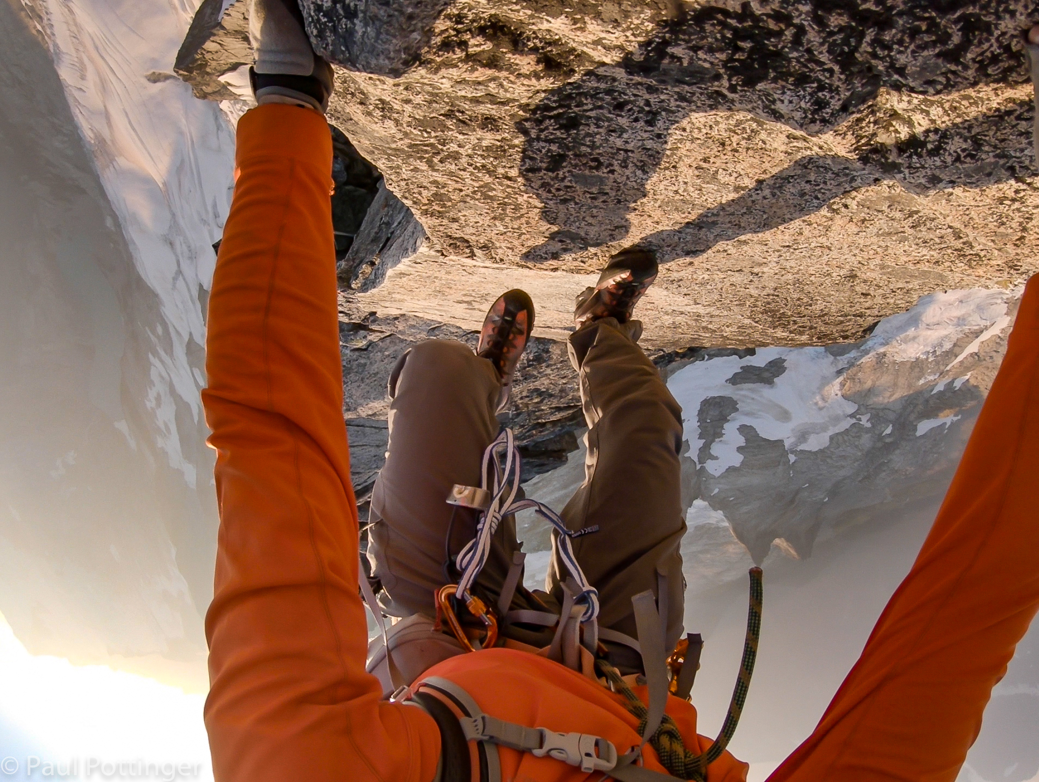
Mountaineering requires full focus, which suits me well. I am not innately gifted at multi-tasking or thinking strategically. I have to do that in my administrative roles, and I don’t mind it. But, the single-mindedness required in mountaineering calls to my true talents, in the same way as clinical medicine: Here is a problem that I can see, touch, smell… If I just put my mind and my whole heart into this, I can solve it. I will figure this out. Certainly, mountaineering is all about solving problems, great and small.  But, there’s more to it than than. At a break I looked past my boots dangling in the air, down to the turquoise-colored tarn far below. I reflected on why I had chosen this hobby: It’s beautiful… challenging… inspiring. And on Forbidden’s North Ridge, it is also hazardous. I climb in spite of the danger, not because of it. Right?

Maybe the hazard is part of the attraction. Twenty-One Pilots’ lyrics came to mind: “Death inspires me like a dog inspires a rabbit.”

Route descends a bit here.
Almost out of shadow… will be in sun for most of the day.
Draping the rope over a horn, our usual manner of protection.
Simulwalking in the sunshine.
Ridge is wide and gentle here.
Dropping briefly towards the glacier.
Doozy of an exposure below the gap.
Ann descends towards the gap. Justin has us protected on a horn.
Occasionally I can help her get a foot into position.
We are in balance here, and Justin can safely follow.
Truly, perfect conditions.
Ridge walking.
Justin takes the lead again as we walk along the last bits of green on the ridge.
Taking a breather for a moment before we start up this wall.
Starting up the green wall.
A combination of low angle and high angle here, especially as we near the top of this tower.
Check out this sweet bivvy site we found atop the tower! Room for one….
Ann flicks the rope over her head as we follow Justin to a break spot in the shadows below.
Short break in the shade.
Looking across to El Dorado in the distance.
Pondering the route ahead.
Justin leads from the break.
Passing the first snow patch.
Looking back at the first snowfield.
I wondered if those mare’s tails portend precip. Turns out, they did not.
Justin prepares to lead up the next tower.
The next tower face is steep.
A burly Merle anchor. In many cases, because our stance was solid and we were moving quickly on relatively low angle terrain, we could just clip the rope through the locker without tying a clove hitch.
I have Justin on belay as he leads this pitch.
We gain altitude quickly on this one.
Ann gets ready for some steeper stuff above.
Getting steeper here.
The ridge is about one hand’s width here. Perfect for grabbin’.
Some low 5th class.
Narrow, but with burly standing positions.
Just keep up with Ann….
Cresting a knob.
Yep, we need to step to the right.
Puuuuuurfect.
The cams I clean tend to catch rock edges during the climb. #aggravating
Wrapping a horn.
Close quarters on the ridge.
Here I come, Annie!
These blocks look loose, but most felt steady underfoot.
Approaching another crest.
Lunging for a block.
Dropping to a small saddle.
Ann cleans up like a pro.
We pose for a photo by Justin.
There we are.
Looking at Forbidden’s East Ridge. Glacier Peak in the far distance.
Selfie near a tower crest.
Justin leads a pretty narrow section of ridge.
Justin snaps us passing another tower tip.
Yeah, there we are.
Looking down at the Boston Glacier.
The ridge narrows….
Justin protects us from a stance atop a tower.
This is the last obstacle between us and the second snowfield.

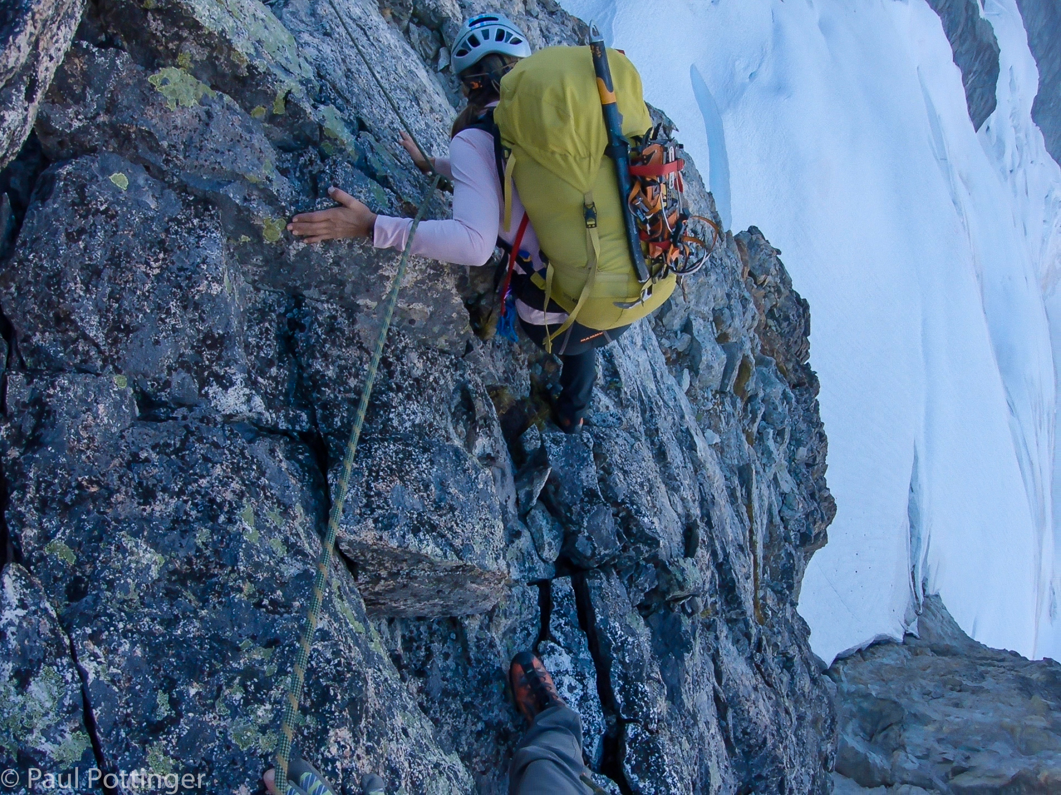
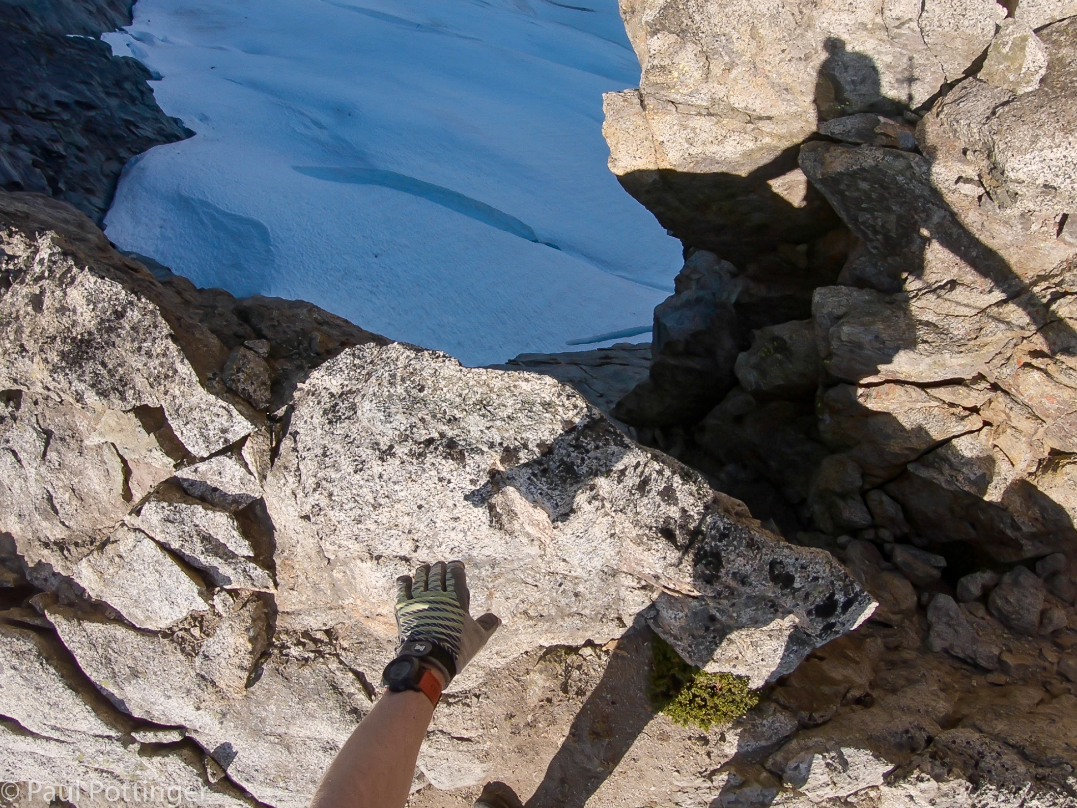
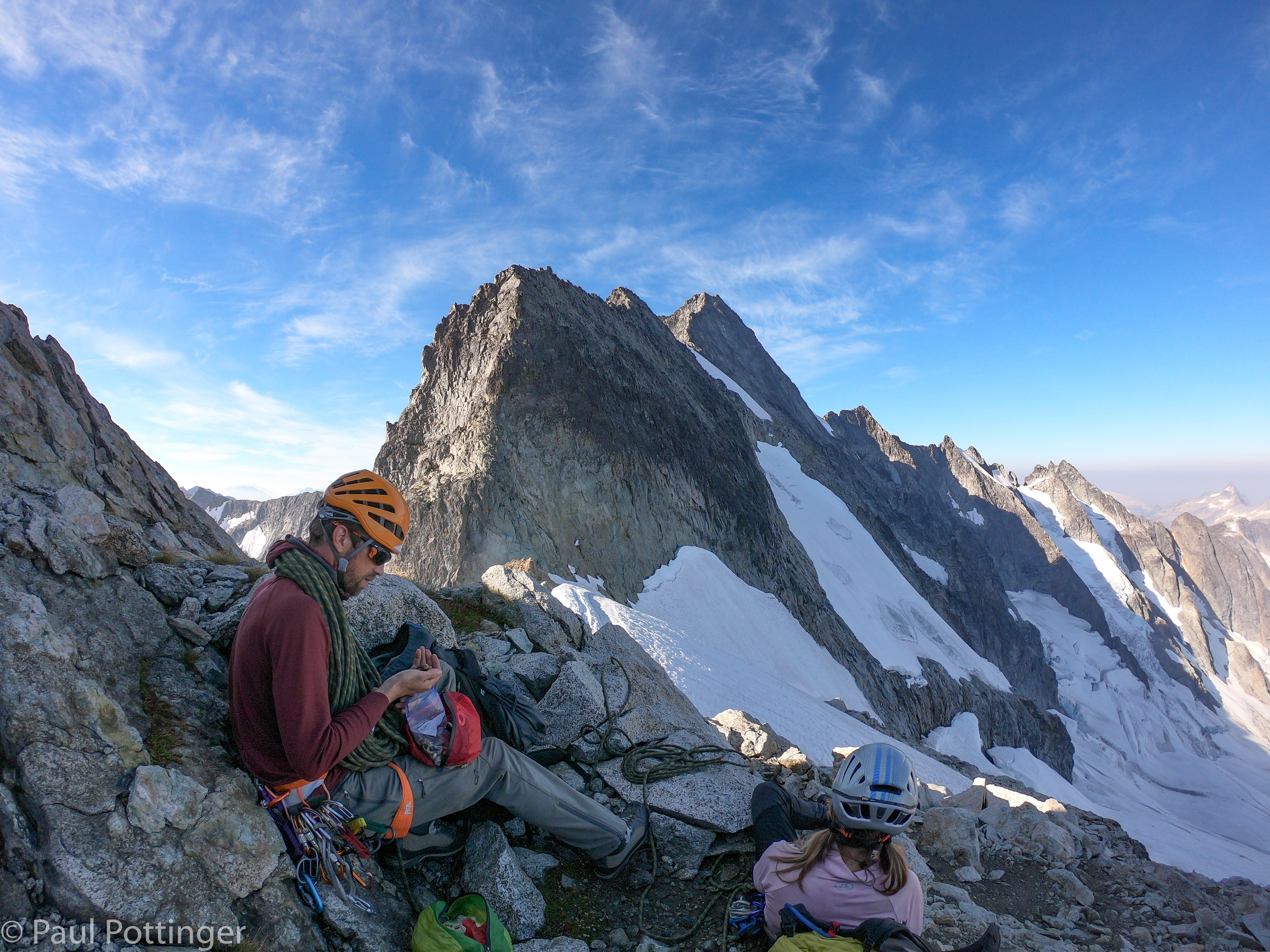
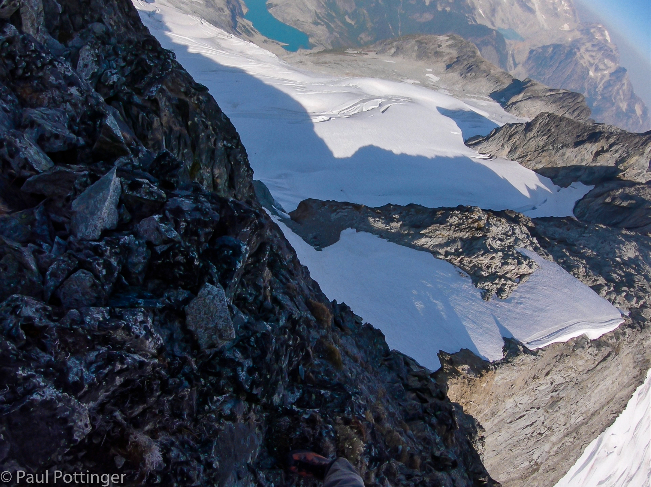
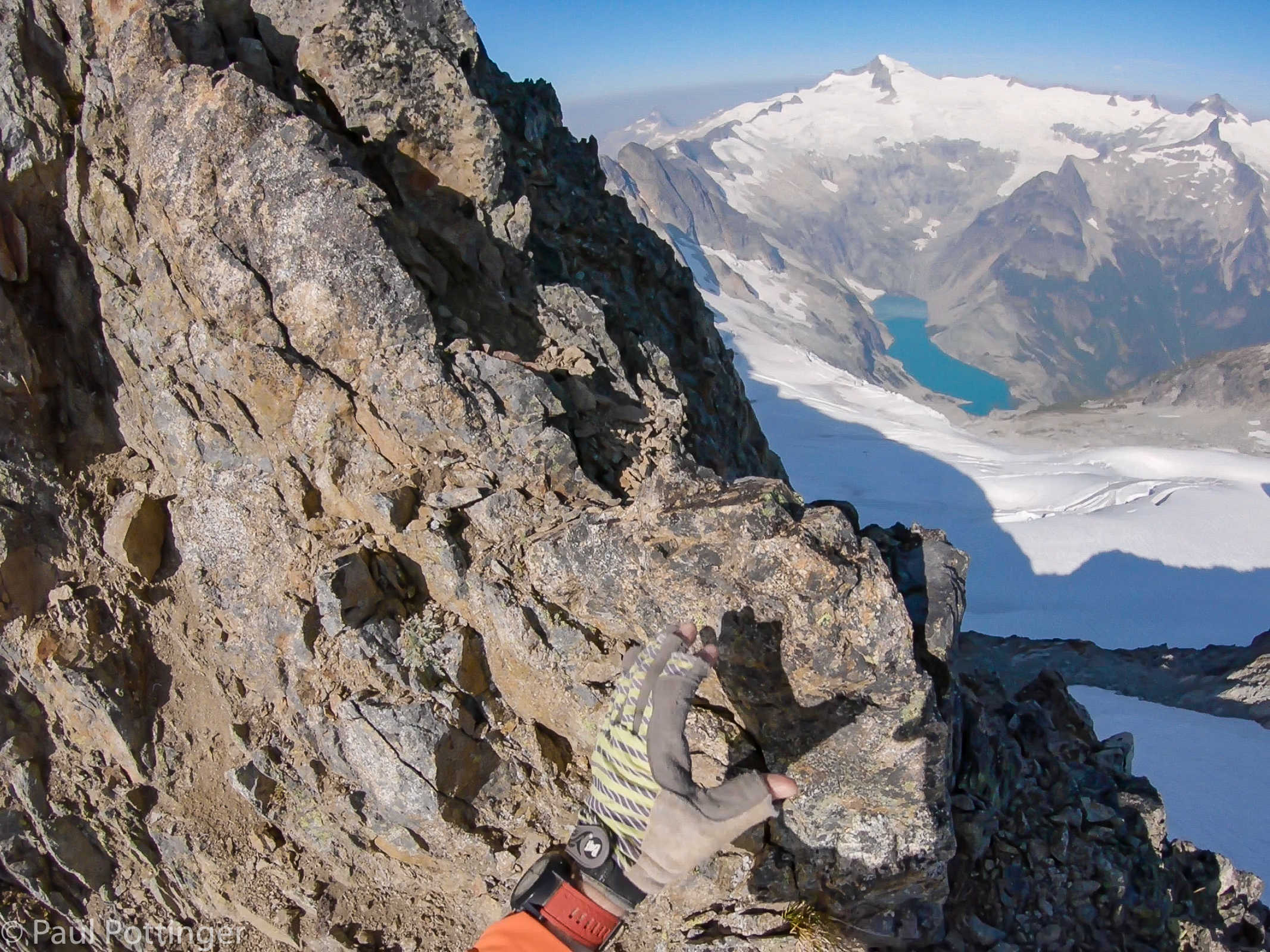
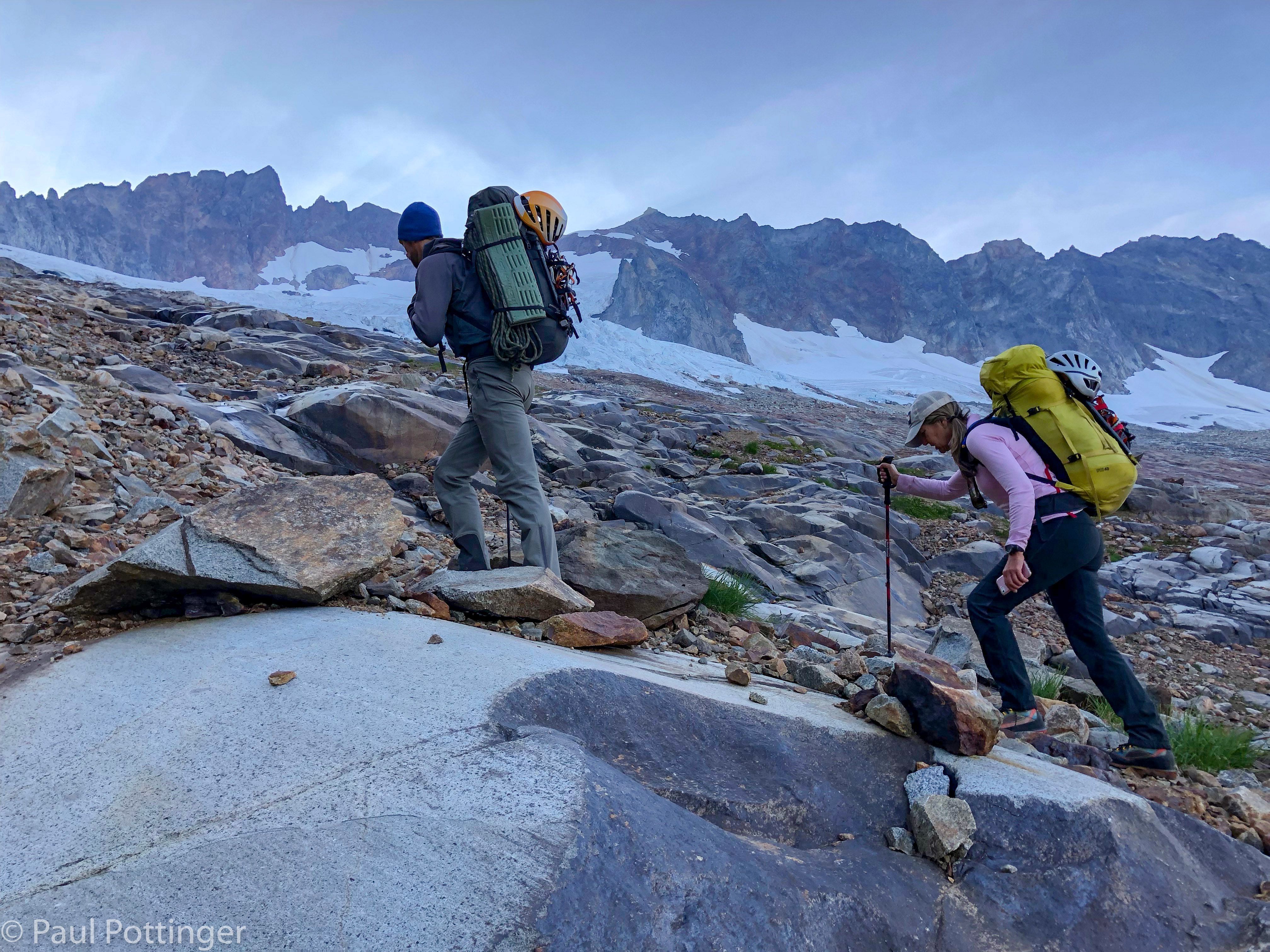
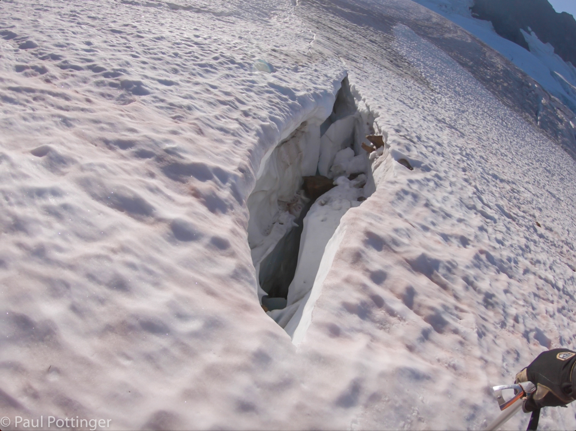
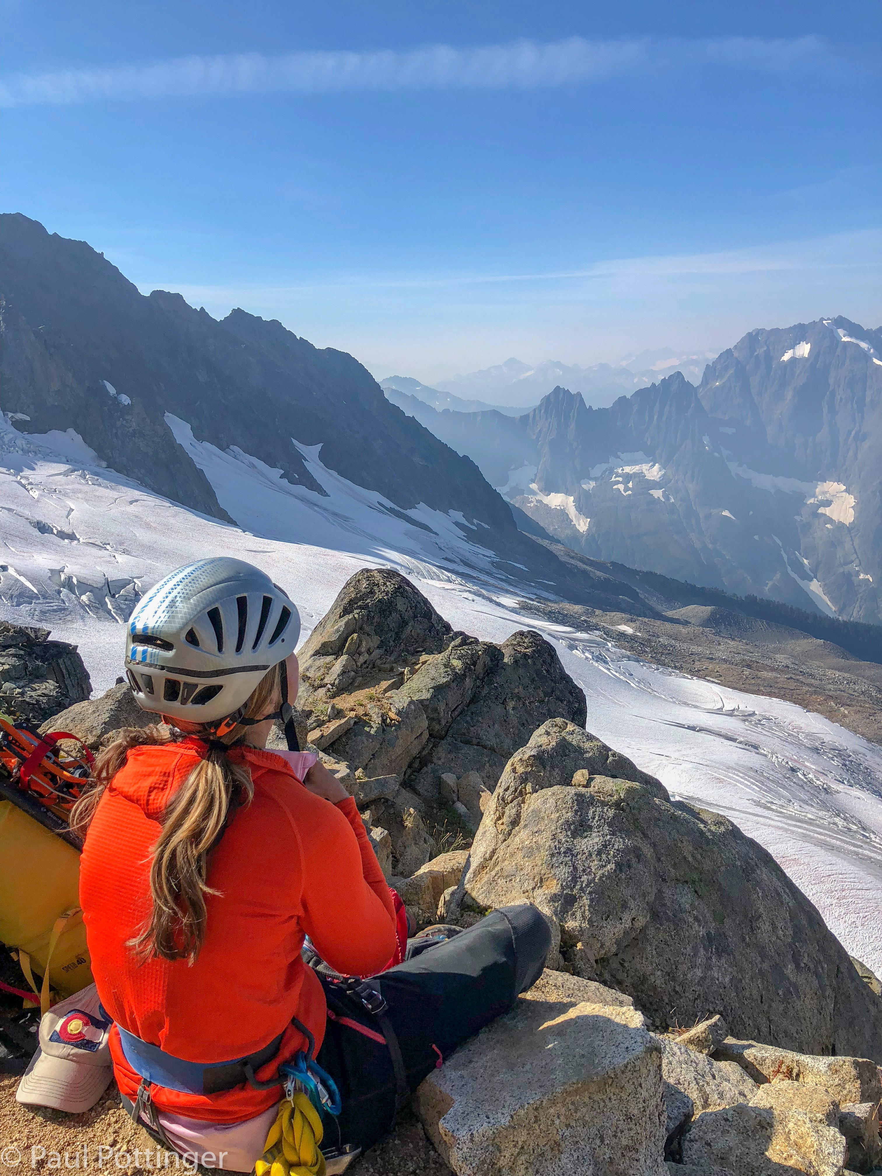
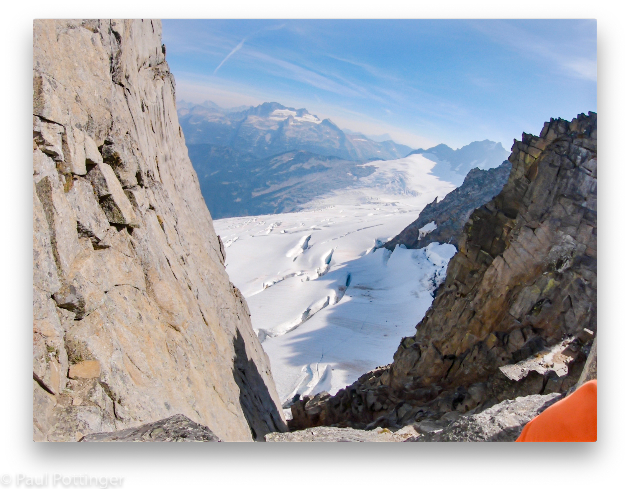
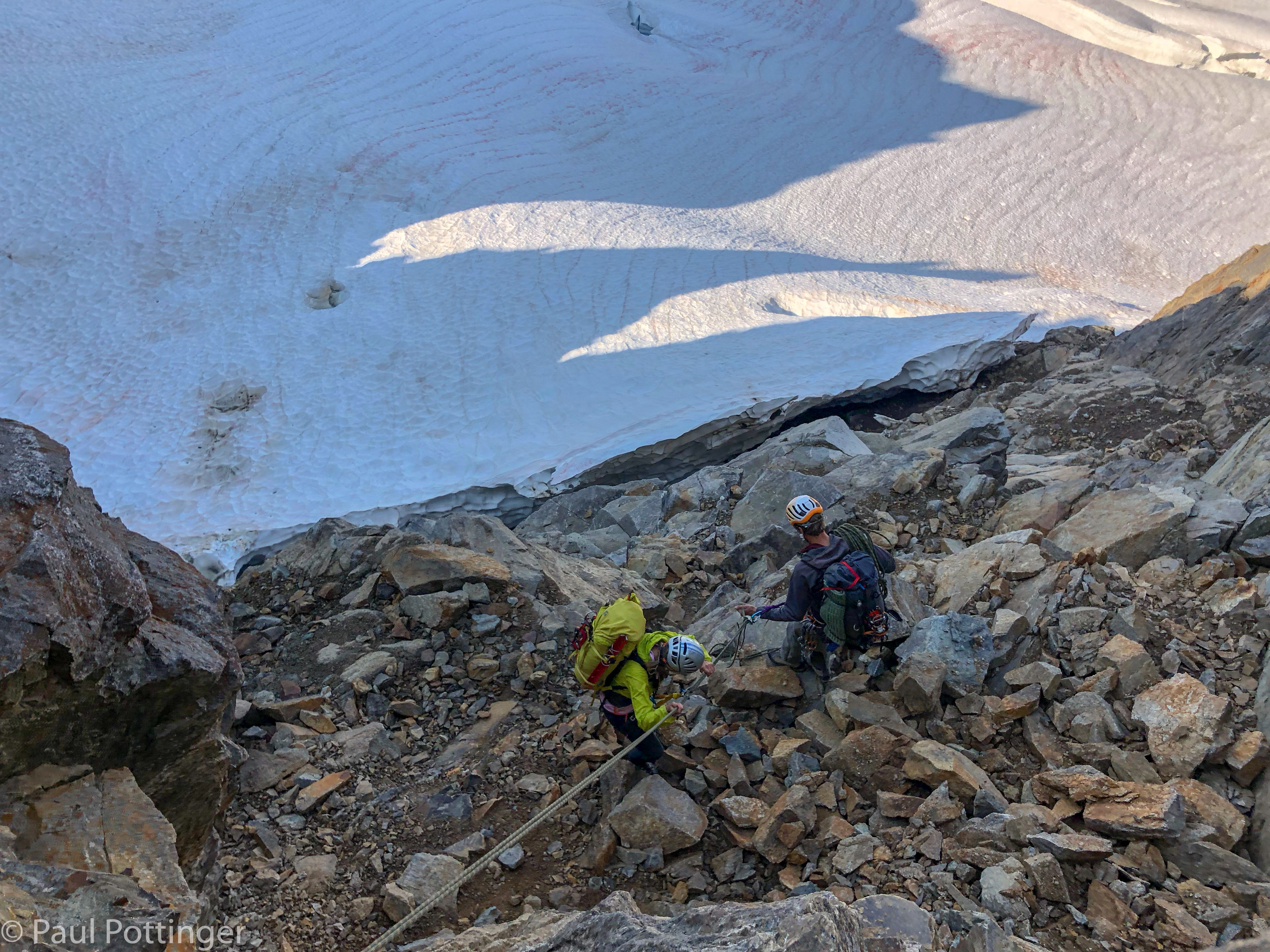
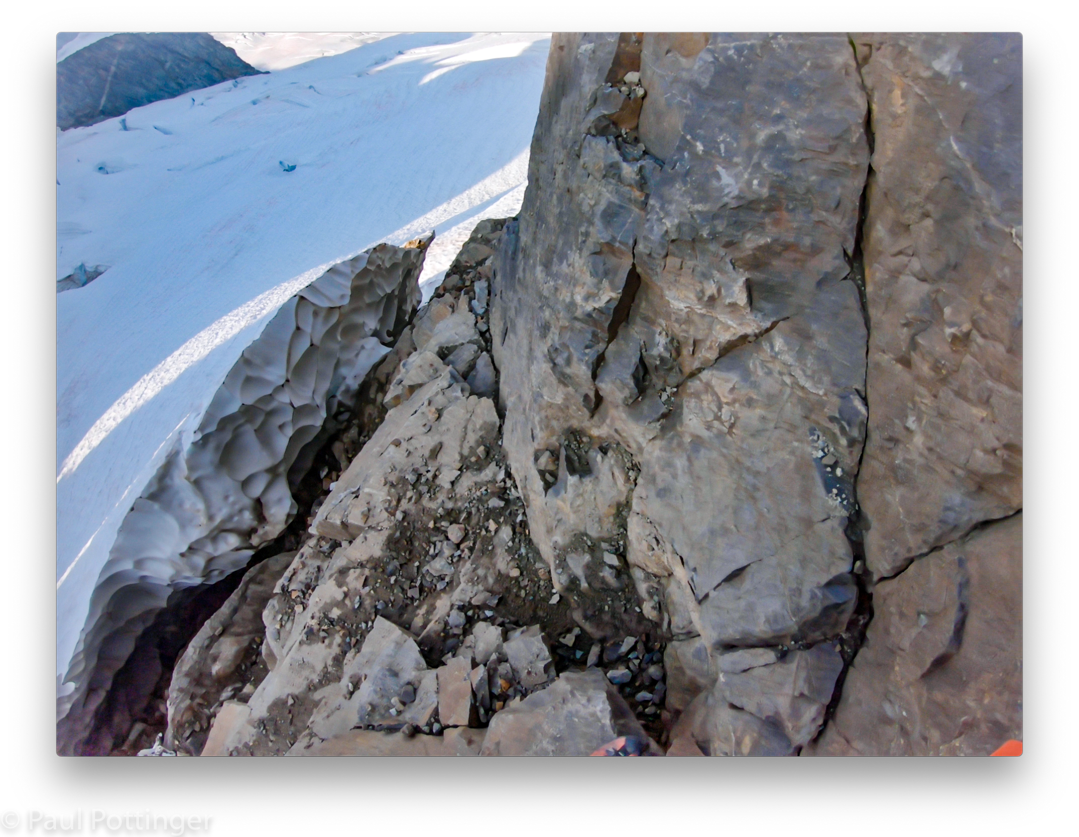
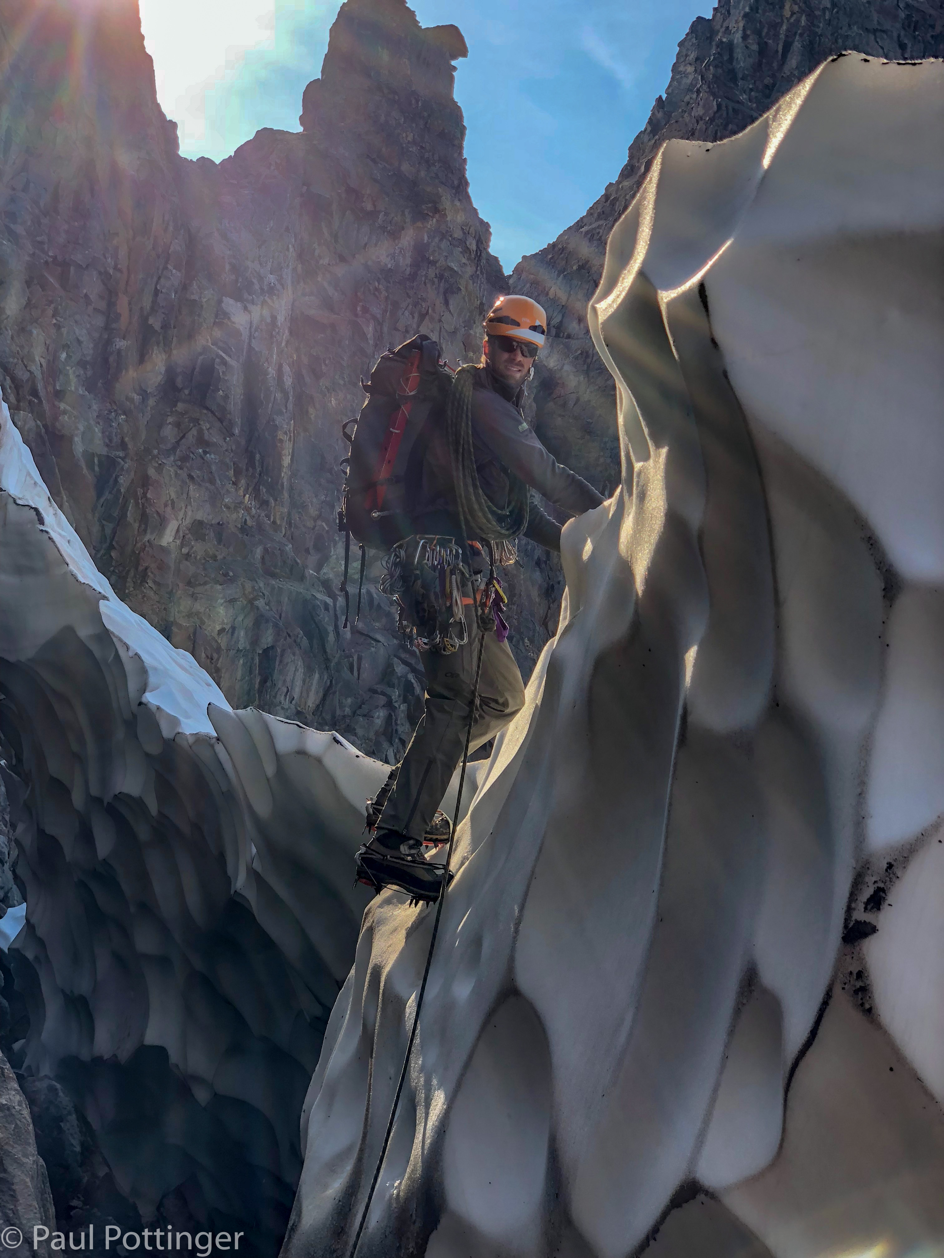
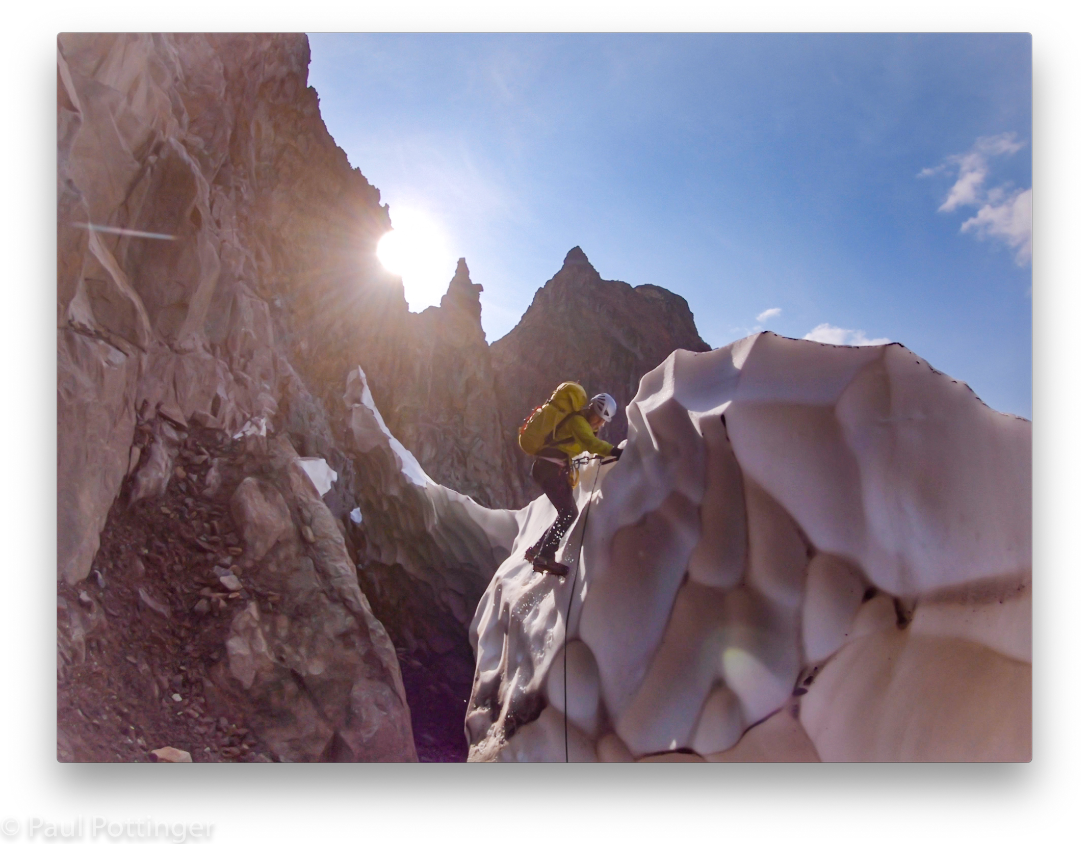
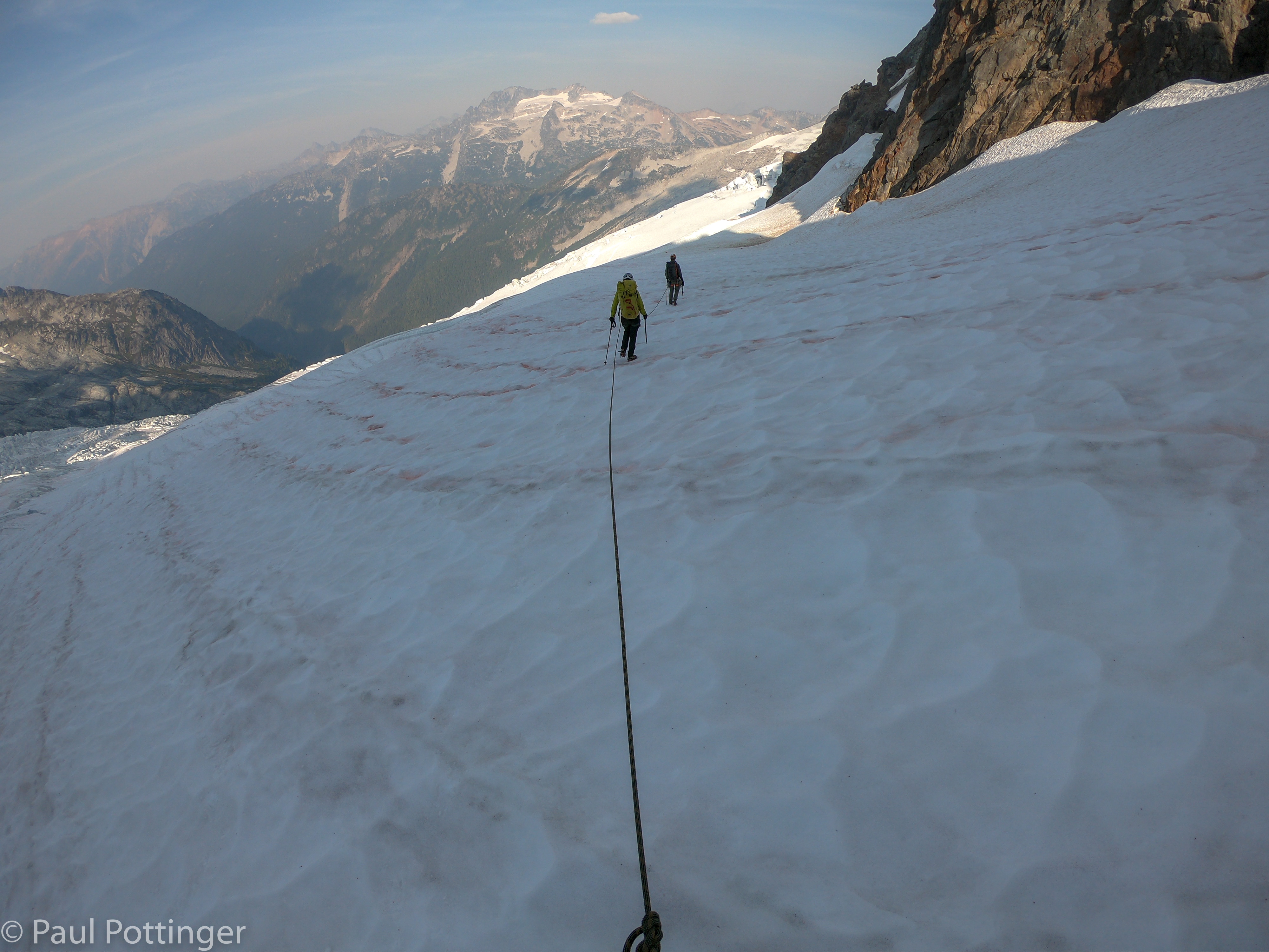
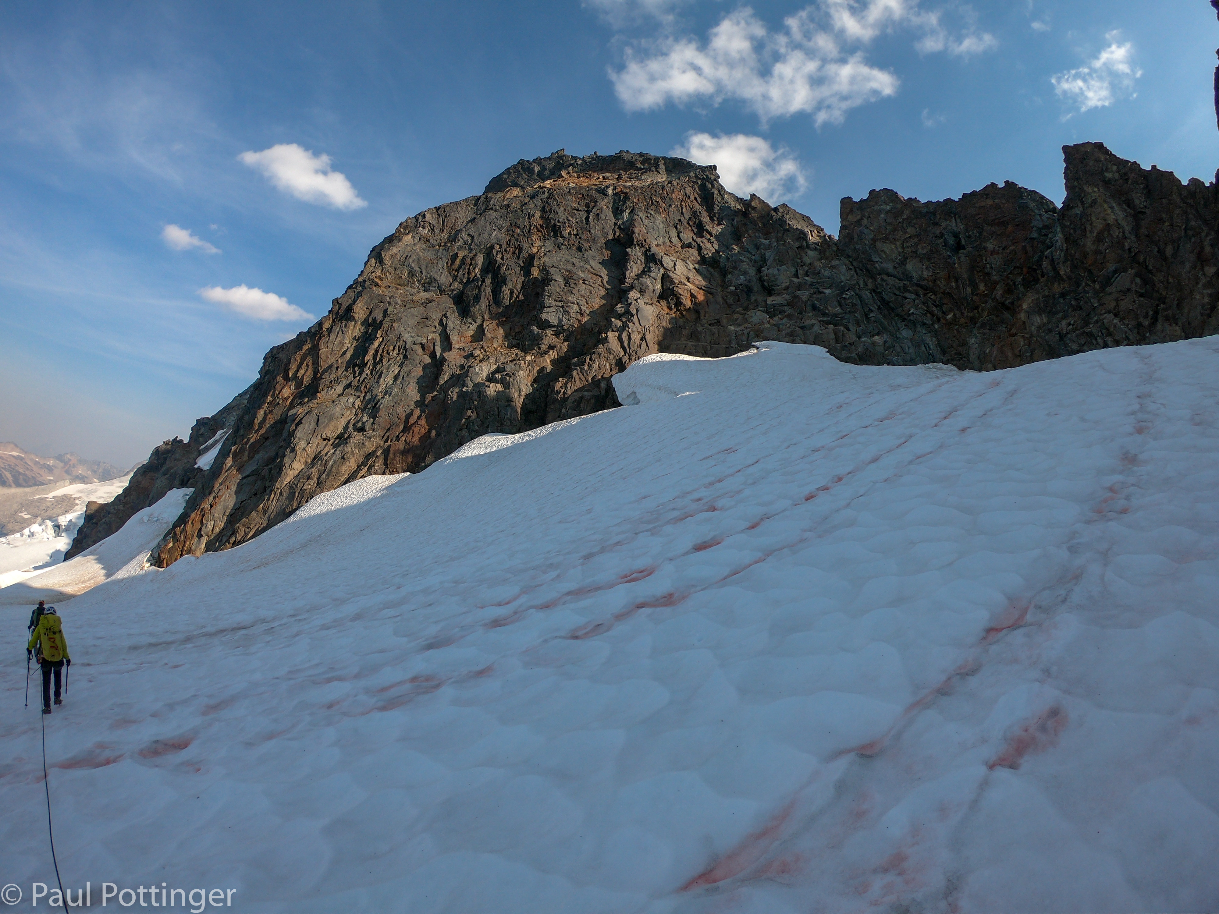
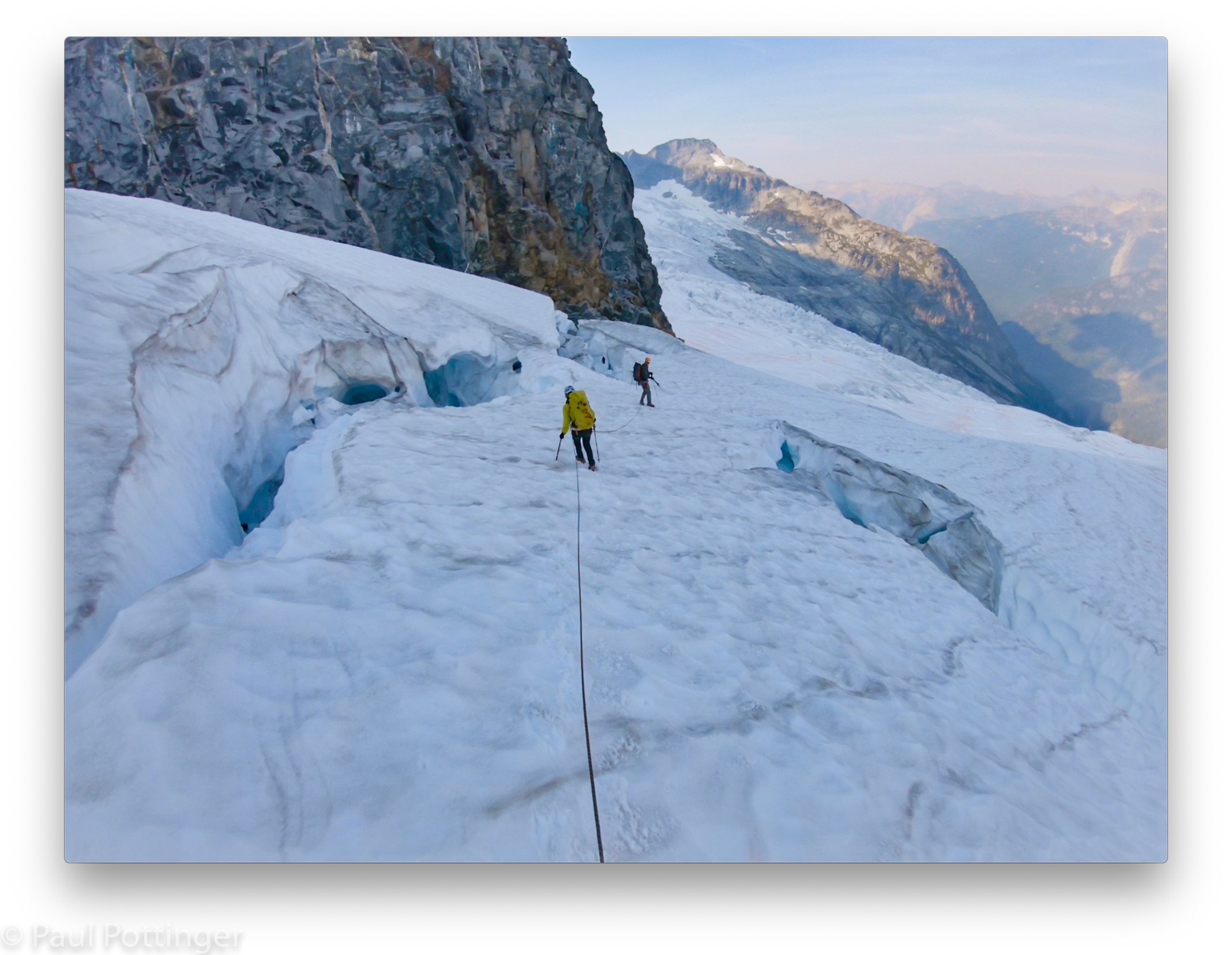
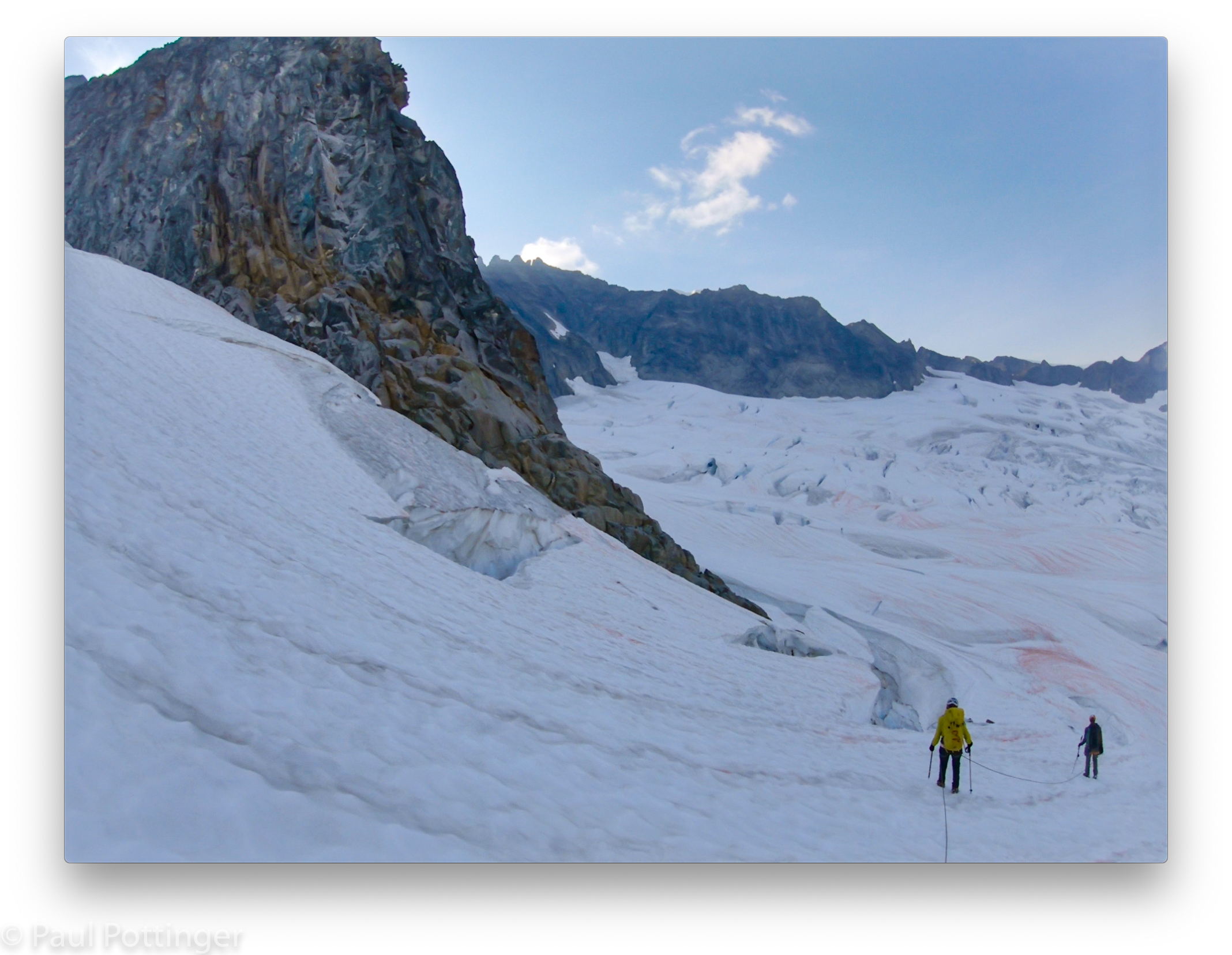
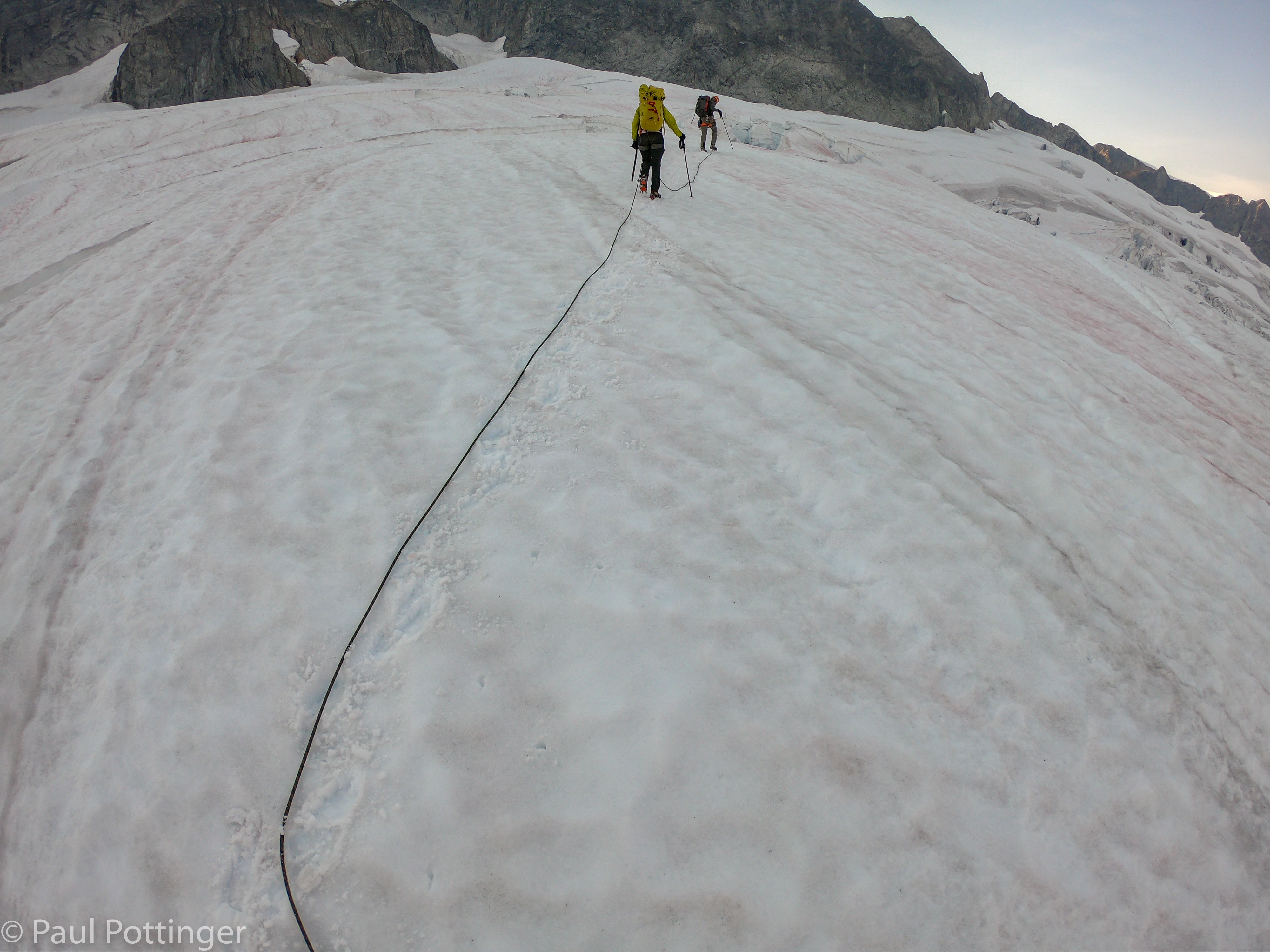
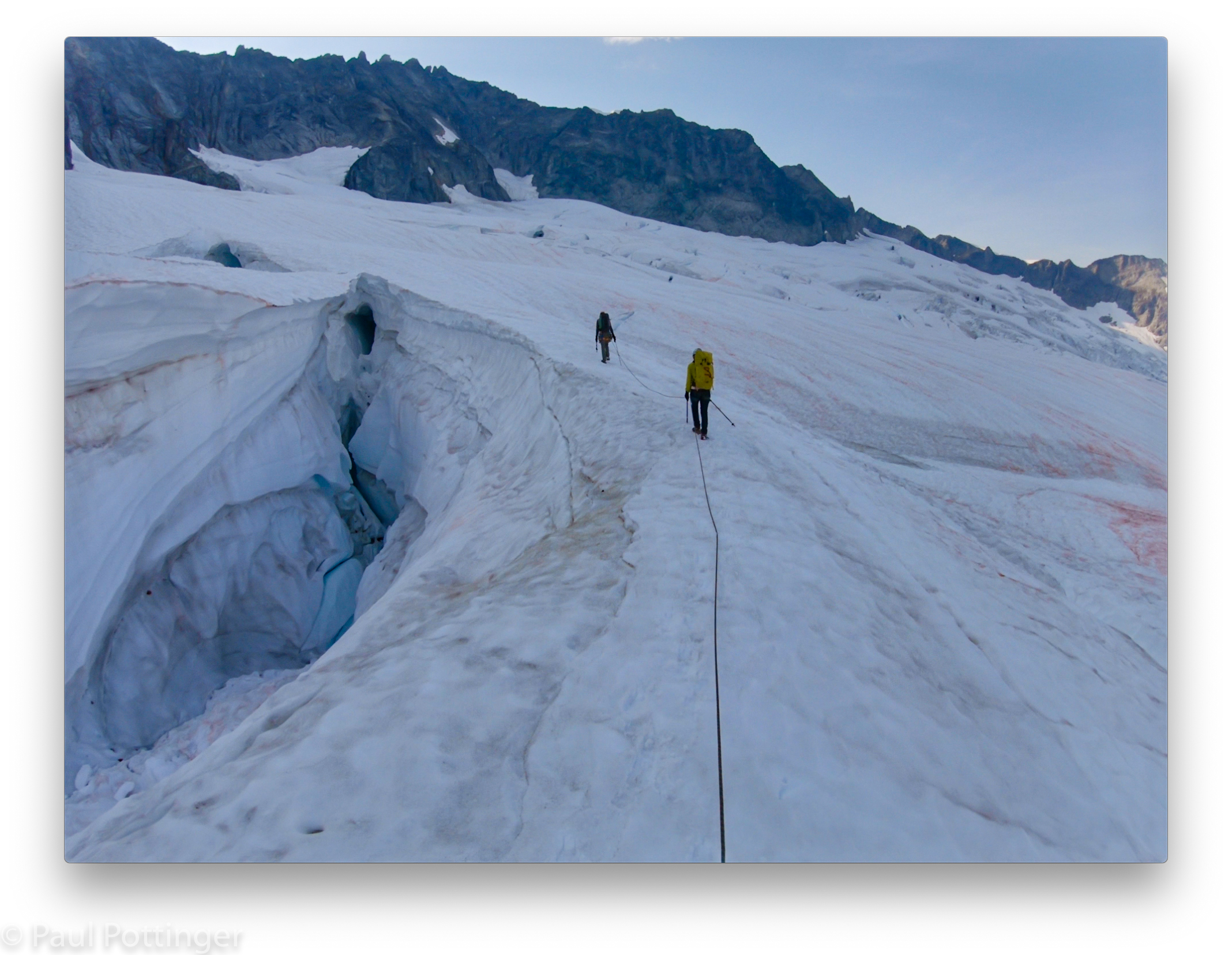
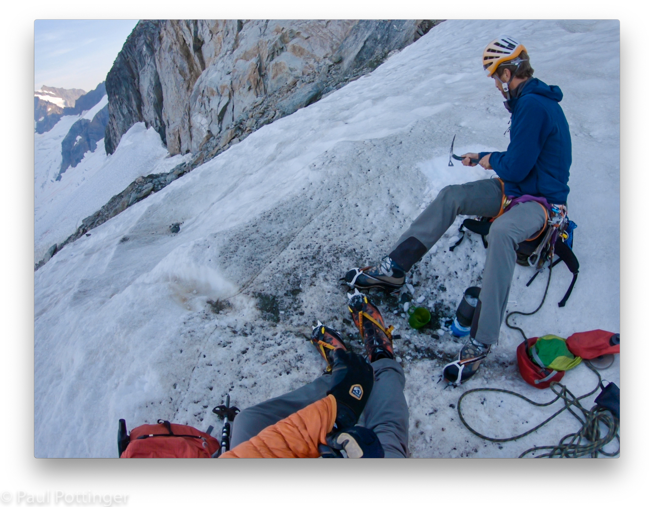
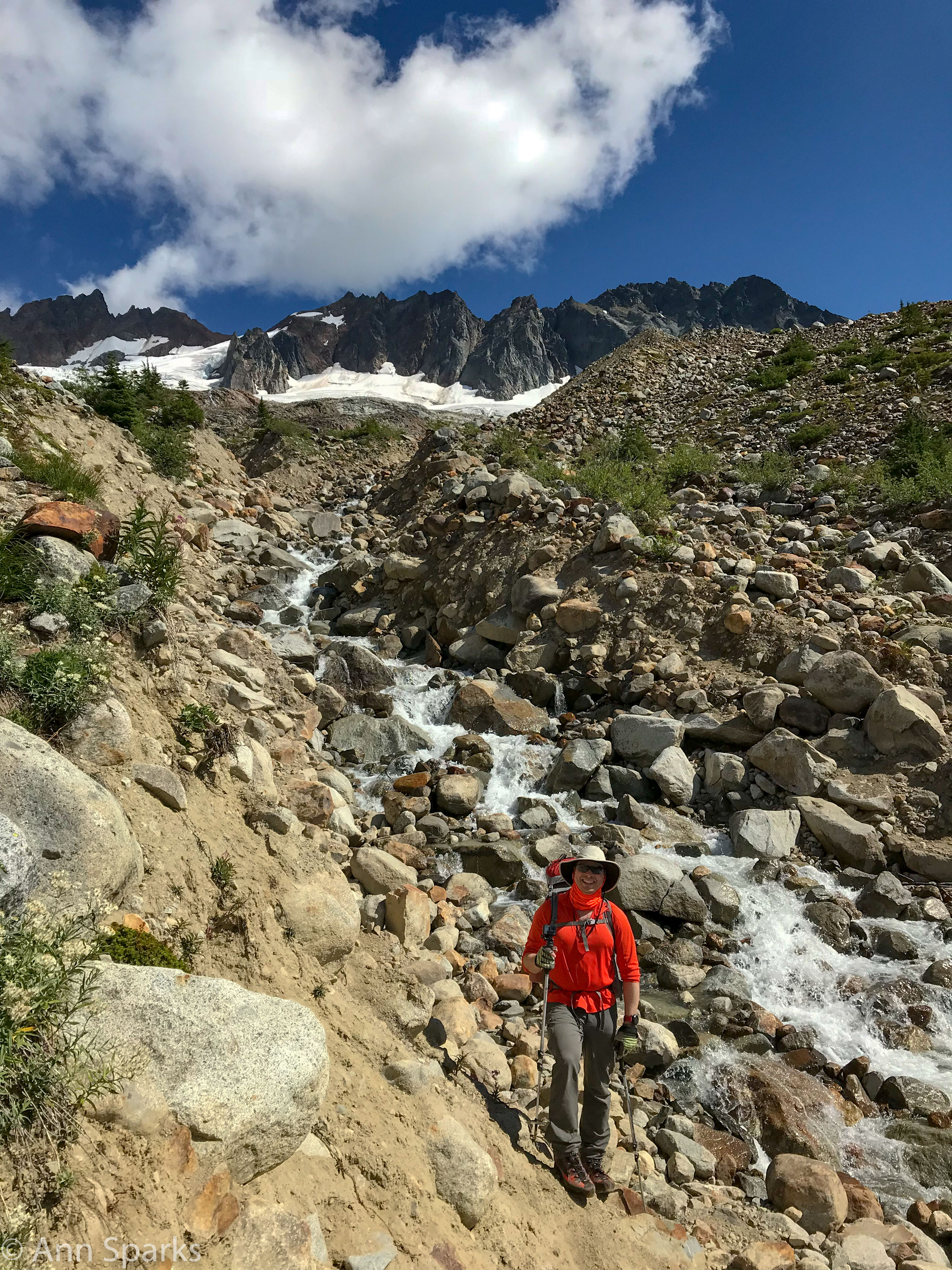
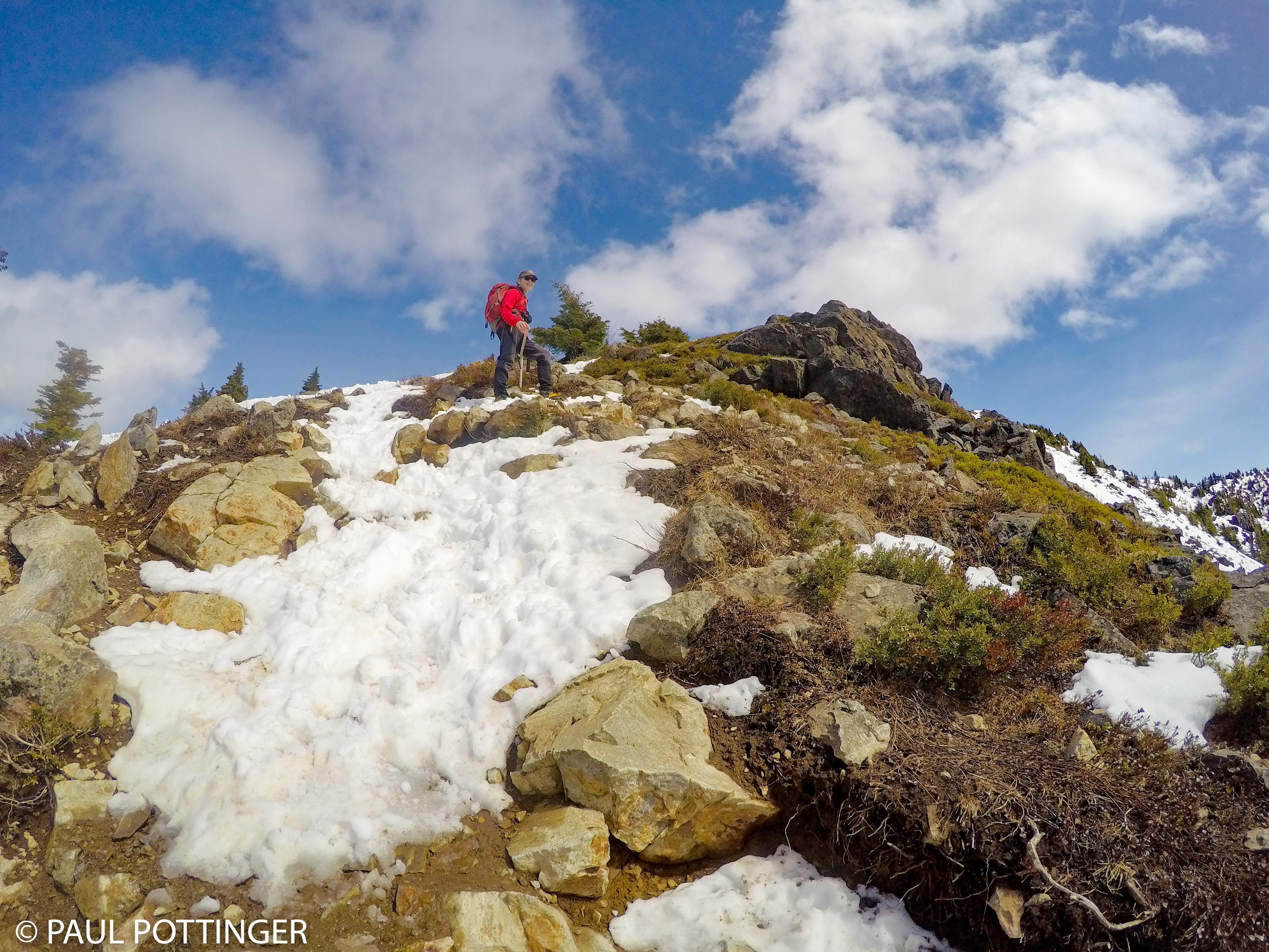
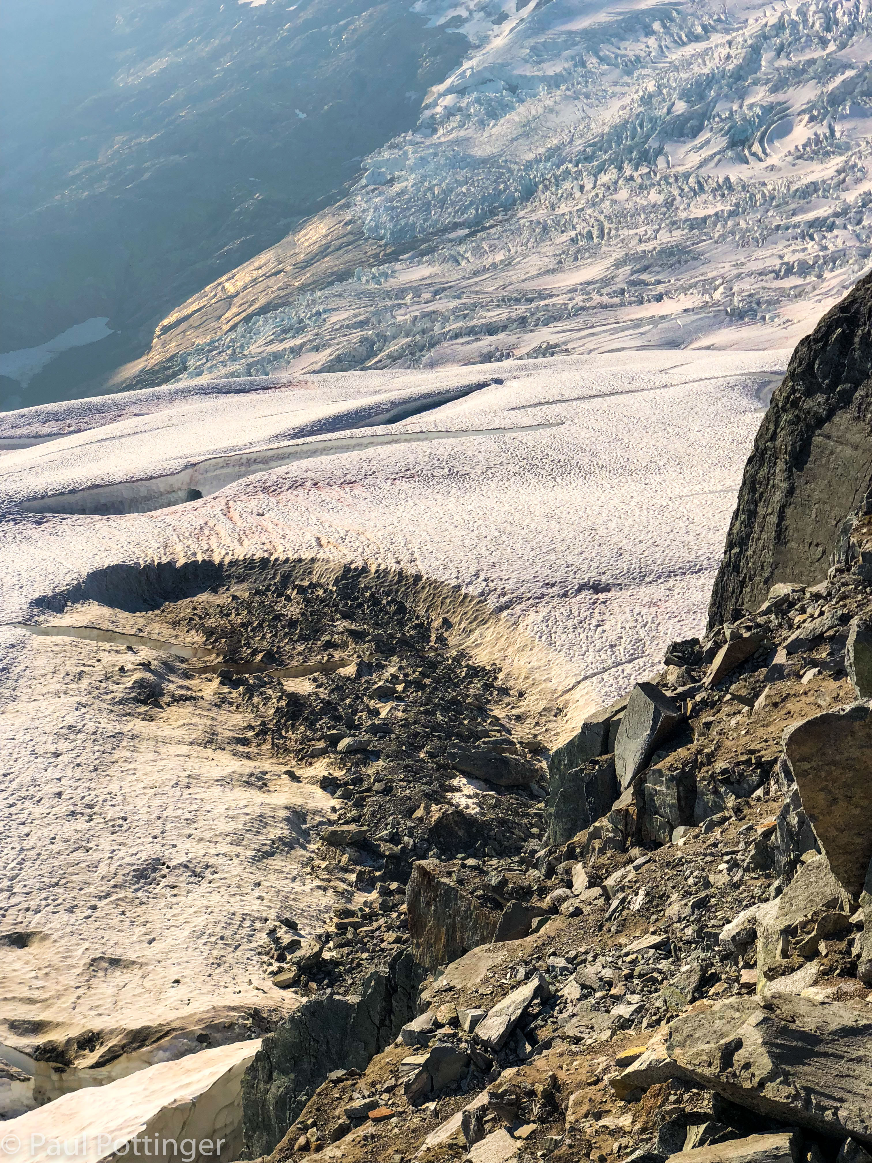
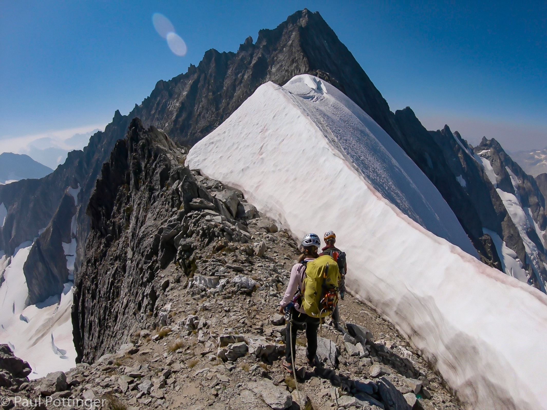
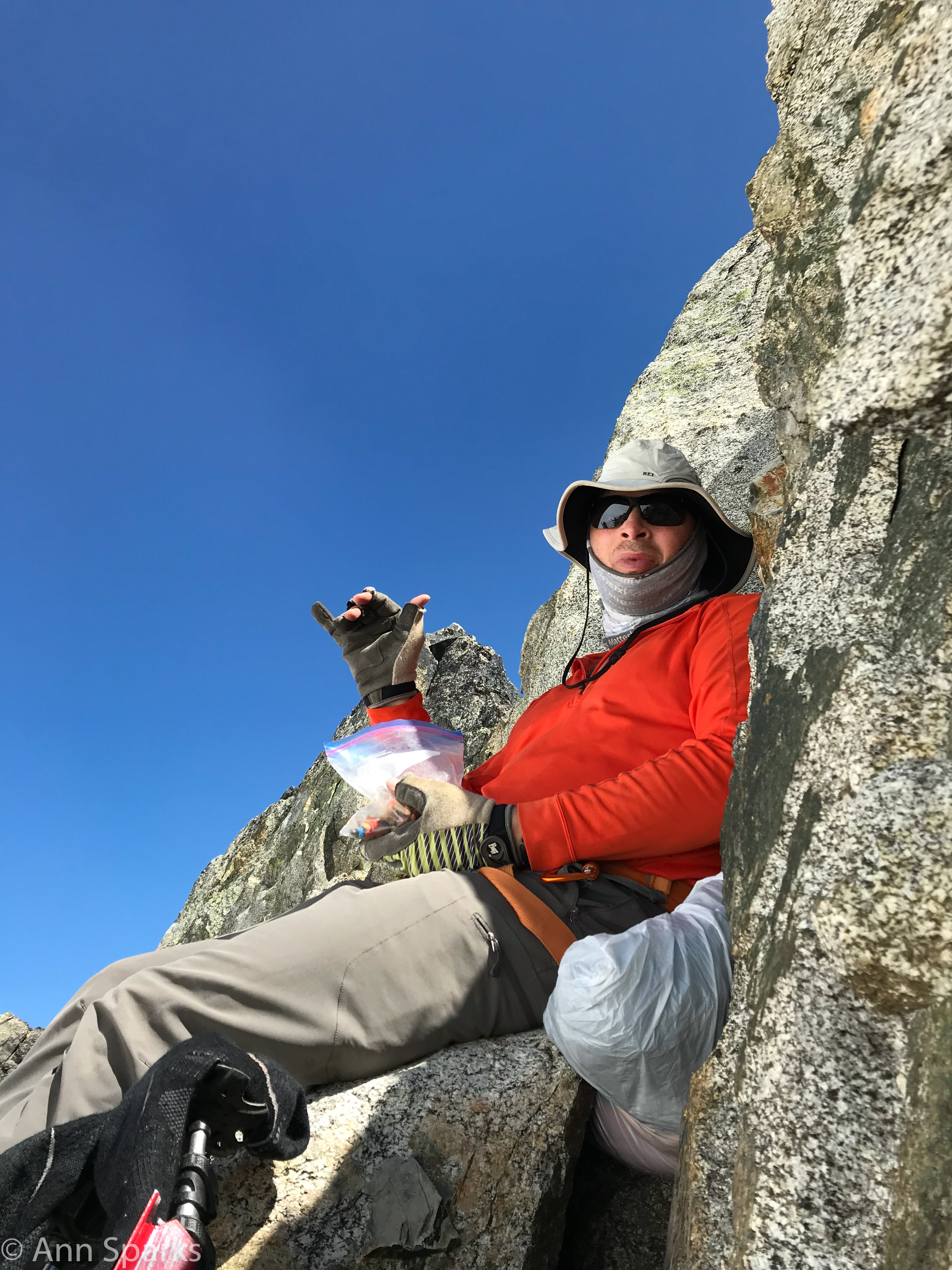
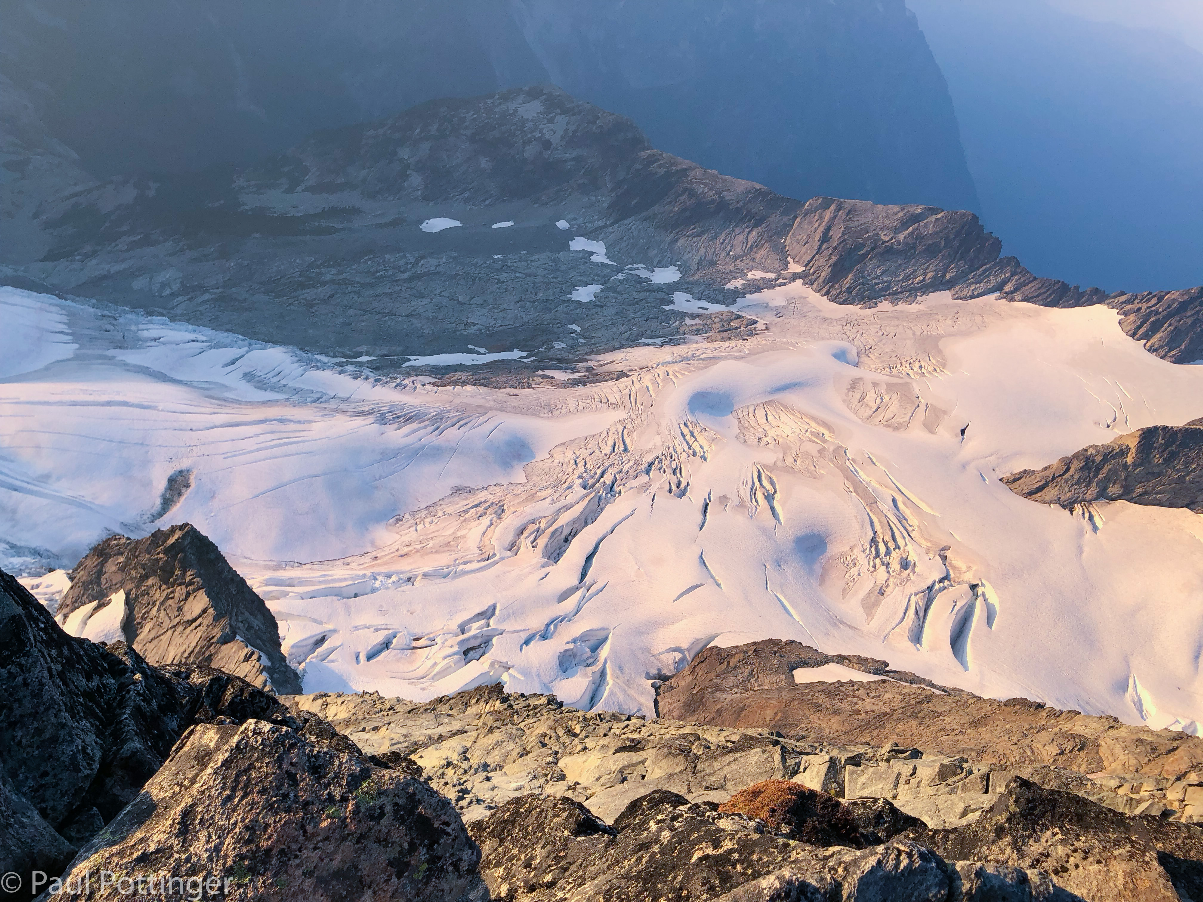
The ridge was bone-dry, except for two snowfields. We passed the first one soon after leaving camp, and decided to press on to the upper snowfield rather than stop for water so early. This was the right decision… I drank the last of my water just before we reached that upper snowfield. It was an ideal spot for a break, because we were protected by a stone wall on one side, and the snowpack on the other. For the first time in hours we could untie, get the boots off, take a leak, eat food, gossip… be human again. The stress of the exposed ridge melted away, and for half an hour we were just three friends enjoying the outdoors, like on any other trip.

The Mother Lode! Snow! And not a moment too soon. #parched
Our break spot affords a nice view of the summit.
Justin scrapes fresh snow into the Reactor.
Ann prepares a tasty and very appetizing lunch. #thatsnotchocolate #sh*teatinggrin
I keep cool during lunch.

Gearing up after the break, I felt pretty good. Hydrated, nourished, not sunburned… it seemed we had plenty of daylight left. We were moving slowly but steadily, and with total protection thanks to Justin. We were climbing the North Ridge. Let’s do this.

Justin wraps a horn.
Looking back at the second snowfield after leaving the break.
Route to the summit beyond the second snow field. Note the climber standing on the summit.
One of many obstacles between us and destiny.
Justin leads with authority.

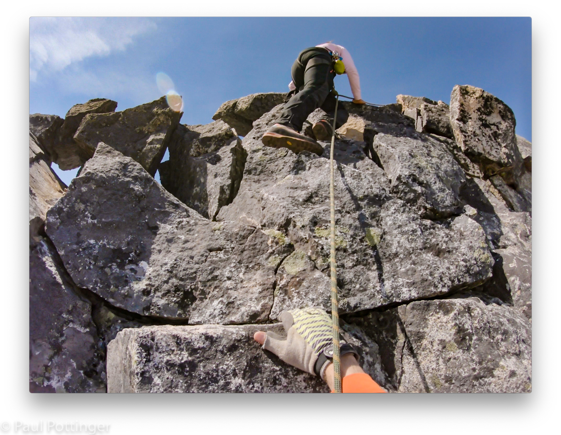
I climbed just fine. At one point I was deeply disappointed in myself for failing to clean one of Justin’s cams. We were on the west side of the ridge, in deep shadow (a momentary blessing), on a section of vertical rock punctuated by standing platforms filled with loose dirt. There was just enough of a foothold for me to balance and grab the cam’s handle… but the jaws just would not move. Not a millimeter. Goddamn it. I wiggled it gently, shook it, tried to slide it to and fro… Nada. I told Justin I was out of options, and confirmed that the cams were no longer moving. He told me to leave it, and I apologized profusely. he did not seem perturbed, not even a little bit. “It happens, no worries.” But I still felt badly.

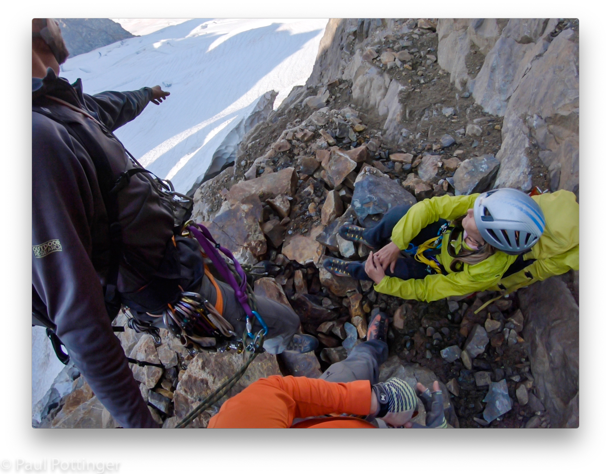
We could see people on the summit above… they looked so close. But it took hours to reach the final pitch, because we climbed carefully and with solid protection the whole way.

My GoPro-6 failed to capture those last pitches, which was very disappointing… it was brand new. Removing the battery on the summit seemed to reset it, and I was able to capture most of our descent that evening.

A rare moment in shadow.
Stepping into the void….
The East Ridge is looming closer… meaning we are approaching the summit!
Ann wrangles the rope around a horn. Summit not far now.
Justin snaps us climbing to his belay station on the summit.

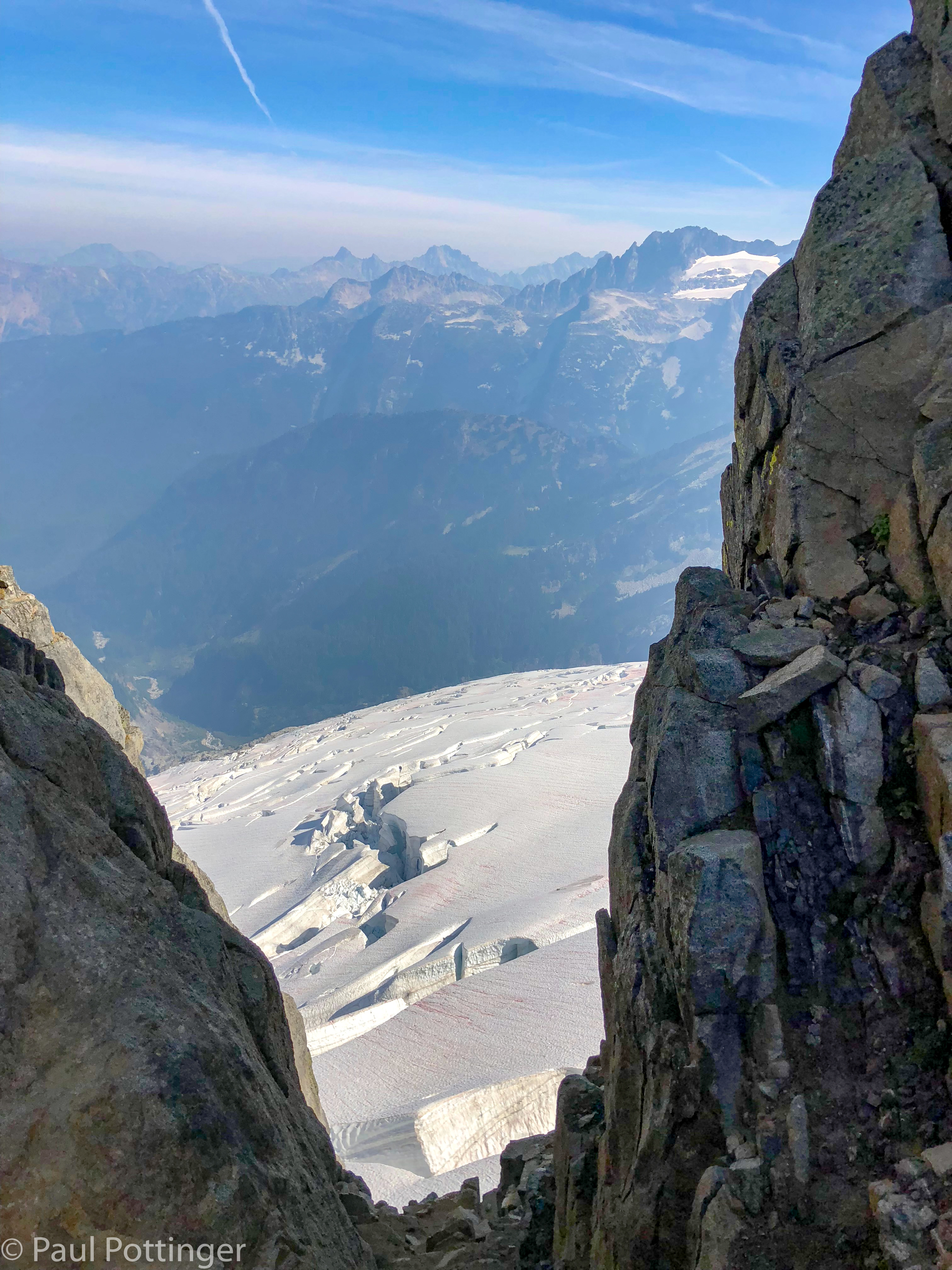
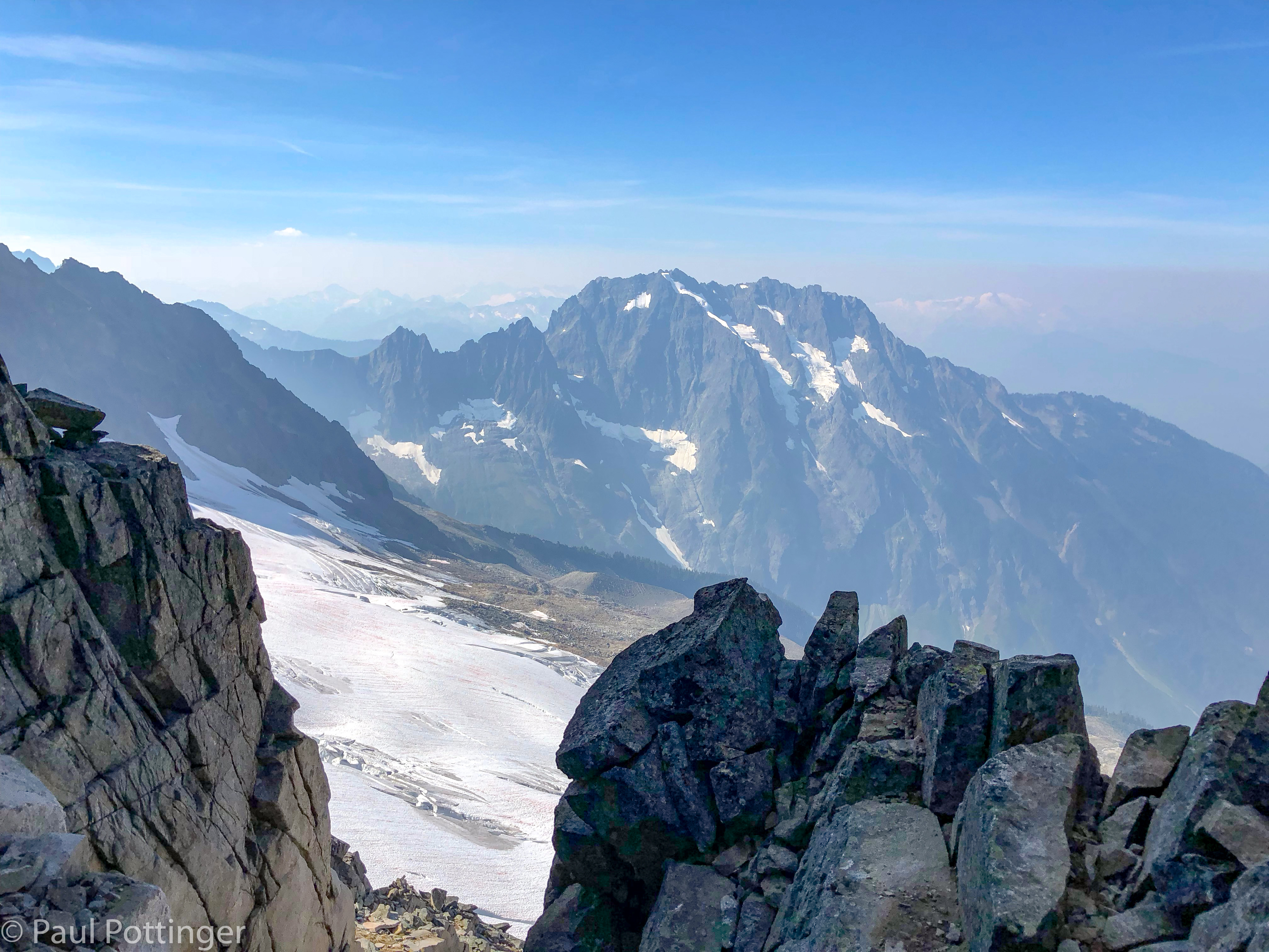
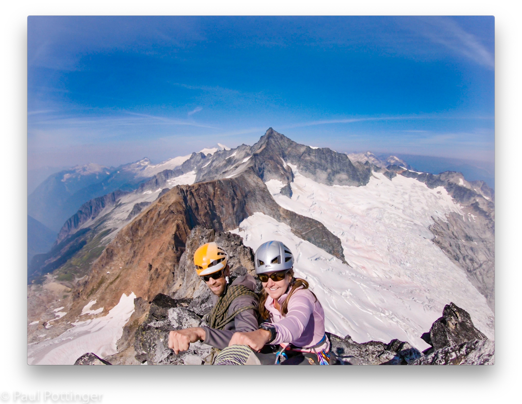
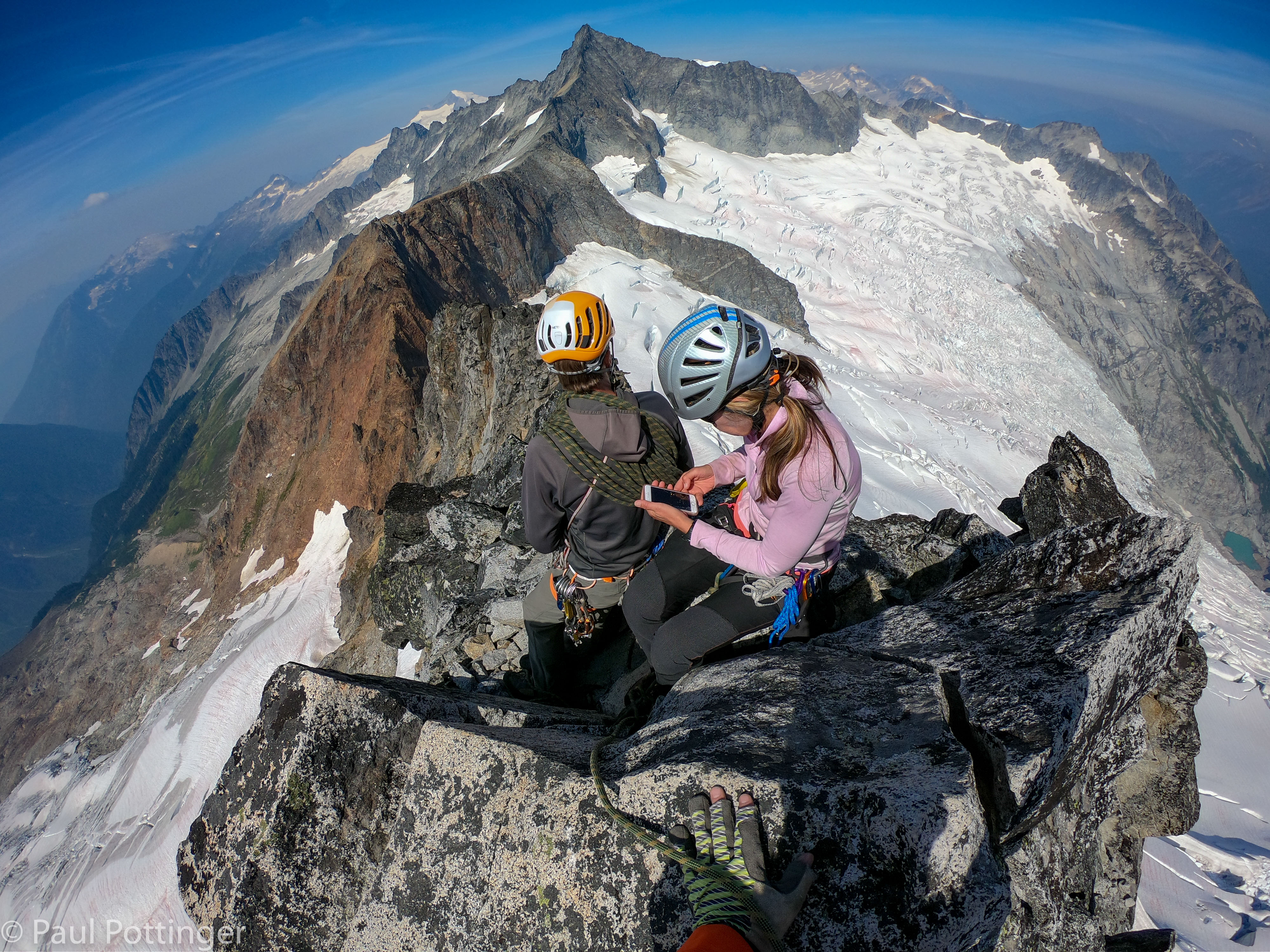
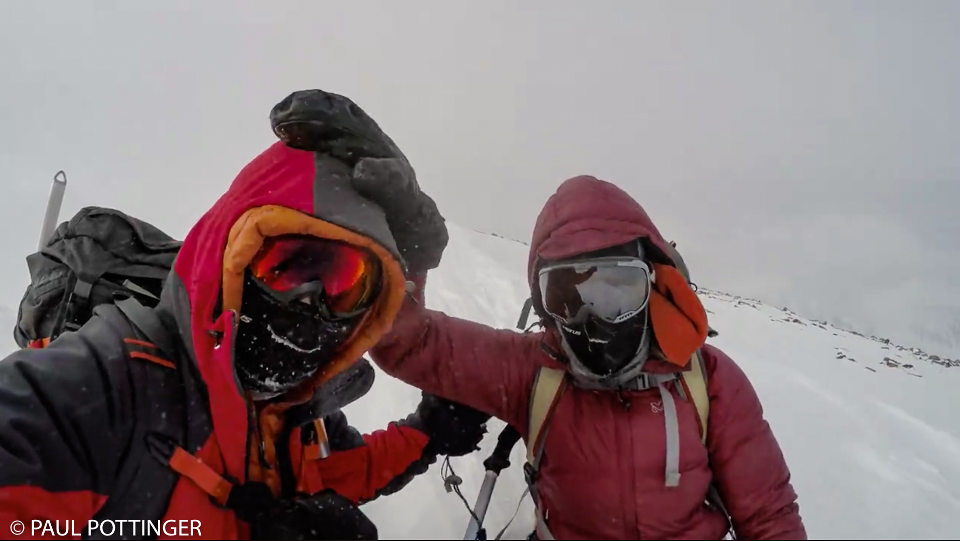
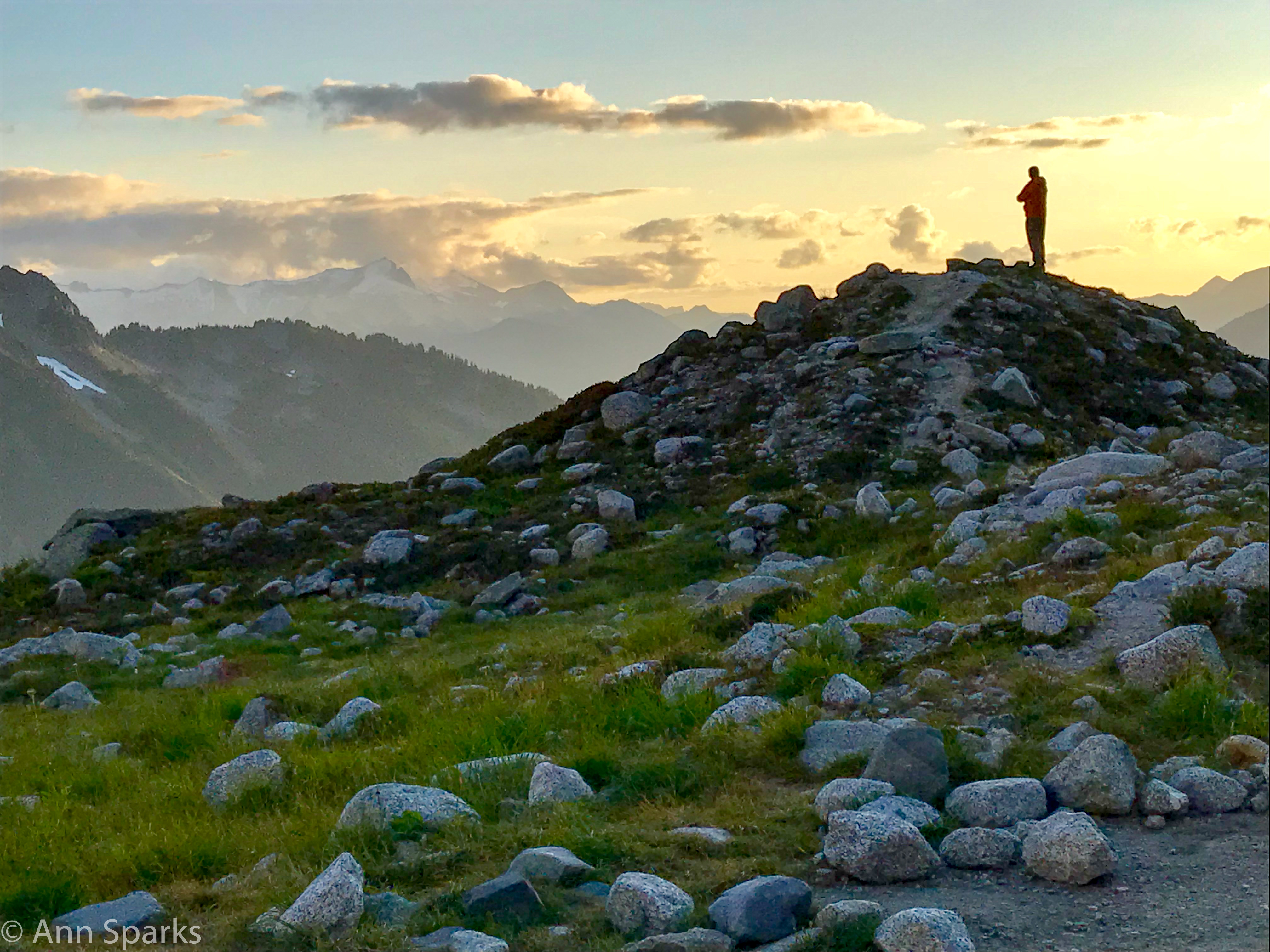
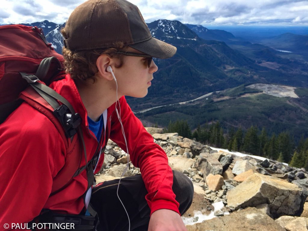
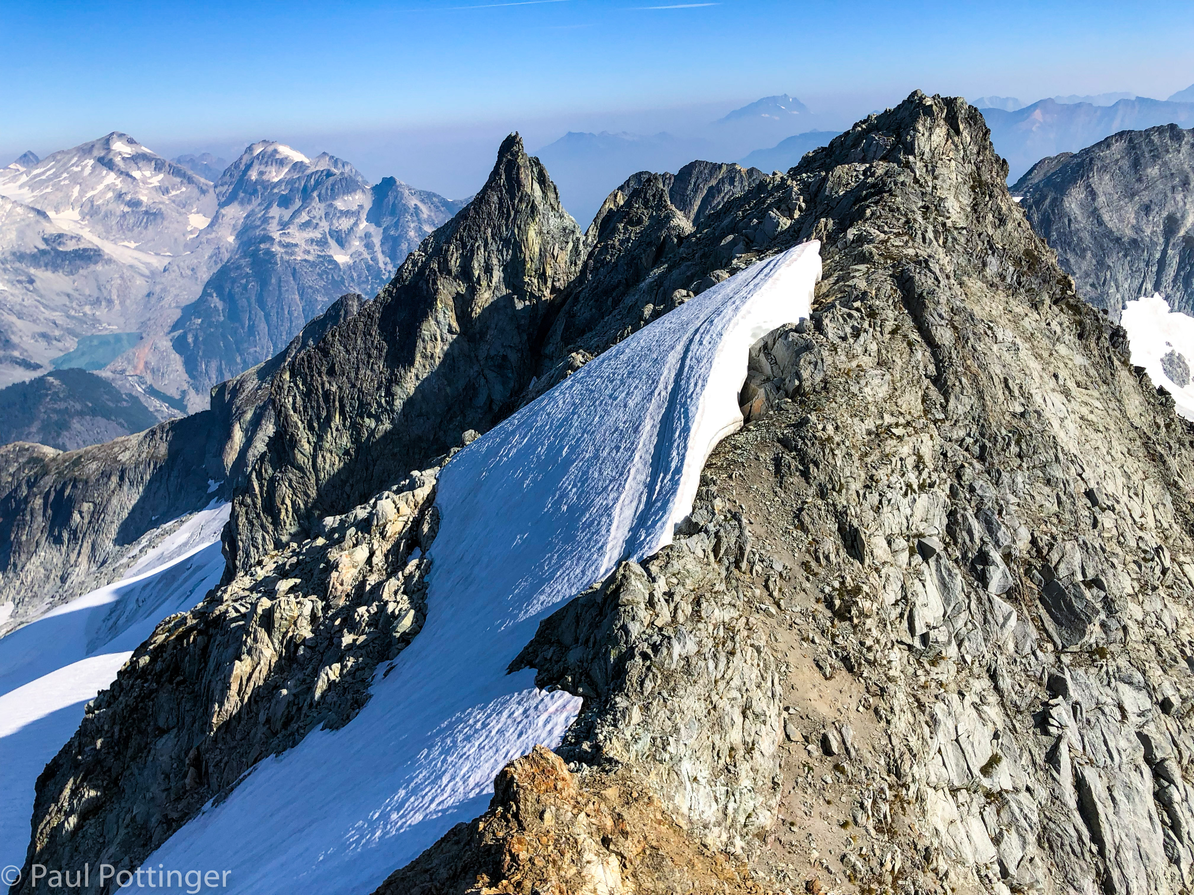
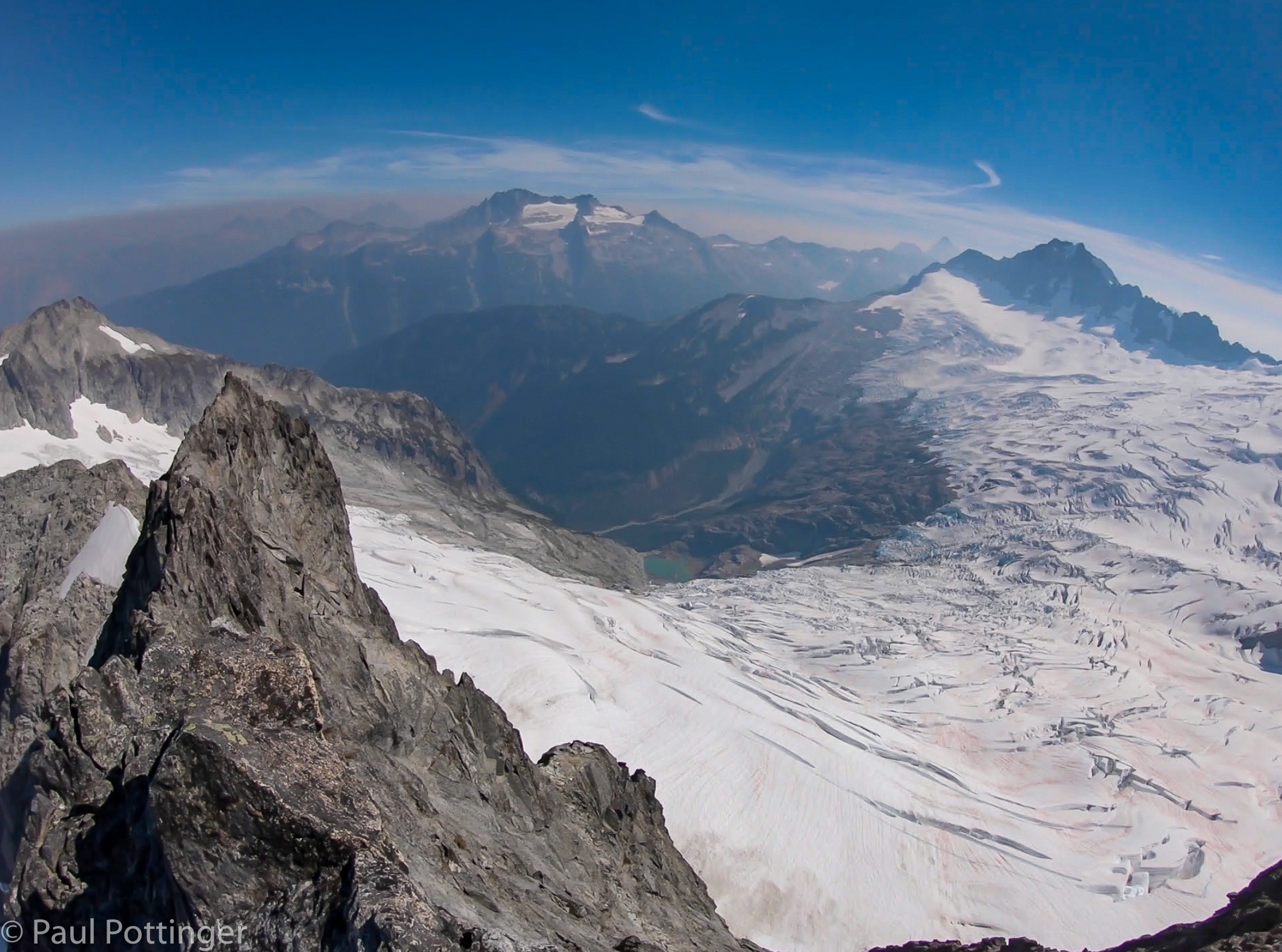
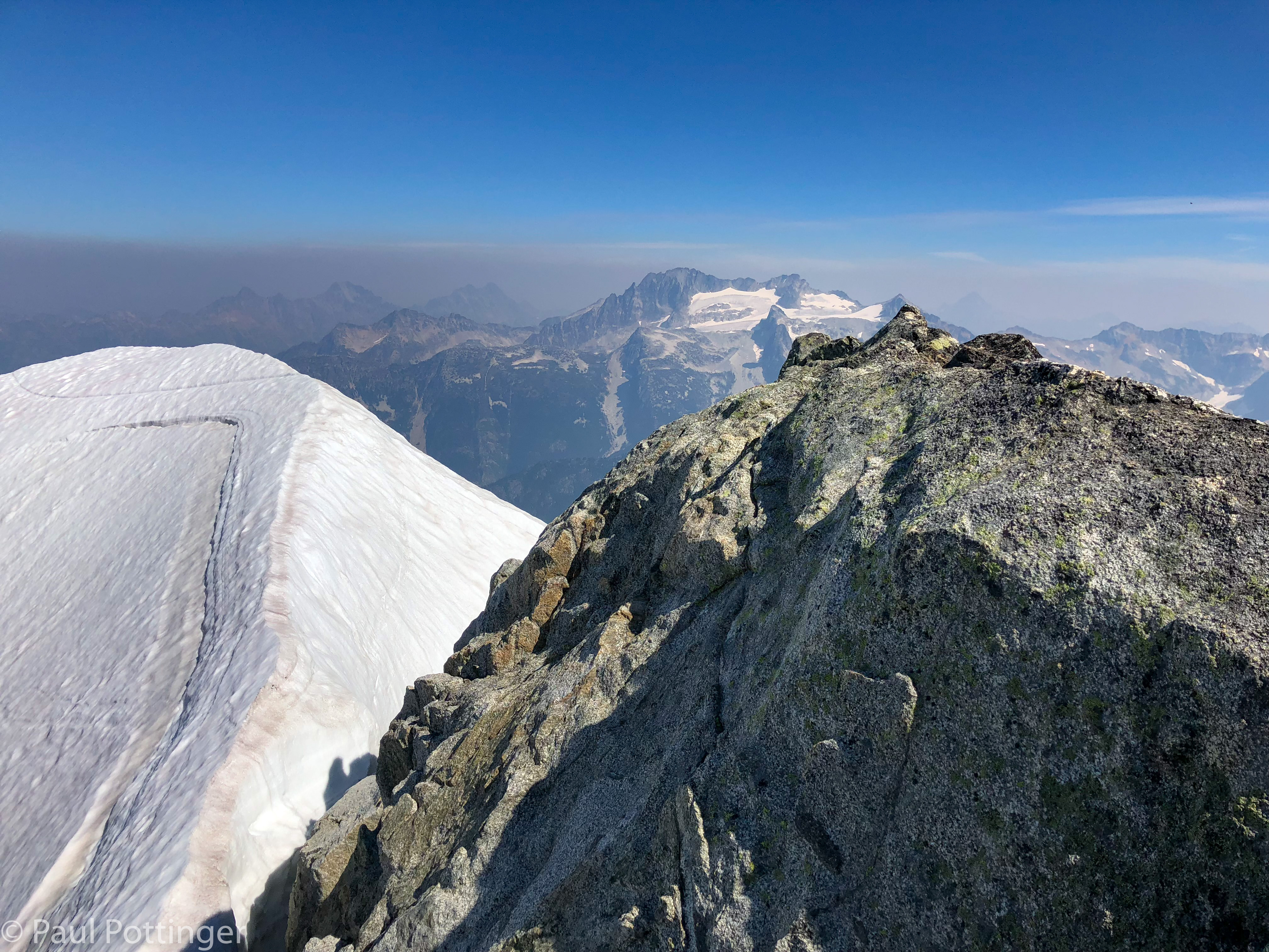
The top of Forbidden is a tiny outcrop, just big enough for me and Justin to share… Ann found a tiny perch several feet away. It was warm but not too hot, with a nice breeze. The wildfire smoke was mostly below us. We could see for miles in all directions, including back at the route we had just climbed… and the way we would have to descend now, via the West Ridge. We grabbed a quick snack and water, mindful of the late hour. We needed to hustle, but it was sooooo beautiful.

Pano from the summit.
The North Ridge of Forbidden, photographed from the summit. Our bivvy spot last night is where the rock cleaver meets the main ridge, casting a shadow upon it. Distance is about one mile.
Justin Merle: A legend. Our guide. And our friend.
Ann Sparks: Inspiration to humankind.
Loving it up here. Not my typical Wednesday… wondering what’s happening back at work.

I drank the summit in, and thought of Julie and the kids. I wish they could see this. I thought of work. What was happening back at the hospital? It was almost 6:00 PM on a Wednesday… case conference and board review would be wrapping up, and the fellows would probably head out for celebratory drinks. The next day, when I got cell service again, they texted me this photo taken while we were descending the West Ridge, confirming my suspicions.

The amazing first-year ID fellows, AKA Team Strongyladies, photographed at the same moment in Seattle.

It was time to descend.

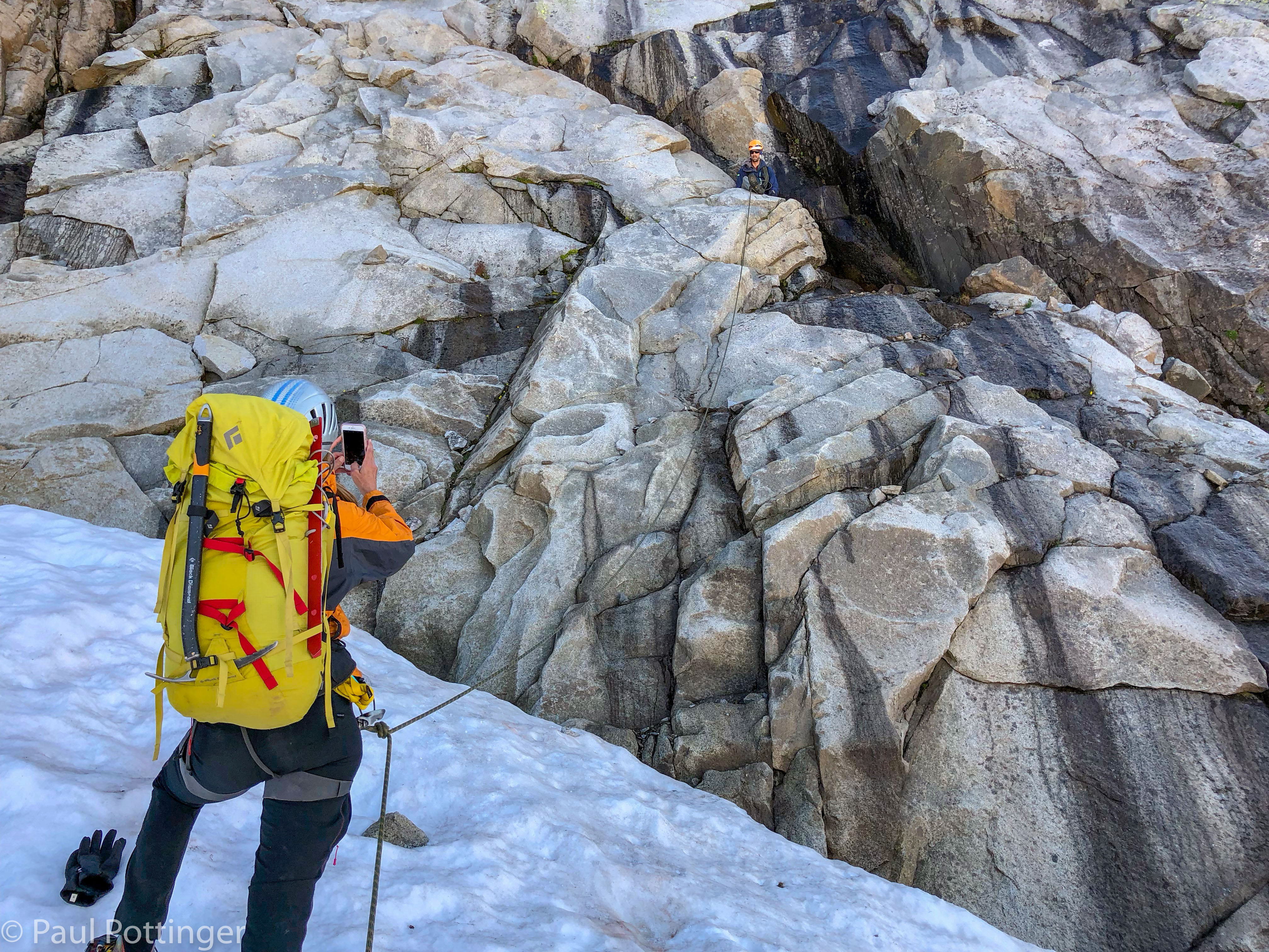
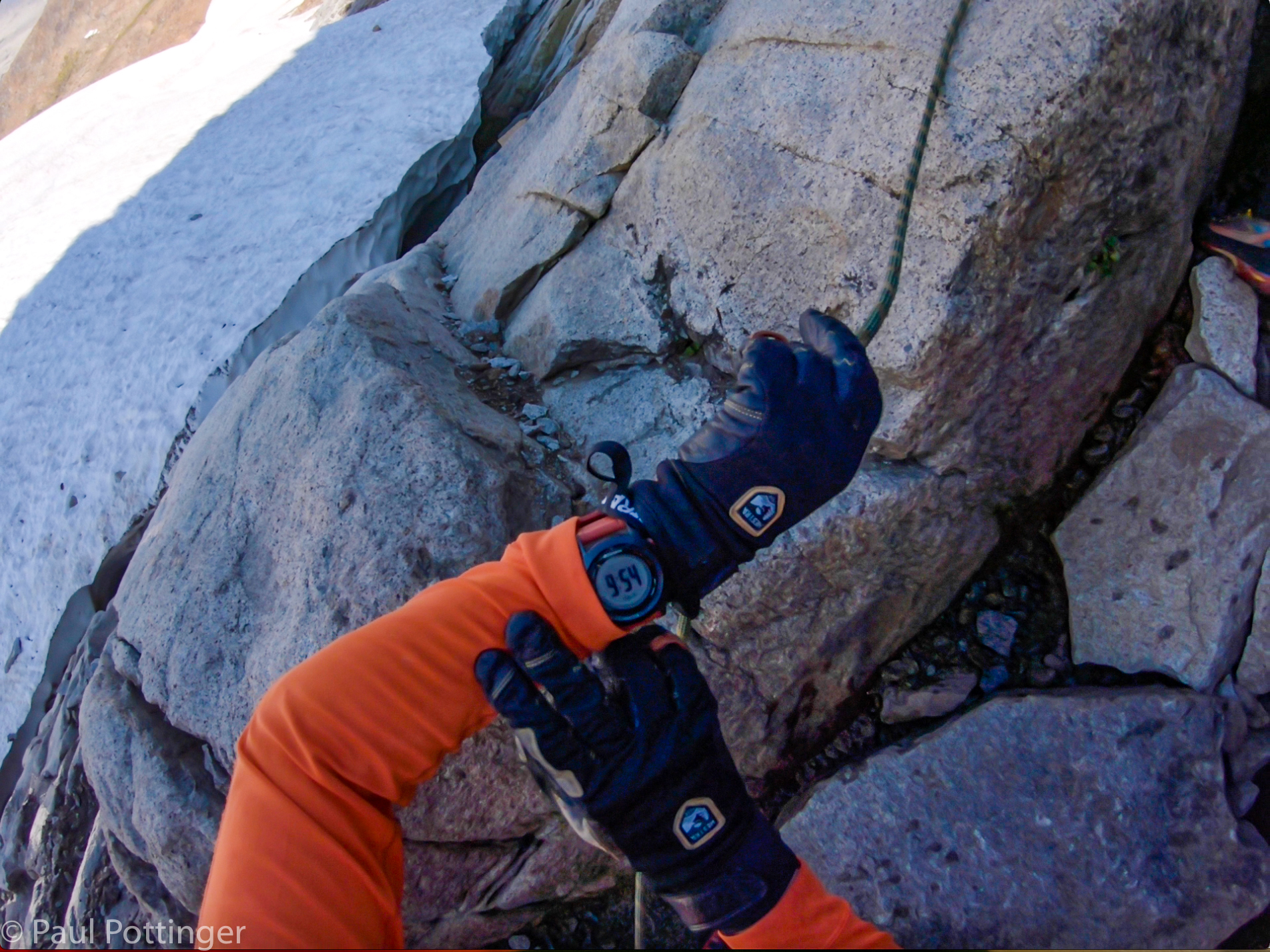
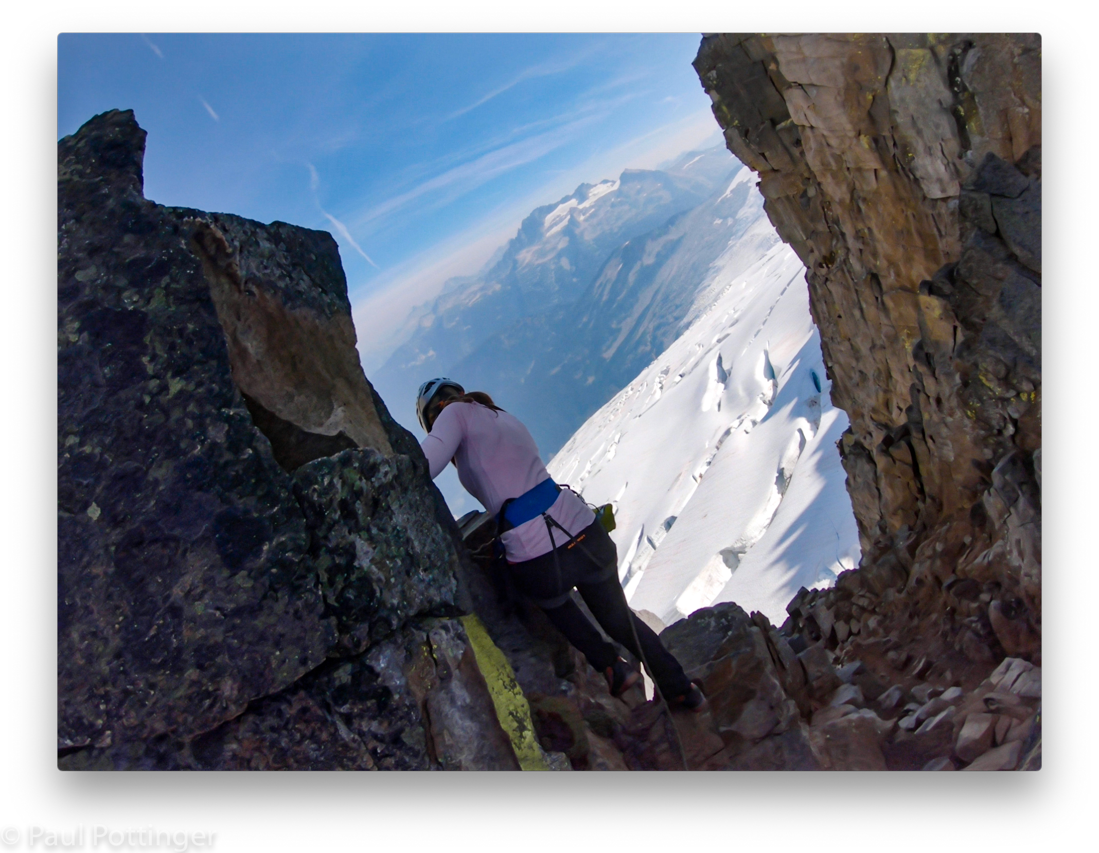
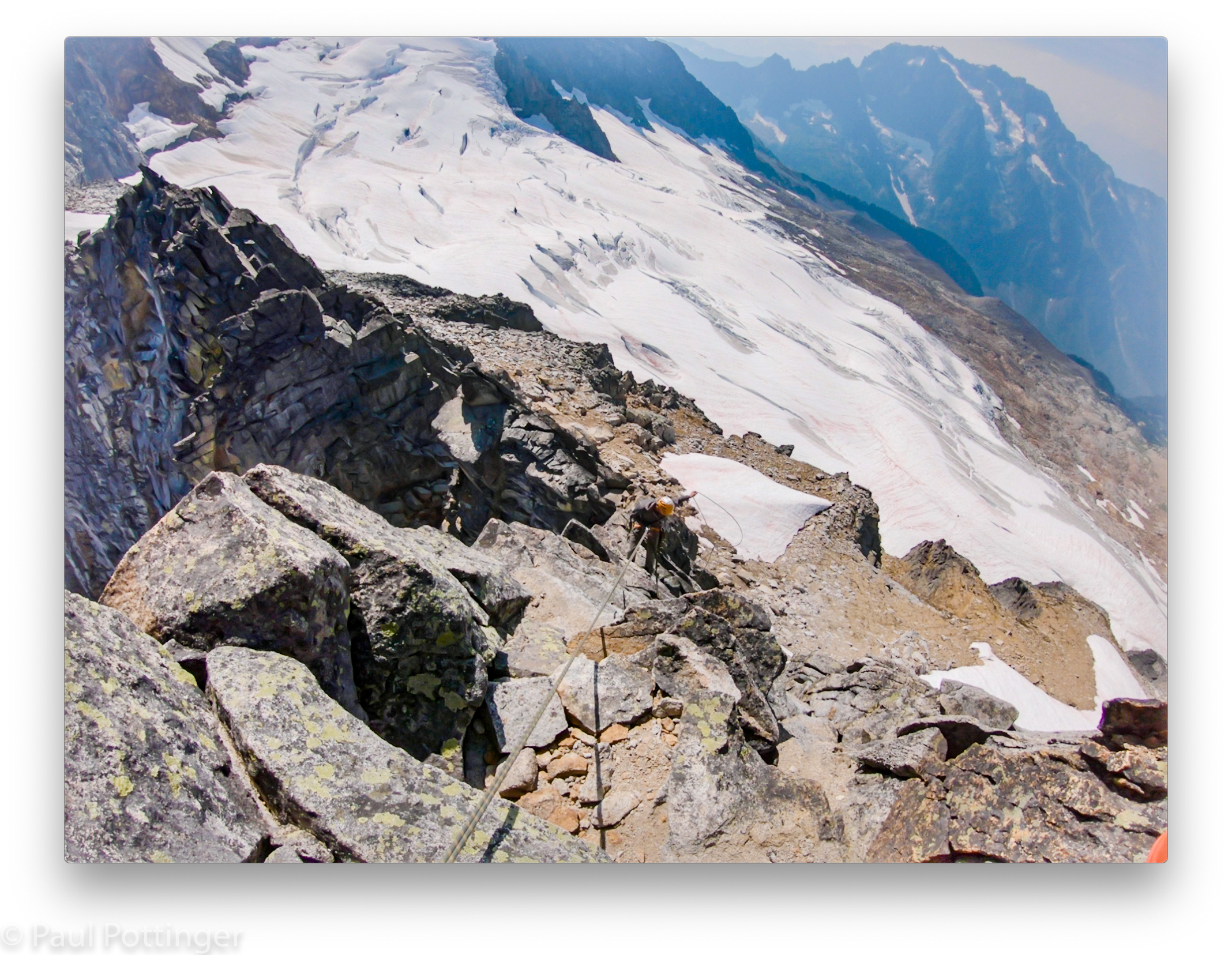
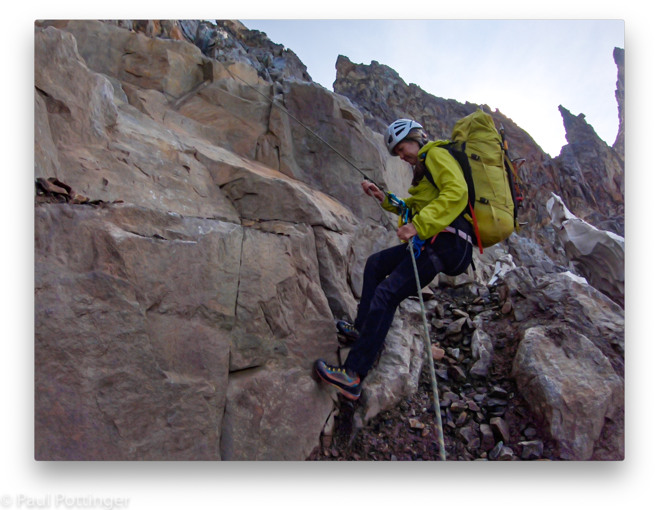
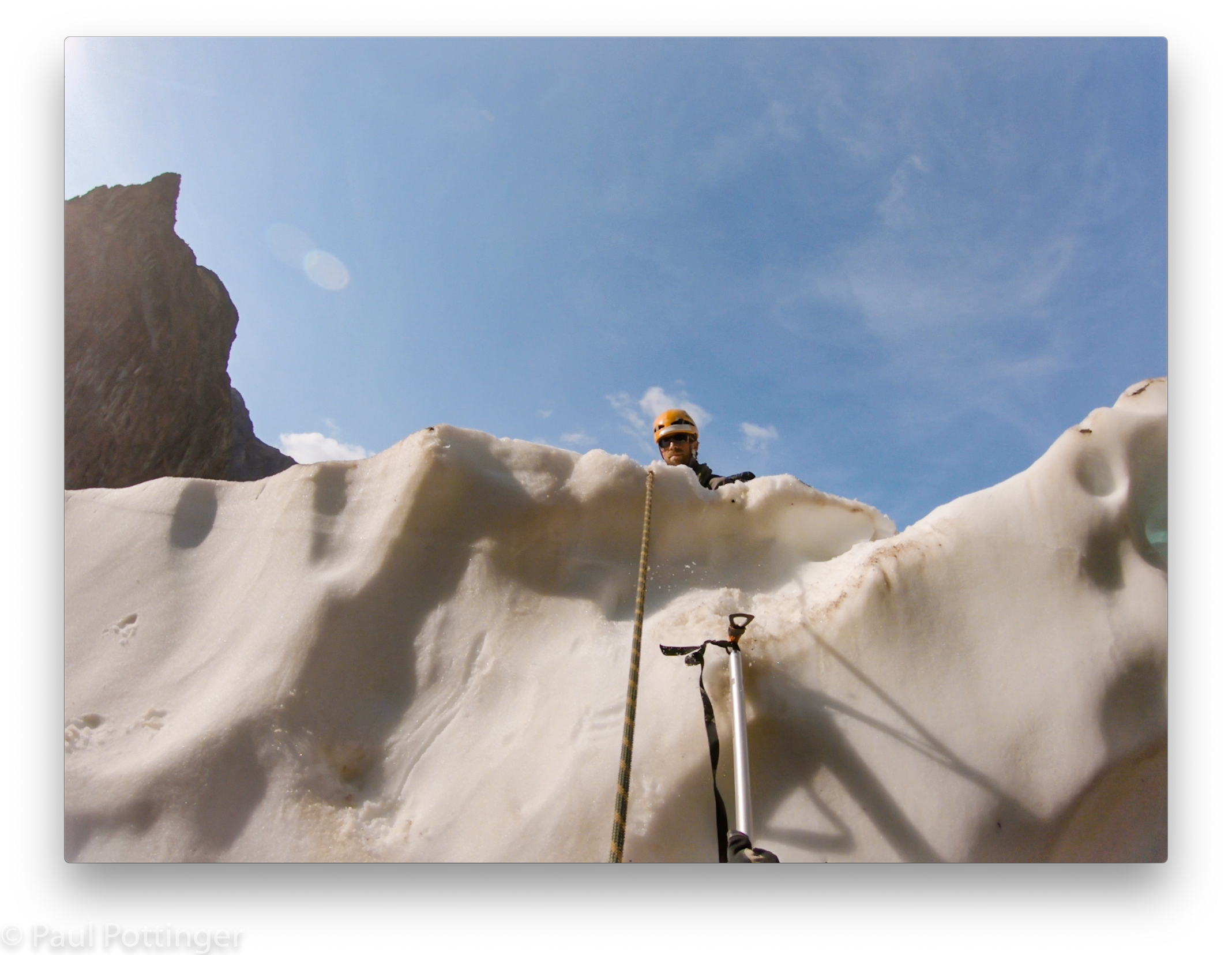
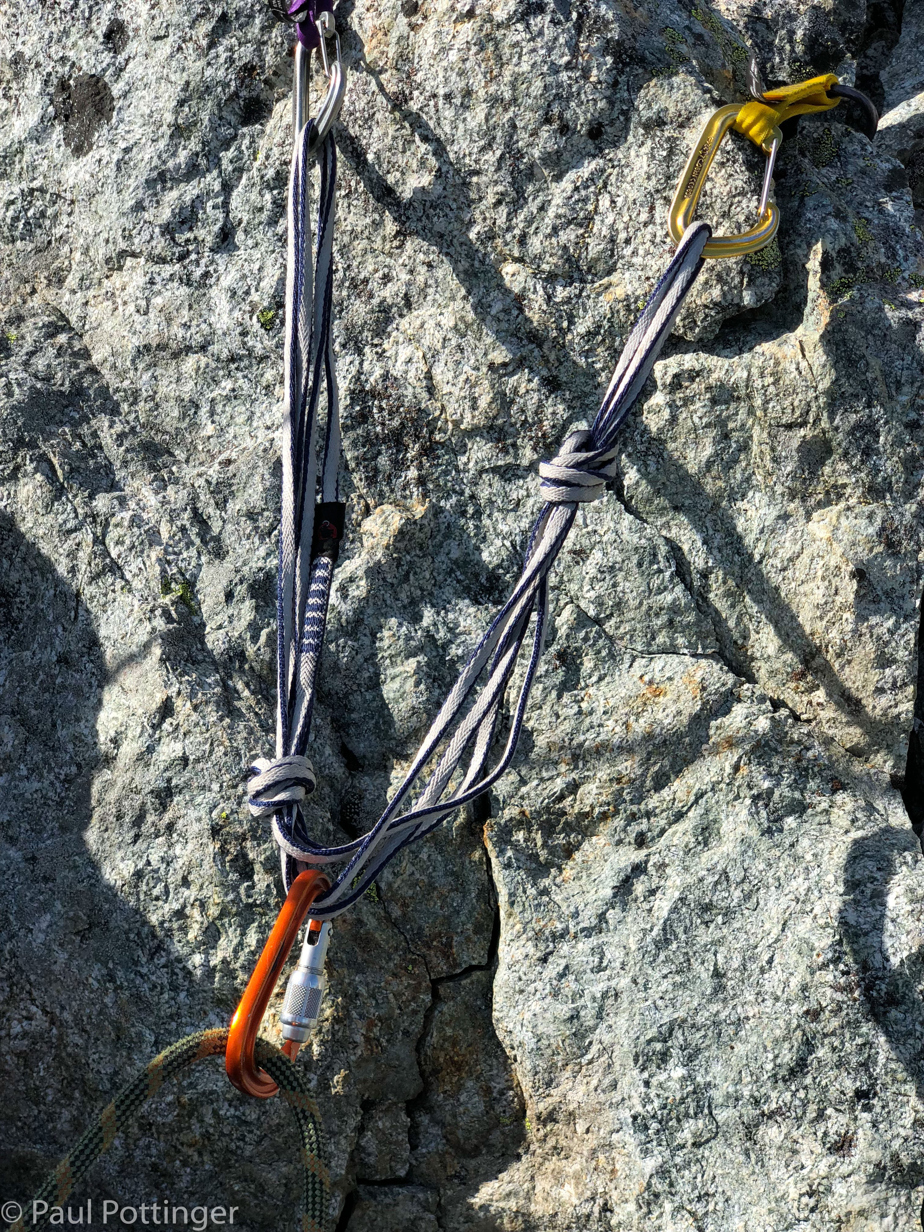
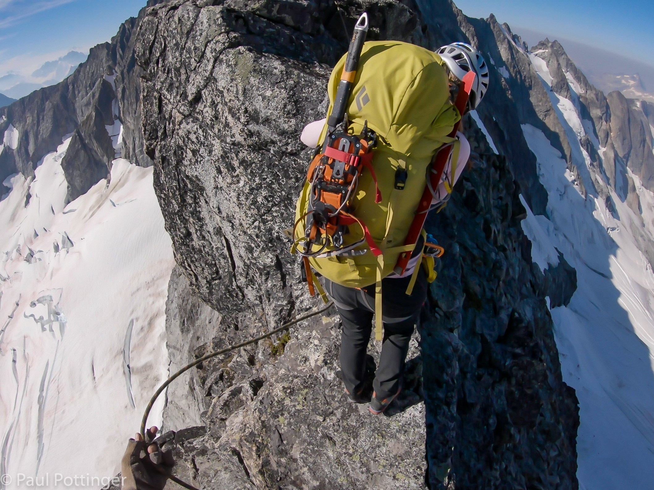
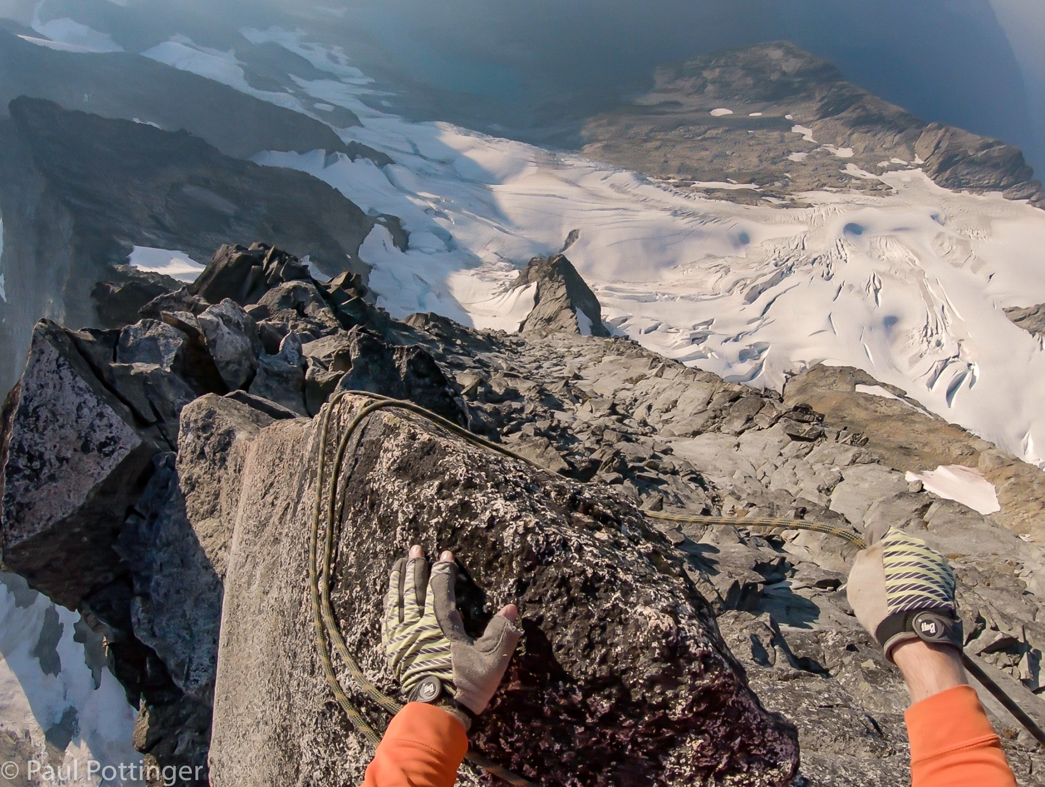
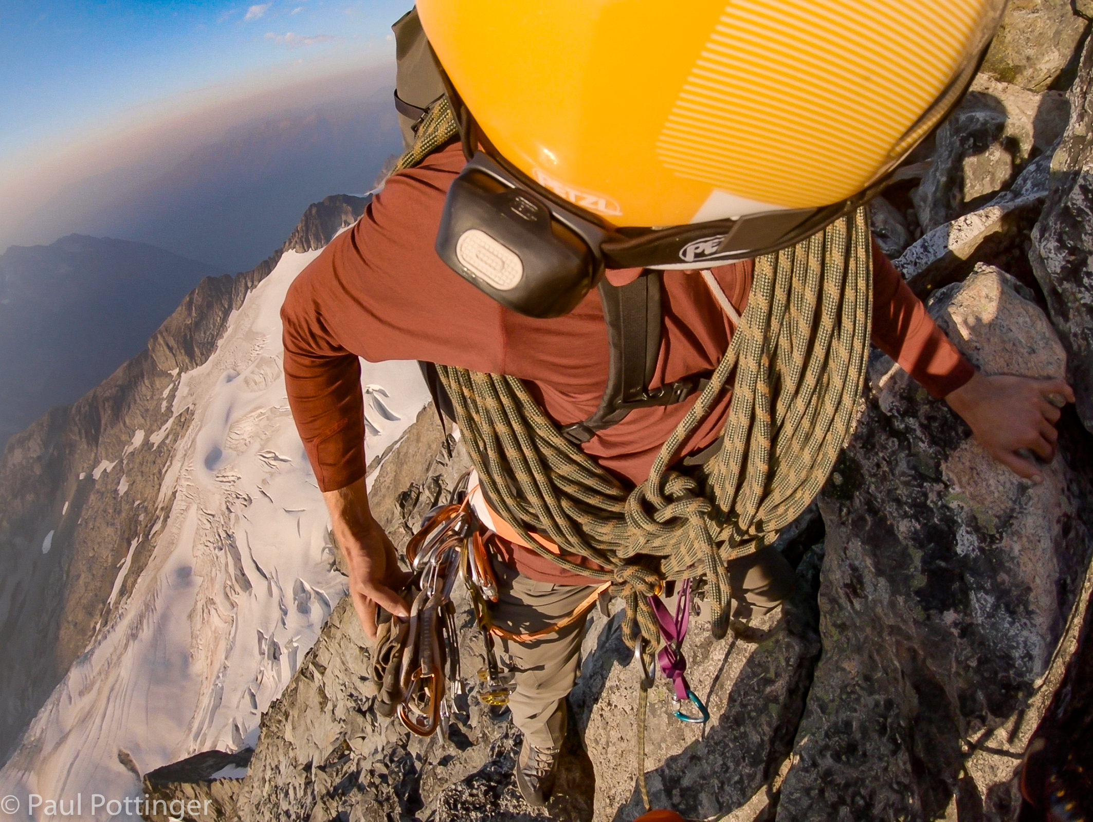
Now it was my turn to lead. Instead of watching Ann’s moves, she had to watch mine. I needed to be sure my pace was slow, steady, and predictable, lest I pull the rope taught between us. Justin kept us on belay while we simul-climbed, then we would set up a rap station using a cam or simply by slinging the rope twice around a horn. Eventually we came across several proper rap stations, and clipping to those was very reassuring.

Initially the route was very austere: Totally exposed on either side of the ridge, which was narrow. In some cases it was possible to traverse on one side or the other, but usually the best option was also the most intimidating: directly down the spine.

Very solid handholds as I begin the descent.
The slabs here are steep and oblique.
Ann prepares to smear down this little wall.
Ann follows me to the catwalk below the belay station.
Stepping across a small notch in the ridge.
Just a few more steps to the belay station.
Belaying Justin down from his anchor spot.
Tight quarters up here.
Up he goes….
Watching Justin take the lead.
Some of these flakes look so precarious… but feel solid in hand and underfoot.
Downclimbing the north side of the ridge.
Pointing out my planned route. Justin approves.
Here comes Ann. Note rope in a notch at Justin’s belay station.
Here he comes.
Justin keeps himself protected using that horn.
Steep slabs, but somehow there are always good footholds.
Crabwalking is a venerable descent technique up here.
Is that block really stable? Yes!
An odd spot where progress means regaining a bit of elevation. Spicy exposure….
Moving as a team.
Straddling the ridge.
In mountaineering boots, the smaller rock features are tough to feel. Here I lend Ann a hand with her foothold.
Wrapping a horn.
Progress is slow, and daylight is burning.

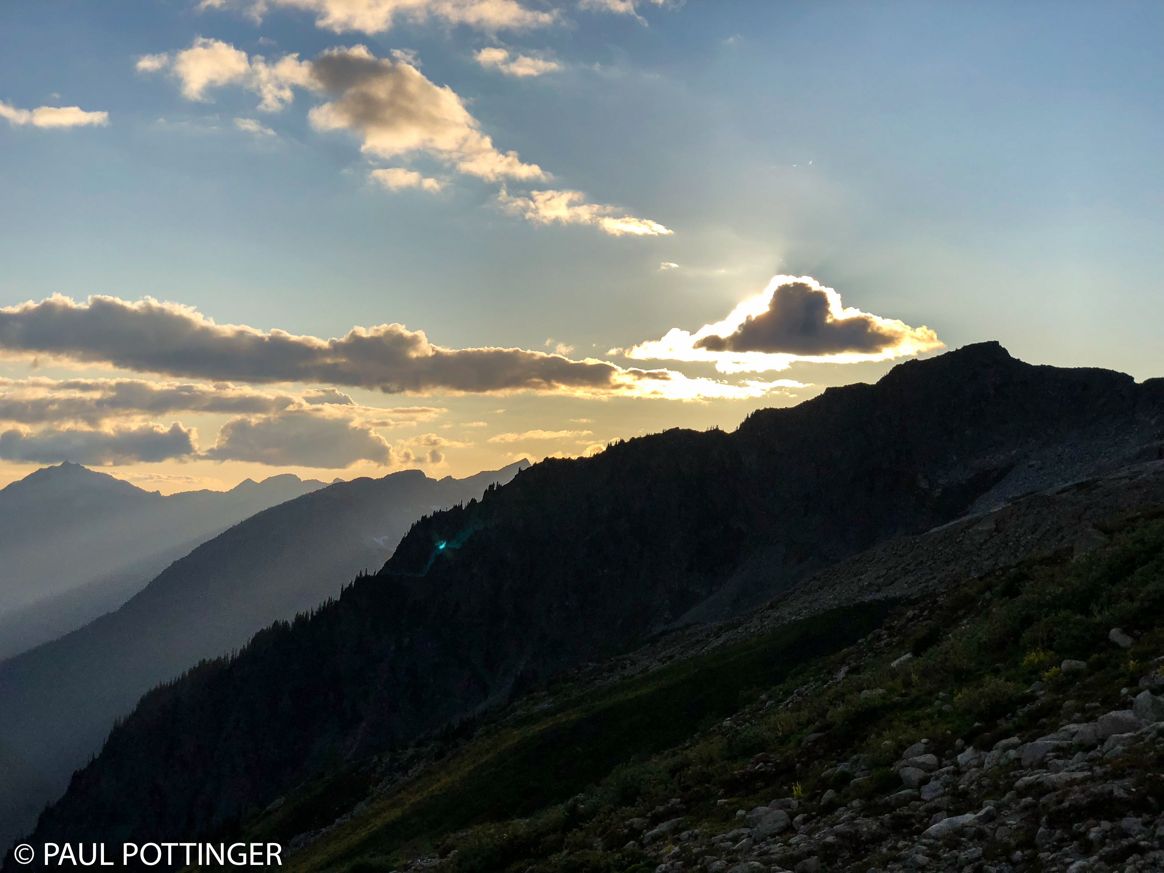
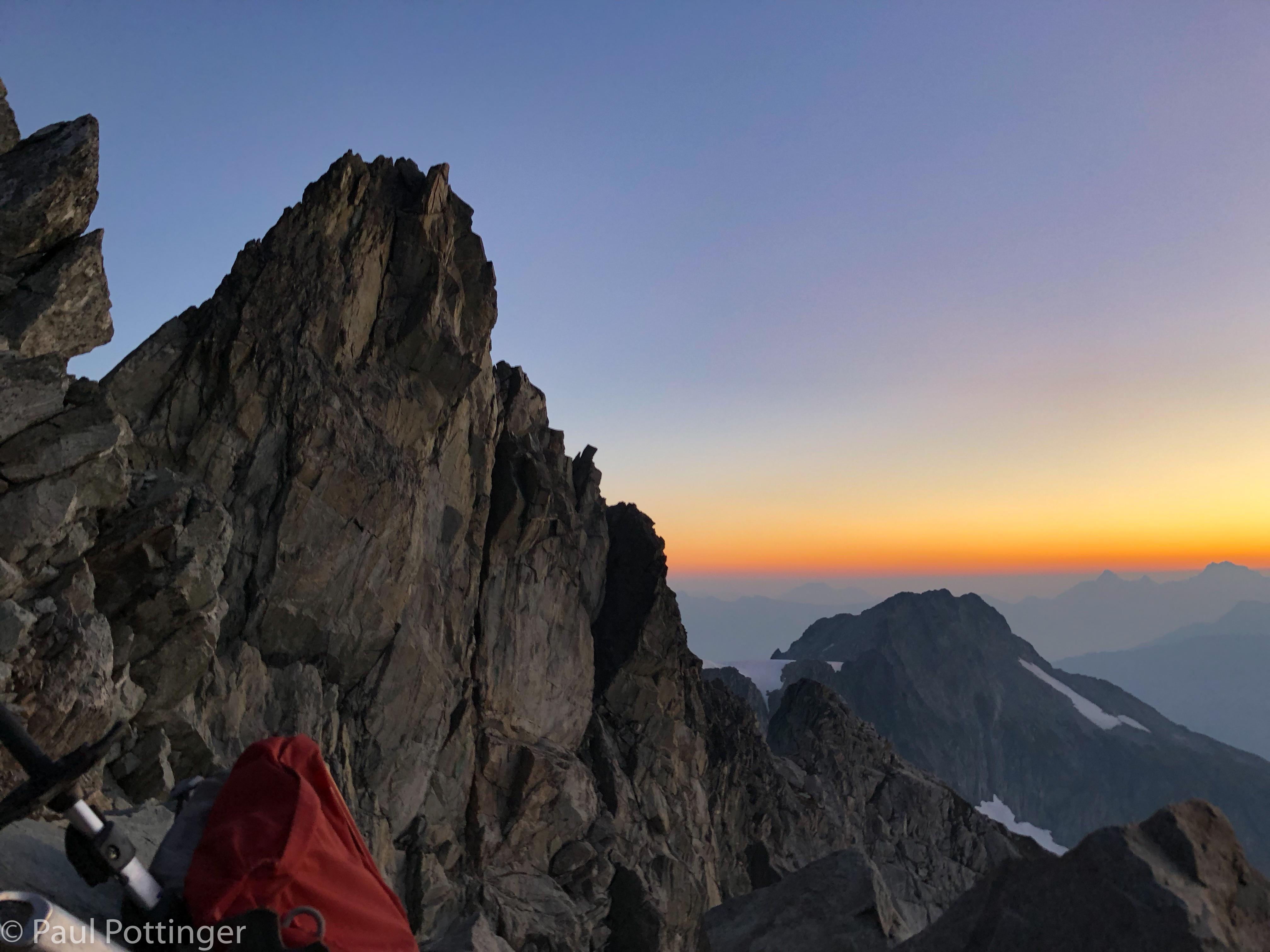
When I found the first rap station I clipped in, and Ann joined me moments later. Justin descended carefully, and we had a few minutes to take in the scene. The sunlight light was warm and cast the ridge in a red hue, made more dramatic by the wildfire smoke below. It was going to be a beautiful sunset.

And then it would turn to night. And we would be forced to continue the descent in darkness.

Benighted. Fuck….

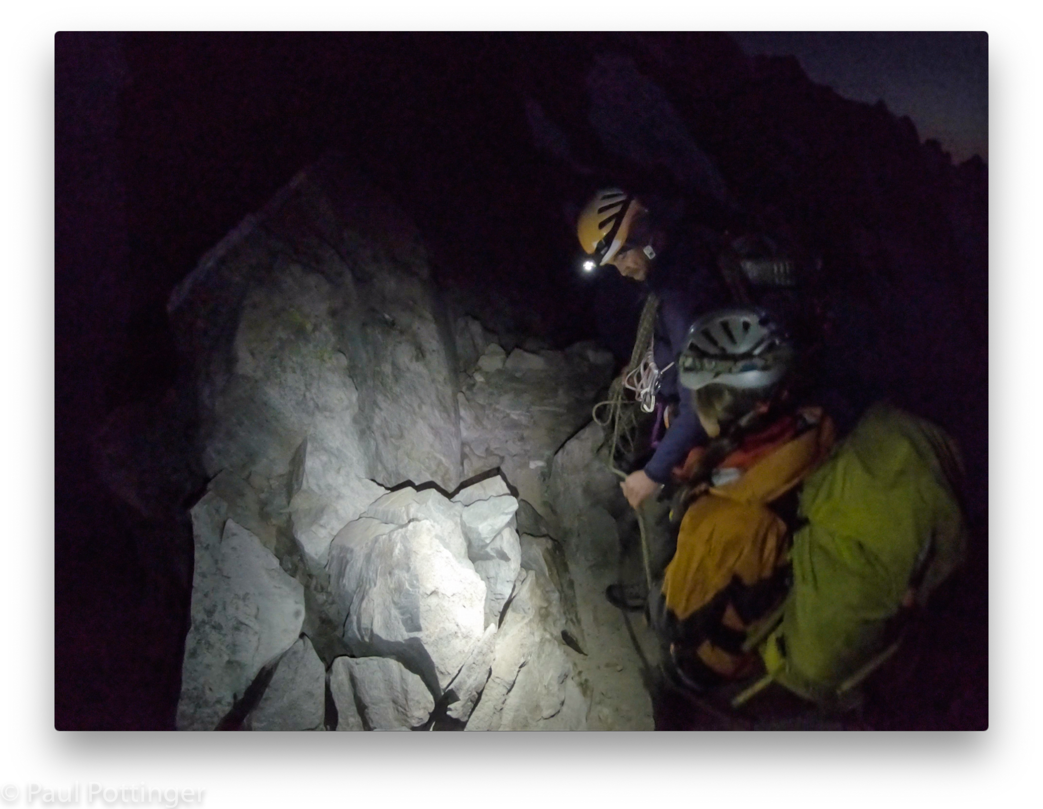
Justin had climbed this ridge multiple times, as had Ann. We would be fine. Still, I felt badly having to put on the headlamp, because it meant Justin would have to work that much harder to get us down. Be careful, smooth, and efficient. No rushing. Indeed, there was nothing else to do.

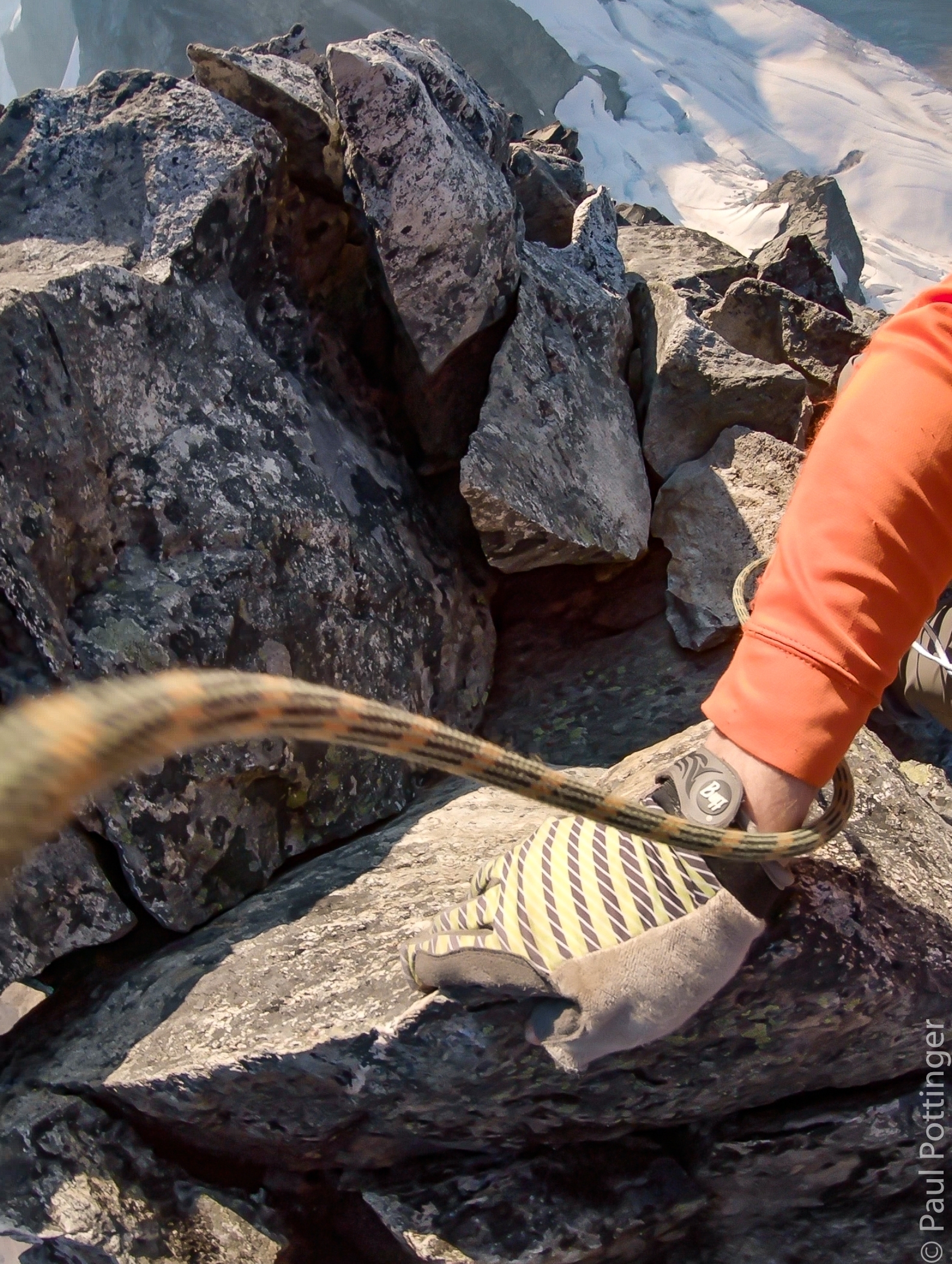
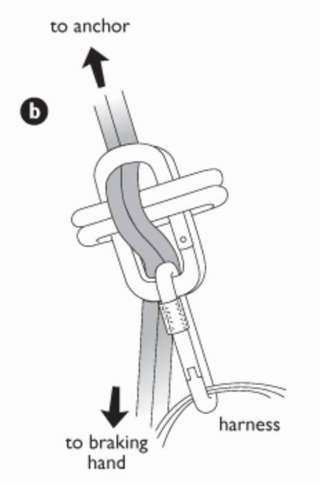
Justin joined us at the rap station, where we clustered together tightly on a slightly awkward perch and got ready to rappel the 50 foot face below. And we realized that Justin’s belay device was gone. It must have gotten hung up on one of the crags he had scrambled down below the summit. This struck me as a big deal… I had rapped on a Munter hitch before, and it added a jillion twists to the kernmantle, which was a total pain. Justin had a better idea, and was unfazed. When it was his turn to descend he simply rigged a 4-biner brake, like one I had seen in Freedom of the Hills years earlier. And it worked perfectly.

Every step taken with greatest care.
Stepping ’round the horn.
Rope management never gets old.
Hanging with my buddy Ann. Literally.
Justin adjusts his rope in preparation to descend to us.
Routefinding.
That moment when your guide realizes his belay device is gone. #noworries
Yep. This worked perfectly for Justin. Thanks to the bible (Freedom of the Hills) for the image.

But, first I had to descend the tower. We could have thrown the rope down ahead of us then rapped it, as is customary on most Class 5 routes. However, that would have been a mess here, because there were low-angle sections and horns that would have snagged the butterfly coil as it sailed down. It would have been a pain. Instead, Justin lowered me directly, which was easy and quick. An odd descent for sure, switching from high-angle to gentler terrain, meaning I was half rapping and half scrambling. But it worked well. He then lowered Ann on the other end of the rope, so that when she reached me both strands were safely down the route, and he could rappel smoothly.

The sun seemed to hang in the West for a long time, hovering over Mt Torment like a big old lightbulb. Inevitably, we fell into shadow, and the chill of the evening quickly set in. Adding a layer and switching into the Hestra gloves did the trick. I noticed how much better I felt than 24 hours earlier, when the glacier crossing had really knocked the tar out of me. Now I was fine. It was night, but we were all fine. This was no epic. We’ve got this.

See the cordelette tied around the mushroom-shaped rock? This is a rap station.
Better view of a rap station.
Justin lowers me to the next belay station.
Slabs underfoot during the lower.
Not quite rappelling… not quite downclimbing… half of each… and all concentration.
Ann snapped this of me during the descent.
Justin prepares to lower Ann down this small tower.
The West Ridge. Almost sunset. Our bivvy site is just beyond the snowfield on the right side of the ridge.
Looking down at the glacier and basin below.
Ann lowered by Justin on the tower.
Looking back as Justin begins to rap.
West Ridge of Forbidden.
Rapping at dusk.

Soon after nightfall the route plunged down to the right. We watched Justin’s headlamp become smaller and smaller as he rappelled the North Face. It was remarkably still. In darkness, the mountain seemed to change: It began to feel friendly, smaller, enclosed, as though the night became walls and ceiling of a private room surrounding us. I breathed—really breathed deeply—for the first time in hours. I forced my shoulders to relax, then my arms, then my spine. However, we remained exposed, and the sensation of enclosure was an illusion. Stay focused. I thought of Christian Reindl’s lyrics:

You don’t have to search for more
We’ve heard it all before…
You can’t fight this twisted fantasy

“A friend of mine”
I’ll wait for you to see…
Don’t try too hide
You know you’re better off with me

I’m the devil on your shoulder
I’m only cold so you’ll come closer
When you strain your eyes to find the light
I won’t be far behind
Cause it’s better in the dark
When you’re a friend of mine

It’s a hell of a ride…

You don’t have to search for more
I’ll give you what you need
What are you waiting for?
I’m right beside you, tearing on your sleeve

—Christian Reindl

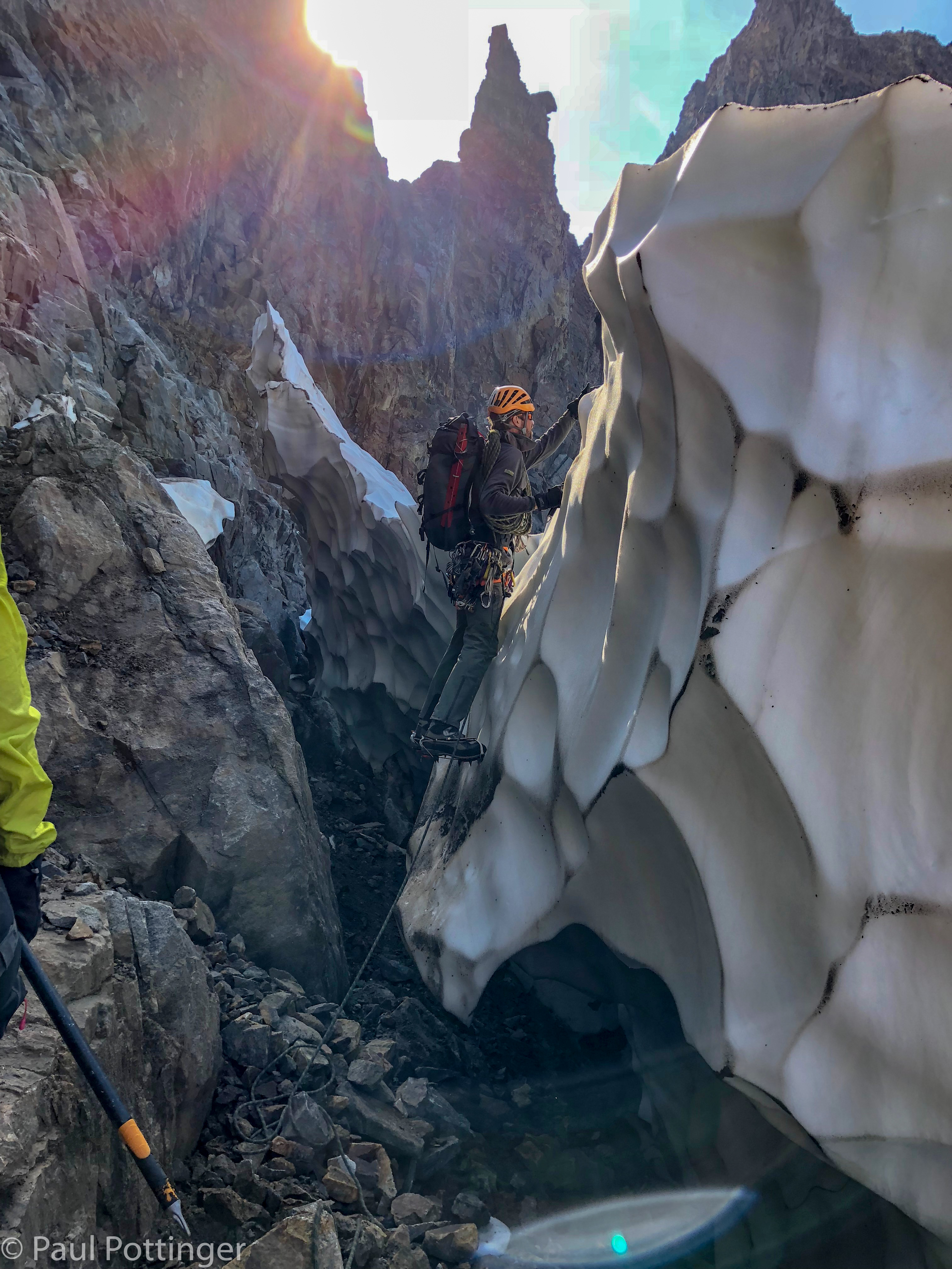
We made slow, steady progress, down and down. The north side of the ridge grew wider, littered by car-sized boulders lying in a jumbled mess. Just before 10 PM I said, “Hey, there’s a big snowfield ahead.”

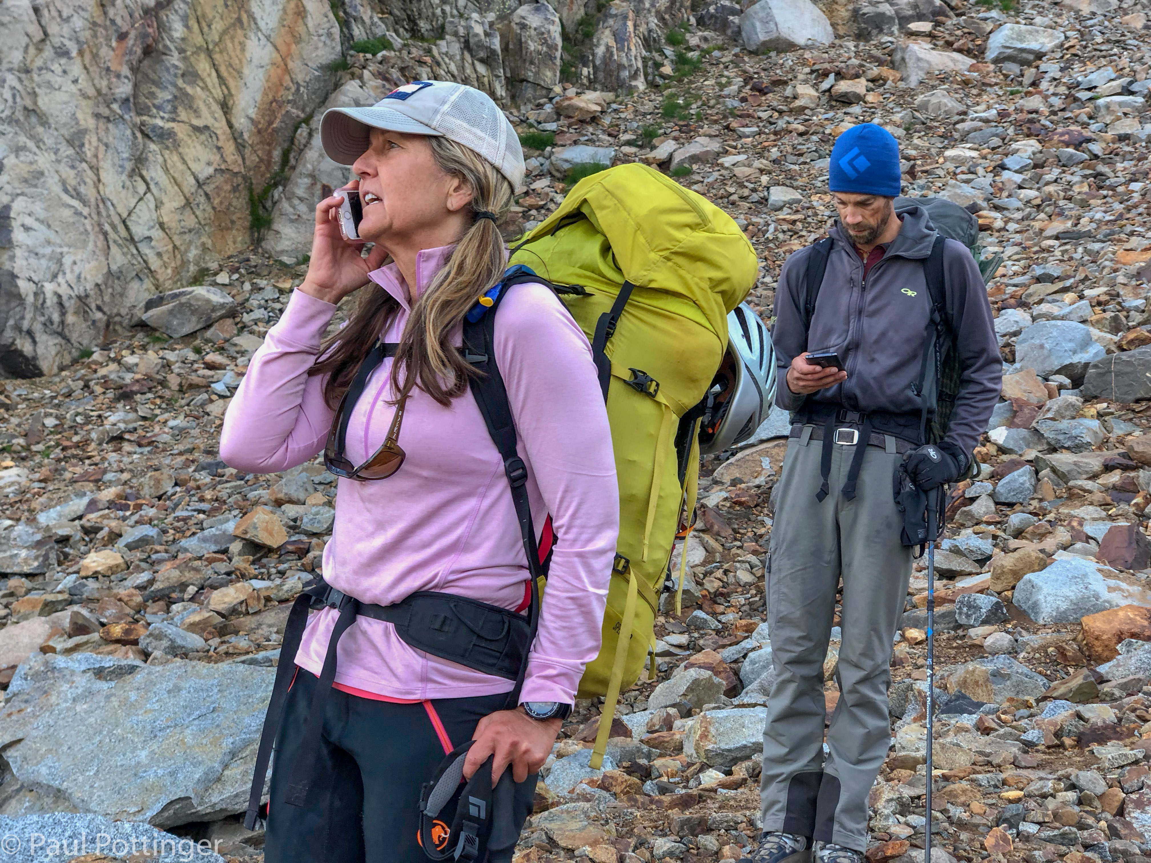
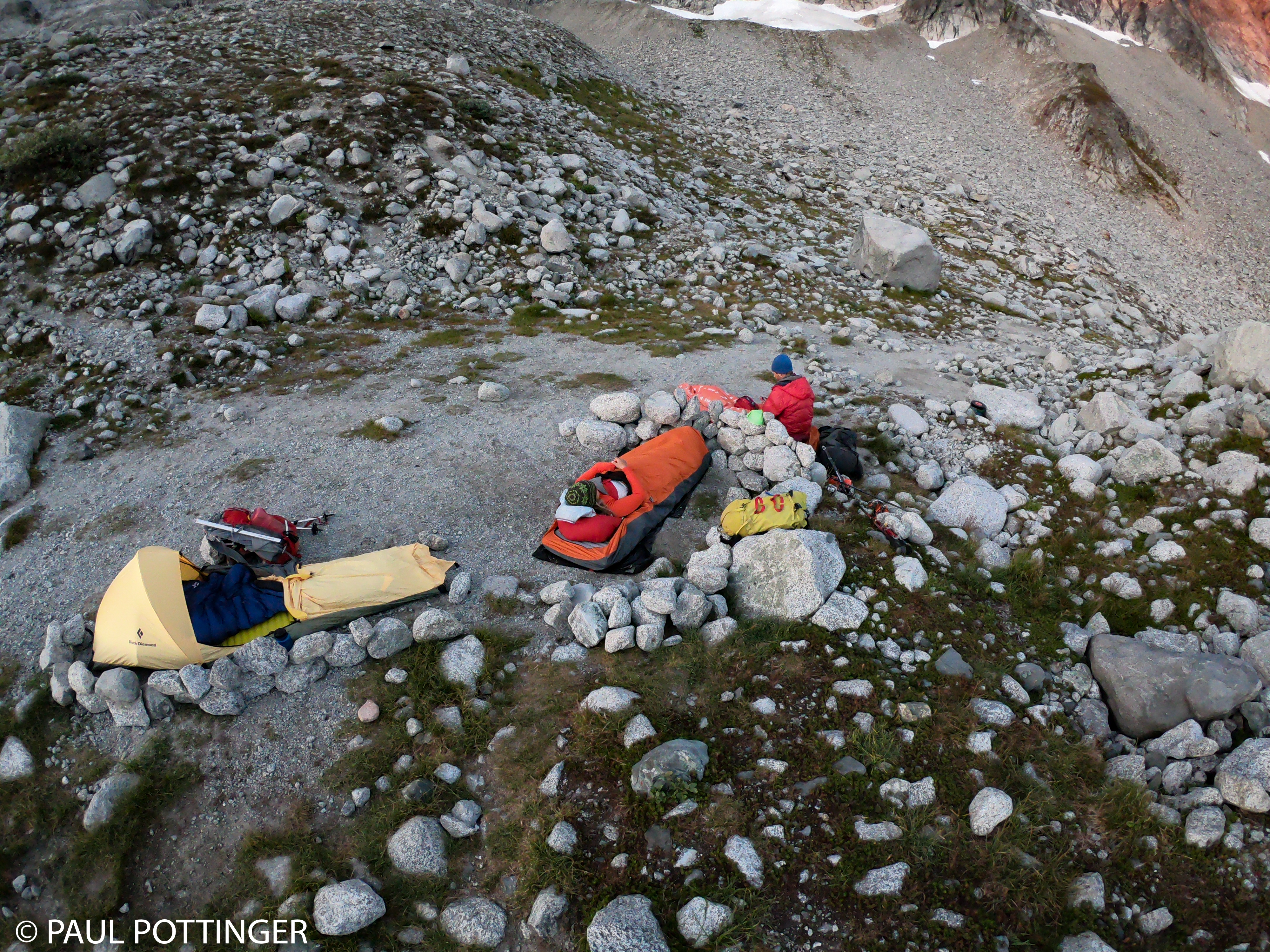
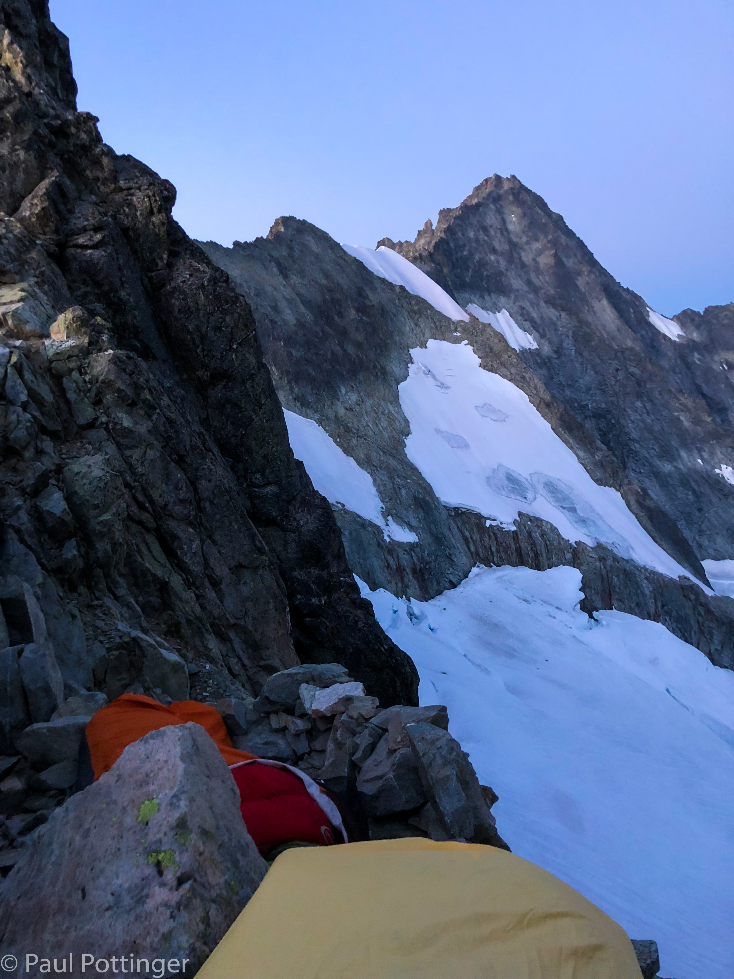
“YES!” cried Ann. She knew that the bivvy ledge was perched just above the snowfield. And, sure enough, it was. Atop a story-high wall were three platforms of earth, each totally smooth and the perfect size for a bivvy bag. Justin chopped some snow from the glacier into a garbage bag, then hauled it up to the ledge so we could melt water. I sent a text to George Dunn telling him we were at camp. Hot food… dry sleeping bag… a billion stars overhead.

Ann told me to turn out my headlamp and look south. I knew the ridge was there, and wondered if we could see it in starlight. As my eyes adjusted, I realized that the ridge was much bigger than I had guessed: It rose like a tall, evil pyramid towards the sky. “Holy cow.”

“Pretty cool, right? We climbed that.”

Yes, we did. Thanks to Justin, this summit had become a reality for me, and doing it via the North Ridge made it even better. Doing it with my friends was the best part of all. I thought of our other buddies who would love to have been there. A larger team on the North Ridge would be impossible, or unsafe at the very least, but I still wished they could have joined.

As I fell asleep, I thought about the Catscratch Gullies we would rap in the morning. But, only briefly. Enough climbing… put that monkey mind to sleep. I let all my concerns fade away. I hoped that my blue bag would help fend off the snafflehounds in the night. Even shrouded in three plastic bags it smelled simply horrendous.

Forbidden Peak via North Ridge Day 2

Temperatures dropped overnight, but I stayed toasty in my merino layer and Feathered Friends Nano Swallow bag. The BD Light Saber bivvy bag made for posh accommodations.

The wind shifted from Westerly to Easterly, perhaps driven by katabatic effect from the Quien Sabe, but it was gentle. And we got hit with smoke, which had somehow been minor the previous day. This summer all of BC seemed to be on fire, and strange wind patterns had suffocated Puget Sound under thick, acrid, choking blankets of wildfire smoke, day after day. Many of my patients were admitted with exacerbations of chronic lung disease that summer. My own asthma is very minor, usually triggered by cold dry air, but I had developed a rattling cough, throat irritation, copious mucus production triggered by the smoke. Now it was back, but only a hint… breathing through my buff filtered most of the smell, which at times was almost pleasant, reminiscent of sitting by a campfire, or taking that first whiff of air when deplaning in Arusha for my annual teaching gig at KCMC. And it made for a beautiful sunrise.

Dawn greets us.
Packing up.
Ann’s favorite top is sooooo clean and tidy.
Check out the coffee ring. I mean, how does that even happen?

We ate breakfast, used the latrine, got packed up, and headed out of camp a bit after 7 AM. The route to Sharkfin took us in a traversing path across vast talus fields, sprinkled with wildflowers and low green cover. The sky was clear, winds were calm, and we had the entire Basin to ourselves.

Heading to the Quien Sabe Glacier. Sharkfin Tower at center screen. Last vestiges of green underfoot.
Looking down valley from a break. Note the wildfire smoke below.
Screenagers.
Selfie on the moraine.

Less than an hour after leaving camp we left the jumble of the lateral moraine and stepped onto the comparatively flat glacier bed itself. I suspect that this terrain had been covered with ice in previous decades, and that the Quien Sabe has retreated like most glaciers in North America. Now it is a mixture of smooth slabs and choss fragments resting on saturated earth. Justin guided us up the most footsure route.

Ascending the moraine.
Still feels like summer here.
Sharkfin Tower is the peak at center. It looks nothing like a shark fin, definitely more like an orca fin.

Soon we made it to the Quien Sabe, and took a break to refuel and get set for glacier travel. I was glad to be in the Grivel Airtech Lights: the points were ridiculously dull, but the snow was crunchy corn underfoot, and they worked perfectly, exactly as we had predicted. Justin led out, followed by Ann, and I walked anchor.

Roped up now on a tongue of the glacier.
Covering up from the sun.
Traversing towards an entry gully.
First proper crevasse on our way up the Quien Sabe.

Our goal was a gully that connected the moat with a broad shelf several pitches above the glacier. In fact, there are numerous such gullies, and we traversed past them, one by one, each looking perfectly fine to me: broad, sunlit, well-traveled. But, Justin had a different way in mind, a couloir that I would not even have identified from the snow. Looking back now, it is clear that the gully he chose was far more stable than the others. He crossed the moat with ease, found a perch to belay from, and protected us one by one as we crossed simultaneously, separated by an arm span of rope.

Justin has crossed the moat and prepares to belay us.

It was a warm day, and snow on the ledge above had already begun to melt in the sun, sending water down the route onto us. It flowed down the walls, splashed onto us, and ran along the gully floor. This couloir is rarely climbed, and lots of choss shifted underfoot. Not the kind of route people dream of, but it felt like we were pioneering something new. This was OUR route.

And it was fun.

Starting up the gully just before 10 AM.
Justin scrambles up the large stones choking the gully.
Continuous snowmelt in the gully makes this a spicy ascent.
Justin leads up the gully. Note the waterfall trickling down the rock face on the right.
Here we go….
Grabbing the wet rock as we simulclimb.
I love getting wet in deep shadowy gullies. LOVE IT.
We try to keep the rope away from Ann’s feet as much as possible.
Simulclimbing. Large boulders mix with smaller scree.
Choss.
Low angle terrain mixes with steeper stuff.
Justin has us on belay.

After several pitches we made it to the ledge. I hesitate to call it a ledge, actually it was a broad 30 degree incline of choss and snow, but its low angle would allow us to walk for about 15 minutes up to the base of the fifth class. First, it was time for a quick break.

Looking down valley from a break on the shelf.
Ann hates it up here.
Justin chills at the break. Our route to the Tower is up that scree behind him.
Looking to climber’s left. We will have to cross this scree later to gain the col. Forbidden summit peeks from behind the ridge.
Ann told us she always put her finger in the shot. “Look, she’s doing it!”
“OK that’s better! Now do it again with no finger, and summit in the background.”
#missionaccomplished

We ditched our packs and walked up the choss towards the small notch of a col, where the proper climbing would begin. I was eager to get to the notch so we could finally see the upper route, which had been difficult to discern from below. The notch offered a splendid view of the Boston Glacier far below, like an unseen or newly-discovered, pristine land, but the upper mountain was still mostly obscured by a jumble of dark granite. We stood on a small dirt path and got organized for the 5th class ahead by ditching our trekking poles and adjusting our rope system.

Almost to the start of the 5th class route, at the notch above.
Some of this choss looks ready to slide…
The notch is ours.
Ditching our poles at the col. Justin gets ready to lead. Sheer face to right of the arete visible in the sunshine beyond.
Looking down at the Boston Glacier from the col.
Looking back at the Quien Sabe from the Col, Jo’burg in the distance.

We put Justin on belay and he traversed out and around the bulge, out of sight. A few minutes later he called to us, and we started after him simultaneously, separated from each other by an arm span of rope.

Around the corner, there it was, startlingly close: the east face of Sharkfin Tower. A dagger of clean, impossibly smooth granite cutting almost vertically into the unbroken blue sky, emerging from the pristine white glacier like a fang. Not one ledge or crack system interrupted its descent hundreds of feet to the bottom, where a crevasse opened into bottomless black shadow. It was large, steep, and intimidating. And I thought, 5.4 my ass.

View of the first arete from the col.
Admiring the tower. “OK… now we get to start climbing.”
This will be fun.
Justin steps around a tight spot and out of sight. We have him on belay.
Ann starts up, me simulclimbing a few meters behind.
Our view of the tower as we round the corner. Boston Glacier below.
The tower as we leave the shadows behind. Justin can be seen at the notch above.
Peek-a-boo view of Boston Basin as we ascend.

We climbed to Justin’s position on a small ridge and he pointed out the route above: Not via the face, but rather via the arete on climber’s left. It was intimidating enough, but a relief that we could straddle the edge of the mountain, one foot and hand on each side of the arete if we had to. Justin reassured us: Although the exposure was real, the moves themselves were no big deal. He pointed out the crux move of this pitch, about halfway to the belay station, and encouraged us to watch how he did it.

Well, the way he did it was the same as how he does everything up there: With his crazy long legs and gargantuan stride. “Oh that’s great,” said Ann. “How the hell am I supposed to match that?”

Somehow, she did. I watched her move like a ballerina in a well-choreographed dance. Each move considered in sequence… every position balanced… progress achieved move by move. Inevitably, but somehow surprisingly, the rope would come tight, and I realized that it was my turn to hustle and reproduce all the same moves. I may be a bad dancer but I can do this.

We spoke constantly, but most of our communication was non-verbal. I could see what she saw, and by following her gaze I understood the moves to come, even before she made them. She felt the weight of the rope on her harness, and without looking back could tell when I was past the challenging spots. Sometimes I pointed out footholds at my eye level that were hidden from her view, but most of my job was to move the rope away from her boots, thread it around horns when possible, and generally manage the slack. And to never, ever weight the line. We made a good team.

Boston Glacier below our belay station at a notch.
Ann at the belay station. Boston Glacier on the left, Boston Basin on the right.
Justin, with the arete behind him.
Our fearless leader heads up.
Justin makes progress up the arete.
Ann prepares to step right onto the tower face.

At the crux, Ann stepped out over the void and found a teeny, tiny toehold for her Trango boot. There was no way she could reach the next toehold in one step—it was at her shoulder height. Smearing was the only option. I draped the rope between us over a small horn in case she lost her foot grip and swung in a pendulum away from the arete. “Up rope!” She hollered. The rope went tight. And up she went, in a single smooth move that got her onto a proper standing ledge.

I looked down. There was nothing between her and a deep, dark crevasse on the Boston Glacier hundreds of feet below. “Good move. If you fall here you’ll go down that hole. I’m naming it Schnittker’s Sinister Sphincter.”

“Ha. No one wants to be in that sphincter….”

I followed her, using the same technique.

One bomber foothold makes this quite doable.
That right toehold is suuuper small. Nothing but air below….
I give Justin the “rad” sign after making the crux move.
Looking back at Boston Peak from one of several nice platforms on the arete.
Climbing the arete.
I need to keep tension off that rope at all times… not slack, but never pulling back on Ann.
I move the rope away from her feet.
A quick step on small toehold to this bomber platform.

Soon we made it to the rap station. From there, the terrain moderated a bit, or at least there was less exposure for most of the remainder. In some sections, Justin placed traditional protection and our job was to clean it as we followed. Other times he protected us by draping the rope over horns and in crevices. This was exactly the way JR had protected me and Matt when climbing the Aiguille du Tour and Gouter Face in 2011. We always knew what kind of pro we were working with, and we respected it. We were safe.

The summit was ours, and ours alone. Conditions were perfect. We had done it.

A belay station atop the arete.
Justin shows me where to step.
He has guided me this way many times before.
These stones look like a tenuous, jumbled mess. But, most feel solid in our hands.
Tasty exposure.
Justin protects us with rope wrapped around a horn.
A few feet below the summit….
Pounding on top of Sharkfin Tower.
Quarters are tight atop Sharkfin.
Pano from summit of Sharkfin Tower. Forbidden at top center. North Ridge of Forbidden on the right… Boston Basin on the left.
Checking the summit register.
Our summit register: “IMG Guide Justin Merle AKA Mustin Jerle… Ann Schnittker Sparks… One Smart Mountaineer.”
Justin Merle.
Sharkfin Summit Selfie.
Our route ahead, seen from the summit of Sharkfin. We would spend the rest of the day crossing the Boston Glacier and gaining a bivvy spot on the North Ridge, near where that little tongue of snow creeps up the granite at about 1 o’clock.
Mt Buckner atop Boston Glacier.
Boston Peak and the Quien Sabe below. Sahale in the distance.

We descended in the reverse order, me picking my way down first thanks to Justin’s precise instructions, then Ann, then Justin who protected us all the way. 24 hours later, on the North Ridge, this experience on Sharkfin would pay nicely as we spent hour after hour simulclimbing in similar conditions, with even more exposure.

Most of the descent was fine, including a final rappel… although there was one tricky move near the bottom, just above the station, where a big step coincided with a shift in the fall line towards the East Face. Justin made sure I saw this coming, and it was no problem. But, somehow, Ann took a wrong step here during her rap and pendulumed out over the face, slamming her right side against the granite, exactly where she had injured herself in the Rockies a few days before. We joked about her trying to go down that sinister sphincter, the crevasse yawning hundreds of feet below. She righted herself and traversed back to us. She didn’t complain—Ann never complains—but I thought, Damn that has to hurt.

Descent begins. We climbed down and to the left of this obstacle.
The ridge is narrow up here.
Now Ann gets to have my six.
Justin has us protected with a horn above.
Nice example of a second horn pro, right between me and Ann.
Justin rapping from the top station.

From the col, we descended the sketchy, slidey choss unroped back to our packs.

Coiling the rope after rapping to the col.
Getting our game face on for the downclimb of the scree fields.

Lunch! Then, our real adventure began: Finding our way down to Boston Glacier. Apparently, most climbers descend from Sharkfin Col, which is the biggest notch to the west of the summit. But, there is a better option using a smaller, nameless col before that. Trick is, where is the nameless col? We scrambled up a chossy gully to its top, only to find that this was not THE col we wanted. So, we descended the way we had come up, then traversed a bit farther until another likely suspect appeared, cutting steeply up to the right. We followed it up, but this too turned out to be an inauspicious place to drop in. But, we were getting closer…. Down again to a small ridge at the gully’s midpoint. The footing here was unstable, with every step sending waves of dirt and stones cascading to the bottom, more than a hundred feet below. We needed to drop about halfway down then ascend another gully that branched off. Justin came up with an ingenious system to lower us simultaneously down the low-angle slope. Ann and I had to move in synch, lest she go faster than me and introduce slack into the line between us. It was an odd setup, and it worked perfectly.

Justin traversed above us to our new gully, got onto some more stable rock, and began ascending. While we waited for the slack to disappear I paused for a moment to look down at the gully, to the Quien Sabe below, and smelled the air.

“What is that smell?” asked Ann. It was reminiscent of the scent of a tooth being drilled at the dentist.

“Fractured rocks we kicked down. Brimstone. Welcome to hell.” We still had a long way to go, with a big glacier crossing to come and a few pitches of 5th class to gain the bivvy ledges. The sun was high enough in the sky, and we seemed to have ample time… but I we felt an unspoken pressure to get up this damn gully and get to the Boston.

The rope went taught. We followed. It was a true chossfest, but most of the stones were smaller than a loaf of bread. The only one that thwapped me on the arm was the size of a tennis ball, and it was moving slowly, in fact did not even leave a bruise.

Talus and choss on the traverse.
Almost to the notch we hope is our exit col….
But, it is not meant to be. This could work, but it would be awkward. Time to turn back.
Justin simul-lowers us down the chossy gully.
Trekking poles help with balance during the lower.

This was our col! A soccer ball-sized chockstone at the top was adorned with webbing and rap rings left by prior parties. Below was a world cast in blue shadow: a couple benches littered with mud and sharp talus, and below that the upper Boston Glacier stretched away for miles.

We knew the drill, and rearranged our harnesses to pre-rig for rappel on extensions. Justin went first, no worries. Then it was Ann’s turn. She started smoothly down, and I took a moment to look at the sunshine once more, for the last time all day before we dropped into shadow. Kim would love it here. I heard the clatter of rockfall below—which was not unusual when we rappelled this unstable terrain. Then one big, loud thwump. You will not believe me, but it is true: I felt this rockfall in my boots, in my hips, in my spine. Perhaps the shockwave simply reverberated up the rope, but it felt as though the mountain itself had groaned. And I thought, That was a big one. I hope Ann is alive. It was hard to see exactly what had happened, but I saw her twisted onto her side—the same right side!—a short distance above Justin. I shouted down to them, and listened. Ann’s voice was clear and feisty: “Goddamn it! Again!” This was reassuring, and clearly everything was going to be OK.

I rapped down carefully, and came to the spot where she had lost her footing. It was tricky.  By the time I reached them, Ann was settled and seemed to be doing fine, more injured of her pride than her body. But, injured she was. Justin asked her explicitly whether she could continue, and she dismissed his concern with a wave of her hand. She could stand, walk, and climb. There were no fractures. Of course she would continue. She was just frustrated.

We reassured her. I pointed out how challenging this rappel had been: low angle alternating with high angle… oblique shifts in the fall line… loose choss falling on us… wet, cold slabs covered in BB-sized grit… late in the day… in cold shadow… after climbing several suuuuper sketchy gullies in the baking sunshine, and after climbing Sharkfin itself… for a climber with an injured hip already, she was doing awesome.

Ann has straddled the chockstone at the rap station, and watches Justin rappel.
Watching Ann rap from the chockstone. A few moments later she thwapped her hip something fierce.
My buddies descending towards the moat.
One last glimpse into Boston Basin from the chockstone.
Rapping towards the glacier.
Gathering ourselves before the downclimb to the glacier. Justin shows me where to go.
Ann is very, very happy after injuring her hip.
Eye of the tiger….
Let’s do this.

It took us a little while to get to the glacier itself, because of all the unstable downslabby terrain, but eventually we made it. The moat was complicated: The glacier was actually above the earth here, having melted out from the bottom faster than from the top, leaving about 15 feet of soft, scalloped vertical snow overhanging a creepy dark cave beneath. We could make out some shallow depressions that were remnants of footholds kicked by a previous party, I guessed at least a week earlier. Justin led up with the same ease we had come to admire in Ouray. Then Ann, then me. I wished I had a second tool, but Justin himself had trained me to climb terrain like this with feet only, and it worked.

Atop the snow face I could see the Boston Glacier dropping steeply away to the north. We quickly rearranged things for glacier travel. The pressure for time was real. Daylight was fading, and this was a huge glacier; our objective was a tongue of snow on the far side, which looked like it was 2 miles away. (Measuring the distance now, I see that it was 1.2 miles as the crow flies, and actually our track was just under 2 miles.) I did not even tie prusik cords to the line, although I made sure they were in easy reach on my harness.

Our entry point just beyond the moat.
Now I see the footprints of prior climbers on the vertical snow, just above my fingers.
We can still see some of the crevasses from this elevated vantage point.
Ann lowers to my position in the moat. Totally smooth and strong, though she must have been hurting.
Justin leads up the snow face to get us onto the glacier.
He really likes it up here.
Ann climbs the snow face out of the moat.
I spy Justin atop the snow face.
He’s got me on belay.
One last swing of the axe and I’m out.

Justin had photographed and studied the crevasse pattern from the summit, which was brilliant because our perspective here was much less auspicious. There was a stone cleaver interrupting our way to the North Ridge, we would have to descend about 800 vertical feet to bypass it and then gradually make our way upwards again, regaining all the elevation we had given up. The thought of climbing up all that way was disheartening, but only slightly.

Once we settled into the rhythm of roped travel, it dawned on me that this was one of the great glacier crossings of my life. We were truly isolated in a giant, spectacular, private amphitheater. The North Cascades stretched into the distance, in row after jagged row, into Canada. No one was here but the three of us, and this ice might not have been crossed for weeks previously… and might not be crossed again until next year. The crevasses were massive, ragged, and deep, suggestive of those I have seen in Alaska. Justin picked a smooth path between them, along wide ridges and stout snow bridges. The surface was riddled with shallow channels carved by meltwater, each filled with crimson algae called “watermelon snow.” This algae smells clean, fresh, and precisely like the inside of a ripe watermelon. It will give you diarrhea if eaten, but the scent is intoxicating.

And the baggage I carry every day dropped out of mind, piece by piece, as I listened to the snow crunching beneath my crampons. I felt so fortunate to have this world class wilderness in my own back yard. This is why we do this.

After we rounded the cleaver there was nowhere to go but up, towards the highest snow tongue in the distance. I began to feel rotten. Every joint felt cold, and there was no sunshine to warm us in the long shadows of Forbidden’s East Ridge. No doubt I was running on vapors, having consumed GORP for lunch hours earlier… which was also the last time I had urinated. At this point I did have water left in one bottle, close to a liter, but we were racing against sunset to reach the bivvy ledge, and there was no way I was going to call for a hydration break. Just get to the moat and you can warm up.

Getting re-ordered for our glacier crossing.
Beginning the weave-and-dodge game around crevasses.
The striations are “watermelon snow.”
Looking back at our moat entry point, the right tongue of snow at center screen.
Looking north towards the glacier drainage.
Heading towards the cleaver.
Some of these suckers are deep.
Nearing the tip of the cleaver that separates us from the North Ridge.
This snow really does smell like watermelon.
Rounding the cleaver. This will be our low point of the traverse. Exit point visible in the distance directly above Ann’s head. Crevasse pattern on our route ahead is complex.
Inevitably, we need to regain the elevation lost on the traverse….
Threading our way between crevasses.
Justin looks back at us on the way to the exit point. Sharkfin is the sharp spire seen on the distant horizon.
Rockfall from last year revealed in a crevasse, below the blanket of 2018 snow.
This snow fin was firm and fun!

We reached a broad crater in the snow just below the moat and stopped for a break. This had looked like a crevasse from above, but in fact it was a rockfall zone, littered with dark stones that had fallen away from the North Ridge earlier in the season, in what must have been an epic slide. Since then, the rocks’ dark color had attracted sunshine and heat, melting a vast shallow crater in the glacier’s surface. This made for a fine spot to stop briefly and get ready for the 5th class to come. Ann and I were both feeling pretty shitty, and the break was welcome. Justin got right to work uncovering clean snow and melting it in the reactor. There would be no snow above, at least on the lower ridge, so this was our chance to drink and make water to last until the middle of the following day. The meltwater went down nicely. I urinated for the first time in many hours. My homemade GORP tasted great… shards of crystallized ginger seems to be a good ingredient for the stomach. And salty pretzel sticks were really good here too.

The debris field crossed by crevasses.
Resting on the glacier just below our exit point, Justin turning snow into water.
Looking east from our break at Boston Glacier and Mt Buckner.

Crossing the moat was pretty straightforward, it was smaller here than at our entry point. Off came the spikes. I was tired. Daylight was fading fast… headlamps on, packs sorted, and up we go.

Both Justin and I have Ann’s back while she crosses the moat.
This snow face is smaller than the one we climbed to gain the glacier a couple hours earlier.
Getting the points off after crossing the moat.
Looking beyond the moat, across Boston Glacier. Dusk is approaching quickly.

Gaining the North Ridge was not too tricky from this location, just a few odd moves that felt elusive in the twilight—zig here, zag there, and consider that the best handhold may actually be behind you. The terrain contained numerous false passages and short walls, meaning Justin could not see us and we had a hard time hearing him. But, if in doubt, follow the rope to glory.

In the PNW we are blessed with long summer days, and if we had climbed a couple months earlier there would have been no need for headlamps at all. By September 4, however, sunset is 7:45. We only had to use our headlamps for the last section. The ridgeline was barely backlit by the fading dusky sky, and I thought I saw an irregularity it its shape, like the crenelations of a medieval castle tower. Could that be the bivvy site?

It was. When we first gained the ridge there was a slanted dirt spot with some scattered sharp stones, and simultaneously we all thought, I really hope that’s not our bivvy site! The real site was a few steps uphill: Three coffin-sized ledges, one for each of us… each inches away from sheer drops of hundreds of feet to the glaciers below. Ann and I were on the Forbidden Basin side, Justin on the Boston Glacier side, separated by a thin rock wall. The Mountain House Lasagna never tasted better… I felt the warmth radiate from my belly to my extremities. We texted with George at IMG HQ telling him we were settling in for the night, and I did the same on Facebook… only to learn after arriving home that FB has removed this feature from the InReach, which is highly aggravating.

Flicking the rope around a fin as we follow Justin.

A stout ledge is most welcome during our climb to the bivvy col.
Keeping the rope out of Ann’s way as she negotiates this slab.
Ann’s foot and my hand share precious real estate.
Our bivvy site. Ann’s platform is at center screen. Both of them are now standing where I will bed down. Justin’s spot is to the left of the small rock fin at bottom.

We were done. It was after 9:00 PM when we started to fall asleep. A 13 hour day. And tomorrow will be bigger. I slept well, except for the snafflehounds that scampered around our bags all night. And I dreamed of Forbidden Peak.

Forbidden Peak via North Ridge Day 1

On January 17, at 6:32 AM, I received this text from my buddy Ann:

“Paul – JM and I had a good dinner and talked about some fun climbs in the PNW next summer, namely the north or east ridge of forbidden – Justin I forget which one. Anyhow would you be able to join? I would be able to go late August. 3-4 day trip. Thoughts?”

And thus began a seven-month odyssey of dreaming, scheming, planning, preparing, and ultimately fulfilling her proposal: Climbing Forbidden Peak via the North Ridge with Ann Sparks and Justin Merle.

I had tried to climb Forbidden’s West Ridge in October 2015 with buddies John and Tom, but we were thwarted by rockfall just below the col and cold, wet, cloudy conditions. I knew nothing about the North Ridge, but I understood that Forbidden is a serious mountain that is appropriately named. Climbing it would push my skills to their limits, and would be impossible without such an incredible team: I knew Ann’s strength firsthand because we had climbed some 14ers and steep ice in Colorado, and Justin had shown his skills getting me safely up and down Everest.

I was totally excited to try to pull this off.

The trip was threatened at all turns, mostly by our conflicting schedules. Even when the calendars aligned, everyone seemed to get injured during the runup:  Justin broke his ribs in a mountainbike crash… Ann sustained a monstrous hematoma on her thigh after falling on a talus field on Snowmass…and I thwapped my calf on a canoe bench a couple days prior to departure. Plus, due to work and family obligations, I could not train and sleep beforehand as I would have liked. This route would require long hours, so banking rest beforehand can make a real difference. Two weeks earlier I had attempted Challenger with John and Tom while exhausted, and there was no way in hell I could have done it safely even if the rain had not forced us to spin. It was time to invest in new boots: LS Trango Cubes felt great in the shop, but would I get blisters on the route? I did not have an easy way to apply ToughFoot daily, my usual protocol when wearing new boots. Finally, the question of mountain conditions remained: September in the PNW may be plagued by wind and rain, and this year the entire region seemed to be consumed by wildfires. It was not until several days before departure that our fortune seemed to turn:

Bomber forecast for Forbidden Peak.

Exhausted? Check.
Injured? Check.
Psyched? Double check.
This is happening!

Ann flew to Seattle on Sunday, arriving several hours after we returned from the East Coast, and we went to dinner for a last meal of “real” food before the coming days of dehy and GORP.

This is how we look pre-mountain, photo taken by Julie.
In the mountains we look different….

After dinner we ran our kits. Justin had already given us very detailed instructions, even beyond the standard IMG list for trips in the North Cascades. His bottom line: We had to come in below 35 lbs each, including full water bottles, so that we could haul our shares of the group gear to Boston Basin on day 1, up and over Sharkfin Tower on day 2, then to the summit of Forbidden on day 3, and all the way out on day 4.

My Personal Gear List

Mammut Creon Light 45 pack
Feathered Friends Nano Swallow 20F bag
BD Light Saber Bivvy Bag (no toe pole, no stakes)
Thermarest NeoAir pad
LS Trango Cube boots
Smartwool PhD ski socks for climbing
REI light merino socks for camp
Ibex merino base layer
Patagonia light base layer
Patagonia R1 hoody
OR Helium shell
Patagonia Nano Puff hoody
Patagonia midweight climbing pants.
Acrteryx shell pants
4 pair gloves (buff fishing gloves, SW merino liners, Hestra insulated leathers, Neoprene kayakers)
Hats (merino, ballcap for under helmet, sun hat for approach, 2 buffs)
Sunglasses
Grivel Airtech Light aluminum leverlock crampons
BD Raven Pro axe
BD trekking poles
BD Alpine Bod Couloir harness (3 lockers, 3 wiregates, ATC, long sling, prusik cords)
Petzl Meteor 3 helmet
Food
2 liter bottles
GoPro 6
iPhone (used instead of my trusty Sony Alpha 5100 to save weight)
InReach
Garmin Fenix2
Auxiliary battery & USB cords
Super tiny med kit and blue bag kit

All of which came to 31 lbs in the pack.

Our food needed to be hauled in bear canisters provided by the NPS because of the “five black bears” in Boston Basin. Ursacks would work too, though we did not have any. On top of this we would haul some group gear, such as MSR Reactor and cells, or part of the rack. Justin always carried the rope.

Off to bed, and up at 5:00 AM, rolling by 6:00 so we could meet Justin at Marblemount and get things settled with the NPS. The rangers were super helpful and friendly, as always.

We are here just after they open.
This fuel canister was chewed by a bear in the Basin. One fang puncture I can understand, but why so many? Do bears groove on petroleum products…?
Everything looks so tiny from here…
A nice model of our route, which I have outlined here.
Massive breakfast at the Eatery, and a visit with the rabbits who apparently call this place home.
Ann flirts with her new friend, “Francisella T.”
Sorting gear in Marblemount.
Photobombing shenanigans start early.


Paring it down to the absolute minimum.
I almost peeled out with Justin’s breakfast still on my hood.

The Cascade River Road leads from Marblemount, past El Dorado, and up to the Boston Basin trailhead. Cascade Pass is apparently just a few minutes farther up the road.

Road is open to the trailhead now! This saves us miles….
We may not get solitude up there, but at least we can meet fun people! Check this rig….

The hike to Boston Basin was beautiful. Last time I was here, three years earlier, we had started before dawn, miles down the road due to a washout, in cold overcast conditions. This time it was hot, (but not oppressive) and the views were stunning and breezy. I was delighted to bump into some trainees from the hospital on their way down who recognized me immediately, even in my mountain garb. The only other party we met all day was also on their way down after tagging the top via the West Ridge, and we discovered mutual friends as well. The biomedical-mountaineering axis runs strong in the PNW. They warned us of having to chase a curious bear away earlier in the day, which made me thankful for the canister I had squeezed into the pack.

Airy views greet us after emerging from the slide alder.
Crossing one of several creeks along the approach hike.
Justin and his patented tortilla lunch system.
Lots of water here means lots of snow–and sun–above.
I like this photo of Mt Torment and its basin, snapped by Ann. Aiguille de M on the right.
The basin! And Forbidden at center.
Looking down the valley.
Now above treeline, in the lower Boston Basin.
Justin: never, ever happy to be at work. Our first objective for the following day, Sharkfin Tower, can be seen over his right shoulder.
Ann: Are we on vacation yet?
Yes. Yes we are.
Johannesburg is always impressive.
Getting closer to the bivvy site.
Tailings from an abandoned mining operation.

The bivvy site was immaculate, even came with a composting toilet. Justin made a killer Thai dinner. We had the entire Basin to ourselves, with sweeping views in all directions, from Johannesburg to Sahale to Boston to Forbidden to Torment, and down the valley towards the sunset. Only a small amount of wildfire smoke was noticeable before nightfall. Just before we fell asleep, a small flock of ptarmigans strolled right through camp, making creepy / adorable chirping sounds.

Our bivvy.
Our posh camp. Perfect conditions for bivvy bags. And a great place to air my feet out after the approach march in Trango Cubes.
View uphill from the bivvy.
View right, including Sahale and the Quien Sabe Glacier.
Closer view of Sahale and the Quien Sabe.
Wildflowers everywhere.
Ann takes a stroll.
Justin makes a super-great dinner for all of us.
Justin’s spectacular kitchen.
BEST… DINNER… EVER….
All good guides read poetry from the chocolate wrapper after dinner.
He’s an excellent raconteur.
Sunset approaches, and temps drop. But not too badly.
The little hill where I shot the sunset with my iPhone. A pristine composting toilet sits just over the rise.
Johannesburg Peak across the valley.
Wildfire smoke begins to rise from down valley.
Sahale in alpenglow.
Minor cloud cover shrouds Forbidden Peak.
Tucking in for the night.
Yes. I am happy to be here.
The view of Quien Sabe Glacier from my bivvy bag as we tuck in.

I fell asleep thinking of my family, and of Sharkfin tower which was our objective for the next day. And I thought, This will be awesome.

Mailbox with Matthew

Mailbox is my usual training climb. I have not been up it in months, however, due to work. I was stunned to realize that a trough of high pressure air was likely to protect the mid-Cascade range from precipitation on Friday… when my son was on spring break. We had a chance to get up there and give him some practice using the axe and crampons on the snowfields. In preparation, Matthew devoured the relevant chapters in Freedom of the Hills, our mountaineering bible. Like the real bible, this one is full of hocum… and some nuggets of wisdom too.

I did not sleep the night before due to work, but the weather models remained favorable, and we stuck with our plan to climb Mailbox. And so we did.

And so it begins….
Yes. A rare ridge of high pressure is predicted to protect the Cascades from precip for the next few hours. This is happening….
So, the model seems to have been off by an hour or so. We start walking in the rain.
Fire road leads past the new trail to our starting point, at head of the old trail.
“Ewwww it’s so muddy!”
Within minutes we can see our shadows.
Hints of blue sky above the trees.
This tree cracked in half during a recent windstorm. We take these moments seriously, and hustled past.
Last vestiges of the fog are burning off in the forest… compact snow ice underfoot on the trail.
Breaking out into pure sunshine.
At the top of the first talus field. We ascended in the snow, a great chance to practice with the axe.
Surveying the valley below from a break atop the first talus field.
Yeah, we love it up here.
Summit beckons above.
Matthew had no trouble on this section.
On the summit.
Summits are built for moments like this.
Summit pano.
All sorts of odd scraps and stories in the Box.
Gearing up.
Starting down from the summit.
Why bother to arrest when sliding is so much fun?
Clearly I have have spawned a luge enthusiast.
Matthew loves to glissade. I had no choice but to follow…
This glissade stuff is fun.
Practicing self arrest.

A bit of plunge stepping.
Enjoying the snow field.
The forest has dried out nicely.
Almost at the car. Feeling happy… and tired.
Paying dues for all that time in the snow. It was worth it.